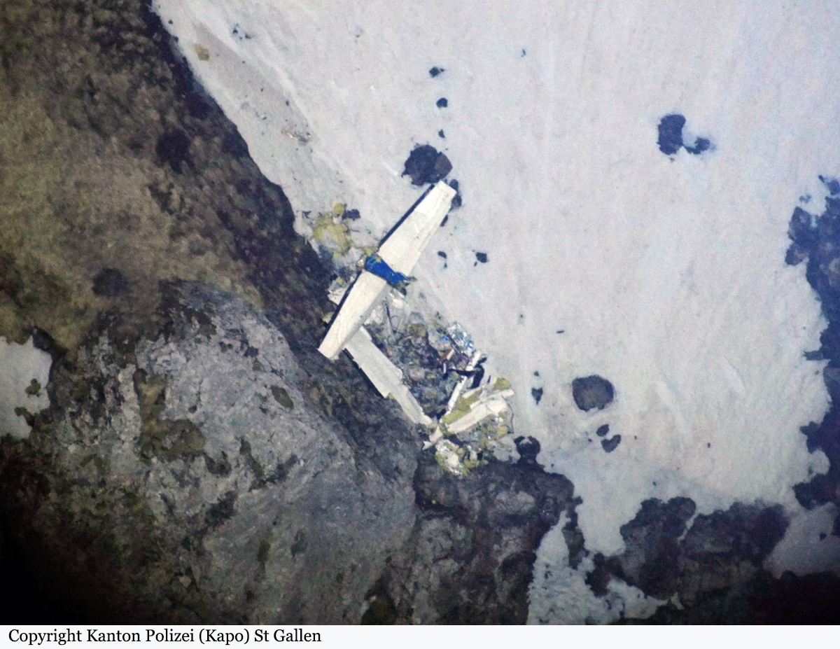
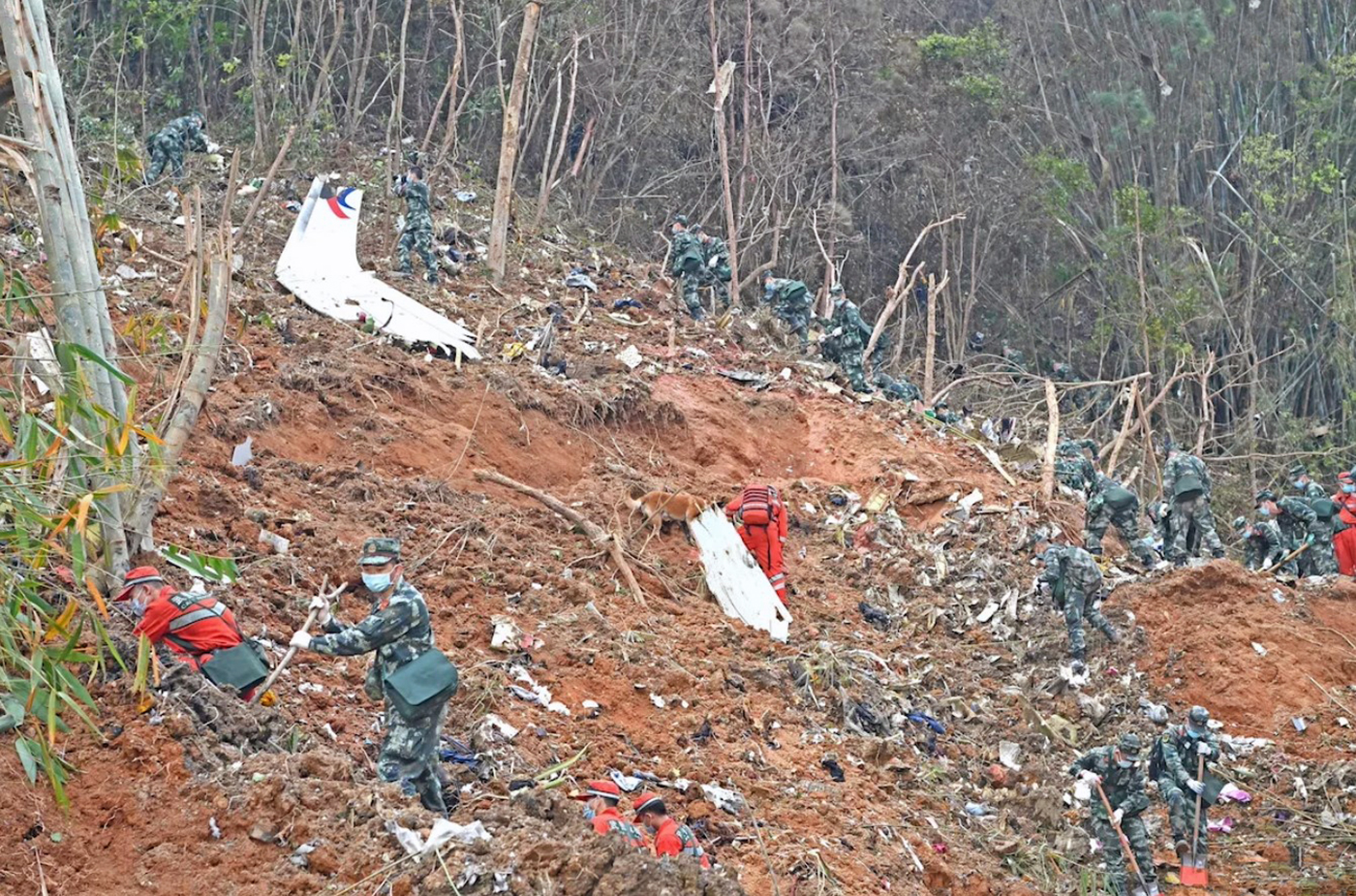
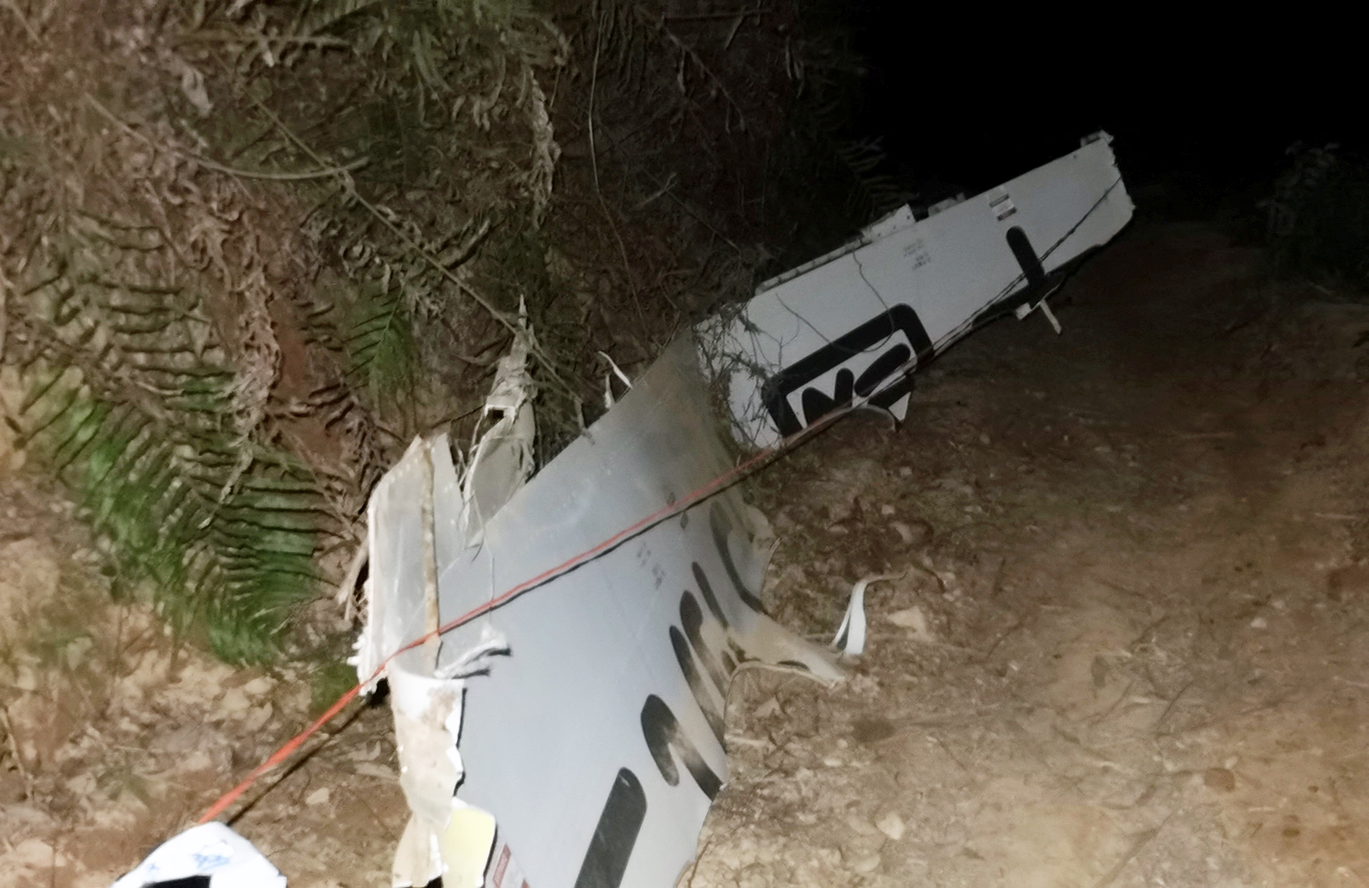
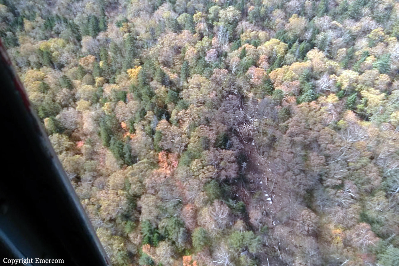
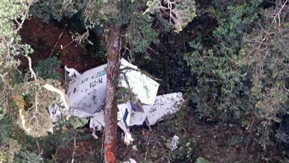
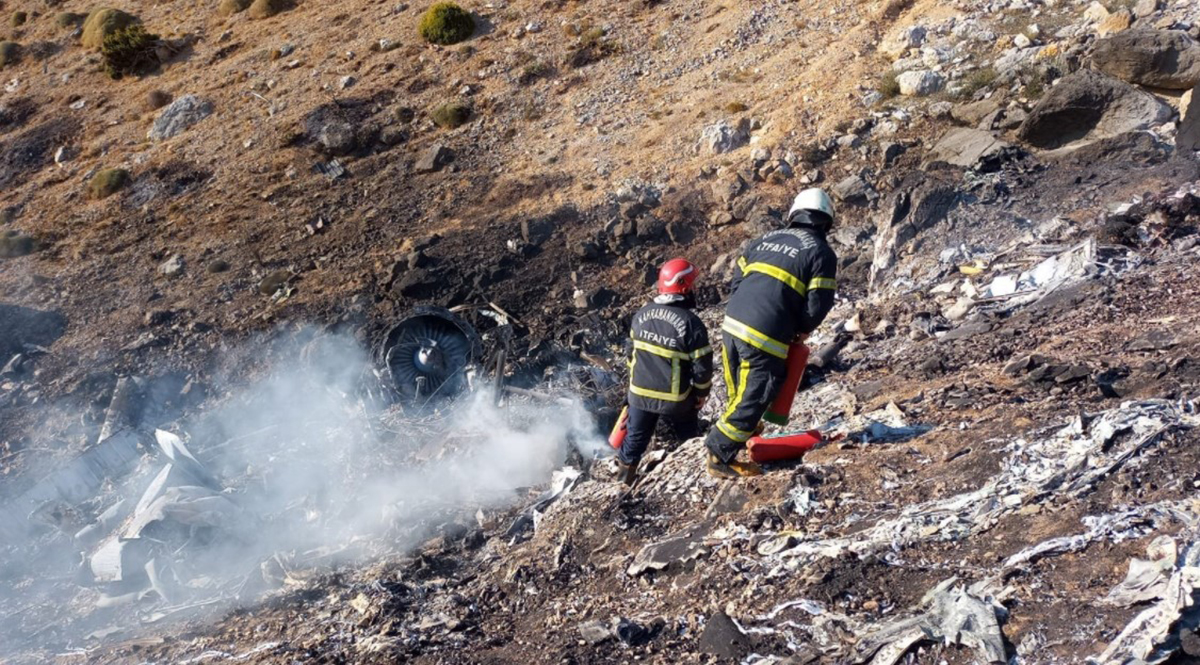
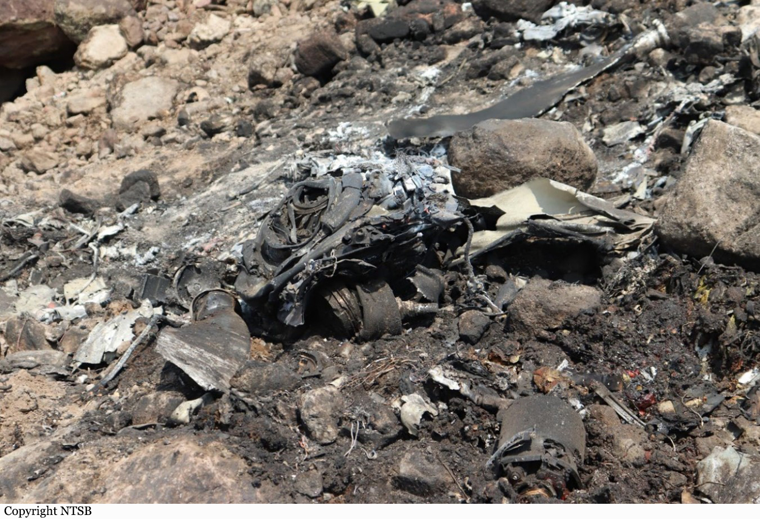
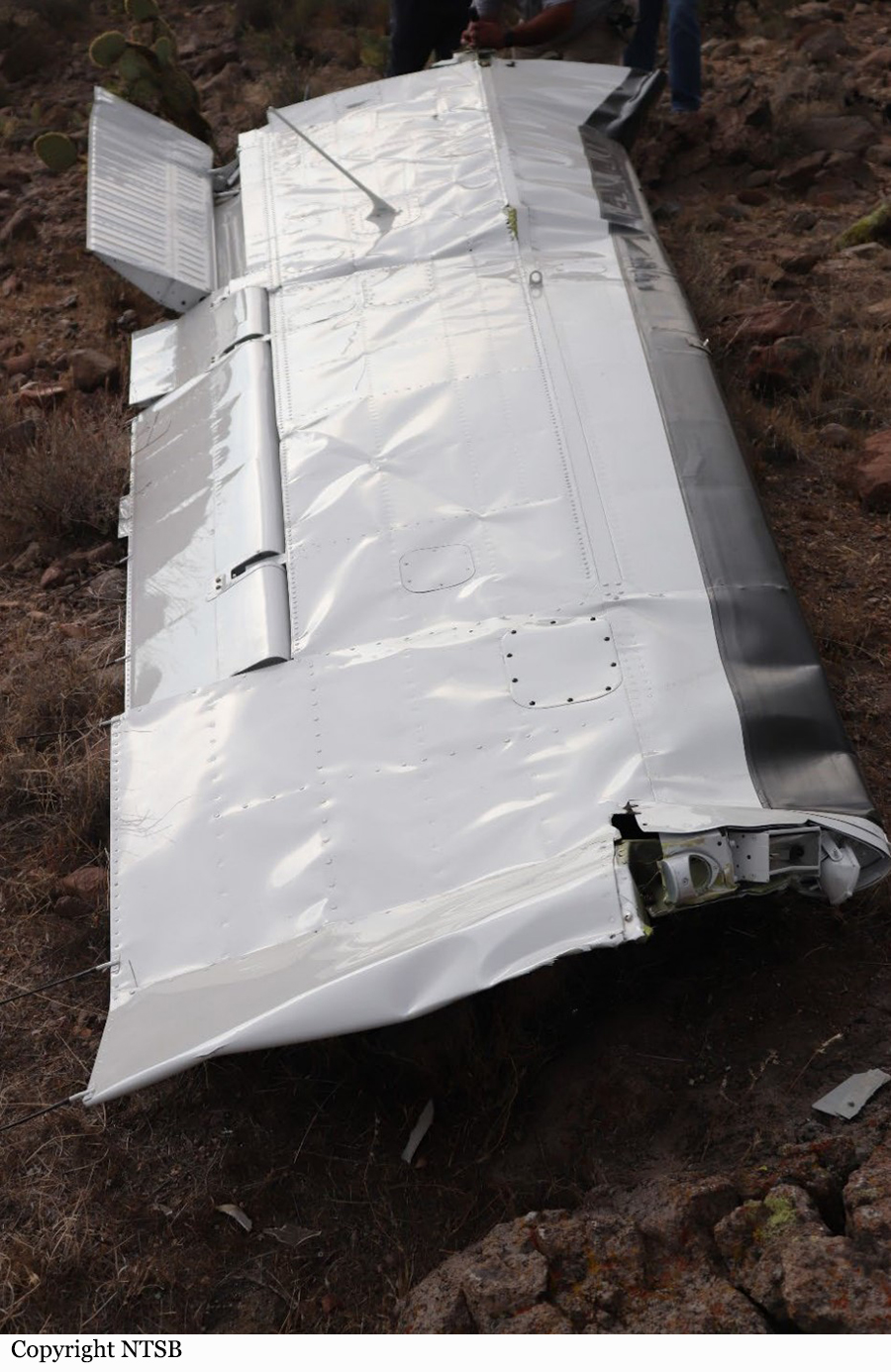
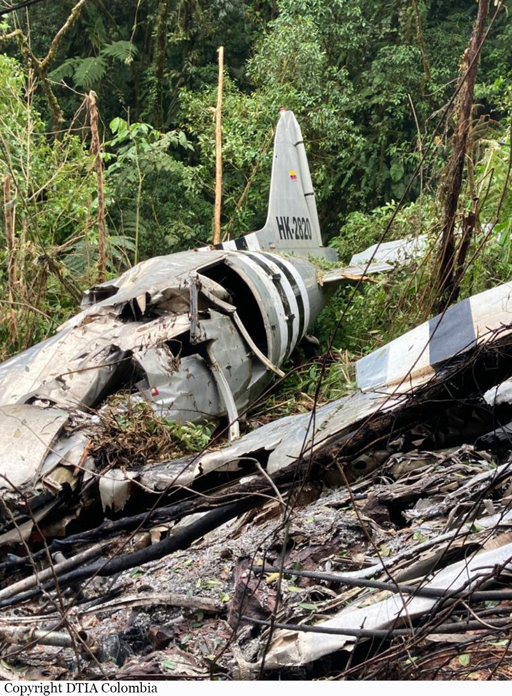
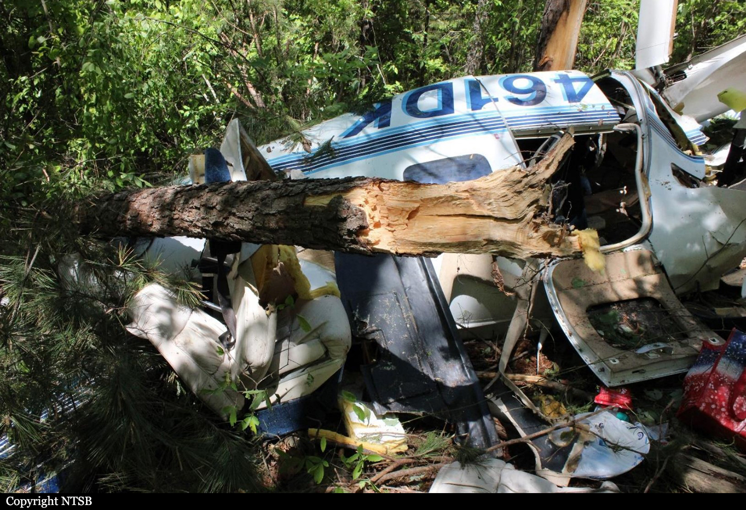
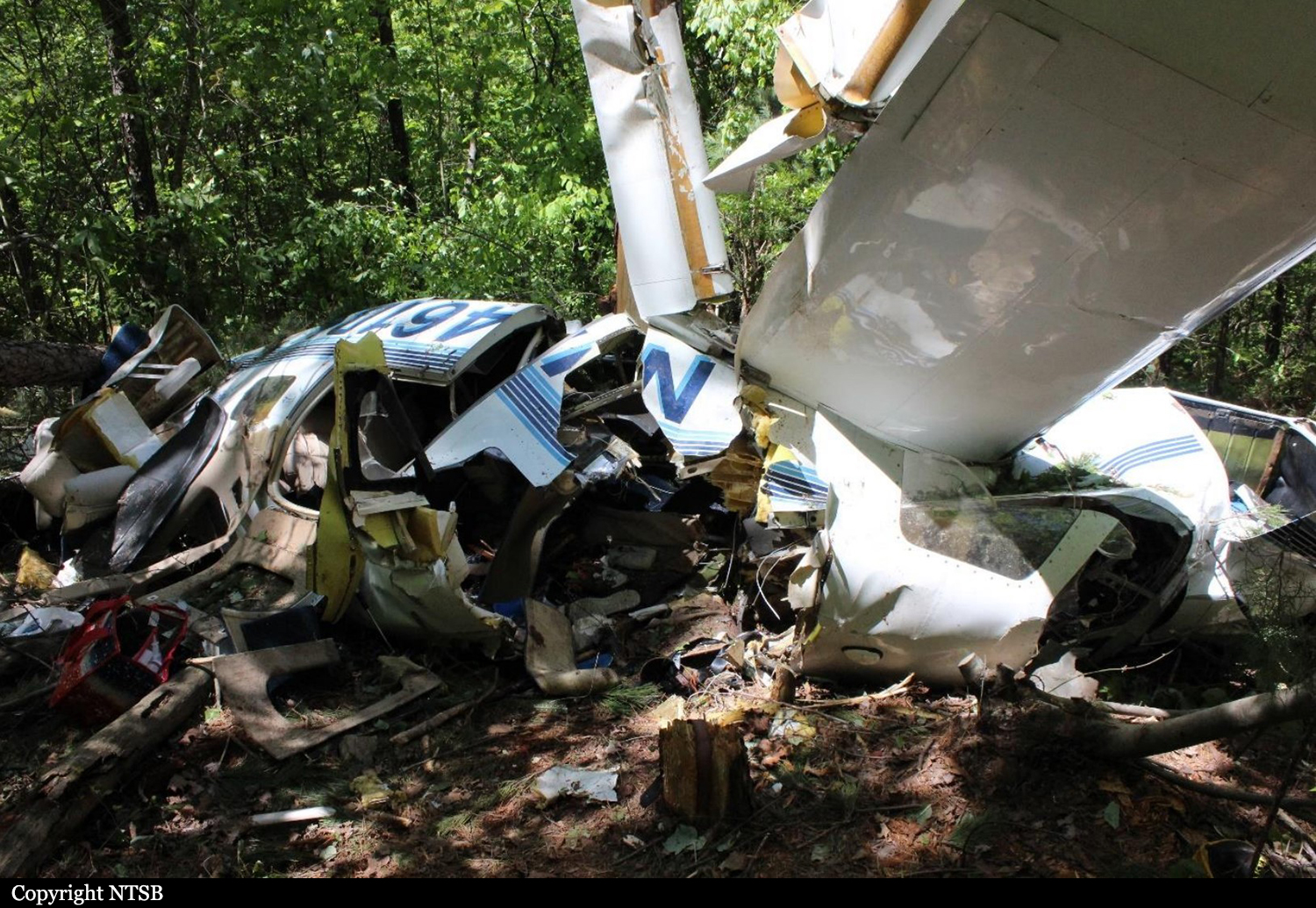
Crash of a Canadair CL-215-1A10 near Lobios: 1 killed

Date & Time: Aug 8, 2020 at 1220 LT
Type of aircraft:
Operator:
Registration:
EC-HET
Flight Phase:
Flight Type:
Survivors:
Yes
Site:
Schedule:
Castelo Branco - Castelo Branco
MSN:
1034
YOM:
1974
Location:
Country:
Region:
Crew on board:
2
Crew fatalities:
Pax on board:
0
Pax fatalities:
Other fatalities:
Total fatalities:
1
Captain / Total flying hours:
2500
Captain / Total hours on type:
1120.00
Copilot / Total flying hours:
15150
Copilot / Total hours on type:
600
Aircraft flight hours:
12003
Aircraft flight cycles:
5645
Circumstances:
Operated by Babcock Spain, the aircraft was stationed at Castelo Branco Airport in Portugal on behalf of the Civil Security of Portugal (Autoridade Nacional de Emergência e Proteção Civil).. The airplane departed Castelo Branco Airfield at 0815LT with a second CL-215 and was dispatched over the region of Lindoso, at the border with Spain, to fight a fire. While approaching the area to treat, the airplane was too low and impacted ground, causing the tail to detach. The aircraft crashed on a rocky area located near Lobios, on Spanish territory. The cockpit was destroyed upon impact and the Portuguese copilot aged 66 was killed while the Spanish captain aged 39 was seriously injured and transferred to an hospital in Alto Minho.
Probable cause:
The accident was the consequence of an erroneous assessment of the aircraft's ability to climb over the mountain.
Final Report:

Crash of a PZL-Mielec AN-2R near Kagarkhay: 6 killed

Date & Time: Jul 19, 2020 at 2026 LT
Type of aircraft:
Operator:
Registration:
RA-71276
Flight Phase:
Survivors:
No
Site:
Schedule:
Kyren - Kyren
MSN:
1G207-47
YOM:
1984
Country:
Region:
Crew on board:
2
Crew fatalities:
Pax on board:
4
Pax fatalities:
Other fatalities:
Total fatalities:
6
Captain / Total flying hours:
4280
Captain / Total hours on type:
4236.00
Copilot / Total flying hours:
8363
Copilot / Total hours on type:
8363
Aircraft flight hours:
7382
Circumstances:
The single engine airplane departed Kyren Airport in the afternoon with four employees of the company and two pilots. The purpose of the flight was to familiarize them with the area of ​​the planned aviation chemical works for the processing of the silkworm. As the airplane failed to return to Kyren in the evening, SAR operations were initiated, but abandoned few days later as no trace of the aircraft was found. More than a year later, on July 24, 2021, a group of tourist discovered the burnt wreckage near the Baikonur Pass, in a rocky area, at an altitude of 2,780 metres. The airplane was destroyed by a post crash fire and all six occupants were killed.
Probable cause:
The accident with the An-2 RA-71276 aircraft occurred as a result of a collision with a mountain at an altitude of 2,780 metres above sea level perpendicular to the direction of the ridge with its minimum height of 2,960 metres conditions of limited visibility and the closure of mountain tops by clouds.
The following contributing factors were identified:
- The crew took the decision to perform a flight over a mountainous area with predicted closure of the mountains by clouds and unfavorable wind conditions,
- The crew took the decision to return to the landing site through the mountain range along an unexplored and previously unused route,
- Operational fatigue of the crew due to the significant duration of working hours on the day of the accident (more than 12 hours),
- The airplane falling under the influence of descending air currents on the leeward side of a mountain slope.
Final Report:

Crash of a Beechcraft 350i Super King Air on Mt Artos: 7 killed

Date & Time: Jul 15, 2020 at 2245 LT
Operator:
Registration:
EM-809
Flight Phase:
Survivors:
No
Site:
Schedule:
Van - Van
MSN:
FL-896
YOM:
2015
Country:
Region:
Crew on board:
2
Crew fatalities:
Pax on board:
5
Pax fatalities:
Other fatalities:
Total fatalities:
7
Circumstances:
The twin engine aircraft departed Van-Ferit Melen Airport at 1834LT on a survey/reconnaissance mission over the province of Hakkari and Van, carrying five passengers and two pilots. At 2232LT, the crew informed ATC about his position vertical to Başkale on approach to Van-Ferit Melen Airport. Thirteen minutes later, the aircraft struck the slope of Mt Artos located 30 km southwest of runway 03 threshold. The aircraft was destroyed upon impact and all seven occupants were killed.

Crash of a PAC Cresco 08-600 near Carterton: 1 killed

Date & Time: Apr 24, 2020 at 0710 LT
Type of aircraft:
Operator:
Registration:
ZK-LTK
Flight Phase:
Survivors:
No
Site:
MSN:
30
YOM:
2002
Country:
Region:
Crew on board:
1
Crew fatalities:
Pax on board:
0
Pax fatalities:
Other fatalities:
Total fatalities:
1
Captain / Total flying hours:
15000
Captain / Total hours on type:
8700.00
Circumstances:
On 24 April 2020 the pilot of a Pacific Aerospace Cresco 08-600 aircraft, registered ZK-LTK (the aeroplane), was conducting agricultural flight operations spreading superphosphate fertilizer on a farm in the Kourarau Hill area, near Masterton. The airstrip was a typical topdressing airstrip, with a downward slope and a left bend of about 5 degrees partway down the strip, in the direction of take-off. The ground at the end of the airstrip dropped sharply away to a valley that ran perpendicular to the direction of the airstrip. On the commencement of the third topdressing flight, witnesses reported, the aeroplane accelerated normally from the loading point. However, the aeroplane did not follow the direction of the airstrip around to the left, as it had done during the previous two flights. Instead, the aeroplane continued in a straight line from the load point and subsequently struck uneven terrain off to the right of the airstrip. The impact with the uneven terrain caused the right main undercarriage assembly to fracture off and damage the right wing and flap. The aeroplane descended into the valley, striking a tree with the right-hand wing, then continued across the valley floor and impacted the far side of the valley, coming to rest inverted. The aeroplane was destroyed by the impacts and a post-crash fire. The sole pilot occupant did not survive the accident sequence.
Probable cause:
The following findings were identified:
- The pilot did not make the necessary left turn during the take-off roll to align with the strip centreline, so the aeroplane continued the take-off roll in a straight line.
- The right-rear undercarriage struck uneven ground with sufficient force to break the undercarriage mounting brackets and dislodge the undercarriage assembly from the aeroplane.
- The right main undercarriage subsequently struck the right flap, resulting in a partial dislocation of the flap. This very likely resulted in the aeroplane becoming uncontrollable.
- The pilot was about as likely as not to have been incapacitated early in the take-off roll.
Final Report:

Crash of a Piper PA-61 Aerostar (Ted Smith 601) near Craig: 1 killed

Date & Time: Apr 23, 2020 at 2130 LT
Registration:
N601X
Flight Phase:
Flight Type:
Survivors:
No
Site:
MSN:
61-0393-117
YOM:
1977
Location:
Crew on board:
1
Crew fatalities:
Pax on board:
0
Pax fatalities:
Other fatalities:
Total fatalities:
1
Captain / Total flying hours:
30
Circumstances:
The student pilot, who was not qualified to operate the airplane, reportedly flew from California to Pennsylvania on a commercial flight the morning of the accident to pick up and fly the accident airplane, which he purchased, to California. The student pilot departed Pennsylvania at 0719 and made several en route stops before arriving at the departure airport at 1949. A witness stated that the airplane’s right engine quit during taxi at the last en route stop and the pilot said he "cut it a little close on fuel." Another witness said that the pilot was “really tired” and planned to fly over the mountains for his return flight. The student pilot was not in communications with air traffic control while en route from the departure airport and did not receive an instrument flight rules clearance to operate the flight in class A airspace as required by Federal Aviation Regulations. The airplane was not equipped with automatic dependent surveillance-broadcast as required for flight in class A airspace. Radar track data indicate the airplane last departed from Fort Collins, Colorado, and maneuvered while climbing to 16,000 ft. The airplane proceeded west/southwest for a little over 40 miles before climbing to about 22,000 ft. The airplane then made several large heading changes and altitude changes between 20,000 ft and 23,000 ft before entering a tight looping turn to the left and losing altitude rapidly before track data was lost. All components of the airplane were distributed along the wreckage path in a manner consistent with a low-angle, high-speed impact with terrain. The airplane was destroyed. A green cylindrical tank consistent in color with an oxygen tank was separated from the airframe and was found along the wreckage path. Portions of pneumatic lines were attached to the tank and exhibited impact damage and separations from impact. Due to accident-related damage, the amount of the tank’s contents prior to the accident are unknown, and the functionality, if any, of the oxygen system is unknown. The reason for the airplane’s impact with terrain could not be determined based on available evidence.
Probable cause:
The student pilot’s flight into terrain for undetermined reasons.
Final Report:

Crash of a Beechcraft 200 Super King Air near Iriona: 2 killed

Date & Time: Mar 12, 2020
Operator:
Registration:
HK-5075
Flight Phase:
Flight Type:
Survivors:
No
Site:
MSN:
BB-801
YOM:
1981
Location:
Country:
Crew on board:
2
Crew fatalities:
Pax on board:
0
Pax fatalities:
Other fatalities:
Total fatalities:
2
Circumstances:
The twin engine aircraft was engaged in an illegal flight carrying two pilots and a probable load of cocaine bags. En route, the aircraft crashed in unknown circumstances in a prairie located in a mountainous area near Iriona. The aircraft disintegrated on impact and both occupants were killed.

Crash of a Cessna S550 Citation S/II in Friemersheim: 3 killed

Date & Time: Jan 23, 2020 at 1050 LT
Type of aircraft:
Operator:
Registration:
ZS-CAR
Flight Phase:
Flight Type:
Survivors:
No
Site:
Schedule:
George - George
MSN:
S550-0078
YOM:
1985
Country:
Region:
Crew on board:
3
Crew fatalities:
Pax on board:
0
Pax fatalities:
Other fatalities:
Total fatalities:
3
Captain / Total flying hours:
5215
Captain / Total hours on type:
1315.00
Copilot / Total flying hours:
1061
Copilot / Total hours on type:
265
Aircraft flight hours:
10106
Circumstances:
A Cessna S550 Citation S/II of the South African Civil Aviation Authority crashed into the Outeniqua mountains, near the town of Friemersheim. The three occupants were killed and the aircraft was destroyed. The Citation departed Port Elizabeth Airport (FAPE) on a positioning flight to George Airport (FAGG). On approach to FAGG, the flying crew requested to carry out a calibration flight for the very high frequency omnidirectional range (VOR) beacon at FAGG. Due to inclement weather conditions at the time, they were not cleared to conduct VOR calibration. As a result, they decided to land and refuel the aircraft before commencing with the calibration of the Instrument Landing System (ILS) on runway 11 at FAGG. The flying crew requested take-off from runway 11 and an early right turn to intercept radial 250°, 17 nautical miles (nm) DME arc to radial 330° at 3000 feet (ft) climbing to 4,000 feet. The air traffic control (ATC) granted their request. Radar data indicated that at 10:42, the aircraft took off from runway 11 and, once airborne, made a right-hand turn to intercept radial 250° using the George VOR (GRV VOR). The aircraft climbed to 3000ft. Once the aircraft reached 17 nm on the DME from the GRV VOR (DME is co-located with the VOR), it commenced with a right-hand turn to intercept radial 330° while maintaining 17nm DME arc. At 10:46, the ATC at FAGG advised the flying crew that they were now exiting controlled airspace and were advised to broadcast on the special rules frequency. The crew acknowledged the advisory to change frequency and there was no further communication. The aircraft was still being monitored by ATC using secondary surveillance radar. At 10:50, radar data showed the aircraft crossing radial 310° and entered a climb from 3000ft, reaching 3,900 feet. As the aircraft levelled off at 3,900 feet, a rapid descent occurred, and the aircraft lost 1500ft in approximately 9 seconds. Three seconds prior to impact, the aircraft nose pitched up before impacting a ridge at 2,192 feet. The aircraft was destroyed and all three occupants were killed.
Probable cause:
The crew lost control of the aircraft which resulted in significant loss of altitude; as they attempted to recover, they collided with the mountain. According to the SAWS report, there was significant cloud coverage below 1,500 feet above ground level at the time of the accident as observed in the METARs. Mountain tops were obscured as seen on the webcam. The aircraft route which is 17 NM arc passes over the obscured mountains. From the limited FDR reading the aircraft attitude drastically changed into an unusual attitude when approaching the mountain area. This indicates that most probably, the pilot has entered an unusual attitude during transition from VFR to IFR flight without preparation. The accident flight plan was VFR.
The following contributing factor were identified:
- The presence of low clouds at about 1,500 feet above ground and obscured mountains with clouds,
- The incapability of the crew to recover from unusual attitude,
- Lack of supervision and disregard of the Civil Aviation Regulations requirements by the FIU (operator),
- Overbanked and steep dive maneuver, unable to gain the required altitude before impact,
- Lack of upset prevention and recovery technique (UPRT).
Final Report:

Crash of a Beechcraft C90GT King Air near Caieiras: 1 killed

Date & Time: Dec 2, 2019 at 0602 LT
Type of aircraft:
Registration:
PP-BSS
Flight Phase:
Flight Type:
Survivors:
No
Site:
Schedule:
Jundiaí – Campo de Marte
MSN:
LJ-1839
YOM:
2008
Country:
Crew on board:
1
Crew fatalities:
Pax on board:
0
Pax fatalities:
Other fatalities:
Total fatalities:
1
Captain / Total flying hours:
6000
Captain / Total hours on type:
211.00
Circumstances:
The pilot departed Jundiaí-Comandante Rolim Adolfo Amaro Airport at 0550LT on a short transfer flight to Campo de Marte, São Paulo. While descending to Campo de Marte Airport, he encountered poor weather conditions and was instructed by ATC to return to Jundiaí. Few minutes later, while flying in limited visibility, the twin engine airplane impacted trees and crashed in a wooded area located in Mt Cantareira, near Caieiras. The aircraft was destroyed by impact forces and a post crash fire and the pilot, sole on board, was killed.
Probable cause:
The accident was the consequence of the combination of the following factors:
- Attention – undetermined.
It is likely that the pilot has experienced a lowering of his attention in relation to the available information and the stimuli of that operational context in face of the adverse conditions faced.
- Attitude – a contributor.
It was concluded that there was no reaction to the warnings of proximity to the ground (Caution Terrain) and evasive action to avoid collision (Pull Up), a fact that revealed difficulties in thinking and acting in the face of an imminent collision condition, in which the aircraft was found.
- Adverse meteorological conditions – a contributor.
The clouds height and visibility conditions did not allow the flight to be conducted, up to SBMT, under VFR rules.
- Piloting judgment – a contributor.
The attempt to continue with the visual flight, without the minimum conditions for such, revealed an inadequate assessment, by the pilot, of parameters related to the operation of the aircraft, even though he was qualified to operate it.
- Perception – a contributor
The ability to recognize and project hazards related to continuing flight under visual rules, in marginal ceiling conditions and forward visibility, was impaired, resulting in reduced pilot situational awareness, probable geographic disorientation, and the phenomenon known as " tunnel vision''.
- Decision-making process – a contributor.
The impairment of the pilot's perception in relation to the risks related to the continuation of the flight in marginal safety conditions negatively affected his ability to perceive, analyze, choose alternatives and act appropriately due to inadequate judgments and the apparent fixation on keeping the flight under visual rules, which also contributed to this occurrence.
Final Report:

Crash of a Piper PA-31-350 Navajo Chieftain near Cooper Landing: 3 killed

Date & Time: Nov 29, 2019 at 1911 LT
Operator:
Registration:
N4087G
Flight Phase:
Flight Type:
Survivors:
No
Site:
Schedule:
Anchorage – Seward
MSN:
31-8152127
YOM:
1981
Flight number:
SVX36
Crew on board:
1
Crew fatalities:
Pax on board:
2
Pax fatalities:
Other fatalities:
Total fatalities:
3
Captain / Total flying hours:
35000
Captain / Total hours on type:
1200.00
Aircraft flight hours:
5502
Circumstances:
On November 29, 2019, about 1911 Alaska standard time, a Piper PA-31-350 airplane, N4087G, was destroyed by impact and postcrash fire when it collided with mountainous terrain about 15 miles west of Cooper Landing, Alaska. The three occupants; the airline transport pilot, a flight nurse, and the flight paramedic were fatally injured. The airplane was operated by Fly 4 You Inc., doing business as Security Aviation, as a Title 14 Code of Federal Regulations Part 135 visual flight rules air ambulance flight. Dark night visual meteorological conditions existed at the departure and destination locations and company flight following procedures were in effect. The flight departed Ted Stevens International Airport (PANC), Anchorage, Alaska, about 1848, destined for Seward Airport (PAWD), Seward, Alaska. Dispatch records indicated that, on November 29, Providence Seward Medical Center emergency clinic personnel contacted multiple air ambulance companies with a "weather check" for possible air ambulance transportation of a patient from Seward to Anchorage. The first company contacted was Guardian Flight, who declined the flight at 1624 due to limited daylight hours. The second company, LifeMed Alaska, declined the flight at 1637 due to weather. The third and final company contacted for the flight was Medevac Alaska. Their dispatch officer was not notified of the previous declined flight requests and forwarded the request to Security Aviation, who is their sole air charter provider. At 1731 Security Aviation accepted the flight, and Medevac Alaska flight SVX36 was staffed with a nurse and paramedic. A preliminary review of archived Federal Aviation Administration (FAA) radar and automatic dependent surveillance (ADS-B) data revealed that the accident airplane departed PANC and flew south about 3,000 ft mean sea level (msl) toward the Sterling Highway. The airplane was then observed descending to 2,200 ft msl while flying a right racetrack pattern before flying into the valley toward Cooper Landing. The last data point indicated that at 1911:14 the airplane was over the west end of Jean Lake at 2,100 ft msl, on a 127° course, and 122 kts groundspeed. Ground witnesses who were in vehicles on the Sterling Highway near milepost 63, reported that they saw the lights of the airplane flying over the highway that night. One witness stated that he saw the airplane west of the mountains turn in a circle as it descended and then entered the valley. He observed the wings rocking back and forth and while he was looking elsewhere, he heard an explosion and observed a large fire on the mountainside. Another witness reported seeing the airplane flying low and explode when it impacted the mountain. Witnesses to the fire called 911 and observed the wreckage high on the mountainside burning for a long time after impact. The airplane was reported overdue by the chief pilot for Security Aviation and the FAA issued an alert notice (ALNOT) at 2031. The Alaska Rescue Coordination Center dispatched an MH-60 helicopter to the last known position and located the burning wreckage that was inaccessible due to high winds in the area. On December 1, 2019, the Alaska State Troopers coordinated a mountain recovery mission with Alaska Mountain Rescue Group. The wreckage was observed on the mountain at an elevation of about 1,425 ft msl in an area of steep, heavily tree-covered terrain near the southeast end of Jean Lake in the Kenai National Wildlife Refuge. The airplane was highly fragmented and burned, however all major airplane components were accounted for. Multiple large trees around the wreckage were fractured and indicated an easterly heading prior to the initial impact.

Crash of a Viking Air DHC-6 Twin Otter 400 near Kampung Mamontoga: 4 killed

Date & Time: Sep 18, 2019 at 1100 LT
Operator:
Registration:
PK-CDC
Flight Phase:
Flight Type:
Survivors:
No
Site:
Schedule:
Timika - Ilaga
MSN:
950
YOM:
2016
Country:
Region:
Crew on board:
3
Crew fatalities:
Pax on board:
1
Pax fatalities:
Other fatalities:
Total fatalities:
4
Circumstances:
The twin engine airplane departed Timika Airport at 1036LT on a cargo flight to Ilaga, carrying one passenger, a crew of four and a load of 1,7 ton of rice. At 1054LT, the crew gave his ETA at Ilaga Airport when the contact was lost about six minutes later. As the airplane failed to arrive at destination, SAR operations were initiated. The wreckage was found four days later in a mountainous terrain, at an altitude of 4,115 meters, about 10 km from Kampung Mamontoga. The aircraft was totally destroyed and all four occupants were killed.