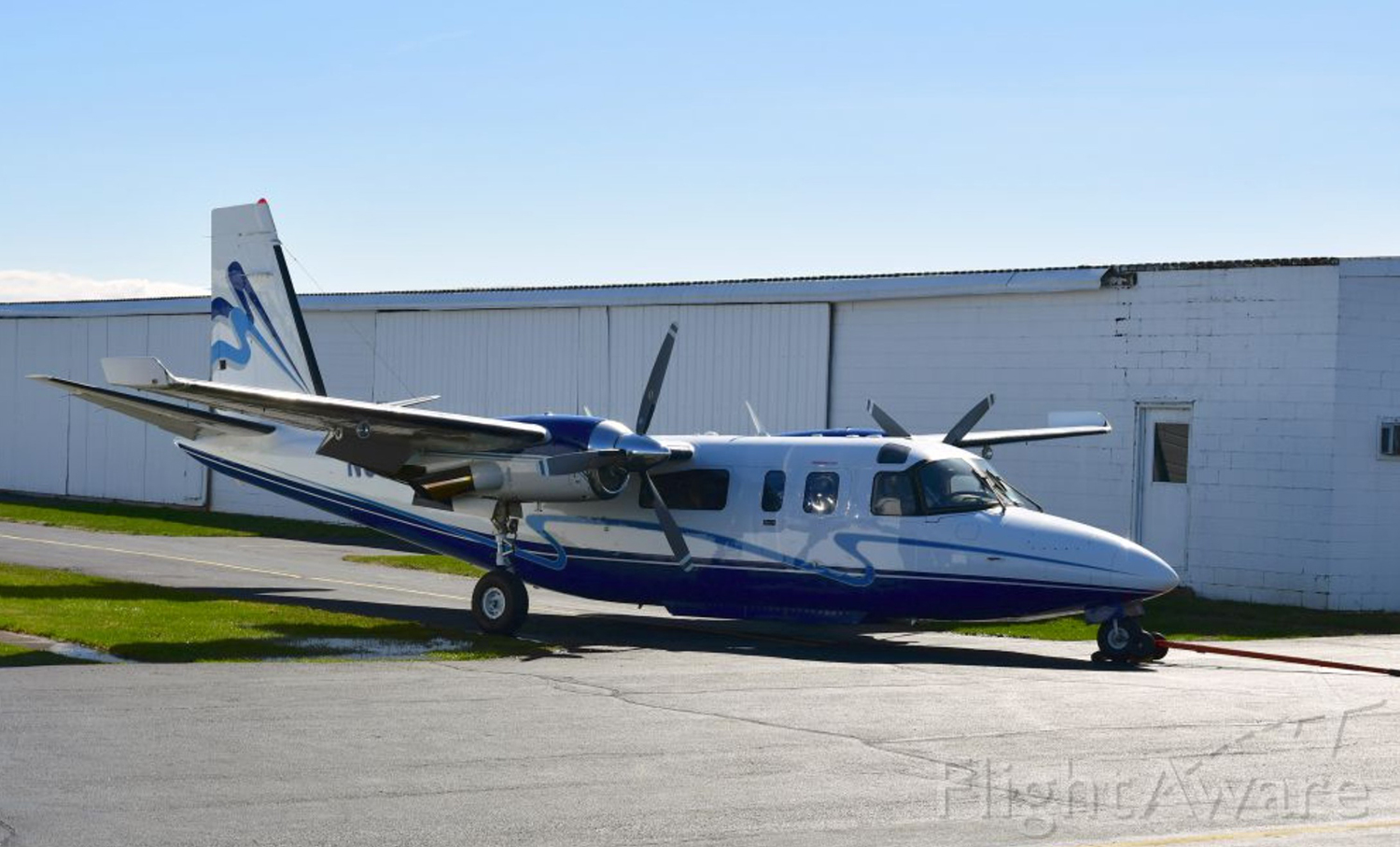
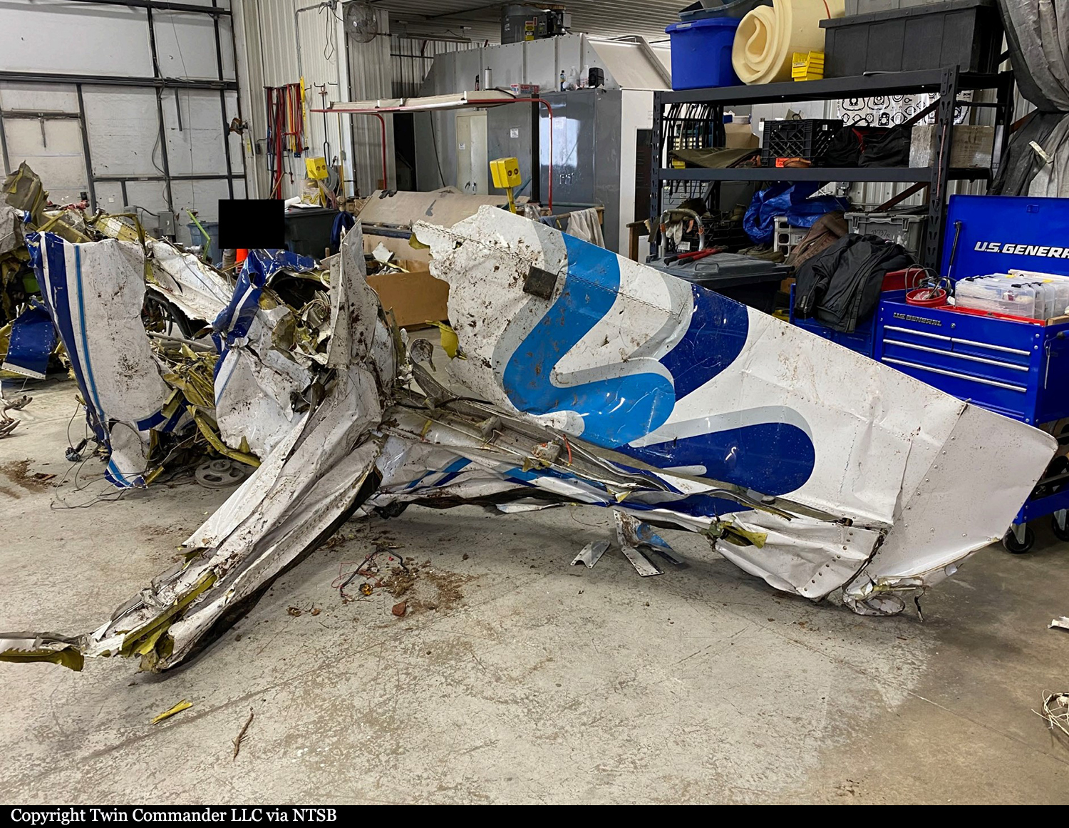
Crash of a Cessna 208B Grand Caravan in Fulshear: 2 killed
Date & Time:
Dec 21, 2021 at 0926 LT
Operator:

Registration:
N1116N
Survivors:
No
Schedule:
Houston - Victoria
MSN:
208B-0417
YOM:
1994
Flight number:
MRA685
Crew on board:
1
Crew fatalities:
Pax on board:
0
Pax fatalities:
Other fatalities:
Total fatalities:
2
Aircraft flight hours:
13125
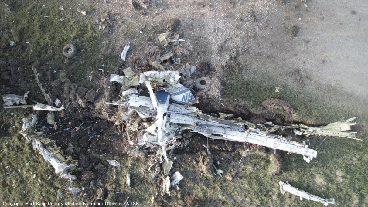
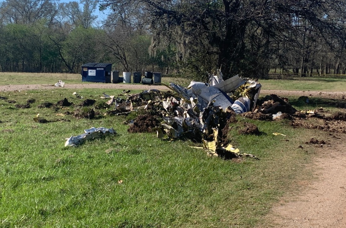
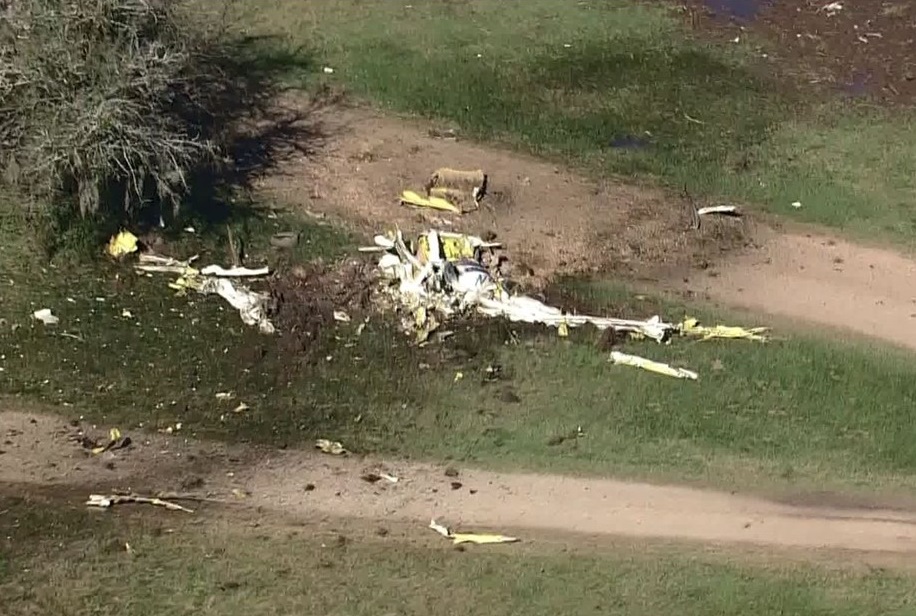
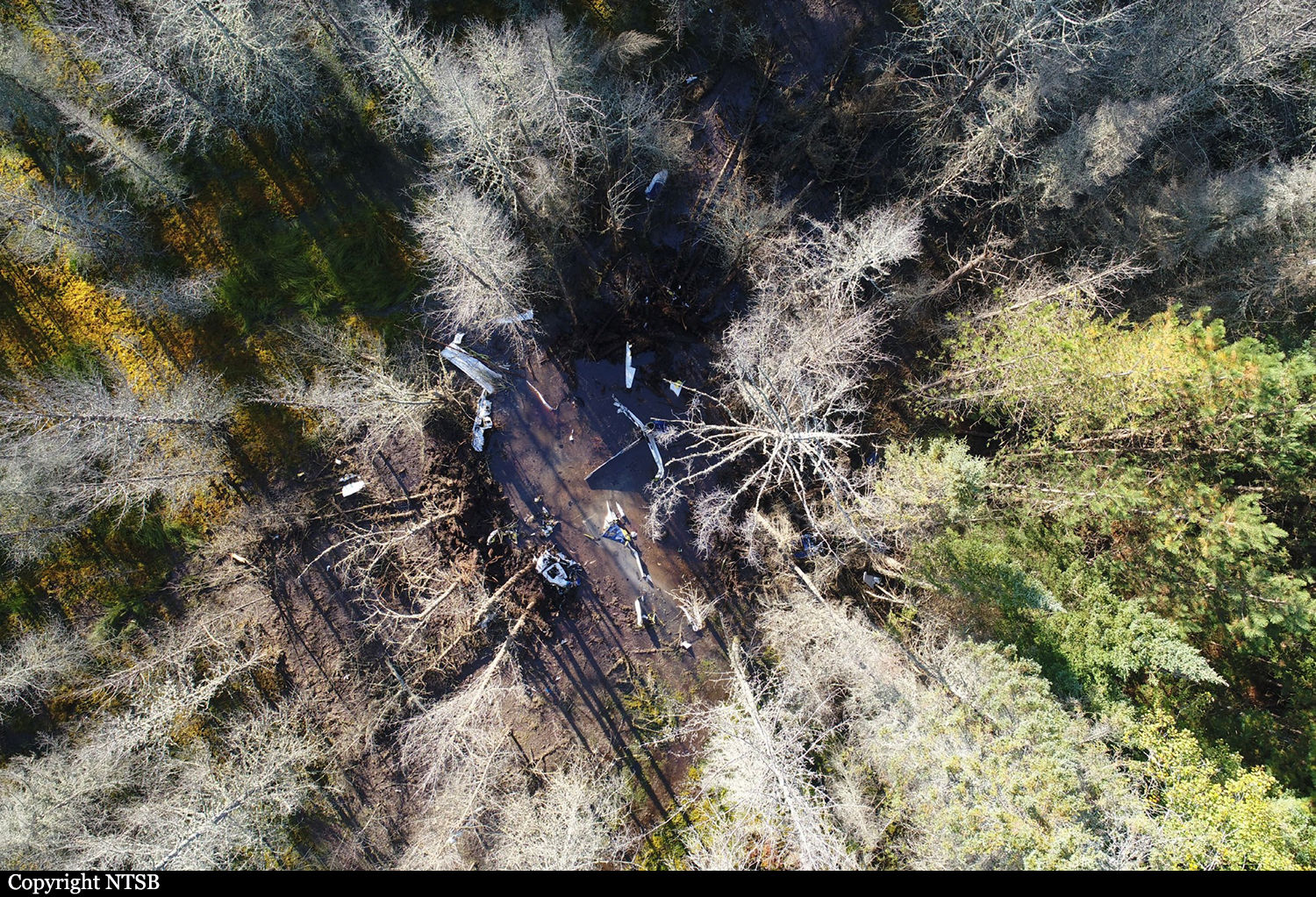
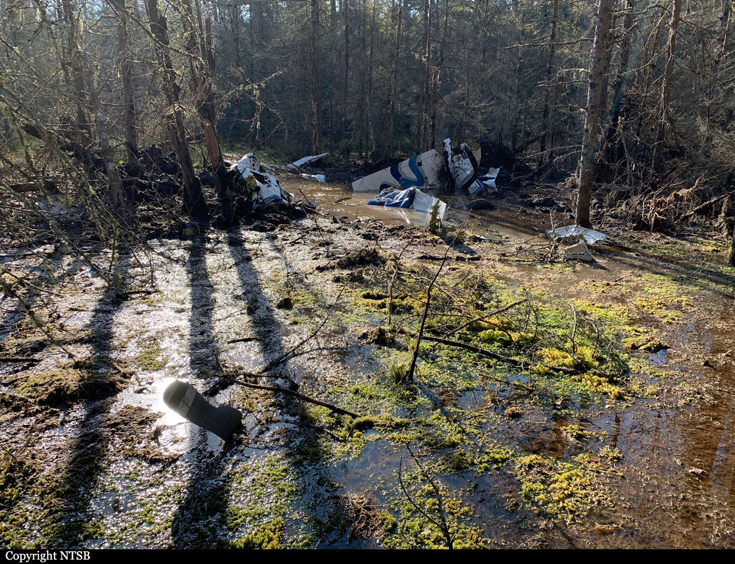
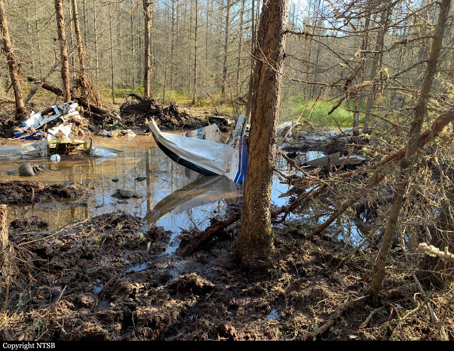
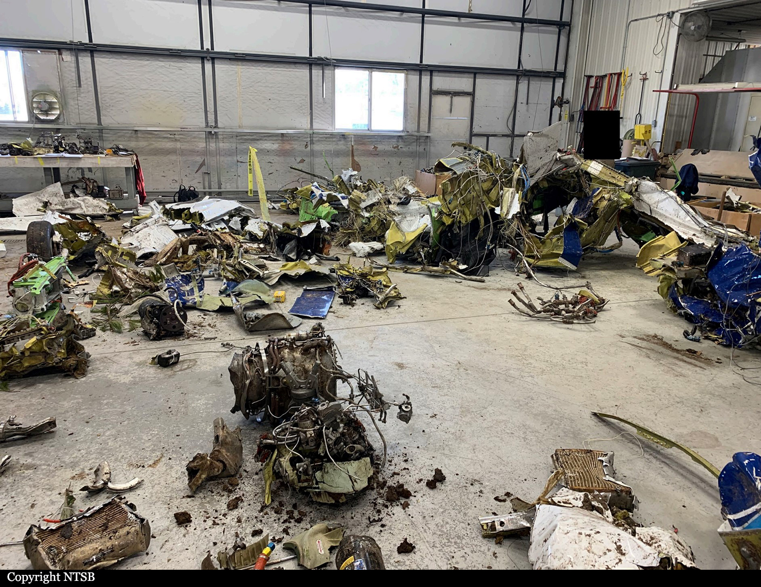
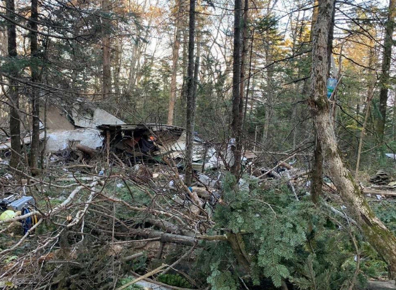
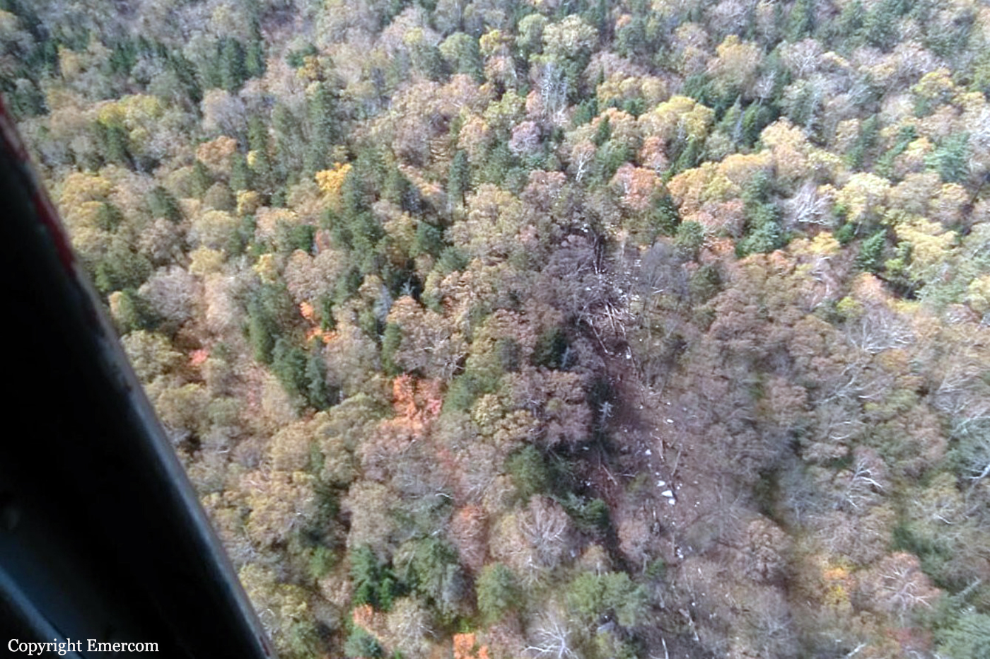
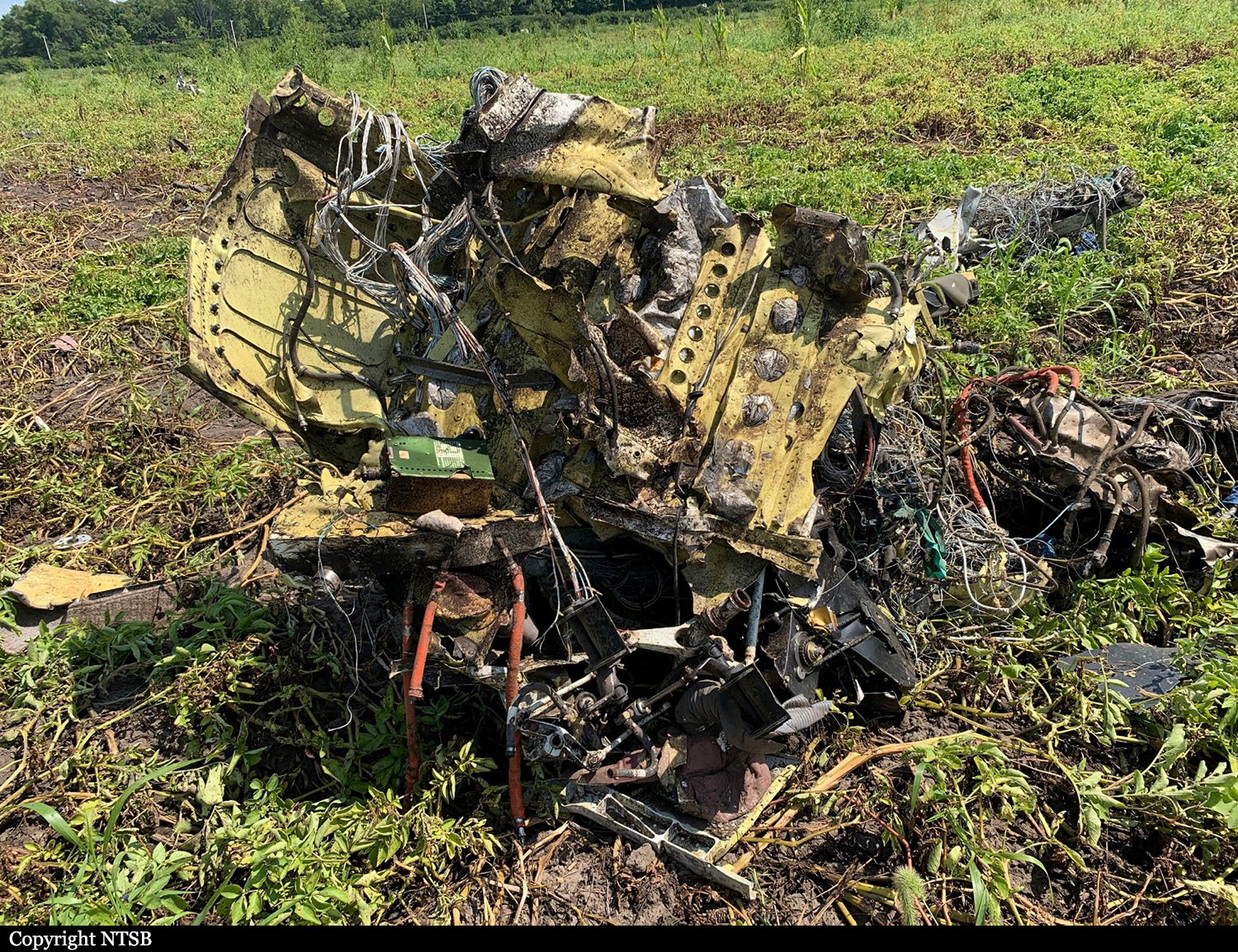
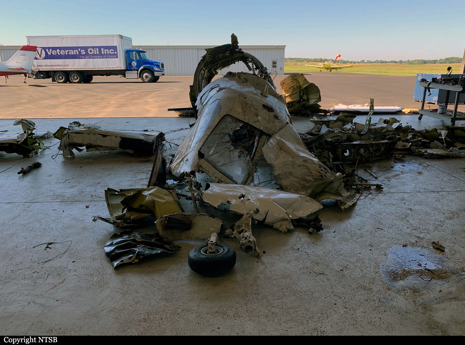
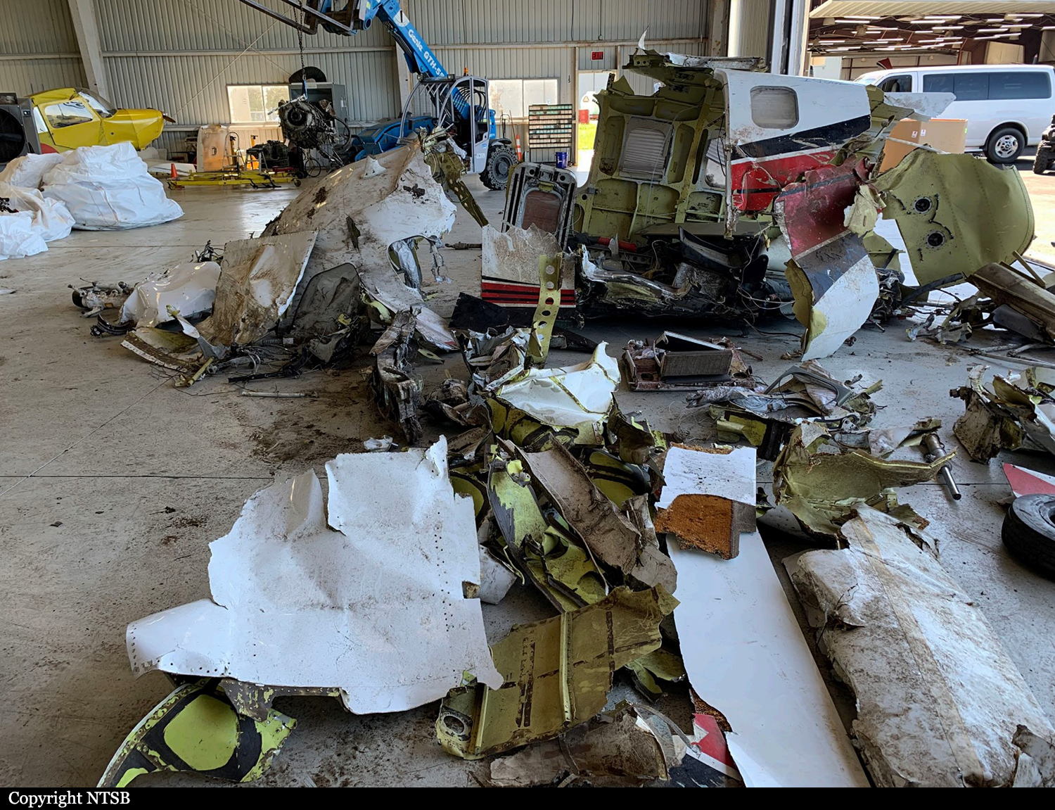
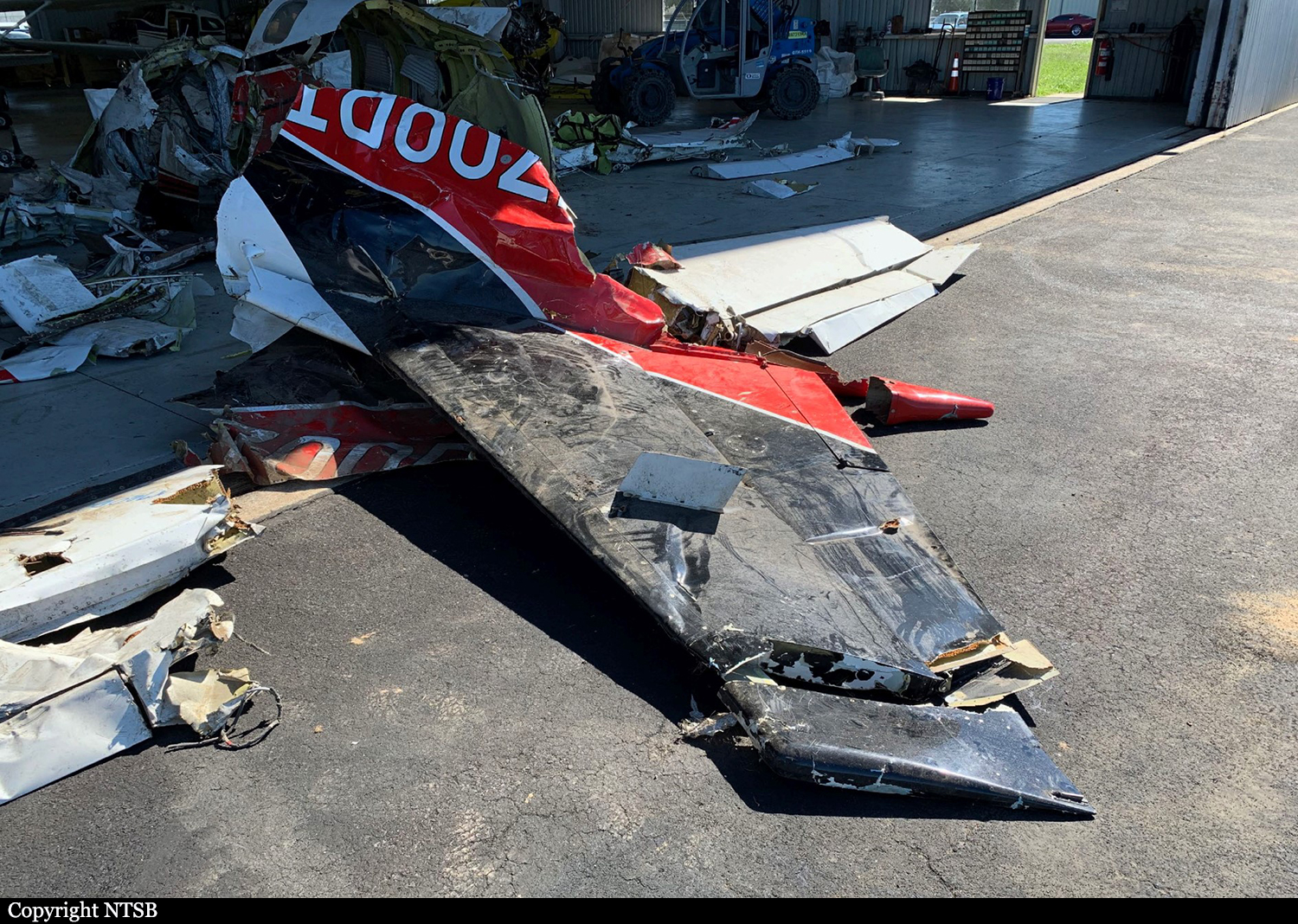
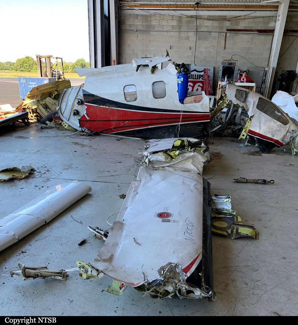
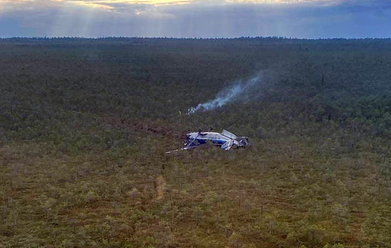
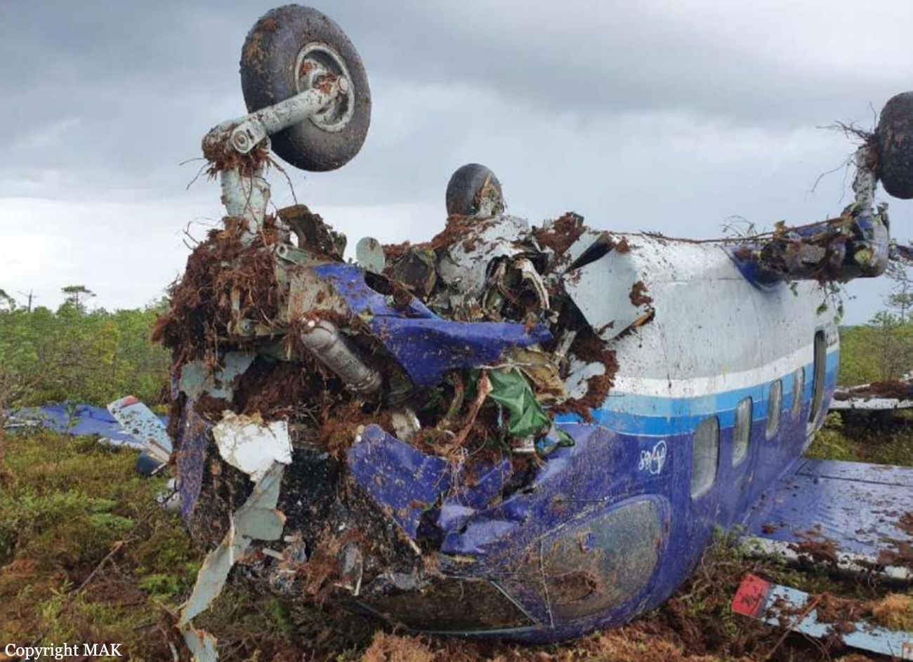
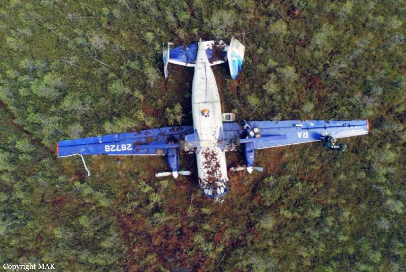
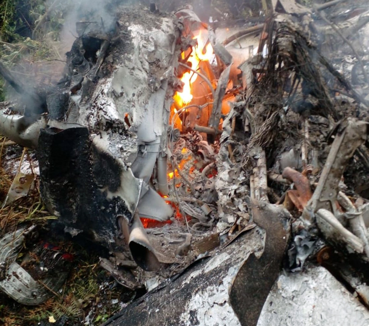
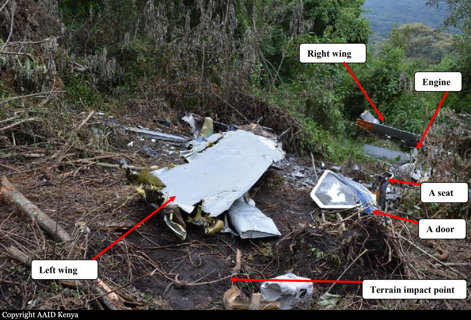
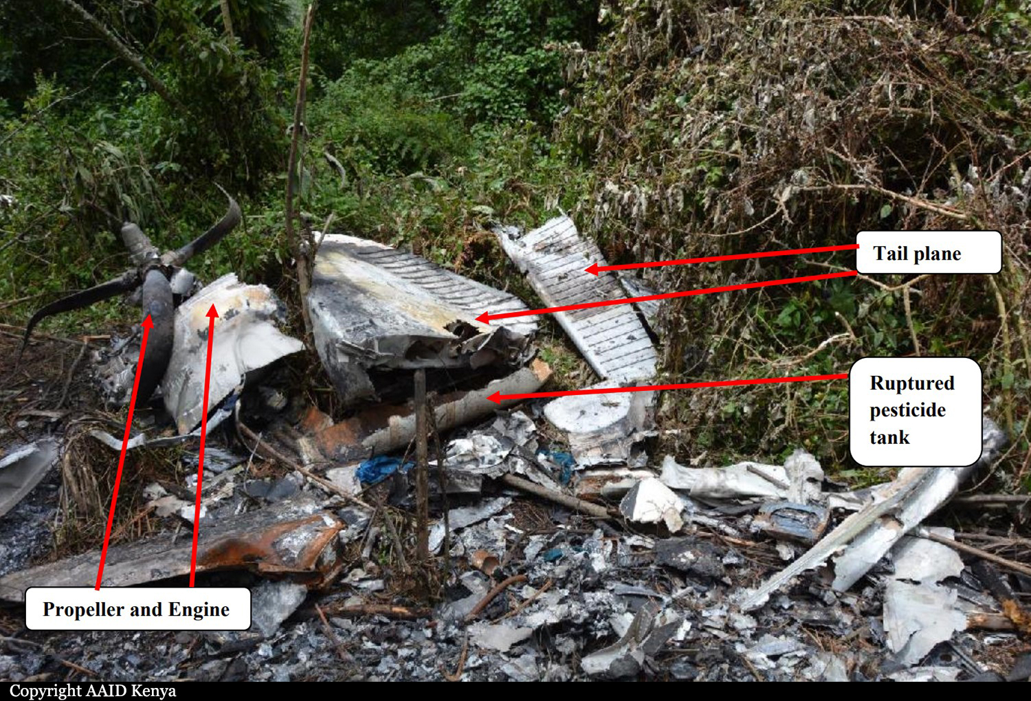
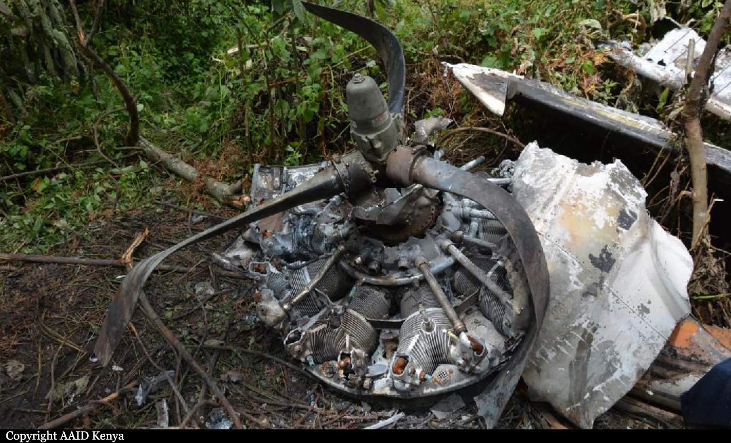
Circumstances:
A Cessna 208B airplane collided with a powered paraglider during cruise flight at 5,000 feet mean sea level (msl) in Class E airspace. Based on video evidence, the powered paraglider operator impacted the Cessna’s right wing leading edge, outboard of the lift strut attachment point. The outboard 10 ft of the Cessna’s right wing separated during the collision. The Cessna impacted terrain at high vertical speed in a steep nose-down and inverted attitude. The powered paraglider operator was found separated from his seat style harness. The paraglider wing, harness, and emergency parachute were located about 3.9 miles south of the Cessna’s main wreckage site. Based on video evidence and automatic dependent surveillance-broadcast (ADS-B) data, the Cessna and the powered paraglider converged with a 90° collision angle and a closing speed of about 164 knots. About 8 seconds before the collision, the powered paraglider operator suddenly turned his head to the right and about 6 seconds before the collision, the powered paraglider maneuvered in a manner consistent with an attempt to avoid a collision with the converging Cessna. Research indicates that about 12.5 seconds can be expected to elapse between the time that a pilot sees a conflicting aircraft and the time an avoidance maneuver begins. Additionally, research suggests that general aviation pilots may only spend 30-50% of their time scanning outside the cockpit. About 8 seconds before the collision (when the powered paraglider operator’s head suddenly turned to the right), the Cessna would have appeared in the powered paraglider operator’s peripheral view, where research has demonstrated visual acuity is very poor. Additionally, there would have been little apparent motion because the Cessna and the powered paraglider were on a collision course. Under optimal viewing conditions, the powered paraglider may have been recognizable to the Cessna pilot about 17.5 seconds before the collision. However, despite the powered paraglider’s position near the center of his field of view, the Cessna pilot did not attempt to maneuver his airplane to avoid a collision. Further review of the video evidence revealed that the powered paraglider was superimposed on a horizon containing terrain features creating a complex background. Research suggests that the powered paraglider in a complex background may have been recognizable about 7.4 seconds before the collision. However, the limited visual contrast of the powered paraglider and its occupant against the background may have further reduced visual detection to 2-3 seconds before the collision. Thus, after considering all the known variables, it is likely that the Cessna pilot did not see the powered paraglider with sufficient time to avoid the collision. The Cessna was equipped with a transponder and an ADS-B OUT transmitter, which made the airplane visible to the air traffic control system. The operation of the powered paraglider in Class E airspace did not require two-way radio communication with air traffic control, the use of a transponder, or an ADS-B OUT transmitter and therefore was not visible to air traffic control. Neither the Cessna nor the powered paraglider were equipped with ADS-B IN technology, cockpit display of traffic information, or a traffic alerting system. Postmortem toxicological testing detected the prescription antipsychotic medication quetiapine, which is not approved by the Federal Aviation Administration (FAA), in the Cessna pilot’s muscle specimen but the test results did not provide sufficient basis for determining whether he was drowsy or otherwise impaired at the time of the collision (especially in the absence of any supporting details to suggest quetiapine use). Testing also detected ethanol at a low level (0.022 g/dL) in the Cessna pilot’s muscle specimen, but ethanol was not detected (less than 0.01 g/dL) in another muscle specimen. Based on the available results, some, or all of the small amount of detected ethanol may have been from postmortem production, and it is unlikely that ethanol effects contributed to the accident. The Cessna pilot likely did not have sufficient time to see and avoid the powered paraglider (regardless of whether he was impaired by the quetiapine) and, thus, it is unlikely the effects of quetiapine or an associated medical condition contributed to the accident.
Probable cause:
The limitations of the see-and-avoid concept as a method for self-separation of aircraft, which resulted in an inflight collision. Contributing to the accident was the absence of collision avoidance technology on both aircraft.
Final Report: