Country
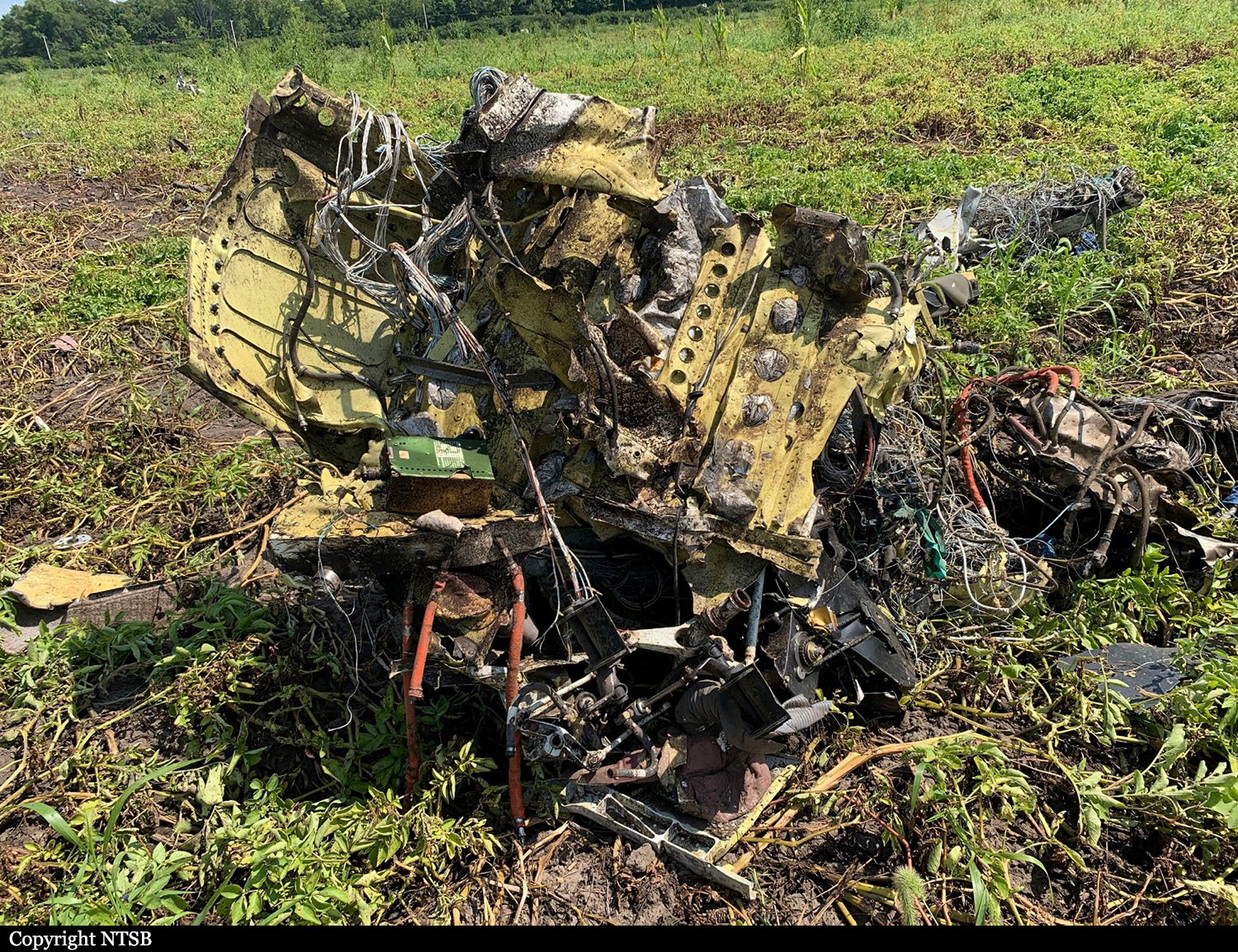
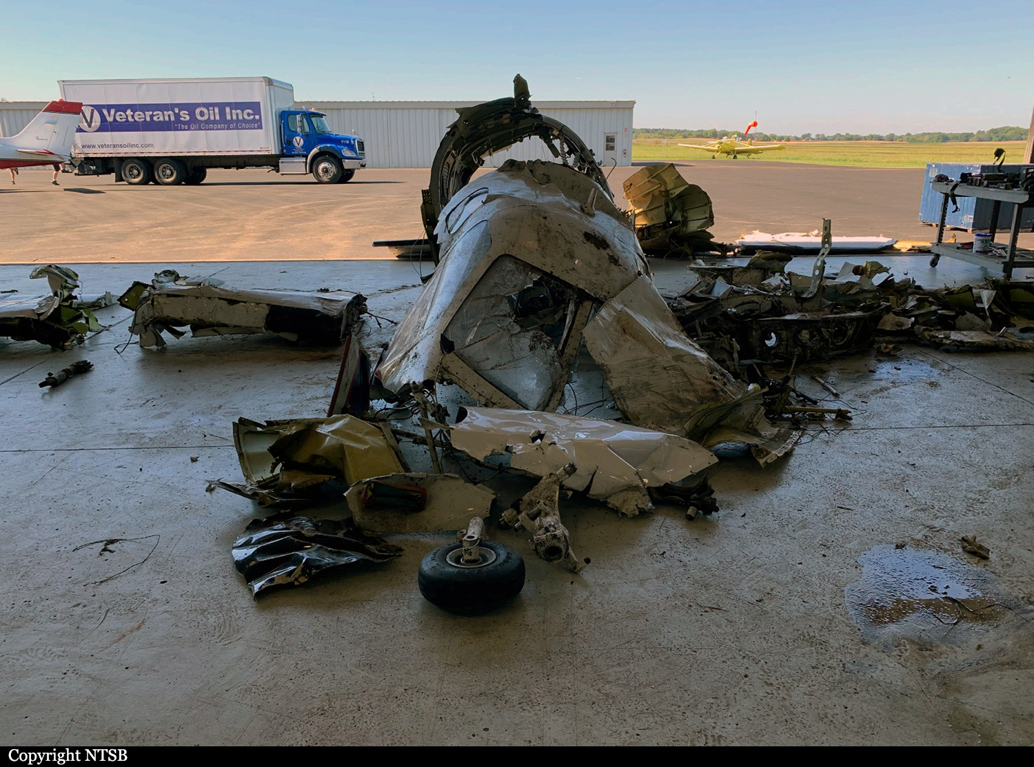
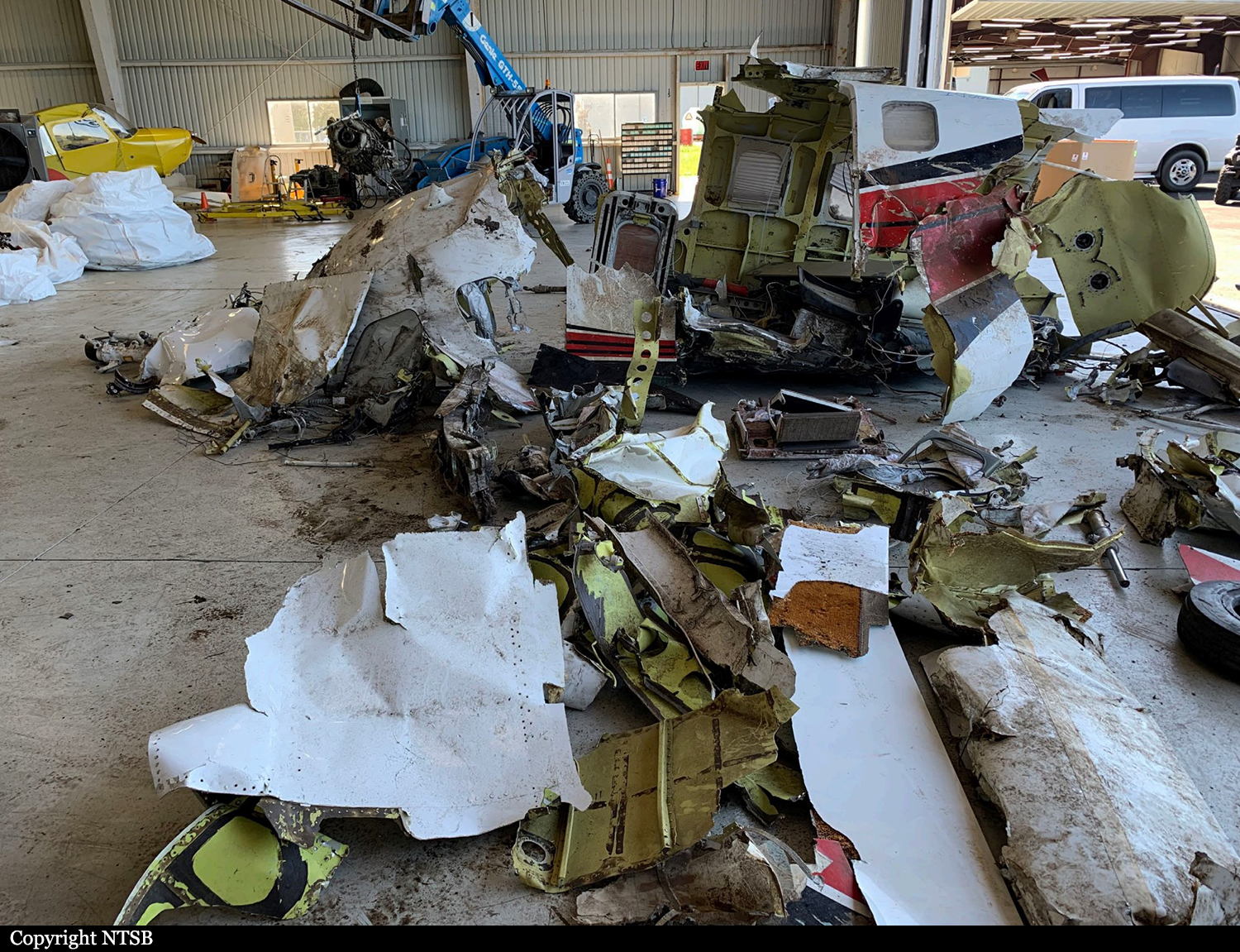
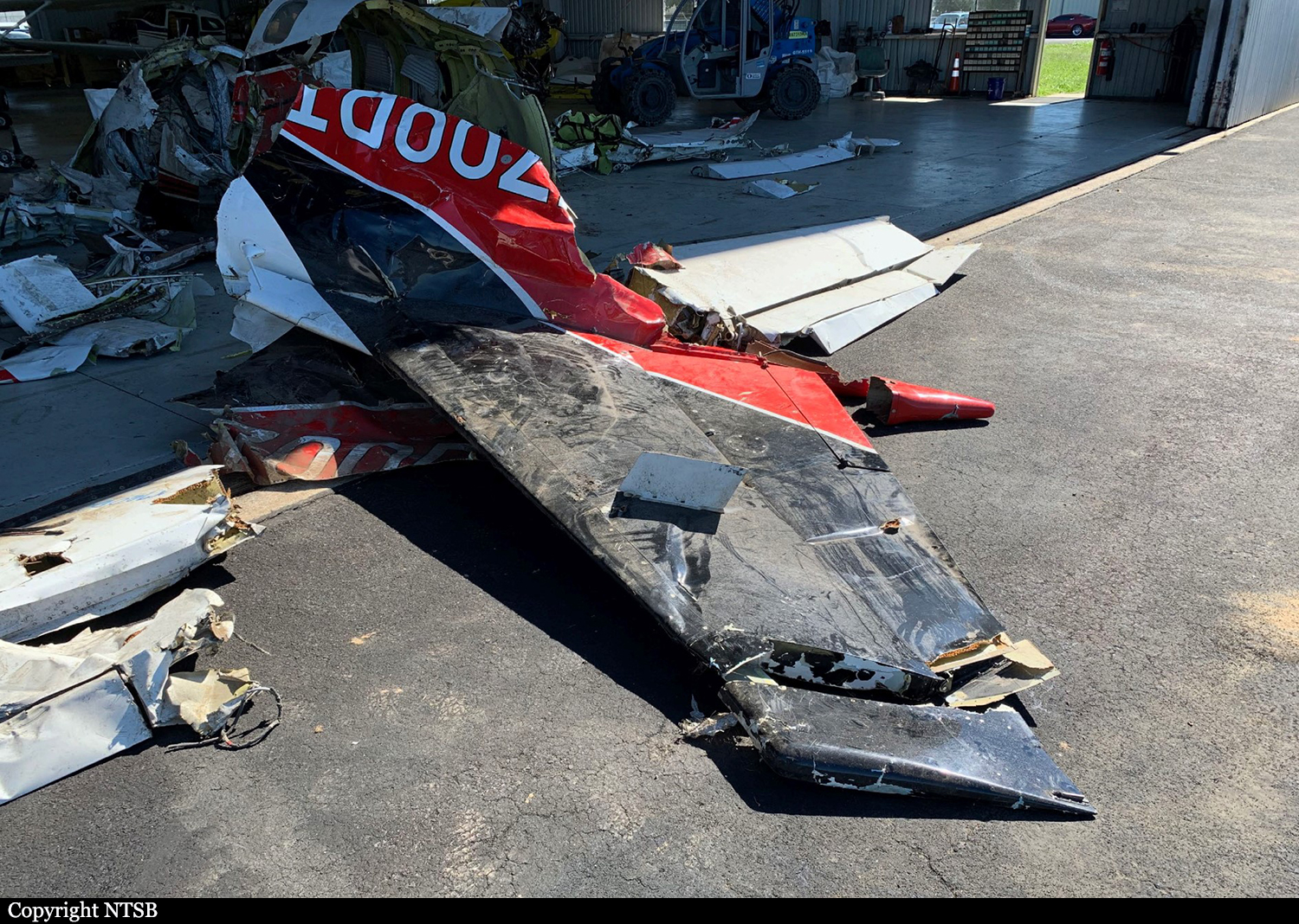
Crash of a Socata TBM-700C in Monroe: 2 killed
Date & Time:
Nov 24, 2025 at 1715 LT
Registration:
N700PT
Survivors:
No
Schedule:
Oshkosh - Monroe
MSN:
268
YOM:
2003
Crew on board:
1
Crew fatalities:
Pax on board:
1
Pax fatalities:
Other fatalities:
Total fatalities:
2
Circumstances:
On final approach to Monroe Municipal Airport Runway 20, the single engine airplane went out of control and crashed in a gravel quarry located north of the airfield. Both occupants were killed. They were completing a flight from Oshkosh.

Crash of a Socata TBM-700 in New Bedford: 2 killed
Date & Time:
Oct 13, 2025 at 0813 LT
Registration:
N111RF
Survivors:
No
Schedule:
New Bedford - Kenosha
MSN:
259
YOM:
2003
Crew on board:
1
Crew fatalities:
Pax on board:
1
Pax fatalities:
Other fatalities:
Total fatalities:
2
Circumstances:
After takeoff from New Bedford Airport Runway 05 in rain falls, the pilot made two successive turns to the left and reached the maximum altitude of 750 feet. The single engine airplane started to lose height and speed then struck a car on highway 195 and crashed in the embankment separating both highways, bursting into flames. The accident occurred 6,6 km southwest of New Bedford Airport. Both occupants in the airplane were killed and the car's drive was injured.


Crash of a Socata TBM-700 in Brooklyn Park: 1 killed
Date & Time:
Mar 29, 2025 at 1222 LT
Registration:
N721MB
Survivors:
No
Schedule:
Des Moines - Anoka County
MSN:
91
YOM:
1993
Crew on board:
1
Crew fatalities:
Pax on board:
0
Pax fatalities:
Other fatalities:
Total fatalities:
1
Circumstances:
On approach to Anoka County-Blaine Airport Runway 09, the single engine airplane entered a sharp turn to the left then descended to the ground in a near vertical attitude before crashing onto a house located in the north part of Brooklyn Park, some 9 km short of runway, bursting into flames. The airplane and the house were destroyed by a post crash fire and the pilot, sole on board was killed. There were no casualties on the ground.


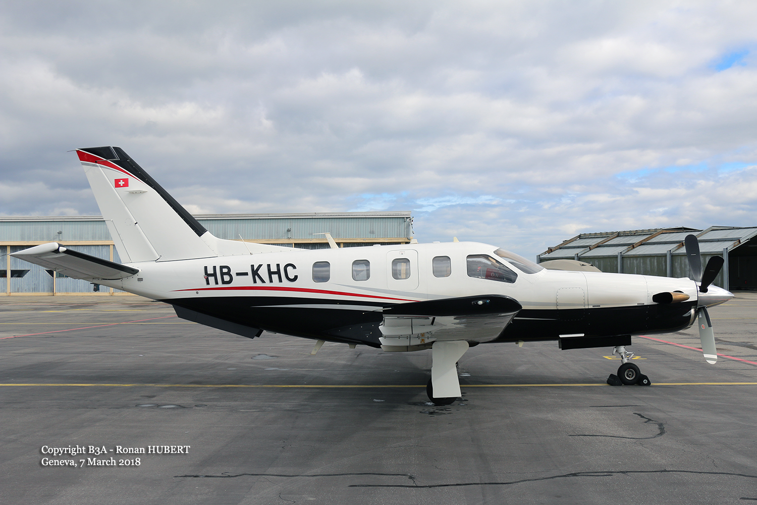
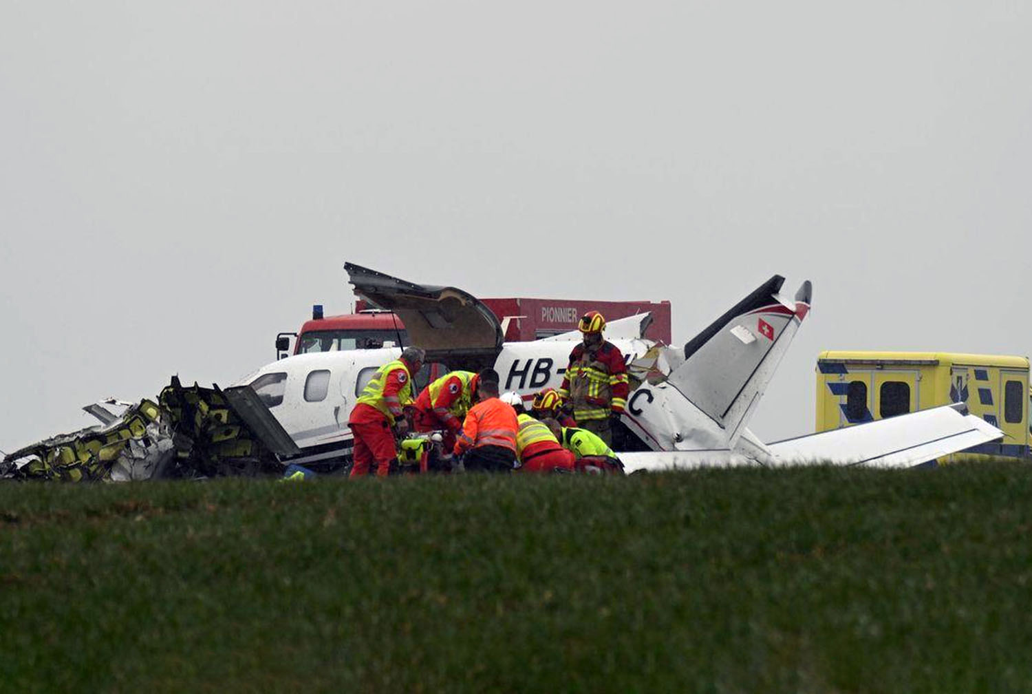
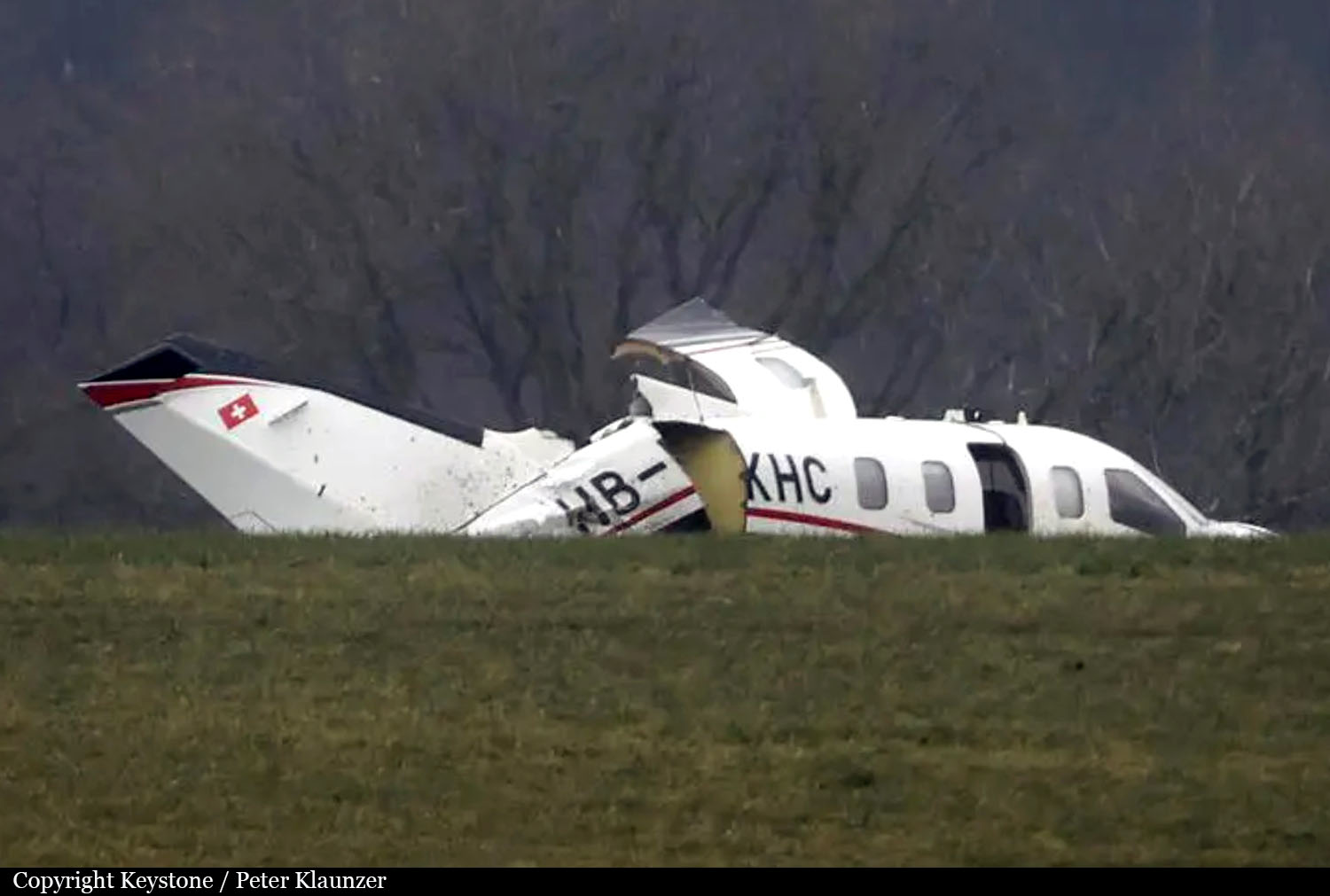
Crash of a Socata TBM-700 C2 in Leuzigen
Date & Time:
Feb 6, 2025 at 1120 LT
Registration:
HB-KHC
Survivors:
Yes
Schedule:
Locarno - Grenchen
MSN:
342
YOM:
2005
Crew on board:
1
Crew fatalities:
Pax on board:
2
Pax fatalities:
Other fatalities:
Total fatalities:
0
Circumstances:
The single engine airplane departed Locarno Airfield on a private flight to Grenchen, carrying two passengers and one pilot. While in a circuit for an approach to Grenchen Airport Runway 06, the airplane stalled and crashed in a pasture located in Leuzigen, about 4 km east of the airport. The airplane was destroyed and all three occupants were injured. At the time of the accident, the visibility was estimated to be 4 km with wind from 070 at 6 knots with mist, scattered at 800 feet and overcast at 1,400 feet.
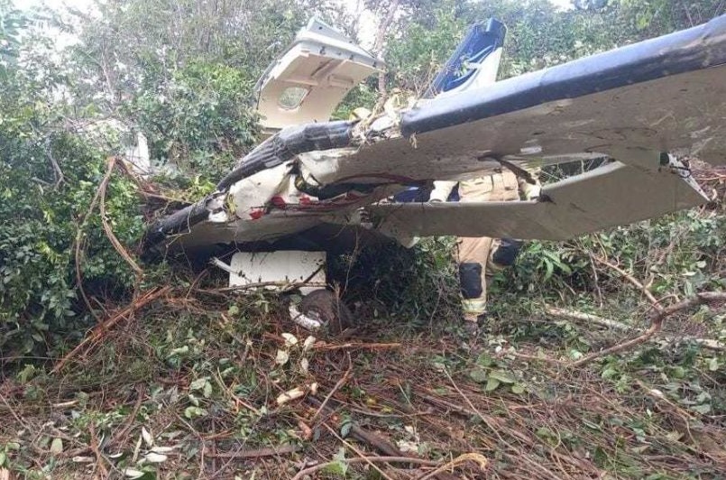
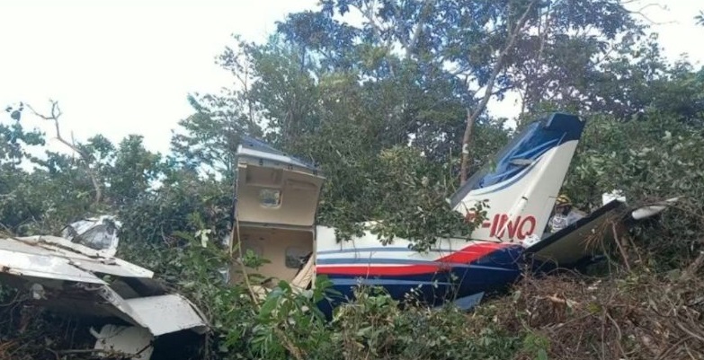
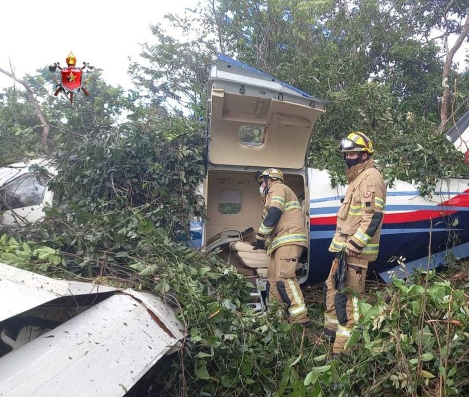
Crash of a Socata TBM-700 in Brasília
Date & Time:
Jan 31, 2022 at 0935 LT
Registration:
PP-INQ
Survivors:
Yes
Schedule:
Fazenda Santa Maria - Brasília
MSN:
558
YOM:
2010
Crew on board:
1
Crew fatalities:
Pax on board:
4
Pax fatalities:
Other fatalities:
Total fatalities:
0
Captain / Total hours on type:
60.00
Circumstances:
The single engine airplane departed Fazenda Santa Maria Airfield located 116 km west of Formosa do Rio Preto, Bahia, on a flight to Brasília, carrying four passengers and one pilot. On final approach to Brasília-Nelson Piquet Airport runway 28, the pilot encountered marginal weather conditions with crosswind. The airplane impacted the ground in the grassy area, approximately 3 metres beyond the lateral edge of runway 28 with no evidence of prior ground contact or impact. The terrain alongside the runway sloped downward and was covered with native vegetation (cerrado biome). The pilot attempted a go around procedure but the airplane veered off runway to the left at a speed of 70 knots and collided with trees, coming to rest 120 metres further. The airplane was destroyed and all five occupants escaped unhurt.
Probable cause:
Contributing factors:
- Adverse meteorological conditions – a contributor.
The significant weather, indicated with the proximity qualifier “vicinity” in the METAR for SBBR, encompassed the SSGP region and affected the aircraft’s stability on short final, requiring the pilot to perform additional control inputs compared to normal operating
conditions.
- Handling of aircraft flight controls – a contributor.
The improper use of flight controls during heading correction on final approach - due to wind gusts - and the failure to effectively neutralize the aircraft’s rolling tendency during the go-around maneuver contributed to destabilization on final and to the unsuccessful go around.
- Piloting judgment – a contributor.
The application of rudder to correct for lateral wind deviation, based on the belief that using aileron would result in loss of lift, reflected an inadequate assessment.
- Perception – undetermined.
It is possible that situational awareness was reduced due to the wind gust occurring near touchdown, where increased workload may have led to delayed or selective perception of the required action, in this case, the go-around procedure.
- Decision-making process – a contributor.
The decision to continue the approach, followed by exposure to another wind gust during a critical phase (low altitude and left of runway centerline), resulted in a delayed execution of the go-around procedure, highlighting difficulty in perceiving, analyzing, and
selecting appropriate alternatives for the situation encountered.
Final Report:

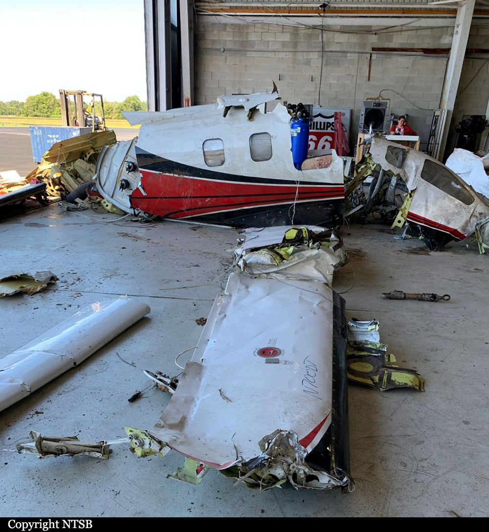
Crash of a Socata TBM-700 near Urbana: 1 killed
Date & Time:
Aug 20, 2021 at 1440 LT
Registration:
N700DT
Survivors:
No
Schedule:
Port Clinton – Cincinnati
MSN:
134
YOM:
1998
Crew on board:
1
Crew fatalities:
Pax on board:
0
Pax fatalities:
Other fatalities:
Total fatalities:
1
Captain / Total hours on type:
17.00
Aircraft flight hours:
2624
Circumstances:
The pilot was performing a short cross-country flight, which was his third solo flight in the high-performance single-engine airplane. The airplane departed and climbed to 20,000 ft mean sea level (msl) before beginning to descend. About 8 minutes before the accident, the airplane was southbound, descending to 11,000 ft, and the pilot established communications with air traffic control (ATC). About 4 minutes later, the controller cleared the pilot to descend to 10,000 ft msl and proceed direct to his destination; the pilot acknowledged the clearance. While descending through 13,000 ft msl, the airplane entered a descending left turn. The controller observed the left turn and asked the pilot if everything was alright; there was no response from the pilot. The controller’s further attempts to establish communications were unsuccessful. Following the descending left turn, the airplane entered a high speed, nose-down descent toward terrain. A witness observed the airplane at a high altitude in a steep nose-down descent toward the terrain. The witness noted no signs of distress, such as smoke, fire, or parts coming off the airplane, and he heard the airplane’s engine operating at full throttle. The airplane impacted two powerlines, trees, and the terrain in a shallow descent with a slightly left-wing low attitude. Examination of the accident site revealed a long debris field that was consistent with an impact at a high speed and relatively shallow flightpath angle. All major components of the airplane were located in the debris field at the accident site. Examination of the airframe and engine revealed no preimpact mechanical malfunctions or failures with the airplane that would have precluded normal operation. A performance study indicated the airplane entered a left roll and dive during which the airplane exceeded the airspeed, load factor, and bank angle limitations published in the Pilot’s Operating Handbook (POH). An important but unknown factor during these maneuvers was the behavior of the pilot and his activity on the flight controls during the initial roll and dive. The pilot responded normally to ATC communications only 98 seconds before the left roll started. It is difficult to reconcile an alert and attentive pilot with the roll and descent that occurred, but there is insufficient information available to determine whether the pilot was incapacitated or distracted during any part of the roll and dive maneuver. Although all the available toxicological specimens contained ethanol (the alcohol contained in alcoholic drinks such as beer and wine), the levels were very low and below the allowable level for flight (0.04 gm/dl). While it is possible that some of the identified ethanol had been ingested, it is also possible that all or most of the identified ethanol was from sources other than ingestion (such as postmortem production). In either case, the levels were too low to have caused incapacitation. It is therefore unlikely that any effects from ethanol contributed to the circumstances of the accident. There was minimal available autopsy evidence to support any determination of incapacitation. As a result, it could not be determined from the available evidence whether medical incapacitation contributed to the accident.
Probable cause:
The pilot’s failure to arrest the airplane’s left roll and rapid descent for reasons that could not be determined based on the available evidence.
Final Report: