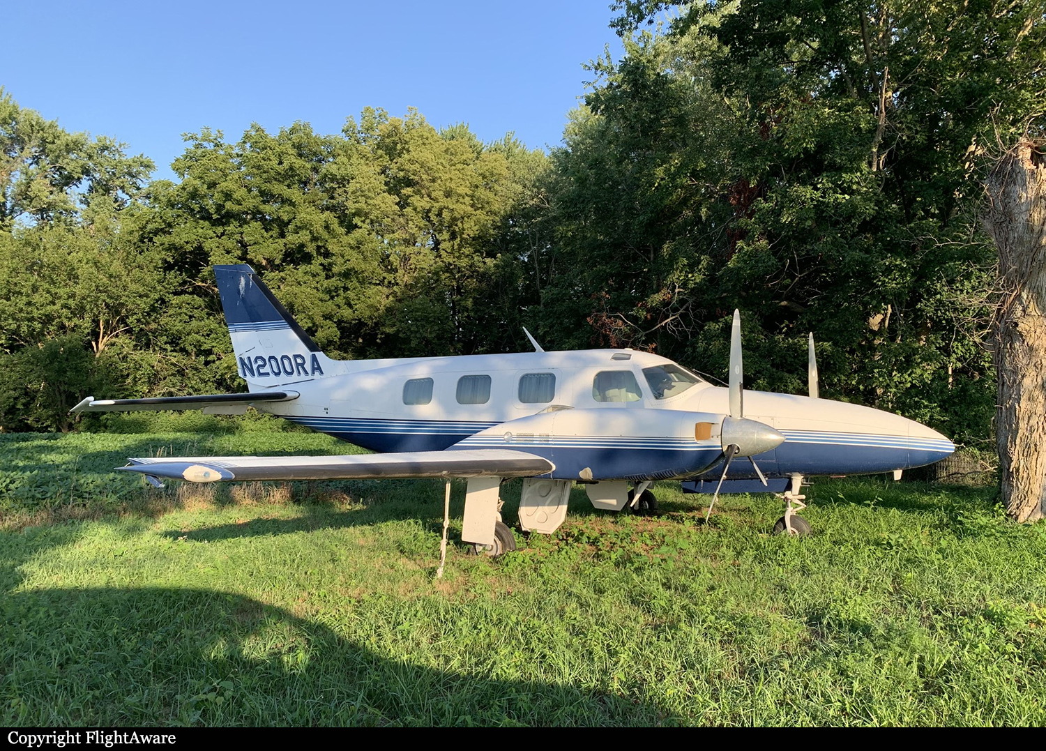
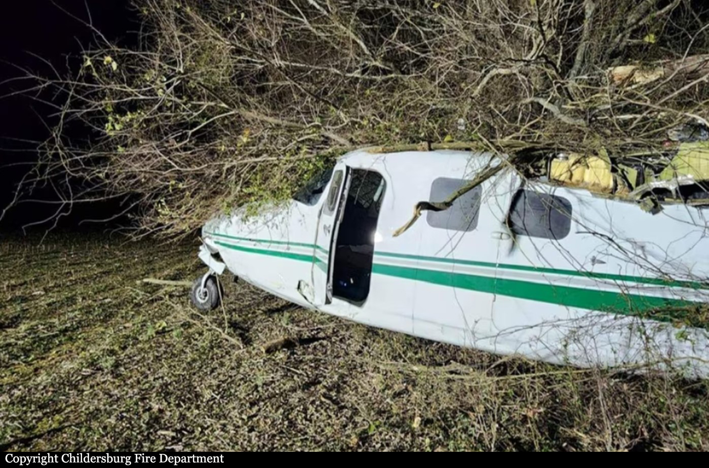
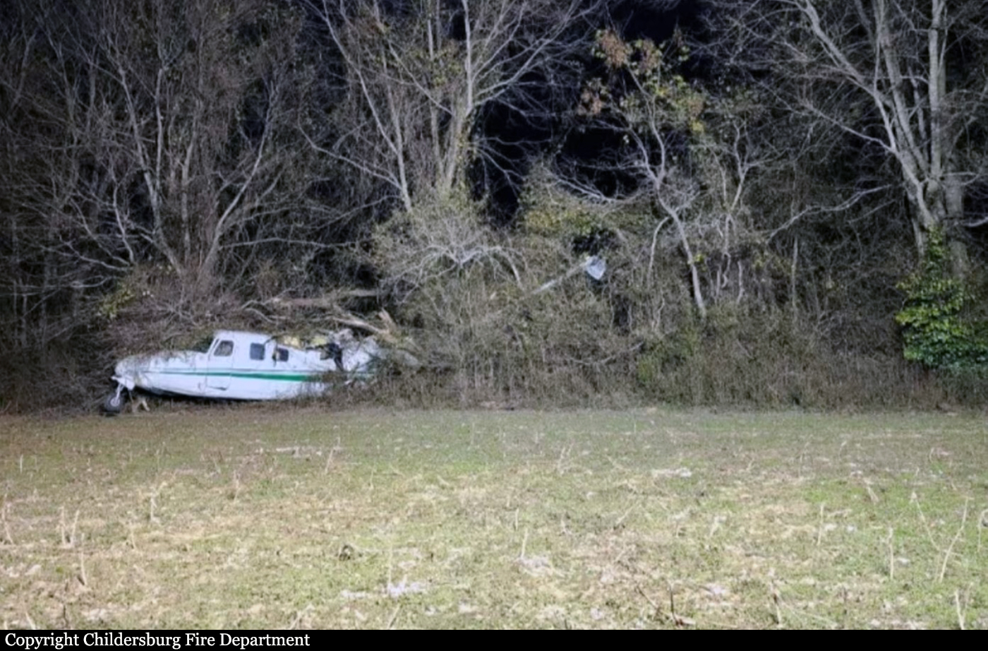
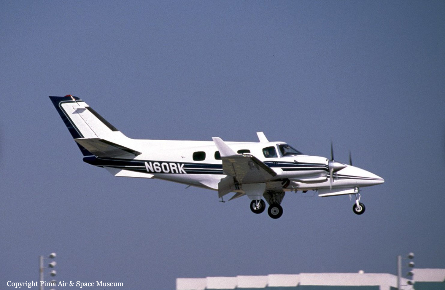
Crash of a Piper PA-31P Pressurized Navajo in Mosby: 1 killed
Date & Time:
Jul 20, 2023 at 0934 LT
Registration:
N200RA
Survivors:
No
Schedule:
Mosby - Kingman
MSN:
31-7400198
YOM:
1974
Crew on board:
1
Crew fatalities:
Pax on board:
0
Pax fatalities:
Other fatalities:
Total fatalities:
1
Aircraft flight hours:
1192
Circumstances:
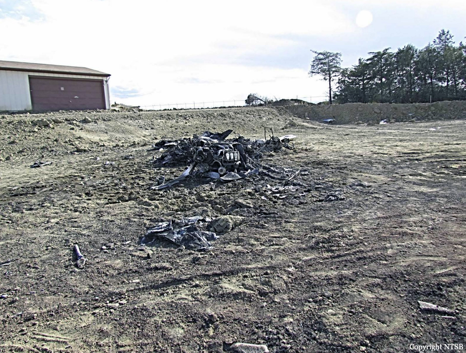
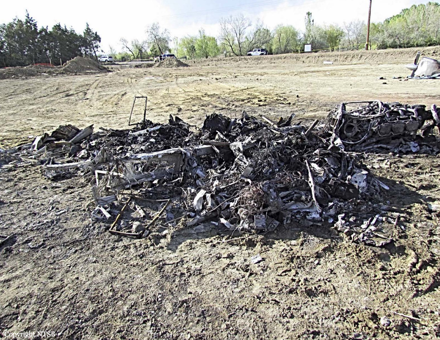
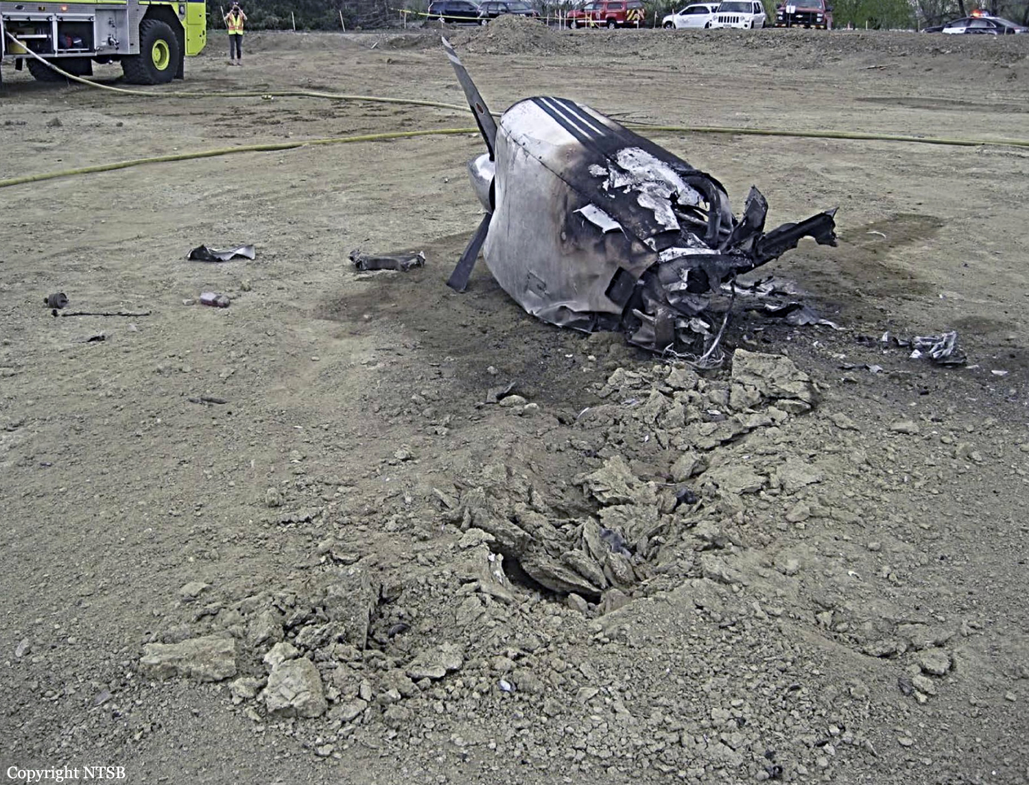
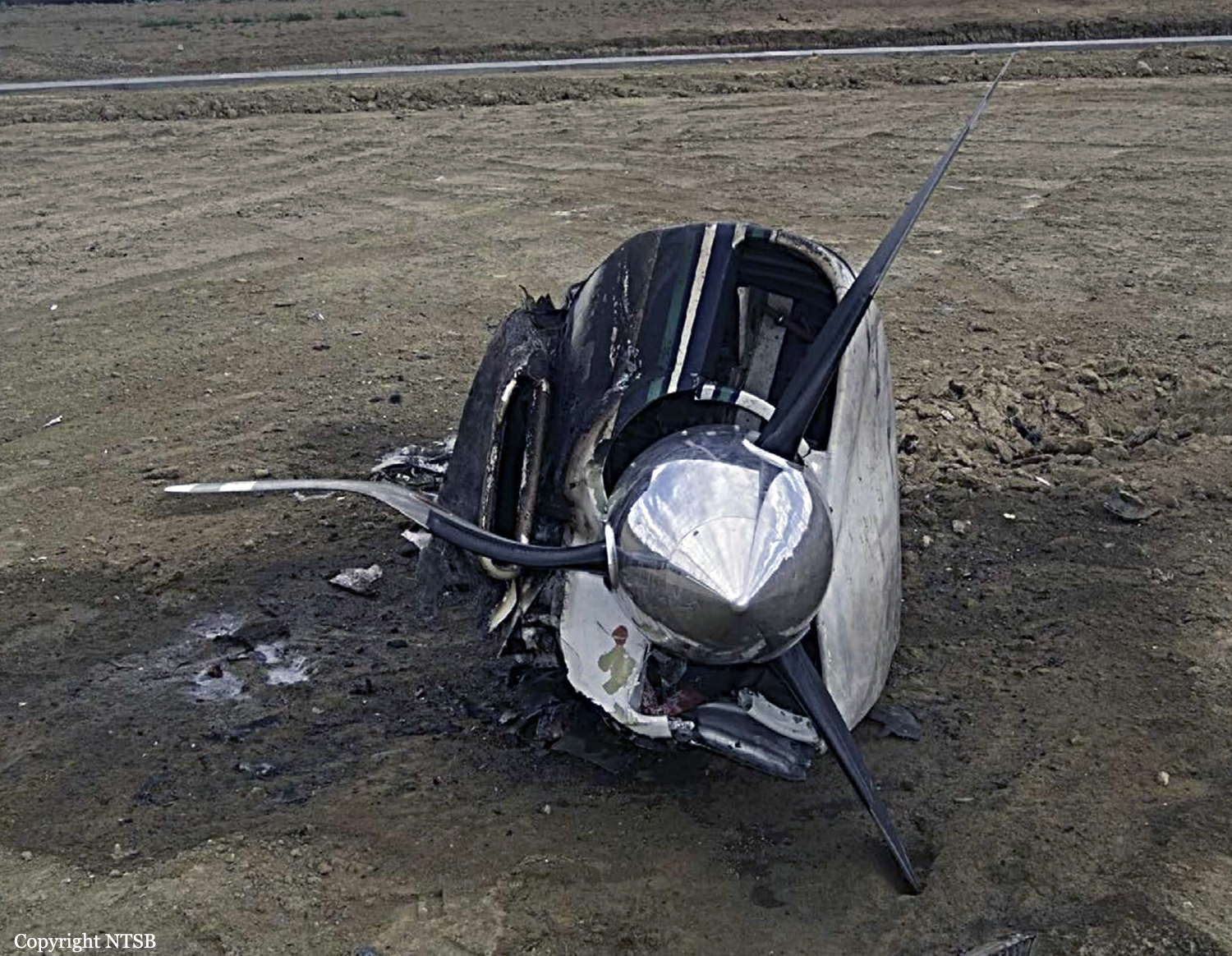
The pilot was flying the airplane on an FAA Special Flight Permit to another location to complete maintenance and an overdue annual inspection. The airplane had been abandoned, with its most recent flight being 8 years before, and chained to a tree in an agricultural field adjacent to the airport from August 2021 until December 2022 when it was purchased by the current owner. Before the accident flight, an attempt was made to top off the airplane’s fuel tanks. However, fuel started to leak from multiple locations and only three fuel tanks were able to be fueled. The pilot asked the mechanic about the leaks; the mechanic stated that the filler necks were leaking, and the lineman had attempted to top off the fuel tanks instead of the previously agreed upon lower level. The pilot then completed a brief preflight inspection before starting the airplane. During engine start, the pilot requested the mechanic’s assistance three times to ask about various issues that the mechanic talked him through. The pilot then taxied to the runway and departed without performing an engine run-up. Multiple cellphone video recordings of the takeoff sequence showed the airplane veer to the right and attempt to rotate before settling back to the runway. The recordings then showed the airplane become airborne near the end of the runway end and initially yaw to the right before it entered a shallow climb. The witnesses observed the airplane barely clear a line of trees past the departure end of the runway and make a left turn before it disappeared behind trees. Analysis of the video recordings showed that rotation was at a ground speed of about 70.8 knots, corresponding to an estimated air speed of about 74.8 knots, which was significantly below the recommended rotation speed of 85 knots. A witness north of the airport heard a loud airplane that appeared from behind trees and headed toward his residence. He observed the airplane strike two static wires on a power transmission line before it impacted the canopy of a large tree in his front yard. The airplane continued in a left bank toward a nearby soybean field and impacted the terrain in a nose-low, left bank attitude. The airplane was partially destroyed by a post impact fire and the pilot, sole on board, was killed.
Probable cause:
The pilot’s decision to operate an airplane with known fuel leaks, his failure to conduct an engine run-up before takeoff, his subsequent failure to abort the takeoff, and the mechanic’s inadequate maintenance, which resulted in a partial loss of right engine power during takeoff due to fuel starvation as a result of blocked fuel injector ports.
Final Report: