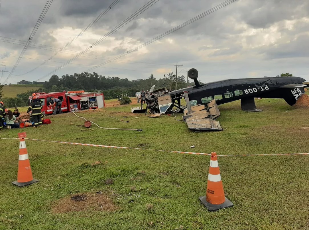
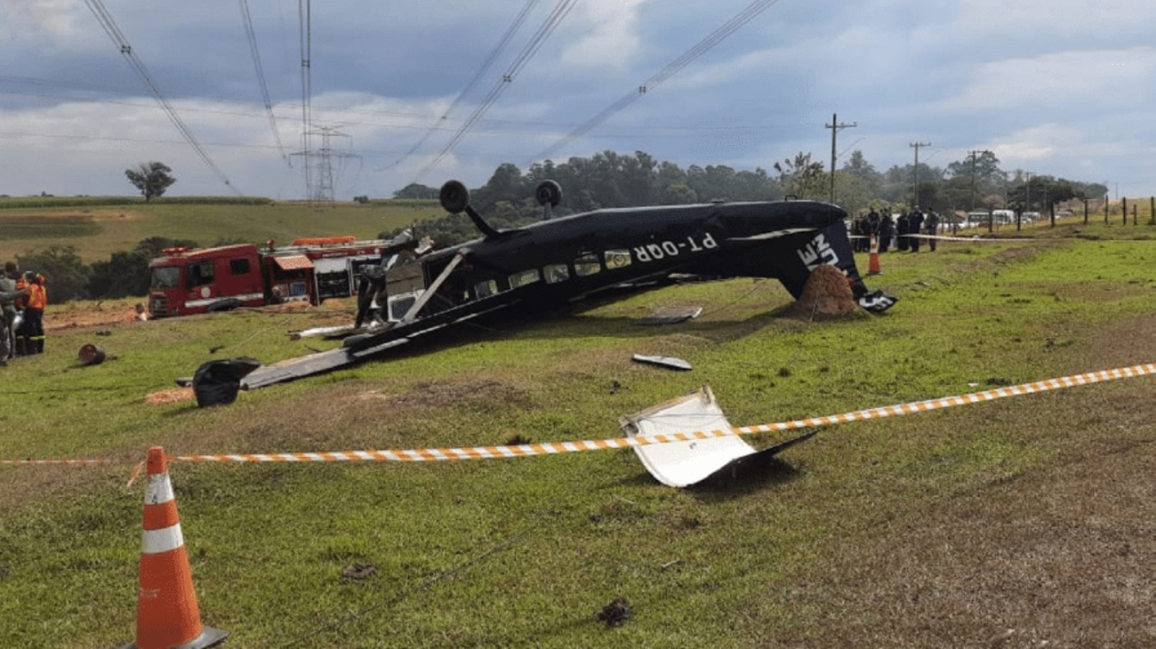
Crash of a Cessna 208A Caravan I in Berisso

Date & Time: Feb 16, 2023 at 0100 LT
Type of aircraft:
Operator:
Registration:
CX-MAX
Flight Phase:
Flight Type:
Survivors:
Yes
Schedule:
Montevideo – Buenos Aires
MSN:
208-0042
YOM:
1985
Country:
Crew on board:
2
Crew fatalities:
Pax on board:
0
Pax fatalities:
Other fatalities:
Total fatalities:
0
Circumstances:
On a cargo flight from Montevideo to Buenos Aires, while cruising at night over the Río de la Plata, the crew encountered engine problems and decided to divert to La Plata Airport located in the Buenos Aires Province. On approach, the crew was forced to attempt an emergency landing when the airplane impacted trees and crashed on a small road located about 5 km northeast of runway 20 threshold, bursting into flames. Both pilots escaped uninjured while the airplane was totally destroyed by a post crash fire.

Crash of a Cessna 208 Caravan I in Boituva: 2 killed

Date & Time: May 11, 2022 at 1213 LT
Type of aircraft:
Operator:
Registration:
PT-OQR
Flight Phase:
Survivors:
Yes
Schedule:
Boituva - Boituva
MSN:
208-0219
YOM:
1992
Country:
Crew on board:
1
Crew fatalities:
Pax on board:
14
Pax fatalities:
Other fatalities:
Total fatalities:
2
Circumstances:
The single engine airplane departed Boituva Aerodrome on a local skydiving mission, carrying 14 skydivers and one pilot. After takeoff, the pilot apparently encountered electrical problems and elected to return for an emergency landing. Shortly later, the aircraft collided with high tension wires, stalled and crashed inverted in a field. Two passengers were killed while all other occupants were injured.

Crash of a Cessna 208 Caravan I on Mt Grüehorn: 1 killed

Date & Time: Mar 30, 2022 at 1222 LT
Type of aircraft:
Operator:
Registration:
D-FLIC
Flight Phase:
Flight Type:
Survivors:
No
Site:
Schedule:
Siegerland – Monte Argentario
MSN:
208-0274
YOM:
1998
Country:
Region:
Crew on board:
1
Crew fatalities:
Pax on board:
0
Pax fatalities:
Other fatalities:
Total fatalities:
1
Circumstances:
The pilot, sole on board, departed Siegerland Airport at 1100LT on a ferry flight to Monte Argentario, Tuscany. En route, while overflying Switzerland, he encountered marginal weather conditions. While cruising in IMC conditions, the single engine airplane impacted the slope of a rocky and snow covered face located west of Mt Grüehorn, in the south part of the canton of saint Gallen. The wreckage was found at an altitude of 1,700 metres. The aircraft disintegrated on impact and the pilot was killed.

Crash of a Cessna 208 Caravan I in Lake Seul

Date & Time: Mar 8, 2022 at 1310 LT
Type of aircraft:
Operator:
Registration:
C-GIPR
Flight Phase:
Survivors:
Yes
Schedule:
Sioux Lookout – Springpole Lake
MSN:
208-0343
YOM:
2001
Country:
Crew on board:
1
Crew fatalities:
Pax on board:
1
Pax fatalities:
Other fatalities:
Total fatalities:
0
Captain / Total flying hours:
1315
Captain / Total hours on type:
126.00
Circumstances:
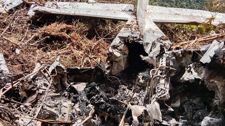
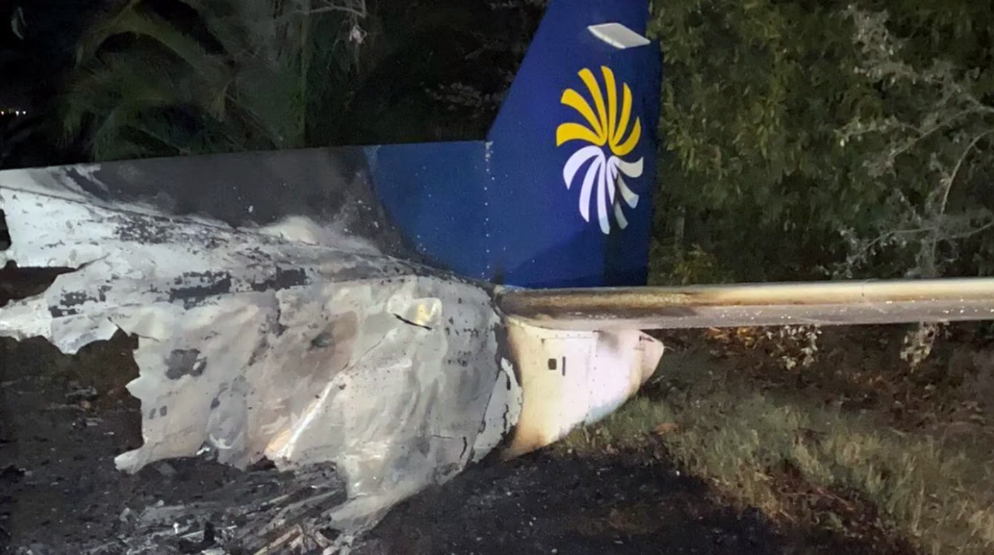
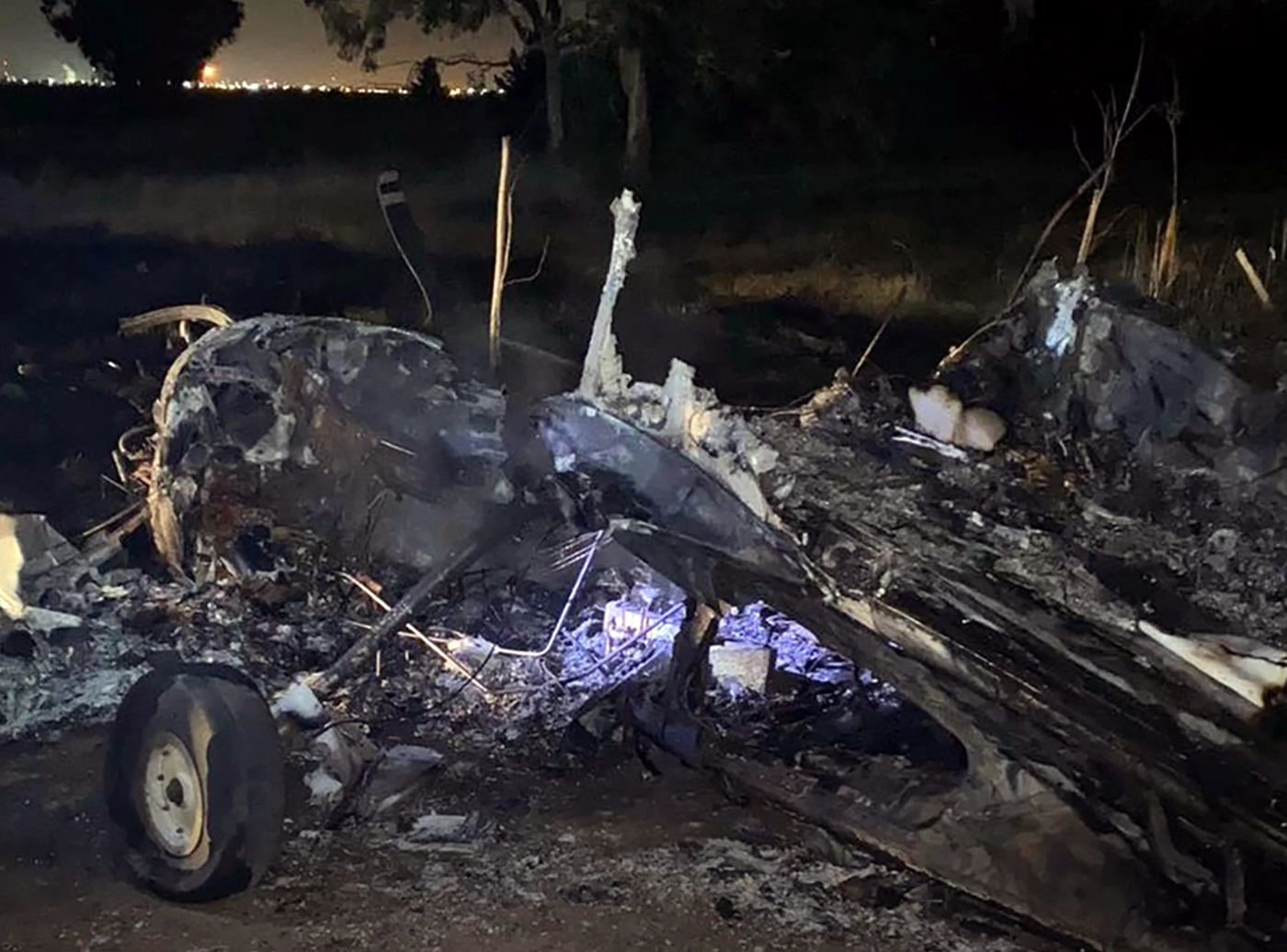
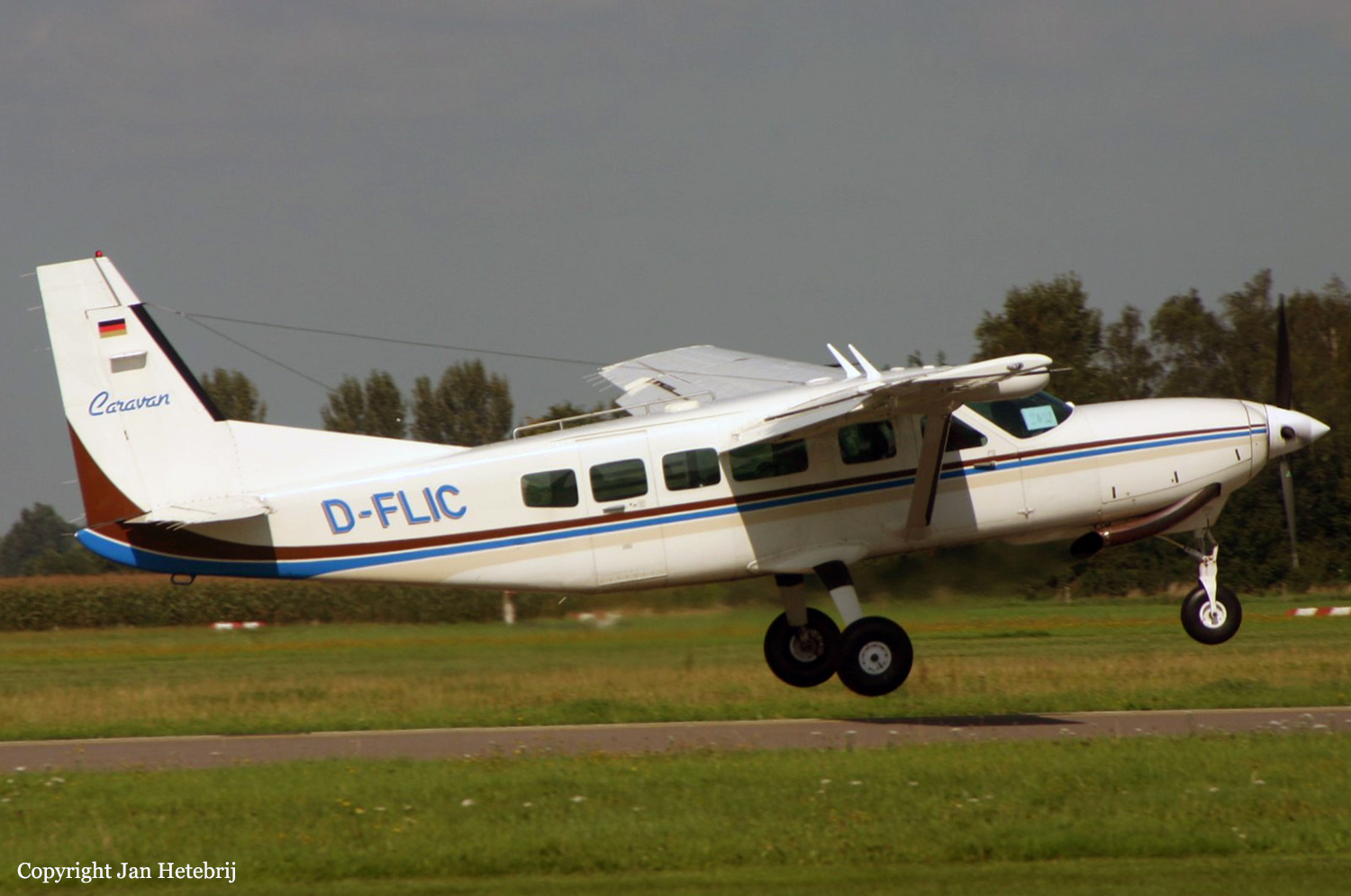
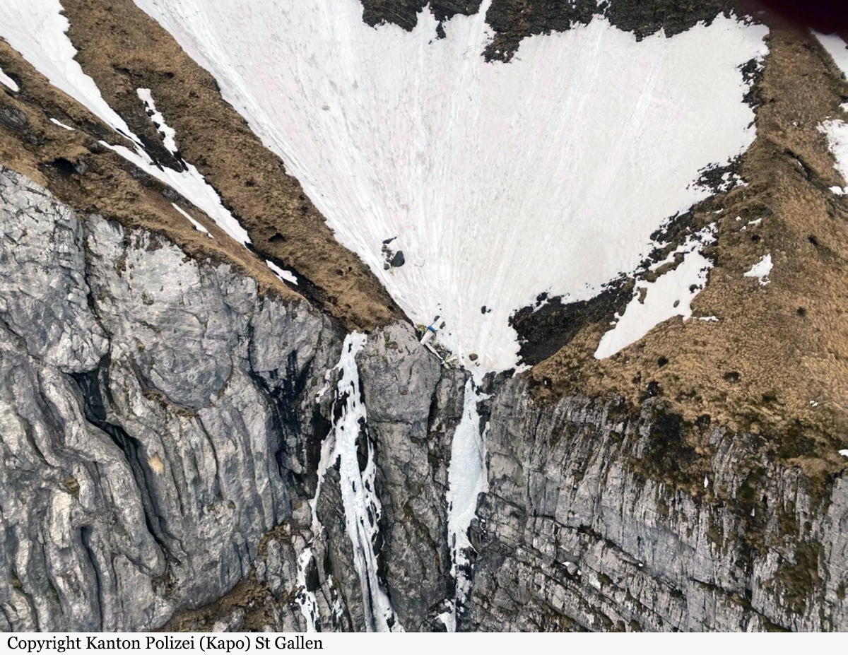
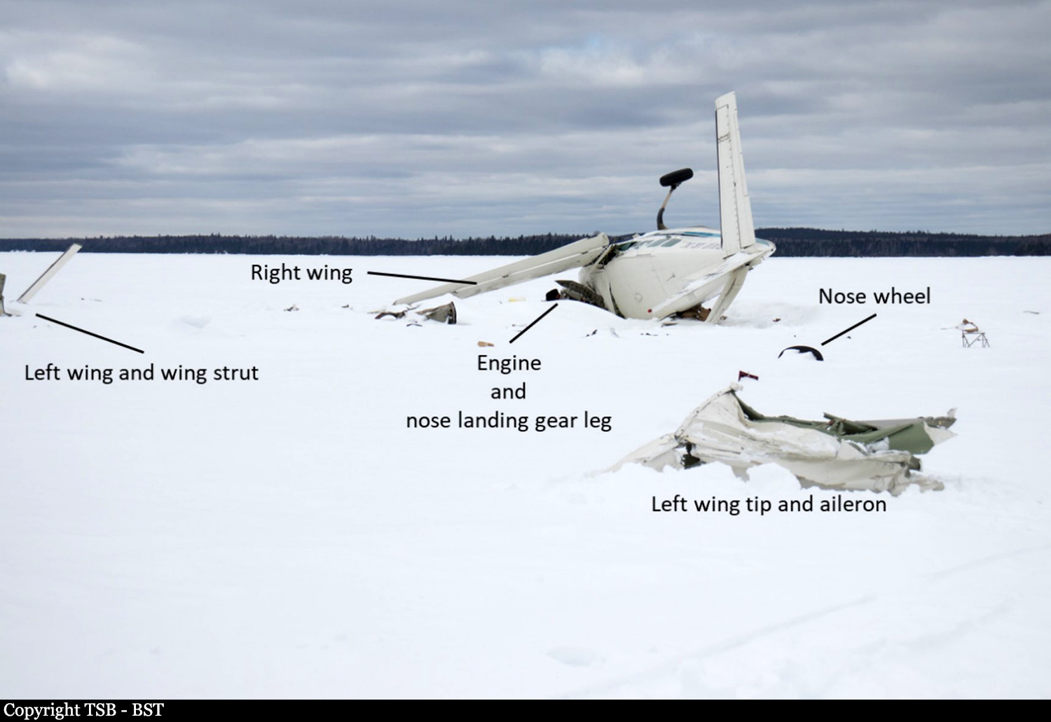
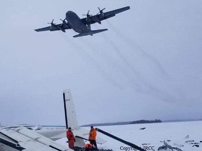
On 08 March 2022, the Bamaji Air Inc. (Bamaji) wheel-equipped Cessna 208 Caravan aircraft (registration C-GIPR, serial number 20800343) was conducting a series of visual flight rules (VFR) flights from Sioux Lookout Airport (CYXL), Ontario. At 1031, after checking the aerodrome forecast (TAF) valid from 0900 to 2000, and the graphic area forecast (GFA) valid from 0600 to 1800, the pilot departed on a flight to an ice runway on Springpole Lake, Ontario, about 78 nautical miles (NM) north-northwest of CYXL. The aircraft returned to CYXL with 2 passengers at 1200. In preparation for a second flight to Springpole Lake, the pilot loaded approximately 900 pounds of freight into the cabin and secured it under a cargo net. The aircraft had 750 pounds of fuel remaining on board, which was sufficient for the planned flight. The pilot and 1 passenger boarded the aircraft. The pilot occupied the left cockpit seat and the passenger occupied the right cockpit seat. Both occupants were wearing the available 5-point-harness safety belt system. At 1250, a snow squall began to move across CYXL, reducing ground visibility. The pilot taxied the aircraft to a position on the apron and waited for the fast-moving snow squall to pass. At 1301, the pilot taxied the aircraft to Runway 34 and took off in visual meteorological conditions. The aircraft climbed to approximately 1800 feet above sea level (ASL), then, once clear of the control zone, it descended to approximately 1600 to 1700 feet ASL, roughly 500 to 600 feet above ground level (AGL), to remain below the overcast ceiling. As the aircraft began to cross Lac Seul, Ontario, the visibility straight ahead and to the west was good. However, when the aircraft was roughly midway across the lake, it encountered turbulence and immediately became enveloped in whiteout conditions generated by a snow squall. The pilot turned his head to inspect the left wing and saw that ice appeared to be accumulating on the leading edge. He turned his attention back to the flight instruments and saw that the altimeter was descending rapidly. He then pulled back on the control column to stop the descent; however, within a few seconds, the aircraft struck the frozen surface of Lac Seul, approximately 17 NM north-northwest of CYXL. The aircraft was substantially damaged. There was no fire. The aircraft occupants received minor injuries. The Artex Model Me406 emergency locator transmitter (ELT) activated on impact and the signal was detected by the Cospas-Sarsat satellite system. The Joint Rescue Coordination Centre in Trenton, Ontario, re-tasked a Royal Canadian Air Force aircraft that was in the area and 3 search and rescue technicians (SAR Techs) parachuted into the site within 1 hour of the accident. The aircraft occupants and the SAR Techs were extracted from the site by a civilian helicopter later that day.
Probable cause:
The accident occurred while the aircraft was crossing a large, frozen, snow-covered lake at low altitude. Other than some small islands and the distant treed shorelines, there were few features to provide visual references. The terrain, coupled with the snow squalls that were passing through the area generated circumstances conducive to the creation of localized whiteout conditions.
Final Report:

Crash of a Cessna 208 Caravan I in Ilaga: 1 killed

Date & Time: Oct 25, 2021 at 0810 LT
Type of aircraft:
Operator:
Registration:
PK-SNN
Flight Type:
Survivors:
Yes
Schedule:
Timika - Ilaga
MSN:
208-0556
YOM:
2014
Country:
Region:
Crew on board:
2
Crew fatalities:
Pax on board:
0
Pax fatalities:
Other fatalities:
Total fatalities:
1
Circumstances:
On final approach to Ilaga Airport, the crew encountered poor visibility due to foggy conditions. The single engine airplane impacted ground near the runway 25 threshold, lost its undercarriage and slid for few dozen metres before coming to rest on the runway. One of the pilot was killed.

Crash of a Cessna 208 Caravan I off Norderney: 1 killed

Date & Time: Jul 26, 2021 at 1309 LT
Type of aircraft:
Operator:
Registration:
D-FLEC
Survivors:
No
Schedule:
Borkum - Norderney
MSN:
208-0388
YOM:
2005
Country:
Region:
Crew on board:
1
Crew fatalities:
Pax on board:
0
Pax fatalities:
Other fatalities:
Total fatalities:
1
Circumstances:
The single engine airplane departed Borkum Airport in the early afternoon on a local skydiving mission. At an altitude of 14,000 feet, the skydivers jumped out the cabin then the pilot reduced his altitude and returned to Norderney Airport. On approach, control was lost and the airplane crashed in the sea of Wadden, about 4 km southeast of the airfield. The aircraft was destroyed and the pilot was killed.

Crash of a Cessna 208 Caravan I in Moo 2: 2 killed

Date & Time: Sep 24, 2019 at 0930 LT
Type of aircraft:
Operator:
Registration:
1917
Flight Phase:
Flight Type:
Survivors:
No
Schedule:
Surasi - Surasi
MSN:
208-0267
YOM:
1997
Country:
Region:
Crew on board:
2
Crew fatalities:
Pax on board:
0
Pax fatalities:
Other fatalities:
Total fatalities:
2
Circumstances:
The crew (one instructor aged 58 and one pilot under supervision aged 28) departed Surasi Air Base around 0900LT on a training flight. En route, in unknown circumstances, the single engine airplane crashed near Moo 2 (Sai Yok district). The aircraft disintegrated on impact and both occupants were killed.

Crash of a Cessna 208 Caravan I in Gransee: 1 killed

Date & Time: Sep 11, 2019 at 1505 LT
Type of aircraft:
Operator:
Registration:
D-FIDI
Survivors:
No
Schedule:
Gransee - Gransee
MSN:
208-0301
YOM:
1999
Country:
Region:
Crew on board:
1
Crew fatalities:
Pax on board:
0
Pax fatalities:
Other fatalities:
Total fatalities:
1
Captain / Total flying hours:
1553
Captain / Total hours on type:
288.00
Aircraft flight hours:
4066
Aircraft flight cycles:
4983
Circumstances:
At 1448 hrs, the pilot took off from Gransee Special Airfield with the Cessna 208 Caravan to a commercial flight in accordance with visual flight rules. On board were the pilot and 15 skydivers, which were dropped at flight level 130. On this day, the pilot had already conducted three flights dropping skydivers with a total flight time of 48 min. After having dropped the skydivers during the fourth flight, the airplane was last captured by the radar at 1505:49 hrs, during approach to land at the airfield, close to the accident site at about 550 ft AMSL. At the time, ground speed was 168 kt and heading 330°. The Flugleiter stated that he had observed the last phase of the approach. The airplane had been in a left-hand turn with a bank angle of up to 90° close to the ground. He assumed that the pilot might have “overshot” the extended centre line of runway 29 when he entered the final approach coming from the south. Then the airplane had vanished behind the trees. The pilot did not transmit an emergency call. The Flugleiter also stated that with the previous flight he had witnessed a similar manoeuvre. The radar recording of the third flight ended at 1417:54 hrs with a recorded altitude of about 1,400 ft AGL. At the time, ground speed was 168 kt and heading 355°. During both flights the skydivers had been dropped at flight level 130 at a heading of about 300° south of the airfield. After dropping the skydivers, at 1415:07 hrs and at 1502:52 hrs, respectively, the airplane entered a descent with a very high rate of descent and flew in a wide left-hand turn back to the airfield. During the third flight a right-left-hand turn with bank angles of about 50° to 60° occurred during descent.
Probable cause:
The air accident was due to a risky flight manoeuvre close to the ground which resulted in a controlled impact with the ground. The speed during the approach exceeded the operations limitations of the airplane. The approach was not stabilized.
Contributing Human Factors:
- Recurrent acceptance of risky flight manoeuvres close to the ground by the pilot (routine violations),
- Overconfidence and insufficient risk assessment of the pilot.
Contributing Operational Factors:
- Unsuitable wording in the operations manual in regard to approaches after dropping skydivers.
Final Report:

Crash of a Cessna 208 Caravan 675 on Addenbroke Island: 4 killed

Date & Time: Jul 26, 2019 at 1104 LT
Type of aircraft:
Operator:
Registration:
C-GURL
Flight Phase:
Survivors:
Yes
Site:
MSN:
208-0501
YOM:
2008
Country:
Crew on board:
1
Crew fatalities:
Pax on board:
8
Pax fatalities:
Other fatalities:
Total fatalities:
4
Captain / Total flying hours:
8500
Captain / Total hours on type:
504.00
Aircraft flight hours:
4576
Circumstances:
Seair Seaplanes (Seair) was contracted by a remote fishing lodge on the central coast of British Columbia (BC) (Figure 1) to provide seasonal transport of guests and supplies between Vancouver International Water Aerodrome (CAM9), BC, and the lodge, which is located about 66 nautical miles (NM) north-northwest of Port Hardy Airport (CYZT), BC, and about 29 NM southeast of Bella Bella (Campbell Island) Airport (CBBC), BC. On 26 July 2019, the occurrence pilot arrived at Seair’s CAM9 base at approximately 0630. Over the next hour, the pilot completed a daily inspection of the Cessna 208 Caravan aircraft (registration C-GURL, serial number 20800501), added 300 L of fuel to the aircraft, and began flight planning activities, which included gathering and interpreting weather information. On the morning of the occurrence, 4 Seair visual flight rules (VFR) flights were scheduled to fly to the central coast of BC, all on Caravan aircraft: C-GURL (the occurrence aircraft) was to depart CAM9 at 0730, C-GSAS at 0745, C-FLAC at 0800, and C-GUUS at 0900. The first 3 flights were direct flights to the fishing lodge, while the 4th flight had an intermediate stop at the Campbell River Water Aerodrome (CAE3), BC, to pick up passengers before heading to a research institute located approximately 4 NM southwest of the fishing lodge. Because of poor weather conditions in the central coast region, however, all of the flights were delayed. After the crews referred to weather cameras along the central coast region, the flights began to depart, but in a different order than originally scheduled. It is not uncommon for the order of departure to change when groups of aircraft are going to the same general location. One of Seair’s senior operational staff (operations manager) departed CAM9 at 0850 aboard C-FLAC. C-GUUS, bound for the research institute, departed CAM9 next at 0906, and then the occurrence aircraft departed at 0932 (Table 1). The pilot originally scheduled to fly C-GSAS declined the flight. This pilot had recently upgraded to the Caravan, had never flown to this destination before, and was concerned about the weather at the destination. When Seair’s chief pilot returned to CAM9 at 0953 after a series of scheduled flights on a different type of aircraft, he assumed the last remaining flight to the lodge and C-GSAS departed CAM9 at 1024.After departing the Vancouver terminal control area, the occurrence aircraft climbed to 4500 feet above sea level (ASL) and remained at this altitude until 1023, when a slow descent was initiated. The aircraft levelled off at approximately 1300 feet ASL at 1044, when it was approximately 18 NM northeast of Port Hardy Airport (CYZT), BC, and 57 NM southeast of the destination. At 1050, the occurrence aircraft slowly descended again as the flight continued northbound. During this descent, the aircraft’s flaps were extended to the 10° position. At this point, the occurrence aircraft was 37 NM south-southeast of the fishing lodge. The aircraft continued to descend until it reached an altitude of approximately 330 feet ASL, at 1056. By this point, the occurrence aircraft was being operated along the coastline, but over the ocean. C-FLAC departed from the fishing lodge at 1056 on the return flight to CAM9. C-FLAC flew into the Fitz Hugh Sound and proceeded southbound along the western shoreline. At approximately 1100, it flew through an area of heavy rain where visibility was reduced to about 1 statute mile (SM). C-FLAC descended to about 170 feet ASL and maintained this altitude for the next 5 minutes before climbing to about 300 feet ASL. As the southbound C-FLAC entered Fitz Hugh Sound from the north at Hecate Island, the occurrence aircraft entered Fitz Hugh Sound from the south, near the southern tip of Calvert Island. The occurrence aircraft then changed course from the western to the eastern shoreline, and descended again to about 230 feet ASL (Figure 2), while maintaining an airspeed of approximately 125 knots. The 2 aircraft established 2-way radio contact. The pilot of C-FLAC indicated that Addenbroke Island was visible when he flew past it, and described the weather conditions in the Fitz Hugh Sound to the occurrence pilot as heavy rain showers and visibility of approximately 1 SM around Kelpie Point. The occurrence pilot then indicated that he would maintain a course along the eastern shoreline of the sound. At 1103, the 2 aircraft were separated by 2 NM and passed each other on reciprocal tracks, approximately 4 NM south of the accident site. The occurrence aircraft maintained a consistent track and altitude for the next 54 seconds, then slowly began a 25° change in track to the west (0.35 NM from the Addenbroke Island shoreline). Seven seconds after the turn started (0.12 NM from the island’s shoreline), the aircraft entered a shallow climb averaging 665 fpm. At 1104:55, the occurrence aircraft struck trees on Addenbroke Island at an altitude of approximately 490 feet ASL, at an airspeed of 114 knots, and in a relatively straight and level attitude. The aircraft then continued through the heavily forested hillside for approximately 450 feet, coming to rest at an elevation of 425 feet ASL, 9.7 NM east-southeast of the destination fishing lodge. The pilot and three passengers were killed and five other occupants were injured, four seriously.
Probable cause:
Findings as to causes and contributing factors:
These are conditions, acts or safety deficiencies that were found to have caused or contributed to this occurrence.
1. The flight departed Vancouver International Water Aerodrome even though the reported and forecast weather conditions in the vicinity of the destination were below visual flight rules minima; the decision to depart may have been influenced by the group dynamics of Seair pilots and senior staff at the flight planning stage.
2. The pilot continued flight in reduced visibility, without recognizing the proximity to terrain, and subsequently impacted the rising terrain of Addenbroke Island.
3. The configuration of the visual and aural alerting systems and the colouration ambiguity in the primary flight display of the Garmin G1000 was ineffective at alerting the occurrence pilot to the rising terrain ahead.
4. The occurrence pilot’s attention, vigilance, and general cognitive function were most likely influenced to some degree by fatigue.

Findings as to risk:
These are conditions, unsafe acts or safety deficiencies that were found not to be a factor in this occurrence but could have adverse consequences in future occurrences.
1. If pilots do not receive specialized training that addresses the hazards of their flying environment, there is a risk that they will not be proficient in the specific skills necessary to maintain safety margins.
2. If aircraft are operated in excess of the maximum allowable take-off weight, there is a risk of performance degradation and adverse flight characteristics, which could jeopardize the safety of the flight.
3. If cargo is stowed in front of emergency exits, there is a risk that egress may be impeded in an emergency situation, potentially increasing evacuation time and risk of injuries.
4. If air operators do not employ a methodology to accurately assess threats inherent to daily operations, then there is a risk that unsafe practices will become routine and operators will be unaware of the increased risk.
5. If air operators that have flight data monitoring capabilities do not actively monitor their flight operations, they may not be able to identify drift toward unsafe practices that increase the risk to flight crew and passengers.
6. If Transport Canada’s oversight of operators is insufficient, there is a risk that air operators will be non-compliant with regulations or drift toward unsafe practices, thereby reducing safety margins.
7. If Transport Canada does not make safety management systems mandatory, and does not assess and monitor these systems, there is an increased risk that companies will be unable to effectively identify and mitigate the hazards associated within their operations.

Other findings:
These items could enhance safety, resolve an issue of controversy, or provide a data point for future safety studies.
1. The pilot was actively using a cellphone throughout the flight; the operator provided no guidance or limitations on approved cellphone use in flight.
Final Report:

Crash of a Cessna 208 Caravan I in the Dry Tortugas National Park

Date & Time: Apr 23, 2019 at 1200 LT
Type of aircraft:
Operator:
Registration:
N366TA
Flight Phase:
Flight Type:
Survivors:
Yes
Schedule:
Dry Tortugas - Key West
MSN:
208-0249
YOM:
1996
Crew on board:
1
Crew fatalities:
Pax on board:
4
Pax fatalities:
Other fatalities:
Total fatalities:
0
Captain / Total flying hours:
2407
Captain / Total hours on type:
27.00
Aircraft flight hours:
9506
Circumstances:
The pilot landed the seaplane into an easterly wind, then noticed that the surface wind was greater than forecast. Unable to taxi to the beaching location, he elected to return to his destination. He maneuvered the airplane into the wind and applied takeoff power. He described the takeoff run as "bumpy" and the water conditions as "rough." The pilot reported that the left float departed the airplane at rotation speed, and the airplane subsequently nosed into the water. The pilot and passengers were assisted by a nearby vessel and the airplane subsequently sank into 50 ft of water. Inclement sea and wind conditions prevented recovery of the wreckage for 52 days, and the wreckage was stored outside for an additional 13 days before recovery by the salvage company. Extensive saltwater corrosion prevented metallurgical examination of the landing gear components; however, no indication of a preexisting mechanical malfunction or failure was found.
Probable cause:
The pilot's decision to attempt a takeoff in rough sea conditions, resulting in damage to the floats and the sinking of the seaplane.
Final Report: