Crash of a PZL-Mielec AN-2P near Tanzybei: 2 killed
Date & Time:
Oct 3, 2025 at 1700 LT
Registration:
RA-70350
Survivors:
No
Schedule:
Verkhneusinskoye – Shushenskoye
MSN:
1G141-04
YOM:
1972
Crew on board:
2
Crew fatalities:
Pax on board:
0
Pax fatalities:
Other fatalities:
Total fatalities:
2
Captain / Total hours on type:
7147.00
Copilot / Total hours on type:
2660
Aircraft flight hours:
15484
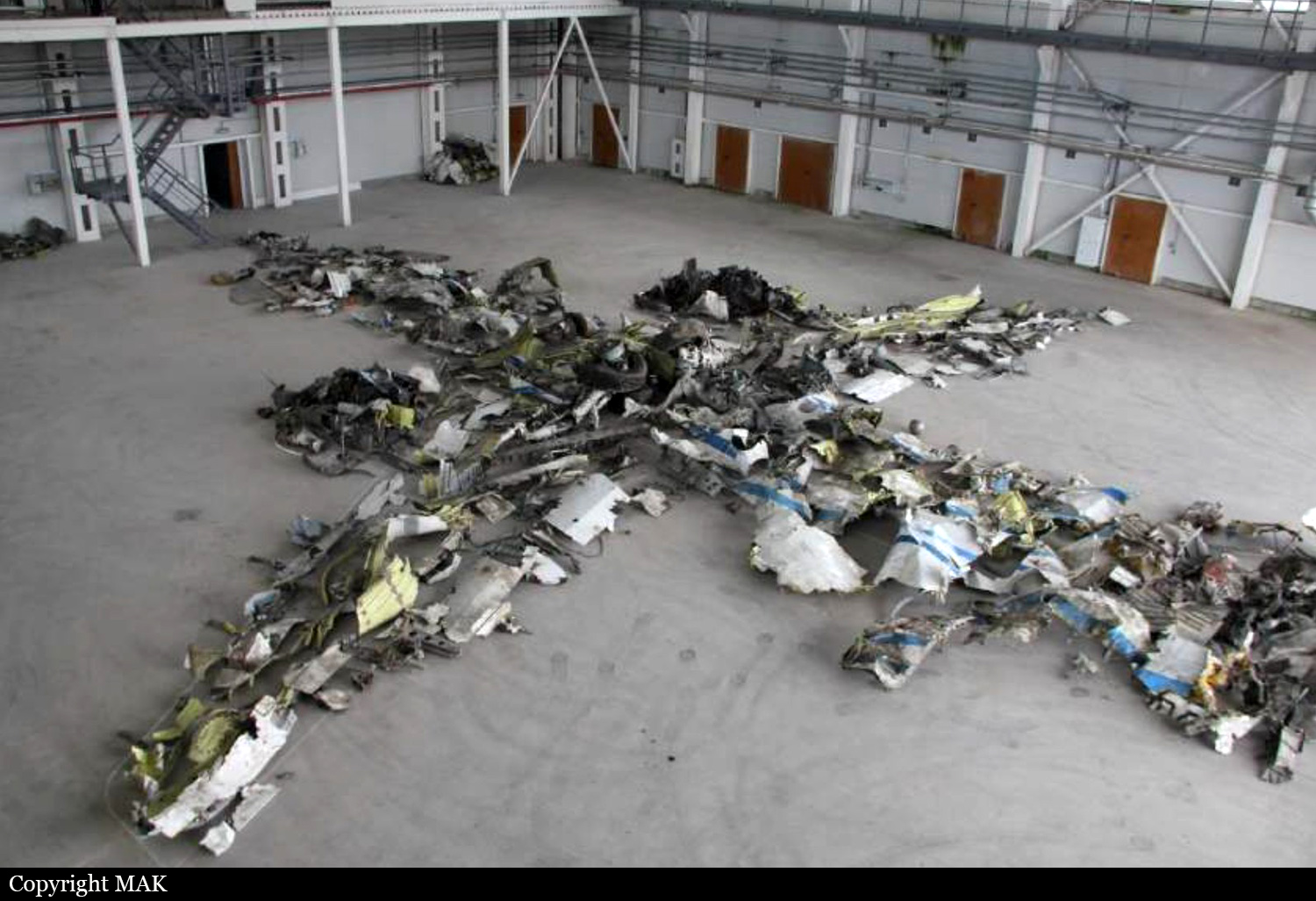
Circumstances:
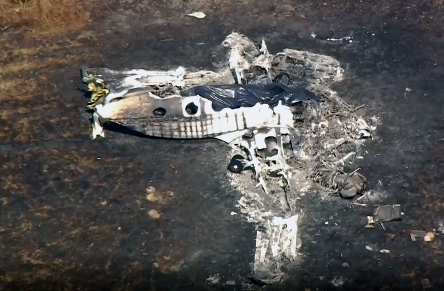
After the airplane has been leased for the summer period for forest fire survey missions, the contract was ended early October and the airplane was ferried back from Verkhneusinskoye to Shushenskoye. The crew departed Verkhneusinskoye at 1605LT and maintained regular radio contacts with their base, confirming that weather conditions were good. Nevertheless, while at halfway-point, weather conditions deteriorated. While cruising in clouds, the airplane collided with tall pine trees and crashed in a dense wooded area located some 40 km southwest of Tanzybei, bursting into flames. The airplane was destroyed by impact forces and a post crash fire and both crew members were killed.
Probable cause:
The accident resulted from the PIC's loss of visual contact with ground references when entering non-VFR weather conditions, resulting in a collision with obstacles and the ground.
The accident was the result of a combination of the following factors:
- The crew's unfounded decision to conduct a VFR flight along a route through mountainous terrain, without analyzing all necessary meteorological information.
- Failure to abort the flight and to return to the departure landing site when weather conditions deteriorated below established limits.
- Flight below safe altitude in conditions of limited visibility.
Final Report: