Crash of a Cessna 680A Citation Latitude in Laredo: 1 killed
Date & Time:
Jun 16, 2026 at 2158 LT
Operator:

Registration:
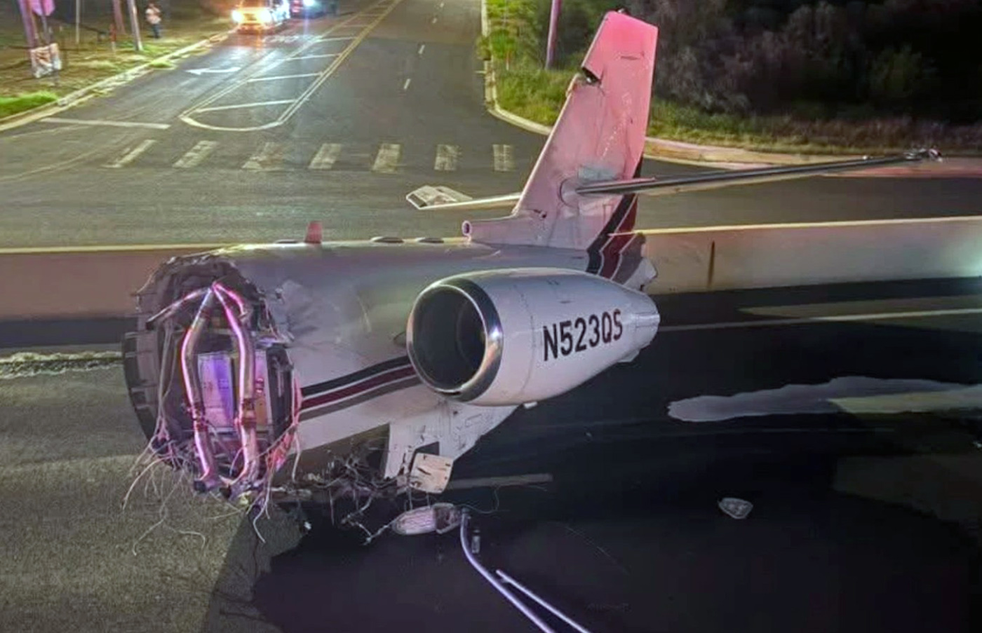
N523QS
Survivors:
Yes
Schedule:
San José del Cabo – Austin
MSN:
680A-0061
YOM:
2016
Crew on board:
2
Crew fatalities:
Pax on board:
4
Pax fatalities:
Other fatalities:
Total fatalities:
1
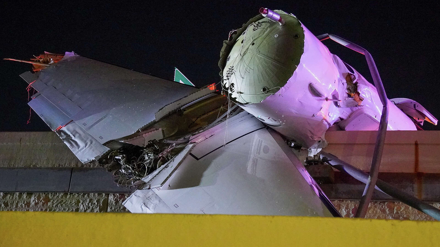
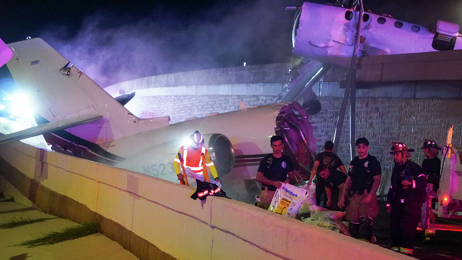
Circumstances:
The airplane departed San José del Cabo-Los Cabos Airport runway 16 at 1818LT on a taxi flight to Austin-Bergstrom, TX, carrying four passengers and two pilots. It climbed to FL430 and proceeded to the northeast when, about an hour into the flight, the crew decided to divert to Laredo Airport. After being cleared for an approach to runway 36L, the crew attempted an emergency landing on the Bob Bullock Loop 20 Highway, about 4 km south-southeast of the airport. After landing at night, the airplane hit a concrete berm and crashed. It broke in two and the front part of the fuselage caught fire. A passenger was killed while five other occupants were injured. According to the Laredo Airport Director, the crew reported low fuel and a power outage.