Crash of a Rockwell Shrike Commander 500S in San Juan

Date & Time: Feb 28, 2005 at 1120 LT
Operator:
Registration:
N97VB
Flight Phase:
Survivors:
Yes
Schedule:
San Juan – Tortola
MSN:
500-3233
YOM:
1975
Country:
Crew on board:
1
Crew fatalities:
Pax on board:
6
Pax fatalities:
Other fatalities:
Total fatalities:
0
Captain / Total flying hours:
1038
Captain / Total hours on type:
282.00
Aircraft flight hours:
6943
Circumstances:
The non-Spanish speaking commercial pilot was preparing for a Title 14, CFR Part 135 on-demand charter flight in a twin-engine airplane with gasoline engines. A non-English speaking fuel truck operator inadvertently serviced the accident airplane with 120 gallons of Jet-A turbine fuel. In the pilot's written statement he reported that just after takeoff, with six passengers aboard, both engines began to lose power, and the airplane subsequently descended and collided with tree-covered terrain at the departure end of the runway. An on-site examination of the fuel vender's Jet-A fuel truck disclosed that the dispensing nozzle installed on the truck was the same nozzle as a typical gasoline nozzle. An examination of the accident airplane's fuel caps and fueling ports disclosed that the accident airplane was equipped with round, fuel tank inlet restrictors, that would prevent fueling from a jet fuel nozzle of the appropriate size, but the fueling ports were not placarded with the required statement indicating that only gasoline (av-gas) should be used.
Probable cause:
The fuel truck operator's improper refueling of a gasoline engine powered airplane with jet (turbine) fuel, and the pilot's inadequate preflight, which resulted in a loss of power in both engines and subsequent collision with trees. Factors associated with the accident were the unclear communications between the Spanish-speaking fuel truck operator and the English speaking pilot, and the uel truck operator's lack of familiarity with the accident airplane's fueling requirements. An additional factor was the absence of the required placards adjacent to the fuel filler caps indicating that only gasoline (av-gas) should be used.
Final Report:

Crash of a Rockwell Shrike Commander 500S near Hobart: 1 killed

Date & Time: Feb 19, 2004 at 1643 LT
Operator:
Registration:
VH-LST
Flight Phase:
Flight Type:
Survivors:
No
Schedule:
Hobart – Devonport
MSN:
500-3111
YOM:
1971
Location:
Country:
Region:
Crew on board:
1
Crew fatalities:
Pax on board:
0
Pax fatalities:
Other fatalities:
Total fatalities:
1
Captain / Total flying hours:
371
Captain / Total hours on type:
40.00
Circumstances:
The aircraft commenced taxying at Hobart for a Visual Flight Rules (VFR) ferry flight to Devonport. The pilot, who was the sole occupant, reported a departure time of 1643 to air traffic control, with an intention to climb to 8,500 ft and to fly a track of 319 degrees magnetic. Due to following traffic, the pilot was required to report leaving specific altitudes. At 1646, the pilot reported leaving 4,500 ft, and was advised that air traffic services were terminated. The acknowledgement of that call was the last communication heard from the pilot. At about 1800, the operator’s staff at Devonport advised the Hobart base that the aircraft had not arrived. The operator advised AusSAR and the Hobart air traffic control tower, and organised company search aircraft from both Hobart and Devonport. The non-flying occupant of the Hobart search aircraft sighted the wreckage at about 1930. Shortly after, a search and rescue helicopter arrived at the accident site. The pilot of the aircraft was found fatally injured in the wreckage. The wreckage was located 58 km from Hobart airport on a bearing of 320 degrees magnetic. Based on predictions of aircraft performance and the distance of the accident site from Hobart, the estimated time of the accident was 1656. There were no eyewitnesses to the accident. Aircraft flight profile The aircraft was not equipped with a flight data recorder or cockpit voice recorder, nor was it required to be. As such, and given that the aircraft was operating outside of radar coverage, there was no recorded flight profile information available. The pilot was not required to report cruising at 8,500 ft and there was no evidence to confirm that the aircraft had reached that altitude. However, based on the normal climb and cruise performance, forecast winds and the radio broadcasts made by the pilot, the aircraft should have reached an altitude of 8,500 ft approximately 35 km from Hobart at about 1651, which was 5 minutes prior to the estimated time of the accident at 1656.
Probable cause:
The trajectory analysis provided the ATSB with a high degree of confidence with respect to the aircraft altitude and speed at the time of the in-flight breakup. The aircraft’s speed could have readily accelerated to Vne during a rapid descent from the nominated cruise altitude of 8,500 ft to the break-up altitude of around 3,150 ft. At such a speed, a relatively small control input force or gusts encountered in the longitudinal (pitch) axis of the aircraft could have resulted in the symmetrical downward wing overloading and failure that occurred. There is no compelling evidence to support any one reason for the departure of the aircraft from the cruise altitude into a high speed dive type situation. However, there are a number of factors that provide some weight to the possibility of a flight upset related to operation of the autopilot. These factors include:
• The lack of any reference in the operations manual to the installation of a Bendix FCS-810 autopilot in LST and the lack of information in the operations manual on the operation of the FCS-810 autopilot
• The pilot’s relative inexperience in the operation of the particular autopilot system fitted to LST
• The operating characteristics of the autopilot system fitted to LST
• The illegible nature of the Aircraft Flight Manual supplement pertaining to the limitations and operating procedures for the autopilot system fitted to LST
• The autopilot controller pitch command wheel being found at the accident site in the maximum nose-down position
• Both elevator trim tabs being found at the accident site at or close to the maximum nose-down trim position. However, it is not possible to discount other explanations for the departure from cruise flight, including a runaway pitch-trim condition, pilot incapacitation, the effects of mountain waves and/or severe turbulence, or a combination of any of the above. On the evidence available to the investigation, it was not possible to conclusively determine the circumstances that led to the aircraft descending at speed to the altitude at which the in-flight breakup occurred.
Final Report:

Crash of a Rockwell Shrike Commander 500S in Mount Pleasant

Date & Time: Apr 14, 2003 at 1140 LT
Operator:
Registration:
N19WL
Flight Phase:
Survivors:
Yes
Schedule:
Mount Pleasant - Mount Pleasant
MSN:
500-3160
YOM:
1973
Crew on board:
2
Crew fatalities:
Pax on board:
0
Pax fatalities:
Other fatalities:
Total fatalities:
0
Captain / Total flying hours:
4578
Captain / Total hours on type:
280.00
Aircraft flight hours:
11617
Circumstances:
According to the pilot, he requested the refueler to top off his fuel tanks with "100 low lead fuel". After refueling, the pilot performed a preflight including taking fuel samples from under the wings, draining the rear fuel drain, and checking the fuel cap for security. The engine start, run-up, and taxi were uneventful. The airplane departed runway 17 and was in a positive rate of climb. At approximately 200 feet AGL the airplane began to lose power. Shortly after the pilot ensured that the throttle, propeller, and mixture controls were in the full forward position, the airplane lost power in both engines. The pilot executed an emergency off field landing. Examination of the wreckage revealed that the left wing had broken off and the aft cabin area was crushed. According to the refueler, he stated that he mistakenly used the Jet-A fuel truck instead of the AVGAS 100 low lead truck, and pumped 58 gallons of Jet-A into the airplane. Examination of the fuel samples taken from both engines revealed the left and right engine contained 70 percent of jet A fuel.
Probable cause:
The improper refueling of the airplane by airport personnel with the incorrect fuel grade that resulted in a total loss in engine power on both engines during initial climb. A factor was the inadequate preflight inspection by the pilot in command.
Final Report:

Crash of a Rockwell Shrike Commander 500S in Fortaleza

Date & Time: Jul 2, 2002 at 1640 LT
Operator:
Registration:
PT-KZD
Flight Phase:
Flight Type:
Survivors:
Yes
Site:
Schedule:
Fortaleza - Fortaleza
MSN:
500-3140
YOM:
1972
Country:
Crew on board:
1
Crew fatalities:
Pax on board:
2
Pax fatalities:
Other fatalities:
Total fatalities:
0
Captain / Total flying hours:
8000
Captain / Total hours on type:
2900.00
Aircraft flight hours:
9960
Circumstances:
The twin engine aircraft departed Fortaleza-Pinto Martins Airport on a local post maintenance test flight (50 hours), carrying two passengers and one pilot. After takeoff, while climbing to a height of 200 feet, the power on the left engine fluctuated. The pilot modified the position of the fuel selector but the situation did not change. As the aircraft was losing height, the pilot shut down the left engine and feathered its propeller when the aircraft rolled to the left, causing the left wing to struck a concrete wall. Out of control, the aircraft struck the roof of a house, then a second one and eventually crashed on a third residence. All three occupants were injured as well as one people on the ground.
Probable cause:
The fuel pump and the servo-injectors had faults which certainly contributed to the accident as the left engine was not properly supplied with fuel.
Final Report:

Crash of a Rockwell Shrike Commander 500S in Exeter: 1 killed

Date & Time: Feb 17, 2002 at 1752 LT
Registration:
N999N
Survivors:
No
Schedule:
Wilmington - Newport
MSN:
500-3277
YOM:
1976
Crew on board:
1
Crew fatalities:
Pax on board:
0
Pax fatalities:
Other fatalities:
Total fatalities:
1
Captain / Total flying hours:
900
Captain / Total hours on type:
200.00
Aircraft flight hours:
2145
Circumstances:
The airplane was in instrument meteorological conditions and the pilot was cleared for an approach. As the airplane neared the final approach fix, the controller observed the airplane diverge from the approach course and change altitude rapidly. Shortly thereafter, the pilot said he had "all sorts of problems." The pilot requested and received vectors to an alternate airport. At 1748:29, the pilot was cleared for an ILS approach and was told to report when "established" on the approach. When asked if he was established on the ILS course, the pilot replied "I sure hope so." The controller observed the airplane descend below the published glide slope intercept altitude and advised the pilot to climb back to 2,000 feet. The pilot reported "I have problems." When asked the nature of the problem, the pilot reported "...I'm all over the place...I think I'm iced up..." Radar data indicated the airplane's radar track began following a left descending turn from 1,900 feet, about 1 minute before radar contact was lost. At 1751:33, the controller advised the pilot that his altitude was 1,000 feet, and requested that he climb to 3,000 feet. The pilot responded, "hey, I'm trying like hell." Radar contact with the airplane was lost about 1752, at 800 feet. A witness near the accident site stated he observed the airplane come out of the clouds, "wobbling" from side to side, make a "hard" left turn and strike the ground. He stated the engine was "loud" and seemed to be at "full throttle." Examination of the airplane did not reveal any pre impact mechanical malfunctions. The pilot purchased the accident airplane about 2 months prior to the accident. His total flight time in make and model was estimated to be about 200 hours. Airman's Meteorological Information (AIRMET) Zulu, Update 4, for Ice and Freezing Level was valid for the accident site area at the time of the accident. The AIRMET advised of occasional moderate rime/mixed icing in cloud in precipitation below 12,000 feet. The AIRMET reported the freezing level was from the surface to 4,000 feet. According to United States Naval Observatory astronomical data obtained for the accident site area, Sunset occurred at 1723, and the end of civil twilight was at 1751. The airplane was equipped with both wing leading edge and empennage de-icing boots. The switches for the de-icing boots were observed in the "Auto" position. The propeller de-ice and windshield anti-ice switches were observed in the "off" position.
Probable cause:
The pilot's failure to maintain control after encountering icing conditions while on approach for landing. Factors in this accident were the night light conditions and pilot's failure to select the airplane's propeller de-icing switches to the "on" position.
Final Report:

Crash of a Rockwell Shrike Commander 500U near Copperhill

Date & Time: Feb 12, 2002 at 1530 LT
Operator:
Registration:
N441WW
Flight Phase:
Flight Type:
Survivors:
Yes
Schedule:
Andrews - Lafayette
MSN:
500-1641-4
YOM:
1966
Crew on board:
1
Crew fatalities:
Pax on board:
0
Pax fatalities:
Other fatalities:
Total fatalities:
0
Captain / Total flying hours:
11805
Captain / Total hours on type:
3100.00
Aircraft flight hours:
7703
Circumstances:
A witness heard the airplane's engines make "sputtering" engine noises that cut out and quit prior to its impact with the wooded terrain. A sheriff's deputy who responded to the scene heard the pilot state the airplane ran out of fuel. The propeller blades of both engines displayed minor damage, and both propeller spinners were found intact and in place. No evidence of fuel odor nor fuel leakage was observed at the accident site. During examination, both engines were supplied fuel and a source of electricity. Each engine operated smoothly during testing at rpm ranging from idle to 1900.
Probable cause:
The pilot's inadequate preflight planning, which resulted in a total loss of engine power due to fuel exhaustion and a subsequent collision with trees during emergency landing on unsuitable terrain.
Final Report:

Crash of a Rockwell Shrike Commander 500S near Eagleville: 5 killed

Date & Time: Nov 21, 2001 at 1126 LT
Registration:
N900RA
Flight Phase:
Flight Type:
Survivors:
No
Site:
Schedule:
Reno - Wenatchee
MSN:
500-3070
YOM:
1970
Crew on board:
1
Crew fatalities:
Pax on board:
4
Pax fatalities:
Other fatalities:
Total fatalities:
5
Captain / Total flying hours:
20069
Aircraft flight hours:
8101
Circumstances:
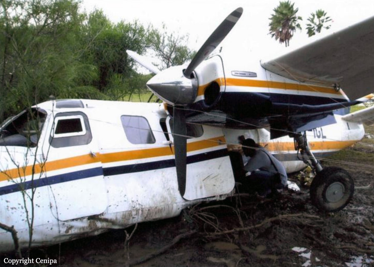
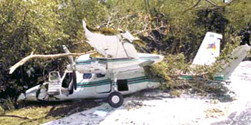
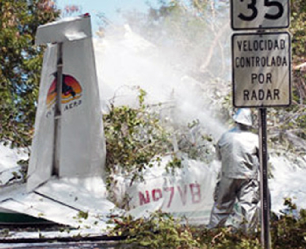
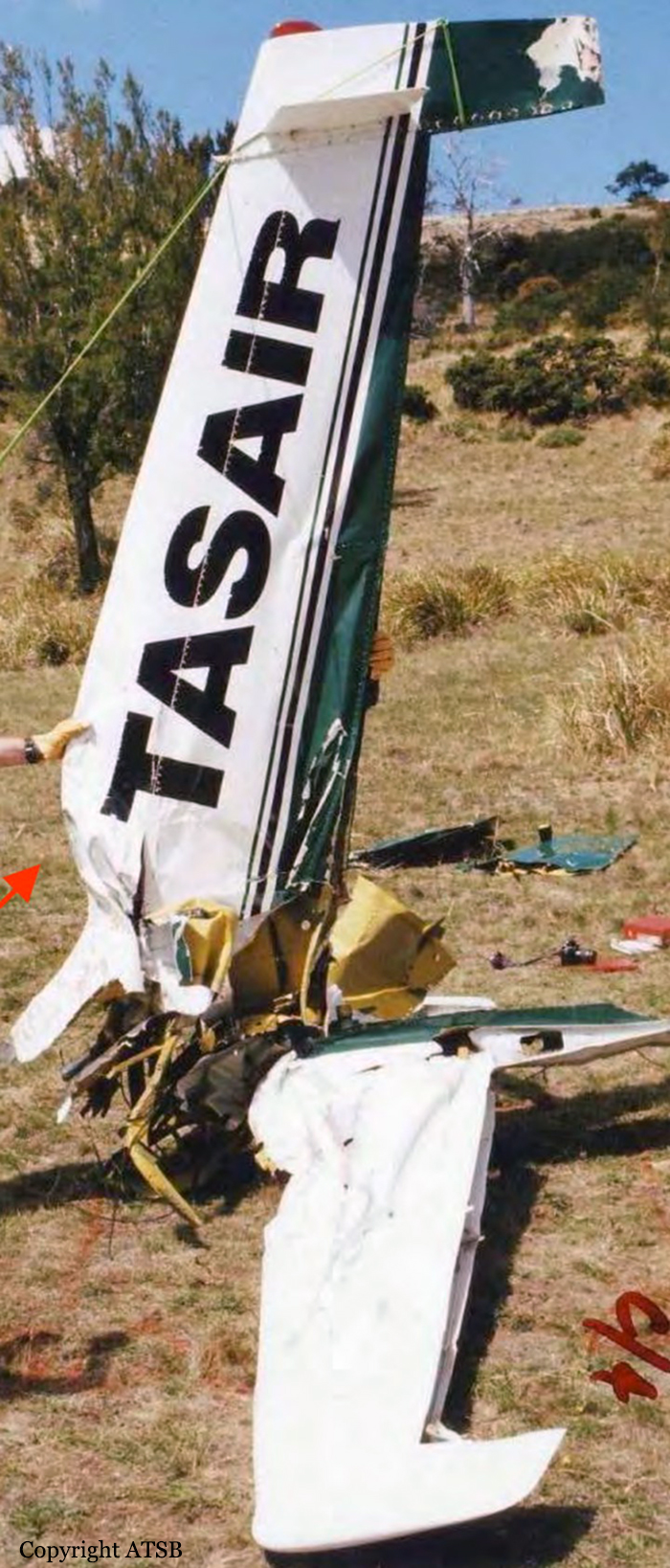
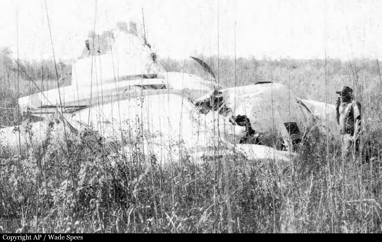
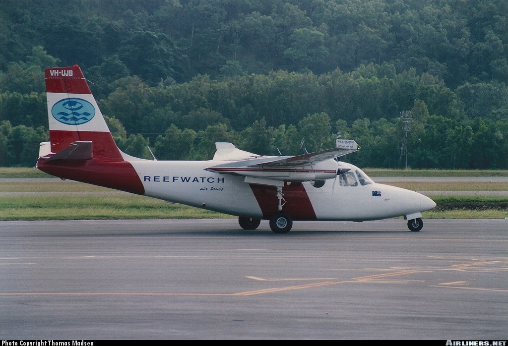
The airplane collided with mountainous terrain during cruise after encountering turbulence and downdrafts associated with mountain wave conditions. According to Federal Aviation Administration (FAA) records, the pilot called the Reno Automated Flight Service Station at 0941 and filed an IFR flight plan, then asked for the winds aloft forecast, which was provided. The pilot did not request any additional weather briefing information for the flight. No other record was found that the pilot obtained additional weather forecast information from any official source associated with the FAA or the National Weather Service. At the time of the pilot's call to the Reno AFSS, several AIRMET weather advisories had been issued hours prior detailing warnings for turbulence and clear icing along the route of flight. The advisories warned of occasional moderate turbulence below 18,000 feet in moderately strong westerly winds especially in the vicinity of mountainous terrain. Clear Air Turbulence (CAT) between 18,000 and 40,000 feet was forecast over the area of the accident site due to jet stream wind shear and mountain wave activity. The pilot departed under visual flight rules (VFR) and picked up his instrument flight rules (IFR) clearance en route and climbed to 14,000 feet. The pilot later asked if he could maintain 12,500 feet. The controller advised him that the minimum IFR altitude on this segment of his route was 14,000 feet, and the pilot cancelled his IFR flight plan. The controller advised the pilot that he had lost radar contact, and instructed the pilot to squawk VFR and the pilot acknowledged the transmission. The last radar target was about 1/2 mile east of Eagle Peak (elevation 9,920 feet) in the Warner Mountains. Rescuers discovered the wreckage near the crest of Eagle Peak on November 23. Investigators found no anomalies with the airframe, engines, or propellers that would have precluded normal operation. The NWS had a full series of AIRMETs current over the proposed route of flight, which included mountain obscuration, turbulence, and icing. Analysis of the weather conditions disclosed a layer between 9,500 and 11,000 feet over the accident site area as having a high likelihood of severe or greater turbulence. A pilot on the same route of flight reported at 1127 that he was in instrument conditions at 11,000 feet, and experiencing light turbulence and light clear icing conditions. He also reported encountering updrafts of 2,000 feet per minute, which was indicative of mountain wave activity. A company pilot was in a second Aero Commander trailing the accident airplane and he reported that at 1147, at a position near the accident site, he encountered a severe downdraft. He applied full climb power, but as the airplane passed over the accident site position, the airplane continued to lose altitude even at maximum power. At 1159, he was able to gain altitude, and return to his assigned cruising altitude of 14,000 feet. The second Aero Commander was turbocharged, the accident airplane was not. Analysis showed that the topography of the area was critical in this case, given that the accident site was at an elevation of 9,240 feet on the eastern slope of Eagle Peak. The accident airplane's flight track was normal along the airway until immediately downwind of the higher terrain. As the flight approached the lee side of the mountain, it came under the influence of the mountain wave and first encountered an updraft and then a downdraft, which increased in amplitude as the flight progressed towards Eagle Peak. Eagle Peak was the tallest point along the Warner Mountain range and the steep slope of this terrain was significant when the mountain wave action was encountered. Such terrain features have been known to enhance the vertical downdrafts and updrafts associated with the most intense mountain wave turbulence.
Probable cause:
The pilot's encounter with forecast mountain wave conditions, moderate or greater turbulence, and icing, with downdrafts that likely exceeded the climb capability of the airplane, which was encountered at an altitude that precluded recovery. Also causal in the accident was the failure of the pilot to obtain an adequate preflight weather briefing which would have included a series of Airmets that were in effect at the time.
Final Report:

Crash of a Rockwell Shrike Commander 500S on Thornton Peak: 4 killed

Date & Time: Apr 10, 2001 at 0725 LT
Operator:
Registration:
VH-UJB
Flight Phase:
Survivors:
No
Site:
Schedule:
Cairns - Hicks Island
MSN:
500-3152
YOM:
1973
Country:
Region:
Crew on board:
1
Crew fatalities:
Pax on board:
3
Pax fatalities:
Other fatalities:
Total fatalities:
4
Captain / Total flying hours:
9680
Captain / Total hours on type:
2402.00
Circumstances:
The aircraft departed Cairns airport at 0707 Eastern Standard Time (EST) on a charter flight to Hicks Island. The aircraft was being operated under the Instrument Flight Rules (IFR) and the expected flight time was 2 hours. Shortly after takeoff the pilot requested an amended altitude of 4,000 ft. He indicated that he was able to continue flight with visual reference to the ground or water. Air Traffic Services (ATS) issued the amended altitude as requested. The IFR Lowest Safe Altitude for the initial route sector to be flown was 6,000 ft Above Mean Sea Level (AMSL). Data recorded by ATS indicated that approximately 13 minutes after departure, the aircraft disappeared from radar at a position 46NM north of Cairns. At the last known radar position the aircraft was cruising at a ground speed of 180 kts and at an altitude of 4,000 ft AMSL. An extensive search located the wreckage the following afternoon at a location consistent with the last known radar position, on the north-western side of Thornton Peak at an altitude of approximately 4,000 ft (1219 metres) AMSL. The aircraft was destroyed by impact forces and post-impact fire. The pilot and three passengers received fatal injuries. Thornton Peak is the third highest mountain in Queensland and is marked on topographic maps as 4,507 ft (1,374 metres) in elevation. Local residents reported that the mountain was covered by cloud and swept by strong winds for most of the year. The aircraft had been observed by witnesses approximately two minutes prior to impact cruising at high speed, on a constant north-westerly heading, in a wings level attitude and with flaps and landing gear retracted. They stated that the engines appeared to sound normal.
Probable cause:
Radar data recorded by Air Traffic Services and witness reports indicated that the aircraft was flying straight and level and maintaining a constant airspeed. Therefore, it is unlikely that the aircraft was experiencing any instrumentation or engine problems. Why the pilot continued flight into marginal weather conditions at an altitude that was insufficient to ensure terrain clearance, could not be established. The aircraft was flown at an altitude that was insufficient to ensure terrain clearance.
Final Report:

Crash of a Rockwell Shrike Commander 500S off Vestmannaeyjar: 2 killed

Date & Time: Mar 6, 2001 at 0856 LT
Registration:
N272BB
Flight Phase:
Flight Type:
Survivors:
No
Schedule:
Keflavik – Stornoway
MSN:
500-3173
YOM:
1973
Country:
Region:
Crew on board:
2
Crew fatalities:
Pax on board:
0
Pax fatalities:
Other fatalities:
Total fatalities:
2
Captain / Total flying hours:
2456
Captain / Total hours on type:
120.00
Copilot / Total flying hours:
704
Copilot / Total hours on type:
13
Circumstances:
Two private pilots, citizens of the United States, who intended to participate in the “London - Sydney Air Race” set to take place 11 March to 7 April 2001, were operating the private aircraft, N272BB. The flight originated at Cape Cod in the United States and the aircraft was to be flown via Greenland, Iceland and Scotland to London, England, where the air-race was to commence. The aircraft arrived at Narsarsuaq, Greenland, on 4 March 2001 at 01:35 hrs. The next morning the pilots requested fuel and according to a statement by the Narsarsuaq airport personnel, 338 litres of LL100 avgas were put on the main fuel tanks that were filled. No fuel was put on the aircraft internal ferry-tank. The pilots received weather briefing and en-route information before departure and there was no anomalies noted by the airport personnel. The flight was planned at Fl-130 from Narsarsuaq, over the Greenland ice cap, to 62°N 040°W and then at FL110 to the border between the Greenland Soendrestrom Flight Information Region and the Reykjavik Flight Information Region. The takeoff from Narsarsuaq airport was at 14:29 hrs. The flight from Narsarsuaq Airport to Iceland was uneventful and the aircraft landed at Keflavik Airport Iceland at 18:59 hrs. Initially the pilots planned to continue the flight from Iceland that night but after studying the weather forecast they decided to stay overnight. At 19:50 hrs 447 litres of LL100 was put in the aircraft main tanks and the aircraft was then placed in a hangar. In the morning of 6 March 2001 the pilots arrived at Flight Operations Office at Keflavik Airport. The pilots were provided with current weather information and weather maps for the planned route and flight planning preparations for the flight to Stornoway, Scotland and onwards to London, England was completed. The plan was from Keflavik Airport (KEF) VOR, direct to ALDAN reporting point (62° 58' 49'' N 018° 45' 50'' W), direct to 61° N 012° 34' W, direct to 60° N 010° W, and direct to Stornoway. The flight level was 150 and the True Air Speed (TAS) was 145 kts. Prestwick in Scotland was filed as the alternate airport. The instrument flight plan was filed with the Air Traffic Control Centre in Reykjavik. The estimated flying time from KEF-VOR to ALDAN was 0:30 hrs, to 61° N 012° 34' W total 2:00 hrs and 02:30 hrs to 60° N 010° W. The planned time from Keflavik Airport to Stornoway was 4:00 hrs or the estimated time of arrival was at 12:19 hrs. The fuel endurance was given 10 hrs. The aircraft was cleared by ATC in accordance with the submitted instrument flight plan and assigned transponder code was 3575. The aircraft taxied out from the ramp at 08:08 hrs towards runway 11 and the take-off was at 08:19 hrs. After take-off the communication with Keflavik Approach Control was normal. The flight was then changed over to Reykjavik Area Control Centre (OACC) at 08:46 hrs and normal communication was established. The track to Aldan will take the aircraft overhead VM-NDB, 53 NM from KEF VOR, and then to Aldan, 120 NM from KEF VOR. Error was on the ATC slip indicating 30 minutes to Aldan. The controller changed that to 1:01, or estimate for Aldan at 09:20. The last communication with the crew took place at 08:49:50 when the aircraft was climbing slowly through about 14400 feet towards the planned cruising level, FL150. At 09:24:55 hrs Reykjavik OACC called N272BB in order to confirm the position, but there was no answer and repeated calls were in vain. The Shanwick Air Traffic Control Centre was notified at 09:29:15 hrs of the N272BB estimates and again at 09:38:01 hrs that ATC had lost contact with the aircraft. A subsequent replay of the ATC radar data showed that at 08:56 hrs the aircrafts target was lost from radar. The last plotted position was at 63° 32' 04'' N 020° 39' 36'' W, or about 8 NM from the south coast of Iceland. At 12:12 hrs a decision was taken to initiate a search in the area by available ships and fishing vessels in the area. An Icelandic Coast Guard helicopter was launched from Reykjavik into the search area at 12:32 hrs. At 13:49 hrs a debris from the missing aircraft and human remains were subsequently found floating on the ocean in a line spread north-westwards over a distance of about 5 NM from the point the target disappeared from radar. Both female pilots were killed.
Probable cause:
The following findings were identified:
- The aircraft was operated in overweight conditions,
- The flight departed Iceland into unfavourable weather conditions,
- The aircraft was climbing in icing conditions prior to it went out of control,
- The reason for the departure from a normal flight could not be positively determined,
- The aircraft went into an uncontrolled descent, followed by an overstress and possible in-flight break-up during an attempted recovery.
Final Report:

Crash of a Rockwell Shrike Commander 500S near Morón AFB: 2 killed

Date & Time: Feb 7, 2001
Operator:
Registration:
T-144
Flight Phase:
Flight Type:
Survivors:
No
Site:
Schedule:
Morón - Morón
MSN:
500-1771-54
YOM:
1968
Country:
Crew on board:
2
Crew fatalities:
Pax on board:
0
Pax fatalities:
Other fatalities:
Total fatalities:
2
Circumstances:
The crew was completing a local training flight at Morón AFB. In unknown circumstances, the aircraft crashed in the swimming pool of a private residence located in the district of Moreno, west of the airbase. Both pilots (Cpt Reyna and Lt Pesci) were killed while there were no injuries on the ground.