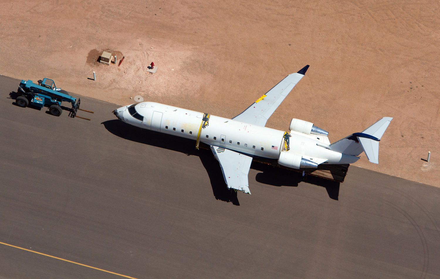
Crash of a Beechcraft B60 Duke in Sedona: 3 killed

Date & Time: Jul 26, 2012 at 0830 LT
Type of aircraft:
Registration:
N880LY
Flight Phase:
Flight Type:
Survivors:
No
Schedule:
Sedona – Albuquerque
MSN:
P-524
YOM:
1980
Location:
Crew on board:
1
Crew fatalities:
Pax on board:
2
Pax fatalities:
Other fatalities:
Total fatalities:
3
Captain / Total flying hours:
663
Captain / Total hours on type:
94.00
Aircraft flight hours:
3924
Circumstances:
Several witnesses observed the airplane before and during its takeoff roll on the morning of the accident. One witness observed the airplane for the entire event and stated that the run-up of the engines sounded normal. During the takeoff roll, the acceleration of the airplane appeared a little slower but the engines continued to sound normal. Directional control was maintained, and at midfield, the airplane had still not rotated. As the airplane continued down the 5,132-foot-long runway, it did not appear to be accelerating, and, about 100 yards from the end of the runway, it appeared that it was not going to stop. The airplane maintained contact with the runway and turned slightly right before it overran the end of the runway. The airplane was subsequently destroyed by impact forces and a postaccident fire. The wreckage was located at the bottom of a deep gully off the end of the runway. Postaccident examination of the area at the end of the runway revealed two distinct tire tracks, both of which crossed the asphalt and dirt overrun of 175 feet. A review of the airplane's weight and balance and performance data revealed that it was within its maximum gross takeoff weight and center of gravity limits. At the time of the accident, the density altitude was calculated to be 7,100 feet; the airport's elevation is 4,830 feet. For the weight of the airplane and density altitude at the time of the accident, it should have lifted off 2,805 feet down the runway; the distance to accelerate to takeoff speed and then to safely abort the takeoff and stop the airplane was calculated to be 4,900 feet. It is unknown whether the pilot completed performance calculations accounting for the density altitude. All flight control components were accounted for at the accident site. Although three witnesses indicated that the engines did not sound right at some point during the runup or takeoff, examination of the engine and airframe revealed no evidence of any preexisting mechanical malfunctions or failures that would have precluded normal operation. Propeller signatures were consistent with rotational forces being applied at the time of impact. No conclusive evidence was found to explain why the airplane did not rotate or why the pilot did not abort the takeoff once reaching the point to safely stop the airplane.
Probable cause:
The airplane's failure to rotate and the pilot's failure to reject the takeoff, which resulted in a runway overrun for reasons that could not be undetermined because postaccident examination of the airplane and engines did not reveal any malfunctions or failures that would have precluded normal operation.
Final Report:

Crash of a Canadair CRJ-200ER in Saint George: 1 killed

Date & Time: Jul 17, 2012 at 0100 LT
Operator:
Registration:
N865AS
Flight Phase:
Flight Type:
Survivors:
No
MSN:
7507
YOM:
2001
Crew on board:
1
Crew fatalities:
Pax on board:
0
Pax fatalities:
Other fatalities:
Total fatalities:
1
Circumstances:
Registered N865AS, the landed at Saint George Airport, Utah, at 2236LT after completing flight DL7772 from Salt Lake City. All occupants deplaned and the aircraft was parked on the ramp for the night. Shortly after midnight, a commercial pilot climbed over the barbed wire fence, open the door of the aircraft (which was not closed by key) and managed to start the engines. The aircraft rolled for several metres before then impacted the terminal building, went through the fence and came to rest in a parking lot. The pilot shot himself in the cockpit. Polices forces confirmed later that he wanted to stole the aircraft after his girlfriend was killed that day in Colorado Springs.
Probable cause:
Aircraft stolen by a commercial pilot who shot himself in the cockpit after trying to take off without any clearance (illegal flight). No investigations were conducted by the NTSB on this event.

Crash of a Beechcraft E90 King Air in Karnack: 1 killed

Date & Time: Jul 7, 2012 at 0404 LT
Type of aircraft:
Operator:
Registration:
N987GM
Flight Phase:
Flight Type:
Survivors:
No
Schedule:
DeKalb - Brownsville
MSN:
LW-65
YOM:
1973
Location:
Crew on board:
1
Crew fatalities:
Pax on board:
0
Pax fatalities:
Other fatalities:
Total fatalities:
1
Captain / Total flying hours:
5300
Aircraft flight hours:
15082
Circumstances:
Before the flight, the pilot did not obtain a weather briefing and departed without approval from company personnel. The airplane departed the airport about 0230 and climbed to 14,500 feet mean sea level. The pilot obtained visual flight rules (VFR) flight following services from air traffic control (ATC) personnel during the flight. While the airplane was en route, ATC personnel advised the pilot that an area of moderate precipitation was located about 15 miles ahead along the airplane’s flight path. The pilot acknowledged the transmission and was then directed to contact another controller. About 3 minutes later, the new controller advised the pilot of an area of moderate to extreme precipitation about 2 miles ahead of the airplane. The pilot responded that he could see the weather and asked the controller for a recommendation for a reroute. The controller indicated he didn’t have a recommendation, but finished by saying a turn to the west (a right turn) away from the weather would probably be better. The pilot responded that he would make a right turn. There was no further radio contact with the pilot. Flight track data indicated the airplane was in a right turn when radar contact was lost. A review of the radar data, available weather information, and airplane wreckage indicated the airplane flew through a heavy to extreme weather radar echo containing a thunderstorm and subsequently broke up in flight. Postaccident examination revealed no mechanical malfunctions or anomalies with the airframe and engines that would have precluded normal operation. During the VFR flight, the pilot was responsible for remaining in VFR conditions and staying clear of clouds. However, Federal Aviation Administration directives instruct ATC personnel to issue pertinent weather information to pilots, provide guidance to pilots to avoid weather (when requested), and plan ahead and be prepared to suggest alternate routes or altitudes when there are areas of significant weather. The weather advisories and warnings issued to the pilot by ATC were not in compliance with these directives. The delay in providing information to the pilot about the heavy and extreme weather made avoiding the thunderstorm more difficult and contributed to the accident.
Probable cause:
The pilot's inadvertent flight into thunderstorm activity, which resulted in the loss of airplane control and the subsequent exceedance of the airplane’s design limits and in-flight breakup. Contributing to the accident was the failure of air traffic control personnel to use available radar information to provide the pilot with a timely warning that he was about to encounter extreme precipitation and weather along his route of flight or to provide alternative routing to the pilot.
Final Report:

Crash of a Lockheed C-130H Hercules near Edgemont: 4 killed

Date & Time: Jul 1, 2012 at 1738 LT
Type of aircraft:
Operator:
Registration:
93-1458
Flight Phase:
Flight Type:
Survivors:
Yes
Schedule:
Colorado Springs - Colorado Springs
MSN:
5363
YOM:
1994
Crew on board:
6
Crew fatalities:
Pax on board:
0
Pax fatalities:
Other fatalities:
Total fatalities:
4
Captain / Total hours on type:
1966.00
Copilot / Total hours on type:
3647
Circumstances:
On 1 July 2012, at approximately 1738 Local time, a C-130H3, Tail Number 93-1458, assigned to the 145th Airlift Wing, North Carolina Air National Guard, Charlotte Douglas International Airport (KCLT), Charlotte, North Carolina, crashed on public land managed by the United States Forest Service (USFS), while conducting wildland firefighting operations near Edgemont, South Dakota. At the time of the mishap all members of the Mishap Crew (MC) were assigned or attached to the 156th Airlift Squadron, based at KCLT. The Mishap Crew (MC) consisted of Mishap Pilot 1 (MP1), Mishap Pilot 2 (MP2), Mishap Navigator (MN), Mishap Flight Engineer (ME), Mishap Loadmaster 1 (ML1) and Mishap Loadmaster 2 (ML2). For the mishap sortie, MP1 was the aircraft commander and pilot flying in the left seat. MP2 was in the right seat as the instructor pilot. MN occupied the navigator station on the right side of the flight deck behind MP2. ME was seated in the flight engineer seat located between MP1 and MP2, immediately aft of the center flight console. ML1 and ML2 were seated on the Modular Airborne Fire Fighting System (MAFFS) unit, near the right paratroop door. ML1 occupied the aft MAFFS control station seat and ML2 occupied the forward MAFFS observer station seat. MP1, MP2, MN and ME died in the mishap. ML1 and ML2 survived the mishap, but suffered significant injuries. The mishap aircraft (MA) and a USFS-owned MAFFS unit were destroyed. The monetary loss is valued at $43,453,295, which includes an estimated $150,000 in post aircraft removal and site environmental cleanup costs. There were no additional fatalities, injuries or damage to other government or civilian property.
Probable cause:
The accident investigation report released by the Air Force Air Mobility Command said:
I developed my opinion by inspecting the mishap site and wreckage, as well as analyzing factual data from the following: historical records, Air Force directives and guidance, USFS and Interagency guidance, reconstructing the mishap sortie in a C-130H3 simulator, engineering analysis, witness testimony, flight data, weather radar data, computer animated reconstruction, consulting with subject matter experts and information provided by technical experts. The failure of the Digital Flight Data Recorder severely complicated the recreation of the mishap, and impacted my ability to determine facts in this investigation. I find by clear and convincing evidence the cause of the mishap was MPl, MP2, MN and ME's inadequate assessment of operational conditions, resulting in the MA impacting the ground after flying into a microburst. Additionally, I find by the preponderance of evidence, the failure of the White Draw Fire Lead Plane aircrew and Air Attack aircrew to communicate critical operational information; and conflicting operational guidance concerning thunderstorm avoidance, substantially contributed to the mishap.
Final Report:

Crash of a Piper PA-31P-425 Navajo in Dalton: 1 killed

Date & Time: Jun 30, 2012 at 1620 LT
Type of aircraft:
Registration:
N33CG
Flight Phase:
Flight Type:
Survivors:
No
Schedule:
Dalton - Dalton
MSN:
31-7300157
YOM:
1973
Location:
Crew on board:
1
Crew fatalities:
Pax on board:
0
Pax fatalities:
Other fatalities:
Total fatalities:
1
Captain / Total flying hours:
1685
Circumstances:
According to a friend of the pilot, the pilot was taking the airplane to have an annual inspection completed. The friend assisted the pilot before departure and watched as the airplane departed. He did not notice any anomalies with the airplane during the takeoff or the climbout. According to a witness in the vicinity of the accident site, he heard the airplane coming toward him, and it was flying very low. He looked up and saw the airplane approximately 200 feet over his house and descending toward the trees. As he watched the airplane, he noticed that the right propeller was not turning, and the right engine was not running. He stated that the left engine sounded as if it was running at full power. The airplane pitched up to avoid a power line and rolled to the right, descending below the tree line. A plume of smoke and an explosion followed. Examination of the right propeller assembly revealed evidence of significant frontal impact. The blades were bent but did not have indications of rotational scoring; thus they likely were not rotating at impact. One preload plate impact mark indicated that the blades were at an approximate 23-degree angle; blades that are feathered are about 86 degrees. Due to fire and impact damage of the right engine and related system components, the reason for the loss of power could not be determined. An examination of the airframe and left engine revealed no mechanical malfunctions or failures that would have precluded normal operation. A review of the airplane maintenance logbooks revealed that the annual inspection was 12 days overdue. According to Lycoming Service Instruction No. 1009AS, the recommended time between engine overhaul is 1,200 hours or 12 years, whichever occurs first. A review of the right engine maintenance logbook revealed that the engine had accumulated 1,435 hours since major overhaul and that neither engine had been overhauled within the preceding 12 years. Although the propeller manufacturer recommends that the propeller be feathered before the engine rpm drops below 1,000 rpm, a review of the latest revision of the pilot operating handbook (POH) revealed that the feathering procedure for engine failure did not specify this. It is likely that the pilot did not feather the right propeller before the engine reached the critical 1,000 rpm, which prevented the propeller from engaging in the feathered position
Probable cause:
The pilot’s failure to maintain airplane control following loss of power in the right engine for reasons that could not be determined because of fire and impact damage. Contributing to the accident was the pilot’s delayed feathering of the right propeller following the loss of engine power and the lack of specific emergency procedures in the pilot operating handbook indicating the need to feather the propellers before engine rpm falls below 1,000 rpm.
Final Report:

Crash of a Beechcraft C90GT King Air in Morgantown: 1 killed

Date & Time: Jun 22, 2012 at 1001 LT
Type of aircraft:
Registration:
N508GT
Flight Type:
Survivors:
No
Schedule:
Tidioute - Farmington - Morgantown
MSN:
LJ-1775
YOM:
2008
Crew on board:
1
Crew fatalities:
Pax on board:
0
Pax fatalities:
Other fatalities:
Total fatalities:
1
Captain / Total flying hours:
22000
Aircraft flight hours:
1439
Circumstances:
The airplane, operated by Oz Gas Aviation LLC, was substantially damaged when it struck a communications tower near Morgantown, West Virginia. The certificated airline transport pilot was fatally injured. No flight plan had been filed for the positioning flight from Nemacolin Airport (PA88), Farmington, Pennsylvania, to Morgantown Municipal Airport (MGW), Morgantown, West Virginia conducted under Title14 Code of Federal Regulations (CFR) Part 91. At 0924 on the morning of the accident, the airplane departed from Rigrtona Airport (13PA), Tidioute, Pennsylvania for PA88 with the pilot and three passengers onboard. The airplane landed on runway 23 at PA88 at 0944. The pilot then parked the airplane; shutdown both engines, and deplaned the three passengers. He advised them that he would be back on the following day to pick them up. After the passengers got on a shuttle bus for the Nemacolin Woodlands Resort, the pilot started the engines. He idled for approximately 2 minutes, and then back taxied on runway 23 for takeoff. At 0957, he departed from runway 23 for the approximately 19 nautical mile positioning flight to MGW, where he was going to refuel and spend the night. After departure from PA88, the airplane climbed to 3,100 feet above mean sea level (msl) on an approximately direct heading for MGW. The pilot then contacted Clarksburg Approach Control and was given a discrete code of 0130. When the airplane was approximately nine miles east of the Morgantown airport, the air traffic controller advised the pilot that he had "radar contact" with him. The airplane then descended to 3,000 feet, and approximately one minute later struck the communications tower on an approximate magnetic heading of 240 degrees. According to a witness who was cutting timber across the road from where the accident occurred; the weather was cloudy with lighting and thunder, and it had just started "sprinkling". He then heard a loud "bang", turned, and observed the airplane descending upside down, and then impact. About 20 minutes later it stopped "sprinkling". He advised that he could still see the top of the tower when it was "sprinkling".
Probable cause:
The pilot's inadequate preflight route planning and in-flight route and altitude selection, which resulted in an in-flight collision with a communications tower in possible instrument
meteorological conditions. Contributing to the accident were the pilot's improper use of the enhanced ground proximity warning system's terrain inhibit switch and the air traffic controller's failure to issue a safety alert regarding the proximity of the tower.
Final Report:

Crash of a Beechcraft Beechjet 400A in Atlanta

Date & Time: Jun 18, 2012 at 1006 LT
Type of aircraft:
Operator:
Registration:
N826JH
Survivors:
Yes
Schedule:
Gadsden - Atlanta
MSN:
RK-70
YOM:
1993
Crew on board:
2
Crew fatalities:
Pax on board:
2
Pax fatalities:
Other fatalities:
Total fatalities:
0
Captain / Total flying hours:
10800
Captain / Total hours on type:
1500.00
Copilot / Total flying hours:
3500
Copilot / Total hours on type:
150
Aircraft flight hours:
4674
Circumstances:
The second-in-command (SIC) was the pilot flying for most of the flight (takeoff, climb, cruise, and descent) and was in the left seat, while the pilot-in-command (PIC) was the pilot monitoring for most of the flight and was in the right seat. Before takeoff, the PIC calculated reference speed (Vref) for the estimated landing weight and flaps 30-degree extension was 120 knots, with a calculated landing distance of 3,440 ft. Further, before takeoff, there were no known mechanical difficulties with the brakes, flaps, antiskid, or traffic alert and collision avoidance (TCAS) systems. After takeoff and for most of the flight, the PIC coached/instructed the SIC, including instructions on how to set the airspeed command cursor, a request to perform the after-takeoff checklist, and a comment to reduce thrust to silence an overspeed warning aural annunciation. When the flight was northwest of Dekalb Peachtree Airport (PDK), Atlanta, Georgia, on a right base leg for a visual approach to runway 20L with negligible wind, air traffic controllers repeatedly announced the location and distance of a Cessna airplane (which was ahead of the Beech 400A on a straight-in visual approach to runway 20R). Because the Beech 400A flight crew did not see the other airplane, the controllers appropriately instructed them to maintain their altitude (which was 2,300 ft mean sea level [msl]) for separation until they had the traffic in sight; radar data indicated the Beech 400A briefly descended to 2,200 ft msl then climbed back to 2,300 ft msl. According to the cockpit voice recorder (CVR) transcript, at 1004:42, which was about 12 seconds after the controller instructed the Beech 400A flight crew to maintain altitude, the on board TCAS alerted "traffic traffic." While the Beech 400A did climb back to 2,300 ft msl, this was likely a response to the air traffic control (ATC) instruction to maintain altitude and not a response to the TCAS "traffic traffic" warning. At 1004:47, the CVR recorded the SIC state, "first degree of," likely referring to flap extension, but the comment was not completed. The CVR recorded an immediate increase in background noise, which was likely due to the landing gear extension. The PIC then advised the local controller that the flight was turning onto final approach. The CVR did not record any approach briefing or discussion of runway length or Vref speed. After landing on runway 20L at Atlanta-DeKalb Peachtree Airport, aircraft did not stop as expected. It overrun the runway, went through a fence and came to rest near a road, broken in two. All four occupants were injured, both pilots seriously.
Probable cause:
The flight crew's failure to obtain the proper airspeed for landing, which resulted in the airplane touching down too fast with inadequate runway remaining to stop and a subsequent
runway overrun. Contributing to the accident were the failure of either pilot to call for a go-around and the flight crew's poor crew resource management and lack of professionalism.
Final Report:

Crash of a Piper PA-31-325 Navajo C/R near Two Harbors: 1 killed

Date & Time: Jun 8, 2012 at 1427 LT
Type of aircraft:
Registration:
N174BH
Flight Phase:
Flight Type:
Survivors:
No
Schedule:
South Saint Paul - South Saint Paul
MSN:
31-7612038
YOM:
1976
Crew on board:
1
Crew fatalities:
Pax on board:
0
Pax fatalities:
Other fatalities:
Total fatalities:
1
Circumstances:
On June 8, 2012, about 1307 central daylight time, a Piper PA-31-325, N174BH, departed from the South St Paul Municipal Airport-Richard E Fleming Field (SGS), South St Paul, Minnesota for a maintenance test flight. The airplane reportedly had one of its two engines replaced and the pilot was to fly for about 4 hours to break-in the engine. The airplane did not return from the flight and was reported overdue. The airplane is missing and is presumed to have crashed. The airline transport pilot has not been located. The airplane was registered to Family Celebrations LLC, and was operated as a 14 Code of Federal Regulations Part 91 personal flight. Visual meteorological conditions prevailed and no flight plan was filed. The flight departed SGS with the intention of returning to SGS at the conclusion of the flight. The airplane was reported missing and an alert notification issued about 2225. The last reported contact with the airplane and pilot was about 1300 when the fixed base operator at SGS towed the airplane to the fuel pumps. When he returned about 15 minutes later, the airplane was no longer there. Aircraft radar track data from various ground based sources indicated that the airplane departed SGS about 1307. The airplane maneuvered east of SGS before turning toward the north. The airplane's track continued north toward Duluth, Minnesota. Once the airplane reached Duluth, it followed the west shoreline of Lake Superior. Radar track data indicated that the airplane was at a pressure altitude of 2,800 feet when it reached the shoreline. The airplane continued along the west shoreline toward Two Harbors, Minnesota, flying over the water while maintaining a distance of about 0.5 miles from the shore. As the airplane approached Two Harbors, it descended. The airplane's last recorded position at 1427 was about 30 miles northeast of Duluth, Minnesota, at an uncorrected pressure altitude of 1,600 feet. The Air Force Rescue Coordination Center coordinated a search for the missing airplane. The Civil Air Patrol, United States Coast Guard, and other entities participated in the search efforts. Search efforts were suspended on July 4, 2012.
Probable cause:
Undetermined because the airplane was not found
Final Report:

Crash of a Pilatus PC-12/47 in Lake Wales: 6 killed

Date & Time: Jun 7, 2012 at 1235 LT
Type of aircraft:
Registration:
N950KA
Flight Phase:
Flight Type:
Survivors:
No
Schedule:
Fort Pierce - Junction City
MSN:
730
YOM:
2006
Crew on board:
1
Crew fatalities:
Pax on board:
5
Pax fatalities:
Other fatalities:
Total fatalities:
6
Captain / Total flying hours:
755
Captain / Total hours on type:
38.00
Aircraft flight hours:
1263
Circumstances:
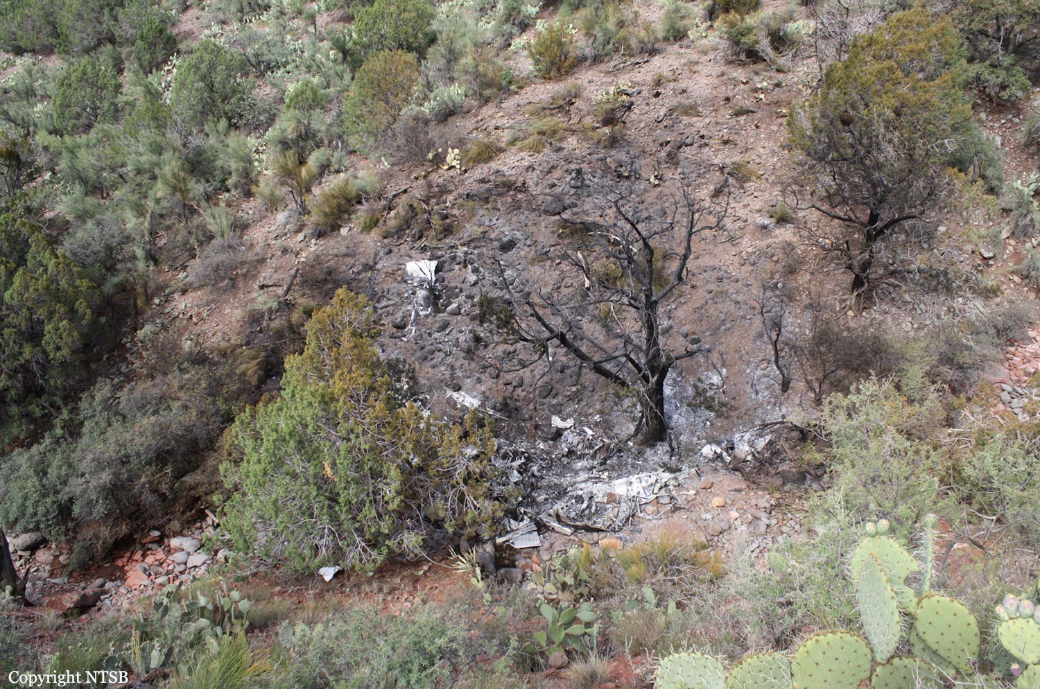
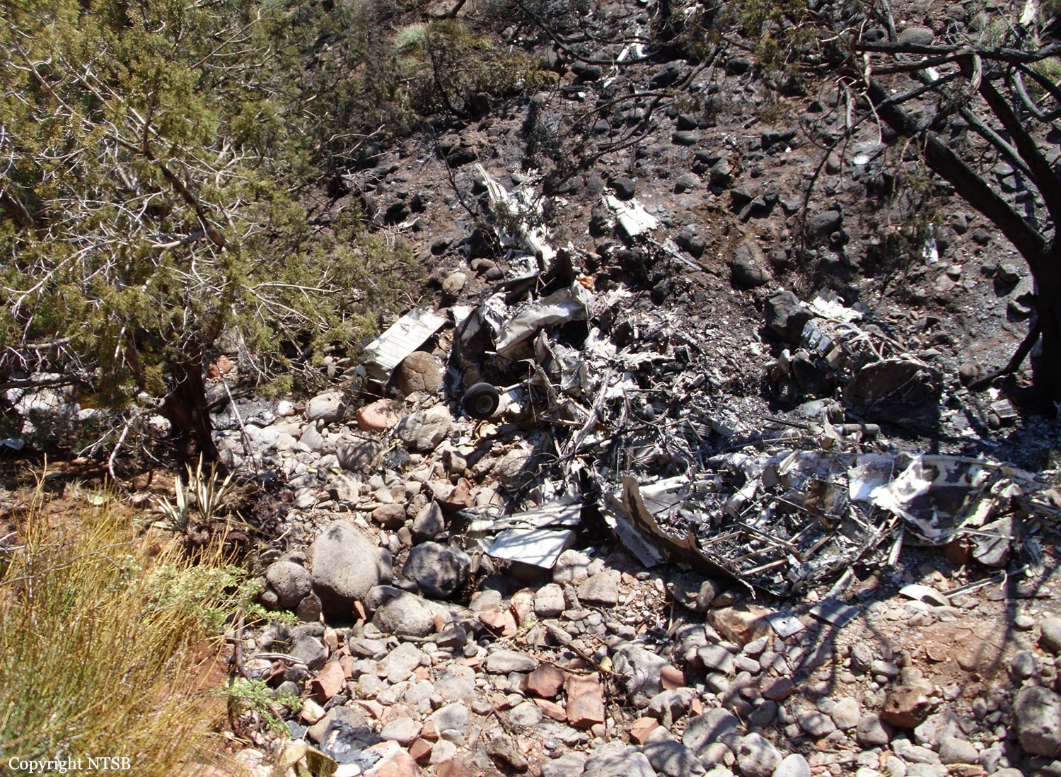
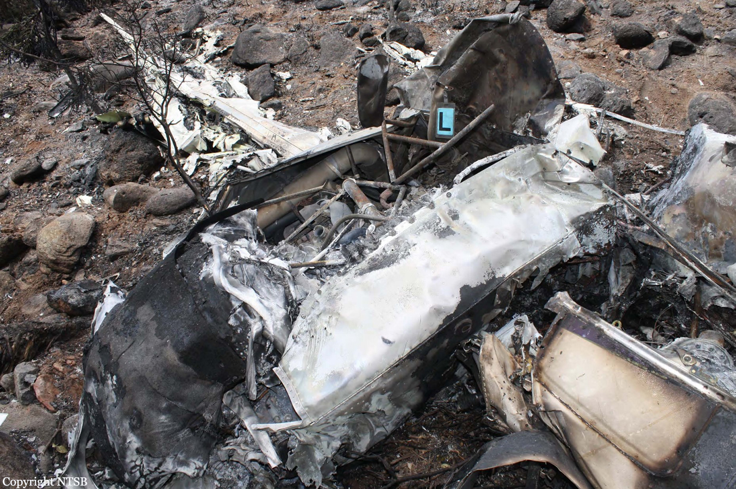
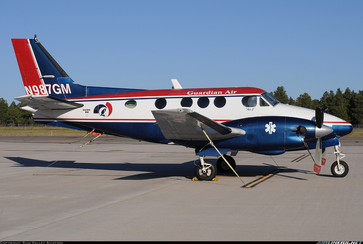
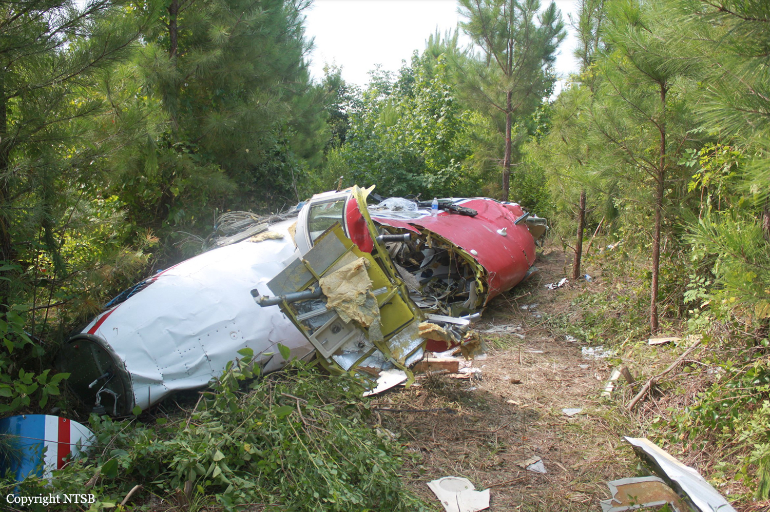
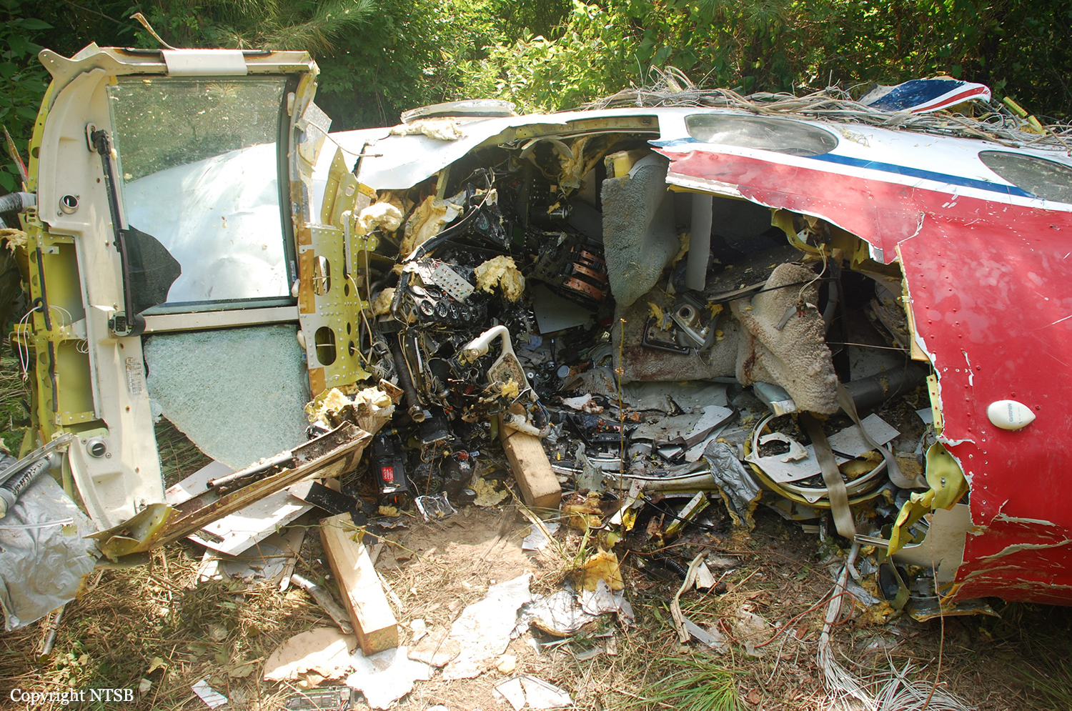
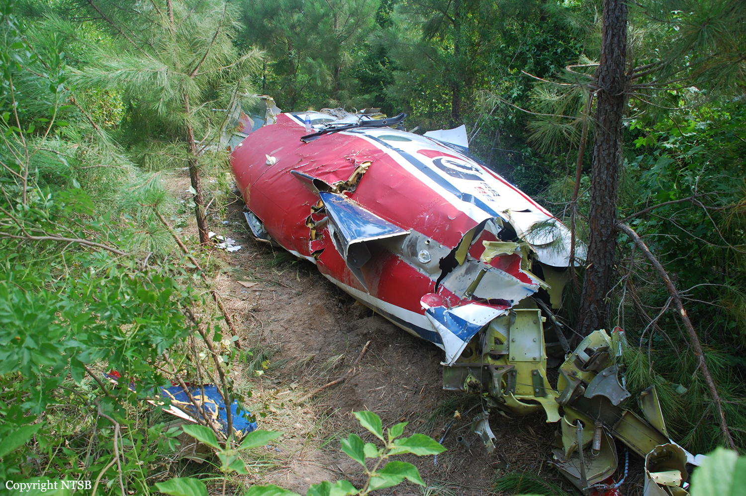
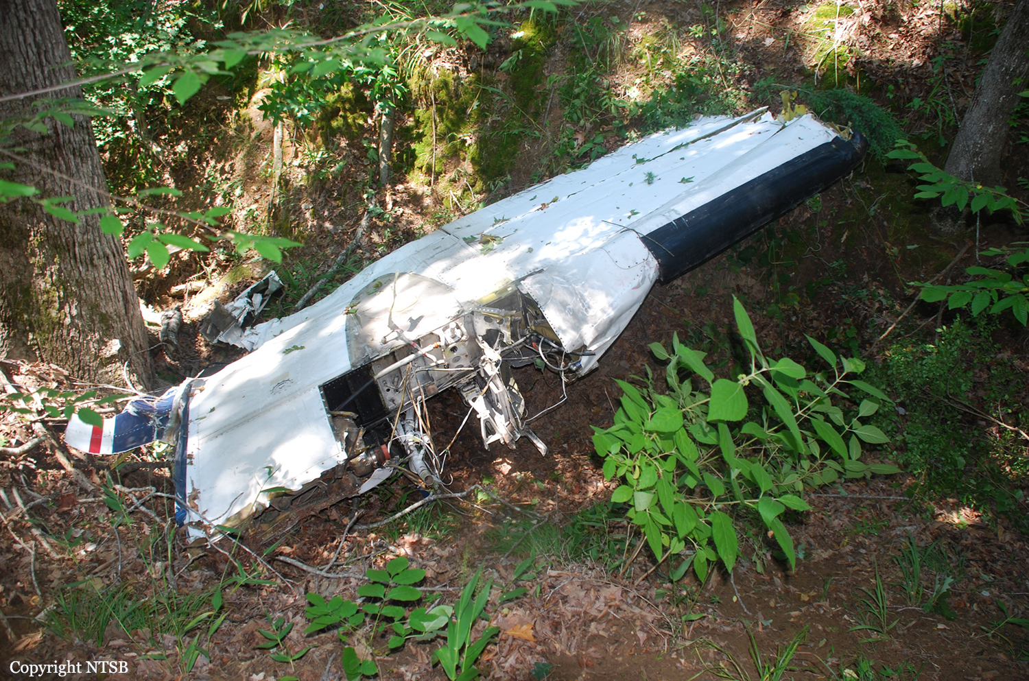
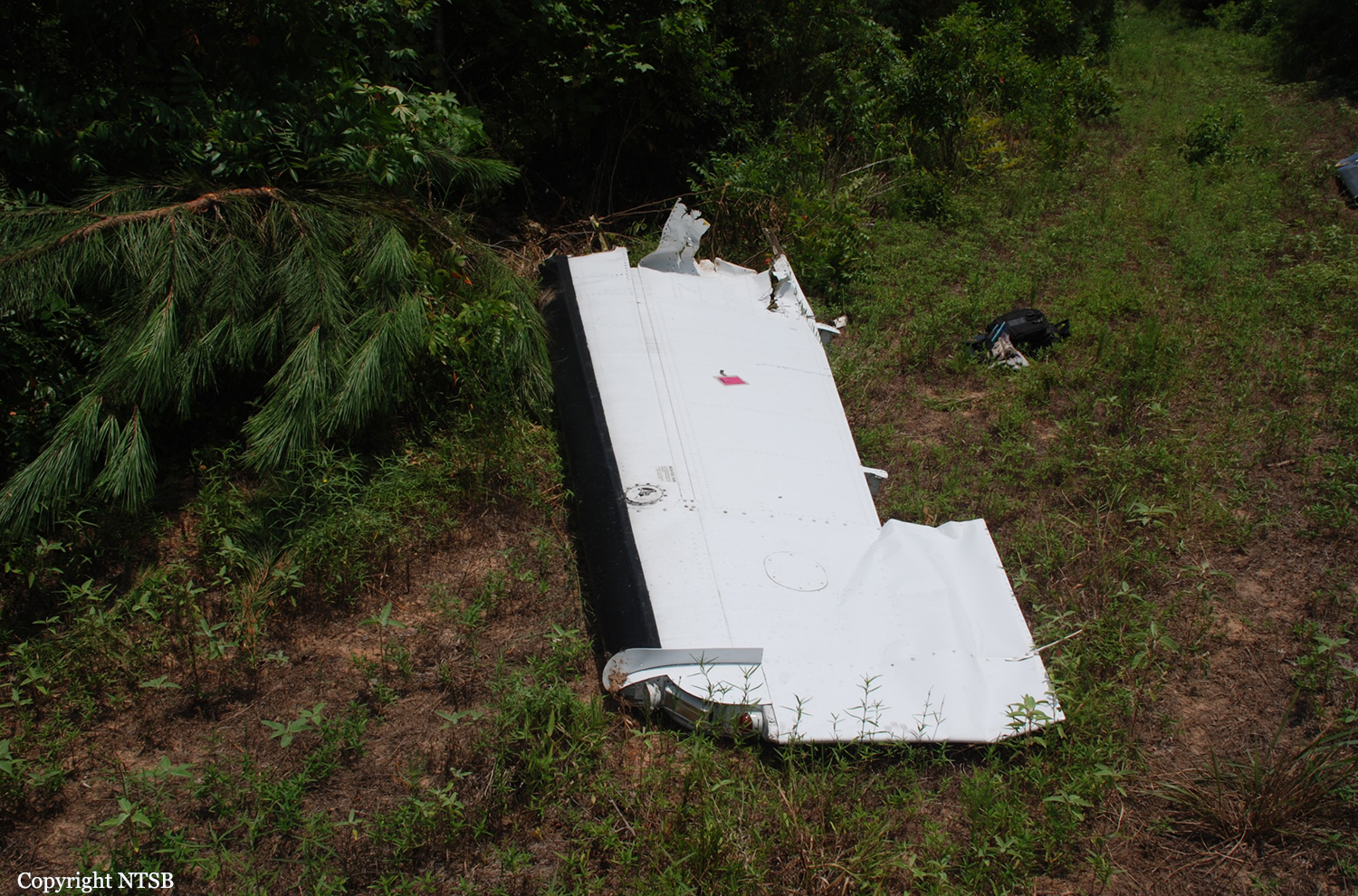
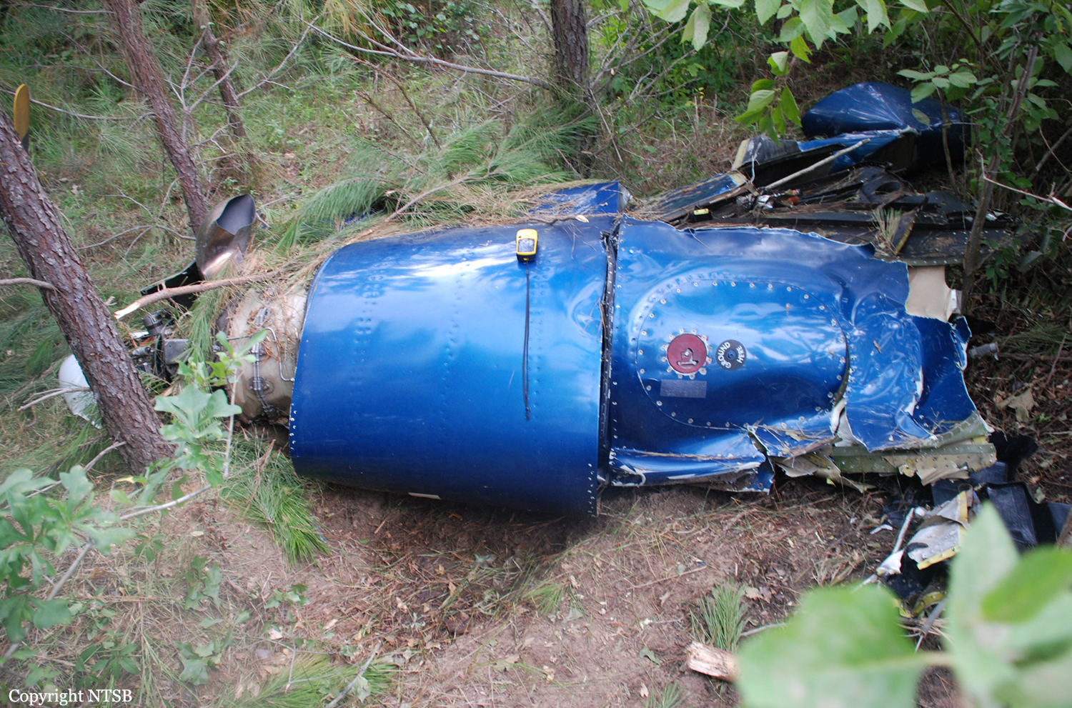
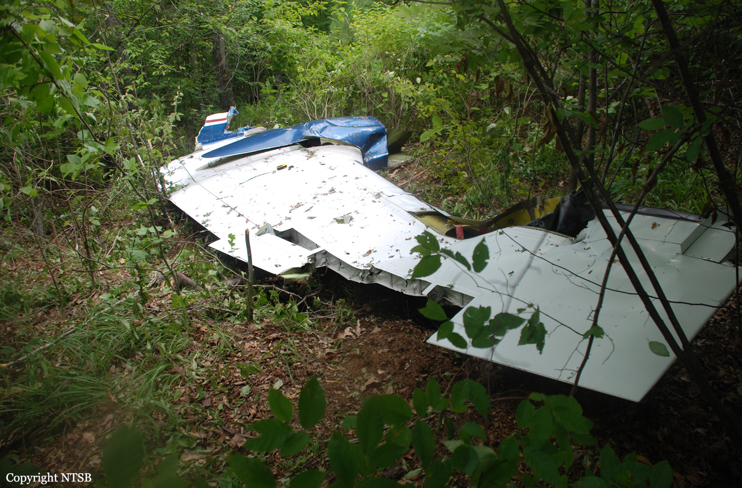
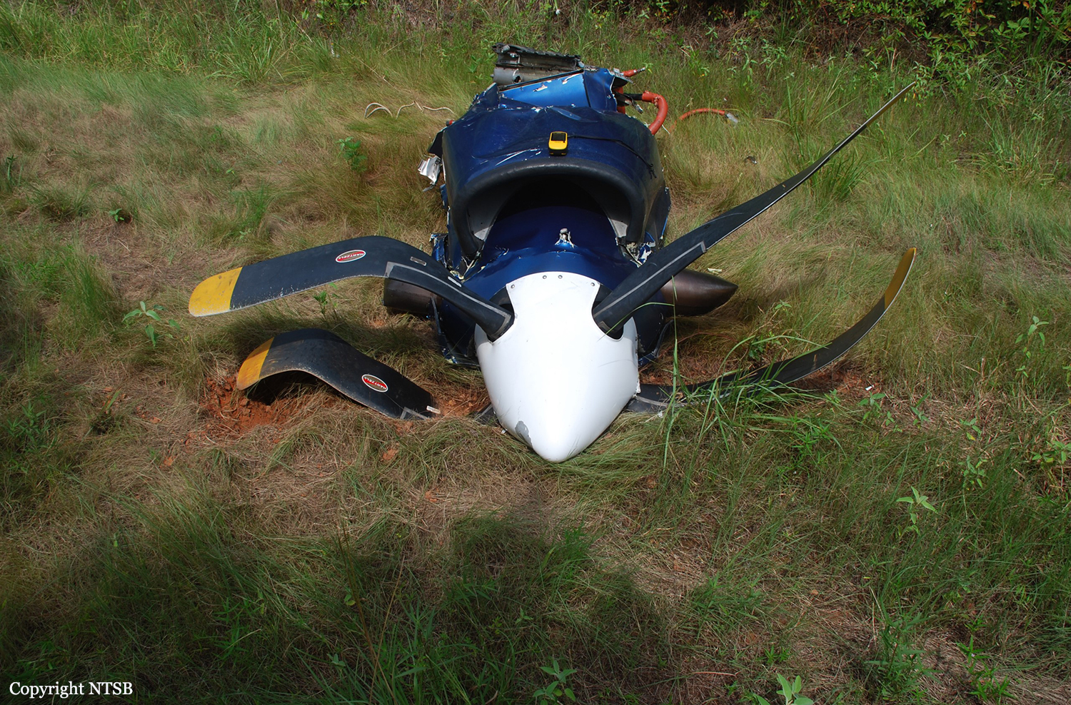
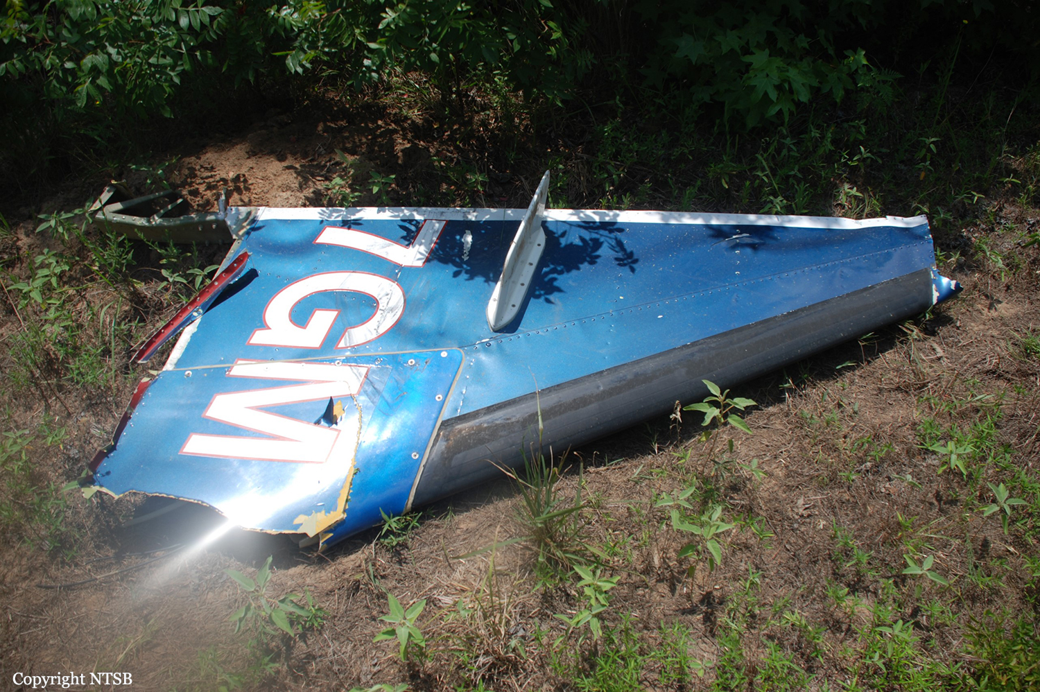
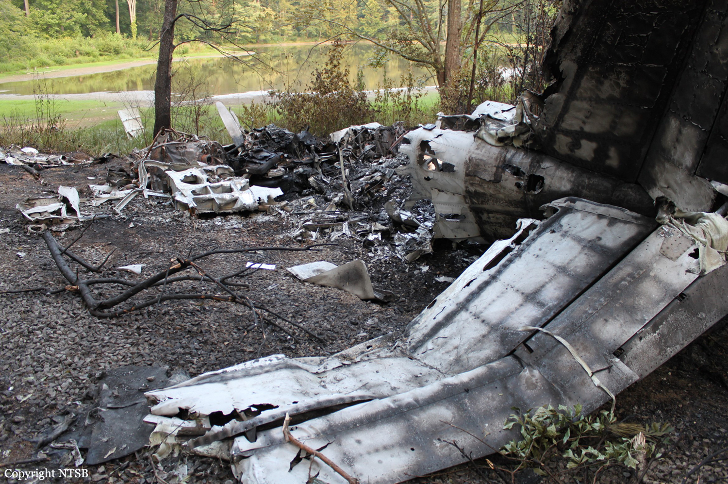
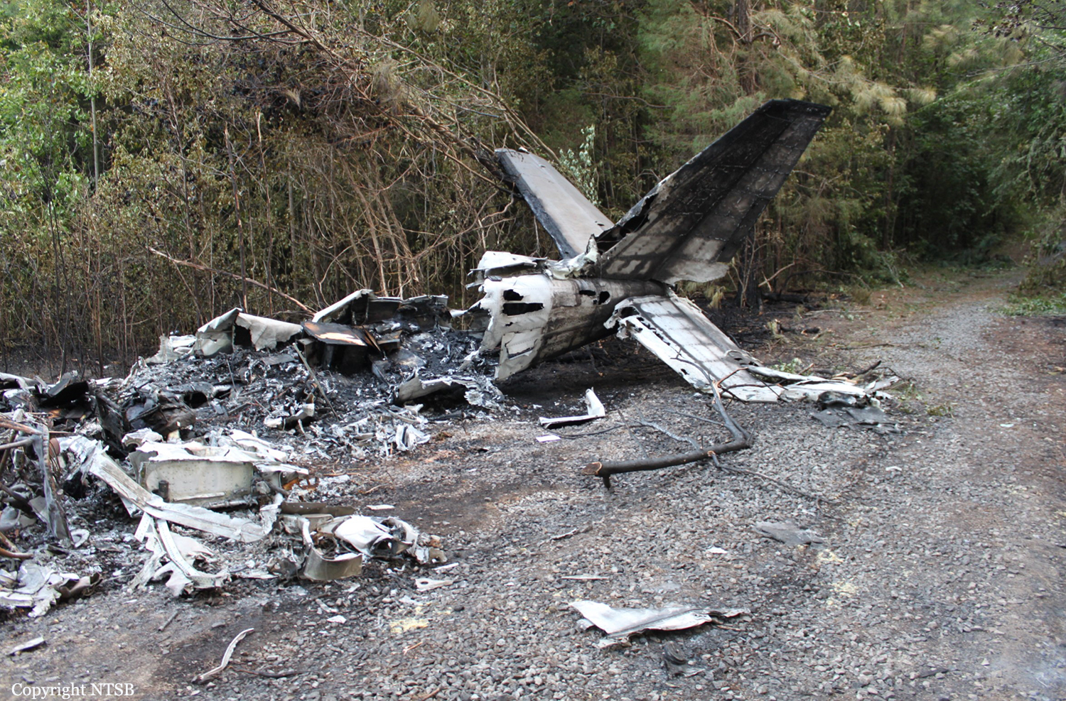
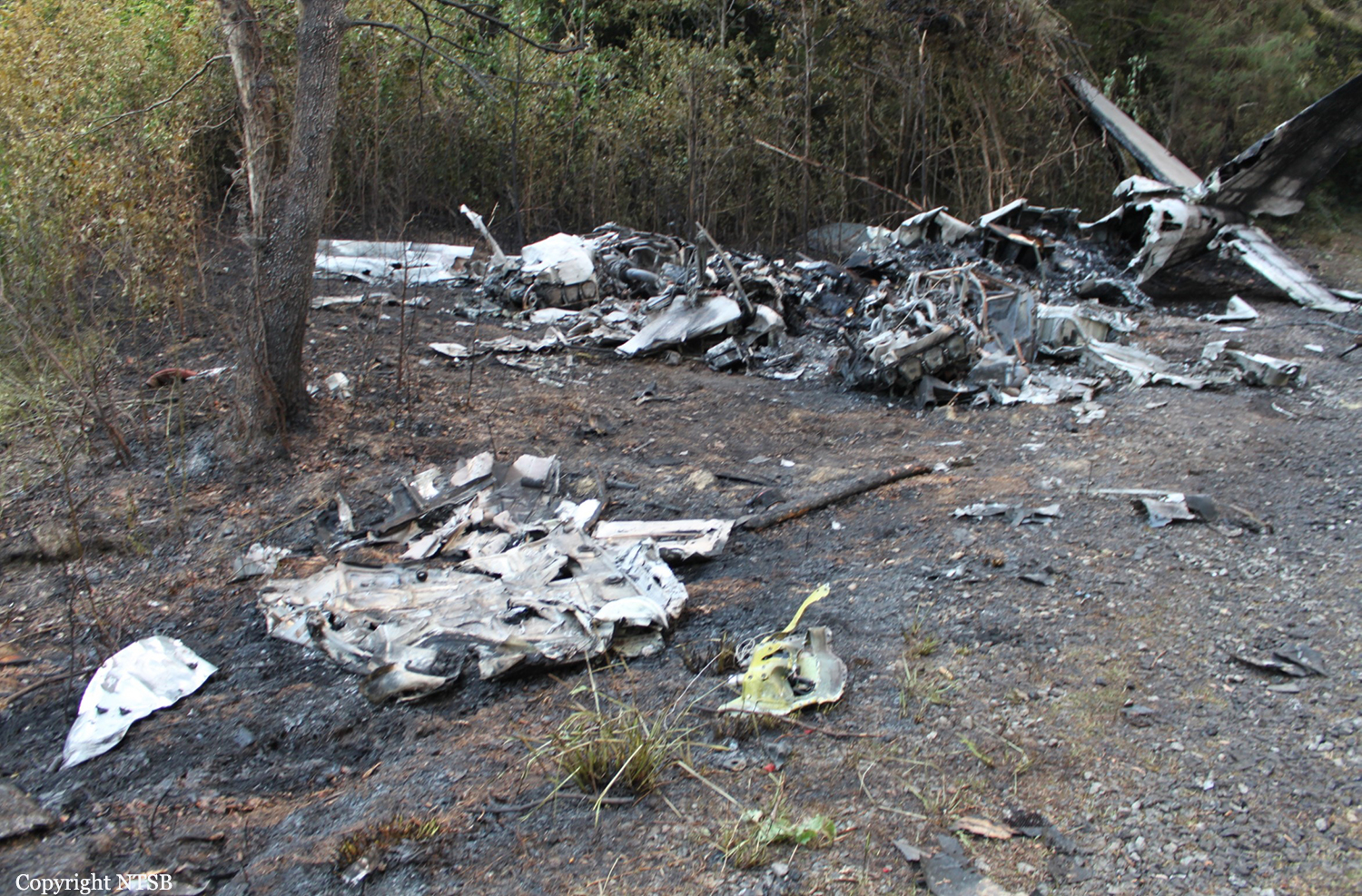
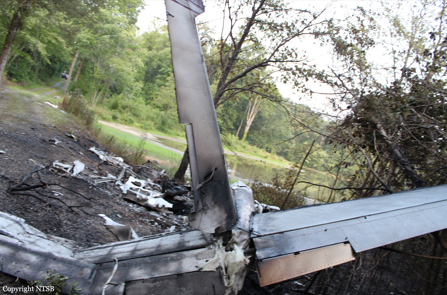
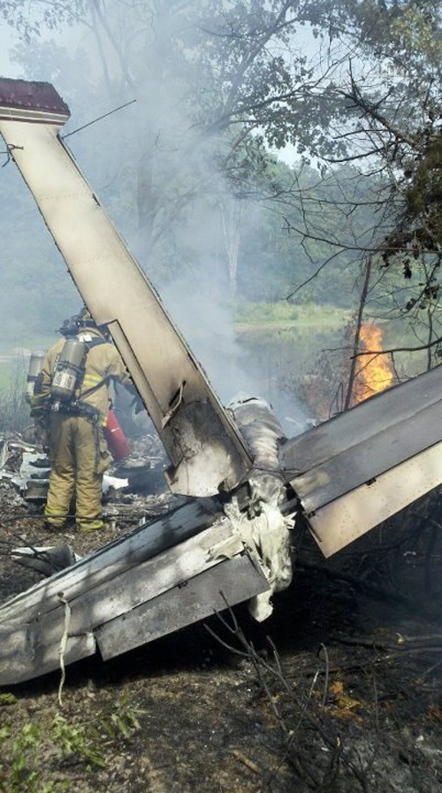
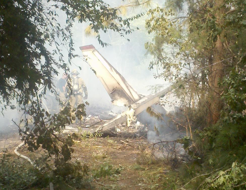
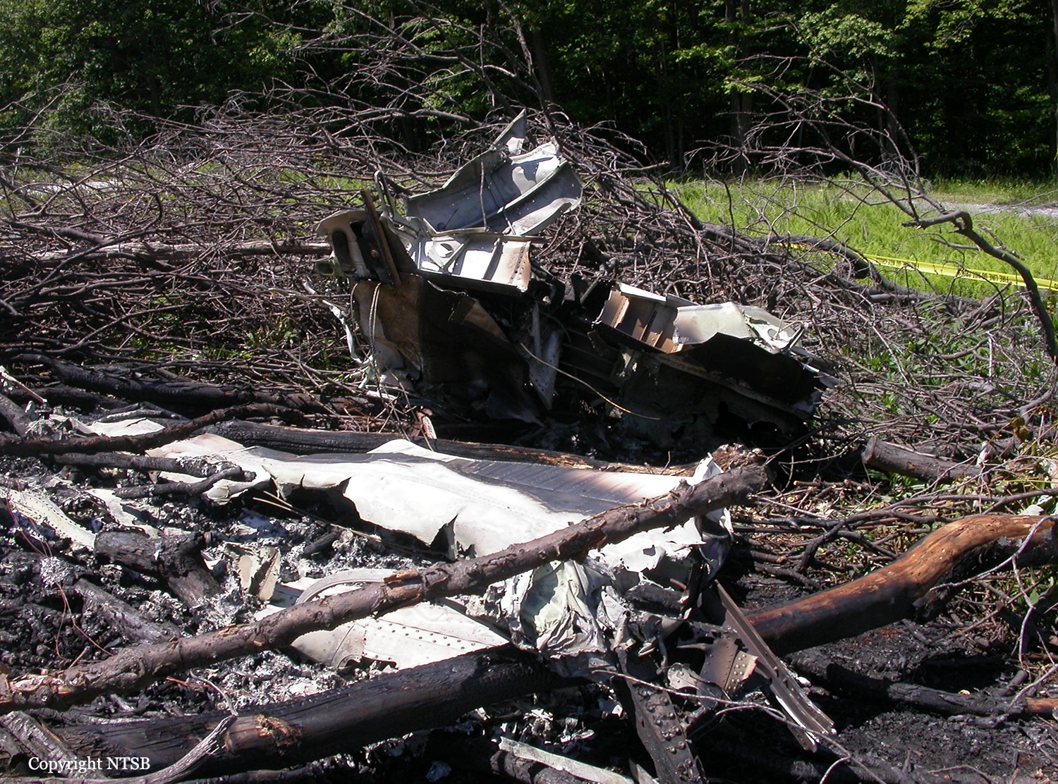
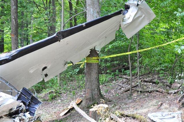
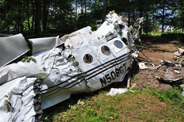
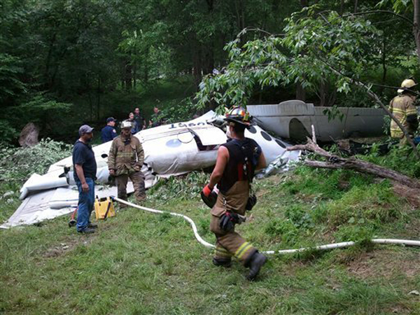
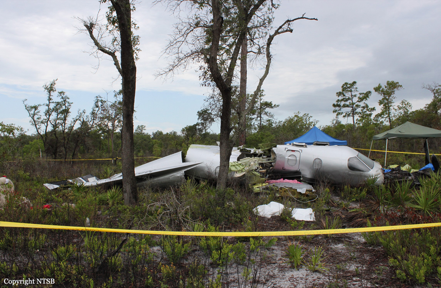
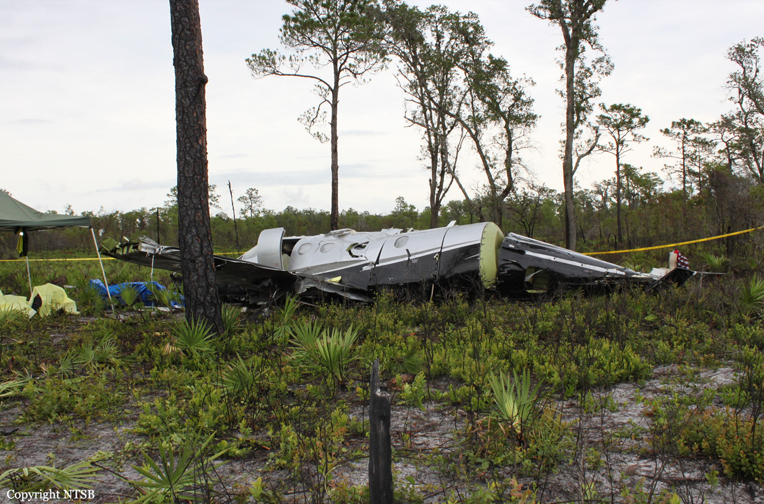
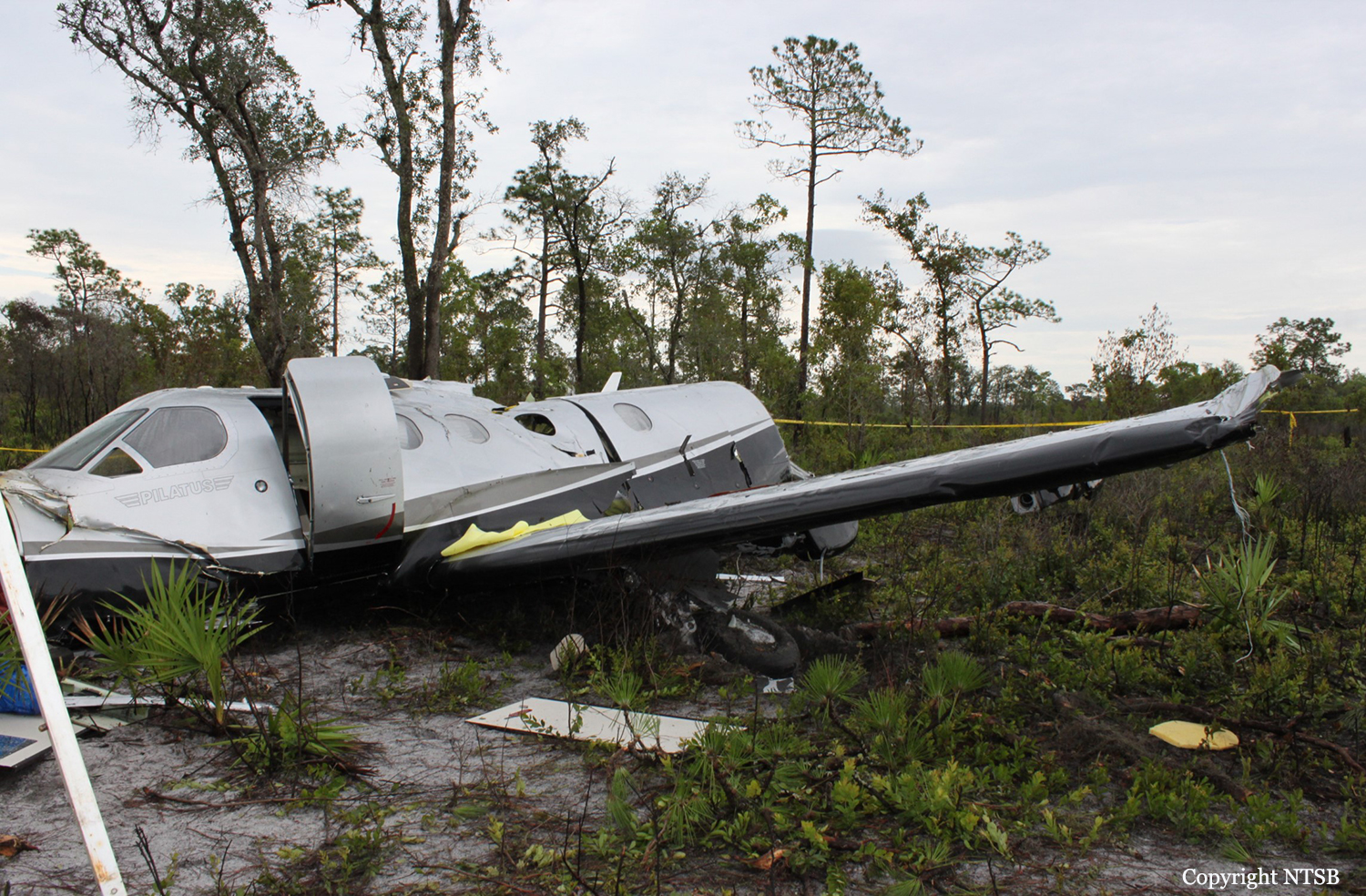
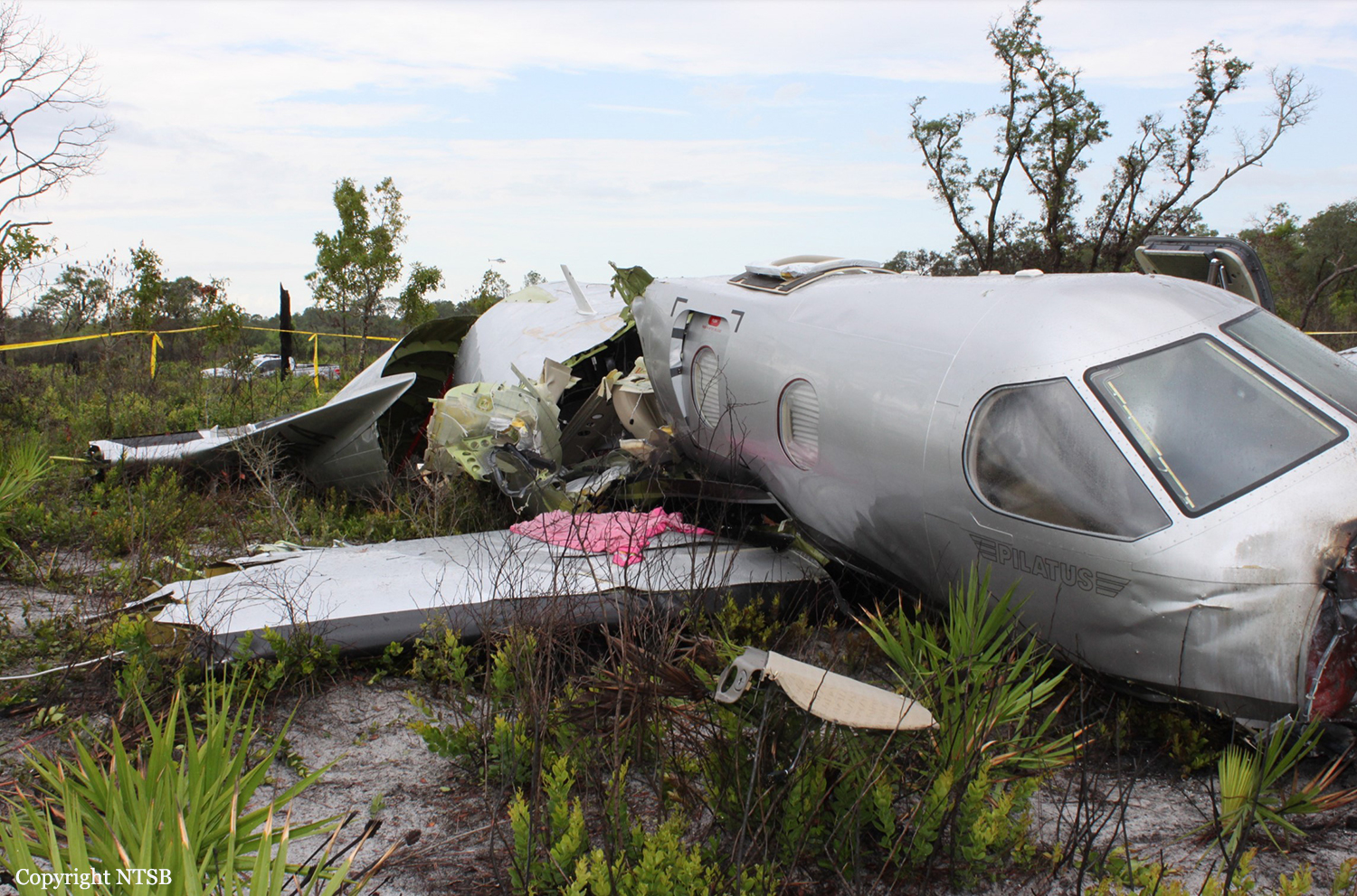
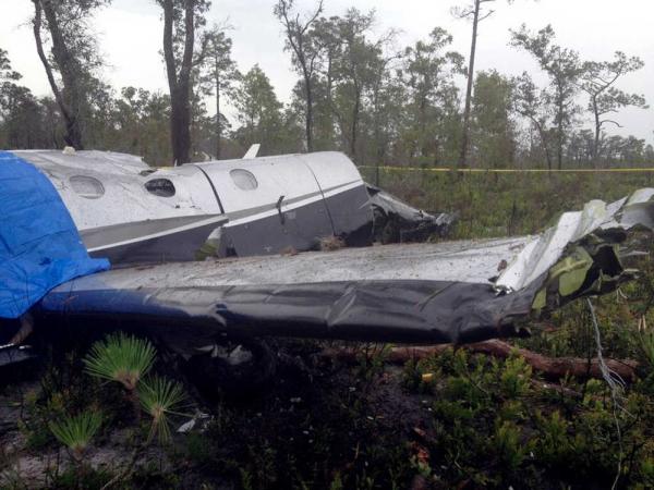
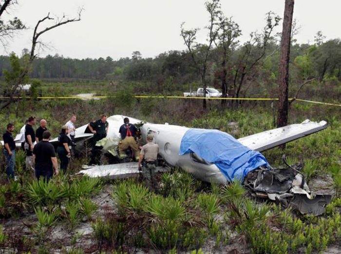
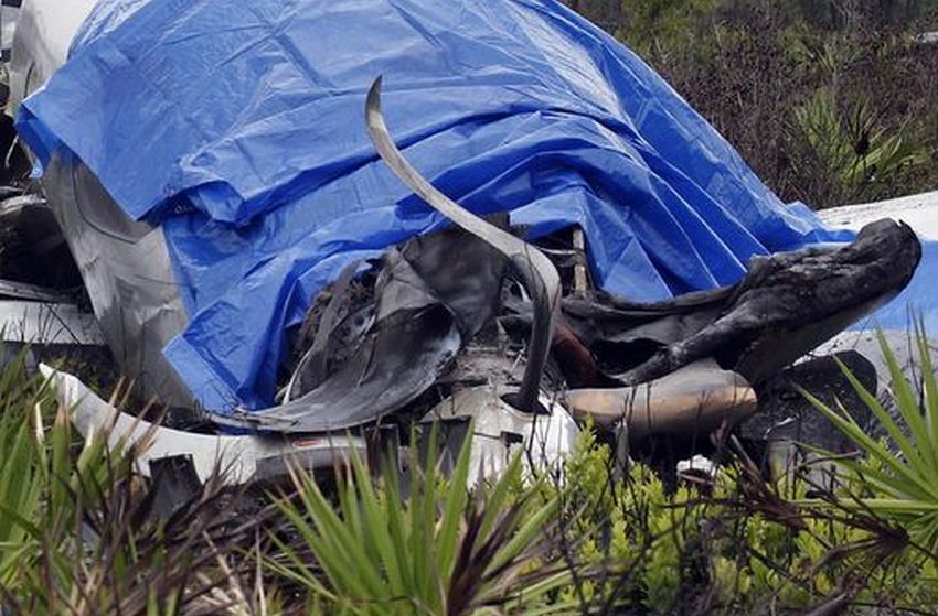
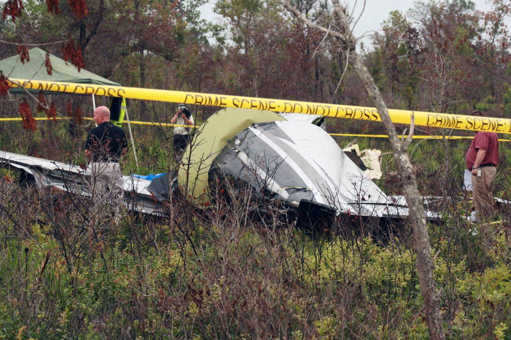
The airplane, registered to and operated by Roadside Ventures, LLC, departed controlled flight followed by subsequent inflight breakup near Lake Wales, Florida. Instrument meteorological conditions prevailed at the altitude and location of the departure from controlled flight and an instrument flight rules (IFR) flight plan was filed for the 14 Code of Federal Regulations (CFR) Part 91 personal flight from St Lucie County International Airport (FPR), Fort Pierce, Florida, to Freeman Field Airport (3JC), Junction City, Kansas. The airplane was substantially damaged and the private pilot and five passengers were fatally injured. The flight originated from FPR about 1205. After departure while proceeding in a west-northwesterly direction and climbing, air traffic control communications were transferred to Miami Air Route Traffic Control Center (Miami ARTCC). The pilot remained in contact with various sectors of that facility from 1206:41, to the last communication at 1233:16. About 6 minutes after takeoff the pilot was advised by the Miami ARTCC Stoop Sector radar controller of an area of moderate to heavy precipitation twelve to two o'clock 15 miles ahead of the airplane's position; the returns were reported to be 30 miles in diameter. The pilot asked the controller if he needed to circumnavigate the weather, to which the controller replied that deviations north of course were approved and when able to proceed direct LAL, which he acknowledged. A trainee controller and a controller providing oversight discussed off frequency that deviation to the south would be better. The controller then questioned the pilot about his route, to which he replied, and the controller then advised the pilot that deviations south of course were approved, which he acknowledged. The flight continued in generally a west-northwesterly direction, or about 290 degrees, and at 1230:11, while at flight level (FL) 235, the controller cleared the flight to FL260, which the pilot acknowledged. At 1232:26, the aircraft's central advisory and warning system (CAWS) recorded that the pusher system went into "ice mode" indicating the pilot had selected the propeller heat on and inertial separator open. At that time the aircraft's engine information system (EIS) recorded the airplane at 24,668 feet pressure altitude, 110 knots indicated airspeed (KIAS), and an outside air temperature of minus 11 degrees Celsius. At 1232:36, the Miami ARTCC Avon Sector radar controller advised the pilot of a large area of precipitation northwest of Lakeland, with moderate, heavy and extreme echoes in the northwest, and asked him to look at it and to advise what direction he needed to deviate, then suggested deviation right of course until north of the adverse weather. The pilot responded that he agreed, and the controller asked the pilot what heading from his position would keep the airplane clear, to which he responded at 1233:04 with, 320 degrees. At 1233:08, the Miami ARTCC Avon Sector radar controller cleared the pilot to fly heading 320 degrees or to deviate right of course when necessary, and when able proceed direct to Seminole, which he acknowledged at 1233:16. There was no further recorded communication from the pilot with the Miami ARTCC. Radar data showed that between 1233:08, and 1233:26, the airplane flew on a heading of approximately 290 degrees, and climbed from FL250 to FL251, while the EIS recorded for the same time the airplane was at either 109 or 110 KIAS and the outside air temperature was minus 12 degrees Celsius. The radar data indicated that between 1233:26 and 1233:31, the airplane climbed to FL252 (highest recorded altitude from secondary radar returns). At 1233:30, while at slightly less than 25 degrees of right bank based on the NTSB Radar Performance Study based on the radar returns, 109 KIAS, 25,188 feet and total air temperature of minus 12 degrees Celsius based on the data downloaded from the CAWS, autopilot disengagement occurred. This was recorded on the CAWS 3 seconds later. The NTSB Performance Study also indicates that based on radar returns between 1233:30, and 1233:40, the bank angle increased from less than approximately 25 degrees to 50 degrees, while the radar data for the approximate same time period indicates the airplane descended to FL249. The NTSB Performance Study indicates that based on radar returns between 1233:40 and 1234:00, the bank angle increased from 50 degrees to approximately 100 degrees, while the radar data indicates that for the approximate same time frames, the airplane descended from FL249 to FL226. The right descending turn continued and between 1233:59, and 1234:12, the airplane descended from 22,600 to 16,700, and a change to a southerly heading was noted. The NTSB Performance Study indicates that the maximum positive load factor of 4.6 occurred at 1234:08, while the NTSB Electronic Device Factual Report indicates that the maximum recorded airspeed value of 338 knots recorded by the EIS occurred at 1234:14. The next recoded airspeed value 1 second later was noted to be zero. Simultaneous to the zero airspeed a near level altitude of 15,292 feet was noted. Between 1234:22, and 1234:40, the radar data indicated a change in direction to a northeast occurred and the airplane descended from 13,300 to 9,900 feet. The airplane continued generally in a northeasterly direction and between 1234:40 and 1235:40 (last secondary radar return), the airplane descended from 9,900 to 800 feet. The last secondary radar return was located at 27 degrees 49.35 minutes North latitude and 081 degrees 28.6332 minutes West longitude. Plots of the radar targets of the accident site including the final radar targets are depicted in the NTSB Radar Study which is contained in the NTSB public docket. At 1235:27, the controller asked the pilot to report his altitude but there was no reply. The controller enlisted the aid of the flight crew of another airplane to attempt to establish contact with the pilot on the current frequency and also 121.5 MHz. The flight crew attempted on both frequencies but there was no reply. At 1236:30, the pilot of a nearby airplane advised the controller that he was picking up an emergency locator transmitter (ELT) signal. The pilot of that airplane advised the controller at 1237:19, that, "right before we heard that ELT we heard a mayday mayday." The controller inquired whether the pilot had heard the mayday on the current frequency or 121.5 MHz, to which he replied that he was not sure because he was monitoring both frequencies. The controller inquired with the flight crews of other airplanes if they heard the mayday call on the frequency and the response was negative, though they did report hearing the ELT on 121.5 MHz. The controller verified with the flight crew's that were monitoring 121.5 MHz whether they heard the mayday call on that frequency and they advised they did not. A witness who was located about 1.5 nautical miles south-southwest from the crash site reported that on the date and time of the accident, he was inside his house and first heard a sound he attributed to a propeller feathering or later described as flutter of a flight control surface. The sound lasted 3 to 4 cycles of a whooshing high to low sound, followed by a sound he described as an energy release. He was clear the sound he heard was not an explosion, but more like mechanical fracture of parts. He ran outside, and first saw the airplane below the clouds (ceiling was estimated to be 10,000 feet). He noted by silhouette that parts of the airplane were missing, but he did not see any parts separate from the airplane during the time he saw it. At that time it was not raining at his location. He went inside his house, and got a digital camera, then ran back outside to his pool deck, and videotaped the descent. He reported the airplane was in a spin but could not recall the direction. The engine sound was consistent the whole time; there was no revving; he reported there was no forward movement. He called 911 and reported the accident. Another witness who was located about .4 nautical mile east-southeast of from the crash site reported hearing a boom sound that he attributed to a lawn mower which he thought odd because it had just been raining, though it was not raining at the time of the accident. He saw black smoke trailing the airplane which was spinning in what he described as a clockwise direction and flat. He ran to the side of their house, and noted the airplane was still spinning; the smoke he observed continued until he lost sight. His brother came by their back door, heard a thud, and both ran direct to the location of where they thought the airplane had crashed. When they arrived at the wreckage, they saw fire in front of the airplane which one individual attempted to extinguish by throwing sand on it, but he was unable. The other individual reported the left forward door was hard to open, but he pushed it up and then was able to open it. Both attempted to render assistance, and one individual called 911 to report the accident. One individual then guided local first responders to the accident site. The airplane crashed in an open field during daylight conditions. The location of the main wreckage was determined to be within approximately 100 feet from the last secondary radar return. Law Enforcement personnel responded to the site and accounted for five occupants. A search for the sixth occupant was immediately initiated by numerous personnel from several state agencies; he was located the following day about 1420. During that search, parts from the airplane located away from the main wreckage were documented and secured in-situ.
Probable cause:
The failure of the pilot to maintain control of the airplane while climbing to cruise altitude in instrument meteorological conditions (IMC) following disconnect of the autopilot. The reason for the autopilot disconnect could not be determined during postaccident testing. Contributing to the accident was the pilot's lack of experience in high-performance, turbo-propeller airplanes and in IMC.
Final Report:

Crash of a Learjet 60 in Aspen

Date & Time: Jun 7, 2012 at 1224 LT
Type of aircraft:
Registration:
N500SW
Flight Type:
Survivors:
Yes
Schedule:
Miami-Opa Locka - Aspen
MSN:
60-017
YOM:
1993
Crew on board:
2
Crew fatalities:
Pax on board:
6
Pax fatalities:
Other fatalities:
Total fatalities:
0
Captain / Total flying hours:
18000
Captain / Total hours on type:
600.00
Copilot / Total flying hours:
13500
Aircraft flight hours:
6456
Circumstances:
While the first officer was flying the airplane on a visual approach to the airport located in a steep mountain valley, the tower controller informed him that the pilot of a Citation that had landed about 10 minutes earlier had reported low-level windshear with a 15-knot loss of airspeed on short final. The first officer used the spoilers while on the left base leg and then maneuvered the airplane in an "S-turn" on the final leg to correct for a too-steep approach. Just as the airplane was about to touch down with the airspeed decreasing, the captain made several calls for "power" and then called for a "go around." However, the first officer did not add power for a go-around, and the captain did not take control of the airplane. Both pilots reported that, when the airplane was about 30 ft above ground level (agl), they felt a sensation that the airplane had "stopped flying" with a simultaneous left roll, which is indicative of an aerodynamic stall, followed by an immediate impact with terrain. After striking obstructions that completely separated the right main landing gear and the right flap, the airplane came to rest upright in the dirt on the side of the runway about 4,000 ft from the initial impact point. The airplane sustained substantial damage to the fuselage and both wings. All eight occupants evacuated through the main cabin door. There was a substantial fuel spill but no postimpact fire. Both pilots reported no mechanical malfunctions or failures of the airplane, and neither pilot reported an uncommanded loss of engine power. Data from the enhanced ground proximity warning system showed that seven warning events occurred in the last 3 minutes before the accident. The first warning was for "sink rate," and it occurred when the airplane was about 1,317 ft agl and in a 3,400-ft-per-minute descent. The last warning was for "bank angle," and it occurred about 10 seconds before touchdown as the airplane exceeded 42 degrees of bank when it was about 200 ft agl. The wind recorded at the airport at the time of the accident would have resulted in a 12-knot variable tailwind with gusts to 18 knots. The evidence is consistent with the first officer flying a non stabilized approach with a decreasing airspeed during low-level windshear conditions. The first officer did not properly compensate for the known low-level windshear conditions and allowed the airspeed to continue to decrease and the bank angle to increase until the airplane experienced an aerodynamic stall.
Probable cause:
The first officer's failure to maintain adequate airspeed and his exceedance of the airplane's critical angle-of-attack during the final approach in known low-level windshear conditions, which resulted in an aerodynamic stall. Contributing to the accident were the first officer's failure to initiate a go-around when commanded and the captain's lack of remedial action when he recognized that the approach was unstabilized.
Final Report: