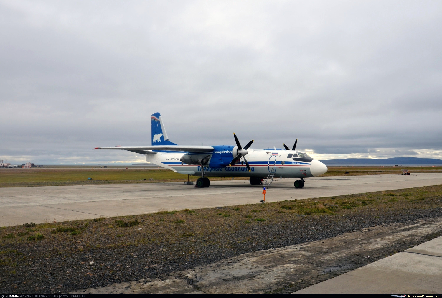
Crash of an Antonov AN-26-100 in Belaya Gora

Date & Time: Oct 11, 2016 at 1638 LT
Type of aircraft:
Operator:
Registration:
RA-26660
Survivors:
Yes
Schedule:
Yakutsk - Belaya Gora
MSN:
8008
YOM:
1979
Flight number:
PI203
Country:
Region:
Crew on board:
6
Crew fatalities:
Pax on board:
27
Pax fatalities:
Other fatalities:
Total fatalities:
0
Captain / Total flying hours:
11439
Captain / Total hours on type:
2697.00
Copilot / Total flying hours:
11142
Copilot / Total hours on type:
122
Aircraft flight hours:
34490
Aircraft flight cycles:
16367
Circumstances:
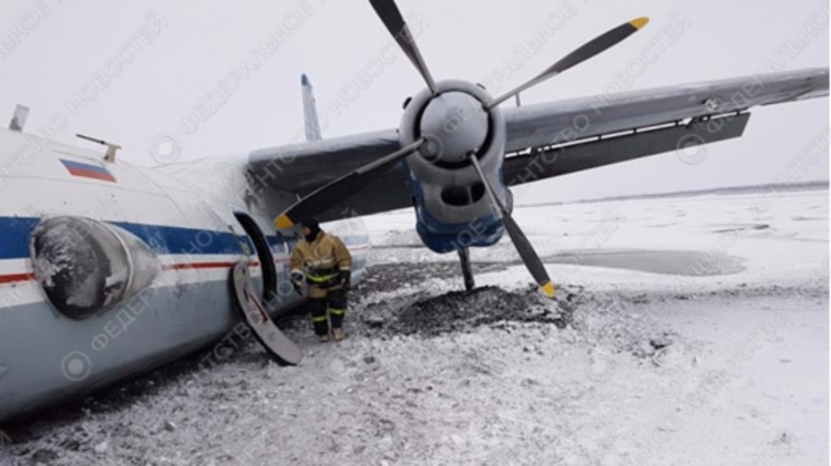
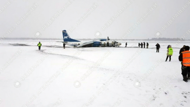
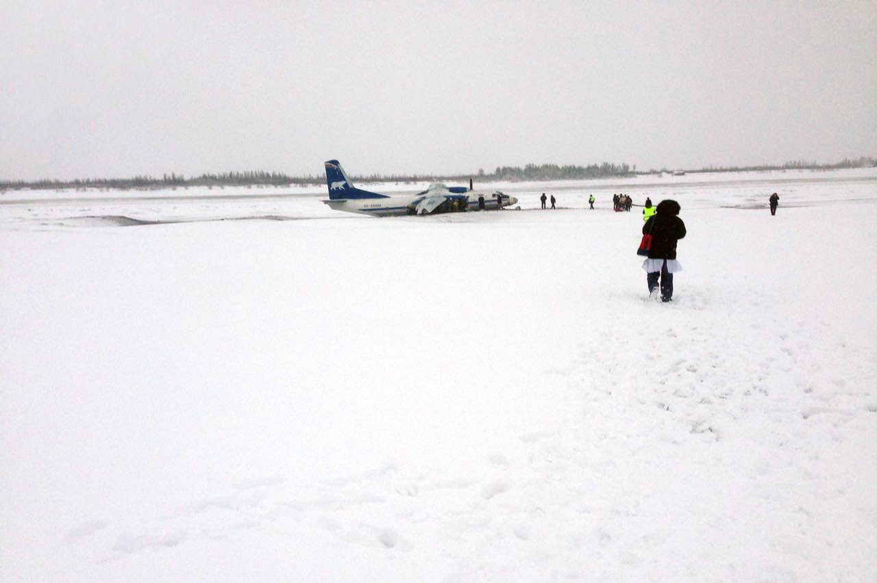
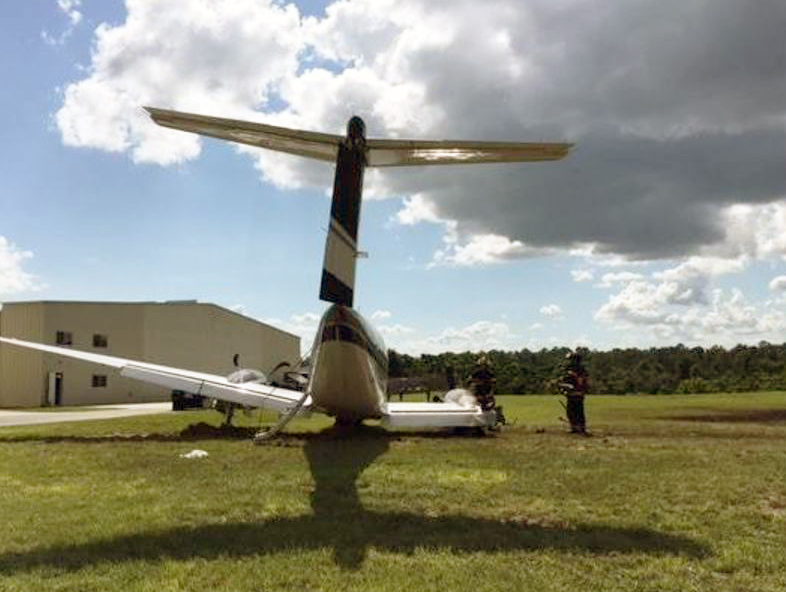
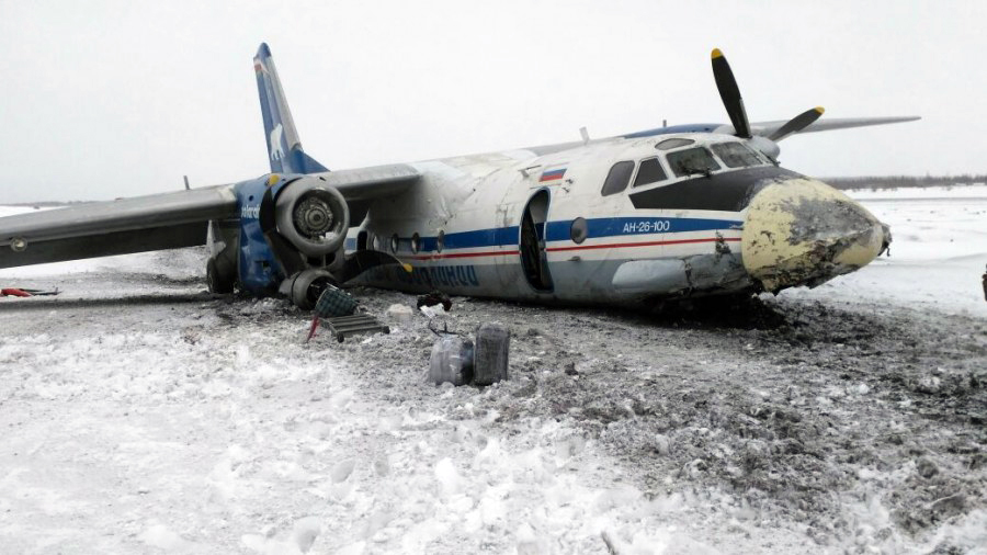
On final approach to Belaya Gora Airport, the aircraft was too low and hit the ground. On impact, the right main gear and the nose gear collapsed. The aircraft slid for several yards before coming to rest in a snow covered field about 400 meters short of runway threshold and 300 meters to the left of the approach path. The propeller on the right engine was torn off and it appears that the fuselage was bent as well. All 33 occupants were evacuated safely. At the time of the accident, weather conditions were marginal with limited visibility caused by snow falls. It was reported the visibility was about 2,5 km at the time of the accident while the crew needed at least 4 km on an NDB approach.
Probable cause:
The accident was caused by the combination of the following factors:
- Absence of standard operating procedures issued by the operator of how to conduct NDB approaches,
- Violation of procedures by tower who only transmitted information about snow fall and recommended to perform a low pass over the runway but did not transmit the actual visibility was 1900 meters below required minimum
- Absence of information that the visibility was below required minimum, the last transmission indicated minimum visibility was present,
- Presence of numerous landmarks (abandoned ships, ship cranes, fuel transshipment complex, ...) covered by snow within 700-1000 meters from the unpaved runway which could be taken as runway markers by flight crew,
- Presence of a number of "bald spots" due to the transitional period of year where the underlying surface became visible making it difficult to visualize and recognize the unpaved runway covered with snow (it was the first flight into Belaya Gora for the crew in the winter season, they had operated into the aerodrome only in summer so far),
- Insufficient use of the available nav aid on final approach which led to lack of proper control of the aircraft position relative to the glide path,
- Lack of possibility for tower to watch the aircraft performing the NDB approach from his work place.
Final Report:
Crash of a De Havilland DHC-2 Beaver I near Laidman Lake: 1 killed

Date & Time: Oct 10, 2016 at 0844 LT
Type of aircraft:
Registration:
C-GEWG
Flight Phase:
Flight Type:
Survivors:
Yes
Schedule:
Vanderhoof - Laidman Lake
MSN:
842
YOM:
1955
Country:
Crew on board:
1
Crew fatalities:
Pax on board:
4
Pax fatalities:
Other fatalities:
Total fatalities:
1
Captain / Total flying hours:
280
Captain / Total hours on type:
23.00
Circumstances:
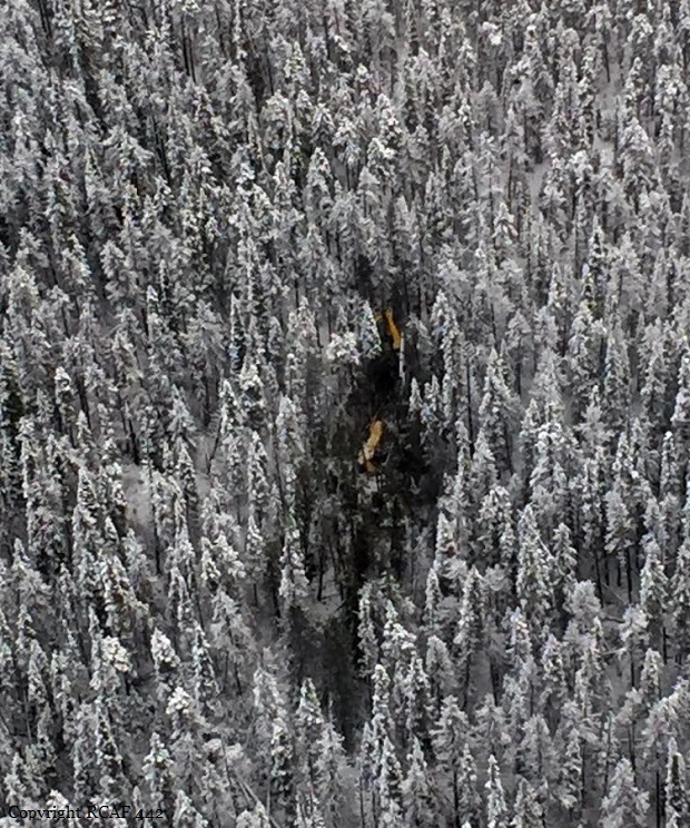
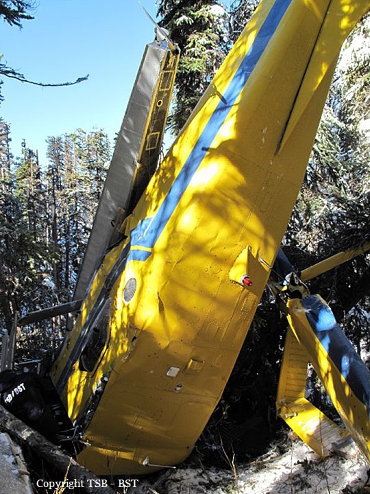
On 10 October 2016, at approximately 0820 Pacific Daylight Time, a privately operated de Havilland DHC-2 Beaver aircraft on amphibious floats (registration C-GEWG, serial number 842), departed from Vanderhoof Airport, British Columbia, for a day visual flight rules flight to Laidman Lake, British Columbia. The pilot and 4 passengers were on board. Approximately 24 minutes into the flight, the aircraft struck terrain about 11 nautical miles east of Laidman Lake. The 406 MHz emergency locator transmitter (ELT) activated on impact. The ELT's distress signal was detected by the Cospas-Sarsat satellite system, and a search-and-rescue operation was initiated by the Joint Rescue Coordination Centre Victoria. One of the passengers was able to call 911 using a cell phone. The pilot was fatally injured, and 2 passengers were seriously injured. The other 2 passengers sustained minor injuries. The aircraft was substantially damaged. There was no post-impact fire.
Probable cause:
Findings as to causes and contributing factors:
1. As the aircraft approached the mountain ridge, the high overcast ceiling and uniform snow-covered vegetation were conducive to optical illusions associated with flight in mountainous terrain. These illusions likely contributed to the pilot’s misjudgment of the proximity of the terrain, inadvertent adoption of an increasingly nose-up attitude, and non-detection of the declining airspeed before banking the aircraft to turn away from the hillside.
2. As the angle of bank increased during the turn, the stall speed also increased and the aircraft entered an accelerated stall.
3. The aircraft’s out-of-limit weight-and-balance condition increased its stall speed and degraded its climb performance, stability, and slow-flight characteristics. As a result, its condition, combined with the aircraft’s low altitude, likely prevented the pilot from regaining control of the aircraft before the collision with the terrain.
4. The absence of a stall warning system deprived the pilot of the last line of defence against an aerodynamic stall and the subsequent loss of control of the aircraft.
5. The forward shifting of the unsecured cargo and the partial detachment of the rear seats during the impact resulted in injuries to the passengers.
6. During the impact sequence, the load imposed on the pilot’s lap-belt attachment points was transferred to the seat-attachment points, which then failed in overload. As a result, the seat moved forward during the impact and the pilot was fatally injured.

Findings as to risk:
1. If pilots do not obtain quality sleep during the rest period prior to flying, there is a risk that they will operate an aircraft while fatigued, which could degrade pilot performance.
2. If cargo is not secured, there is a risk that it will shift forward during an impact or turbulence and injure passengers or crew.

Other findings:
1. Because the aircraft was equipped with a 406 MHz emergency locator transmitter that transmitted an alert message to the Cospas-Sarsat satellites system in combination with the homing signal transmitted on 121.5 MHz, the Joint Rescue Coordination Centre aircraft was able to locate the wreckage and occupants in a timely manner.
Final Report:

Crash of a Cessna T207A Turbo Stationair 8 near Uchuquinua: 3 killed

Date & Time: Oct 9, 2016 at 0900 LT
Operator:
Registration:
OB-1936-P
Flight Phase:
Survivors:
No
Site:
Schedule:
Trujillo - Pucallpa
MSN:
207-0767
YOM:
1984
Country:
Crew on board:
1
Crew fatalities:
Pax on board:
2
Pax fatalities:
Other fatalities:
Total fatalities:
3
Circumstances:
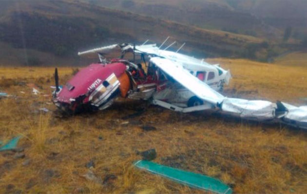
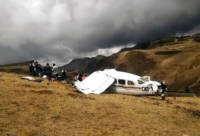
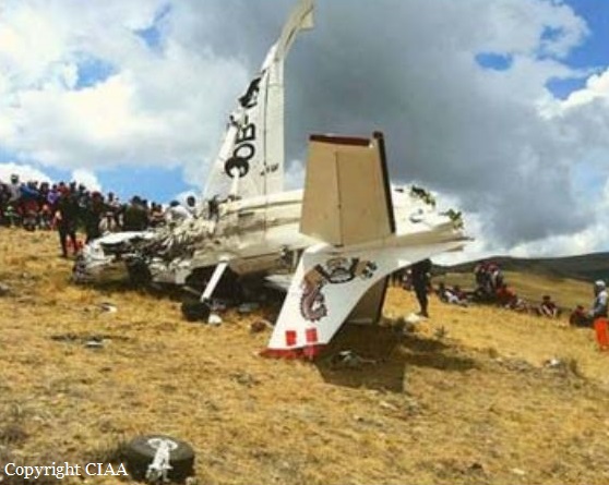
The single engine aircraft was completing a charter flight from Trujillo to Pucallpa, carrying two pilots and pilot. While cruising over the Cajamarca Province, the pilot encountered poor weather conditions with heavy rain falls. He modified his route and was able to continue under VFR mode in good weather conditions. Nevertheless, he continued at an insufficient altitude when the aircraft impacted ground and crashed in a mountainous area. The aircraft was destroyed by impact forces and all three occupants were killed. There was no fire.
Probable cause:
The accident was the consequence of a loss of situational awareness of the pilots, by not making a continuous surveillance during the VFR flight in good weather conditions, not determining timely the corrections of direction or altitude, which finally led them to fail to fly over the ground of the new route adopted in flight, generating a probable aerodynamic loss at the limit of the performance of the aircraft, occurring a CFIT accident.
Contributing factors:
- Limited or poor use of the available GPS Terrain Proximity Warning system.
- Poor or erroneous appreciation of the weather conditions at the beginning of the flight, which led them to vary the route to fly over terrain with higher elevation.
- Limited appreciation of terrain height on the new route in relation to the selected cruising altitude.
Final Report:

Crash of a Cessna 208B Grand Caravan near Togiak: 3 killed

Date & Time: Oct 2, 2016 at 1157 LT
Type of aircraft:
Operator:
Registration:
N208SD
Flight Phase:
Survivors:
No
Site:
Schedule:
Quinhagak – Togiak
MSN:
208B-0491
YOM:
1995
Flight number:
HAG3153
Location:
Crew on board:
2
Crew fatalities:
Pax on board:
1
Pax fatalities:
Other fatalities:
Total fatalities:
3
Captain / Total flying hours:
6481
Captain / Total hours on type:
781.00
Copilot / Total flying hours:
273
Copilot / Total hours on type:
84
Aircraft flight hours:
20562
Circumstances:
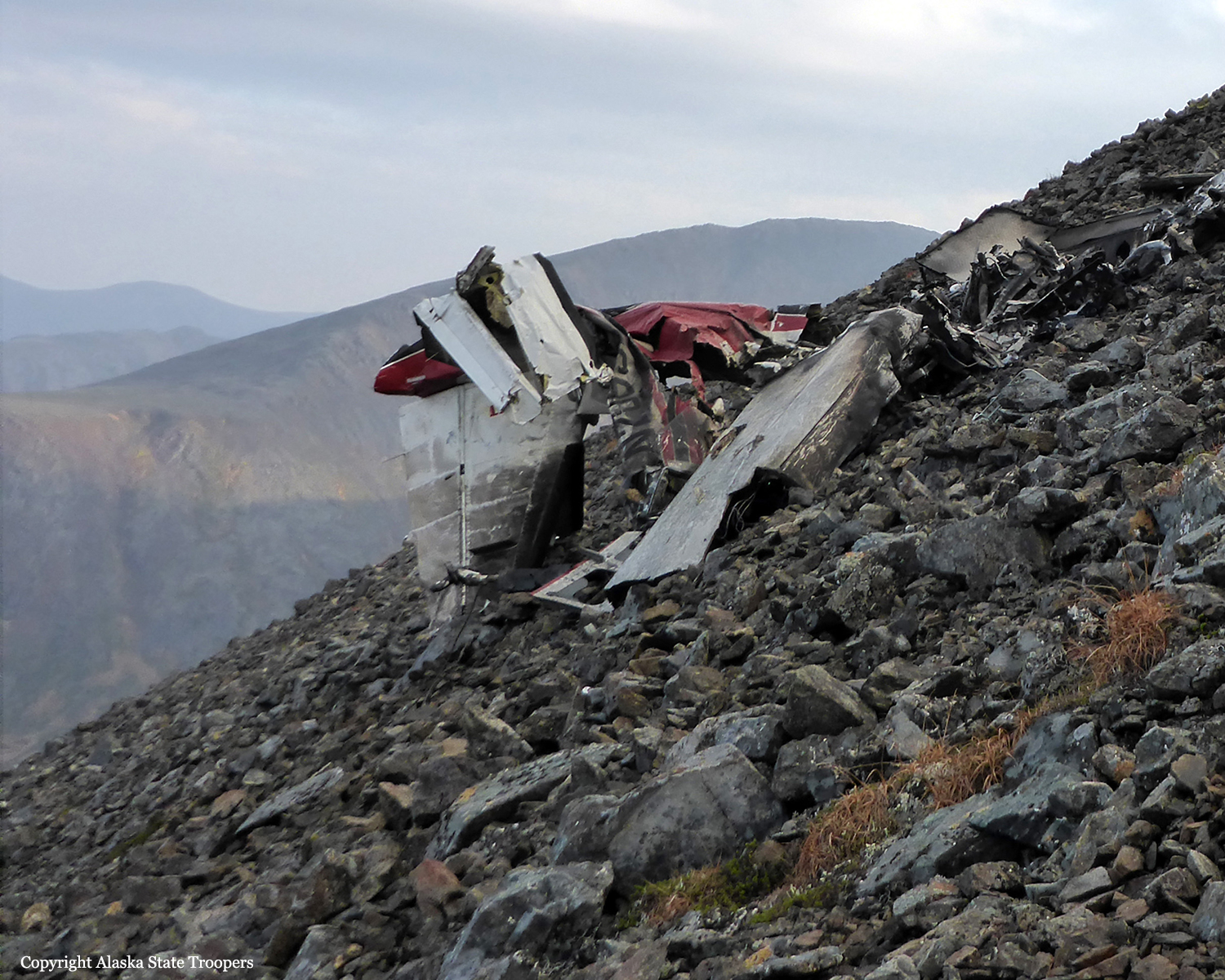
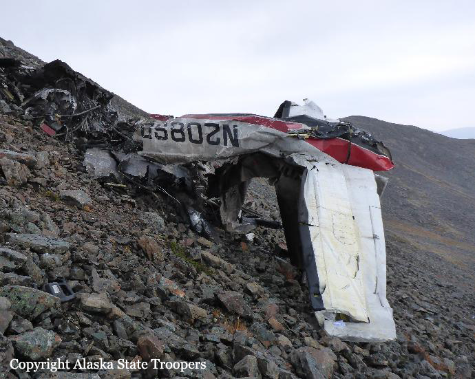
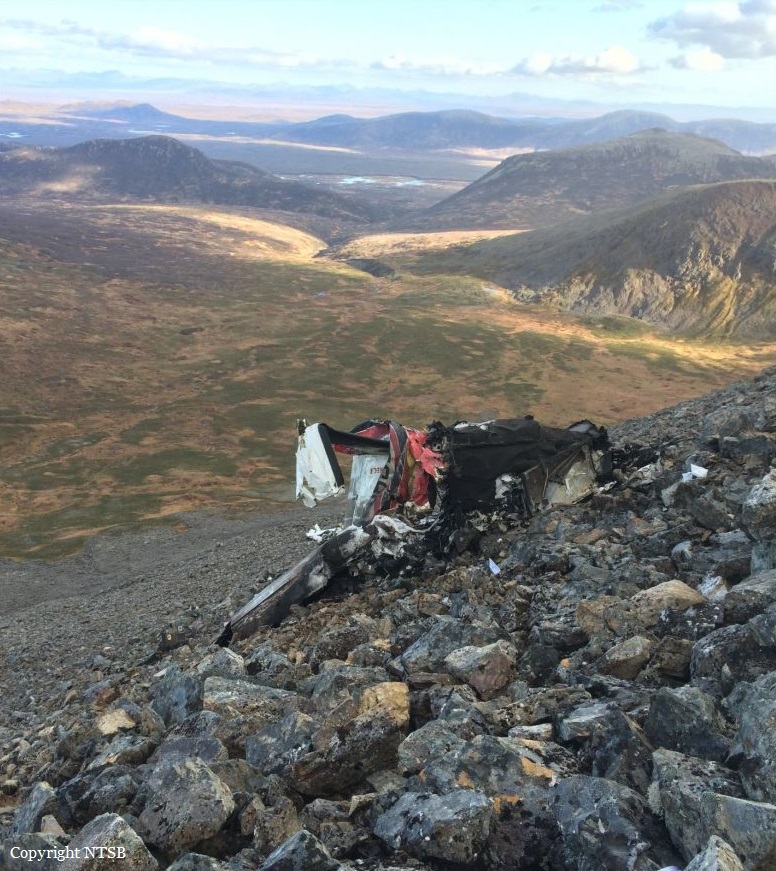
On October 2, 2016, about 1157 Alaska daylight time, Ravn Connect flight 3153, a turbine powered Cessna 208B Grand Caravan airplane, N208SD, collided with steep, mountainous terrain about 10 nautical miles northwest of Togiak Airport (PATG), Togiak, Alaska. The two commercial pilots and the passenger were killed, and the airplane was destroyed. The scheduled commuter flight was operated under visual flight rules by Hageland Aviation Services, Inc., Anchorage, Alaska, under the provisions of Title 14 Code of Federal Regulations Part 135. Visual meteorological conditions prevailed at PATG (which had the closest weather observing station to the accident site), but a second company flight crew (whose flight departed about 2 minutes after the accident airplane and initially followed a similar route) reported that they observed unexpected fog, changing clouds, and the potential for rain along the accident route. Company flight-following procedures were in effect. The flight departed Quinhagak Airport, Quinhagak, Alaska, about 1133 and was en route to PATG.
Probable cause:
The flight crew's decision to continue the visual flight rules flight into deteriorating visibility and their failure to perform an immediate escape maneuver after entry into instrument meteorological conditions, which resulted in controlled flight into terrain (CFIT). Contributing to the accident were:
- Hageland's allowance of routine use of the terrain inhibit switch for inhibiting the terrain awareness and warning system alerts and inadequate guidance for uninhibiting the alerts, which reduced the margin of safety, particularly in deteriorating visibility;
- Hageland's inadequate crew resource management (CRM) training;
- The Federal Aviation Administration's failure to ensure that Hageland's approved CRM training contained all the required elements of Title 14 Code of Federal Regulations 135.330;
- Hageland's CFIT avoidance ground training, which was not tailored to the company's operations and did not address current CFIT-avoidance technologies.
Final Report:

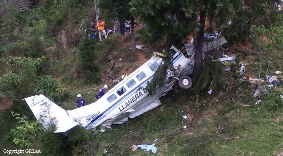
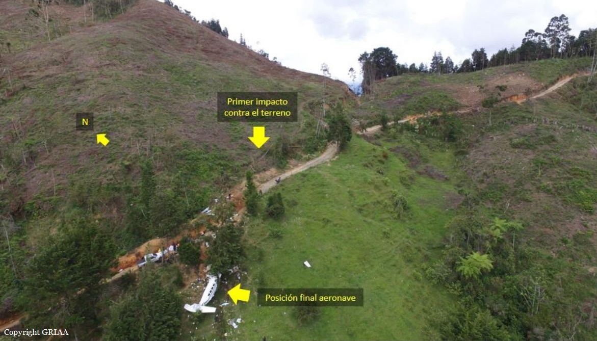
Crash of a Cessna 208B Grand Caravan in San Antonio de Prado: 4 killed

Date & Time: Sep 30, 2016 at 1204 LT
Type of aircraft:
Registration:
HK-3804
Flight Phase:
Survivors:
Yes
Site:
Schedule:
Medellín – Juradó
MSN:
208B-0315
YOM:
1992
Country:
Crew on board:
2
Crew fatalities:
Pax on board:
9
Pax fatalities:
Other fatalities:
Total fatalities:
4
Captain / Total flying hours:
3534
Captain / Total hours on type:
335.00
Copilot / Total flying hours:
6378
Copilot / Total hours on type:
1245
Aircraft flight hours:
2867
Circumstances:
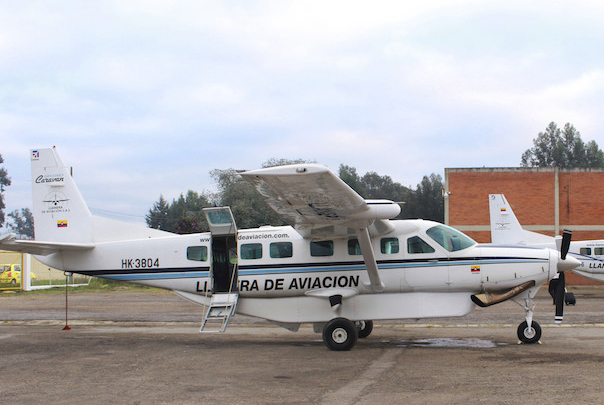
The single engine aircraft departed Medellín-Enrique Olaya Herrera Airport on a charter flight to Juradó, carrying nine passengers and two pilots. Shortly after takeoff, the crew encountered difficulties to gain sufficient altitude and apparently attempted an emergency landing when the aircraft impacted a hill and eventually crashed into trees. The copilot and three passengers were killed and seven others occupants were injured, some seriously. The aircraft was destroyed.
Probable cause:
The following findings were identified:
- Execution of a take-off with a weight approximately 17% higher than the maximum gross operating weight (MTOW) established for the C208B aircraft.
- Limited climb rate with signs of lift loss due to the low performance given by the overweight during the initial climb phase.
- Forced landing in mountainous terrain due to loss of lift caused by overweight during the initial climb.
- Absence in the identification of the risks associated to an overweight operation of the aircraft.
- Lack of supervision by the Aircraft Operator in relation to the dispatch of aircraft operating from the outside at the main base of operation.
Final Report:

Crash of a De Havilland DHC-2 Beaver I off Lopez Island

Date & Time: Sep 30, 2016 at 0837 LT
Type of aircraft:
Operator:
Registration:
N6781L
Survivors:
Yes
Schedule:
Kenmore – Roche Harbor
MSN:
788
YOM:
1955
Crew on board:
1
Crew fatalities:
Pax on board:
3
Pax fatalities:
Other fatalities:
Total fatalities:
0
Captain / Total flying hours:
25000
Captain / Total hours on type:
1630.00
Aircraft flight hours:
7395
Circumstances:
While maneuvering at low altitude for a water landing, the commercial pilot of the float equipped airplane encountered low visibility due to ground fog. The pilot initiated a go-around, but the airplane impacted the water, bounced, and impacted the water a second time before coming to rest upright. The airplane subsequently sank, and all four occupants were later rescued. The pilot reported that there were no mechanical anomalies with the airplane that would have precluded normal operation. The operator further reported that other company pilots who were flying on the day of the accident stated that the low visibility conditions were easily avoided by a slight course deviation.
Probable cause:
The pilot's decision to land in an area of low visibility and ground fog, which resulted in collision with water.
Final Report:

Crash of a Beechcraft B100 King Air in Jackson

Date & Time: Sep 21, 2016 at 1620 LT
Type of aircraft:
Registration:
N66804
Flight Type:
Survivors:
Yes
Schedule:
Memphis – Jackson
MSN:
BE-82
YOM:
1980
Crew on board:
1
Crew fatalities:
Pax on board:
0
Pax fatalities:
Other fatalities:
Total fatalities:
0
Captain / Total flying hours:
11295
Captain / Total hours on type:
570.00
Aircraft flight hours:
4013
Circumstances:
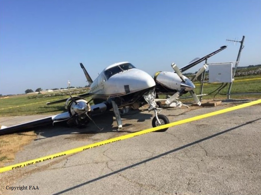
The commercial pilot reported that he had completed several uneventful flights in the multiengine airplane earlier on the day of the accident. He subsequently took off for a return flight to his home airport. He reported that the en route portion of the flight was uneventful, and on final approach for the traffic pattern for landing, all instruments were indicating normal. He stated that the airplane landed "firmly," that the right wing dropped, and that the right engine propeller blades contacted the runway. He pulled back on the yoke, and the airplane became airborne again momentarily before settling back on the runway. The right main landing gear (MLG) collapsed, and the airplane then veered off the right side of the runway and struck a runway sign and weather antenna. Witness reports corroborated the pilot's report. Postaccident examination revealed that the right MLG actuator was fractured and that the landing gear was inside the wheel well, which likely resulted from the hard landing. The pilot reported that there were no preimpact mechanical failures or malfunctions with the airframe or engine that would have precluded normal operation. Based on the pilot and witness statements and the wreckage examination, it is likely that the pilot improperly flared the airplane, which resulted in the hard landing and the collapse of the MLG.
Probable cause:
The pilot's improper landing flare, which resulted in a hard landing.
Final Report:
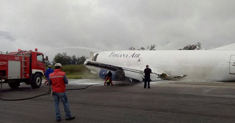
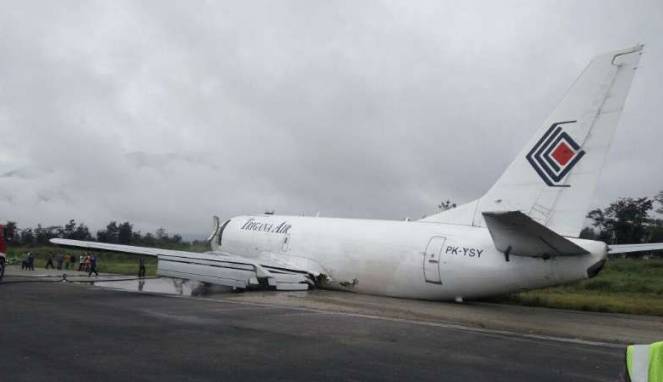
Crash of a Boeing 737-347 in Wamena

Date & Time: Sep 13, 2016 at 0733 LT
Type of aircraft:
Operator:
Registration:
PK-YSY
Flight Type:
Survivors:
Yes
Schedule:
Jayapura – Wamena
MSN:
23597/1287
YOM:
1986
Flight number:
TGN7321
Country:
Region:
Crew on board:
3
Crew fatalities:
Pax on board:
0
Pax fatalities:
Other fatalities:
Total fatalities:
0
Captain / Total flying hours:
23823
Captain / Total hours on type:
9627.00
Copilot / Total flying hours:
650
Copilot / Total hours on type:
480
Aircraft flight hours:
59420
Aircraft flight cycles:
48637
Circumstances:
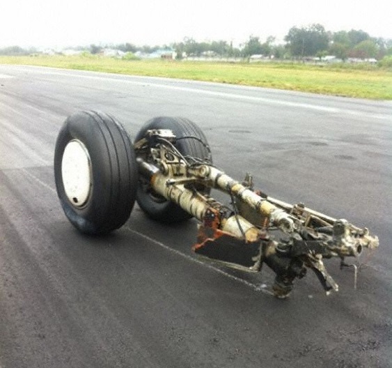
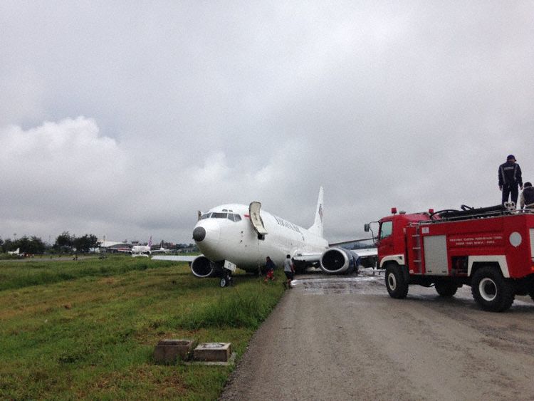
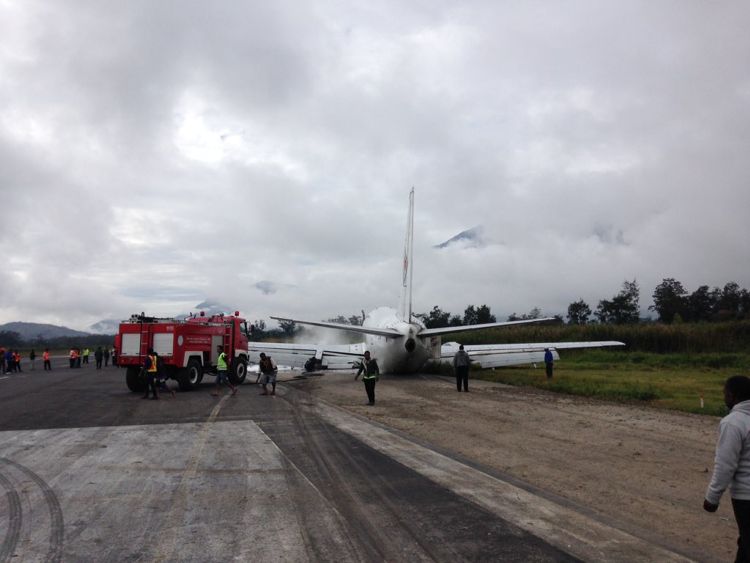
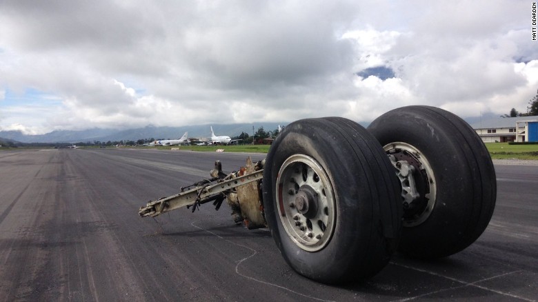
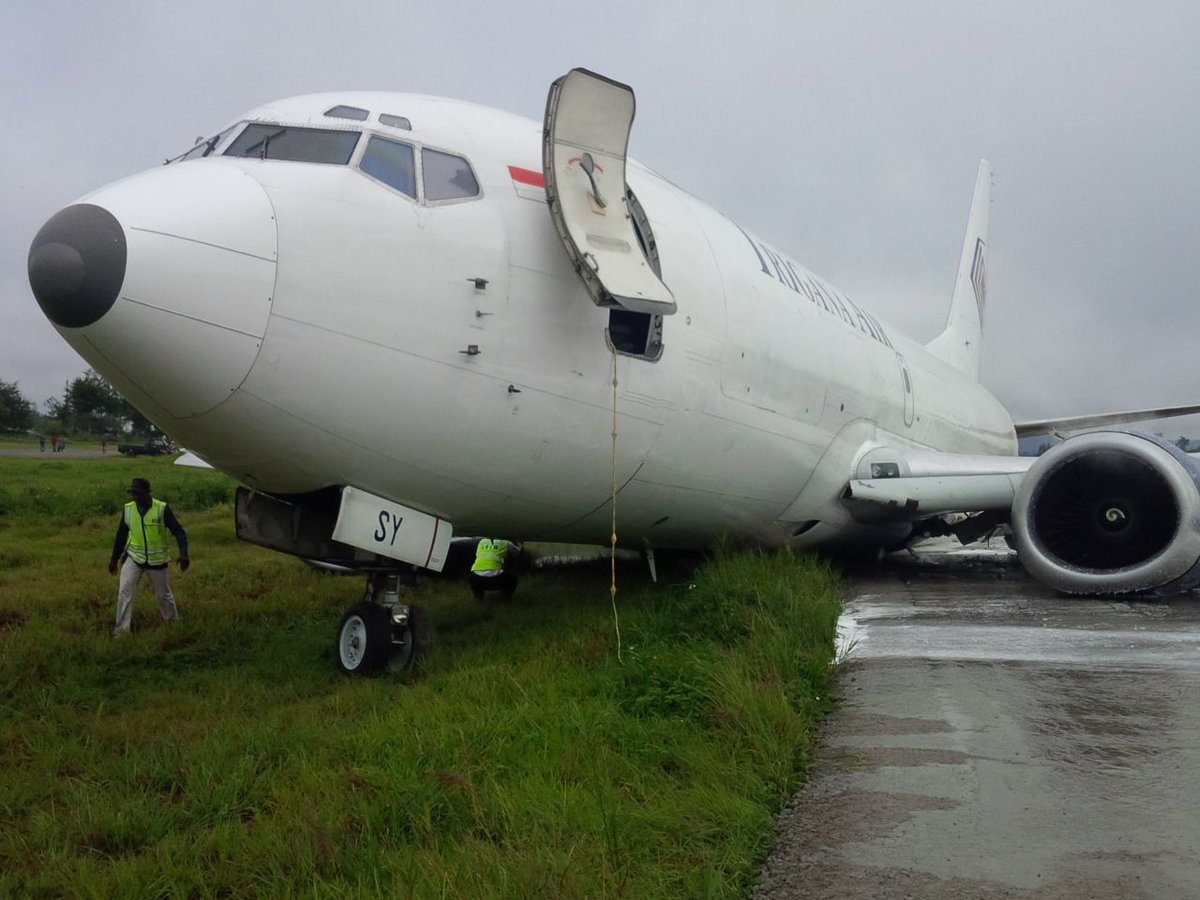
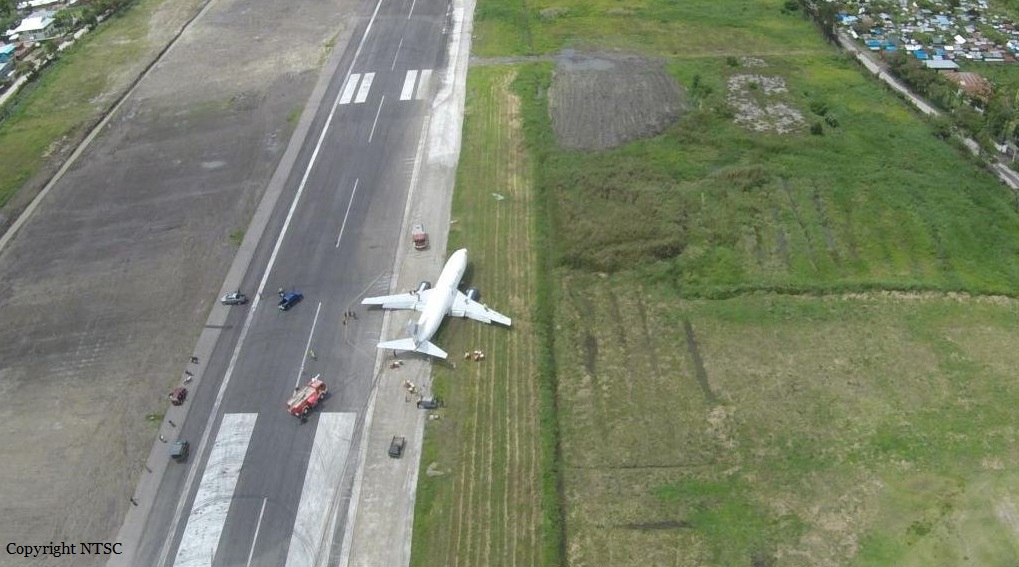
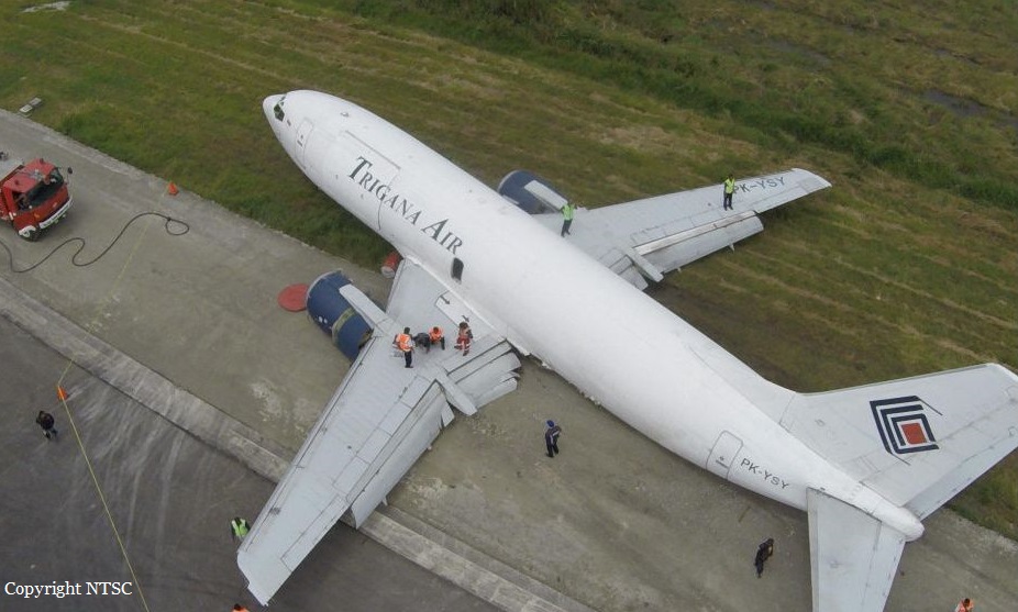
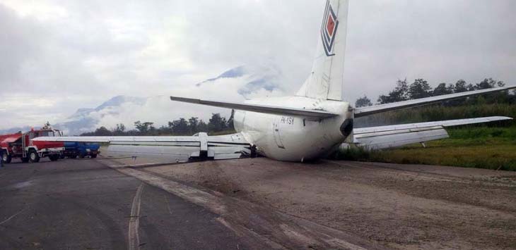
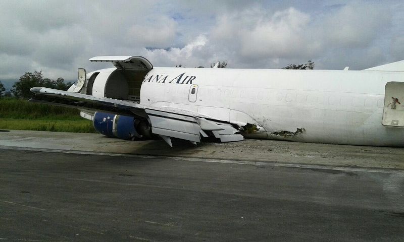
On 13 September 2016, a Boeing 737-300 Freighter, registered PK-YSY was being operated by PT. Trigana Air Service on a scheduled cargo flight from Sentani Airport, Jayapura (WAJJ) to Wamena Airport, Wamena (WAVV), Papua, Indonesia. Approximately 2130 UTC, during the flight preparation, the pilot received weather information which stated that on the right base runway 15 of Wamena Airport, on the area of Mount Pikei, low cloud was observed with the cloud base was increasing from 200 to 1000 feet and the visibility was 3 km. At 2145 UTC, the aircraft departed Sentani Airport with flight number IL 7321 and cruised at altitude 18,000 feet. On board the aircraft was two pilots and one Flight Operation Officer (FOO) acted as loadmaster. The aircraft carried 14,913 kg of cargo. The Pilot in Command (PIC) acted as Pilot Flying (PF) while the Second in Command (SIC) acted as Pilot Monitoring (PM). There was no reported or recorded aircraft system abnormality during the flight until the time of occurrence. After passing point MALIO, the aircraft started to descend. The pilot observed the weather met the criteria of Visual Meteorological Condition (VMC). The pilots able to identify another Trigana flight from Sentani to Wamena in front of them. While passing altitude 13,500 feet, approximately over PASS VALLEY, the Wamena Tower controller instructed the pilot to report position over JIWIKA. When the aircraft position was over point JIWIKA, the Wamena Tower controller informed to the pilot that the flight was on sequence number three for landing and instructed the pilot to make orbit over point X, which located at 8 Nm from runway 15. The pilot made two orbits over Point X to make adequate separation with the aircraft ahead prior to received approach clearance. About 7,000 feet (about 2,000 feet above airport elevation), the pilot could not identify visual checkpoint mount PIKEI and attempted to identify a church which was a check point of right base runway 15. The pilot felt that the aircraft position was on right side of runway centerline. About 6,200 feet (about 1,000 feet above airport elevation), the PF reduced the rate of descend and continued the approach. The PM informed to the PF that runway was not in sight and advised to go around. The PF was confident that the aircraft could be landed safely as the aircraft ahead had landed. Approximately 5,600 feet altitude (about 500 feet above airport elevation) and about 2 Nm from runway threshold the PF was able to see the runway and increased the rate of descend. The pilot noticed that the Enhanced Ground Proximity Warning System (EGPWS) aural warning “SINK RATE” active and the PF reduced the rate of descend. While the aircraft passing threshold, the pilot felt the aircraft sunk and touched down at approximately 125 meters from the beginning runway 15. The Flight Data Recorder recorded the vertical acceleration was 3.25 g on touchdown at 2230 UTC. Both of main landings gear collapsed. The left main landing gear detached and found on runway. The engine and lower fuselage contacted to the runway surface. The aircraft veer to the right and stopped approximately 1,890 meters from the beginning of the runway 15. No one was injured on this occurrence and the aircraft had substantially damage. Both pilots and the load master evacuated the aircraft via the forward left main cargo door used a rope.
Probable cause:
Refer to the previous aircraft that was landed safely, the pilot confidence that a safe landing could be made and disregarding several conditions required for go around.
Final Report:

Crash of a Beechcraft 200 Super King Air in Orlando

Date & Time: Sep 10, 2016 at 1530 LT
Registration:
N369CD
Flight Type:
Survivors:
Yes
Schedule:
Marathon – Orlando
MSN:
BB-110
YOM:
1976
Crew on board:
1
Crew fatalities:
Pax on board:
0
Pax fatalities:
Other fatalities:
Total fatalities:
0
Captain / Total flying hours:
5000
Captain / Total hours on type:
50.00
Aircraft flight hours:
10321
Circumstances:
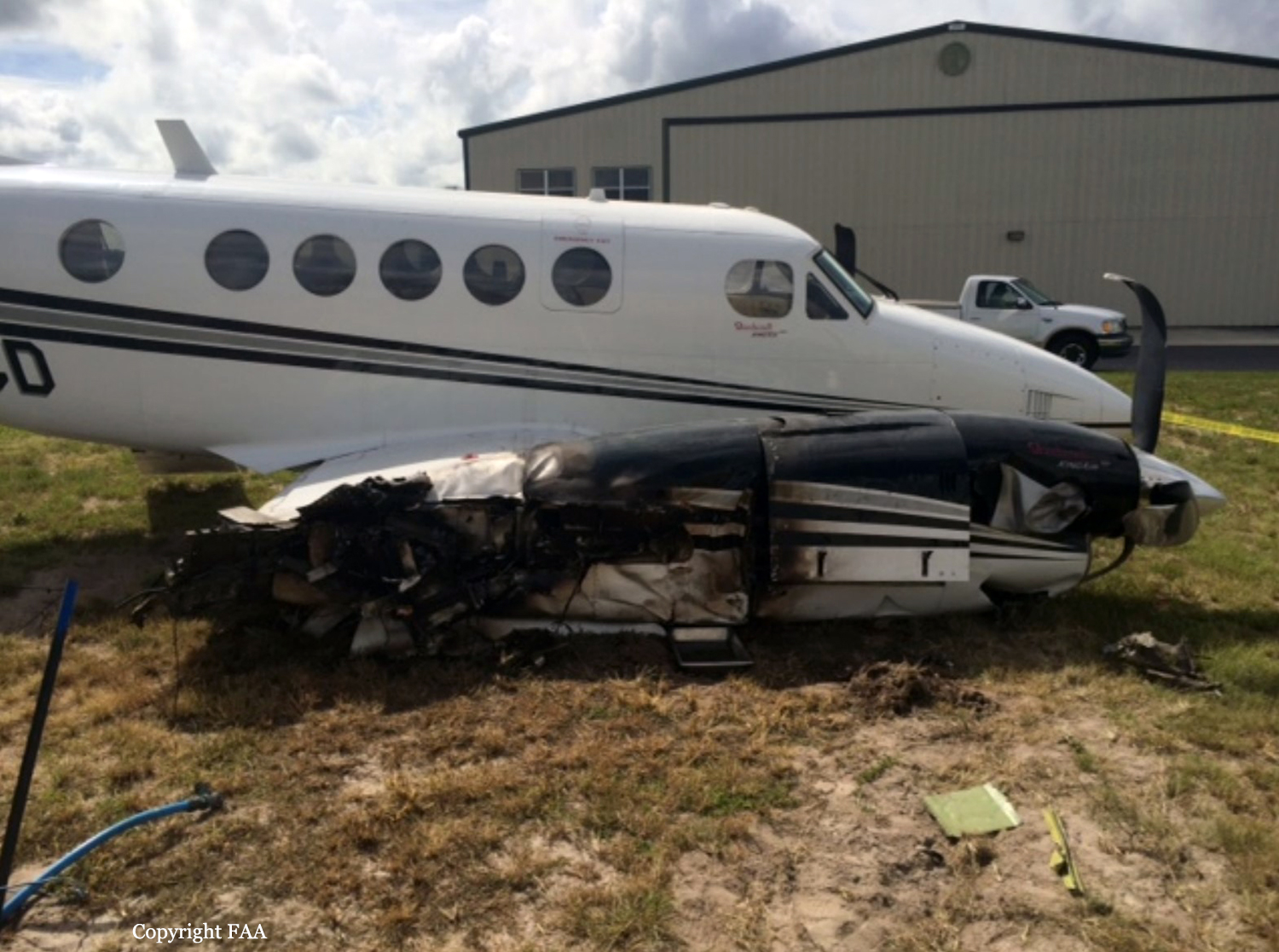
The pilot of a multi-engine turboprop airplane reported that during the landing flare he encountered a crosswind gust, which pushed the airplane to the right of the runway centerline. The pilot further reported that he applied power to abort the landing, but the airplane touched down in the grass to the right of the runway. After the wheels touched down in the grass, he reported that the power added "caught up with the aircraft," but the airplane was rolling toward trees and hangars. Subsequently, the pilot pulled the power to idle, but the right wing impacted a tree and the right main landing gear and nose wheel collapsed. A post-crash fire ensued after the collision and the right wing sustained substantial damage. The pilot reported no preaccident mechanical malfunctions or failures with the airplane that would have precluded normal operation. There was no record of the observed weather at the airport during the accident. An automated weather observing system about 14 nautical miles from the accident airport, near the time of the accident, recorded the wind variable at 5 knots.
Probable cause:
The pilot's failure to maintain directional control during an attempted aborted landing in gusty crosswind conditions, which resulted in a runway excursion and an impact with a tree.
Final Report:
Crash of a Piper PA-46-310P Malibu in Chariton: 1 killed
Date & Time: Sep 7, 2016 at 1219 LT
Registration:
N465JM
Flight Phase:
Flight Type:
Survivors:
No
Schedule:
Olathe - Ankeny
MSN:
46-8408042
YOM:
1984
Location:
Crew on board:
1
Crew fatalities:
Pax on board:
0
Pax fatalities:
Other fatalities:
Total fatalities:
1
Captain / Total flying hours:
242
Captain / Total hours on type:
118.00
Circumstances:
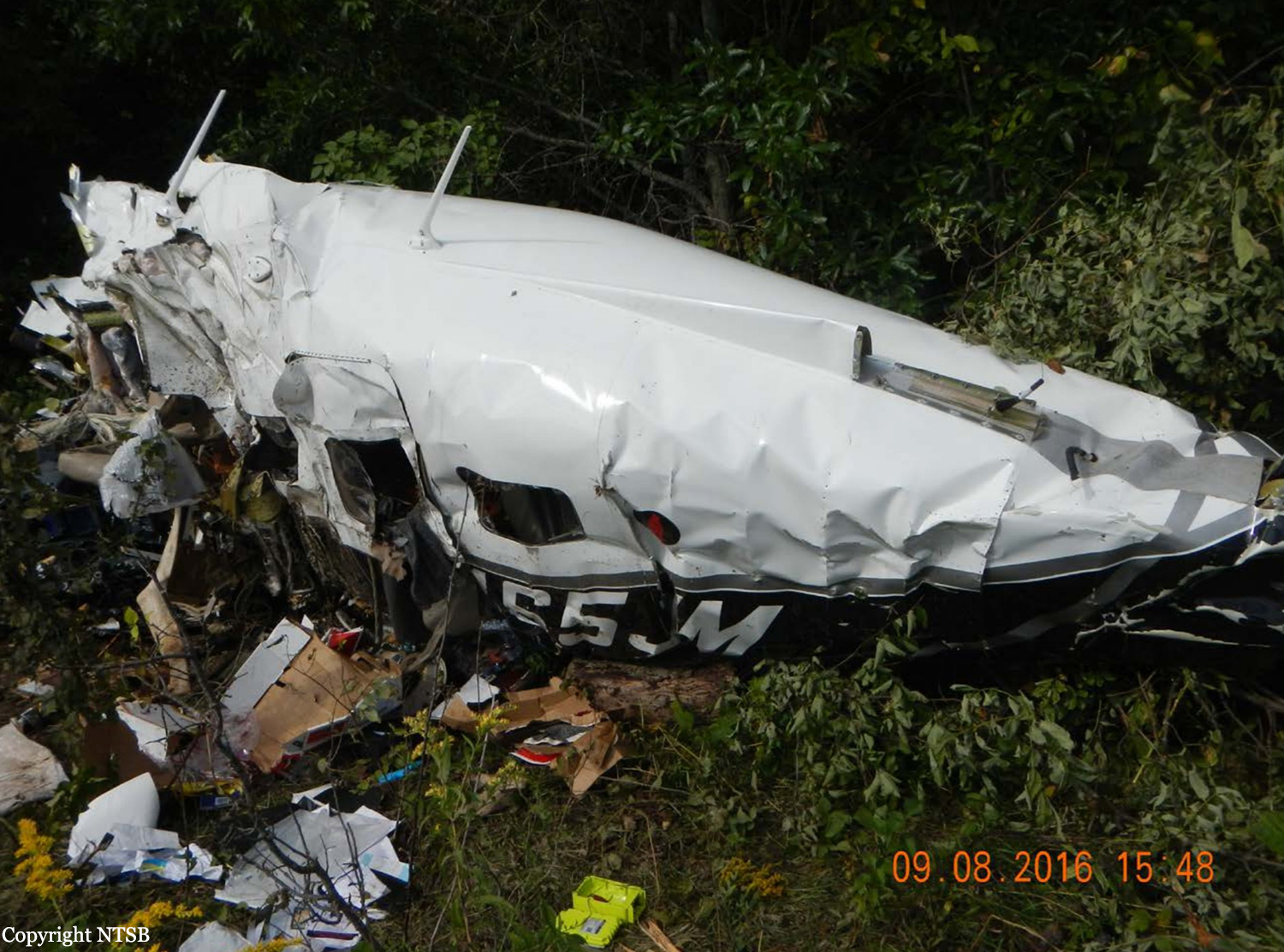
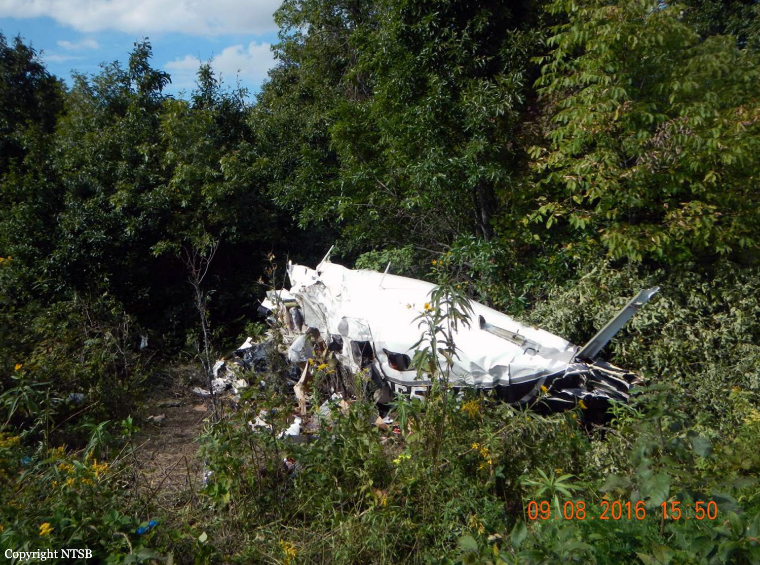
The noninstrument-rated private pilot was conducting a visual flight rules (VFR) cross-country flight while receiving VFR flight following services from air traffic control. Radar data and voice
communication information indicated that the airplane was in cruise flight as the pilot deviated around convective weather near his destination. The controller issued a weather advisory to the pilot concerning areas of moderate to extreme precipitation along his route; the pilot responded that he saw the weather on the airplane's NEXRAD weather display system and planned to deviate around it before resuming course. About 3 minutes later, the pilot stated that he was around the weather and requested to start his descent direct toward his destination. The controller advised the pilot to descend at his discretion. Radar showed the airplane in a descending right turn before radar contact was lost at 2,900 ft mean sea level. There were no eyewitnesses, and search personnel reported rain and thunderstorms in the area about the time of the accident. The distribution of the wreckage was consistent with an in-flight breakup. Examination of the airframe revealed overload failures of the empennage and wings. No pre-impact airframe structural anomalies were found, and the propeller showed evidence of rotation at the time of impact. Further, there was no evidence of pilot impairment or incapacitation. Review of weather information indicated that the pilot most likely encountered instrument meteorological conditions as the airplane descended during the last several minutes of flight. During this time, it is likely that the pilot became disoriented while attempting to maneuver in convective, restricted visibility conditions, and lost control of the airplane. The transition from visual to instrument flight conditions would have been conducive to the development of spatial disorientation; the turning descent before the loss of radar contact and the in-flight breakup are also consistent with a loss of control due to spatial disorientation.
Probable cause:
The non-instrument-rated pilot's loss of control due to spatial disorientation in instrument meteorological conditions, which resulted in an exceedance of the airplane's design stress limitations and a subsequent in-flight breakup. Contributing to the accident was the pilot's decision to continue visual flight into convective instrument meteorological conditions.
Final Report: