Crash of a Boeing 737-85C in Manila

Date & Time: Aug 16, 2018 at 2355 LT
Type of aircraft:
Operator:
Registration:
B-5498
Survivors:
Yes
Schedule:
Xiamen – Manila
MSN:
37574/3160
YOM:
2010
Flight number:
MF8667
Country:
Region:
Crew on board:
8
Crew fatalities:
Pax on board:
157
Pax fatalities:
Other fatalities:
Total fatalities:
0
Circumstances:
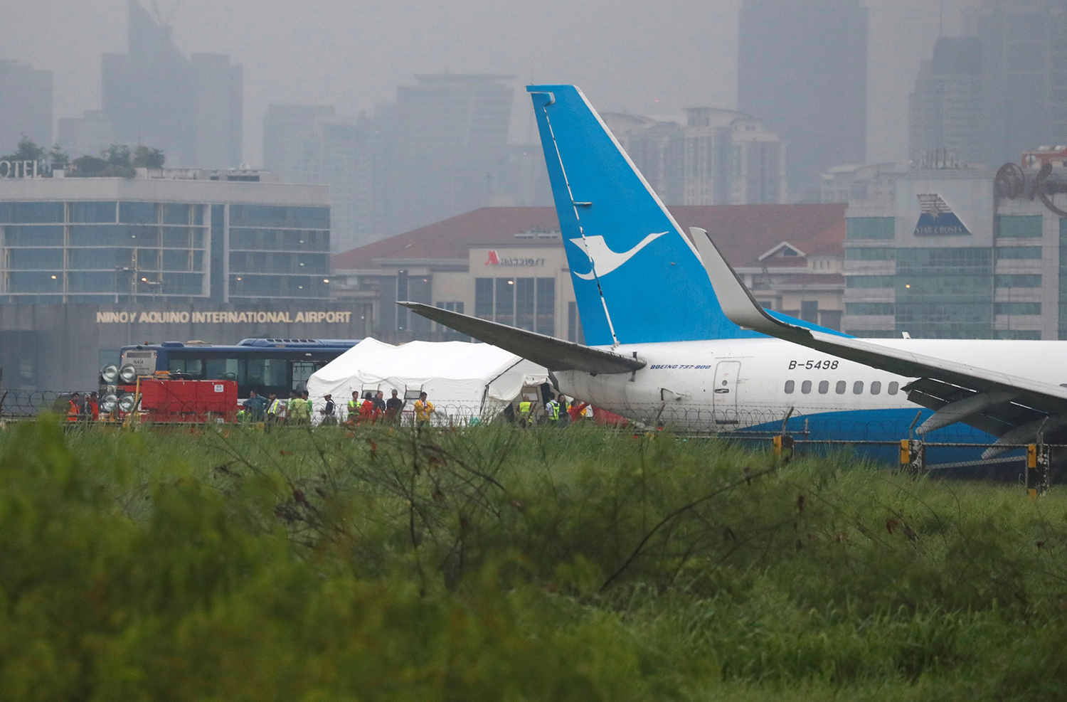
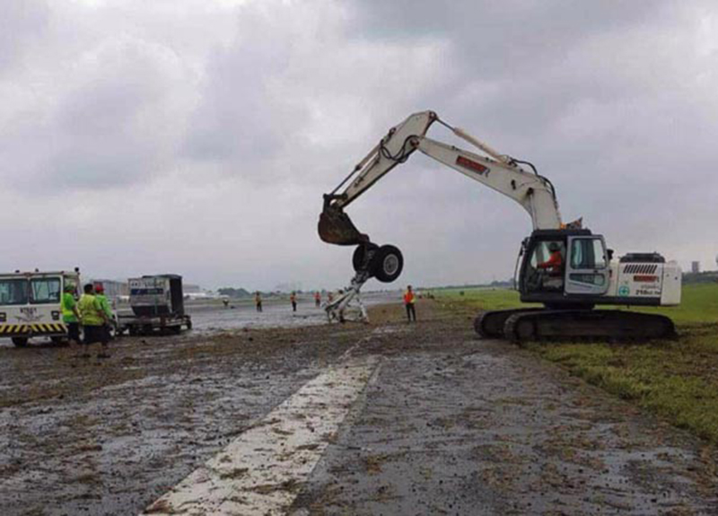
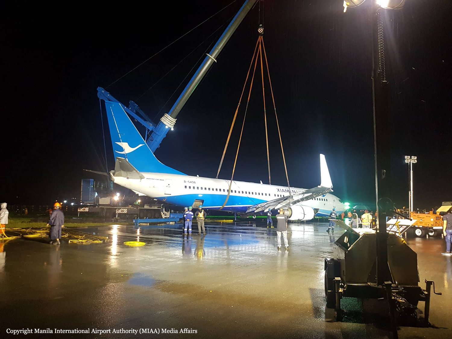
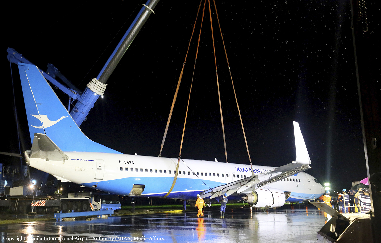
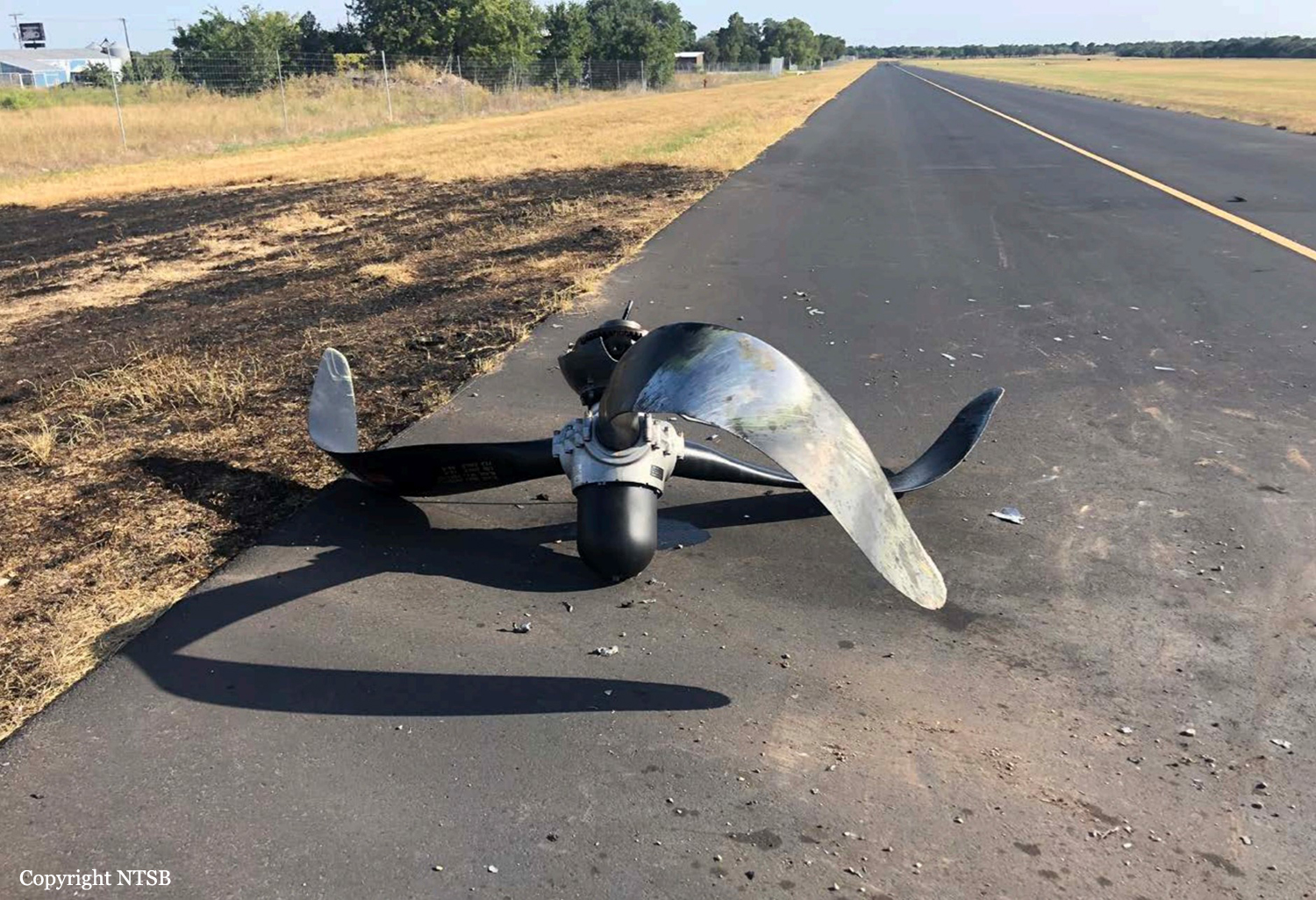
On August 16, 2018, about 1555UTC/2355H local time, a Boeing 737-800 type of aircraft with Registry No. B-5498 operating as flight CXA 8667 sustained substantial damage following a runway excursion after second approach while landing on Runway 24 of Ninoy Aquino International Airport (NAIA), Manila, Philippines. The flight was a scheduled commercial passenger from Xiamen, China and operated by Xiamen Airlines. The one hundred fifty-seven (157) passengers and two (2) pilots together with the five (5) cabin crew and one air security officer did not sustain any injuries while the aircraft was substantially damaged. An instrument flight rules flight plan was filed. Instrument Meteorological Conditions (IMC) prevailed at the time of the accident. During the first approach, the Captain who was the pilot flying aborted the landing at 30 feet Radio Altitude (RA) due to insufficient visual reference. A second approach was considered and carried out after briefing the First Officer (FO) of the possibility of another aborted landing should the flight encounter similar conditions. The briefing included a diversion to their planned alternate airfield. The flight was “stabilized” on the second approach with flaps set at 30 degrees landing position, all landing gears extended and speed brake lever appropriately set in the ARM position. On passing 1,002 feet Radio Altitude (RA), the autopilot was disengaged; followed by the disengagement of the auto-throttle, three (3) seconds later. The ILS localizer lateral path and Glide slope vertical path were accurately tracked and no deviations were recorded. The “reference” landing speed for flaps 30 for the expected aircraft gross weight at the time of landing was 145 knots and a target speed of 150 knots was set on the Mode Control Panel (MCP). The vertical descent rate recorded during the approach was commensurate with the recommended descent rate for the profile angle and ground speed; and was maintained throughout the approach passing through the Decision Altitude (DA) of 375 feet down to 50 feet radio altitude (RA). As the aircraft passed over the threshold, the localizer deviation was established around zero dot but indicated the airplane began to drift to the left of the centerline followed by the First Officer (FO) making a call out of “Go-Around” but was answered by the Captain “No”. The throttle levers for both engines were started to be reduced to idle position at 30 feet RA and became fully idle while passing five (5) feet RA. At this point, the aircraft was in de-crab position prior to flare. At 13 feet RA, the aircraft was rolling left and continuously drifting left of the runway center line. At 10 feet RA another call for go-around was made by the FO but was again answered by the Captain with “No” and “It’s Okay”. At this point, computed airspeed was approximately 6 knots above MCP selected speed and RA was approaching zero feet. Just prior to touchdown, computed airspeed decreased by 4 knots and the airplane touched down at 151 knots (VREF+6). The wind was recorded at 274.7 degrees at 8.5 knots. Data from the aircraft’s flight data recorder showed that the aircraft touched down almost on both main gears, to the left of the runway centerline, about 741 meters from the threshold of runway 24. Deployment of the speed brakes was recorded and auto brakes engagement was also recorded. The auto brakes subsequently disengaged but the cause was undetermined. Upon touchdown, the aircraft continued on its left-wards trajectory while the aircraft heading was held almost constant at 241 degrees. After the aircraft departed the left edge of the runway, all landing gears collided with several concrete electric junction boxes that were erected parallel outside the confines of the runway pavement. The aircraft was travelling at about 147 knots as it exited the paved surface of the runway and came to rest at approximately 1,500 meters from the threshold of Runway 24, with a geographical position of 14°30’23.7” N; 121°0’59.1” E and a heading of 120 degrees. Throughout the above sequence of events from touchdown until the aircraft came to a full stop, the CVR recorded 2 more calls of “GO-AROUND” made by the FO. Throughout the landing sequence, the thrust reversers for both engines were not deployed. Throttle Lever Position (TLP) were recorded and there was no evidence of reverse thrust being selected or deployment of reversers. After the aircraft came to a complete stop, the pilots carried out all memory items and the refence items in the evacuation non-normal checklist, which includes extending the flaps to a 40 degrees position. The aircraft suffered total loss of communication and a failure in passenger address system possibly due to the damage caused by the nose gear collapsing rearwards and damaging the equipment in the E/E compartment or the E-buss wires connecting the Very High Frequency (VHF) 1 radio directly to the battery was broken. The Captain then directed the FO to go out of the cockpit to announce the emergency evacuation. The cabin crew started the evacuation of the passengers utilizing the emergency slides of the left and right forward doors. There were no reported injuries sustained by the passengers, cabin crew, flight crew or the security officer.
Probable cause:
Primary causal factors:
a. The decision of the Captain to continue the landing on un-stabilized approach and insufficient visual reference.
- The Captain failed to maintain a stabilized landing approach moments before touchdown, the aircraft was rolling left and continuously drifting left of the runway centerline.
- The Captain failed to identify correctly the aircraft position and status due to insufficient visual reference caused by precipitation.
b. The Captain failed to apply sound CRM practices.
- The Captain did not heed to the First Officer call for a Go-Around.
Contributory factors:
a. Failure to apply appropriate TEM strategies. Failure of the Flight Crew to discuss and apply appropriate Threat and Error Management (TEM) strategies for the following:
- Inclement weather.
- Cross wind conditions during approach to land.
- Possibility of low-level wind shear.
- NOTAM information on unserviceable runway lights.
b. Inadequate Company Policy on Go-Around:
- Company’s Standard Operation Procedures were less than adequate in terms of providing guidance to the flight crew for call out of "Go-Around" during landing phase of the flight.
c. Runway strip inconsistent with CAAP MOS for Aerodrome and ICAO Annex 14:
- The uneven surface and concrete obstacles contributed to the damage sustained by the aircraft.
Final Report:

Crash of a Cessna 525 CitationJet CJ1 in Payson: 1 killed

Date & Time: Aug 13, 2018 at 0230 LT
Type of aircraft:
Operator:
Registration:
N526CP
Flight Phase:
Flight Type:
Survivors:
No
Site:
MSN:
525-0099
YOM:
1995
Location:
Crew on board:
1
Crew fatalities:
Pax on board:
0
Pax fatalities:
Other fatalities:
Total fatalities:
1
Captain / Total flying hours:
4000
Circumstances:
Owned by a construction company and registered under Vancon Holdings LLC (VanCon Inc.), the aircraft was parked at Spanish Fork-Springville Airport when it was stolen at night by a private pilot. After takeoff, hew flew southbound to Payson, reduced his altitude and voluntarily crashed the plane onto his house located in Payson. The airplane disintegrated on impact and was destroyed by impact forces and a post crash fire. The pilot was killed. His wife and daughter who were in the house at the time of the accident were uninjured despite the house was also destroyed by fire. Local Police declared that the pilot intentionally flew the airplane into his own home hours after being booked for domestic assault charges. An examination of the airplane found no anomalies with the flight controls that would have contributed to the accident. Toxicology testing revealed the presence of a medication used to treat depression, obsessive-compulsive disorder, some eating disorders, and panic attacks; the pilot did not report the use of this medication to the Federal Aviation Administration. The pilot had a known history of depression, anxiety, and anger management issues. The circumstances of the accident were consistent with the pilot's intentional flight into his home.
Probable cause:
The pilot's intentional flight into his residence.
Final Report:

Crash of a Pacific Aerospace PAC 750XL near Oksibil: 8 killed

Date & Time: Aug 11, 2018 at 1420 LT
Operator:
Registration:
PK-HVQ
Survivors:
Yes
Site:
Schedule:
Tanah Merah – Oksibil
MSN:
144
YOM:
2009
Country:
Region:
Crew on board:
2
Crew fatalities:
Pax on board:
7
Pax fatalities:
Other fatalities:
Total fatalities:
8
Captain / Total flying hours:
13665
Captain / Total hours on type:
1468.00
Aircraft flight hours:
4574
Aircraft flight cycles:
5227
Circumstances:
On 11 August 2018, a PAC 750XL aircraft registered PK-HVQ was being operated by PT. Marta Buana Abadi (Dimonim Air) on unscheduled passenger flight from Tanah Merah to Oksibil. At the day of the occurrence the meteorological condition at Oksibil was below the requirement of Visual Flight Rule (VFR) weather minima and did not improve. Being aware that some flights had performed flight to Tanah Merah to Oksibil and returned, the pilot decided to fly to Oksibil. At 1342 LT, on daylight condition the PK-HVQ aircraft departed from Tanah Merah to Oksibil, on board the aircraft were one pilot, one observer pilot and 7 passengers. According to the passenger and cargo manifest, the total weight of passenger and the baggage were 473 kg. Prior to the departure, there was no record or report of aircraft system malfunction. At 1411 LT, the PK-HVQ pilot made initial contact to Oksibil Tower controller and reported that the aircraft was maintaining altitude of 7,000 feet over and the estimate time arrival at Oksibil would be 0520 UTC (1420 LT). The Oksibil Tower controller advised the pilot of the latest meteorological condition that the visibility was 1 up to 2 km and most of the area were covered by cloud. At 1416 LT, the pilot reported that the aircraft position was over Oksibil Aiport and the Oksibil Tower controller instructed the pilot to continue the flight to the final runway 11 and to report when the runway had in sight. The Oksibil Tower controller and pilots of other aircraft called the pilot but no reply. On the following day, the aircraft was found on a ridge of mountain about 3.8 Nm north west of Oksibil on bearing 331° with elevation about 6,800 feet. Eight occupants were fatally injured and one occupant was seriously injured.
Probable cause:
The KNKT concluded the contributing factors as follows:
- The VFR weather minimum requirement that was not implemented properly most likely had made the pilot did not have a clear visual to the surrounding area.
- Considering that the Pilot in Command (PIC) had lack knowledge of the terrain surrounding the Oksibil area, and the absence of voice alert from the TAWS when the aircraft flying close to terrain, resulted in the PIC did not have adequate awareness to the surrounding terrain while flying into clouds and continued to fly below the terrain height until the aircraft impacted the terrain.
Final Report:

Crash of a De Havilland Dash-8-400 on Ketron Island: 1 killed

Date & Time: Aug 10, 2018 at 2043 LT
Operator:
Registration:
N449QX
Flight Phase:
Flight Type:
Survivors:
No
MSN:
4410
YOM:
2012
Crew on board:
1
Crew fatalities:
Pax on board:
0
Pax fatalities:
Other fatalities:
Total fatalities:
1
Circumstances:
On August 10, 2018, about 2043 Pacific daylight time, a De Havilland DHC-8-402, N449QX, was destroyed when it impacted trees on Ketron Island, near Steilacoom, WA. The noncertificated pilot was fatally injured. The airplane was registered to Horizon Air Industries, Inc,. and was being operated by the noncertificated pilot as an unauthorized flight. Visual meteorological conditions prevailed in the area at the time of the event, and no flight plan was filed. The airplane departed from the Seattle-Tacoma International Airport, Seattle, Washington, about 1932. Horizon Air personnel reported that the noncertificated pilot was employed as a ground service agent and had access to the airplanes on the ramp. The investigation of this event is being conducted under the jurisdiction of the Federal Bureau of Investigation (FBI). The NTSB provided requested technical assistance to the FBI, and any material generated by the NTSB is under the control of the FBI. The NTSB does not plan to issue an investigative report or open a public docket.
Probable cause:
The NTSB did not determine the probable cause of this event and does not plan to issue an investigative report or open a public docket. The investigation of this event is being conducted under the jurisdiction of the Federal Bureau of Investigation.
Final Report:

Crash of a Cessna 414 Chancellor in Santa Ana: 5 killed

Date & Time: Aug 5, 2018 at 1229 LT
Type of aircraft:
Registration:
N727RP
Flight Type:
Survivors:
No
Site:
Schedule:
Concord – Santa Ana
MSN:
414-0385
YOM:
1973
Crew on board:
1
Crew fatalities:
Pax on board:
4
Pax fatalities:
Other fatalities:
Total fatalities:
5
Captain / Total flying hours:
980
Captain / Total hours on type:
120.00
Aircraft flight hours:
3963
Circumstances:
The pilot and four passengers were nearing the completion of a cross-county business flight. While maneuvering in the traffic pattern at the destination airport, the controller asked the pilot if he could accept a shorter runway. The pilot said he could not, so he was instructed to enter a holding pattern for sequencing; less than a minute later, the pilot said he could accept the shorter runway. He was instructed to conduct a left 270° turn to enter the traffic pattern. The pilot initiated a left bank turn and then several seconds later the bank increased, and the airplane subsequently entered a steep nose-down descent. The airplane impacted a shopping center parking lot about 1.6 miles from the destination airport. A review of the airplane's flight data revealed that, shortly after entering the left turn, and as the airplane’s bank increased, its airspeed decreased to about 59 knots, which was well below the manufacturer’s published stall speed in any configuration. Postaccident examination of the airframe and engines revealed no anomalies that would have precluded normal operation. It is likely that the pilot failed to maintain airspeed during the turn, which resulted in an exceedance of the aircraft's critical angle of attack and an aerodynamic stall.
Probable cause:
The pilot’s failure to maintain adequate airspeed while maneuvering in the traffic pattern which resulted in an aerodynamic stall and subsequent spin at a low altitude, which the pilot was unable to recover from.
Final Report:

Crash of a Junkers JU.52/3mg4e in Piz Segnas: 20 killed

Date & Time: Aug 4, 2018 at 1657 LT
Type of aircraft:
Operator:
Registration:
HB-HOT
Flight Phase:
Survivors:
No
Site:
Schedule:
Locarno - Dübendorf
MSN:
6595
YOM:
1939
Country:
Region:
Crew on board:
3
Crew fatalities:
Pax on board:
17
Pax fatalities:
Other fatalities:
Total fatalities:
20
Captain / Total flying hours:
20714
Captain / Total hours on type:
297.00
Copilot / Total flying hours:
19751
Copilot / Total hours on type:
945
Aircraft flight hours:
10189
Circumstances:
At 16:14 on 4 August 2018, the historic Junkers Ju 52/3m g4e commercial aircraft, registered as HB-HOT and operated by Ju-Air, took off from Locarno Aerodrome (LSZL) for a commercial VFR flight to Dübendorf (LSMD). On this flight, pilot A was sitting in the left-hand seat in the cockpit and piloting the aircraft as the commander, while pilot B was assisting him as the co-pilot sitting on the right. Following take-off from concrete runway 26R westwards and a 180-degree turn over Lake Maggiore, the flight led into the Blenio valley via Bellinzona and Biasca. HB-HOT steadily gained altitude in the process. North of Olivone, the aircraft turned into the valley of the Lago di Luzzone reservoir and thus into the Adula/Greina/Medels/Vals countryside preservation quiet zone. This zone was crossed at between 120 and 300 m above ground and at times with a minimal lateral separation from the terrain. At 16:45, as the aircraft was flying over Alp Nadels, the ISP sent a text message to a friend in Ruschein (municipality of Ilanz) to say that the Ju 52 was approaching the area. The flight subsequently continued eastwards into the Surselva region at approximately 2,500 m AMSL. At 16:51, the aircraft crossed the Vorderrhein valley in the region of Ilanz on a north-easterly heading and initially made a relatively tight left turn, taking it over Ruschein. The flight path then led generally northwards past the Crap Sogn Gion mountain and towards the basin south-west of Piz Segnas. At first, the aircraft approached this basin on the left-hand, western side of the valley. HB-HOT was climbing at this time, and reached an altitude of 2,833 m AMSL in the Nagens region. The aircraft made a slight right turn when flying past the Berghaus Nagens lodge (see figure 2). During this phase, at 16:55, one of the pilots informed the passengers of the scenery over the speakers in the cabin and through the passengers’ personal headphones. To start with, the aircraft was flying at a ground speed of 165 km/h during this phase. By point F2, the ground speed had decreased to 135 km/h, and roughly remained so until shortly before point F3. Towards point F3, the aircraft’s altitude dropped slightly and the ground speed briefly increased by around 65 km/h to approximately 200 km/h. During this time, its pitch attitude3 was 5 to 7 degrees. Towards the end of this phase, just before point F4, the flight path angle4 changed from -3 degrees to approximately -1 degree and the speed of each of the three engines decreased steadily by approximately 20 revolutions per minute (rpm). At point F4, the aircraft was at an altitude of 2,742 m AMSL. At 16:56:02, shortly after point F4, the speed of each of the three engines increased by approximately 40 rpm. At 16:56:09, HB-HOT entered the basin southwest of Piz Segnas at an altitude of 2,755 m AMSL (point F5, see also figure 14) and was therefore approximately 130 m above the elevation of the Segnes pass. The flight crew then navigated the aircraft on a north-north-easterly heading almost in the centre of the valley. HB-HOT climbed slightly during this phase and its flight path angle was approximately 2 degrees; its pitch angle remained at 5 to 7 degrees. At 16:56:17, the aircraft reached an altitude of 2,767 m AMSL at point F7 and was therefore approximately 140 m above the elevation of the Segnes pass. HB-HOT flew past the Tschingelhörner mountain peaks and began to reduce in altitude, dropping more than 15 m in approximately 6 seconds. During this phase, the power of the engines was rapidly reduced by 30 to 50 rpm, which meant that the engines were increasingly running at a similar speed5 . During this process, the pitch angle increased and the flight path angle continuously became more negative. When the aircraft was approximately abeam the Martinsloch and at an altitude of approximately 2,766 m AMSL (point F8), the flight crew initiated a right turn during their descent and then made a left turn (point F109, see figure 5). The ground speed was approximately 170 km/h and the difference between the aircraft’s pitch and flight path angles increased to approximately 15 degrees during the right turn. When transitioning into the left turn (between points F9 and F10), the pitch angle was approximately 11 degrees and the flight path angle was around -10 degrees. At this time, the aircraft was flying at approximately 125 m above the elevation of the Segnes pass (see figure 3). During roughly the next 4 seconds, the aircraft descended by 25 m and the already negative flight path angle became even more negative, which is clearly apparent when comparing figures 3 and 4 as well as in figure 5. After point F13, the roll to the left increased steadily and did not decrease even when a significant aileron deflection to the right was made. The ailerons were then brought into a neutral position and temporarily deflected into a position for a left turn. At the same time, the pitch attitude began to decrease and the flight path ran increasingly steeper downwards whilst the left bank attitude constantly increased (see figure 6). During this last flight phase, the aircraft experienced low-frequency vibrations. Ultimately, when the aircraft was 108 m above ground (point F16, see figures 6 and 7), its longitudinal axis was pointing downwards by 68 degrees from horizontal. By this time, the elevator had deflected upwards by approximately 13 degrees and the rudder was pointing 2 degrees to the right. The speeds of the three engines had increased slightly compared to the beginning of the downward spiral trajectory and were between 1,720 and 1,750 rpm shortly before impact. The roll to the left accelerated significantly during this phase. Shortly after 16:57, the aircraft hit the ground in a vertical flight attitude with an almost vertical flight path and at a speed of approximately 200 km/h (see figure 8). All 20 people on board the aircraft lost their lives in the accident. The aircraft was destroyed. Fire did not break out. Reconstructions revealed that, at the time of the accident, HB-HOT’s centre of gravity was at 2.071 m behind the wing’s leading edge (see annex A1.6). In the images and video footage available that had been captured from inside HB-HOT, there was no evidence of anyone moving within the aircraft or not sitting in their seat between the period when the aeroplane entered the basin south-west of Piz Segnas and up to the beginning of its downward spiral trajectory. A detailed description of the reconstruction of the flight path and an illustration of the relevant parameters between position F1 and the site of the accident can be found in section 1.11.2. More information regarding the background and history of the flight can be found in annex A1.1.
Probable cause:
Direct cause:
The accident is attributable to the fact that after losing control of the aircraft there was insufficient space to regain control, thus the aircraft collided with the terrain.
The investigation identified the following direct causal factors of the accident:
- The flight crew piloted the aircraft in a very high-risk manner by navigating it into a narrow valley at low altitude and with no possibility of an alternative flight path.
- The flight crew chose a dangerously low airspeed as regard to the flight path. Both factors meant that the turbulence which was to be expected in such circumstances was able to lead not only to a short-term stall with loss of control but also to an unrectifiable situation.
Directly contributory factors:
The investigation identified the following factors as directly contributing to the accident:
- The flight crew was accustomed to not complying with recognized rules for safe flight operations and taking high risks.
- The aircraft involved in the accident was operated with a centre of gravity position that was beyond the rear limit. This situation facilitated the loss of control.
Systemic cause:
The investigation identified the following systemic cause of the accident:
- The requirements for operating the aircraft in commercial air transport operations with regard to the legal basis applicable at the time of the accident were
not met.
Systemically contributory factors:
The investigation identified the following factors as systemically contributing to the accident:
- Due to the air operator’s inadequate working equipment, it was not possible to calculate the accurate mass and centre of gravity of its Ju 52 aircraft.
- In particular, the air operator’s flight crews who were trained as Air Force pilots seemed to be accustomed to systematically failing to comply with generally recognized aviation rules and to taking high risks when flying Ju 52 aircraft.
- The air operator failed to identify or prevent both the deficits and risks which occurred during operations and the frequent violation of rules by its flight crews.
- Numerous incidents, including several serious incidents, were not reported to the competent bodies and authorities. This meant that they were unable to take
measures to improve safety.
- The supervisory authority failed to some extent to identify the numerous operational shortcomings and risks or to take effective, corrective action.
Other risks:
The investigation identified the following factors to risk, which had no or no demonstrable effect on the occurrence of the accident, but which should nevertheless be eliminated in order to improve aviation safety:
- The aircraft was in poor technical condition.
- The aircraft was no longer able to achieve the originally demonstrated flight performance.
- The maintenance of the air operator’s aircraft was not organized in a manner that was conducive to the objective.
- The training of flight crews with regard to the specific requirements for flight operations and crew resource management was inadequate.
- The flight crews had not been familiarized with all critical situations regarding the behavior of the aircraft in the event of a stall.
- The supervisory authority failed to identify numerous technical shortcomings or to take corrective action.
- The expertise of the individuals employed by the air operator, maintenance companies and the supervisory authority was in parts insufficient.
Final Report:

Crash of a Piper PA-31-310 Navajo C on Mt Rae: 2 killed

Date & Time: Aug 1, 2018 at 1336 LT
Type of aircraft:
Operator:
Registration:
C-FNCI
Flight Phase:
Survivors:
No
Site:
Schedule:
Penticton - Calgary
MSN:
31-8112007
YOM:
1981
Location:
Country:
Crew on board:
1
Crew fatalities:
Pax on board:
1
Pax fatalities:
Other fatalities:
Total fatalities:
2
Captain / Total flying hours:
4400
Captain / Total hours on type:
2800.00
Aircraft flight hours:
7277
Circumstances:
On 01 August 2018, after completing 2 hours of survey work near Penticton, British Columbia (BC), an Aries Aviation International Piper PA-31 aircraft (registration C-FNCI, serial number 31-8112007) proceeded on an instrument flight rules flight plan from Penticton Airport (CYYF), BC, to Calgary/Springbank Airport (CYBW), Alberta, at 15 000 feet above sea level. The pilot and a survey technician were on board. When the aircraft was approximately 40 nautical miles southwest of CYBW, air traffic control began sequencing the aircraft for arrival into the Calgary airspace and requested that the pilot slow the aircraft to 150 knots indicated airspeed and descend to 13 000 feet above sea level. At this time, the right engine began operating at a lower power setting than the left engine. About 90 seconds later, at approximately 13 500 feet above sea level, the aircraft departed controlled flight. It collided with terrain near the summit of Mount Rae at 1336 Mountain Daylight Time. A brief impact explosion and fire occurred during the collision with terrain. The pilot and survey technician both received fatal injuries. The Canadian Mission Control Centre received a 406 MHz emergency locator transmitter signal from the occurrence aircraft and notified the Trenton Joint Rescue Coordination Centre. Search and rescue arrived on site approximately 1 hour after the accident.
Probable cause:
Findings as to causes and contributing factors:
1. The pilot did not continuously use oxygen above 13 000 feet and likely became hypoxic as the aircraft climbed to 15 000 feet. The pilot did not recognize his symptoms or take action to restore his supply of oxygen.
2. As a result of hypoxia-related cognitive and perceptual degradations, the pilot was unable to maintain effective control of the aircraft or to respond appropriately to the asymmetric power condition.
3. The aircraft departed controlled flight and entered a spin to the right because the airspeed was below both the published minimum control speed in the air and the stall speed, and because there was a significant power asymmetry, a high angle of attack, and significant asymmetric drag from the windmilling propeller of the right engine.
4. When the aircraft exited cloud, the pilot completed only 1 of the 7 spin-recovery steps: reducing the power to idle. As the aircraft continued to descend, the pilot took no further recovery action, except to respond to air traffic control and inform the controller that there was an emergency.

Findings as to risk:
1. If flight crews do not undergo practical hypoxia training, there is a risk that they will not recognize the onset of hypoxia when flying above 13 000 feet without continuous use of supplemental oxygen.

Other findings:
1. The weather information collected during the investigation identified that the loss of control was not due to in-flight icing, thunderstorms, or turbulence.
2. Because the Appareo camera had been bumped and its position changed, the pilot’s actions on the power controls could not be determined. Therefore, the investigation was unable to determine whether the power asymmetry was the result of power-quadrant manipulation by the pilot or of an aircraft system malfunction.
3. The flight path data, audio files, and image files retrieved from the Appareo system enabled the investigators to better understand the underlying factors that contributed to the accident.
Final Report:

Crash of a Piper PA-60-602P Aerostar (Ted Smith 600) in Greenville: 3 killed

Date & Time: Jul 30, 2018 at 1044 LT
Operator:
Registration:
C-GRRS
Flight Type:
Survivors:
No
Schedule:
Pembroke – Charlottetown
MSN:
60-8265-026
YOM:
1982
Crew on board:
1
Crew fatalities:
Pax on board:
2
Pax fatalities:
Other fatalities:
Total fatalities:
3
Captain / Total flying hours:
590
Captain / Total hours on type:
136.00
Aircraft flight hours:
4856
Circumstances:
The private pilot of the multiengine airplane was in cruise flight at 23,000 ft mean sea level (msl) in day visual meteorological conditions when he reported to air traffic control that the airplane was losing altitude due to a loss of engine power. The controller provided vectors to a nearby airport; about 7 minutes later, the pilot reported the airport in sight and stated that he would enter a downwind leg for runway 14. By this time, the airplane had descended to about 3,200 ft above ground level. Radar data indicated that the airplane proceeded toward the runway but that it was about 400 ft above ground level on short final. The airplane flew directly over the airport at a low altitude before entering a left turn to a close downwind for runway 21. Witnesses stated that the airplane's propellers were turning, but they could not estimate engine power. When the airplane reached the approach end of runway 21, it entered a steep left turn and was flying slowly before the left wing suddenly "stalled" and the airplane pitched nose-down toward the ground. Postaccident examination of the airplane and engines revealed no mechanical deficiencies that would have precluded normal operation at the time of impact. Examination of both propeller systems indicated power symmetry at the time of impact, with damage to both assemblies consistent with low or idle engine power. The onboard engine monitor recorded battery voltage, engine exhaust gas temperature, and cylinder head temperature for both engines. A review of the recorded data revealed that about 14 minutes before the accident, there was a jump followed by a decrease in exhaust gas temperature (EGT) and cylinder head temperature (CHT) for both engines. The temperatures decreased for about 9 minutes, during which time the right engine EGT data spiked twice. Both engines' EGT and CHT values then returned to normal, consistent with both engines producing power, for the remaining 5 minutes of data. It is possible that a fuel interruption may have caused the momentary increase in both engines' EGT and CHT values and prompted the pilot to report the engine power loss; however, the engine monitor did not record fuel pressure or fuel flow, and examination of the airplane's fuel system and engines did not reveal any mechanical anomalies. Therefore, the reason for the reported loss of engine power could not be determined. It is likely that the pilot's initial approach for landing was too high, and he attempted to circle over the airport to lose altitude. While doing so, he exceeded the airplane's critical angle of attack while in a left turn and the airplane entered an aerodynamic stall at an altitude too low for recovery.
Probable cause:
The pilot's exceedance of the airplane's critical angle of attack while maneuvering to land, which resulted in an aerodynamic stall.
Final Report:

Crash of a Beechcraft C90GTi King Air in Campo de Marte: 1 killed

Date & Time: Jul 29, 2018 at 1815 LT
Type of aircraft:
Operator:
Registration:
PP-SZN
Survivors:
Yes
Schedule:
Videira – Campo de Marte
MSN:
LJ-1910
YOM:
2008
Country:
Crew on board:
1
Crew fatalities:
Pax on board:
6
Pax fatalities:
Other fatalities:
Total fatalities:
1
Captain / Total flying hours:
4441
Captain / Total hours on type:
93.00
Aircraft flight hours:
1342
Circumstances:
At approximately 1600LT, the twin engine airplane departed Videira-Ângelo Ponzoni Airport on a flight to Campo de Marte, carrying six passengers (the aircraft's owner) and one pilot. While approaching Campo de Marte Airport at night following an uneventful flight, the pilot encountered technical problems with the landing gear indicator system. He was cleared by ATC to perform two low passes over the airport to confirm visually the problem. After passing the runway 30 threshold to land, the airplane rolled to the left and crashed inverted about 100 metres to the left of runway 30, bursting into flames. All six passengers were injured, two seriously. The pilot was killed.
Probable cause:
Contributing factors:
- Attitude – undetermined.
The pilot's described profile indicated a characteristic of not admitting personal mistakes and being meticulous in his actions. He likely performed multiple traffic circuits as a way to ensure that the landing gear had locked down, aiming to avoid the consequences of landing with a faulty landing gear, which reflected challenges in his way of thinking, leading to the improvisation of procedures.
- Training – undetermined.
Since the PIC had no simulator training, he may not have acquired the necessary skills for performing the procedures related to the management of the emergency.
- Emotional state – undetermined.
The contribution of a state of tension and stress, due to overload, cannot be disregarded, considering that the PIC faced the need to perform a landing with the possibility of the main landing gear retracting, with his superiors on board, as well as the potential
damage to the aircraft as a consequence.
- Handling of aircraft flight controls – undetermined.
It is likely that improper use of the flight controls during the final approach allowed flight at speeds close to stall speed. Furthermore, it is possible that the controls were not adequately applied to counteract the effects and maintain controlled flight, leading to a sudden left roll of the aircraft and entry into a spin condition resulting from the stall.
- Piloting judgment – a contributor.
Despite being qualified and certified to operate the airplane, there was no adequate assessment of the malfunction and procedures to be adopted during the situation encountered.
- Perception – undetermined.
By focusing all his attention on the landing gear indicator light issue, the PIC may have neglected other procedures due to selective perception or "tunnel vision".
- Decision-making process – a contributor.
There was an inadequate judgment caused by fixation on solving the landing gear indication failure, which affected the analysis and choice of better alternatives for the conditions presented.
Final Report:

Crash of a Douglas C-47B in Burnet

Date & Time: Jul 21, 2018 at 0915 LT
Operator:
Registration:
N47HL
Flight Phase:
Flight Type:
Survivors:
Yes
Schedule:
Burnet – Sedalia – Oshkosh
MSN:
15758/27203
YOM:
1945
Location:
Crew on board:
3
Crew fatalities:
Pax on board:
10
Pax fatalities:
Other fatalities:
Total fatalities:
0
Captain / Total flying hours:
12500
Captain / Total hours on type:
2500.00
Copilot / Total flying hours:
8000
Copilot / Total hours on type:
17
Circumstances:
According to the copilot, before takeoff, he and the pilot had briefed that the copilot would conduct the takeoff for the planned cross-country flight and be the pilot flying and that the pilot would be the pilot monitoring. The accident flight was the copilot's first takeoff in the accident airplane with it at or near its maximum gross weight. The pilot reported that he taxied the airplane onto the runway and locked the tailwheel in place and that the copilot then took over the controls. About 13 seconds after the start of the takeoff roll, the airplane veered slightly right, and the copilot counteracted with left rudder input. The airplane then swerved left, and shortly after the pilot took control of the airplane. The airplane briefly became airborne; the pilot stated that he knew the airplane was slow as he tried to ease it back over to the runway and set it back down. Subsequently, he felt the shudder “of a stall,” and the airplane rolled left and impacted the ground, the right main landing gear collapsed, and the left wing struck the ground. After the airplane came to a stop, a postimpact fire ensued. All the airplane occupants egressed through the aft left door. Postaccident examination of the airplane revealed no evidence of any mechanical malfunctions or failures with the flight controls or tailwheel. Both outboard portions of the of the aluminum shear pin within the tailwheel strut assembly were sheared off, consistent with side load forces on the tailwheel during the impact sequence. The copilot obtained his pilot-in-command type rating and his checkout for the accident airplane about 2 months and 2 weeks before the accident, respectively. The copilot had conducted two flights in the accident airplane with a unit instructor before the accident. The instructor reported that, during these flights, he noted that the copilot had directional control issues; made "lazy inputs, similar to those for small airplanes"; tended to go to the right first; and seemed to overcorrect to the left by leaving control inputs in for too long. He added that, after the checkout was completed, the copilot could take off and land without assistance; however, he had some concern about the his reaction time to a divergence of heading on the ground. Given the evidence, it is likely the copilot failed to maintain directional control during the initial takeoff roll. It is also likely that, if the pilot, who had more experience in the airplane, had monitored the copilot's takeoff more closely and taken remedial action sooner, he may have been able to correct the loss of directional control before the airplane became briefly airborne and subsequently experienced an aerodynamic stall.
Probable cause:
The copilot's failure to maintain directional control during the initial takeoff roll and the pilot's failure to adequately monitor the copilot during the takeoff and his delayed remedial action, which resulted in the airplane briefly becoming airborne and subsequently experiencing an aerodynamic stall.
Final Report: