Country
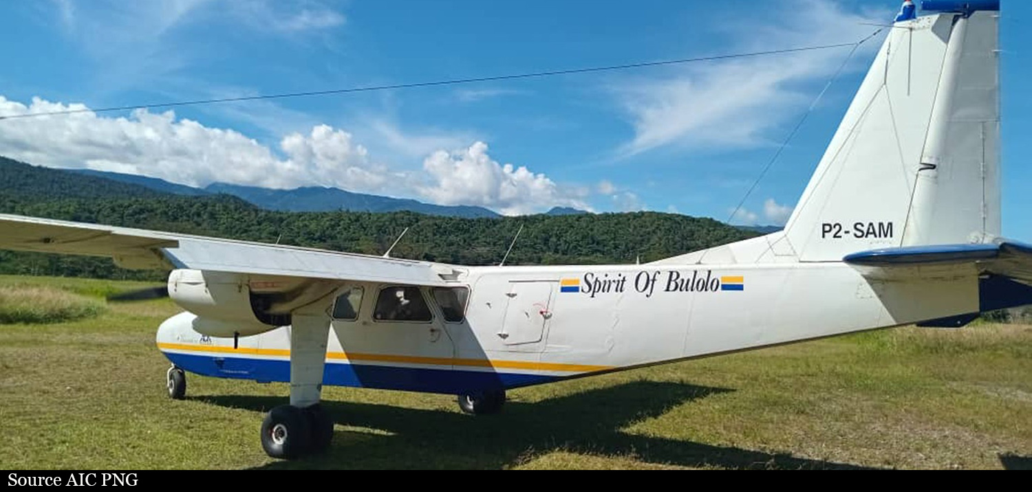
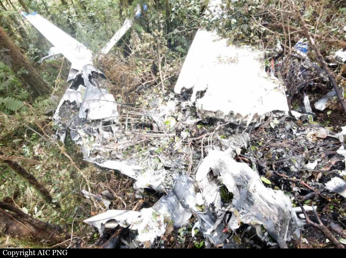
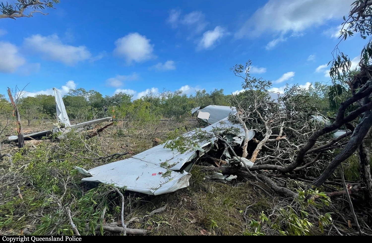
Crash of a Britten-Norman BN-2B-26 Islander near Sapmanga: 5 killed
Date & Time:
Dec 22, 2024 at 1028 LT
Operator:

Registration:
P2-SAM
Survivors:
No
Schedule:
Wasu - Lae
MSN:
2197
YOM:
1986
Crew on board:
1
Crew fatalities:
Pax on board:
4
Pax fatalities:
Other fatalities:
Total fatalities:
5
Captain / Total hours on type:
3600.00
Aircraft flight hours:
19107
Aircraft flight cycles:
38276
Circumstances:
The single engine airplane departed Wasu Airfield at 1012LT on a charter flight to Lae-Nadzab Tomodachi Airport, with an ETA at 1047LT. On board were five people, four passengers and one pilot. The passengers included a member of the Royal Papua New Guinea Constabulary (RPNGC) and an employee from the Housing Ministry. Few minutes after takeoff from Wasu, while cruising at an altitude of 8,400 feet in marginal weather conditions, the airplane impacted trees and crashed in a wooded and hilly terrain near Sapmanga, southwest of Wasu. The airplane was destroyed and all five occupants were killed. The total airframe hours and landings mentioned above stopped to December 3, 2024.
Probable cause:
In an area of rising terrain, the pilot either flew the track in cloud or in markedly reduced visibility, with no reference to terrain, towards steeply rising terrain at an indicated airspeed that was 35 kts above the manufacturer’s (flight tested) promulgated best angle of climb speed to avoid obstacles. There was no evidence of a manoeuvre to avoid the terrain. Furthermore, investigation determined that the aircraft was flown in cloud or in reduced visibility at a cruise climb speed and struck vegetation and the face of a steep ridge resulting in controlled flight into terrain (CFIT). The aircraft was fitted with a Global Navigation System receiver capable of providing visual terrain awareness warnings. It was not fitted with a terrain aural warning interface. Incorporation of an aural warning in conjunction with the visual terrain warning, may have prevented the accident.
Final Report:

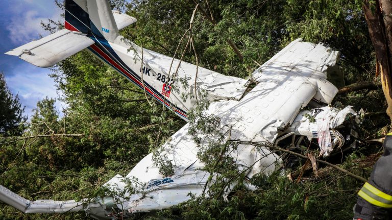
Crash of a Britten-Norman BN-2B-27 Islander in Yerbabuena
Date & Time:
Aug 12, 2024 at 1502 LT
Operator:

Registration:
HK-2822
Survivors:
Yes
Schedule:
Bogotá - La Macarena
MSN:
2109
YOM:
1981
Crew on board:
2
Crew fatalities:
Pax on board:
2
Pax fatalities:
Other fatalities:
Total fatalities:
0
Circumstances:
Few minutes after takeoff from Bogotá-Guaymaral Airport, the crew encountered an unexpected situation and declared an emergency. He attempted an emergency landing when the airplane nosed down and crashed on hilly and wooded terrain located in Yerbabuena, about 10 km northeast of Guaymaral Airport. All four occupants were injured and the airplane was destroyed. It was en route to La Macarena on an ambulance flight, carrying two pilots and a medical team.
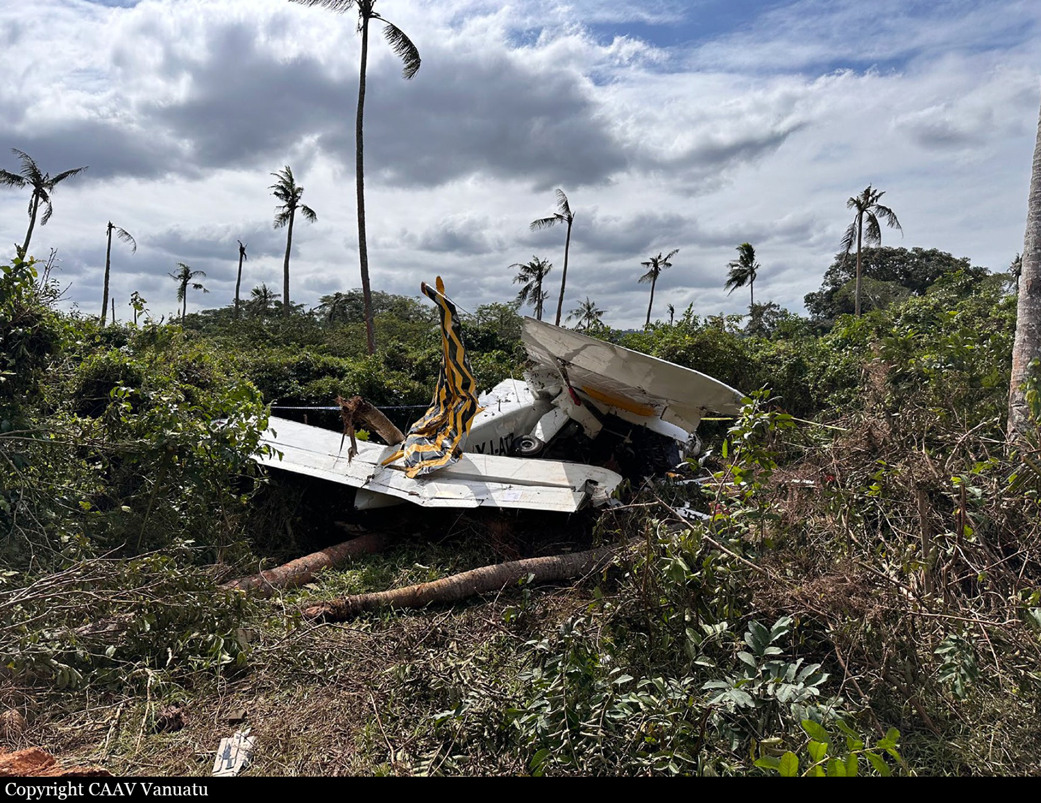
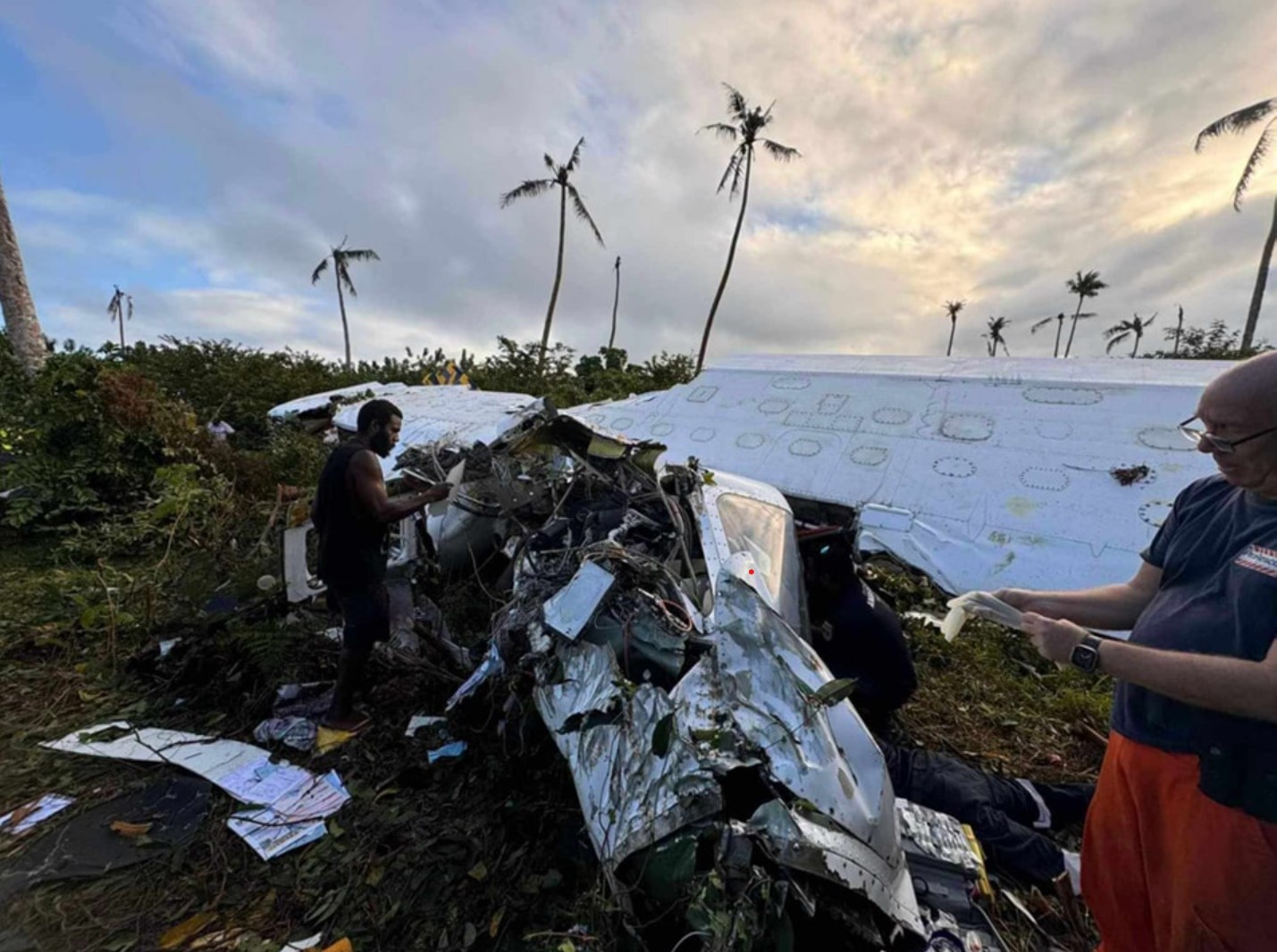
Crash of a Britten-Norman BN-2A Islander in Port Vila: 1 killed
Date & Time:
Jul 15, 2024 at 1553 LT
Operator:

Registration:
YJ-AT2
Survivors:
Yes
Schedule:
Aneityum – Port Vila
MSN:
188
YOM:
1970
Crew on board:
1
Crew fatalities:
Pax on board:
4
Pax fatalities:
Other fatalities:
Total fatalities:
1
Captain / Total hours on type:
2000.00
Aircraft flight hours:
22027
Circumstances:
The airplane departed Port Vila International Airport at 1229LT, carrying 6 passengers to Tanna, 217 km to the south-south-east. The pilot then continued a further 106 km south-south-east to Mystery Island, Aneityum, arriving at 1402. After picking up 4 passengers, the aircraft departed Aneityum at 1412, destined for Port Vila. About 130 km from Port Vila, the pilot observed the fuel quantity gauges indicating significantly less fuel remaining than expected. The pilot elected to continue over water to Port Vila, and about 24 km from the runway, the right engine surged and subsequently stopped producing power. About 3 minutes later, the pilot advised air traffic control that they were 15 km from the airport at 4,000 ft, and the controller responded with a clearance to land on runway 29. No engine noise was detected in that transmission. Four minutes later, the pilot declared a MAYDAY and advised the controller that they were 9 km from the runway, at 1,500 ft and attempting to land at the airport. During that transmission, one engine surged briefly and then stopped. The pilot then radioed that they were losing altitude and would be landing in a farm. The aircraft collided with 2 coconut trees before impacting the ground. One passenger was fatally injured, 2 passengers sustained serious injuries, the pilot and one passenger sustained minor injuries, and the aircraft was destroyed.
Probable cause:
Double engine failure in flight caused by a fuel starvation.
The following findings were identified:
• The pilot did not ensure there was sufficient fuel on board for the planned flight from Aneityum to Port Vila.
• When the pilot identified that there was less fuel on board and higher fuel flow than planned, they elected to continue to Port Vila rather than divert to other suitable aerodromes. Having committed to continue, the pilot then did not lean the mixtures or attempt to transfer fuel from auxiliary tanks (unaware the right auxiliary tank contained usable fuel) to increase endurance. As a result, the engines stopped due to fuel starvation, with usable fuel remaining in one auxiliary tank.
• The pilot did not feather the propellers when the engines stopped and did not maintain optimal airspeed in the time between the first and second engines stopping. Thes actions reduced the pilot’s options and resulted in a forced landing into a coconut plantation.
• The chief pilot misunderstood the chief engineer's verbal instructions regarding engine run-in requirements as a need to operate the engine with the mixture at full rich for at least 25 hours. The chief pilot then conveyed this to other company pilots without providing amended fuel flow figures for pilots' use in flight planning.
• High operational tempo in the months leading up to the accident, and the absence of flight crew workload management, increased the risk of fatigue affecting pilot performance. (Safety issue)
• The forced landing was conducted with a tailwind and the pilot did not extend flaps to allow a slower airspeed immediately prior to the collision to reduce impact forces, which increased the injury risk.
• The passenger seats were fitted with lap belts only and no upper torso restraints, increasing the risk of injury during a ground collision.
Final Report:

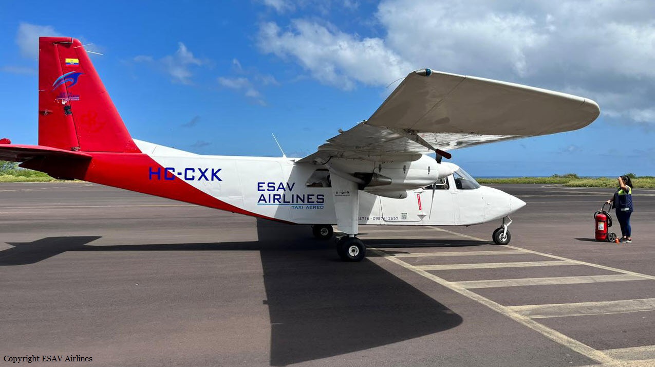
Crash of a Britten-Norman BN-2A-21 Islander off San Cristóbal Island
Date & Time:
Feb 12, 2024 at 0900 LT
Operator:

Registration:
HC-CXK
Survivors:
Yes
Schedule:
San Cristóbal - Puerto Villamil
Crew on board:
2
Crew fatalities:
Pax on board:
7
Pax fatalities:
Other fatalities:
Total fatalities:
0
Circumstances:
The twin engine airplane crashed into the sea some 1,5 km off the beach of Punta Carola, San Cristóbal Island, Galapagos. The airplane sank while all nine occupants were rescued. It appears that the airplane was en route to Puerto Villamil Airport, Isabela Island, when the accident occurred.
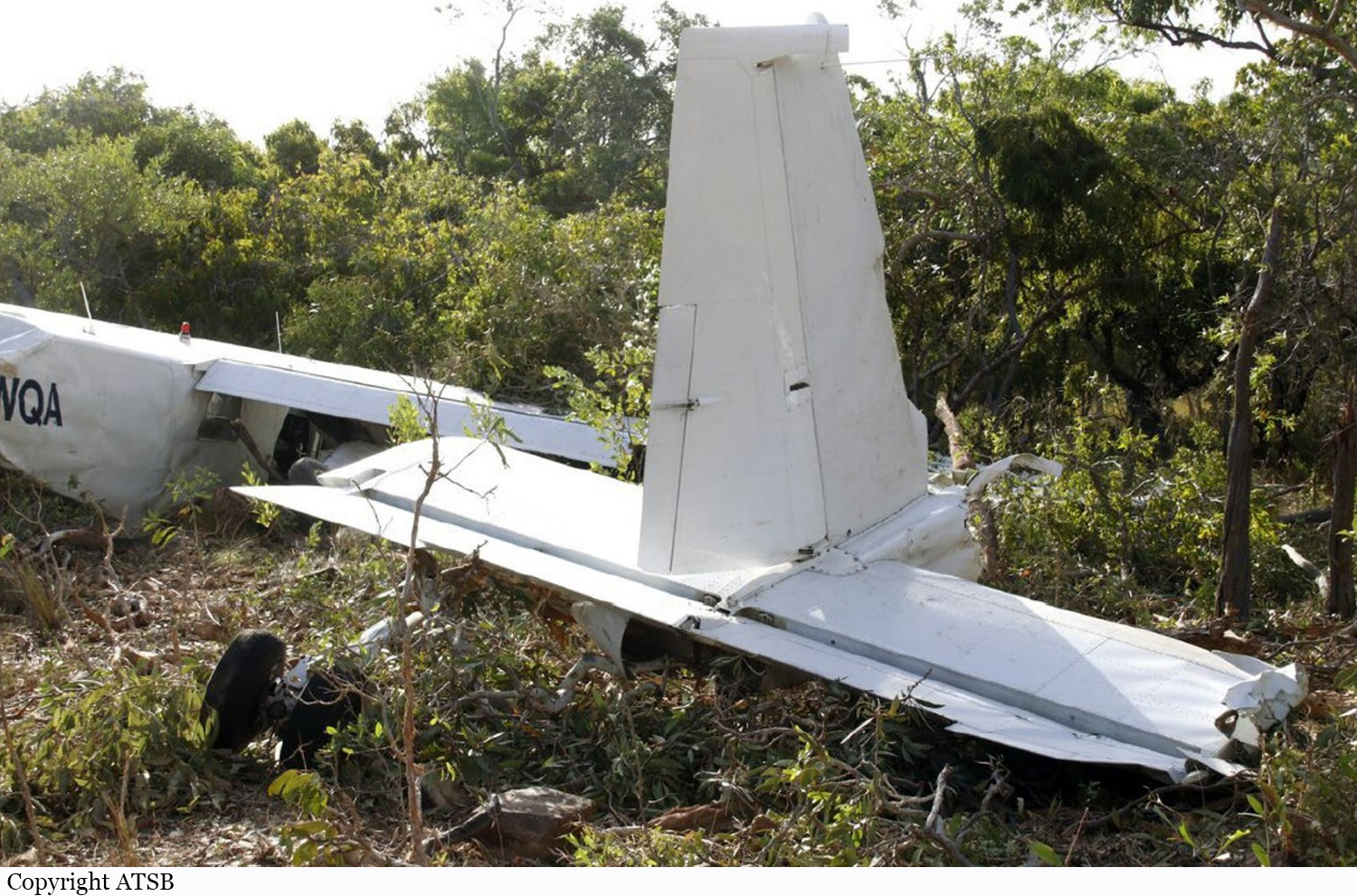
Crash of a Britten-Norman BN-2A-21 Islander on Moa Island
Date & Time:
Oct 3, 2022 at 1338 LT
Operator:

Registration:
VH-WQA
Survivors:
Yes
Schedule:
Saibai Island - Horn Island
MSN:
494
YOM:
1975
Crew on board:
1
Crew fatalities:
Pax on board:
6
Pax fatalities:
Other fatalities:
Total fatalities:
0
Captain / Total hours on type:
250.00
Aircraft flight hours:
14081
Circumstances:
On the afternoon of 3 October 2022, a Pilatus Britten-Norman Islander BN2A-21, registered VHWQA and operated by Torres Strait Air, was conducting a non-scheduled passenger air transport flight from Saibai Island Airport, Queensland (QLD) to Horn Island Airport, QLD. There was 1 pilot and 6 passengers (students) on board. About 19 km NE of Moa Island both engines began to surge. The pilot diverted towards Kubin Airport on Moa Island. As the aircraft passed to the south of the township of Saint Pauls, the pilot determined there was insufficient altitude remaining to reach the airport. As a result, the pilot conducted a forced landing on a road 7 km ENE of Kubin Airport. There were no reported injuries to the pilot or the passengers. The aircraft was substantially damaged.
Probable cause:
The ATSB found that the dual engine speed fluctuations and associated power loss was probably the result of fuel starvation. The mechanism was not conclusively determined, however it was identified that the pilot did not operate the aircraft's fuel system in accordance with the aircraft flight manual, and that the configuration and location of the aircraft’s fuel controls and tank quantity gauges were probably not conducive to rapid and accurate interpretation. The aircraft manufacturer released a service letter in June 2022 that detailed an optional modification to centralize the fuel system controls and gauges, however this modification was not fitted to VH-WQA. The ATSB considered that these factors increased the risk of inadvertent fuel tank selection.
Final Report:
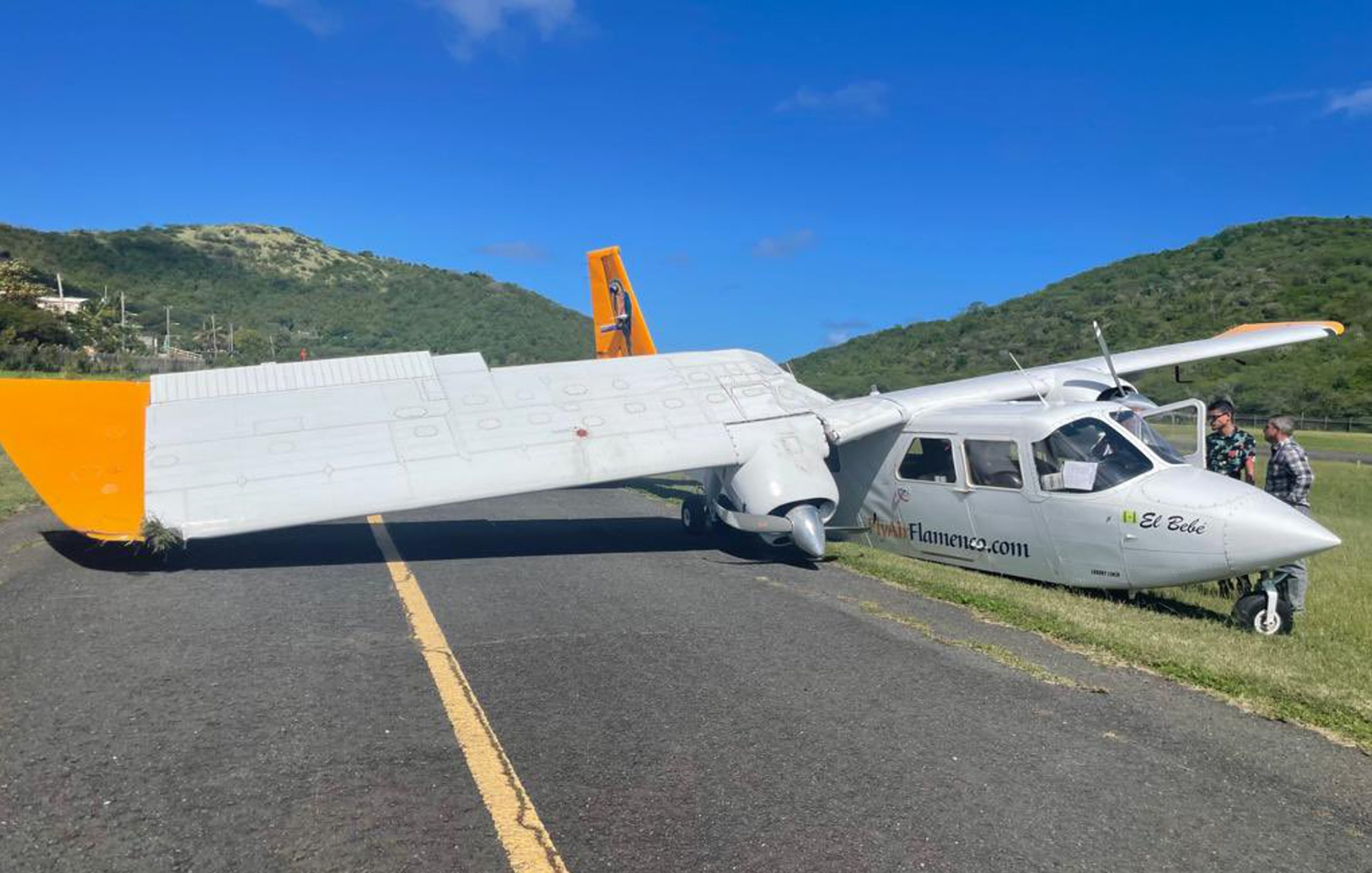
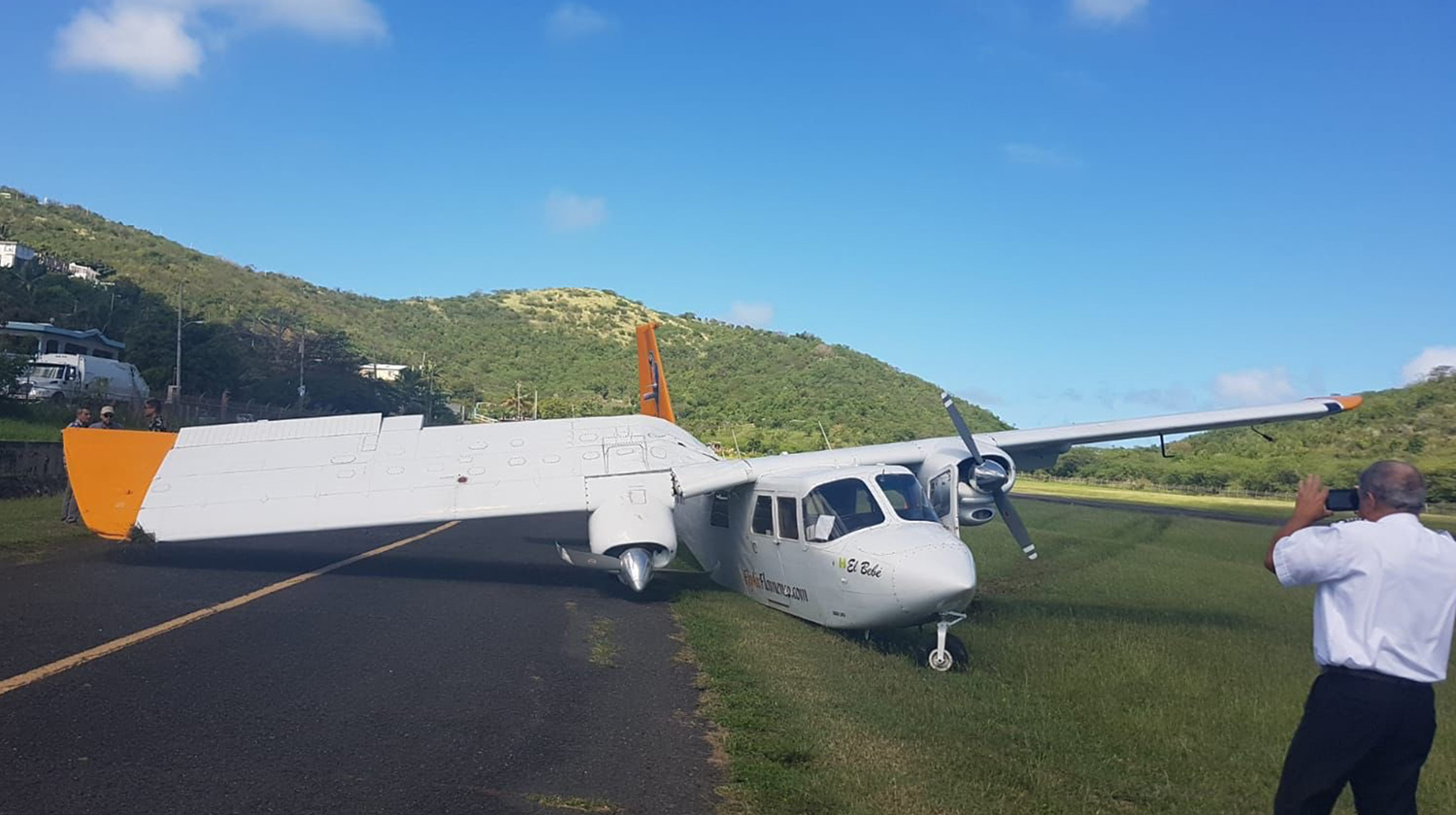
Crash of a Britten-Norman BN-2A-9 Islander in Culebra
Date & Time:
Feb 15, 2022 at 0955 LT
Operator:

Registration:
N821RR
Survivors:
Yes
Schedule:
San Juan - Culebra
MSN:
338
YOM:
1973
Crew on board:
2
Crew fatalities:
Pax on board:
1
Pax fatalities:
Other fatalities:
Total fatalities:
0
Captain / Total hours on type:
0.00
Copilot / Total hours on type:
5000
Aircraft flight hours:
2864
Circumstances:
The pilot was receiving flight training as a new hire, and the accident occurred during his first flight in the airplane and the first landing. The pilot stated the approach was flown at the upper end of the allowable approach speed, and about 100 ft above the normal glidepath. During the landing, all three of the airplane’s landing gear touched down at the same time, the airplane immediately veered right, and continued off the right side of the runway. The airplane sustained substantial damage to the right-wing structure. The flight instructor chose an airport with a challenging approach that required a special training program prior to the first landing. The approach procedure requires a left 40° turn then rolling wings level just before touchdown. It is likely that the airplane’s descent rate during landing exceeded the airplane’s capability, which resulted in a hard landing and failure of the right-wing structure.
Probable cause:
The flight crew’s failure to arrest the descent rate during the non-standard approach, which resulted in a hard landing and failure of the right-wing structure. Contributing was the flight instructor’s selection of a challenging approach for initial training.
Final Report: