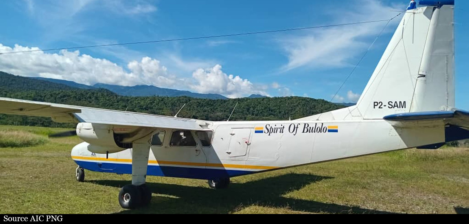
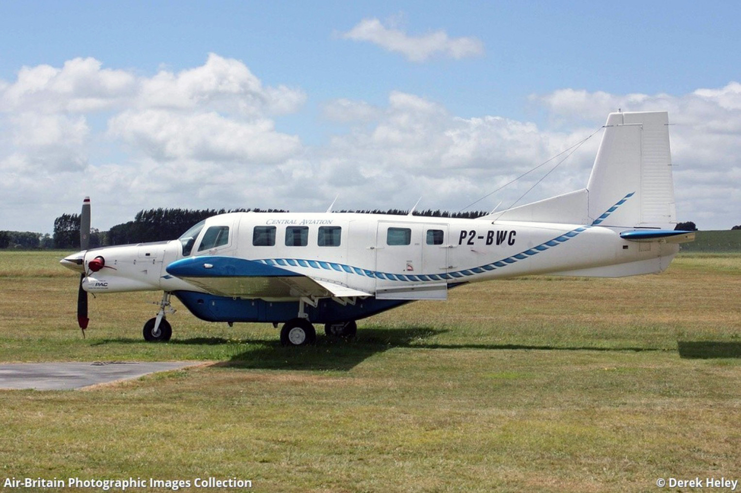
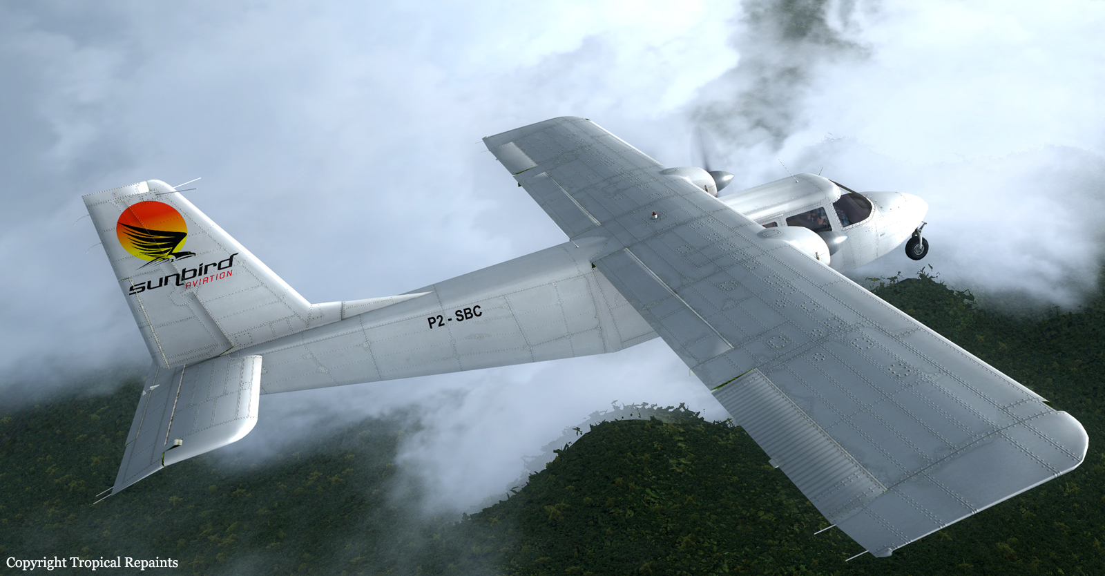
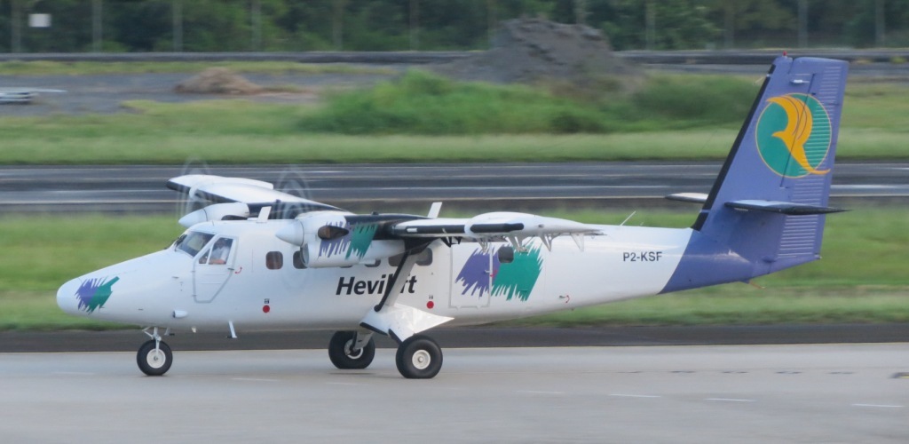
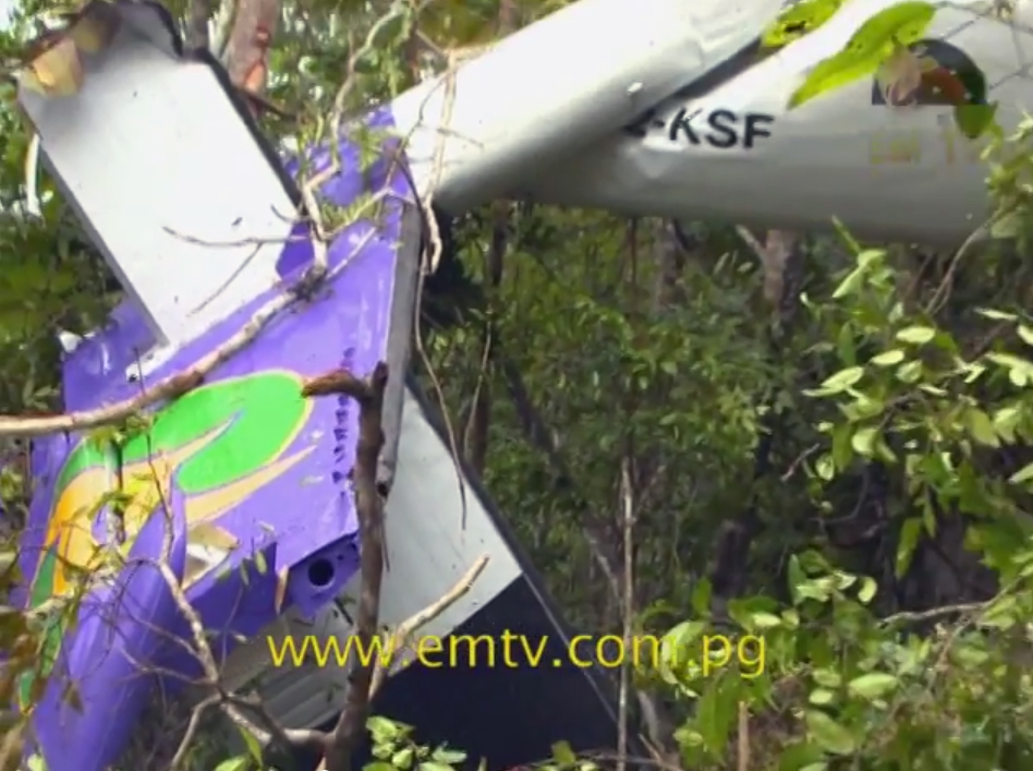
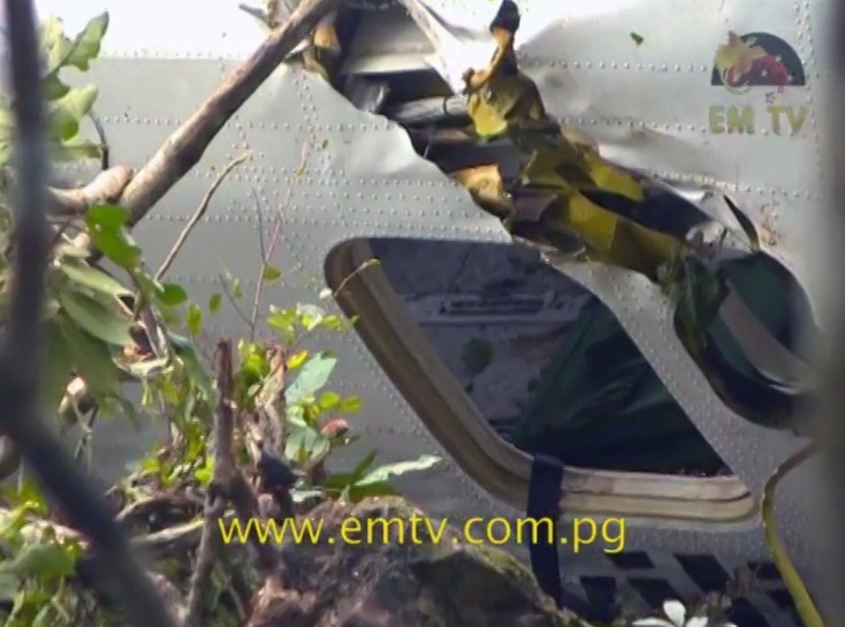
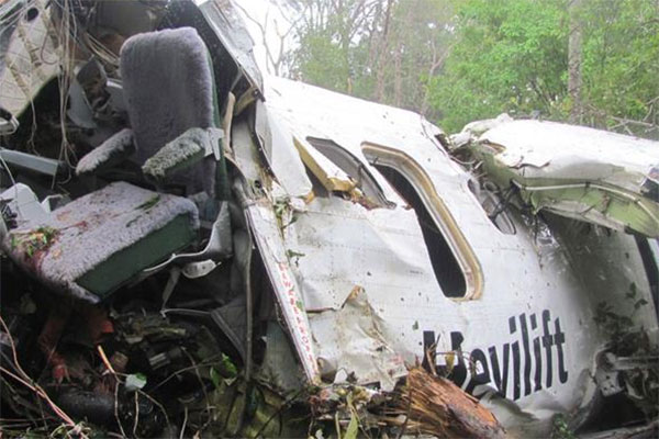
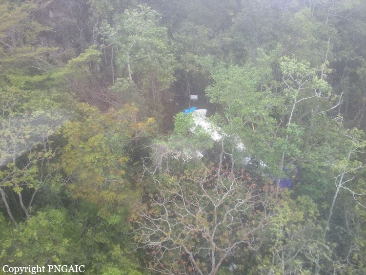
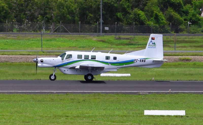
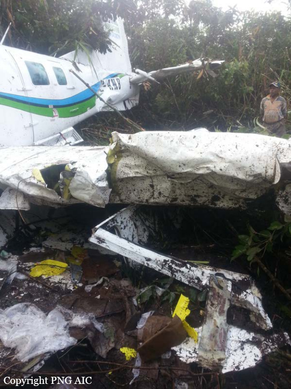
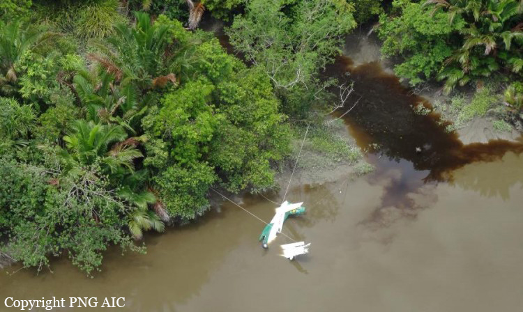
Crash of a Britten-Norman BN-2B-26 Islander near Sapmanga: 5 killed
Date & Time:
Dec 22, 2024 at 1028 LT
Operator:

Registration:
P2-SAM
Survivors:
No
Schedule:
Wasu - Lae
MSN:
2197
YOM:
1986
Crew on board:
1
Crew fatalities:
Pax on board:
4
Pax fatalities:
Other fatalities:
Total fatalities:
5
Captain / Total hours on type:
3600.00
Aircraft flight hours:
19107
Aircraft flight cycles:
38276
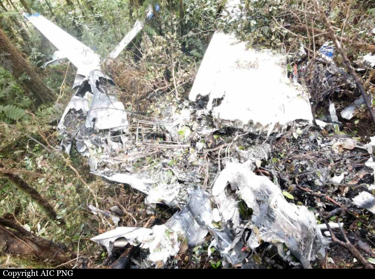
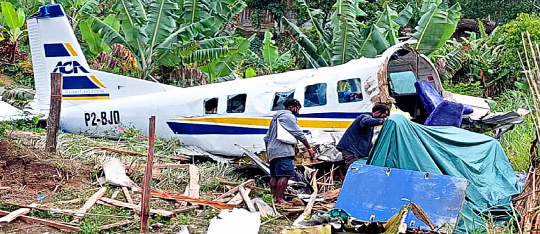
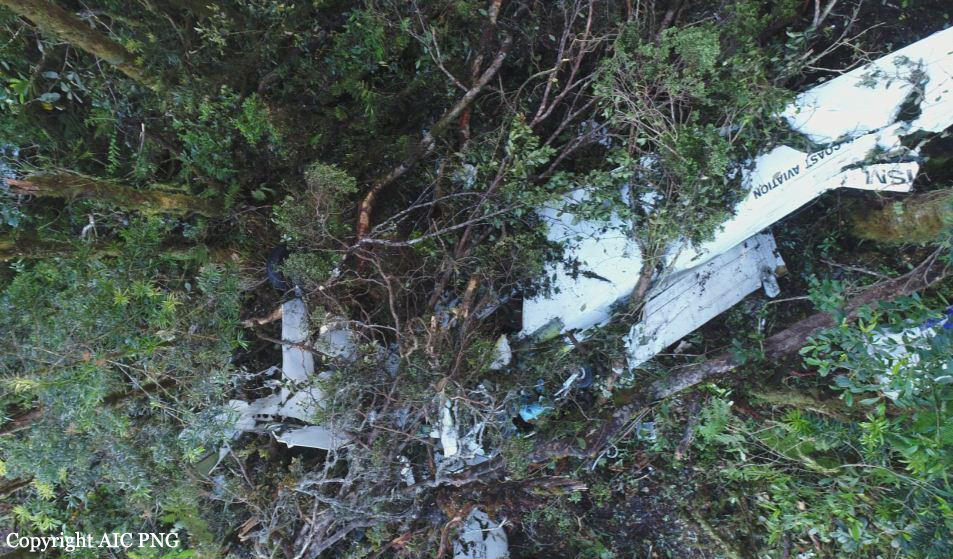
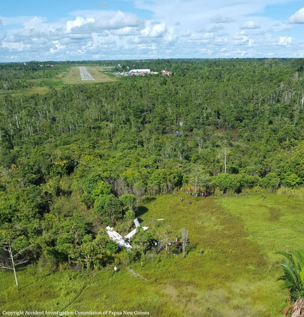
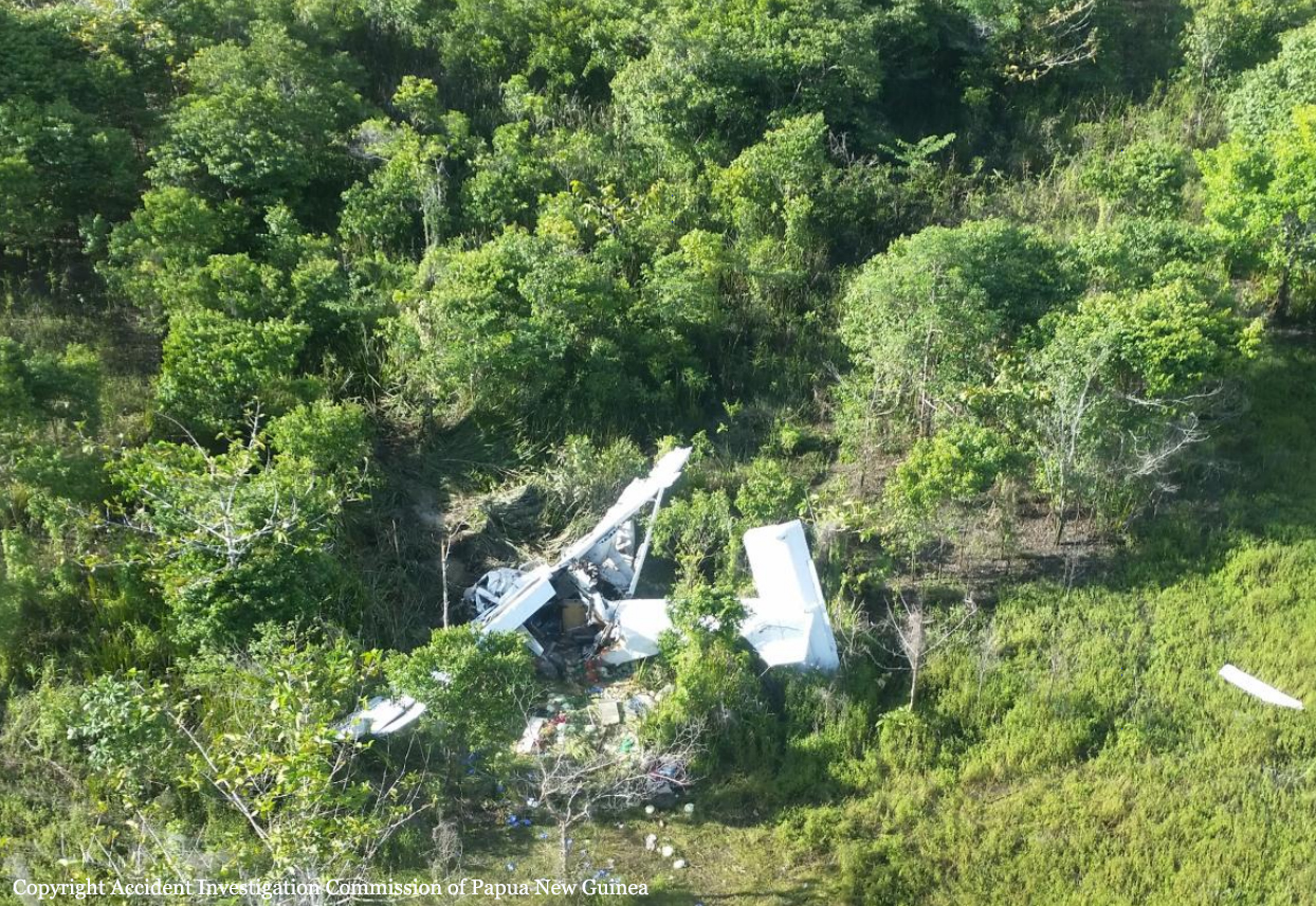
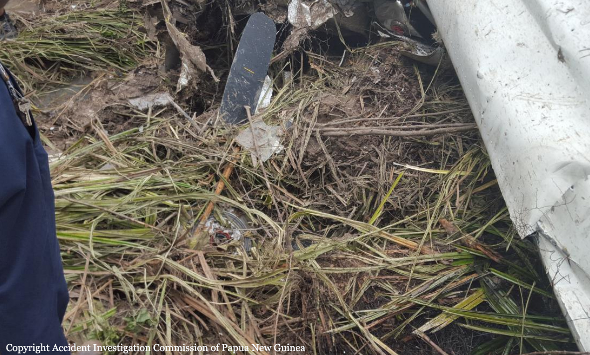
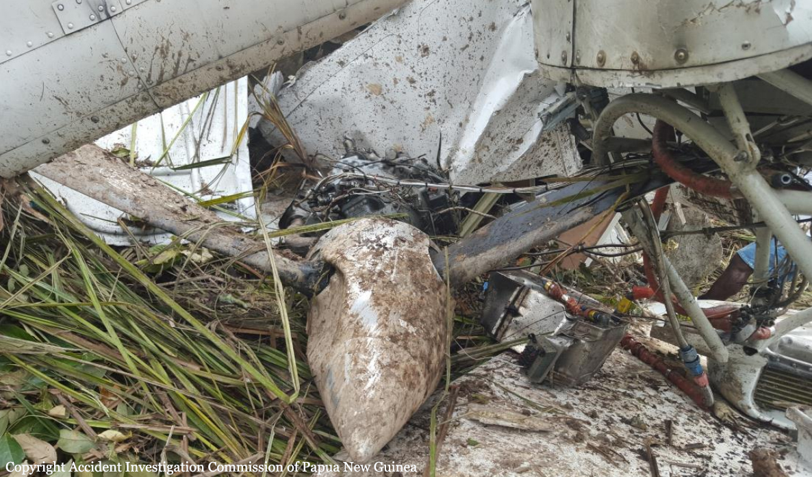
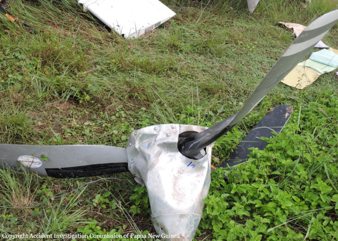
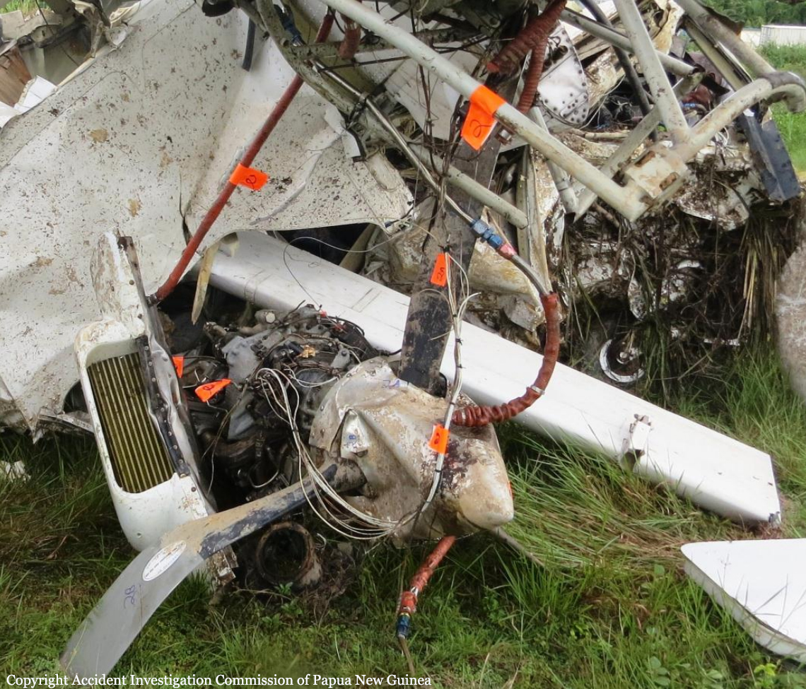
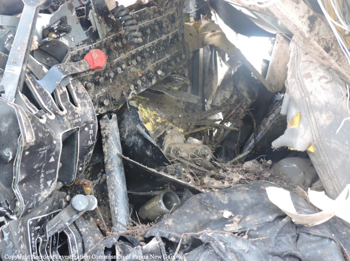
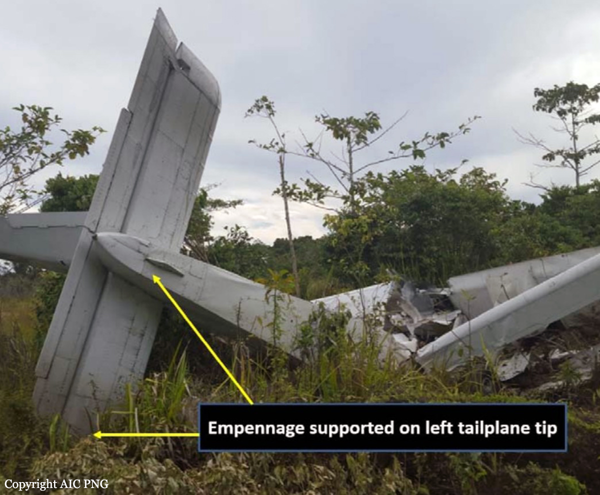
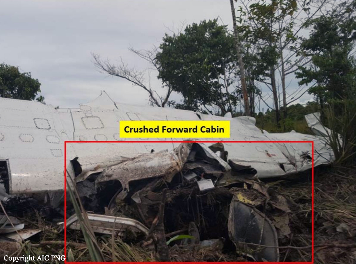
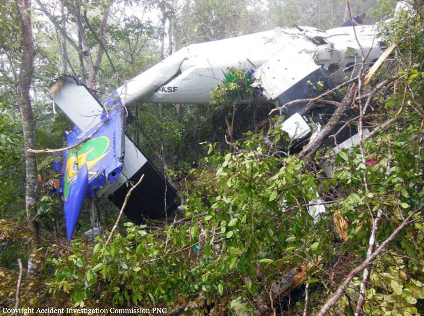
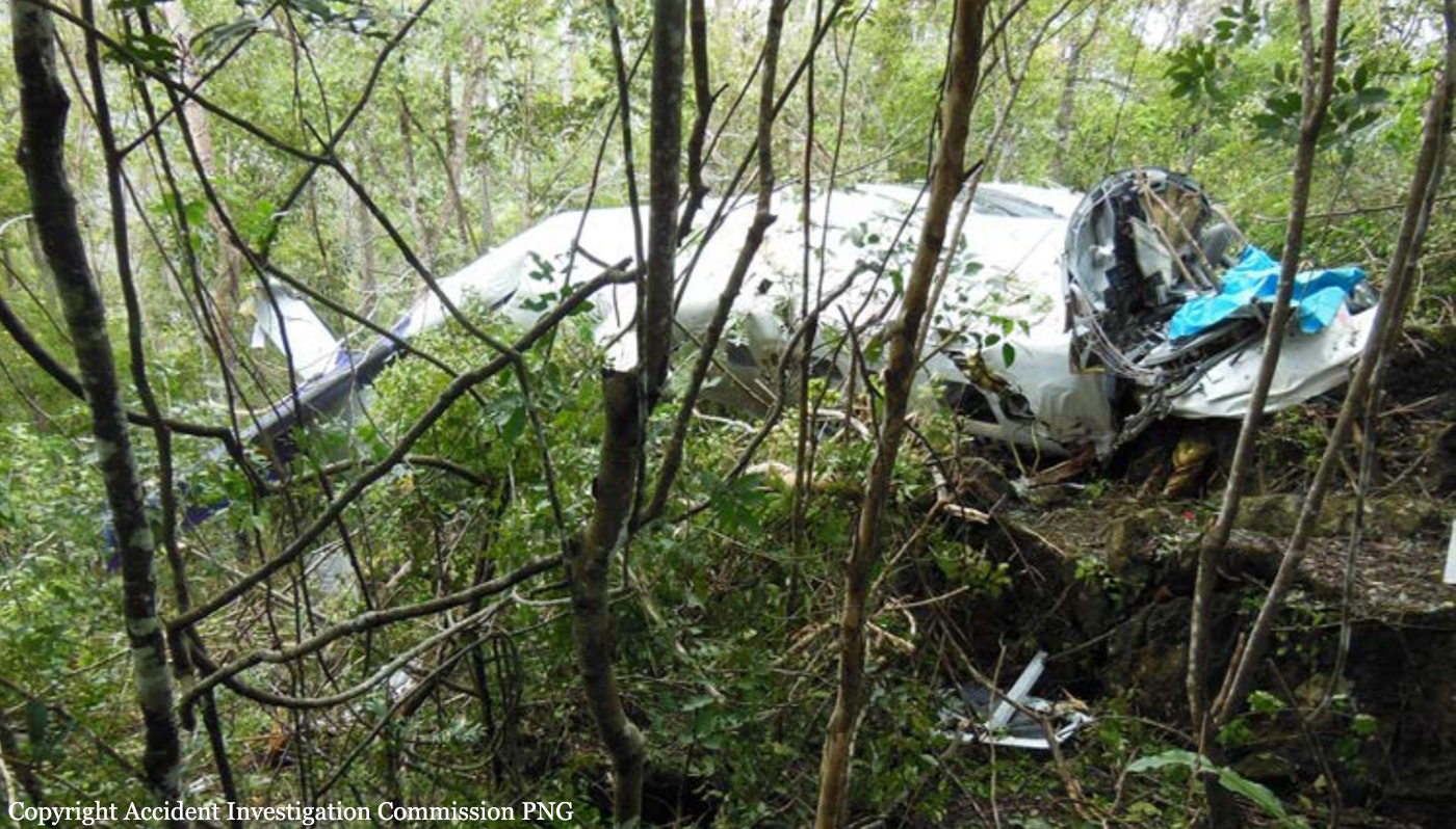
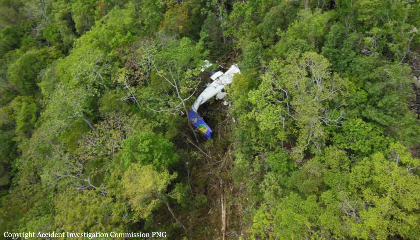
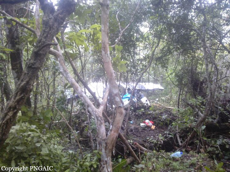
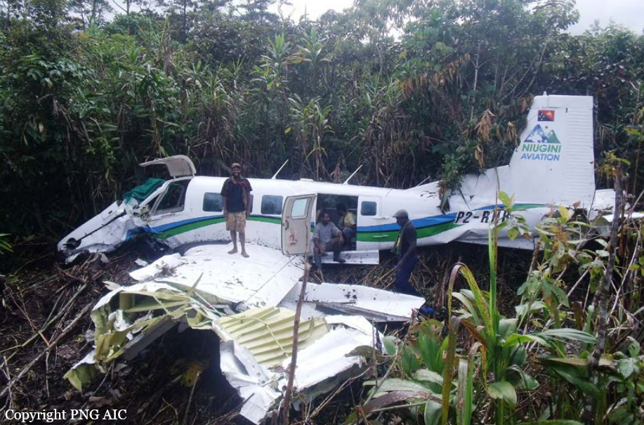
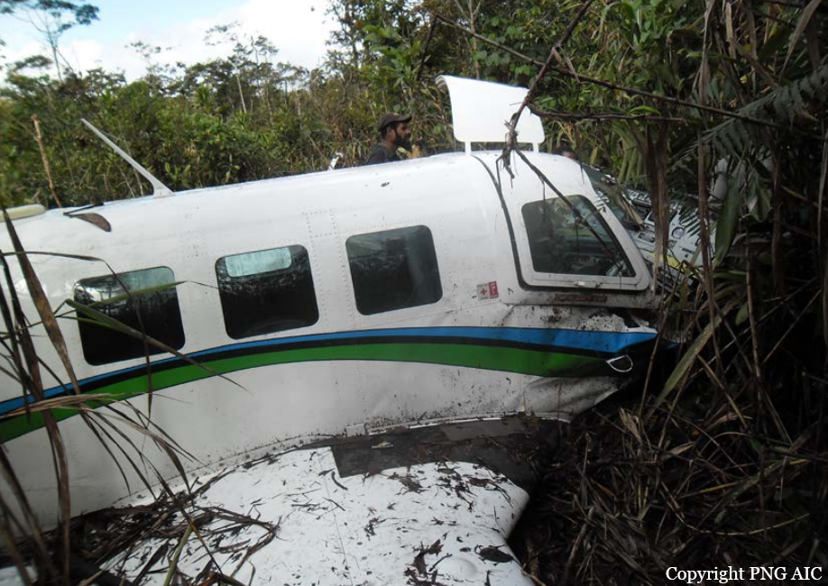
Circumstances:
The single engine airplane departed Wasu Airfield at 1012LT on a charter flight to Lae-Nadzab Tomodachi Airport, with an ETA at 1047LT. On board were five people, four passengers and one pilot. The passengers included a member of the Royal Papua New Guinea Constabulary (RPNGC) and an employee from the Housing Ministry. Few minutes after takeoff from Wasu, while cruising at an altitude of 8,400 feet in marginal weather conditions, the airplane impacted trees and crashed in a wooded and hilly terrain near Sapmanga, southwest of Wasu. The airplane was destroyed and all five occupants were killed. The total airframe hours and landings mentioned above stopped to December 3, 2024.
Probable cause:
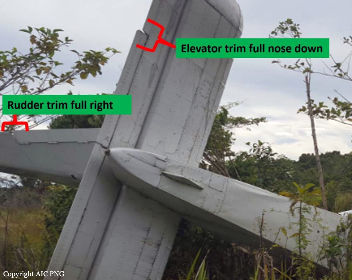
In an area of rising terrain, the pilot either flew the track in cloud or in markedly reduced visibility, with no reference to terrain, towards steeply rising terrain at an indicated airspeed that was 35 kts above the manufacturer’s (flight tested) promulgated best angle of climb speed to avoid obstacles. There was no evidence of a manoeuvre to avoid the terrain. Furthermore, investigation determined that the aircraft was flown in cloud or in reduced visibility at a cruise climb speed and struck vegetation and the face of a steep ridge resulting in controlled flight into terrain (CFIT). The aircraft was fitted with a Global Navigation System receiver capable of providing visual terrain awareness warnings. It was not fitted with a terrain aural warning interface. Incorporation of an aural warning in conjunction with the visual terrain warning, may have prevented the accident.
Final Report: