Crash of a Partenavia P.68B Victor off Rottnest Island

Date & Time: Nov 12, 2006 at 1500 LT
Type of aircraft:
Operator:
Registration:
VH-IYK
Flight Phase:
Flight Type:
Survivors:
Yes
Schedule:
Rottnest Island - Perth
MSN:
138
YOM:
1978
Country:
Region:
Crew on board:
1
Crew fatalities:
Pax on board:
5
Pax fatalities:
Other fatalities:
Total fatalities:
0
Circumstances:
Shortly after takeoff from Rottnest Island Airport, while in initial climb, the twin engine aircraft suffered a bird strike and crashed in a salt lake located near the airport. The aircraft was destroyed upon impact and all six occupants were injured.
Probable cause:
Loss of control during initial climb following a bird strike.

Crash of a Piper PA-31-350 Navajo Chieftain near Raglan: 3 killed

Date & Time: Oct 31, 2006 at 1855 LT
Operator:
Registration:
VH-ZGZ
Flight Phase:
Flight Type:
Survivors:
No
Schedule:
Emerald – Gladstone
MSN:
31-7752006
YOM:
1977
Country:
Region:
Crew on board:
1
Crew fatalities:
Pax on board:
2
Pax fatalities:
Other fatalities:
Total fatalities:
3
Captain / Total flying hours:
3900
Captain / Total hours on type:
70.00
Aircraft flight hours:
3977
Circumstances:
The aircraft was being operated on a private category instrument flight rules (IFR) flight from Emerald to Gladstone, Qld. On board the aircraft were the pilot in command and two passengers. One of the passengers was a qualified pilot, but who was not endorsed on the aircraft type. After departing Emerald at 1807 Eastern Standard Time, the pilot contacted air traffic control and reported climbing to 7,000 ft with an estimated time of arrival at Gladstone of 1915. At 1813:25, air traffic control advised the pilot that ZGZ was radar identified 15 NM east of Emerald. At 1815:12, the pilot requested clearance to climb to 9,000 ft. At 1817:05, air traffic control issued a clearance to the pilot for the aircraft to climb 9,000 ft, and to track direct to Gladstone. At 1820:26, the pilot reported level at 9,000 ft and requested clearance to divert up to 10 NM left and right of track to avoid anticipated weather activity ahead. Air traffic control approved that request. At 1830:56, the pilot requested clearance to divert up to 15 NM left and right of track, and 10 seconds later changed the request to 15 NM left of track. Air traffic control approved that request. At 1835:17, the pilot reported clear of the weather and requested clearance to track direct to Gladstone and to descend to 7,000 ft. Air traffic control approved those requests. At 1848:52, the pilot reported at ‘top of descent’ to Gladstone. Air traffic control cleared the pilot to descend. At 1852:45, the pilot reported changing frequency to the Gladstone common traffic advisory frequency (CTAF). Air traffic control advised the pilot that the aircraft was leaving 5,500 ft and that the radar and control services were terminated. The pilot acknowledged that transmission at 1852:57. Approximately 3 minutes later, at 1855:45, air traffic control noticed that the aircraft’s symbol was no longer evident on the air situation display screen and the controller attempted to contact the pilot of the aircraft by radio. The controller also requested pilots of other aircraft operating in the Gladstone area to attempt to contact the pilot of ZGZ on the Gladstone CTAF frequency. All attempts were unsuccessful. A witness in the Raglan area recalled hearing the sound of aircraft engine(s) overhead. He then heard the engine(s) ‘roar and shut off again’ a few times. A short time later, he saw a flash and a few seconds later heard the sound of an explosion. He realised that the aircraft had crashed and telephoned the Gladstone Police. Subsequently, wreckage of the aircraft was located near Raglan, approximately 39 km west of Gladstone. The three occupants were fatally injured. The aircraft was destroyed by impact forces and post-impact fire.
Probable cause:
From the evidence available, the following findings are made with respect to the loss of control event involving Piper Aircraft Corporation PA-31-350 aircraft registered VH-ZGZ and should not be read as apportioning blame or liability to any particular organisation or individual.
Contributing safety factors:
• The aircraft diverged left from a steady, controlled descent and entered a steep, left spiral descent from which recovery was not achieved.
Other safety factors:
• The dark and very likely cloudy conditions that existed in the area where the aircraft suddenly diverged from its flight path meant that recovery to normal flight could only have been achieved by sole reference to the aircraft’s flight instruments. The difficulty associated with such a task when the aircraft was in a steep descent was likely to have been significant.
Final Report:

Crash of a Swearingen SA227AC Metro III in Canberra

Date & Time: Jul 1, 2006
Type of aircraft:
Operator:
Registration:
VH-VEH
Survivors:
Yes
MSN:
AC-663B
YOM:
1986
Country:
Region:
Crew on board:
0
Crew fatalities:
Pax on board:
0
Pax fatalities:
Other fatalities:
Total fatalities:
0
Circumstances:
By night, the twin engine aircraft landed hard at Canberra Airport. There were no injuries but the aircraft was damaged beyond repair.
Probable cause:
ATSB did not conduct any investigations on this event.

Crash of a Piper PA-31-350 Navajo Chieftain near Condobolin: 4 killed

Date & Time: Dec 2, 2005 at 1350 LT
Registration:
VH-PYN
Flight Phase:
Flight Type:
Survivors:
No
Schedule:
Brisbane – Swan Hill
MSN:
31-8252075
YOM:
1982
Country:
Region:
Crew on board:
2
Crew fatalities:
Pax on board:
2
Pax fatalities:
Other fatalities:
Total fatalities:
4
Captain / Total flying hours:
4600
Captain / Total hours on type:
1000.00
Aircraft flight hours:
2900
Circumstances:
On 2 December 2005, at 1122 Eastern Daylight-saving Time, a Piper Aircraft Corporation PA-31-350 Chieftain aircraft, registered VH-PYN (PYN), departed Archerfield, Qld, on a private flight to Griffith, NSW. The flight was planned under the instrument flight rules (IFR). On board the aircraft were the pilot, two passengers and an observer-pilot who was on the flight to gain knowledge of the aircraft operation. The aircraft tracked direct to Moree and then Coonamble at 10,000 ft, in accordance with the flight plan. At 1303, the pilot amended the destination to Swan Hill, Vic, tracking via Hillston, NSW. At 1314, the pilot advised air traffic control that the aircraft had passed overhead Coonamble at 1312 maintaining 10,000 ft, and was estimating Hillston at 1418. At 1316, the pilot reported that he was tracking 5 NM (9 km) left of track due to weather. At 1337, the pilot advised that he was diverting up to 20 NM (37 km) left of track due to weather. At 1348, the pilot reported that he was diverting 29 NM (54 km) left of track, again due to weather. No further radio transmission from the pilot was heard. At about 1400, police received a report that an aircraft had crashed on a property approximately 28 km north of Condobolin, NSW. The extensively burned wreckage was subsequently confirmed as PYN. Other wreckage, spread along a trail up to 4 km from the main wreckage, was located the following day. Examination of air traffic control recorded radar data indicated that the aircraft entered radar coverage about 50 km north of Condobolin at 1346:34. The last valid radar data from the secondary surveillance radar located on Mount Bobbara was at 1349:53. During that 3 minute 19 second period, the recorded aircraft track was approximately 56 km left of the Coonamble to Hillston track and showed a change in direction from southerly to south-westerly. The aircraft’s groundspeed was in the range between 200 and 220 kts. The aircraft’s altitude remained steady at 10,000 ft. The last recorded radar position of the aircraft was approaching the limit of predicted radar coverage and was within 10 km of the location of the main aircraft wreckage. Earlier that day, the aircraft had departed Bendigo, Vic, at 0602 and arrived at Archerfield at 1034. The pilot and the observer-pilot were on board. The aircraft was refuelled to full tanks with 314 litres of aviation gasoline at Archerfield. The refuelling agent reported that the main and auxiliary tanks were full at the completion of refuelling. He also reported that the pilots had commented that the forecast for their return flight indicated that weather conditions would be ‘patchy’.
Probable cause:
Contributing factors:
• A line of thunderstorms crossed the aircraft’s intended track.
• The aircraft was operating in the vicinity of thunderstorm cells.
• In circumstances that could not be determined, the aircraft’s load limits were exceeded, causing structural failure of the airframe.
Other safety factors:
• Air traffic control procedures, did not require the SIGMET information to be passed to the aircraft.
• There were shortcomings in the Airservices Australia Hazard Alert procedures and guidelines for assessing SIGMET information.
• Air traffic control procedures for the dissemination of SIGMET information contained in the Aeronautical Information Publication were inconsistent with procedures contained in International Civil Aviation Organization (ICAO) Doc. 4444 and ICAO Doc. 7030.
Other key findings:
• The aircraft was not equipped with weather radar or lightning strike detection systems.
• The pilot did not make any request for additional information regarding the weather to air traffic services.
• The pilot in command was occupying the right cockpit seat and the observer- pilot the left cockpit seat at the time of the breakup, but that arrangement was not considered to have influenced the development of the accident.
Final Report:

Crash of a Piper PA-31-350 Navajo Chieftain in Mount Hotham: 3 killed

Date & Time: Jul 8, 2005 at 1725 LT
Operator:
Registration:
VH-OAO
Survivors:
No
Schedule:
Melbourne - Mount Hotham
MSN:
31-8252021
YOM:
1982
Country:
Region:
Crew on board:
1
Crew fatalities:
Pax on board:
2
Pax fatalities:
Other fatalities:
Total fatalities:
3
Captain / Total flying hours:
4770
Captain / Total hours on type:
1269.00
Aircraft flight hours:
9137
Circumstances:
On 8 July 2005, the pilot of a Piper PA-31-350 Navajo Chieftain, registered VH-OAO, submitted a visual flight rules (VFR) flight plan for a charter flight from Essendon Airport to Mount Hotham, Victoria. On board the aircraft were the pilot and two passengers. At the time, the weather conditions in the area of Mount Hotham were extreme. While taxiing at Essendon, the pilot requested and was granted an amended airways clearance to Wangaratta, due to the adverse weather conditions at Mount Hotham. The aircraft departed Essendon at 1629 Eastern Standard Time. At 1647 the pilot changed his destination to Mount Hotham. At 1648, the pilot contacted Flightwatch and requested that the operator telephone the Mount Hotham Airport and advise an anticipated arrival time of approximately 1719. The airport manager, who was also an accredited meteorological observer, told the Flightwatch operator that in the existing weather conditions the aircraft would be unable to land. At 1714, the pilot reported to air traffic control that the aircraft was overhead Mount Hotham and requested a change of flight category from VFR to instrument flight rules (IFR) in order to conduct a Runway 29 Area Navigation, Global Navigation Satellite System (RWY 29 RNAV GNSS) approach via the initial approach fix HOTEA. At 1725 the pilot broadcast on the Mount Hotham Mandatory Broadcast Zone frequency that the aircraft was on final approach for RWY 29 and requested that the runway lights be switched on. No further transmissions were received from the aircraft. The wreckage of the aircraft was located by helicopter at 1030 on 11 July. The aircraft had flown into trees in a level attitude, slightly banked to the right. Initial impact with the ridge was at about 200 ft below the elevation of the Mount Hotham aerodrome. The aircraft had broken into several large sections and an intense fire had consumed most of the cabin. The occupants were fatally injured.
Probable cause:
Findings:
• There were no indications prior to, or during the flight, of problems with any aircraft systems that may have contributed to the circumstances of the occurrence.
• The pilot continued flight into forecast and known icing conditions in an aircraft not approved for flight in icing conditions.
• The global navigation satellite constellation was operating normally.
• The pilot did not comply with the requirements of the published instrument approach procedure.
• The pilot was known, by his Chief Pilot and others, to adopt non-standard approach procedures to establish his aircraft clear of cloud when adverse weather conditions existed at Mount Hotham.
• The pilot may have been experiencing self-imposed and external pressures to attempt a landing at Mount Hotham.
• Terrain features would have been difficult to identify due to a heavy layer of snow, poor visibility, low cloud, continuing heavy snowfall, drizzle, sleet and approaching end of daylight.
• The pilot’s attitude, operational and compliance practices had been of concern to some Airservices’ staff.
• The operator’s operational and compliance history was recorded by CASA as being of concern, and as a result CASA staff continued to monitor the operator. However, formal surveillance of the operator in the preceding two years had not identified any significant operational issues.
Significant factors:
• The weather conditions at the time of the occurrence were extreme.
• The extreme weather conditions were conducive to visual illusions associated with a flat light phenomenon.
• The pilot did not comply with the requirements of flight under either the instrument flight rules (IFR) or the visual flight rules (VFR).
• The pilot did not comply with the requirements of the published instrument approach procedure and flew the aircraft at an altitude that did not ensure terrain clearance.
• The aircraft accident was consistent with controlled flight into terrain.
Final Report:

Crash of a Swearingen SA227DC Metro 23 in Lockhart River: 15 killed

Date & Time: May 7, 2005 at 1144 LT
Type of aircraft:
Operator:
Registration:
VH-TFU
Survivors:
No
Site:
Schedule:
Bamaga – Lockhart River – Cairns
MSN:
DC-818B
YOM:
1992
Flight number:
HC675
Country:
Region:
Crew on board:
2
Crew fatalities:
Pax on board:
13
Pax fatalities:
Other fatalities:
Total fatalities:
15
Captain / Total flying hours:
6071
Captain / Total hours on type:
3248.00
Copilot / Total flying hours:
655
Copilot / Total hours on type:
150
Aircraft flight hours:
26877
Aircraft flight cycles:
28529
Circumstances:
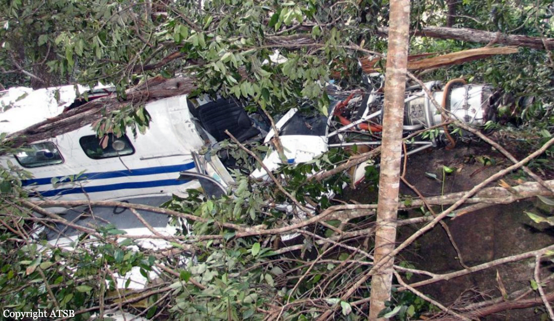
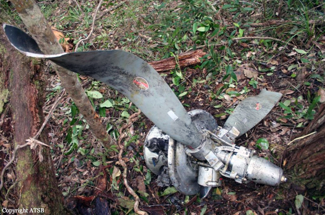
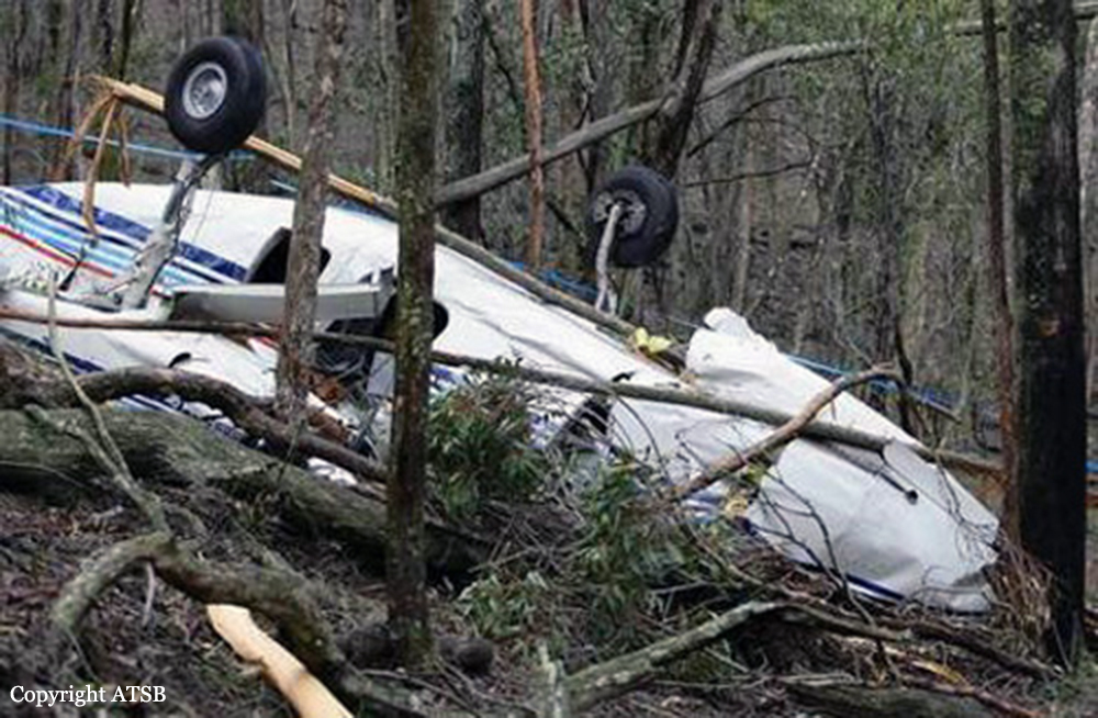
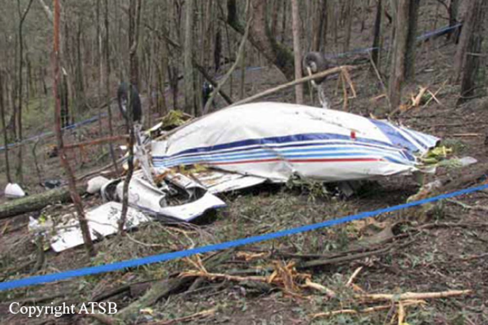
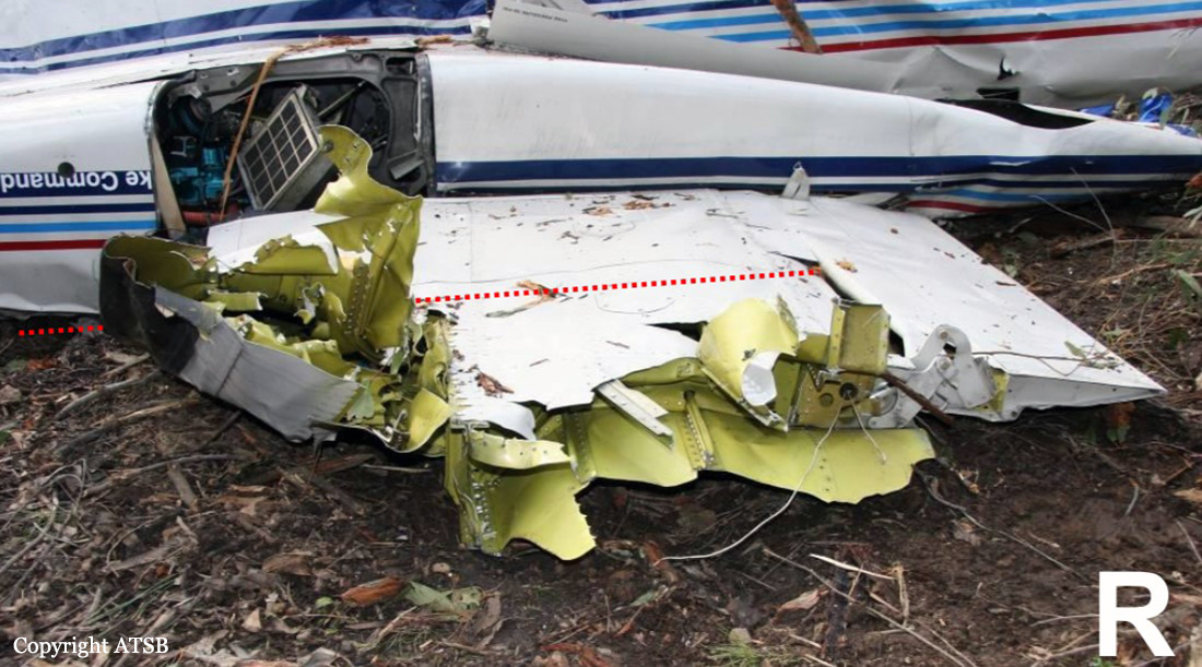
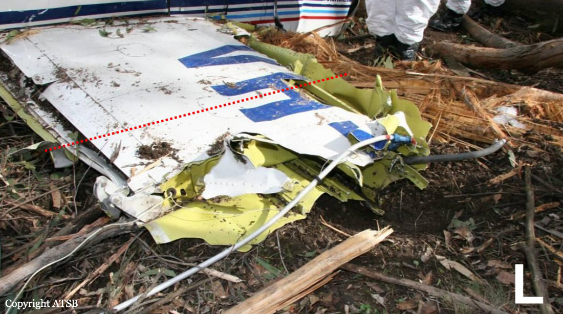
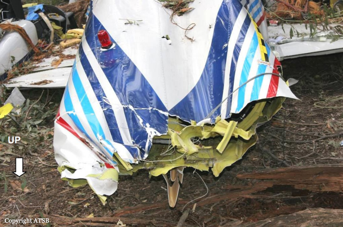
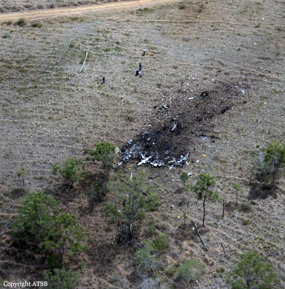
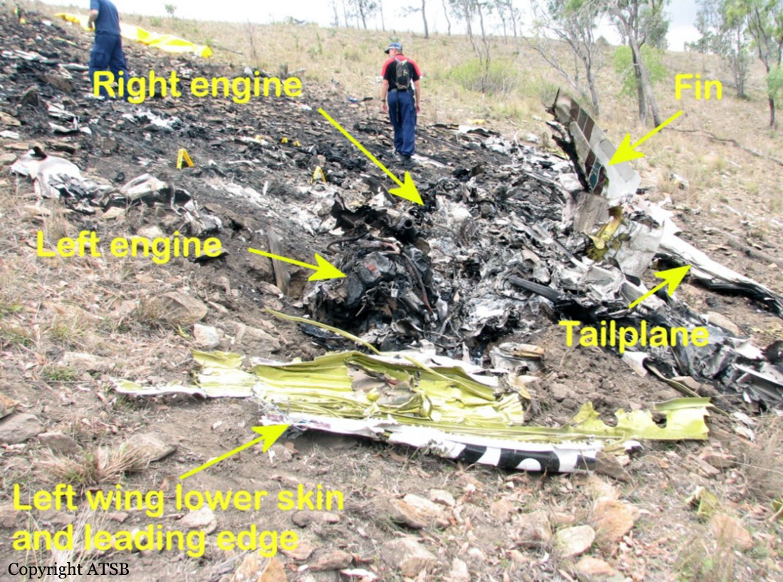
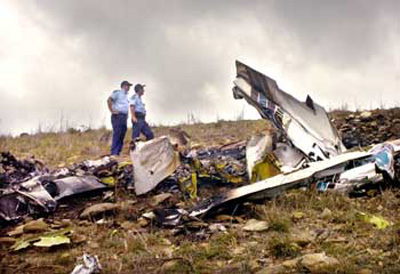
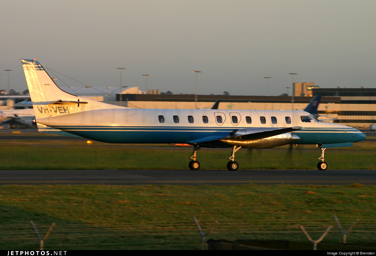
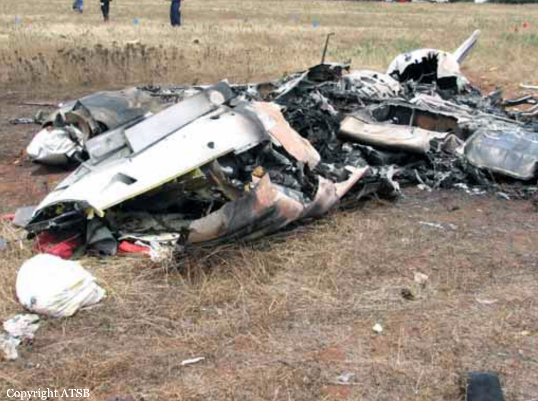
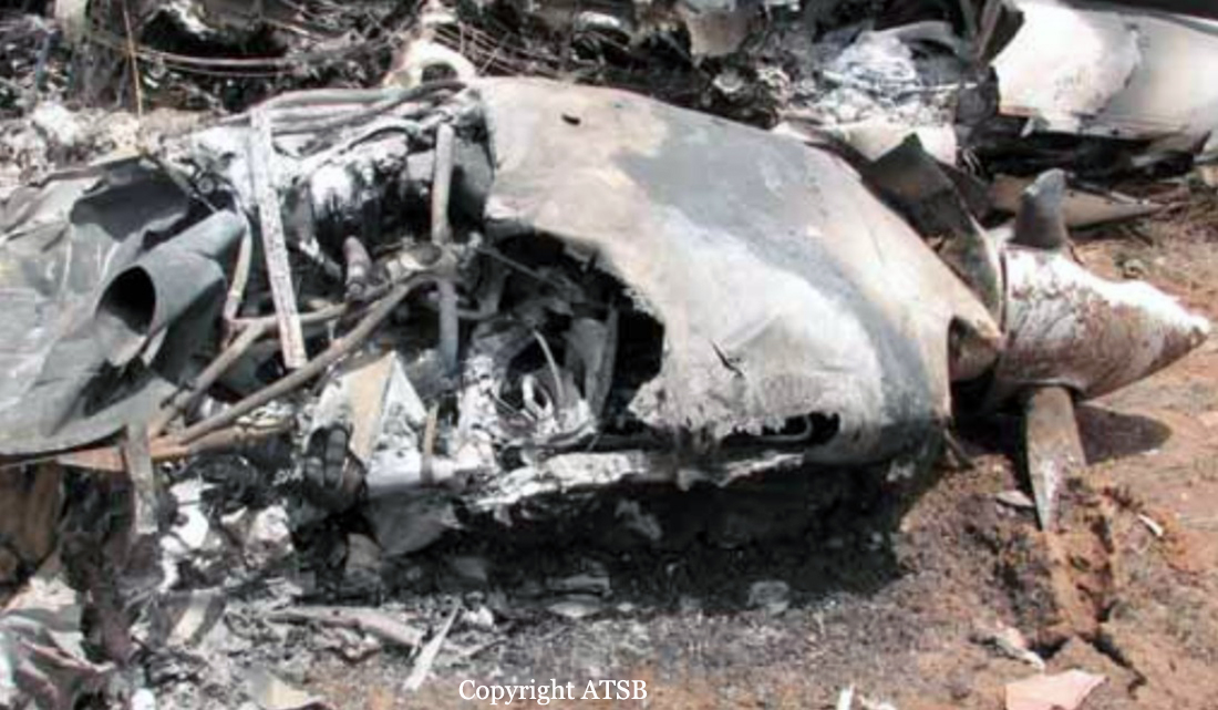
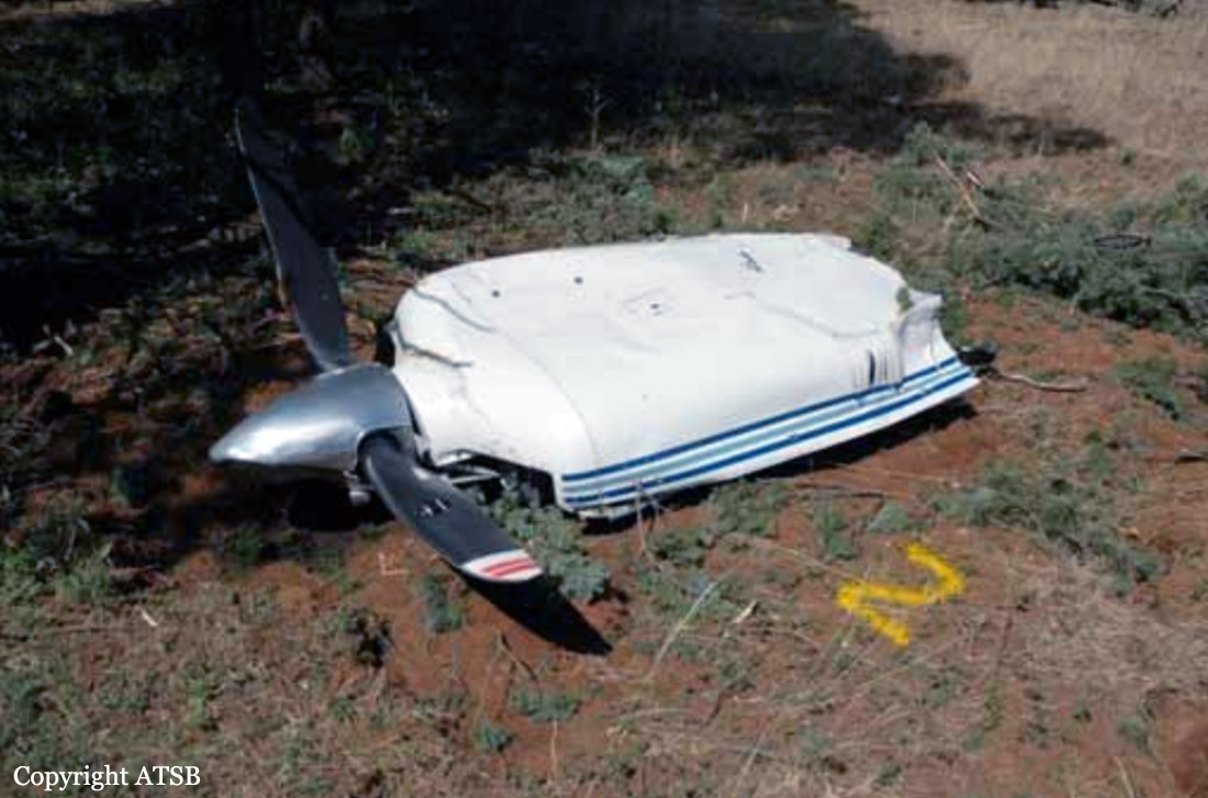
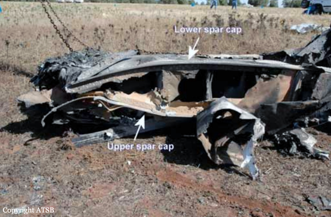
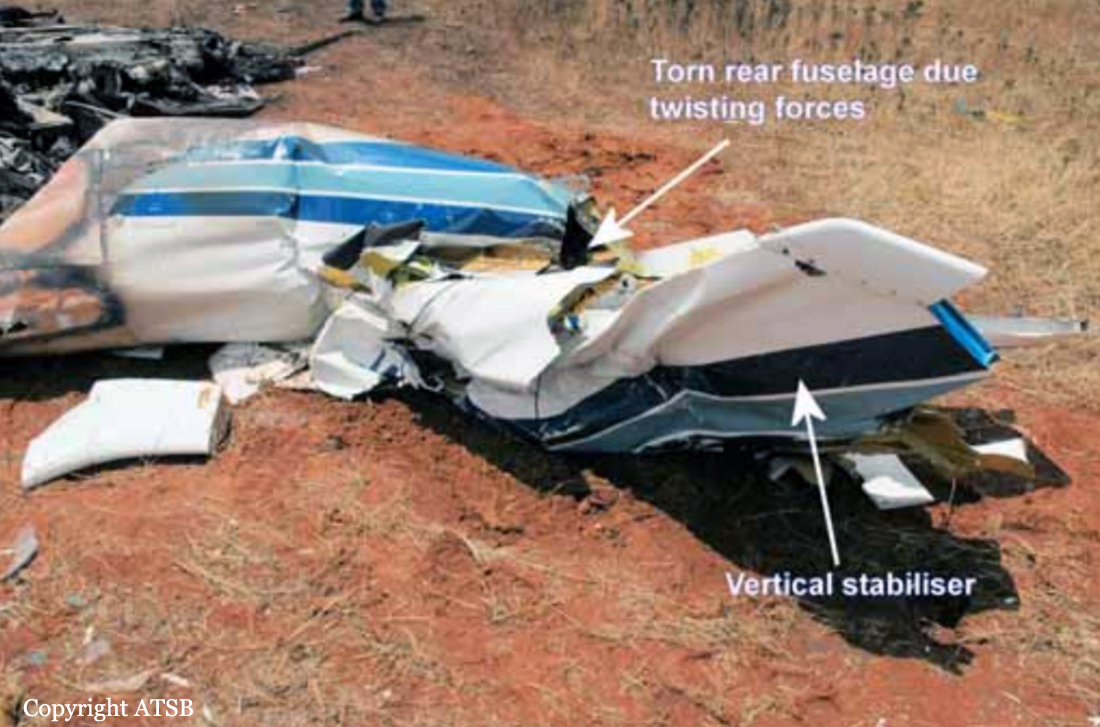
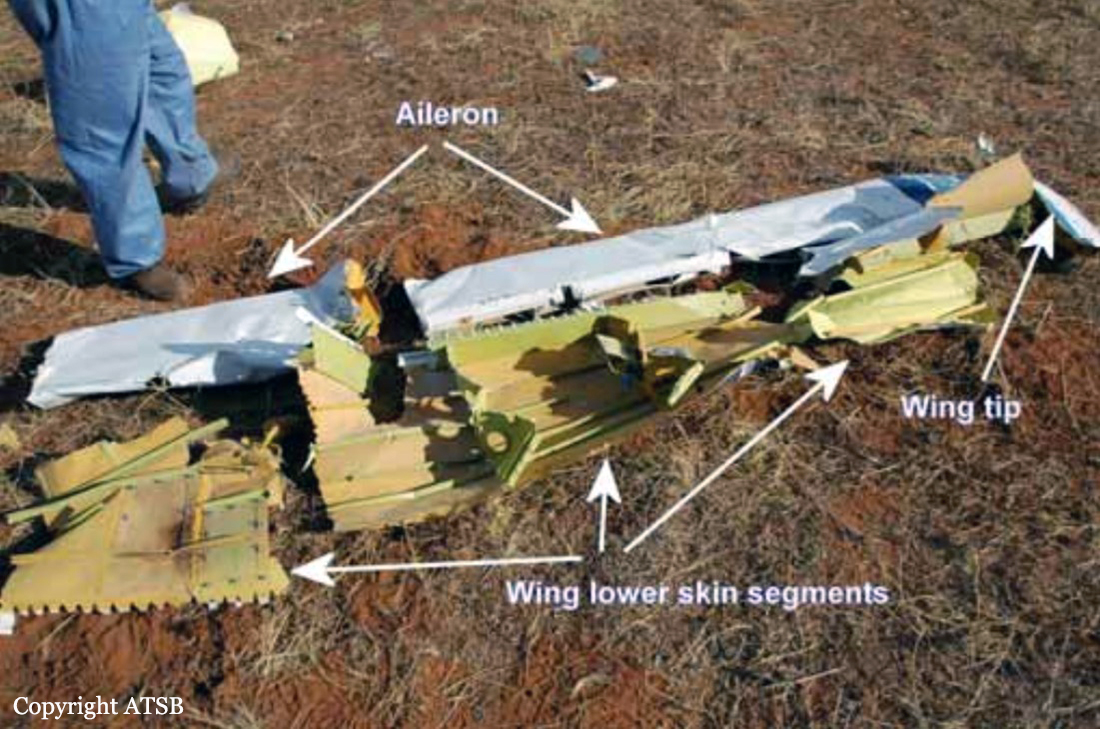
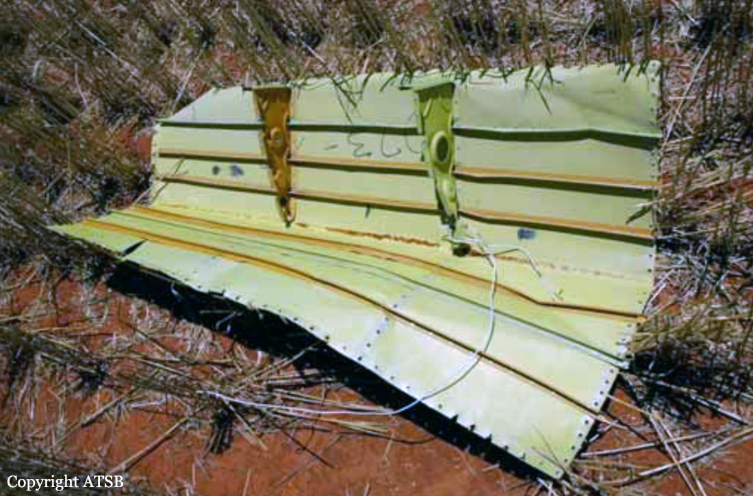
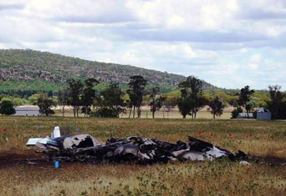
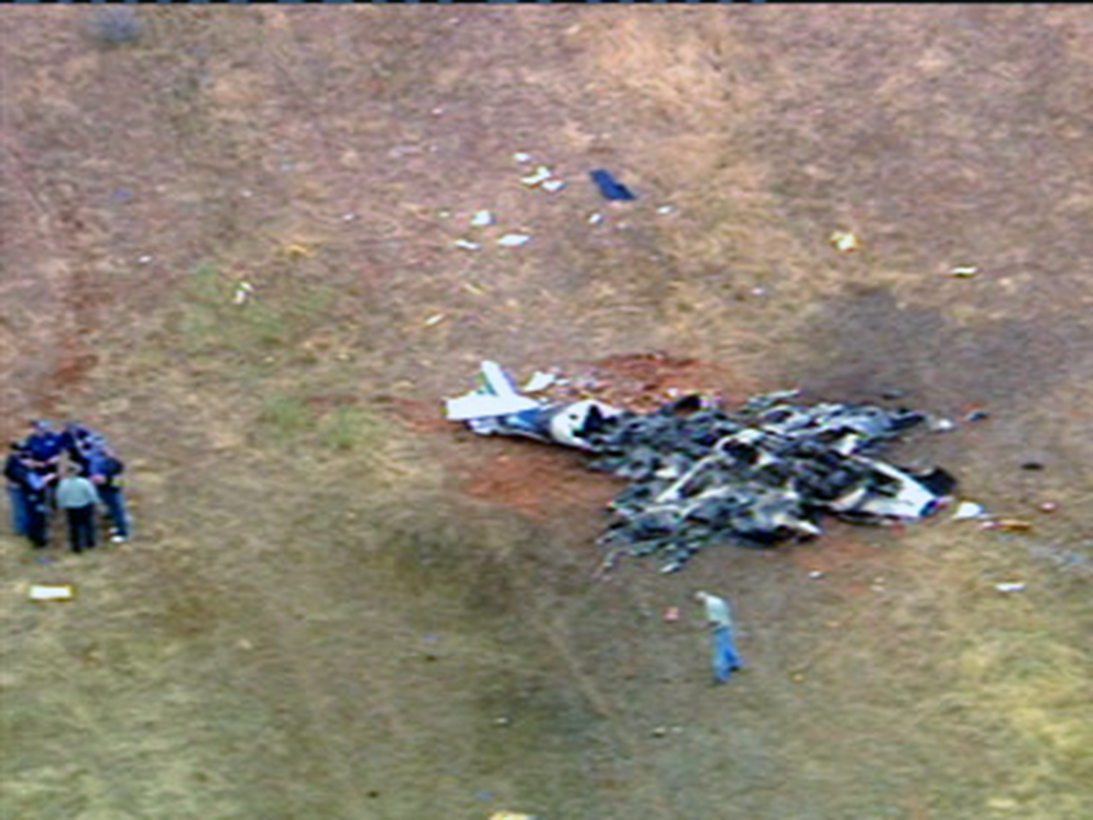
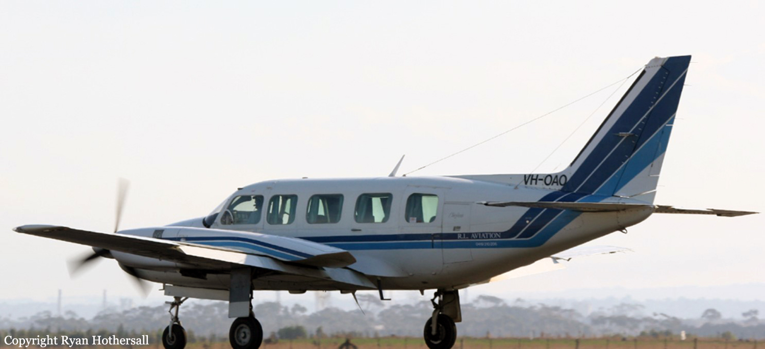
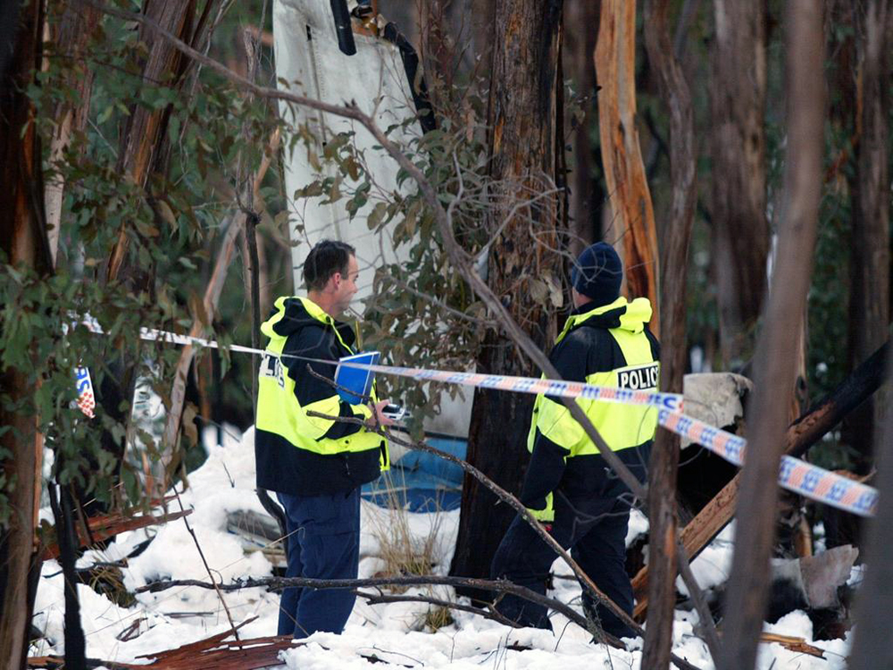
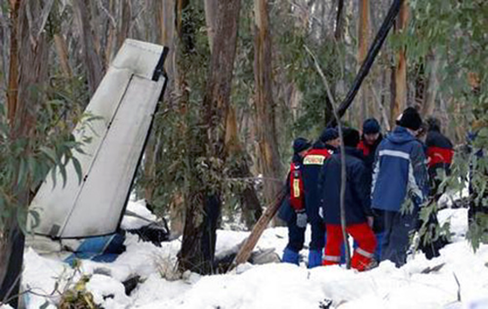
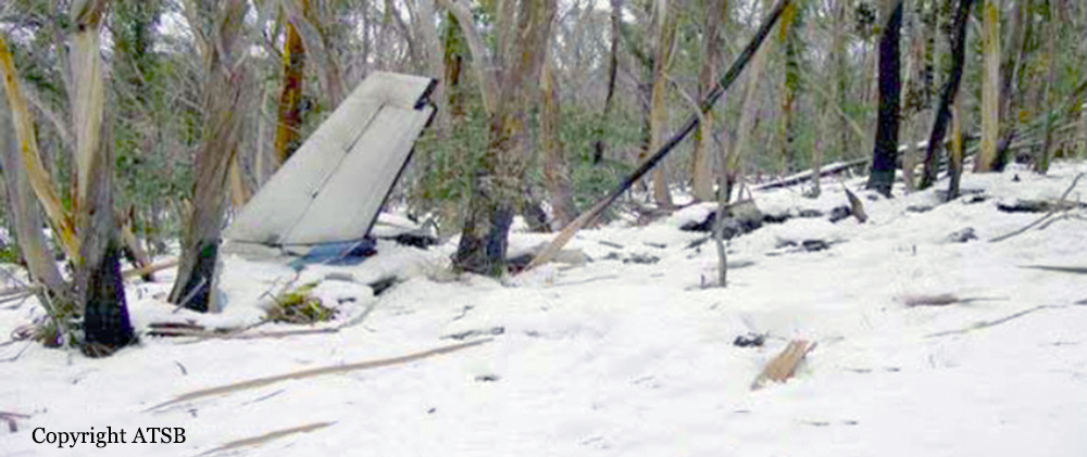
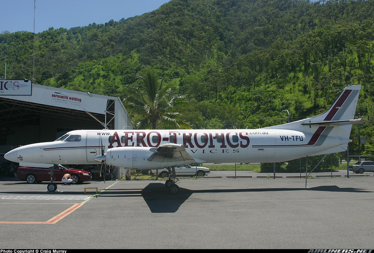
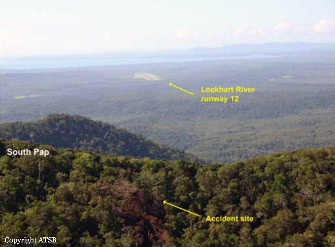
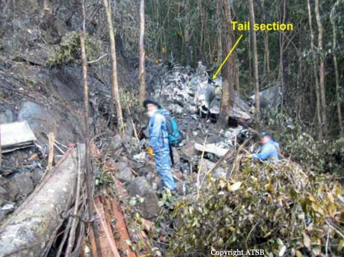
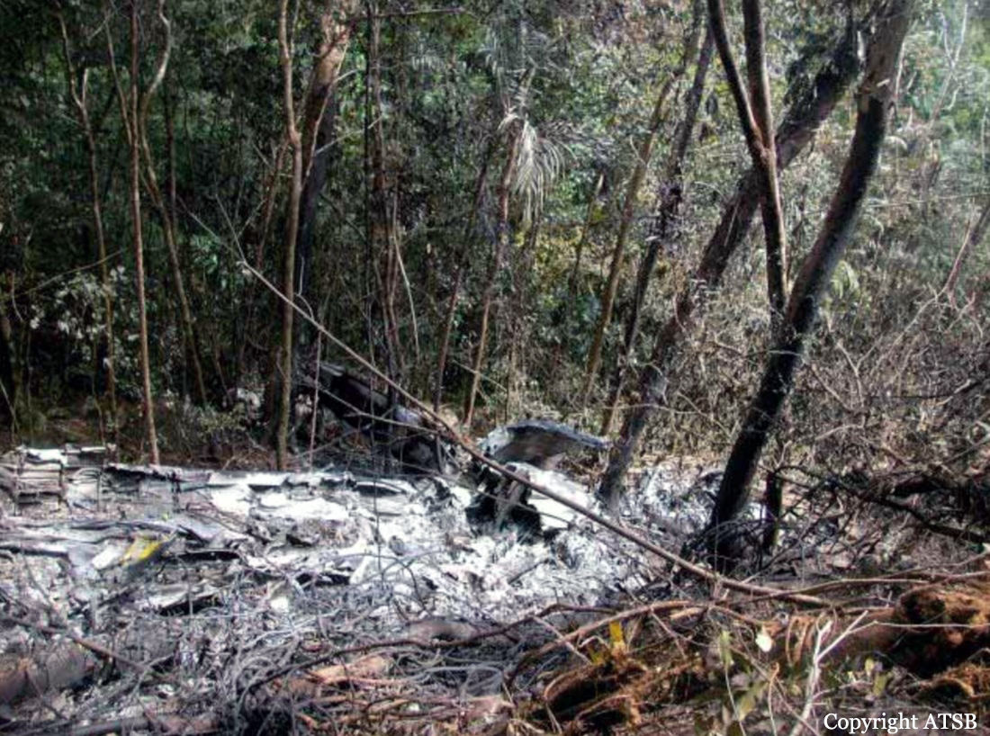
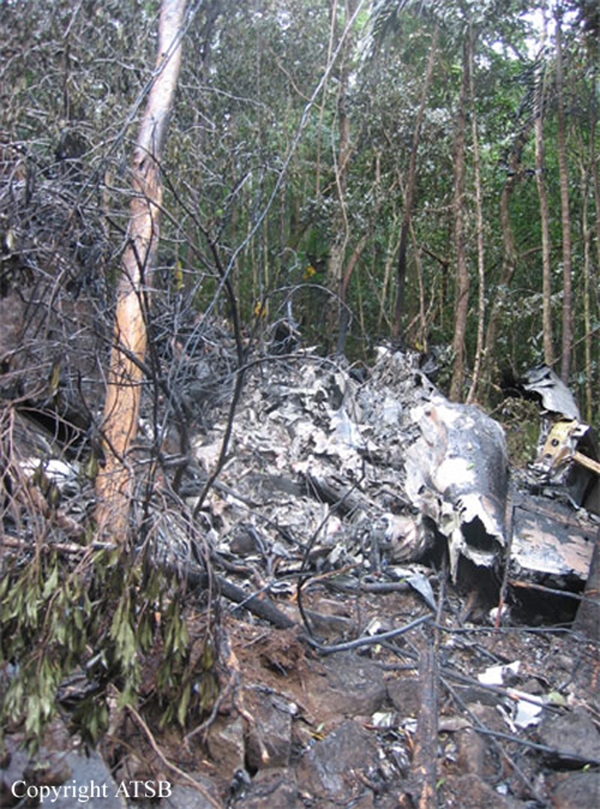
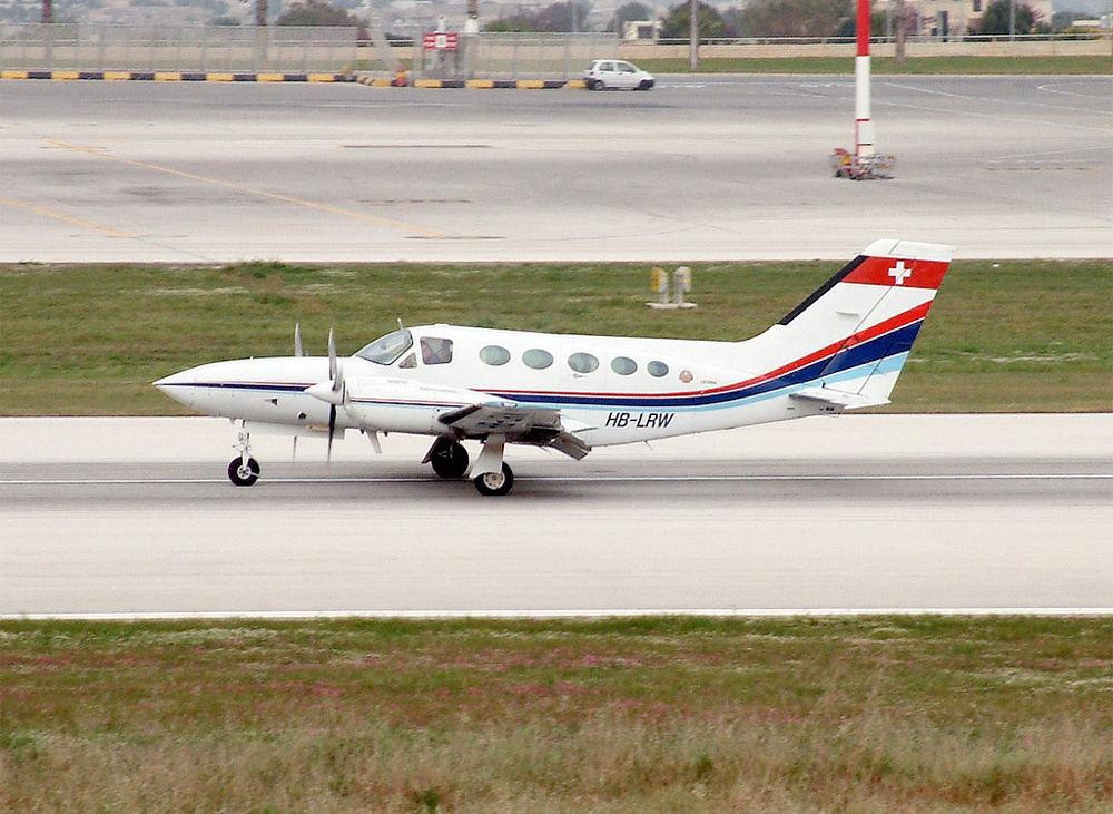
On 7 May 2005, a Fairchild Aircraft Inc. SA227DC Metro 23 aircraft, registered VH-TFU, with two pilots and 13 passengers, was being operated by Transair on an instrument flight rules (IFR) regular public transport (RPT) service from Bamaga to Cairns, with an intermediate stop at Lockhart River, Queensland. At 1143:39 Eastern Standard Time, the aircraft impacted terrain in the Iron Range National Park on the north-western slope of South Pap, a heavily timbered ridge, approximately 11 km north-west of the Lockhart River aerodrome. At the time of the accident, the crew was conducting an area navigation global navigation satellite system (RNAV (GNSS)) non-precision approach to runway 12. The aircraft was destroyed by the impact forces and an intense, fuel-fed, post-impact fire. There were no survivors. The accident was almost certainly the result of controlled flight into terrain; that is, an airworthy aircraft under the control of the flight crew was flown unintentionally into terrain, probably with no prior awareness by the crew of the aircraft’s proximity to terrain. Weather conditions in the Lockhart River area were poor and necessitated the conduct of an instrument approach procedure for an intended landing at the aerodrome. The cloud base was probably between 500 ft and 1,000 ft above mean sea level and the terrain to the west of the aerodrome, beneath the runway 12 RNAV (GNSS) approach, was probably obscured by cloud. The flight data recorder (FDR) data showed that, during the entire descent and approach, the aircraft engine and flight control system parameters were normal and that the crew were accurately navigating the aircraft along the instrument approach track. The FDR data and wreckage examination showed that the aircraft was configured for the approach, with the landing gear down and flaps extended to the half position. There were no radio broadcasts made by the crew on the air traffic services frequencies or the Lockhart River common traffic advisory frequency indicating that there was a problem with the aircraft or crew.
Probable cause:
Contributing factors relating to occurrence events and individual actions:
- The crew commenced the Lockhart River Runway 12 RNAV (GNSS) approach, even though the crew were aware that the copilot did not have the appropriate endorsement and had limited experience to conduct this type of instrument approach.
- The descent speeds, approach speeds and rate of descent were greater than those specified for the aircraft in the Transair Operations Manual. The speeds and rate of descent also exceeded those appropriate for establishing a stabilised approach.
- During the approach, the aircraft descended below the segment minimum safe altitude for the aircraft's position on the approach.
- The aircraft's high rate of descent, and the descent below the segment minimum safe altitude, were not detected and/or corrected by the crew before the aircraft collided with terrain.
- The accident was almost certainly the result of controlled flight into terrain.

Contributing factors relating to local conditions:
- The crew probably experienced a very high workload during the approach.
- The crew probably lost situational awareness about the aircraft's position along the approach.
- The pilot in command had a previous history of conducting RNAV (GNSS) approaches with crew without appropriate endorsements, and operating the aircraft at speeds higher than those specified in the Transair Operations Manual.
- The Lockhart River Runway 12 RNAV (GNSS) approach probably created higher pilot workload and reduced position situational awareness for the crew compared with most other instrument approaches. This was due to the lack of distance referencing to the missed approach point throughout the approach, and the longer than optimum final approach segment with three altitude limiting steps.
- The copilot had no formal training and limited experience to act effectively as a crew member during a Lockhart River Runway 12 RNAV (GNSS) approach.

Contributing factors relating to Transair processes:
- Transair's flight crew training program had significant limitations, such as superficial or incomplete ground-based instruction during endorsement training, no formal training for new pilots in the operational use of GPS, no structured training on minimising the risk of controlled flight into terrain, and no structured training in crew resource management and operating effectively in a multi-crew environment. (Safety Issue)
- Transair's processes for supervising the standard of flight operations at the Cairns base had significant limitations, such as not using an independent approved check pilot to review operations, reliance on passive measures to detect problems, and no defined processes for selecting and monitoring the performance of the base manager. (Safety Issue)
- Transair's standard operating procedures for conducting instrument approaches had significant limitations, such as not providing clear guidance on approach speeds, not providing guidance for when to select aircraft configuration changes during an approach, no clear criteria for a stabilised approach, and no standardised phraseology for challenging safety-critical decisions and actions by other crew members. (Safety Issue)
- Transair had not installed a terrain awareness and warning system, such as an enhanced ground proximity warning system, in VH-TFU.
- Transair's organisational structure, and the limited responsibilities given to non-management personnel, resulted in high work demands on the chief pilot. It also resulted in a lack of independent evaluation of training and checking, and created disincentives and restricted opportunities within Transair to report safety concerns with management decision making. (Safety Issue)
- Transair did not have a structured process for proactively managing safety related risks associated with its flight operations. (Safety Issue)
- Transair's chief pilot did not demonstrate a high level of commitment to safety. (Safety Issue)

Contributing factors relating to the Civil Aviation Safety Authority processes:
- CASA did not provide sufficient guidance to its inspectors to enable them to effectively and consistently evaluate several key aspects of operator management systems. These aspects included evaluating organisational structure and staff resources, evaluating the suitability of key personnel, evaluating organisational change, and evaluating risk management processes. (Safety Issue)
- CASA did not require operators to conduct structured and/or comprehensive risk assessments, or conduct such assessments itself, when evaluating applications for the initial issue or subsequent variation of an Air Operator's Certificate. (Safety Issue)

Other factors relating to local conditions:
- There was a significant potential for crew resource management problems within the crew in high workload situations, given that there was a high trans-cockpit authority gradient and neither pilot had previously demonstrated a high level of crew resource management skills.
- The pilots' endorsements, clearance to line operations, and route checks did not meet all the relevant regulatory and operations manual requirements to conduct RPT flights on the Metro aircraft.
- Some cockpit displays and annunciators relevant to conducting an instrument approach were in a sub-optimal position in VH-TFU for useability or attracting the attention of both pilots.

Other factors relating to instruments approaches:
- Based on the available evidence, the Lockhart River Runway 12 RNAV (GNSS) approach design resulted in mode 2A ground proximity warning system alerts and warnings when flown on the recommended profile or at the segment minimum safe altitudes. (Safety Issue)
- The Australian convention for waypoint names in RNAV (GNSS) approaches did not maximise the ability to discriminate between waypoint names on the aircraft global positioning system display and/or on the approach chart. (Safety Issue)
- There were several design aspects of the Jeppesen RNAV (GNSS) approach charts that could lead to pilot confusion or reduction in situational awareness. These included limited reference regarding the 'distance to run' to the missed approach point, mismatches in the vertical alignment of the plan-view and profile-view on charts such as that for the Lockhart River runway 12 approach, use of the same font size and type for waypoint names and 'NM' [nautical miles], and not depicting the offset in degrees between the final approach track and the runway centreline. (Safety Issue)
- Jeppesen instrument approach charts depicted coloured contours on the plan-view of approach charts based on the maximum height of terrain relative to the airfield only, rather than also considering terrain that increases the final approach or missed approach procedure gradient to be steeper than the optimum. Jeppesen instrument approach charts did not depict the terrain profile on the profile-view although the segment minimum safe altitudes were depicted. (Safety Issue)
- Airservices Australia's instrument approach charts did not depict the terrain contours on the plan-view. They also did not depict the terrain profile on the profile-view, although the segment minimum safe altitudes were depicted. (Safety Issue)

Other factors relating to Transair processes:
- Transair's flight crew proficiency checking program had significant limitations, such as the frequency of proficiency checks and the lack of appropriate approvals of many of the pilots conducting proficiency checks. (Safety Issue)
- The Transair Operations Manual was distributed to company pilots in a difficult to use electronic format, resulting in pilots minimising use of the manual. (Safety Issue) Other factors relating to regulatory requirements and guidance
- Although CASA released a discussion paper in 2000, and further development had occurred since then, there was no regulatory requirement for initial or recurrent crew resource management training for RPT operators. (Safety Issue)
- There was no regulatory requirement for flight crew undergoing a type rating on a multi-crew aircraft to be trained in procedures for crew incapacitation and crew coordination, including allocation of pilot tasks, crew cooperation and use of checklists. This was required by ICAO Annex 1 to which Australia had notified a difference. (Safety Issue)
- The regulatory requirements concerning crew qualifications during the conduct of instrument approaches in a multi-crew RPT operation was potentially ambiguous as to whether all crew members were required to be qualified to conduct the type of approach being carried out. (Safety Issue)
- CASA's guidance material provided to operators about the structure and content of an operations manual was not as comprehensive as that provided by ICAO in areas such as multi-crew procedures and stabilised approach criteria. (Safety Issue)
- Although CASA released a discussion paper in 2000, and further development and publicity had occurred since then, there was no regulatory requirement for RPT operators to have a safety management system. (Safety Issue)
- There was no regulatory requirement for instrument approach charts to include coloured contours to depict terrain. This was required by a standard in ICAO Annex 4 in certain situations. Australia had not notified a difference to the standard. (Safety Issue)
- There was no regulatory requirement for multi-crew RPT aircraft to be fitted with a serviceable autopilot. (Safety Issue)

Other factors relating to Civil Aviation Safety Authority processes:
- CASA's oversight of Transair, in relation to the approval of Air Operator's Certificate variations and the conduct of surveillance, was sometimes inconsistent with CASA's policies, procedures and guidelines.
- CASA did not have a systematic process for determining the relative risk levels of airline operators. (Safety Issue)
- CASA's process for evaluating an operations manual did not consider the useability of the manual, particularly manuals in electronic format. (Safety Issue)
- CASA's process for accepting an instrument approach did not involve a systematic risk assessment of pilot workload and other potential hazards, including activation of a ground proximity warning system. (Safety Issue) Other key findings An 'other key finding' is defined as any finding, other than that associated with safety factors, considered important to include in an investigation report. Such findings may resolve ambiguity or controversy, describe possible scenarios or safety factors when firm safety factor findings were not able to be made, or note events or conditions which 'saved the day' or played an important role in reducing the risk associated with an occurrence.
- It was very likely that both crew members were using RNAV (GNSS) approach charts produced by Jeppesen.
- The cockpit voice recorder did not function as intended due to an internal fault that had developed sometime before the accident flight and that was not discovered or diagnosed by flight crew or maintenance personnel.
- There was no evidence to indicate that the GPWS did not function as designed.
- There would have been insufficient time for the crew to effectively respond to the GPWS alert and warnings that were probably annunciated during the final 5 seconds prior to impact with terrain.
Final Report:

Crash of a Cessna 421C Golden Eagle III in El Questro: 2 killed

Date & Time: Aug 30, 2004 at 1200 LT
Operator:
Registration:
HB-LRW
Flight Phase:
Flight Type:
Survivors:
No
Schedule:
El Questro – Broome
MSN:
421C-0633
YOM:
1974
Country:
Region:
Crew on board:
1
Crew fatalities:
Pax on board:
1
Pax fatalities:
Other fatalities:
Total fatalities:
2
Captain / Total flying hours:
2128
Captain / Total hours on type:
975.00
Aircraft flight hours:
3254
Circumstances:
On 30 August 2004, shortly before 1200 Western Standard Time, the owner-pilot of a twin-engine Cessna Aircraft Company 421C Golden Eagle (C421) aircraft, registered HB-LRW, commenced his takeoff from runway 32 at El Questro Aircraft Landing Area (ALA). The private flight was to Broome, where the pilot intended resuming the aircraft delivery flight from Switzerland to Perth. The available documentation indicated that the flight segments en route to Australia had all been to international or major aerodromes. The pilot of a Cessna Aircraft Company 210 (C210) and his two passengers in the runway 32 parking area witnessed the takeoff. Those witnesses reported that the C421 pilot carried out a pre-flight inspection of the aircraft prior to boarding for the takeoff. During that inspection, he was observed preparing for, and conducting a fuel drain check under the left wing, and to have removed some weed-like material from the right main wheel. He then loaded a small amount of personal luggage into the aircraft cabin, before he and the sole passenger boarded. The C210 pilot witness, who reported having observed a number of twin-engine aircraft operations at another aerodrome, did not comment on the nature of the pilot's start and engines run-up checks. The passenger witnesses reported that the pilot of the C421 made a number of unsuccessful attempts to start the left engine, before reverting to starting the right engine. He then started the left engine and moved the aircraft clear of the C210 in order to conduct his engine run-up checks. The passenger witnesses reported that during those checks they heard a 'frequency vibration' as the C421 pilot manipulated the engines' controls. The witnesses at the parking area reported that the C421 pilot taxied the aircraft onto the runway and applied power to commence a rolling takeoff. They, together with a hearing witness located to the north of the ALA indicated that the engines sounded 'normal' throughout the takeoff. Witnesses who observed the takeoff reported that the aircraft accelerated away 'briskly'. The pilot witness stated that the take-off roll and lift-off from the runway appeared similar to other twin-engine aircraft takeoffs that he had observed. The witnesses at the parking area also stated that, shortly after lift-off from the runway, the aircraft banked slightly to the left at an estimated 10 to 15 degrees angle of bank and drifted left before striking the trees along the side of the runway and impacting the ground. There was no report of any objects falling from the aircraft, or of any smoke or vapour emanating from the aircraft during the takeoff. The aircraft was destroyed by the impact forces and post-impact fire. The pilot and passenger were fatally injured.
Probable cause:
For reasons that could not be determined, the aircraft commenced a slight left angle of bank and drifted left after lift-off at a height from which the pilot was unable to recover prior to striking trees to the left of the runway.
Final Report:

Crash of a Piper PA-31T Cheyenne II near Benalla: 6 killed

Date & Time: Jul 28, 2004 at 1048 LT
Type of aircraft:
Registration:
VH-TNP
Survivors:
No
Site:
Schedule:
Bankstown – Benalla
MSN:
31-7920026
YOM:
1979
Country:
Region:
Crew on board:
1
Crew fatalities:
Pax on board:
5
Pax fatalities:
Other fatalities:
Total fatalities:
6
Captain / Total flying hours:
14017
Captain / Total hours on type:
3100.00
Aircraft flight hours:
5496
Circumstances:
At 0906 Eastern Standard Time on 28 July 2004, a Piper Aircraft Corporation PA31T Cheyenne aircraft, registered VH-TNP, with one pilot and five passengers, departed Bankstown, New South Wales on a private, instrument flight rules (IFR) flight to Benalla, Victoria. Instrument meteorological conditions at the destination necessitated an instrument approach and the pilot reported commencing a Global Positioning System (GPS) non-precision approach (NPA) to Benalla. When the pilot had not reported landing at Benalla as expected, a search for the aircraft was commenced. Late that afternoon the crew of a search helicopter located the burning wreckage on the eastern slope of a tree covered ridge, approximately 34 km southeast of Benalla. All occupants were fatally injured and the aircraft was destroyed by impact forces and a post-impact fire.
Probable cause:
Significant factors:
1. The pilot was not aware that the aircraft had diverged from the intended track.
2. The route flown did not pass over any ground-based navigation aids.
3. The sector controller did not advise the pilot of the divergence from the cleared track.
4. The sector controller twice cancelled the route adherence monitoring alerts without confirming the pilot’s tracking intentions.
5. Cloud precluded the pilot from detecting, by external visual cues, that the aircraft was not flying the intended track.
6. The pilot commenced the approach at an incorrect location.
7. The aircraft’s radio altimeter did not provide the pilot with an adequate defence to avoid collision with terrain.
8. The aircraft was not fitted with a terrain awareness warning system (TAWS).
Final Report:

Crash of a Rockwell Shrike Commander 500S near Hobart: 1 killed

Date & Time: Feb 19, 2004 at 1643 LT
Operator:
Registration:
VH-LST
Flight Phase:
Flight Type:
Survivors:
No
Schedule:
Hobart – Devonport
MSN:
500-3111
YOM:
1971
Location:
Country:
Region:
Crew on board:
1
Crew fatalities:
Pax on board:
0
Pax fatalities:
Other fatalities:
Total fatalities:
1
Captain / Total flying hours:
371
Captain / Total hours on type:
40.00
Circumstances:
The aircraft commenced taxying at Hobart for a Visual Flight Rules (VFR) ferry flight to Devonport. The pilot, who was the sole occupant, reported a departure time of 1643 to air traffic control, with an intention to climb to 8,500 ft and to fly a track of 319 degrees magnetic. Due to following traffic, the pilot was required to report leaving specific altitudes. At 1646, the pilot reported leaving 4,500 ft, and was advised that air traffic services were terminated. The acknowledgement of that call was the last communication heard from the pilot. At about 1800, the operator’s staff at Devonport advised the Hobart base that the aircraft had not arrived. The operator advised AusSAR and the Hobart air traffic control tower, and organised company search aircraft from both Hobart and Devonport. The non-flying occupant of the Hobart search aircraft sighted the wreckage at about 1930. Shortly after, a search and rescue helicopter arrived at the accident site. The pilot of the aircraft was found fatally injured in the wreckage. The wreckage was located 58 km from Hobart airport on a bearing of 320 degrees magnetic. Based on predictions of aircraft performance and the distance of the accident site from Hobart, the estimated time of the accident was 1656. There were no eyewitnesses to the accident. Aircraft flight profile The aircraft was not equipped with a flight data recorder or cockpit voice recorder, nor was it required to be. As such, and given that the aircraft was operating outside of radar coverage, there was no recorded flight profile information available. The pilot was not required to report cruising at 8,500 ft and there was no evidence to confirm that the aircraft had reached that altitude. However, based on the normal climb and cruise performance, forecast winds and the radio broadcasts made by the pilot, the aircraft should have reached an altitude of 8,500 ft approximately 35 km from Hobart at about 1651, which was 5 minutes prior to the estimated time of the accident at 1656.
Probable cause:
The trajectory analysis provided the ATSB with a high degree of confidence with respect to the aircraft altitude and speed at the time of the in-flight breakup. The aircraft’s speed could have readily accelerated to Vne during a rapid descent from the nominated cruise altitude of 8,500 ft to the break-up altitude of around 3,150 ft. At such a speed, a relatively small control input force or gusts encountered in the longitudinal (pitch) axis of the aircraft could have resulted in the symmetrical downward wing overloading and failure that occurred. There is no compelling evidence to support any one reason for the departure of the aircraft from the cruise altitude into a high speed dive type situation. However, there are a number of factors that provide some weight to the possibility of a flight upset related to operation of the autopilot. These factors include:
• The lack of any reference in the operations manual to the installation of a Bendix FCS-810 autopilot in LST and the lack of information in the operations manual on the operation of the FCS-810 autopilot
• The pilot’s relative inexperience in the operation of the particular autopilot system fitted to LST
• The operating characteristics of the autopilot system fitted to LST
• The illegible nature of the Aircraft Flight Manual supplement pertaining to the limitations and operating procedures for the autopilot system fitted to LST
• The autopilot controller pitch command wheel being found at the accident site in the maximum nose-down position
• Both elevator trim tabs being found at the accident site at or close to the maximum nose-down trim position. However, it is not possible to discount other explanations for the departure from cruise flight, including a runaway pitch-trim condition, pilot incapacitation, the effects of mountain waves and/or severe turbulence, or a combination of any of the above. On the evidence available to the investigation, it was not possible to conclusively determine the circumstances that led to the aircraft descending at speed to the altitude at which the in-flight breakup occurred.
Final Report:

Crash of a Cessna 208 Caravan I off Green Island

Date & Time: Feb 8, 2004 at 1610 LT
Type of aircraft:
Operator:
Registration:
VH-CYC
Flight Phase:
Flight Type:
Survivors:
Yes
Schedule:
Cairns - Cairns
MSN:
208-0108
YOM:
1986
Country:
Region:
Crew on board:
1
Crew fatalities:
Pax on board:
1
Pax fatalities:
Other fatalities:
Total fatalities:
0
Captain / Total flying hours:
5333
Captain / Total hours on type:
211.00
Circumstances:
The aircraft, with two pilots on board, was being operated for pilot type endorsement training. Air Traffic Control (ATC) had cleared the pilots to conduct upper level air work between 4,000 and 5,000 ft above mean sea level (AMSL) within a 5 NM radius of Green Island, Queensland. Following the upper level air work, the crew requested, and were granted a clearance for, a simulated engine failure and descent to 2,000 ft. The pilot in command (PIC) reported that while completing the simulated engine failure training, he had retarded the power lever to the FLIGHT IDLE stop and the fuel condition lever to the LOW IDLE range, setting a value of 55% engine gas generator speed (Ng). The pilot under training then set the glide attitude at the best glide speed (for the operating weight) of about 79 knots indicated airspeed (KIAS). The PIC then instructed the pilot under training to place the propeller into the feathered position, and maintain best glide speed. The PIC reported that he instructed the pilot under training to advance the emergency power lever (EPL) to simulate manual introduction of fuel to the engine. According to the PIC, he then noticed that there was no engine torque increase, with the engine inter-turbine temperature (ITT or T5) and Ng rapidly decreasing, and a strong smell of fuel in the cockpit. While the pilot under training flew the aircraft, the PIC placed the ignition switch to the ON position and also selected START on the engine starter switch. He then reportedly placed the EPL to the CLOSED position, the propeller to the UNFEATHERED position and the fuel condition lever to the IDLE CUTOFF position to clear the excess fuel from the engine. The PIC reported that they then increased the aircraft airspeed to 120 KIAS, at which point he reintroduced fuel into the engine by advancing the fuel condition lever. He reported that following these actions, the strong fuel smell persisted. As the aircraft approached 1,500 ft, the PIC broadcast a MAYDAY, informing ATC that they had a 'flameout' of the engine and that they were going to complete a forced landing water ditching near Green Island. While the pilot under training flew the aircraft, the PIC placed the propeller into the feathered position, closed the fuel condition lever to the IDLE CUTOFF position and turned off the starter and ignition switches. They then completed a successful landing in a depth of about 2 m of water near Green Island. The pilots evacuated the aircraft without injury. The aircraft, which sustained minor damage during the ditching, but subsequent substantial damage due to salt water immersion, was recovered to the mainland. Following examination of all connections and control linkages, the engine was removed for examination under the supervision of the Australian Transport Safety Bureau (ATSB) at the engine manufacturer's overhaul facility. The engine trend monitoring (ETM) data logger was also removed from the aircraft for examination.
Probable cause:
The following factors were identified:
1. The pilots of CYC were conducting in-flight familiarization training using the emergency power lever. That procedure was not contained in the aircraft manufacturer's pilot operating handbook.
2. The engine manufacturer's documentation contained information on the use of the emergency power lever, which did not preclude the use of the emergency power lever for in-flight familiarization training.
3. The engine sustained a flameout at an altitude above mean sea level from which reignition of the engine was not successfully completed.
4. Erosion of the first-stage compressor blades would have reduced the aerodynamic efficiency of the compressor blades.
Final Report: