Crash of a Cessna 208 Caravan 675 on Addenbroke Island: 4 killed

Date & Time: Jul 26, 2019 at 1104 LT
Type of aircraft:
Operator:
Registration:
C-GURL
Flight Phase:
Survivors:
Yes
Site:
MSN:
208-0501
YOM:
2008
Country:
Crew on board:
1
Crew fatalities:
Pax on board:
8
Pax fatalities:
Other fatalities:
Total fatalities:
4
Captain / Total flying hours:
8500
Captain / Total hours on type:
504.00
Aircraft flight hours:
4576
Circumstances:
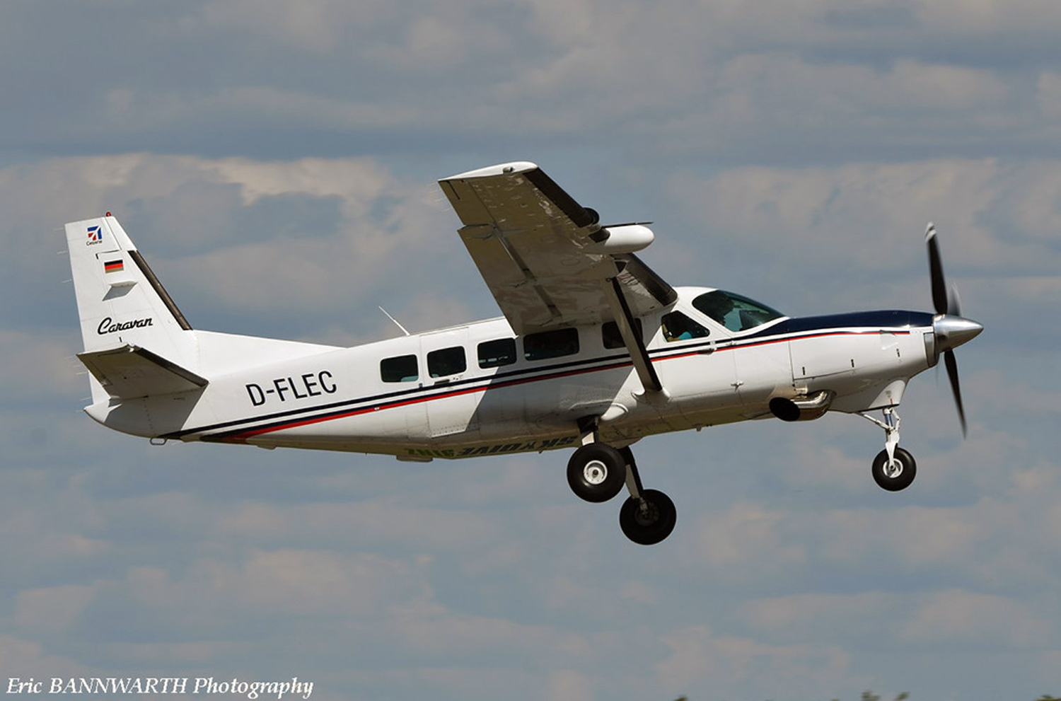
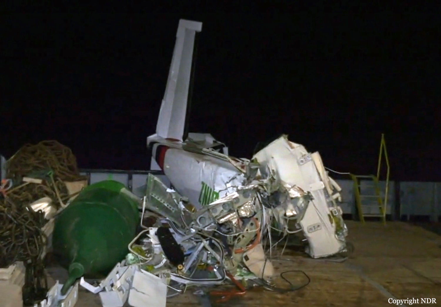
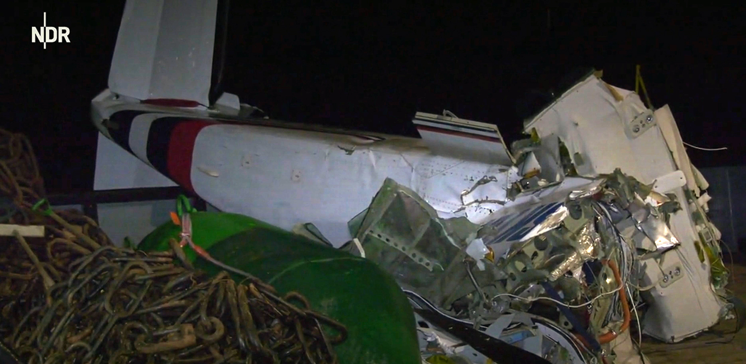
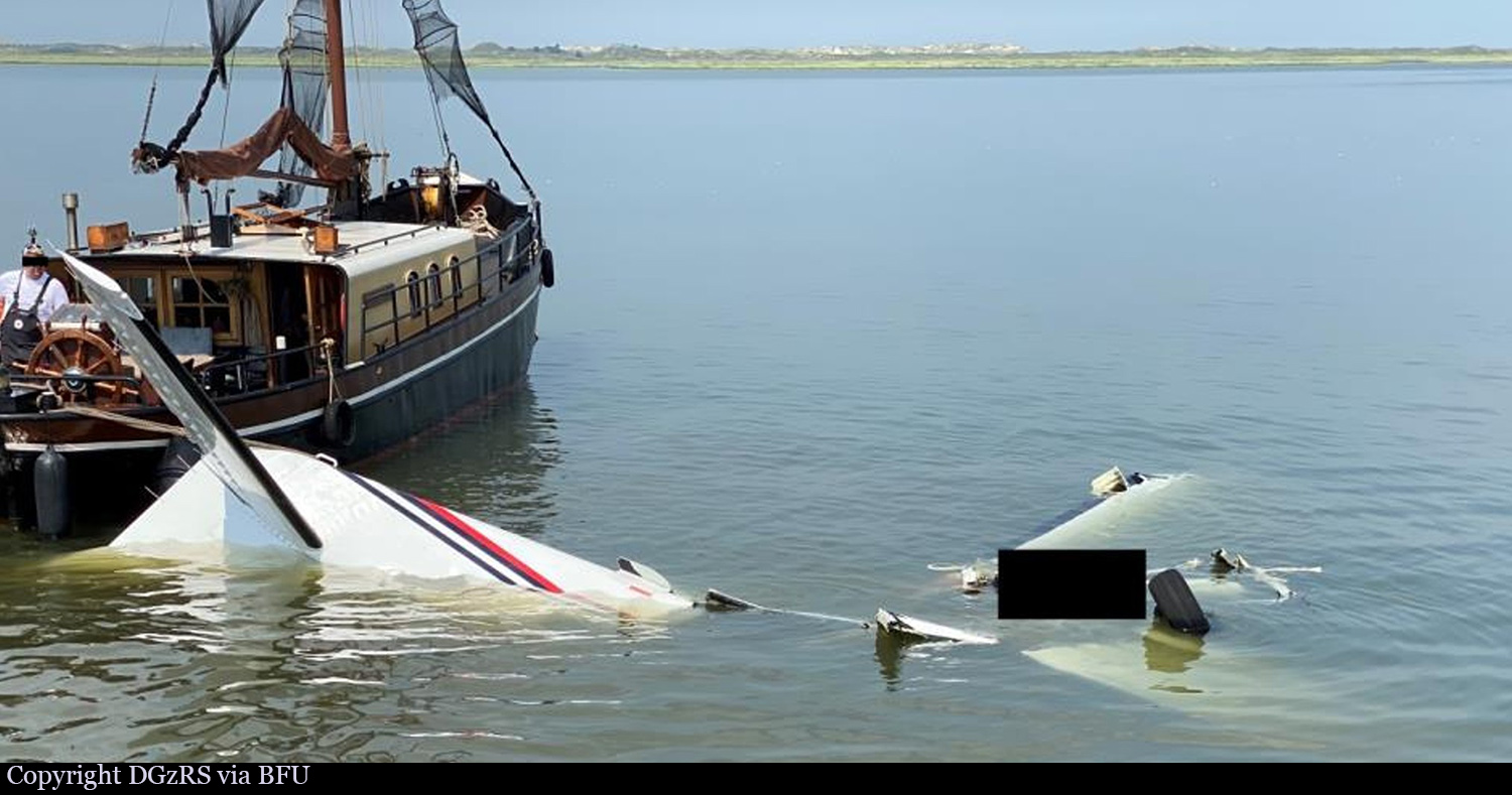
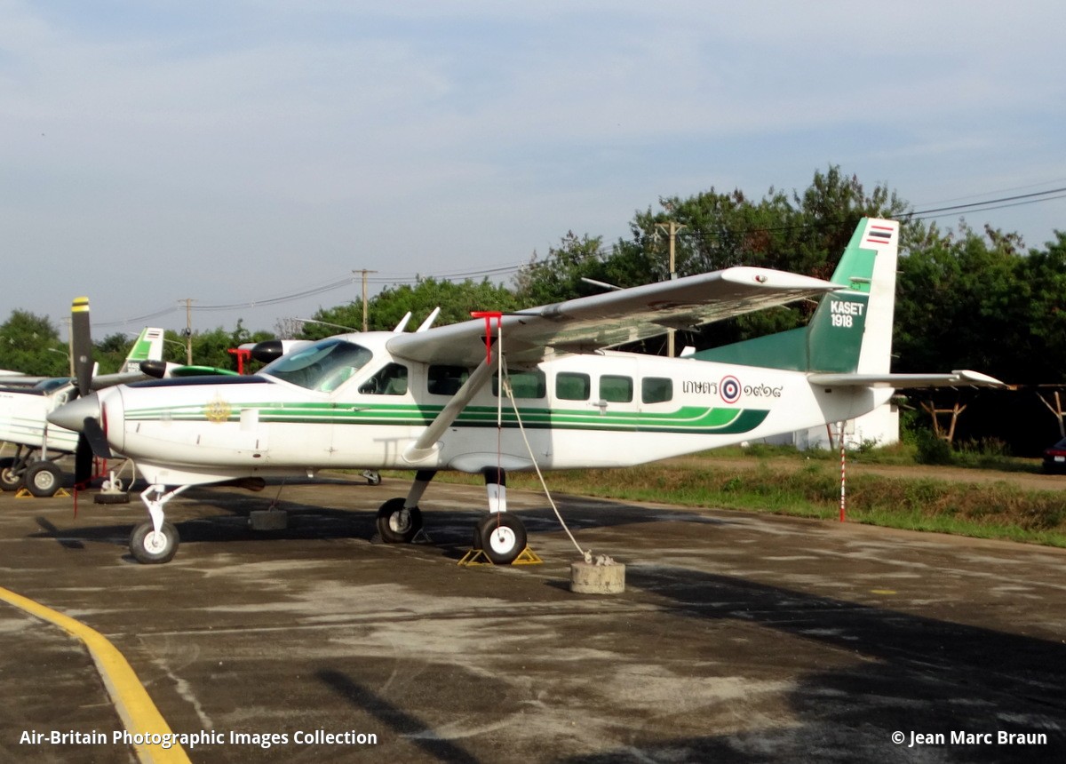
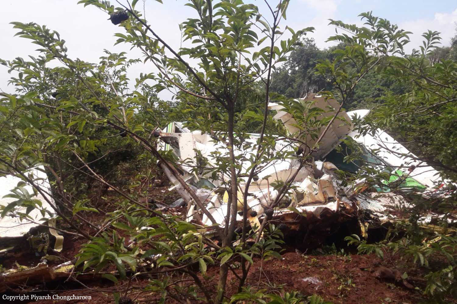
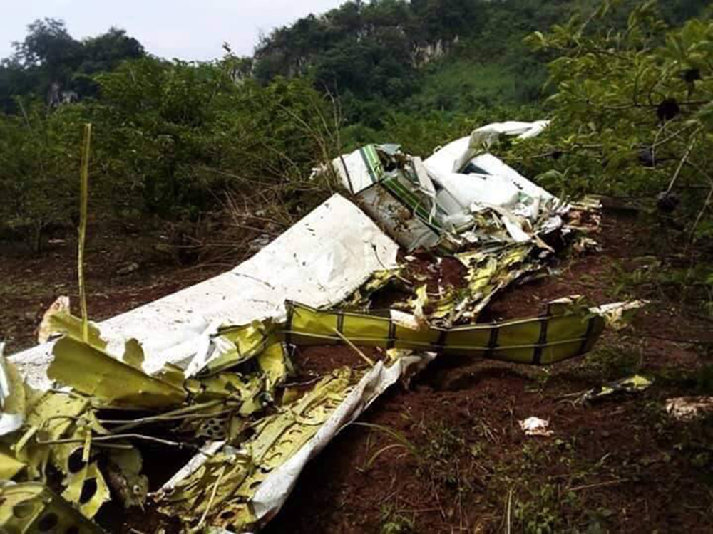
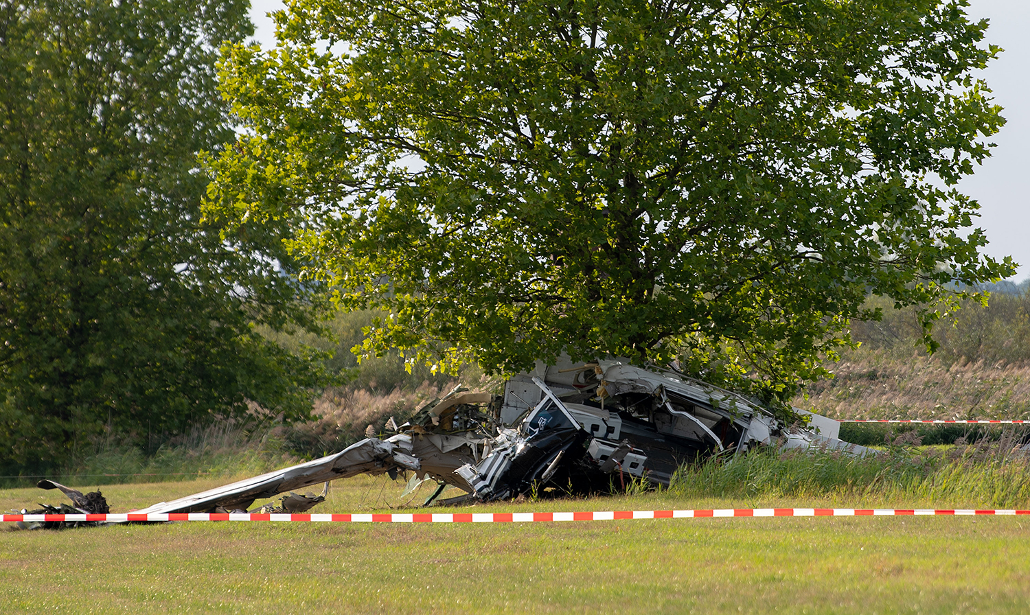
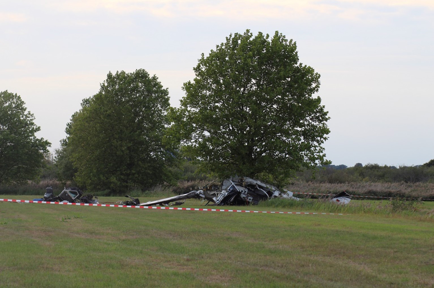
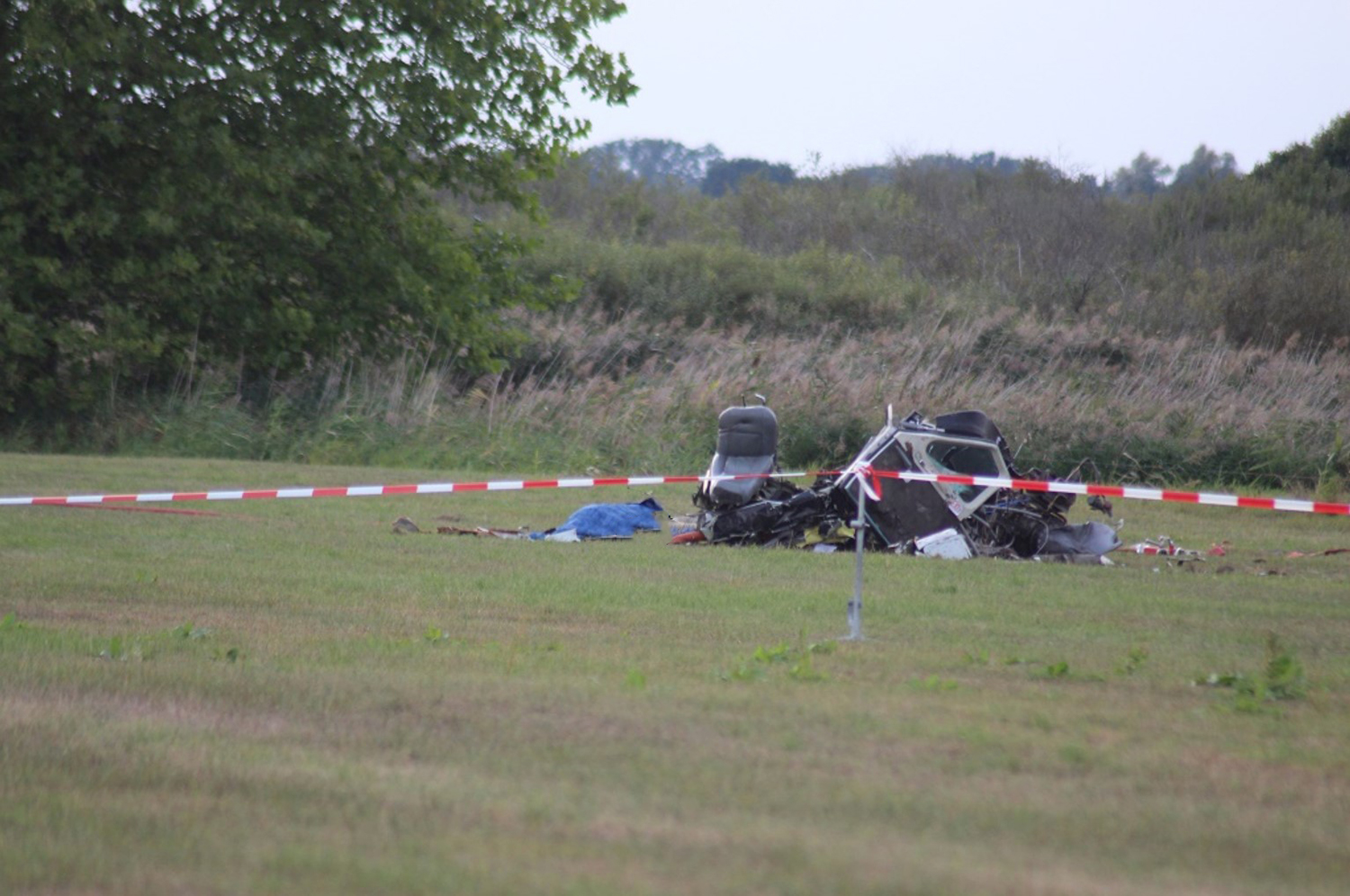
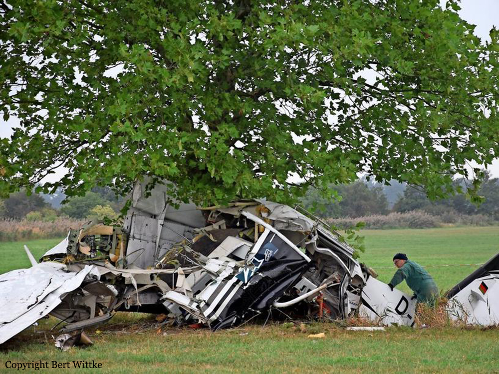
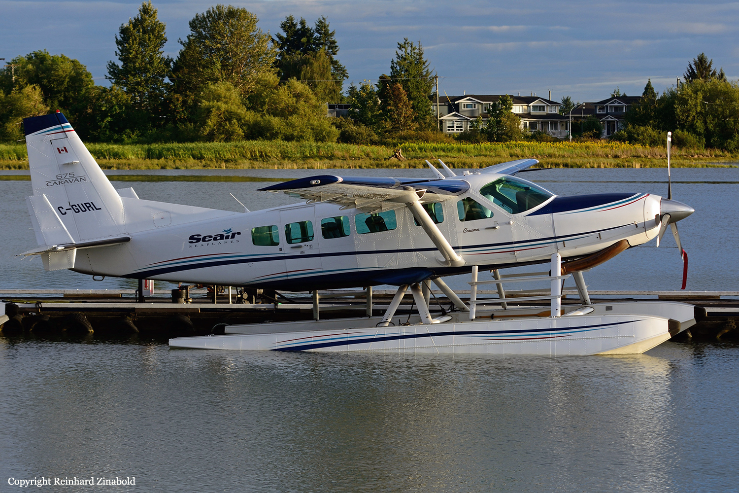
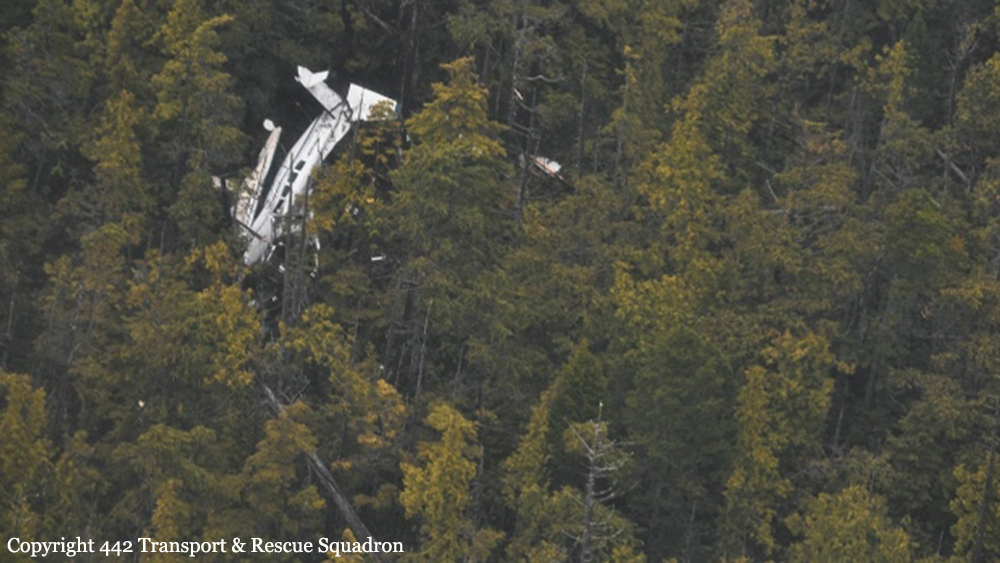
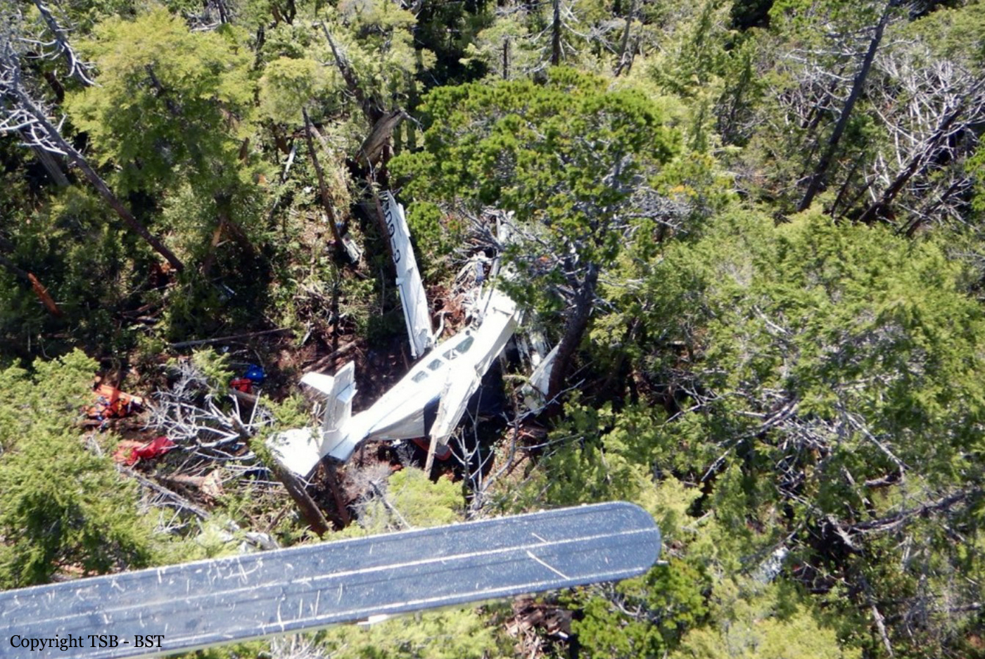
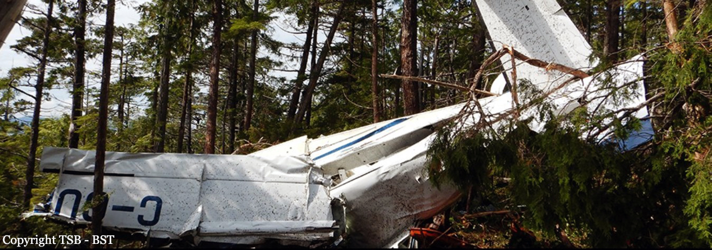
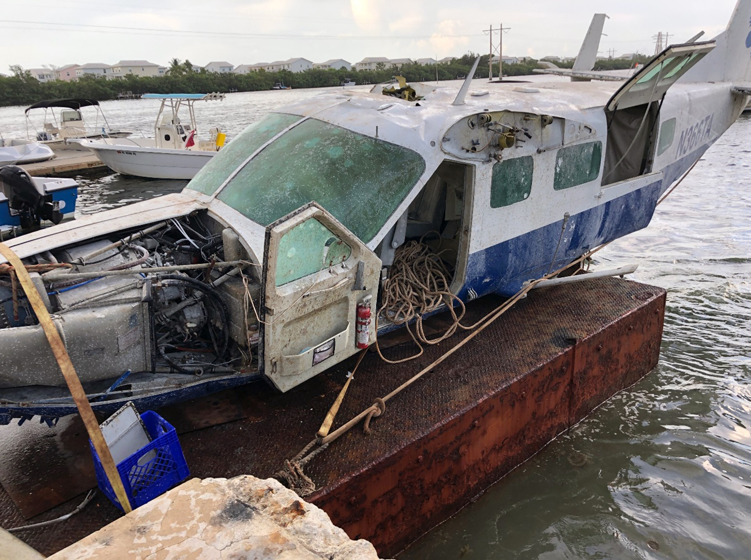
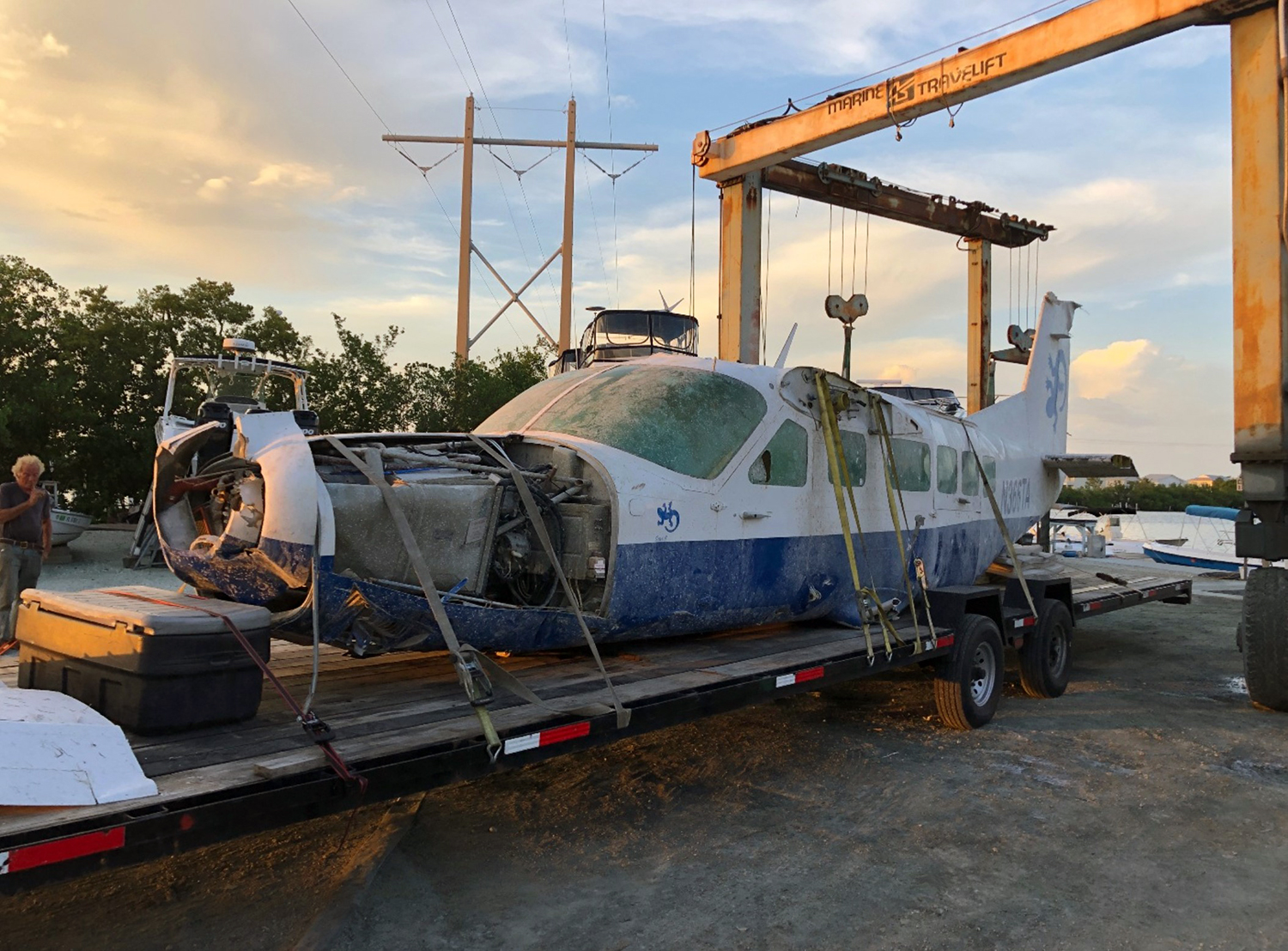
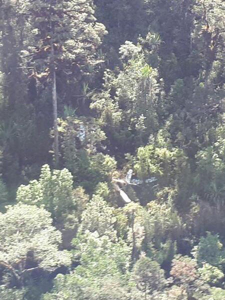
Seair Seaplanes (Seair) was contracted by a remote fishing lodge on the central coast of British Columbia (BC) (Figure 1) to provide seasonal transport of guests and supplies between Vancouver International Water Aerodrome (CAM9), BC, and the lodge, which is located about 66 nautical miles (NM) north-northwest of Port Hardy Airport (CYZT), BC, and about 29 NM southeast of Bella Bella (Campbell Island) Airport (CBBC), BC. On 26 July 2019, the occurrence pilot arrived at Seair’s CAM9 base at approximately 0630. Over the next hour, the pilot completed a daily inspection of the Cessna 208 Caravan aircraft (registration C-GURL, serial number 20800501), added 300 L of fuel to the aircraft, and began flight planning activities, which included gathering and interpreting weather information. On the morning of the occurrence, 4 Seair visual flight rules (VFR) flights were scheduled to fly to the central coast of BC, all on Caravan aircraft: C-GURL (the occurrence aircraft) was to depart CAM9 at 0730, C-GSAS at 0745, C-FLAC at 0800, and C-GUUS at 0900. The first 3 flights were direct flights to the fishing lodge, while the 4th flight had an intermediate stop at the Campbell River Water Aerodrome (CAE3), BC, to pick up passengers before heading to a research institute located approximately 4 NM southwest of the fishing lodge. Because of poor weather conditions in the central coast region, however, all of the flights were delayed. After the crews referred to weather cameras along the central coast region, the flights began to depart, but in a different order than originally scheduled. It is not uncommon for the order of departure to change when groups of aircraft are going to the same general location. One of Seair’s senior operational staff (operations manager) departed CAM9 at 0850 aboard C-FLAC. C-GUUS, bound for the research institute, departed CAM9 next at 0906, and then the occurrence aircraft departed at 0932 (Table 1). The pilot originally scheduled to fly C-GSAS declined the flight. This pilot had recently upgraded to the Caravan, had never flown to this destination before, and was concerned about the weather at the destination. When Seair’s chief pilot returned to CAM9 at 0953 after a series of scheduled flights on a different type of aircraft, he assumed the last remaining flight to the lodge and C-GSAS departed CAM9 at 1024.After departing the Vancouver terminal control area, the occurrence aircraft climbed to 4500 feet above sea level (ASL) and remained at this altitude until 1023, when a slow descent was initiated. The aircraft levelled off at approximately 1300 feet ASL at 1044, when it was approximately 18 NM northeast of Port Hardy Airport (CYZT), BC, and 57 NM southeast of the destination. At 1050, the occurrence aircraft slowly descended again as the flight continued northbound. During this descent, the aircraft’s flaps were extended to the 10° position. At this point, the occurrence aircraft was 37 NM south-southeast of the fishing lodge. The aircraft continued to descend until it reached an altitude of approximately 330 feet ASL, at 1056. By this point, the occurrence aircraft was being operated along the coastline, but over the ocean. C-FLAC departed from the fishing lodge at 1056 on the return flight to CAM9. C-FLAC flew into the Fitz Hugh Sound and proceeded southbound along the western shoreline. At approximately 1100, it flew through an area of heavy rain where visibility was reduced to about 1 statute mile (SM). C-FLAC descended to about 170 feet ASL and maintained this altitude for the next 5 minutes before climbing to about 300 feet ASL. As the southbound C-FLAC entered Fitz Hugh Sound from the north at Hecate Island, the occurrence aircraft entered Fitz Hugh Sound from the south, near the southern tip of Calvert Island. The occurrence aircraft then changed course from the western to the eastern shoreline, and descended again to about 230 feet ASL (Figure 2), while maintaining an airspeed of approximately 125 knots. The 2 aircraft established 2-way radio contact. The pilot of C-FLAC indicated that Addenbroke Island was visible when he flew past it, and described the weather conditions in the Fitz Hugh Sound to the occurrence pilot as heavy rain showers and visibility of approximately 1 SM around Kelpie Point. The occurrence pilot then indicated that he would maintain a course along the eastern shoreline of the sound. At 1103, the 2 aircraft were separated by 2 NM and passed each other on reciprocal tracks, approximately 4 NM south of the accident site. The occurrence aircraft maintained a consistent track and altitude for the next 54 seconds, then slowly began a 25° change in track to the west (0.35 NM from the Addenbroke Island shoreline). Seven seconds after the turn started (0.12 NM from the island’s shoreline), the aircraft entered a shallow climb averaging 665 fpm. At 1104:55, the occurrence aircraft struck trees on Addenbroke Island at an altitude of approximately 490 feet ASL, at an airspeed of 114 knots, and in a relatively straight and level attitude. The aircraft then continued through the heavily forested hillside for approximately 450 feet, coming to rest at an elevation of 425 feet ASL, 9.7 NM east-southeast of the destination fishing lodge. The pilot and three passengers were killed and five other occupants were injured, four seriously.
Probable cause:
Findings as to causes and contributing factors:
These are conditions, acts or safety deficiencies that were found to have caused or contributed to this occurrence.
1. The flight departed Vancouver International Water Aerodrome even though the reported and forecast weather conditions in the vicinity of the destination were below visual flight rules minima; the decision to depart may have been influenced by the group dynamics of Seair pilots and senior staff at the flight planning stage.
2. The pilot continued flight in reduced visibility, without recognizing the proximity to terrain, and subsequently impacted the rising terrain of Addenbroke Island.
3. The configuration of the visual and aural alerting systems and the colouration ambiguity in the primary flight display of the Garmin G1000 was ineffective at alerting the occurrence pilot to the rising terrain ahead.
4. The occurrence pilot’s attention, vigilance, and general cognitive function were most likely influenced to some degree by fatigue.

Findings as to risk:
These are conditions, unsafe acts or safety deficiencies that were found not to be a factor in this occurrence but could have adverse consequences in future occurrences.
1. If pilots do not receive specialized training that addresses the hazards of their flying environment, there is a risk that they will not be proficient in the specific skills necessary to maintain safety margins.
2. If aircraft are operated in excess of the maximum allowable take-off weight, there is a risk of performance degradation and adverse flight characteristics, which could jeopardize the safety of the flight.
3. If cargo is stowed in front of emergency exits, there is a risk that egress may be impeded in an emergency situation, potentially increasing evacuation time and risk of injuries.
4. If air operators do not employ a methodology to accurately assess threats inherent to daily operations, then there is a risk that unsafe practices will become routine and operators will be unaware of the increased risk.
5. If air operators that have flight data monitoring capabilities do not actively monitor their flight operations, they may not be able to identify drift toward unsafe practices that increase the risk to flight crew and passengers.
6. If Transport Canada’s oversight of operators is insufficient, there is a risk that air operators will be non-compliant with regulations or drift toward unsafe practices, thereby reducing safety margins.
7. If Transport Canada does not make safety management systems mandatory, and does not assess and monitor these systems, there is an increased risk that companies will be unable to effectively identify and mitigate the hazards associated within their operations.

Other findings:
These items could enhance safety, resolve an issue of controversy, or provide a data point for future safety studies.
1. The pilot was actively using a cellphone throughout the flight; the operator provided no guidance or limitations on approved cellphone use in flight.
Final Report:

Crash of a Cessna 208 Caravan I in the Dry Tortugas National Park

Date & Time: Apr 23, 2019 at 1200 LT
Type of aircraft:
Operator:
Registration:
N366TA
Flight Phase:
Flight Type:
Survivors:
Yes
Schedule:
Dry Tortugas - Key West
MSN:
208-0249
YOM:
1996
Crew on board:
1
Crew fatalities:
Pax on board:
4
Pax fatalities:
Other fatalities:
Total fatalities:
0
Captain / Total flying hours:
2407
Captain / Total hours on type:
27.00
Aircraft flight hours:
9506
Circumstances:
The pilot landed the seaplane into an easterly wind, then noticed that the surface wind was greater than forecast. Unable to taxi to the beaching location, he elected to return to his destination. He maneuvered the airplane into the wind and applied takeoff power. He described the takeoff run as "bumpy" and the water conditions as "rough." The pilot reported that the left float departed the airplane at rotation speed, and the airplane subsequently nosed into the water. The pilot and passengers were assisted by a nearby vessel and the airplane subsequently sank into 50 ft of water. Inclement sea and wind conditions prevented recovery of the wreckage for 52 days, and the wreckage was stored outside for an additional 13 days before recovery by the salvage company. Extensive saltwater corrosion prevented metallurgical examination of the landing gear components; however, no indication of a preexisting mechanical malfunction or failure was found.
Probable cause:
The pilot's decision to attempt a takeoff in rough sea conditions, resulting in damage to the floats and the sinking of the seaplane.
Final Report:

Crash of a Cessna 208 Caravan I near Caracaraí

Date & Time: Feb 9, 2019 at 1040 LT
Type of aircraft:
Operator:
Registration:
PR-RTA
Survivors:
Yes
Schedule:
Manaus - Caracaraí
MSN:
208-0380
YOM:
2004
Country:
Crew on board:
2
Crew fatalities:
Pax on board:
8
Pax fatalities:
Other fatalities:
Total fatalities:
0
Circumstances:
The single engine floatplane departed Manaus-Eduardo Gomes Airport on a charter flight to the area of the Xeriuini River near Caracaraí, carrying eight passengers and two pilots bound for a fish camp. Due to the potential presence of obstacles in the river due to low water level, the crew decided to land near the river bank. After landing, the left wing impacted a tree and the aircraft rotated to the left and came to rest against trees on the river bank. All 10 occupants evacuated safely and the aircraft was damaged beyond repair.
Probable cause:
The following findings were identified:
- Attention,
- Judgment,
- Perception,
- Management planning,
- Decision making processes,
- Organization processes,
- Support systems.
Final Report:

Crash of a Cessna 208A Caravan I in the Anavilhanas Archipelago: 1 killed

Date & Time: Oct 17, 2017 at 1240 LT
Type of aircraft:
Operator:
Registration:
PR-MPE
Flight Type:
Survivors:
Yes
Schedule:
Manaus - Anavilhanas Archipelago
MSN:
208A-0510
YOM:
2009
Country:
Crew on board:
1
Crew fatalities:
Pax on board:
4
Pax fatalities:
Other fatalities:
Total fatalities:
1
Captain / Total flying hours:
8535
Captain / Total hours on type:
660.00
Circumstances:
The single engine aircraft departed Manaus-Eduardo Gomes Airport at 1220LT on a flight to the Anavilhanas Archipelago, carrying cargo, four passengers and one pilot. Upon landing on the Rio Negro, the airplane struck the water surface and crashed upside down before coming to rest partially submerged. The pilot and three passengers were rescued while a fourth passenger was killed.
Probable cause:
The aircraft landed on the water with the landing gear in the down position.
Contributing factors:
- Attitude – a contributor
Failure to comply with the checklist during the pre-flight inspection and the flight itself favored the landing with inadequate configuration. This attitude may have been triggered by the pilot's confidence in his operational capability, because of his long experience in aviation.
- Flight indiscipline – a contributor
Failure to comply with the checklist indicated, in addition to the low level of situational awareness, a low level of concern for the safe conduction of the flight by failing to follow basic procedures set forth in the manufacturer's manuals and current regulations.
- Piloting judgement – a contributor
The pilot's choice not to use the checklist during the flight phases revealed an inadequate evaluation of parameters related to the operation of the aircraft. Improper compliance with the items in the Pre-Flight Inspection Sheet prevented the AMPHIB PUMP 1 and 2 circuit breakers from being rearmed.
- Aircraft maintenance – a contributor
After performing the test of landing gear extension and retraction by the emergency system, the AMPHIB PUMP 1 and 2 circuit breakers were not rearmed, being the aircraft delivered to fly in this condition. The setting recorded on the AIRSPEED switch of the landing gear position warning system computer demonstrated that the scheduled speed of 74kt was not in accordance with the recommended in the 9600-1A installation manual of Wipaire Inc. in its revision G.
- Memory – undetermined
The AMPHIB PUMP 1 and 2 circuit breakers were found disarmed after the occurrence, indicating that, after the completion of the maintenance service, the executor of the tasks probably forgot to comply with the procedures for reconfiguring the aircraft. In addition, it is possible that the pilot's automatism in relation to his way of carrying out the air operations, without the use of the checklist, has prevented the correct perception of the circuit breakers condition and the erroneous positioning of the landing gear.
- Perception – a contributor
The accomplishment of the landing on the water with the aircraft in inadequate configuration for the situation denotes a decrease in the level of situational awareness of the pilot, considering that the necessary factors and conditions for the safety of the operation were not observed.
Final Report:

Crash of a Cessna 208 Caravan I near Oksibil: 1 killed

Date & Time: Apr 12, 2017 at 1240 LT
Type of aircraft:
Operator:
Registration:
PK-FSO
Flight Phase:
Flight Type:
Survivors:
No
Site:
Schedule:
Tanah Merah – Oksibil
MSN:
208-0313
YOM:
1999
Country:
Region:
Crew on board:
1
Crew fatalities:
Pax on board:
0
Pax fatalities:
Other fatalities:
Total fatalities:
1
Captain / Total flying hours:
4236
Captain / Total hours on type:
2552.00
Aircraft flight hours:
6226
Aircraft flight cycles:
9371
Circumstances:
On 12 April 2017, a Cessna C208 aircraft registered PK-FSO was being operated by PT. Spirit Avia Sentosa (FlyingSAS) for unscheduled cargo flight. The flights of the day scheduled for the aircraft were Mopah Airport (WAKK) – Tanah Merah Airport (WAKT) – Oksibil Airport (WAJO) – Tanah Merah – Oksibil – Tanah Merah. The estimated time departure of first flight from Mopah Airport to Tanah Merah was 0800 LT and the flight departed at 0848 LT, on board the aircraft were two pilots and seven passengers. The aircraft arrived in Tanah Merah at about 0943 LT. At 1012 LT, the flight departed from Tanah Merah to Oksibil. About 10 Nm from Oksibil the pilot contacted the Oksibil tower controller to get air traffic services and landed at 1044 LT. The flight then departed from Oksibil to Tanah Merah at 1058 LT and arrived about 1126 LT. These flights were single pilot operation. At 1144 LT on daylight condition, the aircraft departed Tanah Merah with intended cruising altitude of 7,000 feet. Prior to departure, there was no report or record of aircraft system malfunction. On board the aircraft was one pilot, 1,225 kg of general cargo and 800 pounds of fuel which was sufficient for about 3 hours of flight time. After departure, the pilot advised Tanah Merah tower controller of the estimate time arrival at Oksibil would be 1224 LT. At 1149 LT, the pilot advised Tanah Merah tower controller that the aircraft position was about 10 Nm from Tanah Merah and passing altitude of 3,500 feet. The Tanah Merah tower controller acknowledged the message and advised the pilot to monitor radio communication on frequency 122.7 MHz for traffic monitoring. At about 29 Nm from Oksibil, the PK-FSO aircraft passed a Cessna 208B aircraft which was flying on opposite direction from Oksibil to Tanah Merah at altitude 6,000 feet. At this time, the aircraft ground speed recorded on the flight following system was about 164 knots. The Cessna 208B pilot advised to the pilot on radio frequency 122.7 MHz that the PK-FSO aircraft was in sight. The pilot responded that the aircraft was maintaining 7,000 feet on direct route to Oksibil. At 1230 LT, the Oksibil tower controller received phone call from the FlyingSAS officer at Jakarta which confirming whether the PK-FSO aircraft has landed on Oksibil. The Oksibil tower controller responded that there was no communication with the PK-FSO pilot. The Oksibil tower controller did not receive the flight plan for the second flight of the PK-FSO flight. Afterwards, the Oksibil tower controller called Tanah Merah tower controller confirming the PK-FSO flight and was informed that PK-FSO departed Tanah Merah to Oksibil at 1144 LT and the reported estimate time of arrival Oksibil was 1224 LT. At 1240 LT, the Oksibil tower controller received another phone call from the FlyingSAS officer at Jakarta which informed that the FlyingSAS flight following system received SOS signal (emergency signal) from PK-FSO aircraft and the last position recorded was on coordinate 04°48’47.7” S; 140°39’31.7” E which located approximately 6 Nm north of Oksibil. Afterwards, the Oksibil air traffic controller advised the occurrence to the Search and Rescue Agency. On 13 April 2017, at 0711 LT, the PK-FSO aircraft was found on ridge of Anem Mountain which located about 7 Nm north of Oksibil. The following figure showed the illustration of the aircraft track plotted on the Google earth refer to the known coordinates of Tanah Merah, Oksibil and the crash site.
Probable cause:
The possibility of the pilot being fatigue, physical and environment condition increased pilot sleepiness which might have made the pilot inadvertently falling asleep indicated by no pilot activity. The absence of GA-EGPWS aural alert and warning was unable to wake up the pilot.
Final Report:

Crash of a Cessna 208 Caravan I at Langebaanweg AFB

Date & Time: Mar 3, 2016
Type of aircraft:
Operator:
Registration:
3004
Flight Phase:
Flight Type:
Survivors:
Yes
Schedule:
Langebaanweg - Langebaanweg
MSN:
208-0130
YOM:
1988
Country:
Region:
Crew on board:
2
Crew fatalities:
Pax on board:
0
Pax fatalities:
Other fatalities:
Total fatalities:
0
Circumstances:
The crew was completing a local night training exercice at Langebaanweg AFB. While completing various manoeuvres, the airplane went out of control and crashed in an open field located near airbase, coming to rest upside down. The aircraft was destroyed and both pilots were injured.