Country
Crash of a Cessna 340 in Tomball: 2 killed
Date & Time:
Sep 28, 2025 at 1212 LT
Registration:
N269WT
Survivors:
No
Schedule:
Tomball - Lubbock
MSN:
340-0104
YOM:
1972
Crew on board:
1
Crew fatalities:
Pax on board:
1
Pax fatalities:
Other fatalities:
Total fatalities:
2
Circumstances:
Shortly after takeoff from runway 35L at Tomball-David Wayne Hooks Airport, while climbing, the pilot reported technical problems and elected to return for an emergency landing. Following a right hand circuit at a max altitude of 800 feet, he completed two turns to the right and initiated a descent to runway 35L. On short final, the airplane crashed in an open field, bursting into flames. Both occupants were killed.


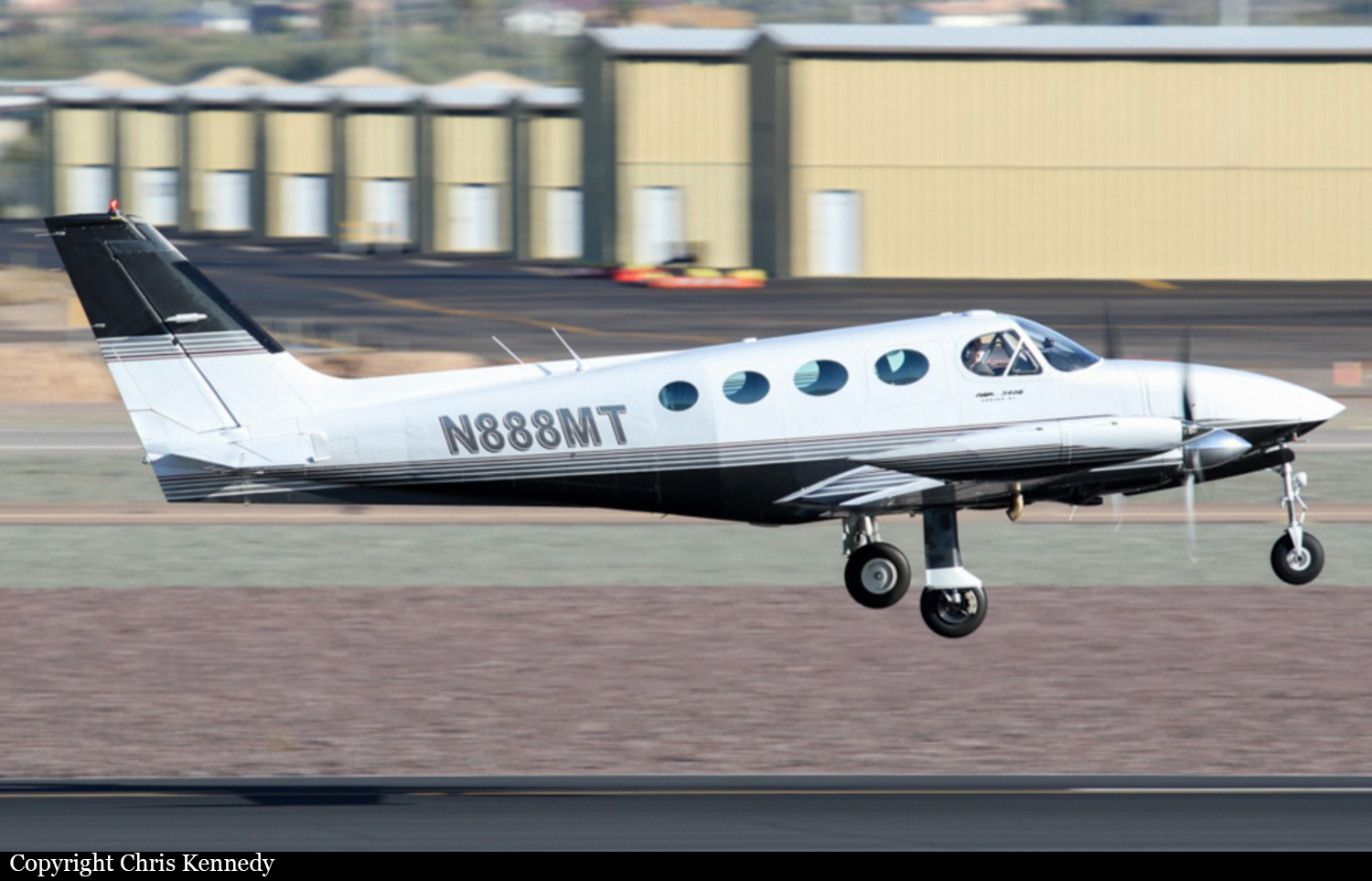
Crash of a Cessna 340A in Mosby: 2 killed
Date & Time:
Aug 27, 2025 at 1157 LT
Registration:
N888MT
Survivors:
No
Schedule:
Washington - Mosby
MSN:
340A-0763
YOM:
1979
Crew on board:
1
Crew fatalities:
Pax on board:
1
Pax fatalities:
Other fatalities:
Total fatalities:
2
Circumstances:
The twin engine airplane departed Washington Regional Airport located 70 km west of Saint Louis, Missouri, at 1058LT, on a one-hour flight to Mosby. Following a left hand circuit, the pilot initiated the approach to runway 18 at Mosby-Midwest National Air Center Airport when the airplane crashed in an open field located about 1,5 km north of the airfield, bursting into flames. The airplane was totally destroyed by a post crash fire and both occupants were killed.
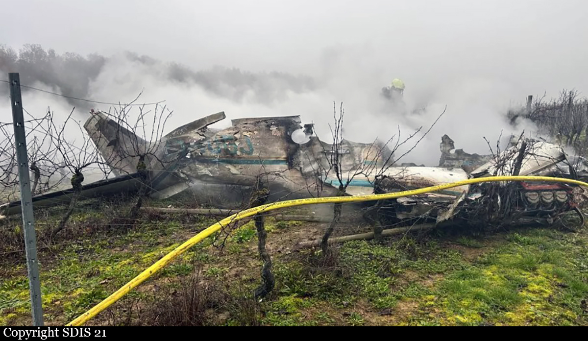
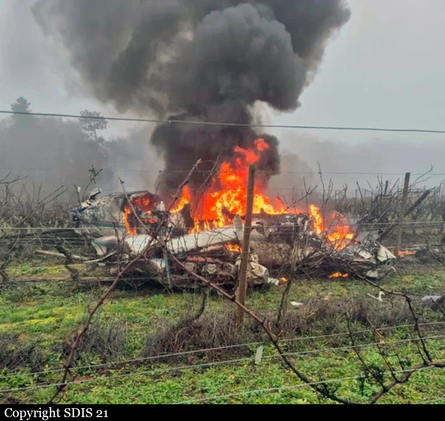
Crash of a Cessna 340A in Pernand-Vergelesses
Date & Time:
Dec 2, 2024 at 1457 LT
Registration:
N340GJ
Survivors:
Yes
Schedule:
Beaune - Beaune
MSN:
340A-0637
YOM:
1978
Crew on board:
2
Crew fatalities:
Pax on board:
0
Pax fatalities:
Other fatalities:
Total fatalities:
0
Captain / Total hours on type:
0.00
Copilot / Total hours on type:
11
Circumstances:
The crew (one TRE pilot and one student pilot) departed Beaune-Challenges Airport at 1326LT on a local training flight. The purpose of the flight was a MEP Class qualification. After takeoff, the crew was unable to raise the landing gear so the decision was taken to return to the airport. A visual check of the landing gear did not reveal any anomalies so the crew decided to take off again at 1405LT to continue the training program. A series of exercises was completed then some touch-and-go manoeuvres at Dijon-Darois Airport. At 1447LT, the crew decided to return to Beaune and the descent was initiated in poor weather conditions with low ceiling and rain. The examiner informed the pilot they were two minutes from the airport and asked him to start the approach. While descending the the airport, the pilot lost visual reference with the ground due to clouds. When he saw 'green' in front of him, he elected to correct the path but the airplane impacted trees and crashed in a vineyard, bursting into flames. Both occupants were seriously injured and the airplane was destroyed by a post crash fire.
Probable cause:
The following findings were identified:
- May have contributed to undertaking and completing a practical examination for a class rating, despite weather conditions likely incompatible with visual flight and an inadequate aircraft condition: the time pressure felt for the MEP examination presentation, resulting from the pilot's training deadline, as well as the limited availability of the aircraft and examiner.
- May have contributed to the loss of visual reference in flight and the collision with the ground: the pilot's repeated passage through layers during previous flights with this examiner may have led the pilot and examiner to consider this type of situation acceptable.
- Furthermore, the choice of an aircraft very different from the one used by the pilot during his training (Tecnam 2006) and the lack of training on the difference resulted in a lack of comfort and an increased workload for both the pilot and the examiner.
- The long trip by car the same morning (five hours between Angoulême and Beaune) may have caused fatigue for both the pilot and the examiner.
Final Report:

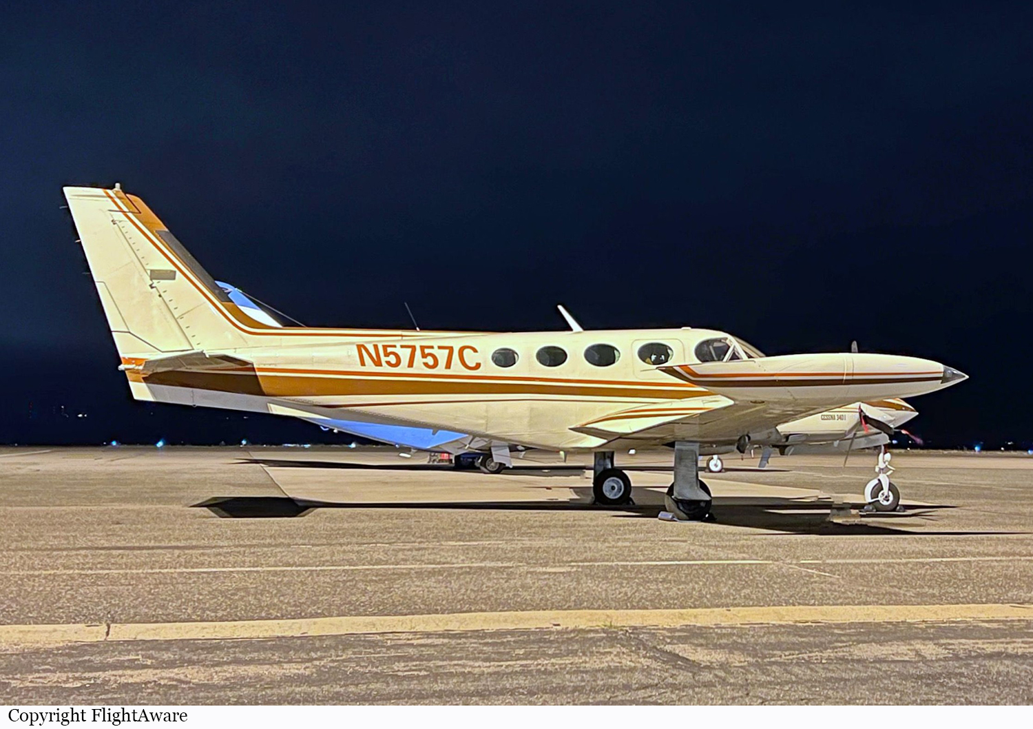
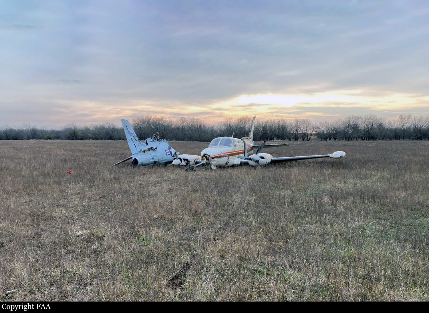
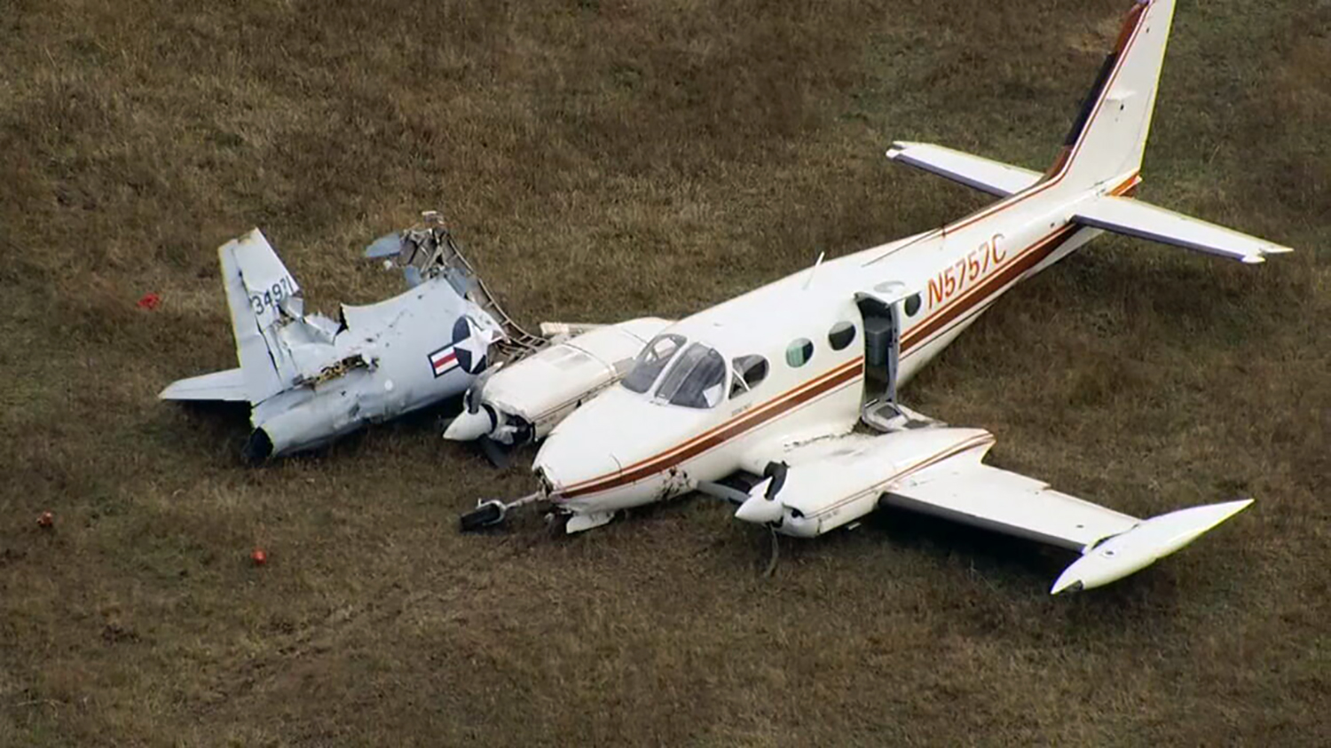
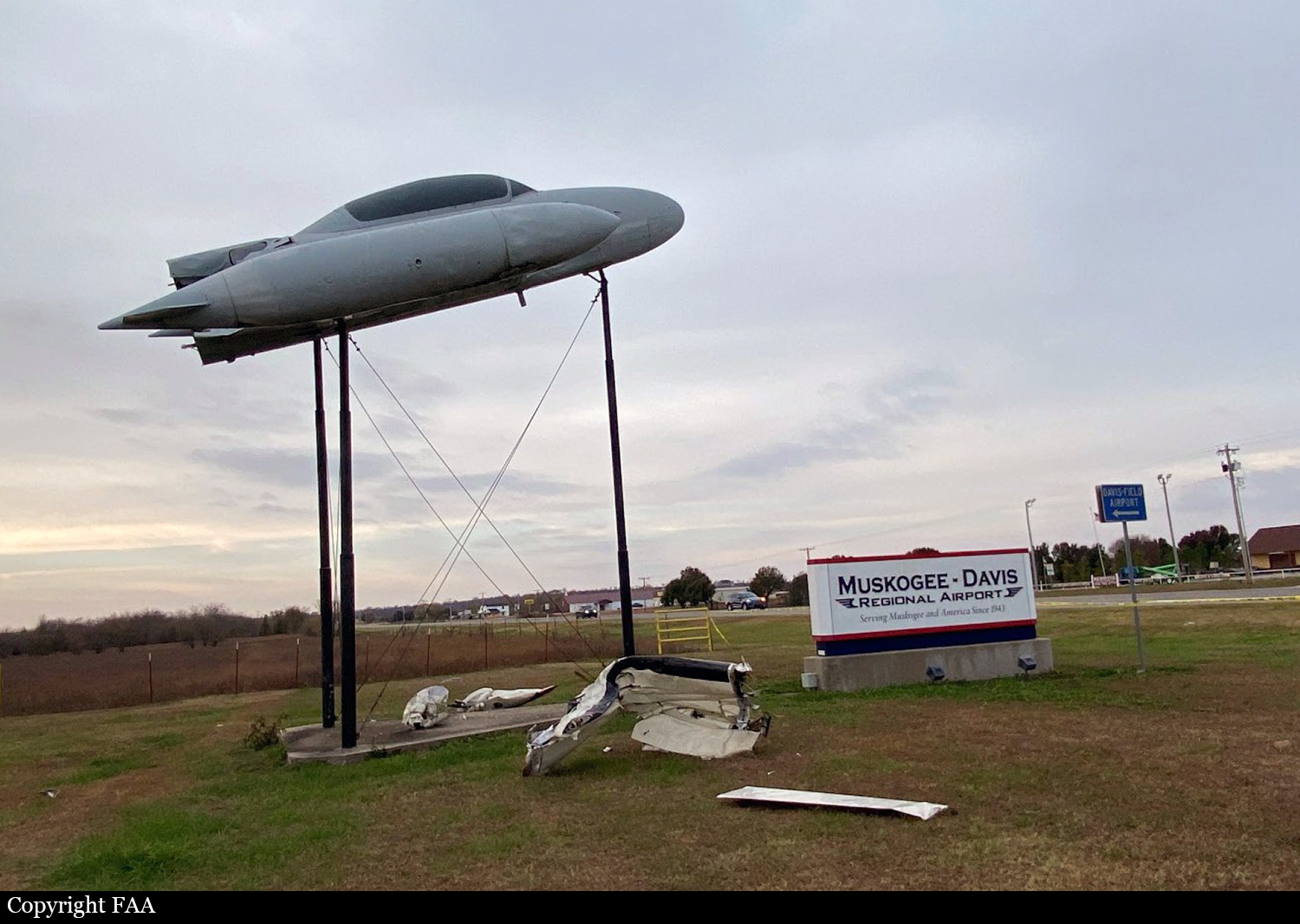
Crash of a Cessna 340A in Muskogee
Date & Time:
Nov 27, 2024 at 0005 LT
Registration:
N5757C
Survivors:
Yes
Schedule:
Livingston – Muskogee
MSN:
340A-0975
YOM:
1980
Crew on board:
1
Crew fatalities:
Pax on board:
4
Pax fatalities:
Other fatalities:
Total fatalities:
0
Captain / Total hours on type:
245.00
Aircraft flight hours:
3163
Circumstances:
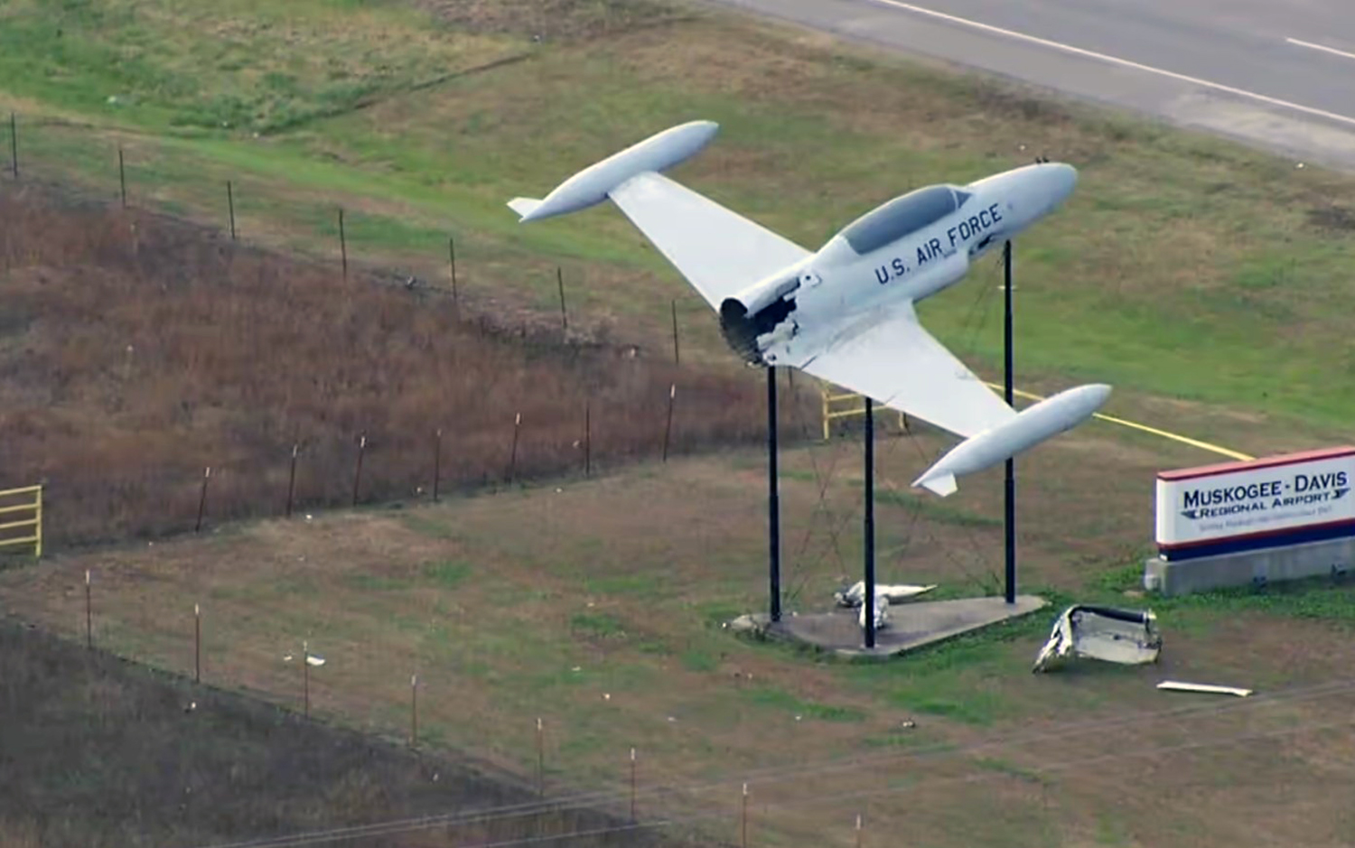
The pilot reported that the airplane was “topped off” with fuel before departing on the night cross-country flight. The pilot performed a preflight inspection, but he did not have his headlamp with him, only his cellular phone. The pilot reported that he typically verified fuel levels at night by feeling inside the fuel tank with his finger, but recalled not verifying the fuel level in the right main fuel tank before departing on the night of the accident flight. The pilot reported that the fuel consumption rate during the first half of the flight was higher than normal due to his operation of the engines slightly rich and his use of the airplane’s heater. While enroute, the pilot transferred fuel from the auxiliary fuel tanks and the left side locker fuel tank to the main fuel tanks. After the “final transfer” was completed, the pilot calculated that there was adequate fuel remaining, including the required reserve fuel, to reach the destination airport; however, he noticed that the indicated fuel remaining levels were less than he expected. Shortly after the pilot was cleared for a visual approach at the destination, the right engine lost total power, followed by the left engine. The pilot reported that, at the time of the initial power loss, gauges indicated that the left side of the airplane had about 30 pounds (about 4.84 gallons) of fuel remaining and the right side had about 30 to 35 pounds (about 4.84 to 5.65 gallons) of fuel remaining. During the subsequent forced landing, the right wing impacted a permanent elevated static display and the airplane came to rest upright on airport property. The airplane sustained substantial damage to the fuselage and the right wing. The pilot and a passenger sustained minor injuries.
Probable cause:
The pilot’s improper fuel planning, which resulted in fuel exhaustion and a total loss of power to both engines.
Final Report: