Crash of a Quest Kodiak 100 in Doyo Baru: 2 killed

Date & Time: Apr 9, 2014 at 0940 LT
Type of aircraft:
Operator:
Registration:
PK-SDF
Flight Phase:
Survivors:
Yes
Schedule:
Doyo Baru – Ninia
MSN:
100-0049
YOM:
2011
Country:
Region:
Crew on board:
1
Crew fatalities:
Pax on board:
6
Pax fatalities:
Other fatalities:
Total fatalities:
2
Captain / Total flying hours:
25530
Captain / Total hours on type:
1752.00
Aircraft flight hours:
1752
Aircraft flight cycles:
2211
Circumstances:
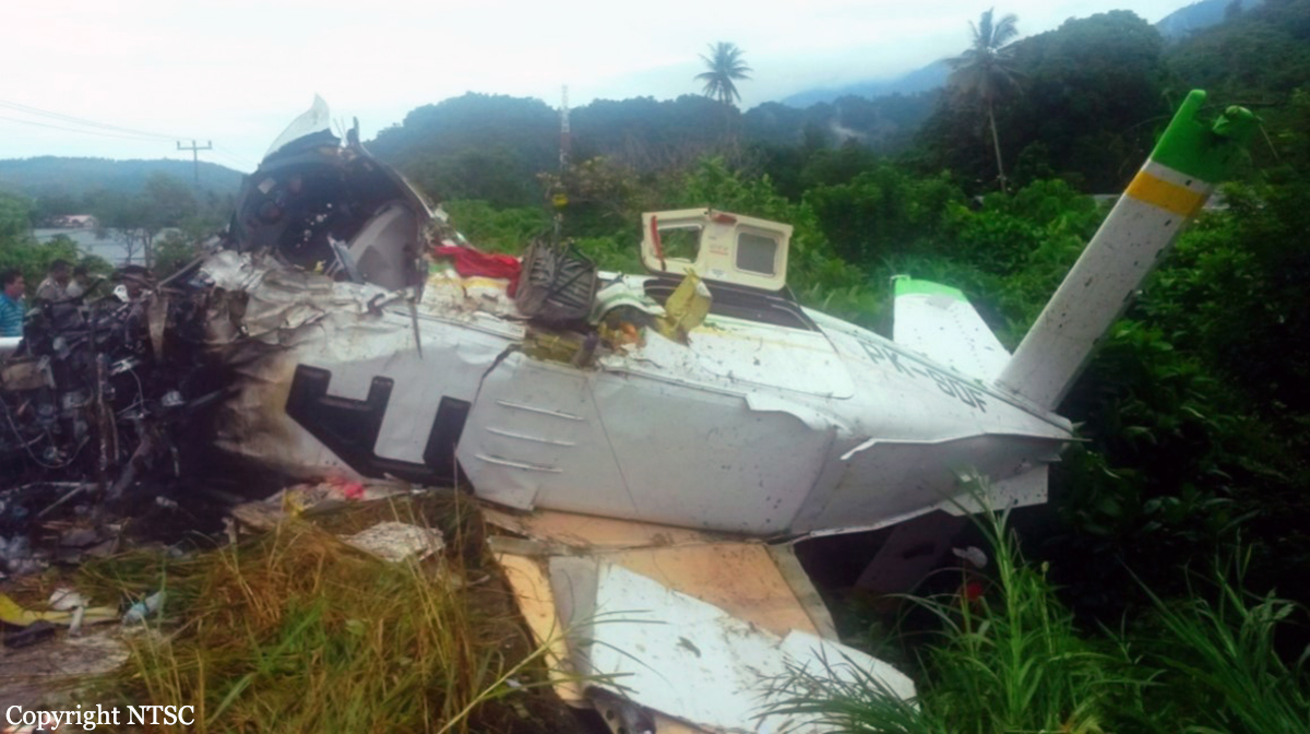
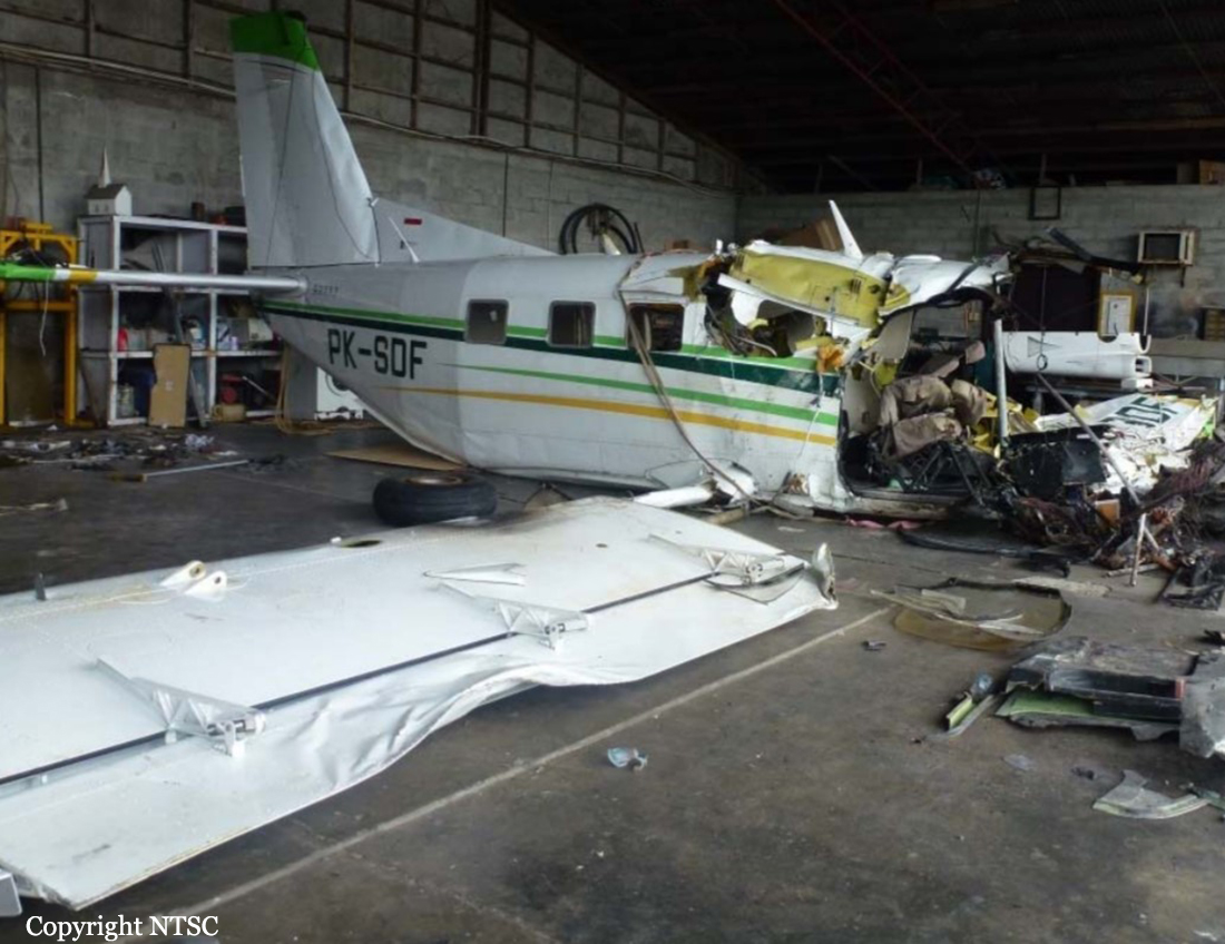
A Kodiak-100 aircraft, registered PK-SDF, on 9 April 2014 was being operated by PT. Adventist Aviation Indonesia as non-schedule flight from Doyo Baru Airstrip with intended destination of Ninia Airstrip, Papua. On board in this flight were 7 persons consist of one pilot and six passengers. This flight was the fourth flights for the pilot who has performed flights from Doyo Baru (DOB) – Puldamat (PUL) at 2138-2228 UTC; Puldamat (PUL) –Soya (SOY) at 2243-2247 UTC; Soya (SOY) – Doyo Baru (DOB) at 2256-2344 UTC. The flight time to destination was estimated of 1 hour with cruising altitude of 10,000 feet and the fuel on board were sufficient for 4 hours flight time. Doyo Baru Airstrip located at approximately 10 NM North West of Sentani Airport (WAJJ). Air traffic movement to and from Doyo Baru Airstrip was controlled by Sentani Tower controller. At 0015 UTC, the pilot contacted to Sentani Tower controller, requested for start engine and clearance to fly to Ninia. The requests were approved and to report when ready for departure. At 0021 UTC, the pilot reported to the Sentani Tower controller ready for departure from Doyo Baru Airstrip. The Sentani Tower Controller instructed the pilot to hold to wait an aircraft took off from Sentani Airport. At 0024 UTC, the pilot received clearance for takeoff with additional traffic information and to report after airborne. At 0027 UTC, Sentani Tower controller has not received reports from the PK-SDF pilot and tried to call but was not responded. After several observations toward Doyo Baru area and did not see PK-SDF aircraft, The Sentani Tower controller reported to the Chief Section of Sentani Tower Air Navigation. At 0030 UTC, The Chief Section of Sentani Tower Air Navigation clarified the condition of PK-SDF aircraft to one of Indonesian Adventist Aviation pilot in Doyo Baru and obtained information that the aircraft had experienced in accident during takeoff at Doyo Baru. An engineer after received the information went to the accident site and saw appearance of white smoke came out from the side of the river which was known as the accident aircraft located. After arrived at the accident site the engineer saw the Adventist’s staffs and local people tried to extinguish the fire on the aircraft engine by throwing some water and used two fire extinguishers while some people moved the passengers from the wreckage. Two occupants including the pilot were fatally injured and five other passengers were seriously injured. All occupants were taken to Yowari Hospital (Rumah Sakit Umum Daerah – RSUD Yowari).
Probable cause:
Contributing Factors:
- The failure to airborne was due to the aircraft was not in correct takeoff configuration which required wing flap 20° while the flap was found at approximately 6° position during impact.
- The actions to recover the situation by selection of emergency power and flap were not proper for particular condition.
Final Report:
Crash of a Piper PA-31-350 Navajo Chieftain in Langgur: 4 killed

Date & Time: Jan 19, 2014 at 1225 LT
Operator:
Registration:
PK-IWT
Flight Type:
Survivors:
No
Schedule:
Jayapura – Langgur – Kendari – Surabaya
MSN:
31-7752090
YOM:
1977
Country:
Region:
Crew on board:
1
Crew fatalities:
Pax on board:
3
Pax fatalities:
Other fatalities:
Total fatalities:
4
Captain / Total flying hours:
2860
Captain / Total hours on type:
1045.00
Aircraft flight hours:
5859
Circumstances:
On 19 January 2014, a PA-31-350 Piper Chieftain, registered PK-IWT, was being operated by PT. Intan Angkasa Air Service, on positioning flight from Sentani Airport, Jayapura with intended destination of Juanda Airport, Surabaya for aircraft maintenance. The positioning flight was planned to transit at Dumatubun Airport Langgur of Tual, Maluku and Haluoleo Airport, Kendari at South East Sulawesi for refuelling. On the first sector, the aircraft departed Sentani Airport at 2351 UTC (0851 WIT) and estimated arrival at Langgur was 0320 UTC. On board on this flight was one pilot, two company engineers and one ground staff. At 0240 UTC the pilot contacted to the Langgur FISO, reported that the aircraft position was 85 Nm to Langgur Airport at altitude 10,000 feet and requested weather information. Langgur FISO acknowledged and informed that the weather was rain and thunderstorm and the runway in used was 09. When the aircraft passing 5,000 feet, the pilot contacted the Langgur FISO and reported that the aircraft position was 50 Nm from langgur and informed the estimated time of arrival was 0320 UTC. The Langgur FISO acknowledged and advised the pilot to contact when the aircraft was at long final runway 09. At 0318 UTC, the pilot contacted Langgur FISO, reported the position was 25 Nm to Langgur at altitude of 2,500 feet and requested to use runway 27. The Langgur FISO advised the pilot to contact on final runway 27. At 0325 UTC, Langgur FISO contacted the pilot with no reply. At 0340 UTC, Langgur FISO received information from local people that the aircraft had crashed. The aircraft was found at approximately 1.6 Nm north east of Langgur Airport at coordinate 5° 38’ 30.40” S; 132° 45’ 21.57” E. All occupants fatally injured and the aircraft destroyed by impact force and post impact fire. The aircraft was destroyed by impact forces and post impact fire, several parts of the remaining wreckage such as cockpit could not be examined due to the level of damage. The aircraft was not equipped with flight recorders and the communication between ATC and the pilot was not recorded. No eye witness saw the aircraft prior to impact. Information available for the investigation was limited. The analysis utilizes available information mainly on the wreckage information including the information of the wings, engines and propellers.
Probable cause:
The investigation concluded that the left engine most likely failed during approach and the propeller did not set to feather resulted in significant asymmetric forces. The asymmetric forces created yaw and roll tendency and the aircraft became uncontrolled, subsequently led the aircraft to impact to the terrain.
Final Report:
Crash of a Xian MA60 in Kupang

Date & Time: Jun 10, 2013 at 0954 LT
Type of aircraft:
Operator:
Registration:
PK-MZO
Survivors:
Yes
Schedule:
Bajawa - Kupang
MSN:
06 08
YOM:
2008
Flight number:
MZ6517
Country:
Region:
Crew on board:
4
Crew fatalities:
Pax on board:
46
Pax fatalities:
Other fatalities:
Total fatalities:
0
Captain / Total flying hours:
12530
Captain / Total hours on type:
2050.00
Copilot / Total flying hours:
311
Copilot / Total hours on type:
141
Aircraft flight hours:
4486
Aircraft flight cycles:
4133
Circumstances:
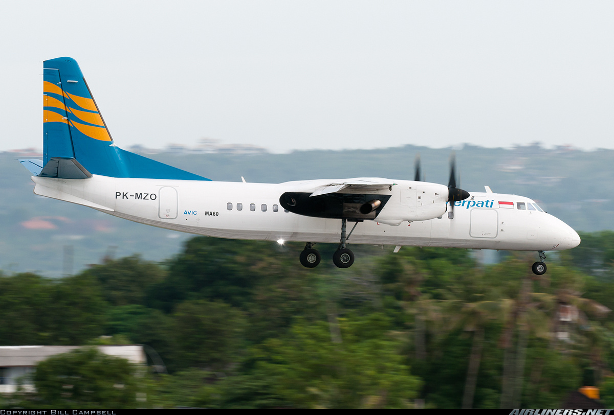
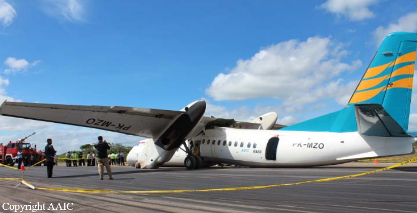
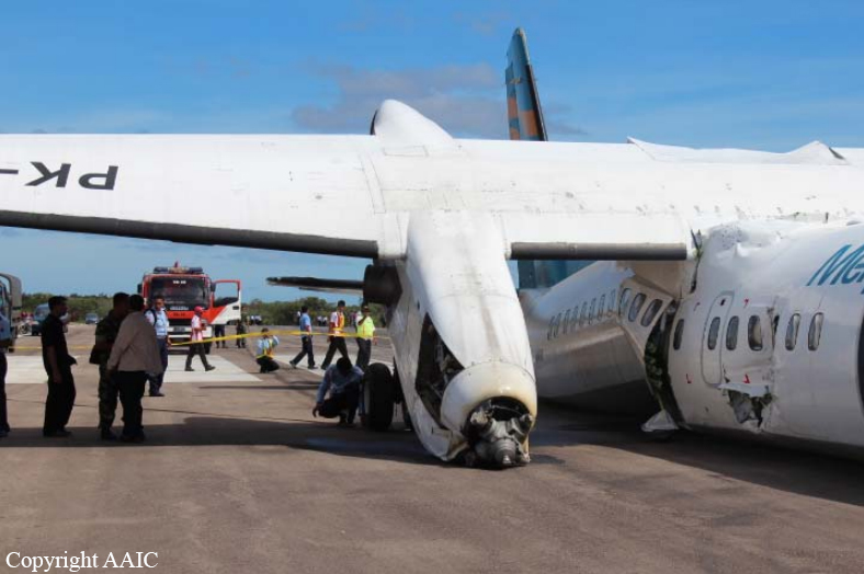
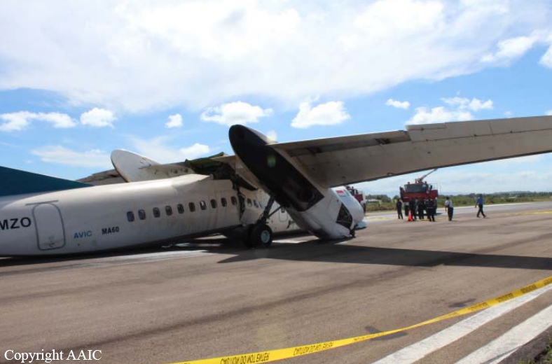
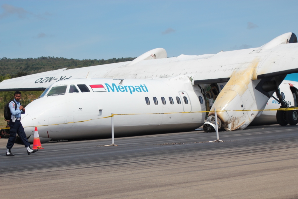
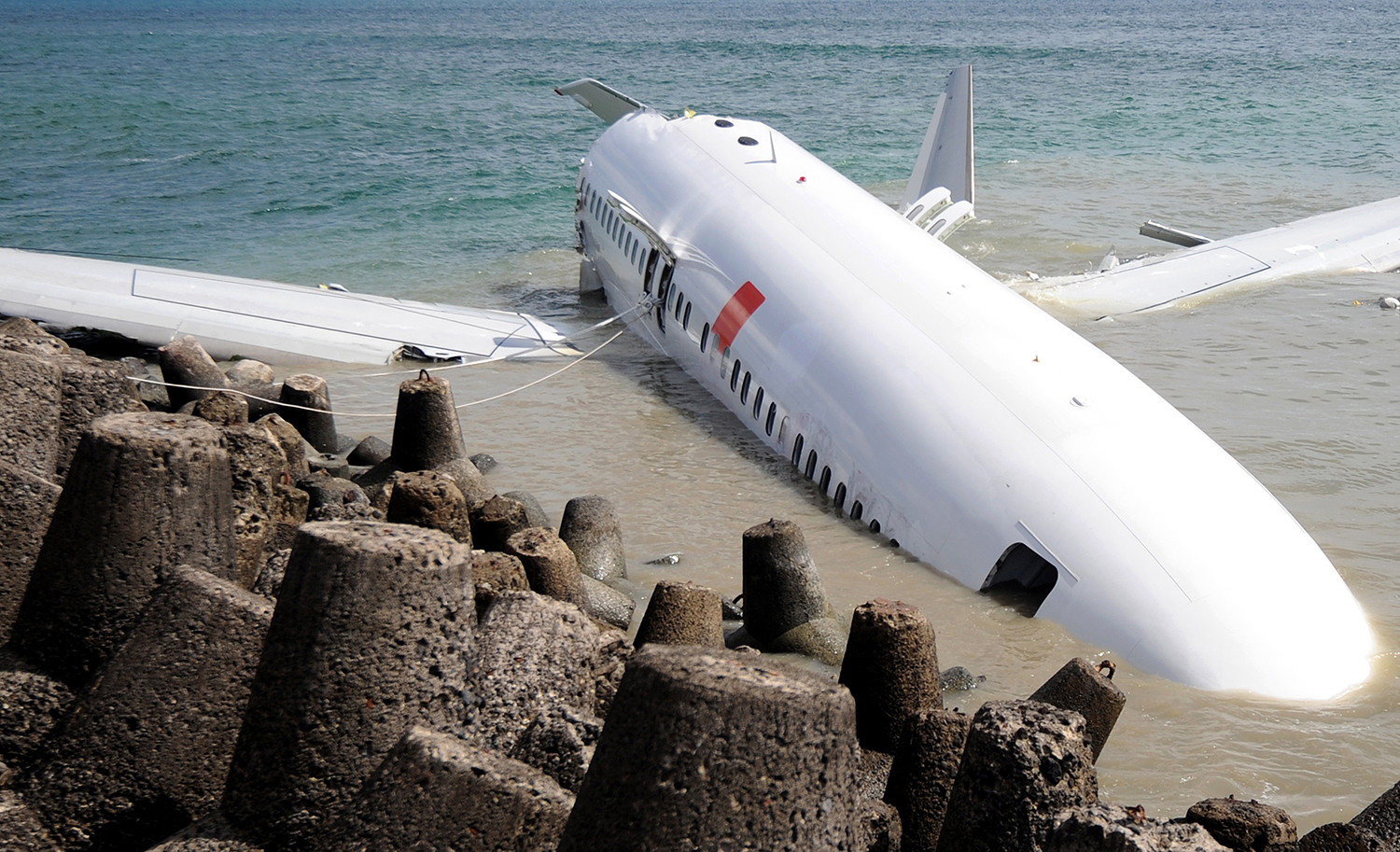
On 10 June 2013, a Xi ‘An MA60 aircraft registered PK-MZO was being operated by PT. Merpati Nusantara Airlines on a scheduled passenger flight as MZ 6517. The aircraft departed from Bajawa Airport (WATB) Nusa Tenggara Timur, at 0102 UTC to El Tari (WATT) Kupang, Nusa Tenggara Timur. On board this aircraft were 2 pilots, 2 flight attendants with 46 passengers consisted of 45 adults and 1 infant. The flight was the second sectors for the aircraft and the crew on that day. The first flight was from Kupang to Bajawa Airport. During the flight the Second in Command (SIC) acted as the Pilot Flying (PF) and the Pilot in Command (PIC) as the Pilot Monitoring (PM). The flight from the departure until commencing for approach was un-eventful. At 0122 UTC, the pilot made first communication with El Tari Control Tower controller (El Tari Tower) and reported their position was on radial 298° 110 Nm from KPG VOR and maintaining 11,500 ft. The pilot received information that the runway in use was 07 and the weather information (wind 110° 11 kts, visibility 10 km, weather NIL, cloud few 2,000 ft, temperature 30° C, dew point 22° C, QNH 1010 mbs and QFE 998 mbs). At 0133 UTC, the aircraft was on radial 297° 68 Nm from KPG VOR and the pilot ready to descend and approved by El Tari Tower to descend to 5,000 ft. At 0138 UTC, the pilot reported the aircraft was passing 10,500 ft and stated that the flight was on Visual Meteorological Condition (VMC). At 0150 UTC, the aircraft position was on left base runway 07 at 5 Nm from KPG VOR. The El Tari Tower had visual contact with the aircraft and issued a landing clearance with additional information that the wind condition was 120° at 14 kts, QNH 1010 mbs. At 0151 UTC, the pilot reported that their position was on final and the El Tari Tower re-issued the landing clearance. The Flight Data Recorder (FDR) recorded that the left power lever was in the range of BETA MODE while the aircraft altitude was approximately 112 ft and followed by the right power lever at 90 ft until hit the ground. At 0154 UTC, the aircraft touched down at about 58 meters and halted on the runway at about 261 meters from the beginning of runway 07. The vertical deceleration recorded on FDR was 5.99 G and followed by - 2.78 G. After the aircraft stopped, the flight attendants assessed the situation and decided to evacuate the passengers through the rear main entrance door. One pilot and four passengers who seated on row number three, seven and eight suffered serious injury. On 11 June 2013, the aircraft was evacuated from the runway and moved to the Air Force hangar at 2100 UTC.
Probable cause:
The following contributing factors were identified:
- The procedure of selecting Power Lever Lock to “OPEN” during approach was made without comprehensive risk assessment.
- Both power levers entered BETA MODE at 90 feet due to the safety device namely Power Lever Lock has been opened during approach, which was in accordance to the operator procedure and lifting of Mechanical Power Lever Stop Slot which was not realized by the pilots.
- The movement of power levers to BETA MODE resulted the pitch angle changed to low pitch angle which produced significant drag and made the aircraft loss of significant lift.
Final Report:
Crash of a BAe ATP in Wamena

Date & Time: May 31, 2013 at 0709 LT
Type of aircraft:
Operator:
Registration:
PK-DGI
Flight Type:
Survivors:
Yes
Schedule:
Jayapura - Wamena
MSN:
2027
YOM:
1990
Country:
Region:
Crew on board:
3
Crew fatalities:
Pax on board:
0
Pax fatalities:
Other fatalities:
Total fatalities:
0
Captain / Total flying hours:
3108
Captain / Total hours on type:
1366.00
Copilot / Total flying hours:
5648
Copilot / Total hours on type:
689
Aircraft flight hours:
15755
Aircraft flight cycles:
25431
Circumstances:
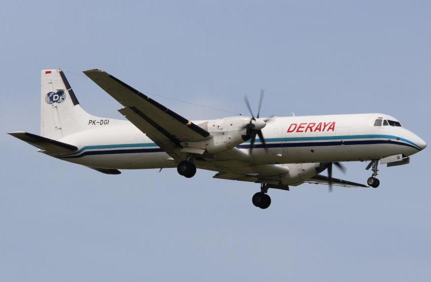
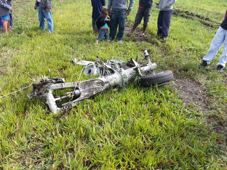
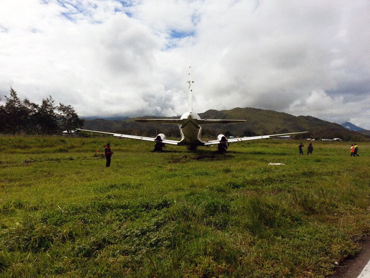
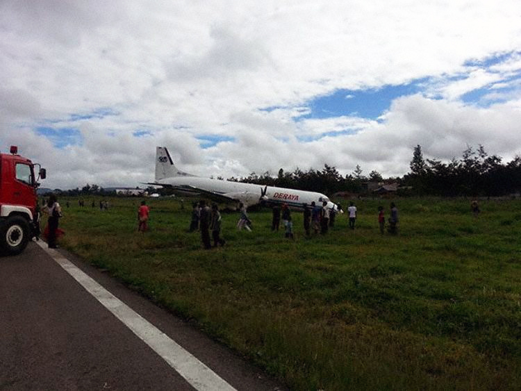
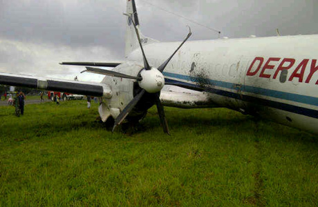
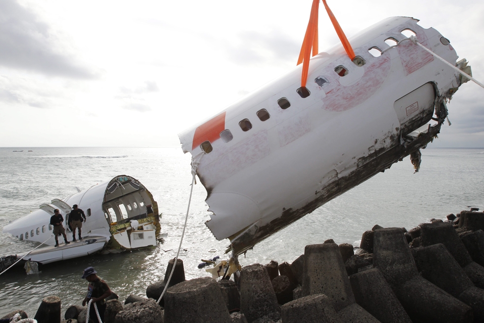
On 31 May 2013 aircraft BAe ATP freighter registered PK-DGI operated by PT. Deraya as scheduled cargo/ freight flight from Sentani Airport (WAJJ) to Wamena Airport (WAJW), Papua. On board in this flight were the Pilot in Command (PIC) acted as Pilot Flying (PF) and the Second in Command (SIC) acted as Pilot Monitoring (PM). At 2127 UTC (0627 LT) the aircraft departed from Sentani Airport. The aircraft cruised at 12,000 feet (FL 120)and estimated time of arrival Wamena Airport was 2207 UTC (0707 LT). The first pilot contact with Wamena Tower controller was at 2201 UTC, the aircraft position was approaching Pass Valley point, the controller informed that runway 15 expect to be used and the weather condition was wind calm, visibility 4 Km, low cloud at final area and QNH 1008 mbs. There was no specific of approach and landing briefing by pilot flying to the pilot non flying considering to such weather condition. At 2207 UTC, the pilot reported the position was on final runway 15. The controller requested the information of the flight condition and the pilot reported that the runway has not insight. At 2209 UTC, the pilot reported that the runway was insight and the controller provided the clearance to land and 25 seconds later the aircraft touched down on the centerline. During the landing roll at about 750 meters from the beginning of runway 15 the aircraft veered to the left of the runway shoulder, the pilot recovered by applying the right rudder and asymmetry reverses thrust but the aircraft continued veer to the left and stopped at about 10 meters on the left shoulder of the runway 15. On the landing roll, the FDR recorded that the left engine torque greater then right engine torque. The pilot shutdown both engines normally and evacuated the aircraft safely. The nose landing gear detached and found on the shoulder at about 250 meter from the aircraft final position. The main landing gears broken and all the propellers bent. No injured in this occurrence.
Probable cause:
The following contributing factors were identified:
- The flight did not meet the criteria according to the recommended elements of stabilized approach which required go around.
- The aircraft touched down with 2° misalignment with the runway direction then the aircraft veered off to the left.
- The recovery action was not in accordance to the correct technique according to the ALAR Tool Kit.
Final Report:
Crash of a Fletcher FU-24-950 in North Rawajitu: 1 killed

Date & Time: May 11, 2013 at 1125 LT
Type of aircraft:
Operator:
Registration:
PK-PNC
Flight Phase:
Survivors:
No
Schedule:
North Rawajitu - North Rawajitu
MSN:
243
YOM:
1977
Country:
Region:
Crew on board:
1
Crew fatalities:
Pax on board:
0
Pax fatalities:
Other fatalities:
Total fatalities:
1
Circumstances:
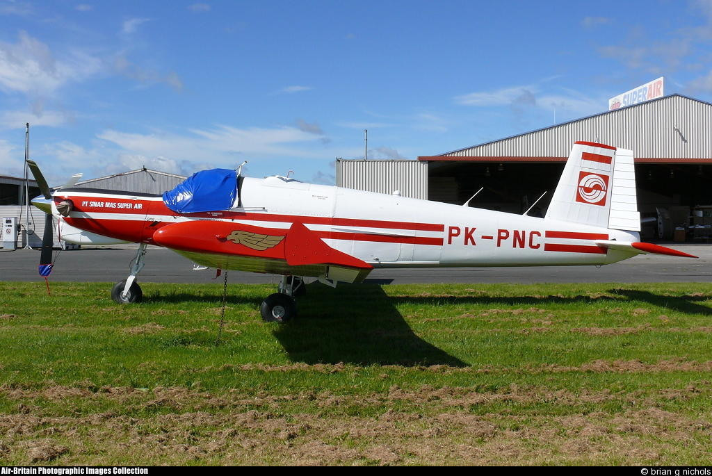
Pilot was engaged in a spraying mission over an oil palm plantation in the region of North Rawajitu, Lampung Province. Less than three minutes after takeoff, the single engine aircraft stalled and crashed in a wooded area, bursting into flames. The aircraft was destroyed by impact forces and a post impact fire and the pilot, sole on board, was killed.

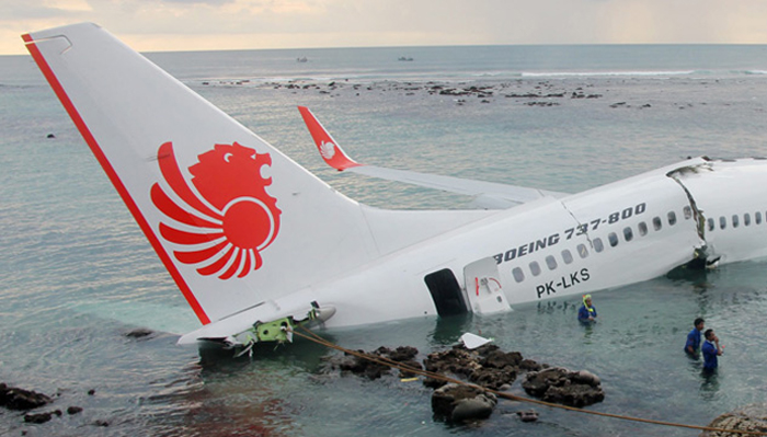
Crash of a Boeing 737-8GP off Denpasar

Date & Time: Apr 13, 2013 at 1510 LT
Type of aircraft:
Operator:
Registration:
PK-LKS
Survivors:
Yes
Schedule:
Bandung - Denpasar
MSN:
38728/4350
YOM:
2013
Flight number:
LNI904
Country:
Region:
Crew on board:
7
Crew fatalities:
Pax on board:
101
Pax fatalities:
Other fatalities:
Total fatalities:
0
Captain / Total flying hours:
15000
Captain / Total hours on type:
6173.00
Copilot / Total flying hours:
1200
Copilot / Total hours on type:
923
Aircraft flight hours:
142
Aircraft flight cycles:
104
Circumstances:
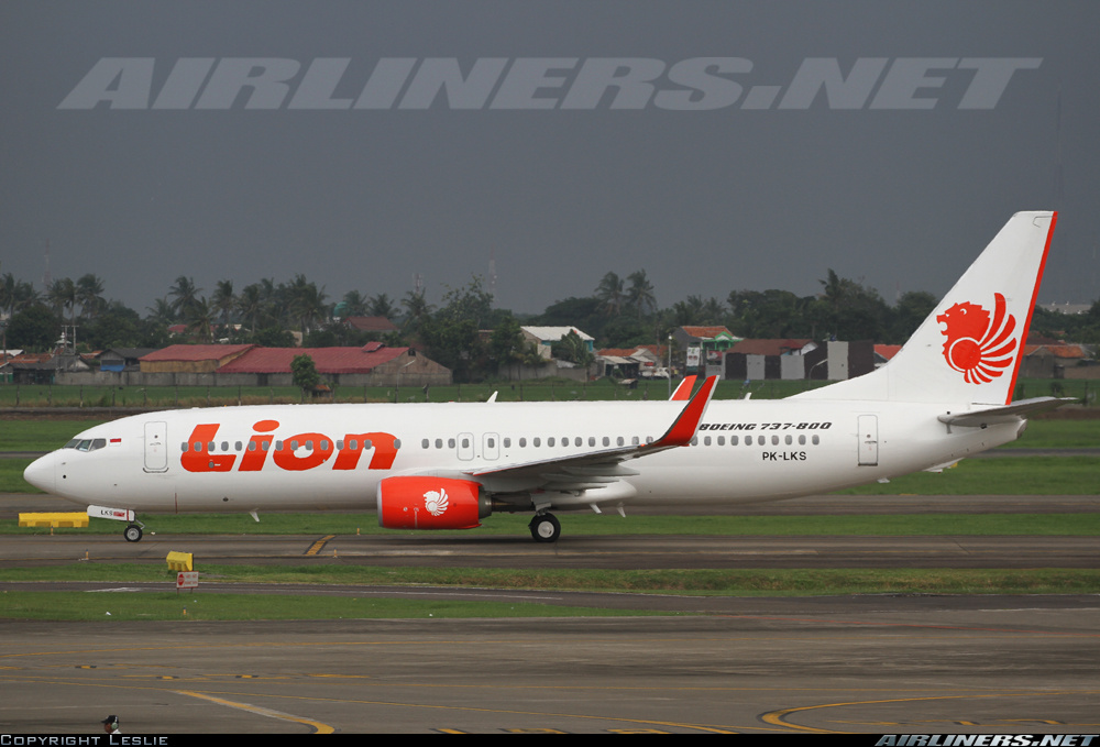
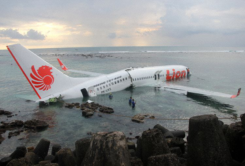
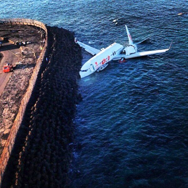
On 13 April 2013, a Boeing 737-800 aircraft, registered PK-LKS, was being operated by PT. Lion Mentari Airlines (Lion Air) on a scheduled passenger flight as LNI 904. The aircraft departed from Husein Sastranegara International Airport (WICC) Bandung at 0545 UTC to Ngurah Rai International Airport (WADD), Bali, Indonesia. The flight was the last sector of four legs scheduled for the crew on that day which were Palu (WAML) - Balikpapan (WALL) - Banjarmasin (WAOO) - Bandung (WICC) - Bali (WADD). The aircraft flew at FL 390, while the Second in Command (SIC) was the Pilot Flying (PF) and the Pilot in Command (PIC) was the Pilot Monitoring (PM). There were 2 pilots, 5 flight attendants and 101 passengers comprising 95 adults, 5 children and 1 infant making a total of 108 persons on board. The flight from the departure until start of the approach into Bali was uneventful. At 0648 UTC, the pilot made first communications with the Bali Approach controller (Bali Director) when the aircraft was located 80 Nm from BLI VOR. The pilot received clearance to proceed direct to the TALOT IFR waypoint and descend to 17,000 feet. At 0652 UTC, the Bali Director issued a further clearance for the pilot direct to KUTA point and descent to 8,000 feet. At 0659 UTC, the aircraft was vectored for a VOR DME approach for runway 09 and descent to 3,000 feet. At 0703 UTC, while the aircraft was over KUTA point, the Bali Director transferred communications with the aircraft to Bali Control Tower (Ngurah Tower). At 0704 UTC, the pilot contacted Ngurah Tower controller and advised that the aircraft was leaving KUTA point. The Ngurah Tower controller instructed the pilot to continue the approach and to reduce the aircraft speed to provide sufficient separation distance with another aircraft. At 0707 UTC, the Ngurah Tower issued take-off clearance for a departing aircraft on runway 09. At 0708 UTC, with LKS at approximately 1,600 feet AGL, the Ngurah Tower controller saw the aircraft on final approach and gave a landing clearance with additional information that the wind was from 120° at 05 knots. At 0708:47 UTC, the aircraft Enhance Ground Proximity Warning System (EGPWS) aural alert called “ONE THOUSAND”, the SIC said one thousand, stabilized, continue, prepare for go-around missed approach three thousand. The FDR showed that the pilot flown using LNAV (Lateral Navigation) and VNAV (Vertical Navigation) during the approach until disengagement of the Auto Pilot. The sequence of events during the final approach is based on the recorded CVR and FDR data, and information from crew interviews as follows: At 0708:56 UTC, while the aircraft altitude was approximately 900 feet AGL, the SIC commented that the runway was not in sight, whereas the PIC commented “OK. Approach light in sight, continue”. At 0709:33 UTC, after the EGPWS aural alert “MINIMUM” sounded at an aircraft altitude of approximately 550 feet AGL, the SIC disengaged the autopilot and the auto-throttle and then continued the approach. At 0709:43 UTC, the EGPWS called “THREE HUNDRED”. At 0709:47 UTC, the CVR recorded a sound similar to rain hitting the windshield. At 0709:49 UTC, the EGPWS called “TWO HUNDRED”. At 0709:53 UTC, while the aircraft altitude was approximately 150 feet AGL, the PIC took over control of the aircraft. The SIC handed control to the PIC and stated that he could not see the runway. At 0710:01 UTC, after the EGPWS called “TWENTY”, the PIC commanded for go-around. At 0710:02 UTC, the aircraft impacted the water, short of the runway. The aircraft stopped facing to the north at about 20 meters from the shore or approximately 300 meters south-west of the beginning of runway 09. Between 0724 UTC to 0745 UTC, three other aircraft took-off and six aircraft landed using runway 09. At 0750 UTC, the airport was closed until 0850 UTC. At 0755 UTC, all occupants were completely evacuated, the injured passengers were taken to the nearest hospitals and uninjured occupants to the airport crisis centre.
Probable cause:
The National Transportation Safety Committee initial findings on the accident flight are as follows:
- The aircraft was airworthy prior to impact and has an item on the DMI (deferred maintenance item) category C (right engine oil filter).
- All crew has valid licenses and medical certificates.
- The Second in Command (SIC) acted as Pilot Flying (PF).
- The flight performed a VOR DME approach runway 09, and the published Minimum Descent Altitude (MDA) was 465 ft AGL.
- The approach configuration used was flap 40.
- At 900 ft AGL the PF did not have the runway in sight.
- Upon reaching the MDA the flight profile indicated a constant path.
- The PIC took over control of the aircraft at about 150 ft radio altitude.
- The SIC handed over control to the PIC at about 150 ft and stated that he could not see the runway.
- The final approach phase of the flight profile was outside the envelope of the EGPWS warning, therefore no EGPWS warning was recorded on the CVR.
The NTSC concluded in its final report that the accident was caused by the following factors:
- The aircraft flight path became unstable below minimum descends altitude (MDA) with the rate of descend exceeding 1000 feet per minute and this situation was recognized by both pilots.
- The flight crew loss of situational awareness in regards of visual references once the aircraft entered a rain cloud during the final approach below minimum descends altitude (MDA).
- The PIC decision and execution to go-around was conducted at an altitude which was insufficient for the go-around to be executed successfully.
- The pilots of accident aircraft was not provided with timely and accurate weather condition despite the weather around the airport and particularly on final approach to the airport was changing rapidly.
Final Report:
Crash of a PAC 750XL near Yahukimo: 2 killed

Date & Time: Oct 3, 2012 at 1120 LT
Operator:
Registration:
PK-RWT
Flight Phase:
Flight Type:
Survivors:
No
Site:
Schedule:
Jayapura - Korupun - Dekai
MSN:
157
YOM:
2009
Country:
Region:
Crew on board:
1
Crew fatalities:
Pax on board:
1
Pax fatalities:
Other fatalities:
Total fatalities:
2
Captain / Total flying hours:
1546
Captain / Total hours on type:
1315.00
Circumstances:
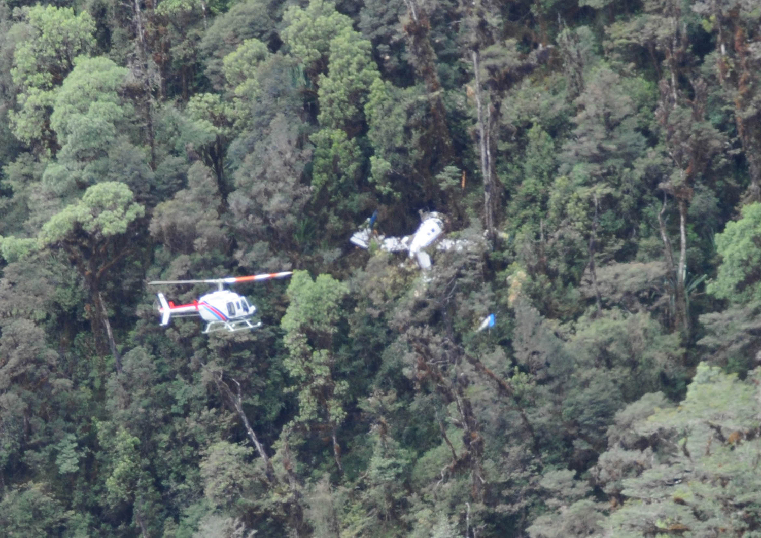
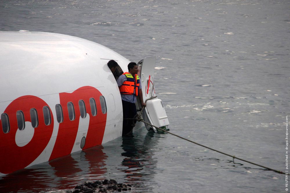
On 03 October 2012, a Pacific Aerospace LTD, PAC 750 XL aircraft registration PK-RWT was being operated by Yayasan Pelayan Penerbangan Tariku on a cargo supply flight from Koropun to Dekai in Papua area. This flight was the 9 th flight of that day. All flights were performed in accordance to the Visual Flight Rules (VFR). The first flight was from Sentani to Langda which was arrived at 2220 UTC (0720 LT). The aircraft arrived Koropun at 0120 UTC (1020 LT) as reported by the pilot through the company flight following system . The aircraft then departed Koropun to Dekai and lost contact during this flight. On board in this flight were one pilot, one passenger and 975 kg of cargo when departure from Sentani. The distance between Koropun to Dekai is about 24.6 Nm and normally takes about 11 minutes. The weather information issued by Badan Meteorologi Klimatologi and Geofisika/BMKG (Indonesia Meteorology Climatology and Geophysics Agency) between 0200 UTC to 0300 UTC, showed the development of cumulus cloud classified as Middle Cloud formation along the route from Koropun to Dekai. According to the company flight following procedure, the pilot should report after the aircraft lands by mentions “aircraft on the ground” which this means that the aircraft had arrived at destination. After aircraft airborne, the pilot should report aircraft airborne time and give the estimate of time arrival at destination. The last contact of the pilot was “the aircraft on the ground Koropun” at 0120 UTC. Normally, the next report would be within 15 up to 20 minutes after arrival. There was no report from the pilot after 20 minutes of the last report. The flight following officer tried to contact the pilot and was unsuccessful. At 0145 UTC, the Operation Manager of the aircraft operator received information from the New Zealand Search and Rescue Agency that informed that Local User Terminal (LUT) has received ELT distress signal from PK-RWT. This information was followed by information through email, which was received at 0150 UTC. Based on this information, the Indonesia Search and Rescue operation was initiated. The aircraft was found on 5 October 2013, in mountainous area with approximate elevation of 7,000 feet, at coordinate 04°28.62’S 139°39’E. The crew and passenger on board were fatally injured and the aircraft substantially damaged.
Probable cause:
The accident was classified as Controlled Flight into Terrain (CFIT), which most likely the aircraft was flown into the weather environment below the VFR margins.
Final Report:
Crash of a Piper PA-31-350 Navajo Chieftain near Bontang: 4 killed

Date & Time: Aug 24, 2012 at 0810 LT
Operator:
Registration:
PK-IWH
Flight Phase:
Survivors:
No
Schedule:
Samarinda - Bontang
MSN:
31-7852065
YOM:
1978
Country:
Region:
Crew on board:
1
Crew fatalities:
Pax on board:
3
Pax fatalities:
Other fatalities:
Total fatalities:
4
Captain / Total flying hours:
17547
Captain / Total hours on type:
4250.00
Aircraft flight hours:
16743
Aircraft flight cycles:
14830
Circumstances:
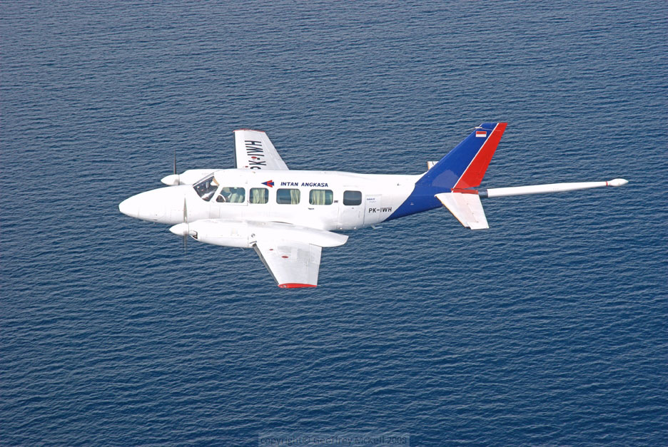
On 24 August 2012, a Piper Chieftain PA-31-350 aircraft, registered PK-IWH, was being operated by PT. Intan Angkasa Airservice to conduct an aerial survey (aero magnetic) flight at a survey area located north of Bontang, East Kalimantan. There were 4 persons on board; one pilot, one security officer and two surveyors. Based on the flight plan submitted by the Pilot in Command (PIC) to the Briefing Office, the flight was planned with an altitude of 3,000 feet AMSL en-route and 500 feet AGL while surveying the area. The fuel endurance was for 6 hours flight time and the aircraft equipped with an Emergency Locator Transmitter (ELT). The aircraft departed from Temindung Airport (WALS), Samarinda at 0751 local time (LT - 2351 UTC). At 0004 UTC, the pilot informed to the Temindung Control Tower controller (Temindung Tower) that the aircraft was abeam Tanjung Santan descending from 3,000 feet and established contact with Bontang Info officer (Bontang Info). At 0005 UTC, the pilot informed the Bontang Info that the aircraft altitude was 300 feet and estimated over Bontang at 0011 UTC. Bontang info acknowledged this transmission and advised the pilot to report when the flight left the Bontang Area. At 0010 UTC, the SureTrack (flight following system) stopped receiving data from the aircraft. The last recorded information was an aircraft speed of 138 knots, heading 352°, latitude 0°8’33” N and longitude 117°12’54” E. At 0600 UTC, the engineer of the PK-IWH aircraft asked the Temindung Tower about the flight as the fuel endurance had been exceeded. The Temindung Tower contacted Bontang Info to get information about the aircraft. After receiving the request, Bontang Info tried to contact the pilot twice and there was no reply. Bontang Info also contacted the Tanjung Bara Airstrip to request information about the aircraft but there was no information. The Temindung Tower reported that:
• at 0610 UTC declared INCERFA (Uncertainty phase);
• at 0630 UTC declared ALERFA (Alert phase);
• at 0700 UTC declared DETRESFA (Distress phase).
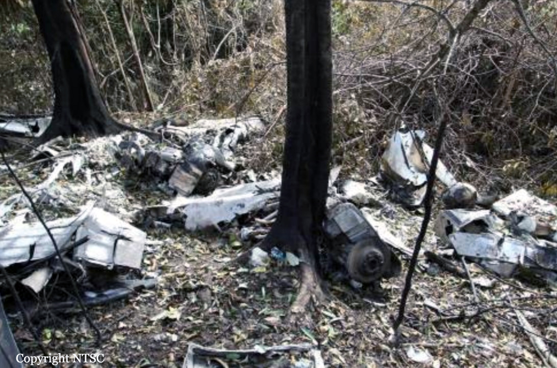
At 0730 UTC, the search and rescue team was assembled; the team consisted of the Temindung Airport Authority, National Search and Rescue, Indonesian Police, Army and Airforce. The search operation was conducted via ground and air using three helicopters. On 26 August 2012 at 0850 UTC, the aircraft wreckage was located by a ground search team on a ridge of Mayang Hill, Bontang at approximately 1,200 feet AMSL at coordinates 00°12’34.3”N, 117°16’57.3”E, 12 NM from Bontang Aerodrome on bearing of 294°. The accident site was within the planned aircraft survey area. All occupants were fatally injured and the aircraft was destroyed by impact force and post impact fire.
Probable cause:
The accident was typical of a Controlled Flight into Terrain (CFIT). Low altitude VFR flying in a low visibility environment limited the pilot’s visibility and increased the probability of impact with terrain.
Final Report:

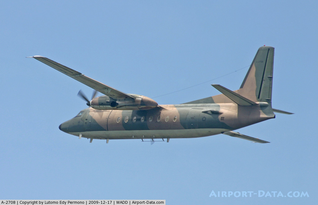
Crash of a Fokker F27 Friendship 400M in Jakarta: 11 killed

Date & Time: Jun 21, 2012 at 1450 LT
Type of aircraft:

Operator:
Registration:
A-2708
Flight Type:
Survivors:
No
Schedule:
Jakarta - Jakarta
MSN:
10546
YOM:
1976
Country:
Region:
Crew on board:
7
Crew fatalities:
Pax on board:
0
Pax fatalities:
Other fatalities:
Total fatalities:
11
Circumstances:
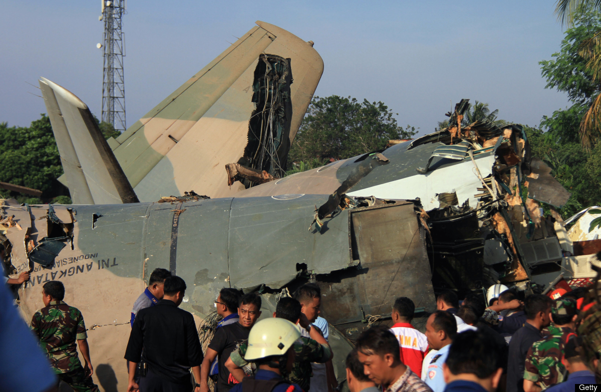
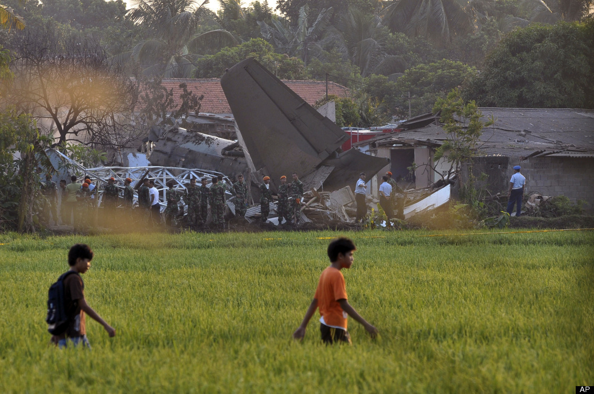
The crew (one instructor and six pilot under training) were engaged in a training flight and departed Jakarta-Halim Perdanakusuma Airport at 1310LT for a local flight consisting of touch-and-go manoeuvres. After a circuit, the pilot-in-command completed a last turn to the left to join the glide for runway 18 when the aircraft stalled and crashed onto several houses located less than one km from the runway threshold. The aircraft was destroyed as well as several houses. Six occupants in the aircraft and four people on the ground were killed while the copilot was critically injured. Unfortunately, he did not survive to his severe injuries and died few hours later at hospital.
Probable cause:
It was reported that the approach speed was too low during the last turn, causing the aircraft to stall. The distance between the aircraft and the ground was insufficient to expect recovery.

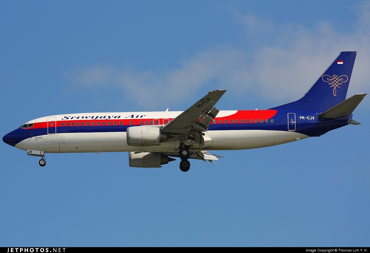
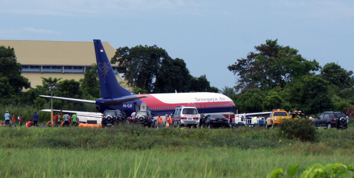
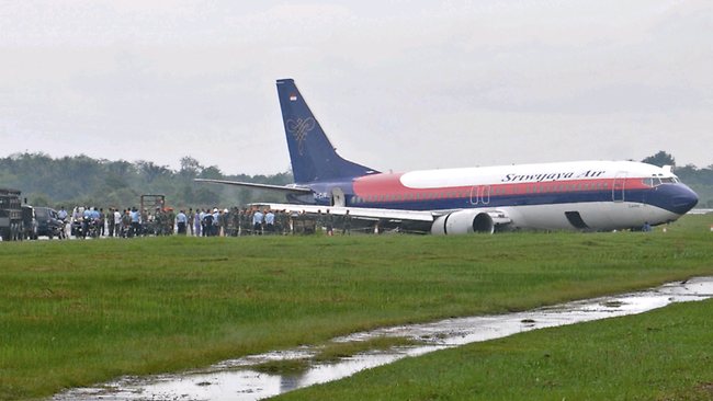
Crash of a Boeing 737-4Y0 in Pontianak

Date & Time: Jun 1, 2012 at 1235 LT
Type of aircraft:
Operator:
Registration:
PK-CJV
Survivors:
Yes
Schedule:
Jakarta - Pontianak
MSN:
24689/1883
YOM:
1990
Flight number:
SJY188
Country:
Region:
Crew on board:
8
Crew fatalities:
Pax on board:
155
Pax fatalities:
Other fatalities:
Total fatalities:
0
Captain / Total flying hours:
25000
Circumstances:
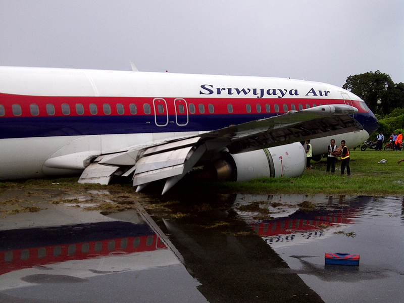
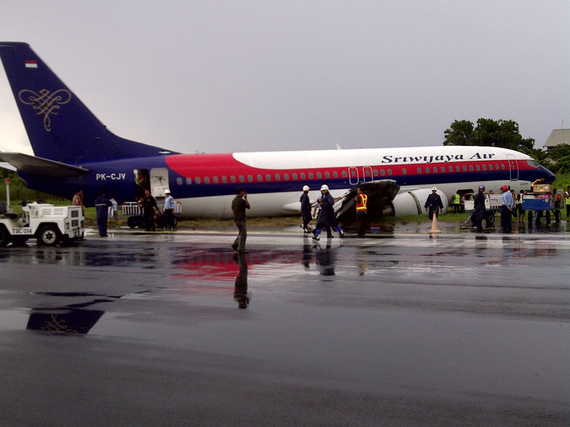
The approach to Pontianak was unstable and really difficult due to turbulence and poor weather conditions (heavy rain falls). The aircraft landed on wet runway 15 and skidded. It eventually veered off runway to the left and went through a muddy field. The nose gear was torn off while both main gears sank, leaving both engines on the ground. While all 163 occupants were evacuated safely, the aircraft was damaged beyond repair. At the time of the accident, weather conditions were as follow: wind from 230 at 22 knots, visibility 600 metres, few clouds at 900 feet, broken at 700 feet, CB's above the terrain and turbulences.