Ground collision with an ATR42-600 in Jakarta
Date & Time:
Apr 4, 2016 at 1957 LT
Operator:

Registration:
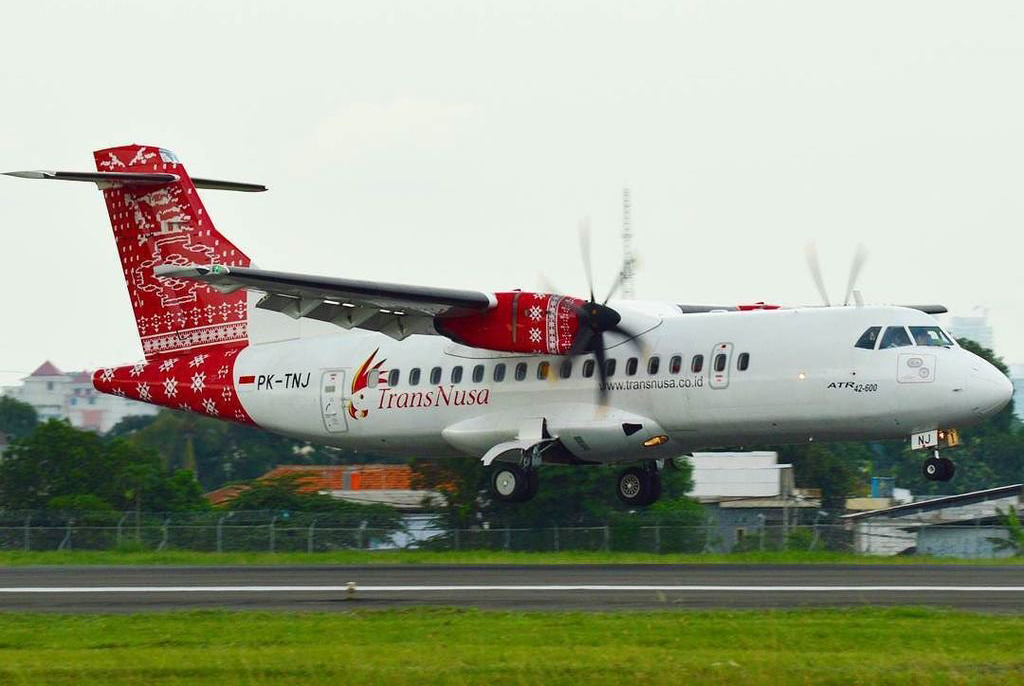
PK-TNJ
Survivors:
Yes
MSN:
1015
YOM:
2014
Crew on board:
2
Crew fatalities:
Pax on board:
0
Pax fatalities:
Other fatalities:
Total fatalities:
0
Aircraft flight hours:
2073
Aircraft flight cycles:
1038
Circumstances:
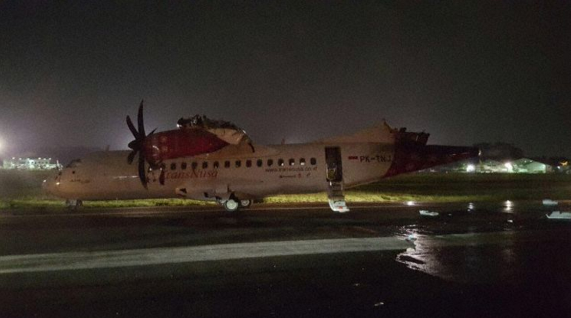
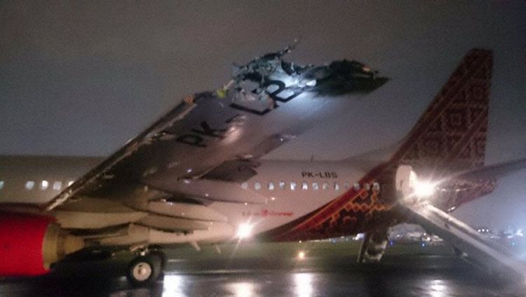
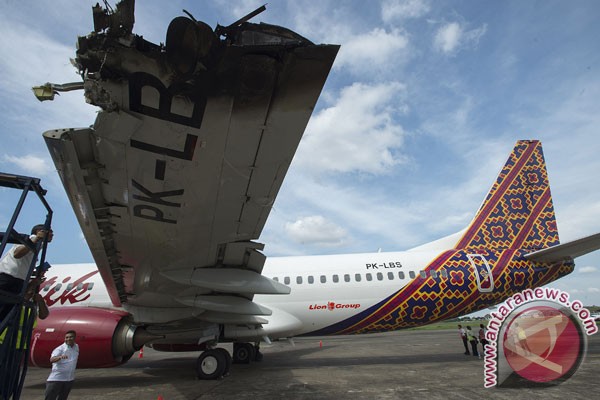
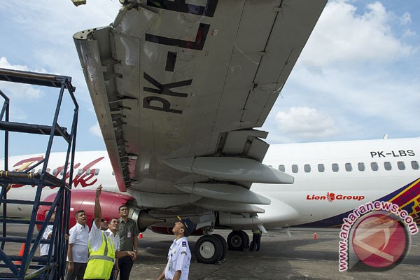
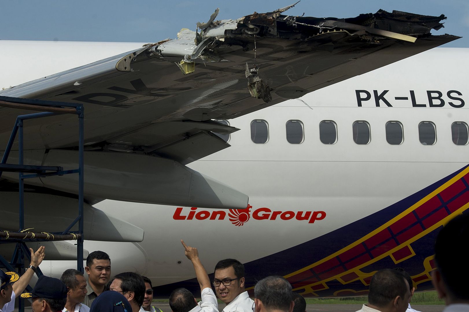
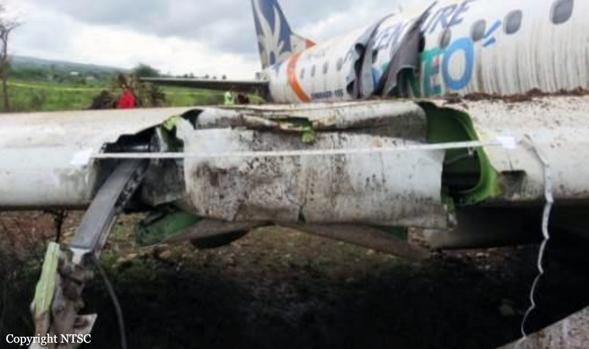
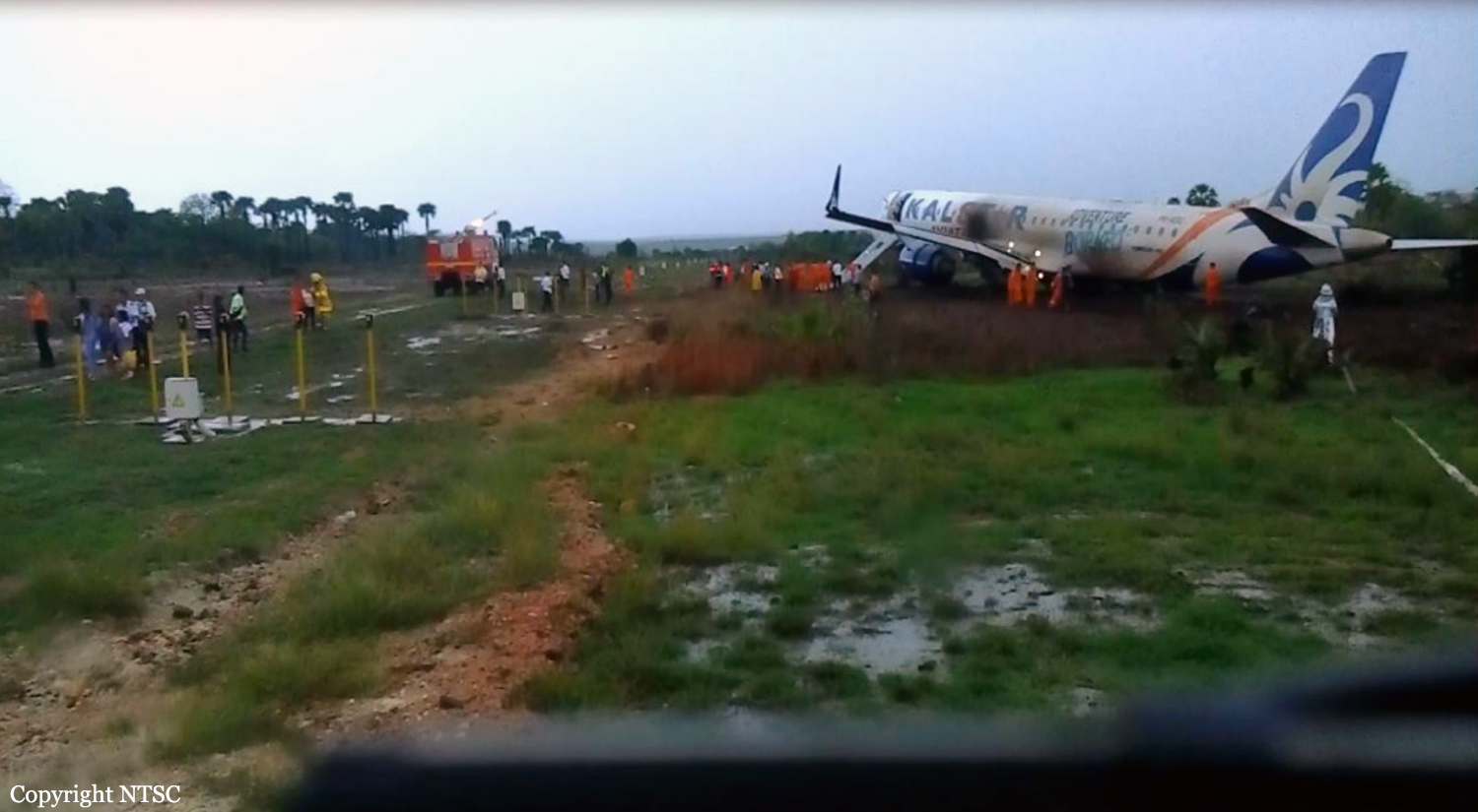
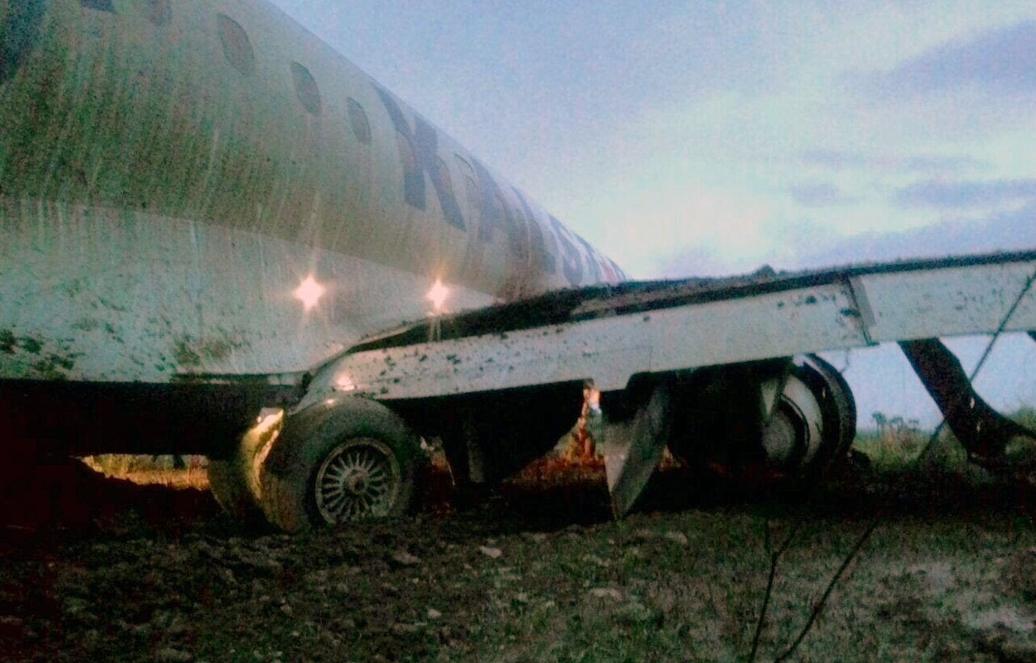
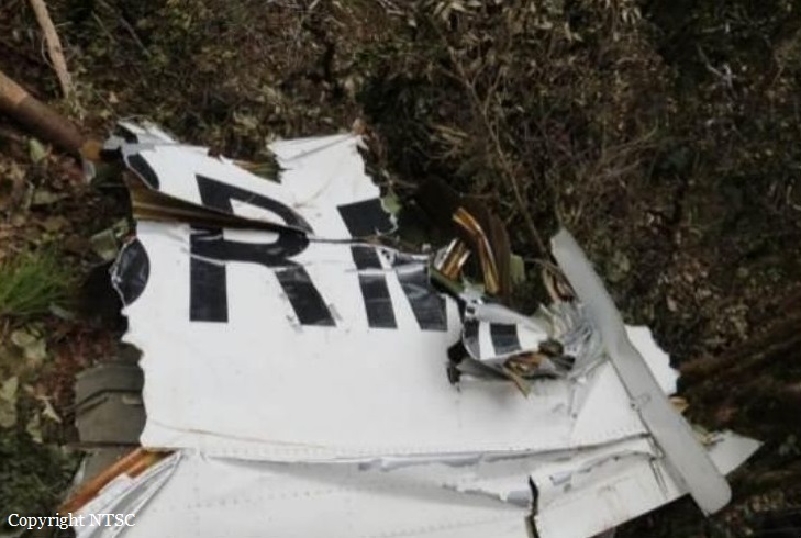
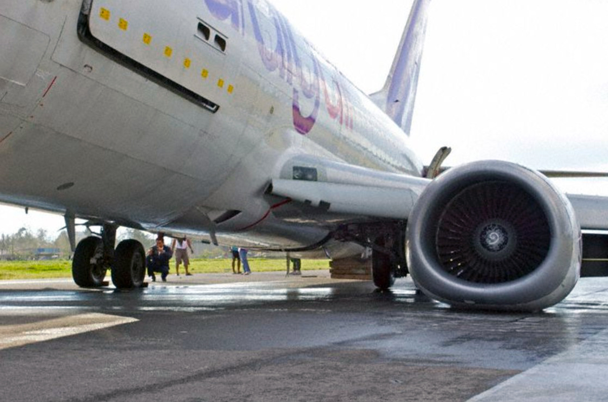
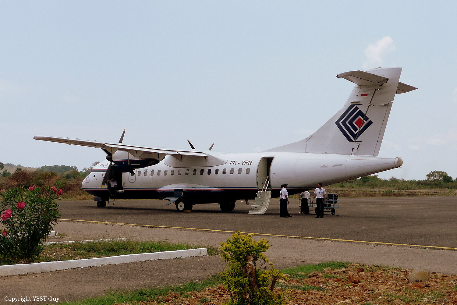
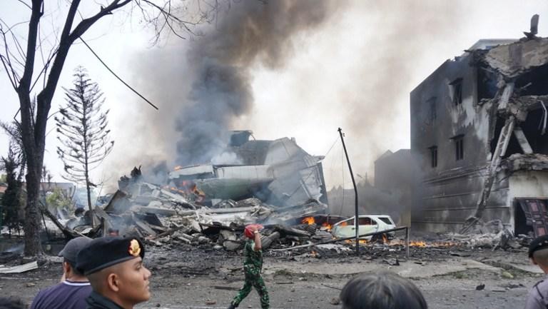
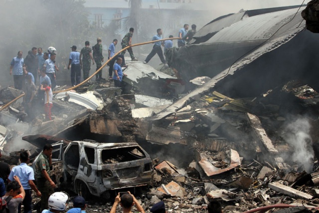
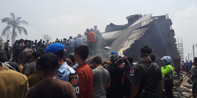
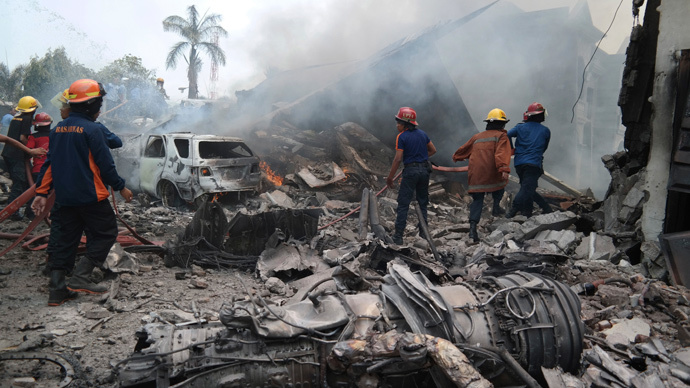
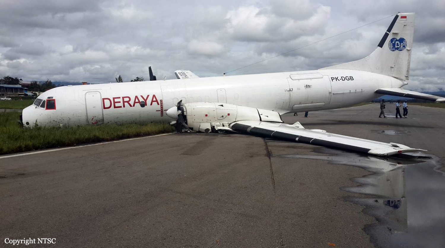
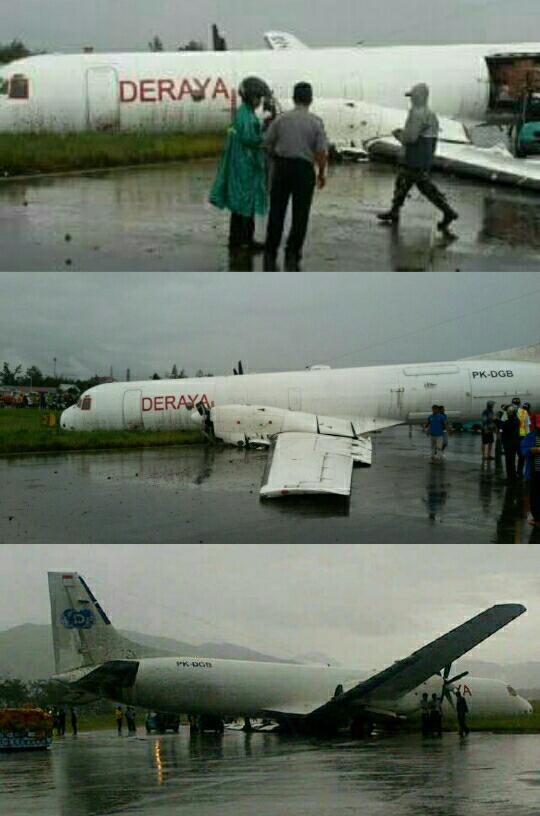
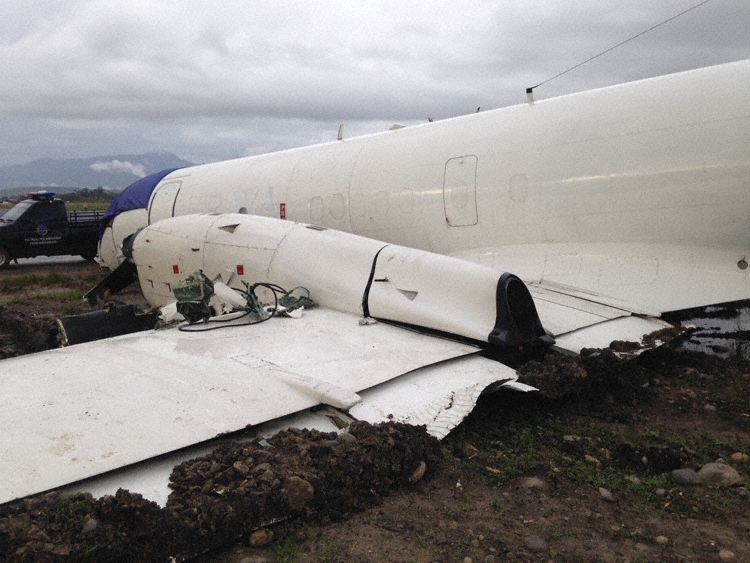
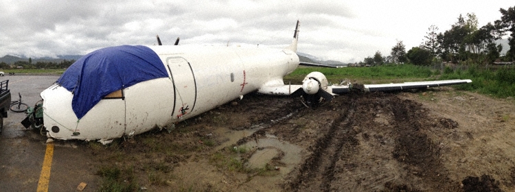
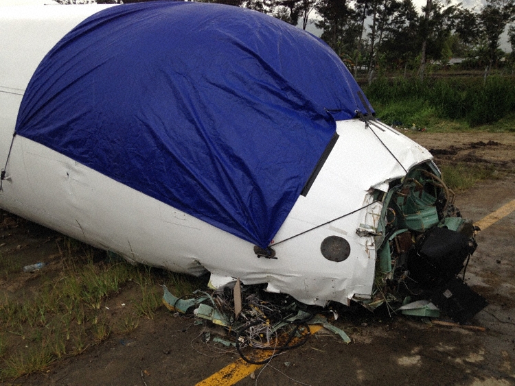
On 4 April 2016, Boeing 737-800 registration PK-LBS was being operated by Batik Air as scheduled passenger flight with flight number ID 7703 from Halim Perdanakusuma Airport with intended destination Sultan Hasanuddin International Airport, Makassar. An ATR 42-600 aircraft, registration PK-TNJ operated by TransNusa Aviation Mandiri was being repositioned from north to south apron of Halim Perdanakusuma Airport by a ground handling agent PT. Jasa Angkasa Semesta (PT. JAS). The aircraft was towed without aircraft electrical power fed to the system including the radio communication and aircraft lighting system. At the time of occurrence, the ID7703 pilot communicated to Halim Tower controller on frequency 118.6 MHz while the towing car driver communicated using handheld radio on frequency 152.73 KHz and was handled by assistant controller. At 1948 LT (1248 UTC), ID7703 pilot received taxi clearance from Halim Tower controller and after the ID7703 taxi, the towing car driver received clearance for towing and to report when on taxiway C. Afterward the towing car driver was instructed to expedite and to follow ID7703. While the ID7703 backtracking runway 24, the towed aircraft entered the runway intended to cross and to enter taxiway G. At 1256 UTC, ID7703 pilot received takeoff clearance and initiated the takeoff while the towed aircraft was still on the runway. The towing car driver and the pilots took action to avoid the collision. The decision of the pilot and the towing car driver to move away from the centerline runway had made the aircraft collision on the centerline runway (head to head) avoided, however the wings collision was unavoidable. At 1257 UTC, the ID7703 collided with the towed aircraft. The ID7703 pilot rejected the takeoff and stopped approximately 400 meters from the collision point while the towed aircraft stopped on the right of the centerline runway 24. No one injured at this occurrence and both aircraft severely damaged.
Probable cause:
The collision was the result of a poor coordination by ATC staff at Jakarta Airport. The following factors were reported:
- Handling of two movements in the same area with different controllers on separate frequencies without proper coordination resulted in the lack of awareness to the controllers, pilots and towing car driver,
- The communication misunderstanding of the instruction to follow ID 7703 most likely contributed the towed aircraft enter the runway,
- The lighting environments in the tower cab and turning pad area of runway 24 might have diminished the capability to the controllers and pilots to recognize the towed aircraft that was installed with insufficient lightings.
Final Report: