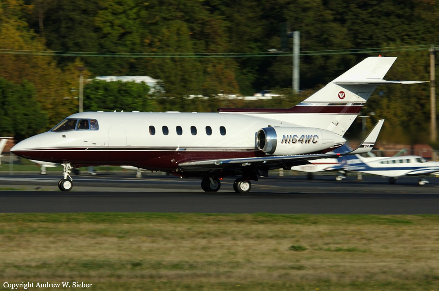
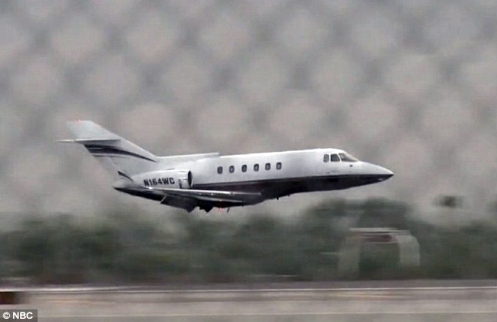
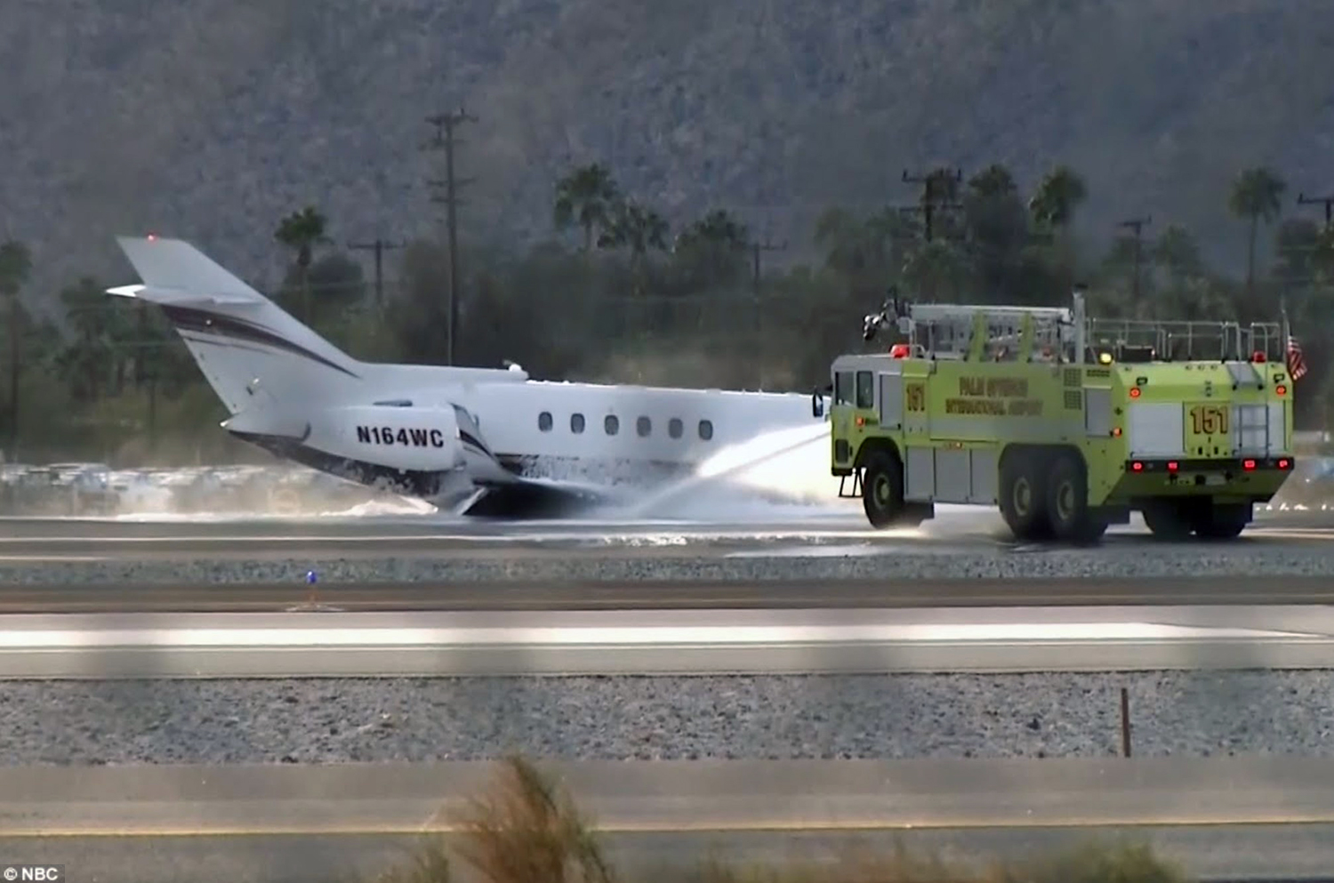
Crash of a BAe 125-800SP in Palm Springs
Date & Time:
Dec 4, 2015 at 1420 LT
Registration:
N164WC
Survivors:
Yes
Schedule:
Palm Springs – Boise
MSN:
258072
YOM:
1986
Crew on board:
2
Crew fatalities:
Pax on board:
0
Pax fatalities:
Other fatalities:
Total fatalities:
0
Aircraft flight hours:
2500
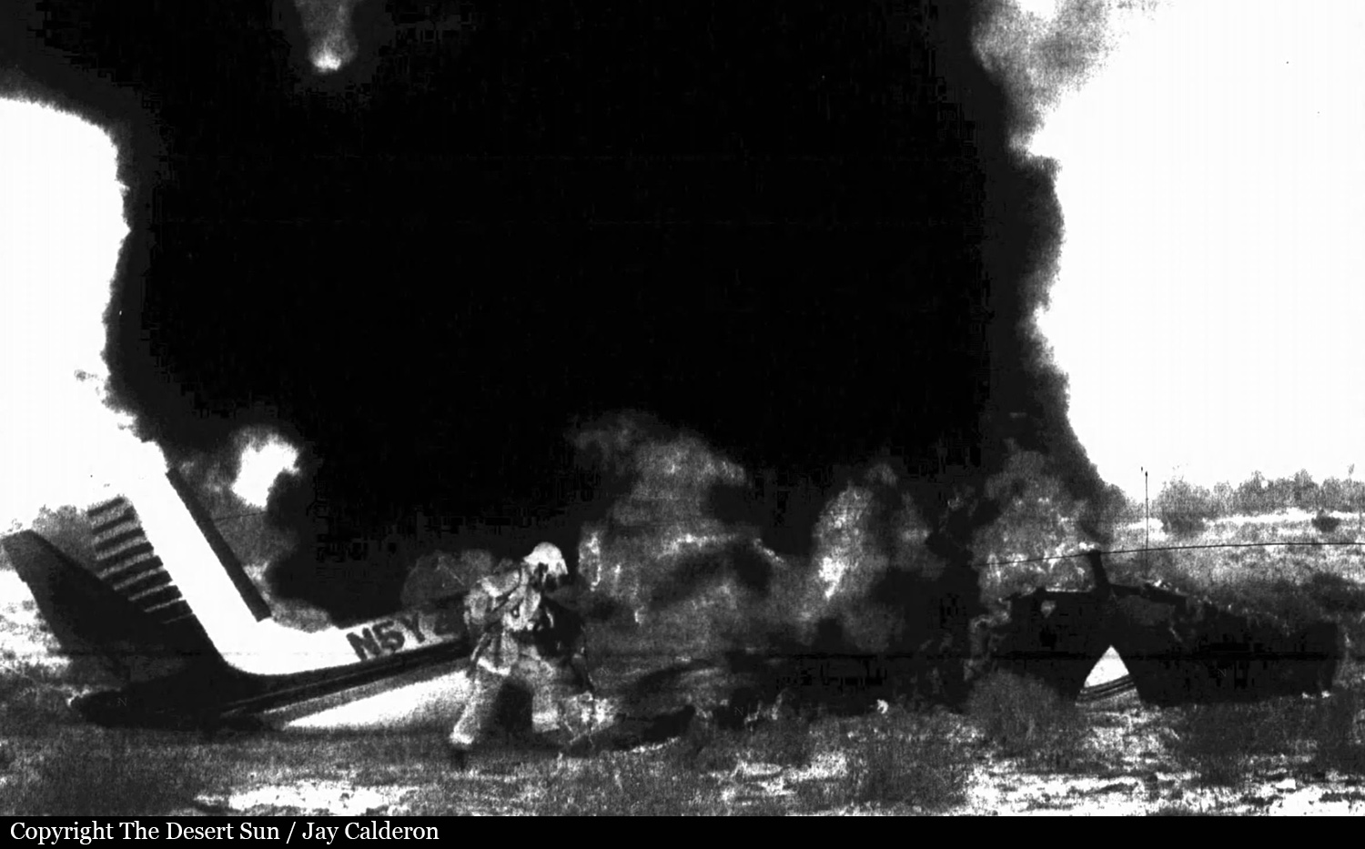
Circumstances:
After takeoff from Palm Springs Airport, while on a positioning flight to Boise, the crew encountered technical problems with the undercarriage. Following a holding circuit, the crew decided to return to Palm Springs and to complete a gear up landing. Upon touchdown, the aircraft slid on its belly for few dozen metres before coming to rest. Both pilots evacuated safely and the aircraft was damaged beyond repair.
Probable cause:
No investigations completed by the NTSB.