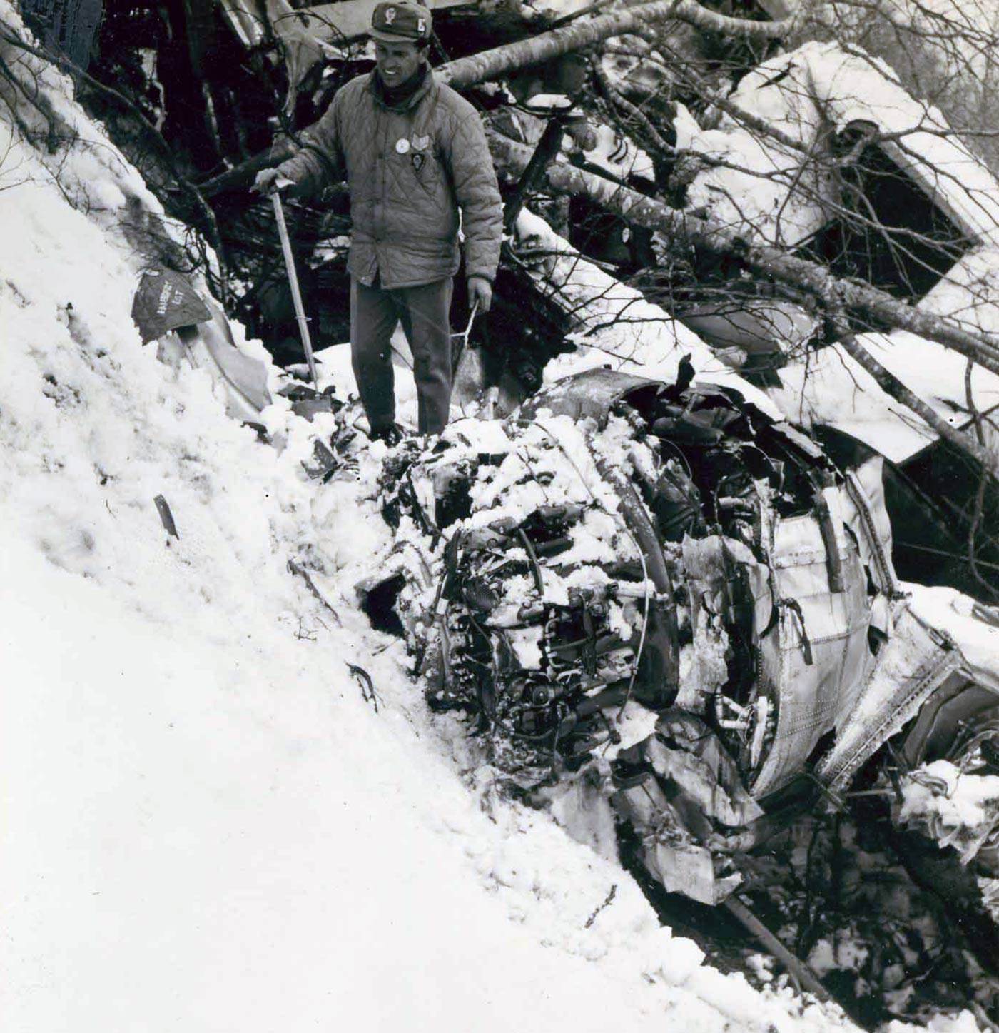
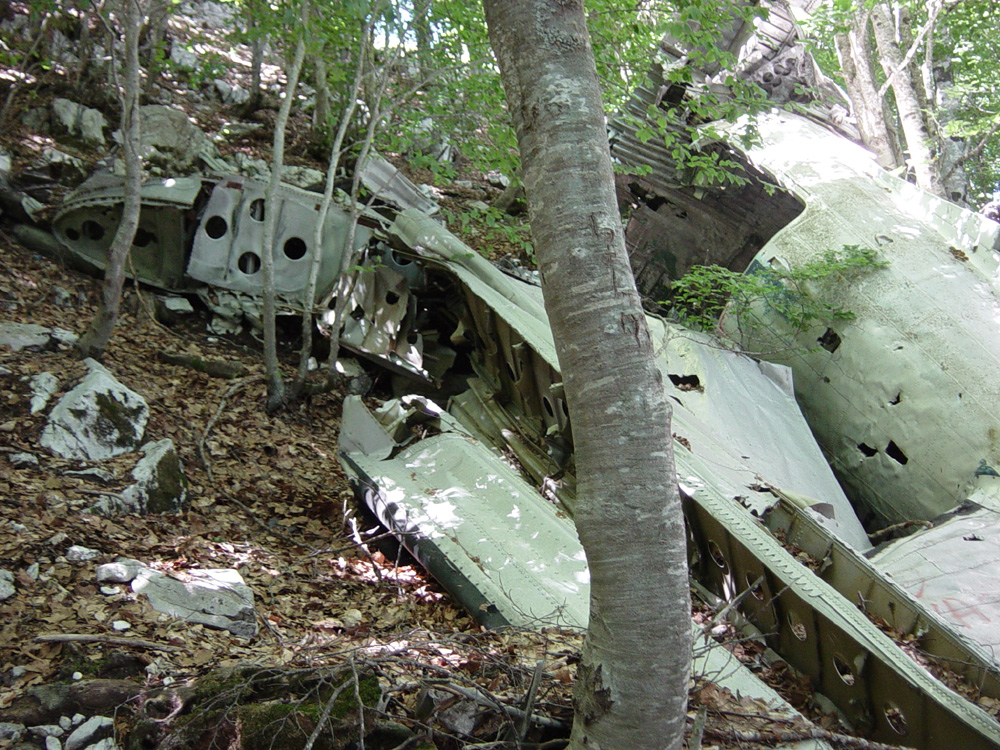
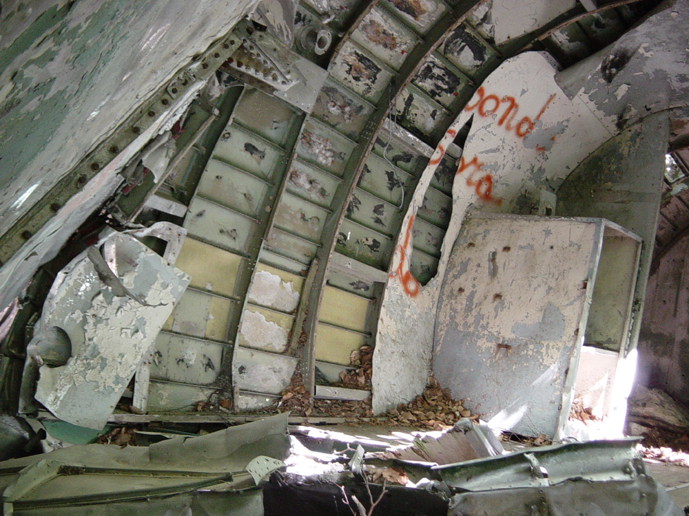
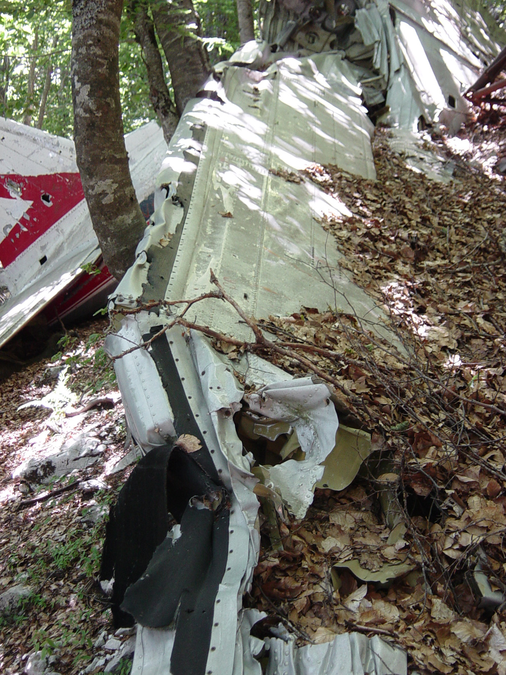
Crash of a Douglas C-47B-35-DK near Sora: 8 killed

Date & Time: Mar 30, 1963 at 1837 LT
Operator:
Registration:
I-TAVI
Flight Phase:
Survivors:
No
Site:
Schedule:
Pescara – Rome
MSN:
16477/33225
YOM:
1945
Flight number:
IH703
Location:
Country:
Region:
Crew on board:
3
Crew fatalities:
Pax on board:
5
Pax fatalities:
Other fatalities:
Total fatalities:
8
Captain / Total flying hours:
10731
Captain / Total hours on type:
2296.00
Copilot / Total flying hours:
832
Copilot / Total hours on type:
832
Aircraft flight hours:
13941
Circumstances:
Flight IH703 was a scheduled domestic flight from Pescara Airport to Rome-Ciampino. The aircraft which had departed Rome at 1526 hours GMT, took off from Pescara with the same crew at 1736 hours on an IFR plan and climbed to flight level 100, its cruising altitude. At 1739 hours the pilot requested radar guidance from the Pescara defence radar "FIONDA", which is not normally available for flight information service to civil aircraft. The first part of the flight was intentionally carried out south of the direct route to avoid heavy cloud formations. At 1750 hours the Pescara defence radar picked up the flight in the Ortona area and at approximately 1803 hours it passed to the flight "QDM Ciampino 265°, distance 80 NM". At 1805 hours the pilot reported this position to the Rome ACC/FIC. After having directed the flight around some cumulonimbus the Pescara defence radar lost the aircraft at 1812 hours. At 1816 hours the pilot enquired whether the aircraft had been picked up by the Rome surveillance radar. Two minutes later he reported to Rome ACC/FIC that he was crossing the eastern edge of airway A 14 and requested a clearance to Rome NDB "LJ". At 1822 hours he reported having Rome in sight and requested authorization to descend from flight level 100. - Two minutes later, upon confirmation that Rome was in sight, the flight was cleared to proceed to Rome NDB and to descend to 6 000 ft. At 1828 hours the pilot reconfirmed that he had Rome in sight and requested clearance to descend further. The flight was then given instruction to contact Ciampino tower, but was unable to establish communication either on the tower frequency or on 120.1 or 124.1 MC/S and therefore came back on the Rome ACC/FIC frequency. At 1830 hours the pilot reported that he was unable to tune on Rome NDB and had to keep out of the clouds since his radio compass was not working properly. At that time the Rome 2 defence radar which had first picked up the flight around 1802 hours, lost its trace in the Arpino area. Around 1832 hours, on a request from Rome ACC/FIC, the pilot reported that he was in the vicinity of Mount Cavo, of which he could see the antennae. One minute later the flight lost visual contact with the ground and, since the pilot believed that his radio compass was out of order, he requested clearance to proceed on Ostia VOR. At 1835 hours he was cleared to Ostia VOR at 6 000 ft, but reported that his VOR was not giving reliable information and that he would fly on a heading of 270° and break over the sea. This was the last message of the aircraft. The aircraft was subsequently found on a very steep slope on the southeast side of Mount Serra Alta at an elevation of 1,630 m. All eight occupants were killed.
Crew:
Ernesto Roggero , pilot,
Erminio Carlo Bonfanti, copilot,
Luigi Politta, steward.
Passengers:
Leonbruno Angeloni,
Marco Di Michele,
Marvin Walter Gelber,
Nicolò Marcello,
Guido Mancini.
Probable cause:
It was determined that the probable cause of the accident was:
- Significant errors by the pilot in estimating his own position with consequent presumed identification of lights in the Rome area and of the Mount Cavo antennae, which led him to:
- Misjudge the effectiveness of the aircraft radio and navigational equipment,
- Request clearance to descend to 6 000 ft and subsequently below the specified level in order to maintain at all costs visual contact with the ground, with the result that he crashed into the mountain because of inability to achieve the desired visual contact.
- Particularly adverse weather conditions over the last segment of the route flown at night,
- Failure to report to the various ATC units the departures from the flight route indicated in the PLN submitted prior to departure and in the subsequent PLN transmitted by the pilot after departure,
- Added to the above, the unfortunate concurrence of a series of facts and circumstances that all played against the pilot.
Final Report:

Crash of a Douglas DC-3D in Kasongo

Date & Time: Mar 29, 1963
Type of aircraft:
Operator:
Registration:
9Q-CUS
Flight Phase:
MSN:
43092
YOM:
1947
Location:
Region:
Crew on board:
0
Crew fatalities:
Pax on board:
0
Pax fatalities:
Other fatalities:
Total fatalities:
0
Circumstances:
Shortly after takeoff from Kasongo Airport, the airplane encountered difficulties to gain height. It struck trees, stalled and crashed. The occupant's fate remains unknown.

Crash of a Douglas DC-6B on Mt Chachacomani: 39 killed

Date & Time: Mar 15, 1963 at 1355 LT
Type of aircraft:
Operator:
Registration:
CP-707
Flight Phase:
Survivors:
No
Site:
Schedule:
Arica – La Paz – Cochabamba
MSN:
43547
YOM:
1951
Flight number:
LB915
Country:
Crew on board:
3
Crew fatalities:
Pax on board:
36
Pax fatalities:
Other fatalities:
Total fatalities:
39
Captain / Total flying hours:
10069
Captain / Total hours on type:
1319.00
Copilot / Total flying hours:
4034
Copilot / Total hours on type:
910
Circumstances:
The airplane departed Arica on the return flight at approximately 1327 hours Bolivian time. It was to be an eight-hour, VFR flight, and the aircraft was to cruise at 17,000 feet. Eight minutes after take-off the crew advised ATC at Cochabamba of the departure time, the number of passengers on board, the aircraft's weight and the amount of fuel being carried. Between 1347 and 1348 the air traffic controller at La Paz advised that Panagra flights 701 and 393, flying at 22,000 and 21,000 feet were estimating Charaña at 1355 and Arica at 1351 respectively. Flight 915 acknowledged the message. ATC at La Paz called the flight at approximately 1400 hours, and several times thereafter, to report on the new positions of the two Panagra aircraft, which were in the Arica zone but received no reply. It was determined subsequently that the aircraft crashed into Chachacomani Peak (latitude 17°49'00'', longitude 69°50'00''W) in Peruvian territory near the Chilean border at an altitude of 14,250 feet, sometime between 1351 and 1355. The wreckage was spotted by the crew of a reconnaissance aircraft few hours later and the first rescuers arrived on scene later to confirm that all 39 occupants have been killed.
Probable cause:
A flight under visual flight rules was attempted below the minimum altitude indicated in the flight plan in weather conditions that were marginal for this type of operation and were associated with the severe turbulence which usually exists in that region (western area).
Final Report:

Crash of an Ilyushin II-18V in Ashgabat: 12 killed

Date & Time: Mar 5, 1963 at 1934 LT
Type of aircraft:
Operator:
Registration:
CCCP-75765
Survivors:
Yes
Schedule:
Krasnovodsk – Ashgabat
MSN:
181 0034 04
YOM:
28
Flight number:
SU191
Country:
Region:
Crew on board:
11
Crew fatalities:
Pax on board:
43
Pax fatalities:
Other fatalities:
Total fatalities:
12
Aircraft flight hours:
2098
Aircraft flight cycles:
1213
Circumstances:
The aircraft departed Krasnovodsk Airport at 1804LT and shortly after takeoff, the crew was informed about weather conditions at destination with a sand storm and a visibility limited to 1,000 meters. En route, while cruising at an altitude of 6,000 meters, weather conditions worsened and the crew obtained the permission to modify his route. At a distance of 25 km from Ashgabat, the crew started the descent and reached the altitude of 400 meters when he reported the runway lights in sight. Shortly later, the airplane became unstable and lost height. It banked left to an angle of 7°, struck power cables and a concrete post. Out of control, it banked left to an angle of 30°, stalled and crashed in flames 1,012 meters short of runway threshold. Eight crew members and four passengers were killed while 42 other occupants were injured. The aircraft was destroyed by impact forces and a post crash fire.
Probable cause:
Wrong decision on part of the crew who continued the approach in below minima weather conditions. Errors on part of ATC were also reported as they cleared the crew to land in below minima weather conditions and failed to divert the crew to another airport. It was also determined that the information transmitted to the crew relating to weather conditions at destination did not reflect the truth, which was considered as a contributing factor.

Crash of a Douglas C-47B-30-DK on Mt Boca: 27 killed

Date & Time: Mar 2, 1963 at 1005 LT
Operator:
Registration:
PI-C489
Flight Phase:
Survivors:
No
Site:
Schedule:
Zamboanga – Cotabato – Davao
MSN:
16115/32863
YOM:
1945
Flight number:
PR984
Country:
Region:
Crew on board:
3
Crew fatalities:
Pax on board:
24
Pax fatalities:
Other fatalities:
Total fatalities:
27
Captain / Total flying hours:
10320
Captain / Total hours on type:
6500.00
Copilot / Total flying hours:
870
Circumstances:
Flight 984 was on a scheduled domestic flight from Zamboanga to Davao, with an intermediate stop at Cotabato. It departed Cotabato at 0940 hours, with a crew of three and twenty-four passengers, estimating Davao at 1025 hours. At 1002 hours the flight reported to the Company radio station at Cotabato that it was halfway to Davao, at Flight level 60, descending. Later on, it contacted the Company radio station at Davao and requested the Davao weather. After having received weather information the flight advised that its arrival would be delayed on account of bad weather. No aircraft difficulty was reported and this was the last message from the flight. When the aircraft failed to arrive, 30 minutes after its ETA a search was started. The aircraft was subsequently found on Mt. Boca, approximately 50 miles SE of Davao Airport, where it had crashed at an altitude of 3 000 ft around 1130 hours. All 27 occupants were killed.
Probable cause:
The probable cause of the accident was due to navigational error, en-route and during let-down. Contributory factors were the limited visibility and the crosswind, all existing on the final phase of the flight.
Final Report:

Crash of a De Havilland DH.104 Dove 1B in Nakatane

Date & Time: Feb 18, 1963
Type of aircraft:
Operator:
Registration:
JA5003
Survivors:
Yes
MSN:
04375
YOM:
1952
Country:
Region:
Crew on board:
0
Crew fatalities:
Pax on board:
0
Pax fatalities:
Other fatalities:
Total fatalities:
0
Circumstances:
After touchdown at Nakatane Airport, the twin engine aircraft encountered difficulties to stop within the remaining distance. It overran, lost its undercarriage and came to rest few dozen yards farther. There were no injuries among the occupants while the airplane was damaged beyond repair.

Crash of a Boeing 720-051B in the Everglades National Park: 43 killed

Date & Time: Feb 12, 1963 at 1350 LT
Type of aircraft:
Operator:
Registration:
N724US
Flight Phase:
Survivors:
No
Schedule:
Miami – Chicago – Spokane – Seattle – Portland
MSN:
18354
YOM:
1961
Flight number:
NW705
Crew on board:
8
Crew fatalities:
Pax on board:
35
Pax fatalities:
Other fatalities:
Total fatalities:
43
Captain / Total flying hours:
17835
Captain / Total hours on type:
150.00
Copilot / Total flying hours:
11799
Copilot / Total hours on type:
1093
Aircraft flight hours:
4684
Circumstances:
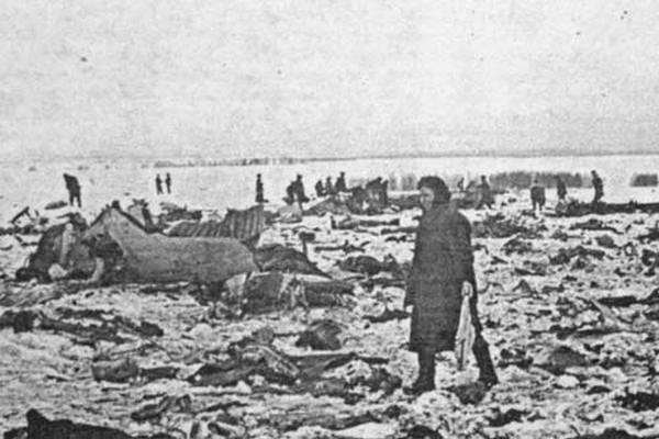
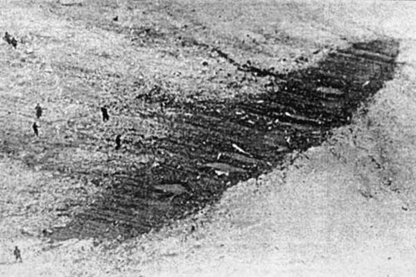
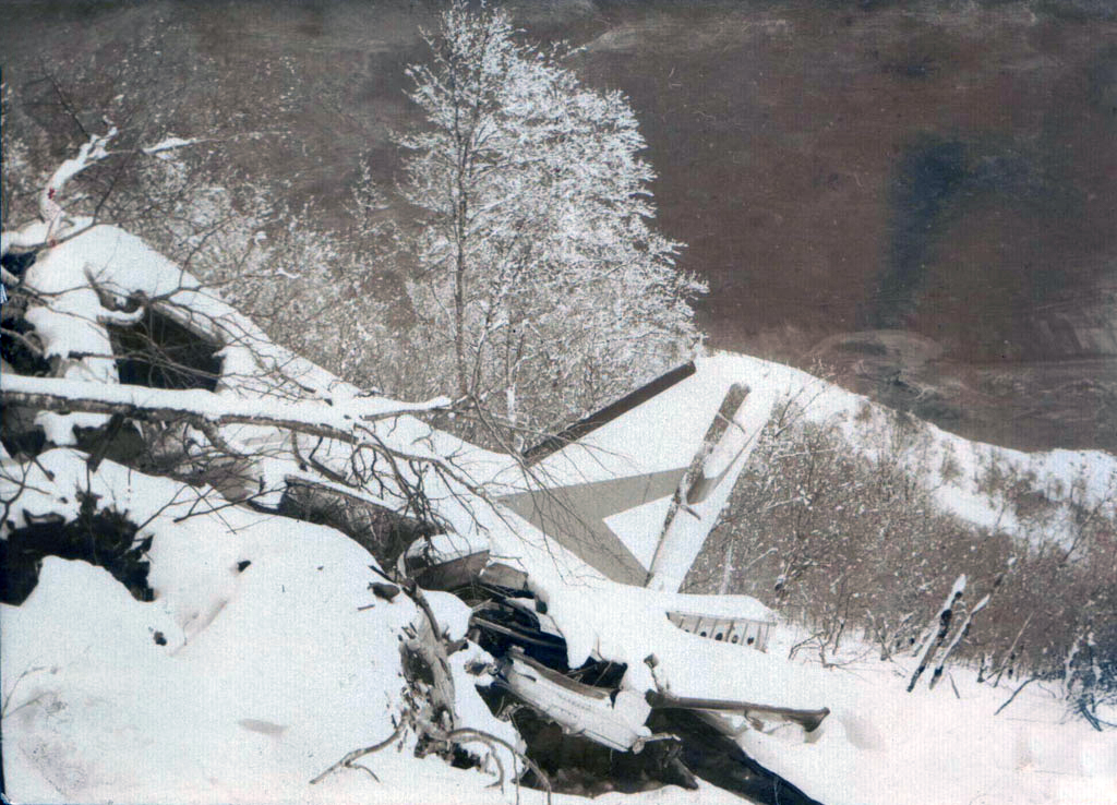
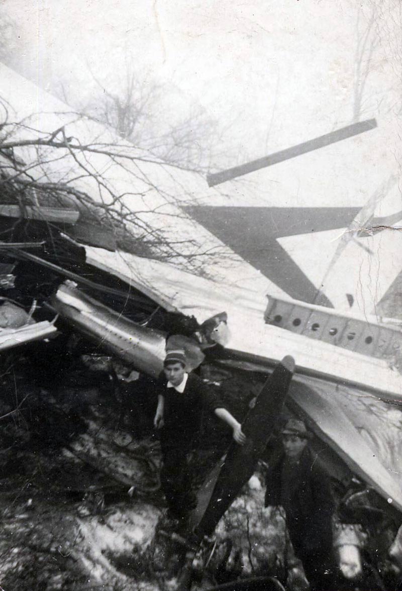
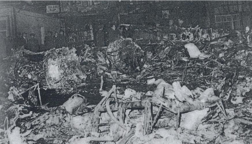
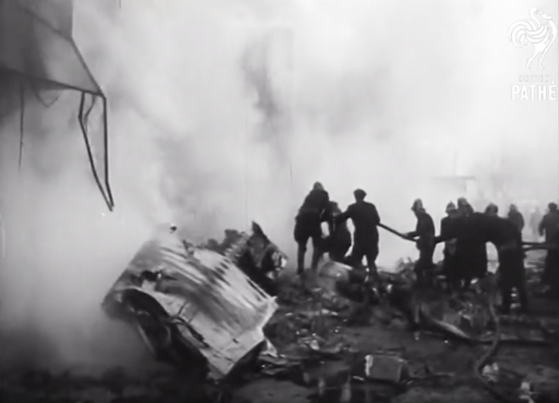
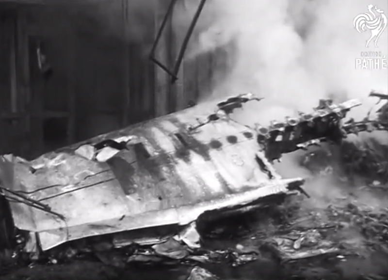
The aircraft arrived in Miami at 1240, following a routine flight from Chicago, Illinois The captain of the inbound flight reported that the only mechanical discrepancy was, "the outflow valves being a little sticky merely made it a little difficult to maintain the pressurization in a smooth manner. "These valves were cleaned, and a leaking rivet at the No. 4 reserve fuel tank was plugged when it was noticed by the mechanic. This was the only maintenance performed during the "turnaround". Flight 705 is regularly scheduled from Miami. to Portland, Oregon, with intermediate stops at Chicago, Illinois and Spokane and Seattle, Washington. The computed takeoff gross weight of 175,784 pounds, and center of gravity (e.g.) of 25 percent mean aerodynamic chord (MAC) were both well within the allowable limits. Prior to departing the ramp at 1325, the crew asked the ground controller about the departure routes being utilized, and he replied that most flights were departing ". . either through a southwest climb or a southeast climb and then back over the top of it. . . "The flight departed Miami with an Instrument Flight Rules (IFR) clearance at 1335 In accordance with the pilot's request for a". . . southeast vector "a left turn was rude after takeoff from runway 27L and circuitous routing was utilized in conjunction with radar vectors from Miami Departure Control, to avoid *** of anticipated turbulence associated with thunderstorm activity (See Attachment A). A similar departure pattern had been previously flown by another flight Subsequently, while maintaining 5,000 feet and a heading of 300 degrees, Flight 705 requested clearance to climb to a higher altitude. Following a discussion between the flight and the Federal Aviation Agency (FAA) radar departure controller about the storm activity, and while clearance to climb was being coordinated with the Miami Air Route Traffic Control Center (ARTCC), the flight advised "Ah-h we're in the clear now. We can see it out ahead . . . looks pretty bad." At 1343, Flight 705 was cleared to climb to flight level 2/ 250 (FL250). They responded, "OK ahhh, we'll make a left turn about thirty degrees here and climb. . "The controller asked of 270 degree was their selected climbout heading, and they replied that this would take them". . . out in the open again". . Accordingly, clearance was granted. Following some discussion about the severity of the turbulence, which was described as moderate to heavy, the flight advised, "OK, you better run the rest of them off the other way then." At 1345 radar service was terminated and control of Flight 705 was transferred to Miami ARTCC. When the flight did not establish radio communication with ARTCC on the initial frequency, Departure Control provided a secondary frequency, and instructed the flight to turn to a heading of 360 degrees which was acknowledged. When Miami ARTCC requested position and altitude, the flight replied, "We're just out of seventeen five (17,500 feet) and standby on the DME one." This transmission ended at 1348, and was the last known communication with Flight 705 The voice transmissions emanating from the flight were made by the first officer. Witnesses in the area reported that a loud explosion had occurred in the air, and several felt a subsequent ground tremor. They also reported that heavy rain had been failing in the area. One witness, in company with five other persons, was seven miles south of the main wreckage site She heard the sound of an explosion which had no echo. When she looked in that direction she saw an orange ball of flame in the edge of a cloud. As she directed the attention of her companions toward this flame, it dropped straight down, becoming a streak, and disappeared behind trees. Shortly after the disappearance a second sound was heard. Statements were received from the crews of four other flights operating in the Miami area at the approximate time of the accident. The first, in a large jet which approached Miami from the west at 7,000 feet, reported the weather as ". . . in and out of broken clouds and light rain showers with light turbulence. Darker heavy shower activity was observed to the (south) of course. We observed no small cells on our radar scope. . only a broad rain area. . . "Another crew, in a four-engine aircraft, departed Miami at 1318, via a departure pattern similar to that which Flight 705 later followed. They described the worst turbulence as". medium to moderate . . . "from west of the airport to north of the Miami VORTAC .3/ They were maintaining 5,000 feet at the time. A third crew in a 720B was folding southeast of Miami at 13,000 feet. They observed numerous rain cells on radar in the Miami area and encountered light ice at this altitude. The fourth crew, also flying a large jet, taxied out shortly after Flight 705 but delayed takeoff for nearly an hour because of the weather. The weather in the Miami area at the time of the accident was characterized by a pre-frontal squall line approximately 250 miles in length, oriented on a northeast-southwest line immediately northwest of Miami (See Attachment A). The U. S. Weather Bureau (USWB) radar observation at Miami at 1344 indicated a broken area of thunderstorms associated with this line, with cells two to twenty miles in diameter, and tops of detectable moisture at 30,000 feet. The line was moving southeast at eight knots, and moderate rain showers were occurring at the station. The 0600 and 1800 Miami radiosonde ascents showed the freezing level to have been at 11,100 and 12,400 feet m.s.1., respectively. SIGMET 4/ No. 3 prepared by the USWB at Miami, valid from 0900-1300, forecast moderate to severe turbulence 5/ in thunderstorms, with a chance of extreme turbulence in heavier thunderstorms. This advisory was called to the attention of the crew of Flight 705 by the operations agent at Miami, and was attached to their dispatch papers. SIGMET No. 4, valid from 1300-1700, was not received until approximately 1315, after the crew of Flight 705 had left the operations office. It forecast moderate to severe turbulence, but deleted the reference to extreme turbulence indicated in SIGMET No 3. Since the dispatcher for this flight is stationed in Minneapolis, the physical Limitations involved made it difficult to apprise the crew of this latest advisory prior to their taxi time of 1325. The aircraft was completely destroyed by impact forces and all 43 occupants have been killed.
Probable cause:
The Board determines that the probable cause of this accident was toe unfavorable interaction of severe vertical air drafts and large longitudinal control displacements resulting in a longitudinal "upset" from which a successful recovered was not made.
Final Report:

Crash of a Vickers 754 Viscount in Ankara: 52 killed

Date & Time: Feb 1, 1963 at 1513 LT
Type of aircraft:
Operator:
Registration:
OD-ADE
Survivors:
No
Site:
Schedule:
Beirut – Nicosia – Ankara
MSN:
244
YOM:
1957
Flight number:
ME265
Country:
Region:
Crew on board:
3
Crew fatalities:
Pax on board:
11
Pax fatalities:
Other fatalities:
Total fatalities:
52
Captain / Total hours on type:
2925.00
Copilot / Total hours on type:
4200
Circumstances:
Middle East Airlines flight 265, a Vickers Viscount registered OD-ADE, was descending for Ankara-Esenboğa Airport, Turkey and had been cleared for an approach to runway 03. Last radio contact was at 13:09 hours GMT when the flight reported being over the Ankara NDB at 8000 feet, descending for 6500 feet. The crew would contact Ankara again over the NDB when inbound. Earlier in the day, at 11:22 GMT, a Douglas C-47 transport plane of the Turkish Air Force (CBK-28) had taken off from Ankara's Etimesgut Air Base for an instrument training flight in the southeast region of the Gölbasi beacon. The duration of the flight was planned for 1 hour 30 minutes . In this type of flight the student pilot is normally seated in the left-hand seat, an orange plexiglass panel is placed in front of him on the left half of the windshield, and he wears dark blue glasses. The instructor is in the right-hand seat and is able to maintain a lookout. The training manoeuvres had been completed, and the aircraft was returning to Etimesgut flying under visual flight rules by the time MEA flight 265 was descending for Esenboğa Airport. The Viscount, cruising on a heading of 283°, collided with the C-47 which was flying on a heading of 243° towards Etimesgut. The lower right-hand-side of the Viscount's nose and the starboard wing struck the C-47 from behind at a 40° angle in the door area on its port side. Propeller no. 3 also struck the C-47's left horizontal stabilizer, cutting it off. The blade ends broke off and remained with the tail unit of the C-47 near the base of the left horizontal stabilizer. The blade of propeller no. 4 cut the underside of the tip of the right horizontal stabilizer. Both aircraft flew together for a very short time then separated. The tail unit of the C-47 having been cut off, the C-47 fell vertically immediately thereafter. Prior to being cut off, the left horizontal stabilizer of the C-47 damaged the starboard side skin covering of the Viscount in the vicinity of the passenger cabin windows. This piece of skin covering broke off, and some of the passengers fell out through this hole. The Viscount flew a very short while following the separation of the two aircraft, then nosed down and fell. Both aircraft crashed into a residential area of Ankara, killing 87 people on the ground. 50 others were seriously injured.
Probable cause:
The Viscount aircraft had an IFR flight plan but was cruising under VFR conditions when it hit, with the lower side of the nose and with its starboard wing, the C-47 aircraft of the Turkish Air Force between the door on the port side of the fuselage and the tail group at an angle of forty degrees from the left rear and at an angle of approximately five to ten degrees upward. It cut off, with its starboard inner (No.3) propeller, the port side horizontal stabilizer of the C-47 aircraft. The pilots of the Viscount aircraft did not see the C-47 aircraft cruising below 7000 feet on their right-hand side forward, and the Viscount, having a higher speed, caught up with the C-47 from the left rear. At the last moment the Viscount pilots saw the C-47 and tried to avoid the collision by pulling up, but they did not succeed. The following findings were reported:
- The Viscount pilot made an estimation error of two minutes on the distance between Gölbasi and the Ankara NDB,
- His radiocommunications did not conform to the standard international conversation procedures,
- The C-47 was returning to Etimesgut Airport under visual flight rules (VFR) following an instrument training flight,
- These training flights are scheduled to be carried out below 7 000 ft with the trainee-pilot behind blind flight panels and the instructor-pilot sitting so as to be able to see outside thoroughly, The flights normally last for 1 hour- and 30 minutes, however, the instructor is authorized to extend this period if he deems it necessary,
- The C-47 was subjected to an impact from the port side rear at an angle of 40° and from the bottom to the top upwards at an angle of approximately 5 to 10°. The Viscount's flaps were set at 32° down, and the gear was down and locked. The aircraft collided over the City of Ankara at an altitude less than 7 000 feet.
Final Report:

Crash of a PZL-Mielec AN-2 near Leninakan: 13 killed

Date & Time: Jan 31, 1963 at 1006 LT
Type of aircraft:
Operator:
Registration:
CCCP-28900
Flight Phase:
Survivors:
No
Site:
Schedule:
Yerevan – Leninakan – Akhalkalaki
MSN:
1G07-14
YOM:
30
Country:
Region:
Crew on board:
2
Crew fatalities:
Pax on board:
11
Pax fatalities:
Other fatalities:
Total fatalities:
13
Aircraft flight hours:
1340
Circumstances:
The single engine aircraft departed Leninakan Airport at 0954LT on the second leg of a flight from Yerevan to Akhalkalaki. Eight minutes into the flight, while cruising in good weather conditions, the crew informed ATC about his position about 20 km north of Leninakan. Four minutes later, the airplane lost height and then climbed, banked left and right then nosed down and crashed in flames in a 90° nose down attitude in a mountainous area located near the village of Sesapar, some 30 km north of Leninakan. The airplane was totally destroyed and all 13 occupants were killed. At the time of the accident, weather conditions were good.
Probable cause:
The exact cause of the accident could not be determined with certainty. However, the board retained the following assumptions:
- Moving passengers towards the rear of the cabin, causing the center of gravity to be outside the envelope,
- Failure of the control cables,
- Attack of the crew in flight.

Crash of a Vickers 812 Viscount in Kansas City: 8 killed

Date & Time: Jan 29, 1963 at 2244 LT
Type of aircraft:
Operator:
Registration:
N242V
Survivors:
No
Schedule:
Midland – Lubbock – Wichita Falls – Lawton – Oklahoma City – Tulsa – Kansas City
MSN:
356
YOM:
1958
Flight number:
CO290
Crew on board:
3
Crew fatalities:
Pax on board:
5
Pax fatalities:
Other fatalities:
Total fatalities:
8
Captain / Total flying hours:
18611
Captain / Total hours on type:
3409.00
Copilot / Total flying hours:
5761
Copilot / Total hours on type:
2648
Aircraft flight hours:
12860
Circumstances:
Continental Air Lines Flight 290, a Viscount 812, N242V, a regularly flight from Midland, Texas, crashed at the Kansas City Municipal Airport, Kansas City, Missouri, at 2244 c. s. t., January 29, 1963. All the occupants, three crew members and five passengers, received fatal injuries and the aircraft was destroyed by impact and subsequent fire. After making a straight-in approach to land on runway 18, in visual flight conditions, the aircraft continued to fly over the runway in a nose-up attitude without touching down. Near the south end of the runway, from an altitude of approximately 90 feet, the aircraft nosed over sharply, wings level, and dived into the ground. The main wreckage came to rest 680 feet beyond the end of the runway.
Probable cause:
The Board determines that the probable cause of this accident was an undetected accretion of ice on the horizontal stabilizer which, in conjunction with a Specific airspeed and aircraft configuration, caused a loss of pitch control.
Final Report: