Zone

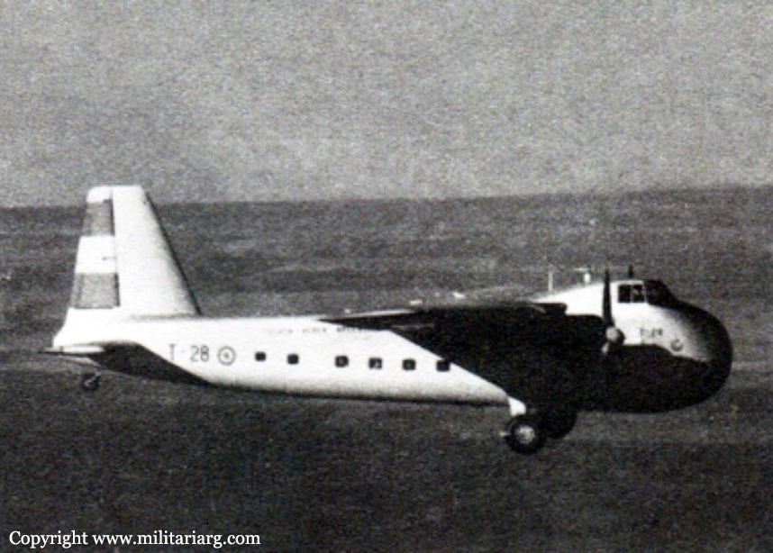
Crash of a GAF Nomad N.22B in Salta

Date & Time: Aug 28, 2006 at 2200 LT
Type of aircraft:
Registration:
ZP-TDZ
Survivors:
Yes
Schedule:
Asunción – Resistencia – Joaquín Víctor González – Salta
MSN:
57
YOM:
1977
Location:
Country:
Crew on board:
2
Crew fatalities:
Pax on board:
10
Pax fatalities:
Other fatalities:
Total fatalities:
0
Circumstances:
The twin engine aircraft departed Asunción on a charter flight to Salta with intermediate stops in Resistencia and Joaquín Víctor González, carrying 10 passengers and two pilots. On approach to Salta-Martín Miguel de Güemes Airport, both engines failed. The crew attempted an emergency landing but the aircraft struck trees and crashed in an open field located 3 km short of runway. All 12 occupants evacuated safely while the aircraft was damaged beyond repair.
Probable cause:
Failure of both engines on final approach after the air intakes got stuck by ice/frost because of incorrect use of the anti-icing systems on part of the crew. A poor flight planning and unfavorable weather conditions (icing) were considered as contributing factors.
Final Report:

Crash of a Dassault Falcon 20C on Mt Chivilme: 4 killed

Date & Time: Feb 7, 1997 at 2211 LT
Type of aircraft:
Registration:
LV-WLH
Flight Phase:
Flight Type:
Survivors:
No
Site:
Schedule:
Córdoba – San Miguel de Tucumán – Salta
MSN:
34
YOM:
1966
Country:
Crew on board:
2
Crew fatalities:
Pax on board:
2
Pax fatalities:
Other fatalities:
Total fatalities:
4
Aircraft flight hours:
15118
Circumstances:
The aircraft was completing a cargo flight from Córdoba to Salta with an intermediate stop in San Miguel de Tucumán, carrying two passengers and two pilots. The crew departed San Miguel de Tucumán-Teniente Benjamin Matienzo Airport at 2145LT and was cleared to climb to FL180. At 2201LT, the crew reported over PONPI VOR located 55 nm from Salta. Two minutes later, the crew was cleared to descent on top of the clouds in VMC conditions. While cruising at an altitude of 6,970 feet, the aircraft struck the slope of Mt Chivilme located 36,4 km southwest of Salta Airport. The aircraft was destroyed by impact forces and all four occupants were killed.
Probable cause:
Collision with a mountain during the descent prior to landing, while flying an instrument approach procedure other than the existing airport destination with errors in distances and heights. The following contributing factors were identified:
- Use of GPS as the primary instrument of navigation, when it should be used as a supplementary tool or reference,
- Lack of control over the instruments and procedures,
- Poor crew resources management,
- Placement of a fictitious point in the GPS with the name 'F-SAL' point which is easily confused with "SALT", the acronym of the Salta airport.

Crash of a Cessna T207 Turbo Skywagon in Vaqueros: 4 killed

Date & Time: Nov 22, 1993
Operator:
Registration:
AE-220
Flight Type:
Survivors:
No
Schedule:
San Miguel de Tucumán – Salta
MSN:
207-0336
YOM:
1976
Location:
Country:
Crew on board:
1
Crew fatalities:
Pax on board:
3
Pax fatalities:
Other fatalities:
Total fatalities:
4
Circumstances:
While approaching Salta Airport, the single engine aircraft crashed in unknown circumstances near Vaqueros, about 20 km north of the airport. All four occupants were killed.

Crash of a BAe 125-700B in Salta: 7 killed

Date & Time: Apr 11, 1985
Type of aircraft:
Operator:
Registration:
LV-ALW
Survivors:
No
Site:
Schedule:
San Miguel de Tucumán – Salta
MSN:
257133
YOM:
1981
Location:
Country:
Crew on board:
2
Crew fatalities:
Pax on board:
5
Pax fatalities:
Other fatalities:
Total fatalities:
7
Circumstances:
On approach to Salta-Martin Miguel de Güemes Airport, the crew encountered stormy weather. In limited visibility, they failed to realize their altitude was insufficient when the aircraft struck the slope of a mountain and crashed few km from the airport. All seven occupants were killed. At the time of the accident, the visibility dropped below minimums.

Crash of an Avro 694 Lincoln IIA in Salta

Date & Time: Oct 1, 1965
Type of aircraft:
Operator:
Registration:
B-020
Flight Type:
Survivors:
Yes
Schedule:
Santiago del Estero - Salta
MSN:
1496
Location:
Country:
Crew on board:
4
Crew fatalities:
Pax on board:
0
Pax fatalities:
Other fatalities:
Total fatalities:
0
Aircraft flight hours:
1760
Circumstances:
The crew was completing a flight from Santiago del Estero to Salta-El Aybal Airport. After touchdown, the airplane went out of control, veered off runway and came to rest. There were no injuries among the four crew members but the aircraft was considered as damaged beyond repair. It is reported that sudden gust of crosswinds affected flight control after touchdown.

Crash of a De Havilland DH.104 Dove 6A on Mt Ingamayo: 2 killed

Date & Time: Nov 28, 1959
Type of aircraft:
Registration:
LV-GIT
Flight Phase:
Flight Type:
Survivors:
No
Site:
Schedule:
Salta – Antofagasta
MSN:
04487
YOM:
1957
Country:
Crew on board:
2
Crew fatalities:
Pax on board:
0
Pax fatalities:
Other fatalities:
Total fatalities:
2
Circumstances:
While cruising at an altitude of 18,000 feet, the twin engine aircraft struck the slope of Mt Ingamayo. The wreckage was found few hours later in rocky terrain and both crew members were killed. It is believed the accident was the consequence of a controlled flight into terrain.

Crash of a Noorduyn Norseman near San Antonio de los Cobres: 1 killed

Date & Time: Oct 23, 1955 at 1400 LT
Type of aircraft:
Operator:
Registration:
ZP-CAX
Flight Phase:
Flight Type:
Survivors:
No
Site:
Schedule:
Mexico City – Antofagasta – Salta – Asunción
Country:
Crew on board:
1
Crew fatalities:
Pax on board:
0
Pax fatalities:
Other fatalities:
Total fatalities:
1
Circumstances:
The aircraft was on a delivery flight from Mexico City to Asunción, Paraguay, with intermediate stops at Antofagasta, Chile and Salta, Argentina. At 1245LT the aircraft took off from Antofagasta for Salta. It was to be a VFR flight via Chosque, Chile and San Antonio de los Cobres, Salta Province. The aircraft was seen at 1400 hours flying in a straight line at very low altitude in the direction of San Antonio de los Cobres 40 km east of Olapacato. One witness, believing that the aircraft intended to land, followed it in a jeep only to find its burned wreckage some 20 km away. It had crashed into the side of a hill rising north of Rio Tocomar, approximately 70 metres above the river bed. The height above sea level at this point is approximately 4,500 metres. One eye witness stated that the aircraft crashed in rectilinear horizontal flight into the northern slope of the hill and that the pilot had not taken any avoiding action. The pilot, the sole occupant, was killed, and the aircraft was destroyed by the crash and the fire which followed.
Probable cause:
The accident was attributed to a loss of control over the aircraft due to a possible state of anoxia on the part of the pilot. A contributing factor was inadequate flight preparation, as no account was taken of the need for oxygen- breathing equipment for high altitude flying.
Final Report:

Crash of a Douglas C-54A-5-DO Skymaster in Córdoba

Date & Time: Jun 17, 1953 at 1930 LT
Type of aircraft:
Operator:
Registration:
LV-ABQ
Survivors:
Yes
Schedule:
Santa Cruz – Salta – Córdoba
MSN:
7468
YOM:
1944
Country:
Crew on board:
7
Crew fatalities:
Pax on board:
34
Pax fatalities:
Other fatalities:
Total fatalities:
0
Captain / Total flying hours:
14000
Captain / Total hours on type:
5300.00
Circumstances:
The aircraft left Santa Cruz de la Sierra (Bolivia) on a scheduled airline flight and landed without incident at Salta 2 hours and 30 minutes later. It took off from Salta airport for Córdoba at approximately 1645LT. At take-off the aircraft was carrying a total load of 3,512 kg. The route forecast as far as Marcos Juarez was as follows: partly cloudy, visibility 15 km, stratocumulus cloud 7/8 at 800 meters, altocumulus 3/8 at 3'000 meters, upper wind 20' 13/15 knots. The aircraft contacted Córdoba Airport control tower at 1856LT and was cleared to enter the airport zone. At 1925LT it passed over the radio beacon and the control tower provided the following weather information: horizontal visibility 6 km, average height of cloud 250 meters, pressure for altimeter correction 30 inches, surface wind SE, 10 to 11 knots. The approach to the airport was begun under IFR conditions, at an indicated speed of mph and at an altitude of 5, 100 feet above the radio range (the requirement is 4,400 feet). aircraft flew a course to the north for 1 minute 50 seconds, with 15° flaps and then, continuing the descent, it turned to the right on a 45° course, flying in this direction for 1 minute more. The altitude just before the turn was 3, 100 feet. It then turned to the left on a course of 225°. When the aircraft direction finder indicated 40° to the left, the compass was set at 180° and the direction finder maintained at O°. At that moment, according to the evidence, the instruments indicated an altitude of 2, 980 feet. The aircraft flew at this altitude for 30 seconds, and the engine speed was reduced for landing. It continued to descend for another minute 20 seconds until the altimeter indicated 2, 200 feet. At that instant, according to the statements made by the pilot-in-command and the copilot, the aircraft came into contact with the ground. The aircraft was finishing the final straight-in approach to the airport and was aligned exactly with runway 17. All 41 occupants were evacuated safely, only both pilots were slightly injured. The aircraft was destroyed.
Probable cause:
Since it was evident that the accident was caused by the fact that the aircraft had been unduly deflected toward the north during the instrument approach, the investigation attempted to discover the reasons for that deflection. The following probable factors were considered:
- An analysis of the approach maneuver indicated that it had been started at a greater altitude than that prescribed by the instrument approach procedures. This in itself would result in a steeper descent on the northern course, and it is possible therefore that the speed of 140 miles per hour was exceeded by 5 or 10 knots, particularly since the landing gear was retracted and tail wind was not taken into account in timing the maneuver,
- The copilot stated that he called the time on his stop-watch, using the small second-hand because the large one was not working properly. This was confirmed by the Investigating Board. Since the co-pilot was wearing the watch on the left wrist and working constantly with that hand in trying to tune in the "C" marker beacon, his time readings may have been inaccurate with the result that the total time may have been exceeded by a few seconds,
- The possibility of upper wind of an intensity greater than that registered on the surface.
This theory was accepted, taking into account the fact that two fronts of the "upper" cold front type occurred at Córdoba on 17 June 1953
Final Report:

Crash of a Bristol 170 Freighter 1A in Burruyacú: 6 killed

Date & Time: Oct 25, 1949 at 1830 LT
Type of aircraft:
Operator:
Registration:
T-28
Flight Phase:
Flight Type:
Survivors:
Yes
Schedule:
El Palomar – Salta
MSN:
12750
YOM:
1946
Country:
Crew on board:
5
Crew fatalities:
Pax on board:
4
Pax fatalities:
Other fatalities:
Total fatalities:
6
Circumstances:
En route, the crew encountered unknown technical problems and the captain elected to make an emergency landing when the aircraft hit a tree and crashed on a hilly terrain. Three crew members and three passengers were killed while three other occupants were injured.