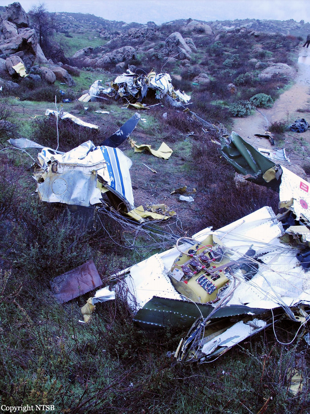
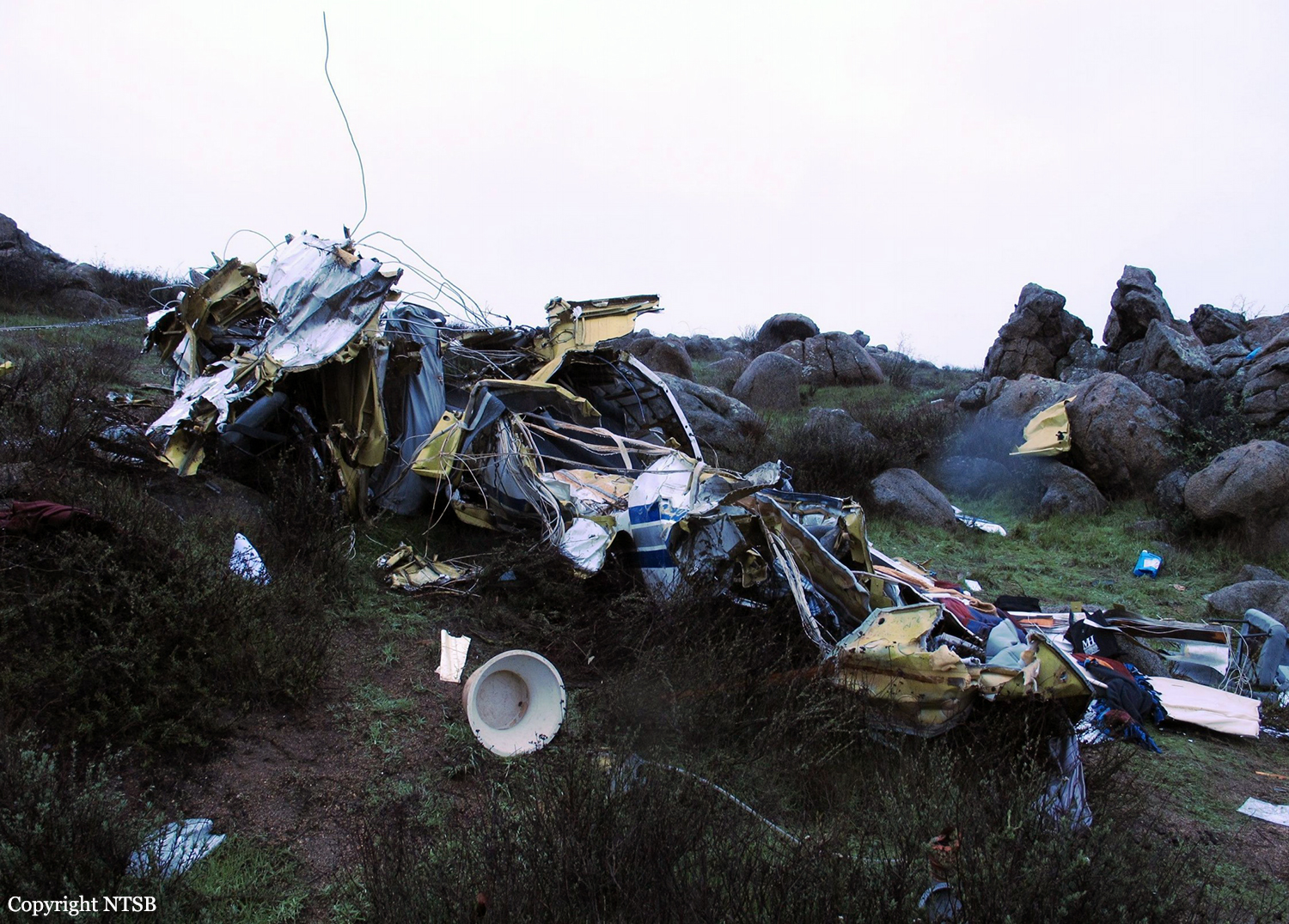
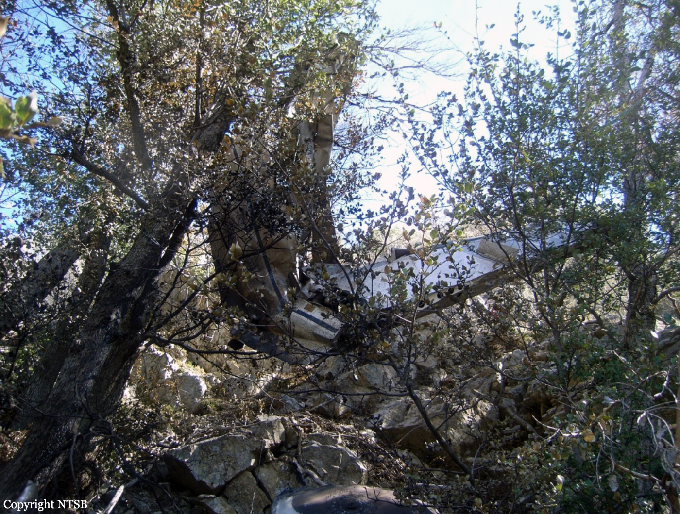
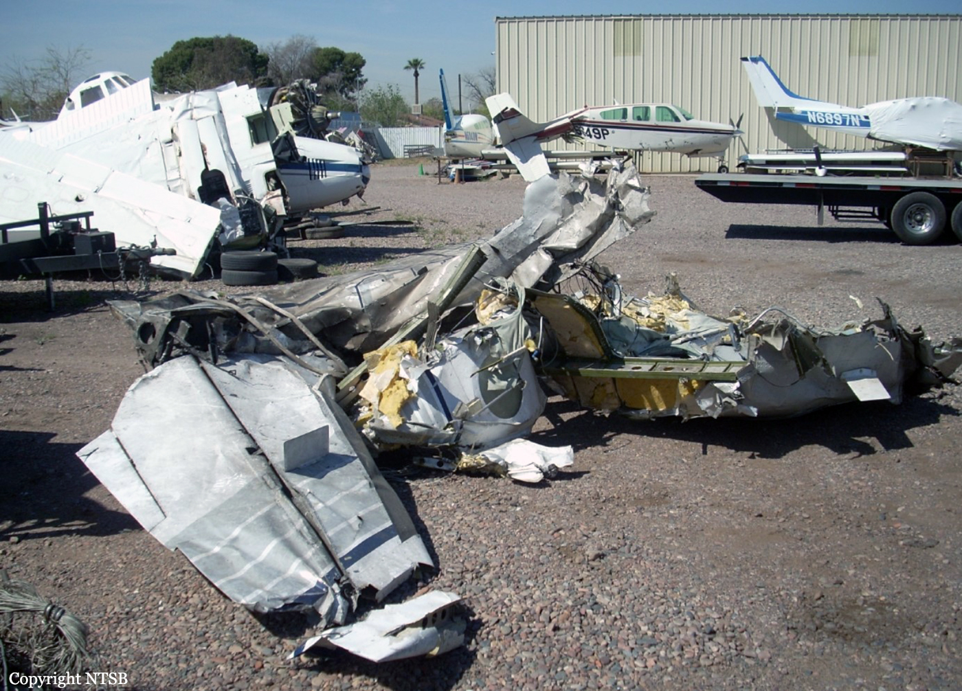
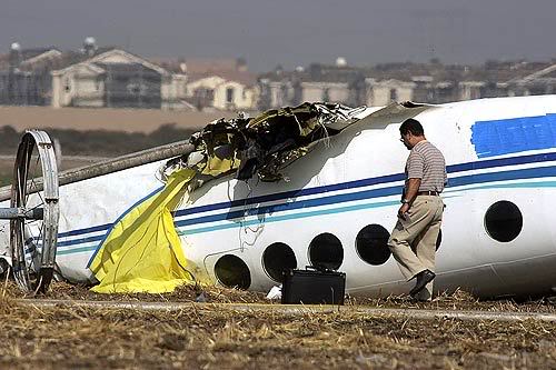
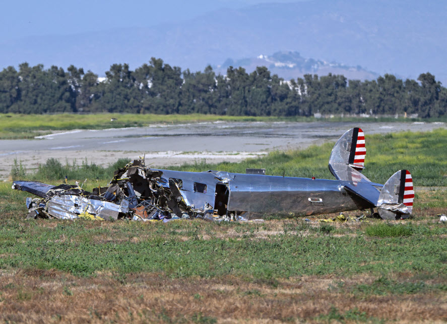
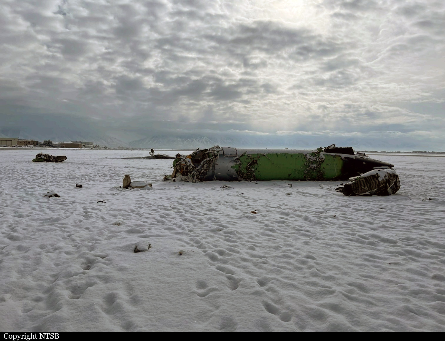
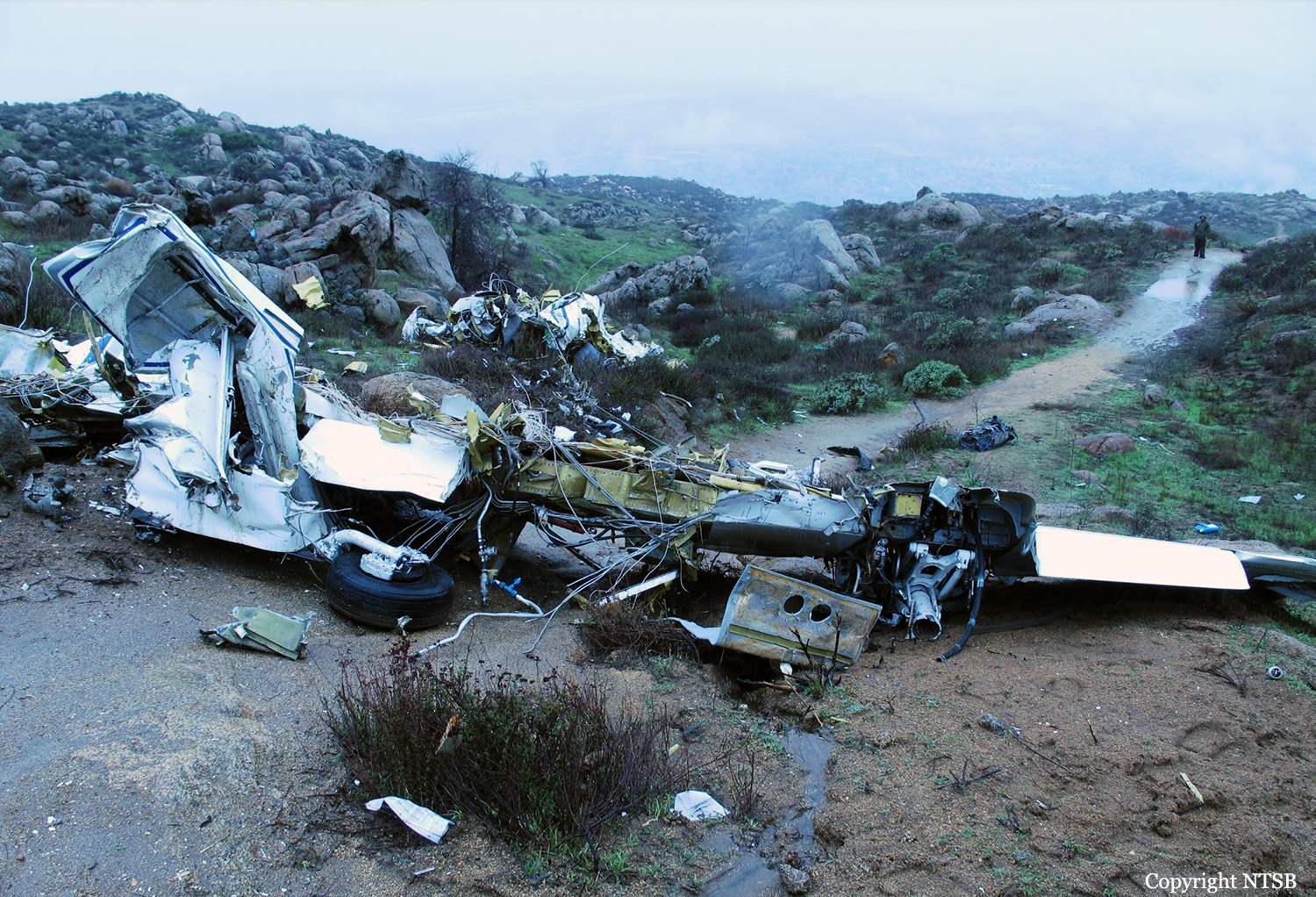
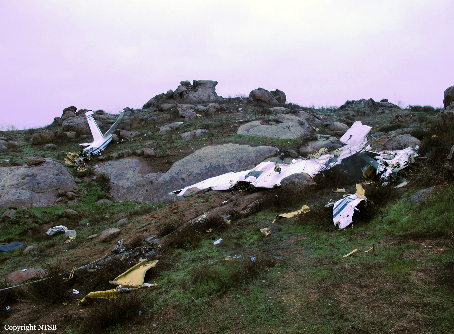
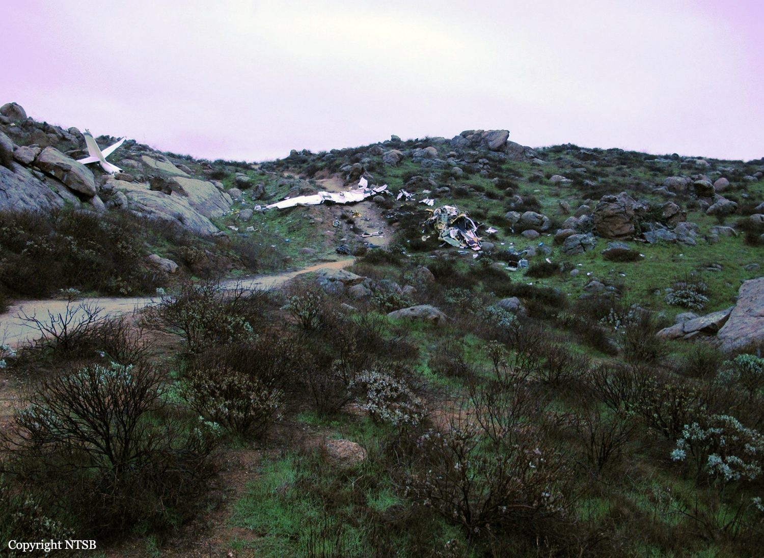
Crash of a Rockwell Gulfstream 695A Jetprop 1000 in San Bernardino: 1 killed

Date & Time: Apr 13, 2024 at 2019 LT
Operator:
Registration:
N965BC
Flight Type:
Survivors:
No
Site:
Schedule:
Stockton - Chino
MSN:
96071
YOM:
1984
Crew on board:
1
Crew fatalities:
Pax on board:
0
Pax fatalities:
Other fatalities:
Total fatalities:
1
Circumstances:
The pilot departed Stockton Airport on a solo flight to Chino. On a standard approach in rainy conditions, the airplane suffered two altitude deviations which the pilot attributed to a problem with the autopilot. Towards the end of the flight, the airplane descended past the Minimum Vectoring Altitude (MVA) of 7,400 feet and was issued an altitude alert by the controller, but there was no response from the pilot. The airplane entered an uncontrolled descent with a rate of about 10'000 feet per minute until it crashed in mountainous terrain. The airplane was destroyed by impact forces and the pilot was killed.

Crash of an Embraer EMB-505 Phenom 300 in Provo: 1 killed

Date & Time: Jan 2, 2023 at 1135 LT
Type of aircraft:
Operator:
Registration:
N555NR
Flight Phase:
Survivors:
Yes
Schedule:
Provo - Chino
MSN:
505-00327
YOM:
2015
Location:
Crew on board:
2
Crew fatalities:
Pax on board:
2
Pax fatalities:
Other fatalities:
Total fatalities:
1
Circumstances:
While taking off from Provo Airport runway 13/31, the airplane went out of control and crashed. Both passengers escaped with minor injuries while both pilots were seriously injured. One of them died from injuries sustained. The airplane was destroyed. It was snowing at the time of the accident.

Crash of a Canadair CL-601-3A Challenger in Chino

Date & Time: Jun 13, 2013 at 1817 LT
Type of aircraft:
Registration:
N613SB
Flight Phase:
Flight Type:
Survivors:
Yes
MSN:
5088
YOM:
1991
Crew on board:
2
Crew fatalities:
Pax on board:
0
Pax fatalities:
Other fatalities:
Total fatalities:
0
Circumstances:
Two technicians were performing engine tests on apron at Chino Airport. While facing a hangar, the aircraft jumped over the chocks and collided with the metallic door of the hangar before coming to rest half inside. Both occupants escaped uninjured and the aircraft was damaged beyond repair.
Probable cause:
No investigation has been conducted by the NTSB about this event.

Crash of a Rockwell Grand Commander 680FL near Perris: 1 killed

Date & Time: Dec 20, 2010 at 1000 LT
Registration:
N316KW
Flight Phase:
Flight Type:
Survivors:
No
Site:
Schedule:
Palm Springs - Chino
MSN:
680-1753-146
YOM:
1968
Crew on board:
1
Crew fatalities:
Pax on board:
0
Pax fatalities:
Other fatalities:
Total fatalities:
1
Captain / Total flying hours:
33000
Aircraft flight hours:
2278
Circumstances:
The pilot departed the airport mid-morning to fly to his home airport, 63 miles to the northwest. Weather conditions at the departureb airport were visual flight rules (VFR), the weather at the destination airport was not reported, and the weather conditions en-route were marginal VFR. The global positioning system (GPS) track for the flight indicated that the airplane departed from the airport and headed west along a highway corridor flying approximately 1,000 feet above ground level (agl) through a mountain pass. For the majority of the flight, the airplane maintained altitudes between 900 feet and 1,200 feet agl. Twenty-nine minutes after takeoff, the airplane’s GPS track turned southwest away from an area of concentrated precipitation and directly towards an isolated mountain peak that rose approximately 1,000 feet above the surrounding terrain. The pilot contacted the local air traffic control facility, reported his position and requested traffic advisories through the local airspace to his destination airport. About 6 minutes later, the pilot stated that he was having difficulty maintaining VFR and asked for an instrument flight rules (IFR)clearance. At the same time, the GPS track showed that the airplane came within 50 feet of the mountainous terrain. No further transmissions from the pilot were received. The final GPS position was recorded 1 minute later, at 500 feet agl and approximately half a mile from the crash site. The terrain rapidly ascended in this area and intersected the airplane's flight path over the remaining 1/2 mile. An airport located about 4 miles from the accident site and in an area of flat terrain 1,000 feet below the isolated mountain top, recorded weather at the time of the accident as few clouds at 900 feet agl, overcast clouds at 1,500 feet agl, and a variable ceiling between 1,200 and 1,800 feet agl, in drizzle. Weather radar images at the time of the accident depicted precipitation at the elevation and location of the accident site, indicating probable mountain obscuration.
Probable cause:
The pilot’s decision to continue visual flight into instrument meteorological conditions, which resulted in an in-flight collision with mountainous terrain.
Final Report:

Crash of a Pilatus PC-12/45 in Hayden: 2 killed

Date & Time: Jan 11, 2009 at 0942 LT
Type of aircraft:
Registration:
N604WP
Flight Phase:
Flight Type:
Survivors:
No
Schedule:
Hayden - Chino
MSN:
604
YOM:
2004
Crew on board:
1
Crew fatalities:
Pax on board:
1
Pax fatalities:
Other fatalities:
Total fatalities:
2
Captain / Total flying hours:
867
Captain / Total hours on type:
82.00
Aircraft flight hours:
558
Circumstances:
The pilot had filed an instrument flight rules flight plan with a planned departure time of 0700 in order to arrive at his intended destination in time for a planned engagement. He and his passenger arrived at the airport approximately 0800 and requested that the airplane be fueled. The airplane was pulled from its heated hangar into heavy snowfall and fueled at 0917. As the airplane sat outside in the heavy snowfall, a measurable amount of wet slushy snow accumulated on the airplane. The Fixed Base Operator manager suggested to the pilot that the airplane be deiced, but he declined. The airplane was then pulled out to the taxiway in an effort to prevent it from becoming stuck in the snow. At 0939, approximately 22 minutes after the airplane was pulled out if its hangar, the pilot departed with a visibility of 3/4 of a mile in snow and with a 4-knot direct tailwind. The pilot then made a right turn and announced that he was heading to his first waypoint. The airplane continued into an ever tightening right turn until it impacted the ground while in an inverted position about one mile north-northwest of the runway. An examination of the airplane’s wreckage revealed no anomalies with either the engine or airframe that would have contributed to the loss of control. The airplane’s Pilot Operating Handbook and Airplane Flight Manual contained the following limitation: "The aircraft must be clear of all deposits of snow, ice and frost adhering to the lifting surfaces immediately prior to takeoff."
Probable cause:
The pilot's loss of control due to snow/ice contamination on the airplane's lifting surfaces as a result of his decision not to deice the airplane before departure.
Final Report:

Crash of a Cessna 340A near Cabazon: 4 killed

Date & Time: Feb 2, 2008 at 1340 LT
Type of aircraft:
Registration:
N354TJ
Flight Phase:
Flight Type:
Survivors:
No
Site:
Schedule:
Palm Springs – Chino
MSN:
340A-0042
YOM:
1976
Crew on board:
1
Crew fatalities:
Pax on board:
3
Pax fatalities:
Other fatalities:
Total fatalities:
4
Captain / Total flying hours:
5972
Circumstances:
The airplane departed under daytime visual meteorological conditions on a cross-country flight from an airport on the east side of a mountain range to a destination on the west side of the mountains. The airplane, which had been receiving flight following, then collided with upsloping mountainous terrain in a mountain pass while in controlled flight after encountering instrument meteorological conditions. The controller terminated radar services due to anticipation of losing radar coverage within the mountainous pass area, and notified the pilot to contact the next sector once through the pass while staying northwest of an interstate highway due to opposing traffic on the south side of the highway. The pilot later contacted the controller asking if he still needed to remain on a northwesterly heading. The controller replied that he never assigned a northwesterly heading. No further radio communications were received from the accident airplane. Radar data revealed that while proceeding on a northeasterly course, the airplane climbed to an altitude of 6,400 feet mean sea level (msl). A few minutes later, the radar data showed the airplane turning to an easterly heading and initiating a climb to an altitude of 6,900 feet msl. The airplane then started descending in a right turn from 6,900 feet to 5,800 feet msl prior to it being lost from radar contact about 0.65 miles southeast of the accident site. A weather observation station located at the departure airport reported a scattered cloud layer at 10,000 feet above ground level (agl). A weather observation system located about 29 miles southwest of the accident site reported a broken cloud layer at 4,000 feet agl. A pilot, who was flying west bound at 8,500 feet through the same pass around the time of the accident, reported overcast cloud coverage in the area of the accident site that extended west of the mountains. The pilot stated that the ceiling was around 4,000 feet msl and the tops of the clouds were 7,000 feet msl or higher throughout the area. Postaccident examination of the airframe and both engines revealed no anomalies that would have precluded normal operation.
Probable cause:
The pilot's continued visual flight into instrument meteorological conditions and failure to maintain terrain clearance while en route. Contributing to the accident were clouds and mountainous terrain.
Final Report:

Crash of a Beechcraft A100 King Air in Chino: 2 killed

Date & Time: Nov 6, 2007 at 0918 LT
Type of aircraft:
Operator:
Registration:
N30GC
Flight Phase:
Survivors:
No
Schedule:
Chino - Visalia
MSN:
B-177
YOM:
1973
Crew on board:
1
Crew fatalities:
Pax on board:
1
Pax fatalities:
Other fatalities:
Total fatalities:
2
Captain / Total flying hours:
3136
Aircraft flight hours:
11849
Circumstances:
The reported weather at the time of the accident was calm winds, a 1/4-mile visibility in fog and a vertical visibility of 100 feet. Shortly after takeoff for the instrument-flight-rules flight, the airplane made a slight turn to the left and impacted the tops of 25-foot trees about a 1/2 mile from the runway. An enhanced ground proximity warning system was installed on the airplane and data extraction from the system indicated that the airplane achieved an initial positive climb profile with a slight turn to the left and then a descent. A witness reported hearing the crash and observed the right wing impact the ground and burst into flames. The airplane then cartwheeled for several hundred feet before coming to rest inverted. The airframe, engines, and propeller assemblies were inspected with no mechanical anomalies noted that would have precluded normal flight.
Probable cause:
The pilot's failure to maintain a positive climb rate during an instrument takeoff. Contributing to the accident was the low visibility.
Final Report:

Crash of a Learjet 24B in Helendale: 2 killed

Date & Time: Dec 23, 2003 at 0913 LT
Type of aircraft:
Operator:
Registration:
N600XJ
Flight Phase:
Survivors:
No
Site:
Schedule:
Chino – Hailey
MSN:
24-190
YOM:
1969
Crew on board:
2
Crew fatalities:
Pax on board:
0
Pax fatalities:
Other fatalities:
Total fatalities:
2
Captain / Total flying hours:
11783
Captain / Total hours on type:
7900.00
Copilot / Total flying hours:
250
Copilot / Total hours on type:
24
Aircraft flight hours:
9438
Circumstances:
The aircraft departed controlled flight and crashed near Helendale, California. The captain and the first officer were killed, and the airplane was destroyed. The flight was operating under the provisions of 14 Code of Federal Regulations (CFR) Part 912 from San Bernardino County Airport (CNO), Chino, California, to Friedman Memorial Airport, Hailey, Idaho. Visual meteorological conditions prevailed for the flight, which operated on an instrument flight rules flight plan. A review of radar data and air traffic control (ATC) transcripts revealed that the flight departed CNO about 0858 and was cleared to climb to an altitude of 29,000 feet mean sea level (msl). About 0909:55, as the airplane was climbing through an altitude of 26,000 feet, the first officer requested a return to CNO. About 0910:01, the controller asked the first officer if he needed to declare an emergency, and the first officer replied that he did not. The controller then directed the flight crew to maintain an altitude of 24,000 feet. Mode C information for the flight showed that, from about 0910:12 to about 0910:59, the airplane descended from 26,500 to 24,000 feet at a rate of about 2,000 feet per minute (fpm). About 0911:08, the controller cleared the flight directly to HECTOR (a navigation fix) and asked the first officer to confirm that the airplane was in level flight at an altitude of 24,000 feet. The first officer did not respond. Radar data showed the airplane descending through 23,000 feet at a rate of about 6,500 fpm about that time. About 0911:24, while the airplane was descending at a rate of about 10,000 fpm, the first officer stated, “we’re declaring an emergency now.” No further transmissions were received from the airplane. No radar data were available after about 0911:35. Starting about 0911:47, mode C information was invalid. The airplane impacted high desert terrain (an elevation of 3,350 feet) about 3 miles southeast of Helendale. The accident site was located about 46 nautical miles (nm) north of CNO. A witness to the accident, who was located about 4.5 miles northwest of the accident site, stated that, after hearing the sound of a jet flying high overhead, he looked up and observed the accident airplane flying straight and level below a high, overcast cloud layer. He stated that the airplane then pitched “nose down a little” and “straightened again.” He also stated that, shortly thereafter, he observed the airplane’s nose pitch “straight down” until it impacted terrain. The witness reported that he did not notice whether the airplane was rotating about its longitudinal axis during the descent, but he did indicate that the airplane appeared to be intact without any components separating from the airplane during the descent. The witness added that he did not observe any smoke or fire before the airplane impacted terrain and that the airplane exploded into a “mushroom cloud” when it impacted terrain. San Bernardino County firefighters, who were performing controlled burns near the accident site, reported hearing an explosion about the time of the accident. The firefighters reported that they looked toward the direction of the explosion and saw a rising smoke cloud. None of the firefighters observed the airplane before the sound of the explosion. The firefighters drove to the accident site and were the first to arrive there. The firefighters extinguished small fires that had erupted as a result of the crash.
Probable cause:
A loss of airplane control for undetermined reasons.
Final Report: