Crash of a De Havilland DHC-2 Beaver near Atlin: 1 killed

Date & Time: Mar 21, 1979
Type of aircraft:
Operator:
Registration:
C-GUIG
Flight Phase:
Flight Type:
Survivors:
Yes
Site:
MSN:
735
YOM:
1954
Country:
Crew on board:
1
Crew fatalities:
Pax on board:
1
Pax fatalities:
Other fatalities:
Total fatalities:
1
Circumstances:
While flying over mountainous terrain, the pilot realized that the summit was shrouded by clouds. He decided to turn back and initiated a turn to the left when he lost visual contact with the ground. The airplane struck the ground and crashed on a snow covered area. The pilot was seriously injured and the passenger, seating in the cabin, was killed. It was reported that the aircraft was equipped with one seat only and the passenger was seating on the ground, without a seat belt.

Crash of a De Havilland DHC-2 Beaver off Ocean Falls

Date & Time: Dec 15, 1978
Type of aircraft:
Registration:
CF-EYS
Flight Type:
Survivors:
Yes
Schedule:
Bella Bella - Ocean Falls
MSN:
484
YOM:
1953
Country:
Crew on board:
1
Crew fatalities:
Pax on board:
0
Pax fatalities:
Other fatalities:
Total fatalities:
0
Circumstances:
While approaching Ocean Falls on a flight from Bella Bella, weather conditions worsened with a limited visibility due to snow falls. At low height, the airplane struck the water surface and crashed in the Cousins Inlet. The pilot, sole on board, was rescued.

Crash of a De Havilland DHC-2 Beaver near Quesnel: 4 killed

Date & Time: Sep 5, 1978
Type of aircraft:
Operator:
Registration:
C-GDAV
Flight Phase:
Survivors:
No
Schedule:
Dragon Lake - Isaac Lake
MSN:
770
YOM:
1955
Country:
Crew on board:
1
Crew fatalities:
Pax on board:
3
Pax fatalities:
Other fatalities:
Total fatalities:
4
Aircraft flight hours:
6905
Circumstances:
The airplane departed Dragon Lake on a charter flight to Isaac Lake located 65 miles to the east, carrying three passengers and a pilot. En route, he encountered poor weather conditions when the seaplane struck trees and crashed in flames in a wooded area located about 12 miles northeast of Quesnel. The aircraft was completely destroyed by fire and all four occupants were killed. At the time of the accident, the visibility was limited due to low clouds.
Probable cause:
It was determined that the pilot lost control of the airplane while flying under VFR mode in IMC conditions. Investigations revealed that at takeoff, the aircraft was 359 pounds overweight and the centre of gravity was 1.5 inch aft of the aft limit. After 45 minutes of flight, the aircraft would be 200 pounds overweight with a centre of gravity located 0.5 inch aft of the limit.

Crash of a De Havilland DHC-6 Twin Otter 200 off Vancouver: 11 killed

Date & Time: Sep 3, 1978 at 1742 LT
Operator:
Registration:
C-FAIV
Survivors:
Yes
Schedule:
Victoria - Vancouver
MSN:
215
YOM:
1969
Country:
Crew on board:
2
Crew fatalities:
Pax on board:
11
Pax fatalities:
Other fatalities:
Total fatalities:
11
Captain / Total flying hours:
6000
Captain / Total hours on type:
3600.00
Copilot / Total flying hours:
450
Circumstances:
Twin Otter C-FAIV, operating as a scheduled VFR flight, departed Victoria Harbour at 1718LT with Vancouver Harbour water-aerodrome as destination. The estimated time en route was 20 minutes. The flight proceeded normally and reported by Active Pass at 2,000 feet. This altitude was maintained in order to cross the Vancouver Control Zone in accordance with standard procedure; once out of the control zone, a slow descent was begun towards Vancouver Harbour. Normal radio procedures were followed as the flight reported by standard visual reporting points. Just before joining final approach, the transmission, "AIV, Third Beach", was made and landing clearance was given to the flight by the Harbour Tower. The approach continued, and when the aircraft reached approximately 175 feet above the surface, nine ground witnesses heard a loud noise from the aircraft. Two surviving witnesses also heard a noise. Power was subsequently applied and C-FAIV yawed left, rolled in the same direction and plunged into the harbour in a left-wing and nose-down attitude, 2 500 feet from the intended landing area. An ELT (Emergency Locator Transmitter) tone was heard by the tower controller 54 seconds after the radio call at Third Beach. The controller called the aircraft several times but there was no response. The flight had been of 24 minutes duration. Both pilots and nine passengers were killed while two others were injured. The aircraft was destroyed.
Probable cause:
The following findings were identified:
- The final approach to land was normal until an unusual noise occurred followed by loss of control,
- The aircraft dived into the water with left wing down, nose down and with some sideslip. Value of roll, pitch and yaw, at impact could not be estimated with useful accuracy,
- At impact, the complete left flap system was in the retracted position,
- The inboard span-wise push-pull flap control rod (inboard bell-crank to inboard rod, PT # C6CW-1029-1), was severely stress-corroded and had at least three longitudinal cracks; the rod had separated from its inboard fitting,
- It was deduced t h a t t h e in-flight failure of the left-hand inboard flap control rod led to sudden retraction of the complete left-hand flap system and sudden loss of control.
- The passengers had not been briefed in evacuation procedures,
- The crew was qualified for the type of operation in accordance with Transport Canada regulations. After the failure of the left flap control rod, no action by the pilot could have averted the accident.
Final Report:

Crash of a Grumman G-21A Goose off Powell River

Date & Time: Aug 14, 1978
Type of aircraft:
Registration:
CF-GEC
Survivors:
Yes
MSN:
B098
YOM:
1944
Country:
Crew on board:
1
Crew fatalities:
Pax on board:
0
Pax fatalities:
Other fatalities:
Total fatalities:
0
Circumstances:
After landing off Powell River, the seaplane struck a dyke and sank. The pilot, sole on board, was unhurt.

Crash of a Grumman CS2F-1 Tracker in Castlegar: 1 killed

Date & Time: Jul 25, 1978
Type of aircraft:
Operator:
Registration:
C-GHQZ
Flight Phase:
Flight Type:
Survivors:
No
Schedule:
Castlegar - Castlegar
MSN:
036
YOM:
1957
Flight number:
Tanker 63
Country:
Crew on board:
1
Crew fatalities:
Pax on board:
0
Pax fatalities:
Other fatalities:
Total fatalities:
1
Circumstances:
The pilot was performing a demo flight at Castlegar Airport when the airplane crashed in unknown circumstances. The pilot, sole on board, was killed.

Crash of a Boeing 737-275 in Cranbrook: 42 killed

Date & Time: Feb 11, 1978 at 1255 LT
Type of aircraft:
Operator:
Registration:
C-FPWC
Survivors:
Yes
Schedule:
Fort McMurray – Edmonton – Calgary – Cranbrook – Castlegar
MSN:
20142/253
YOM:
1970
Flight number:
PW314
Country:
Crew on board:
5
Crew fatalities:
Pax on board:
44
Pax fatalities:
Other fatalities:
Total fatalities:
42
Captain / Total flying hours:
5173
Captain / Total hours on type:
2780.00
Copilot / Total flying hours:
1316
Copilot / Total hours on type:
81
Circumstances:
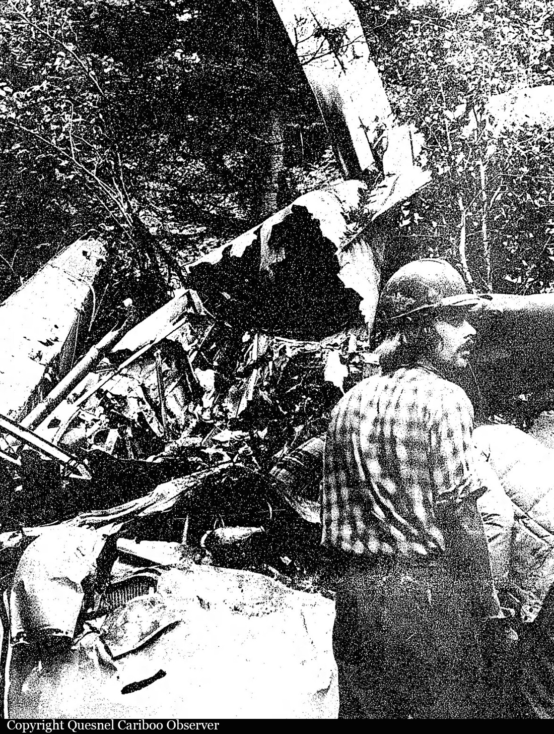
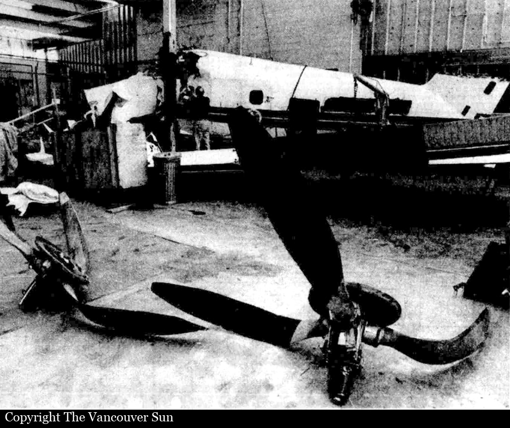
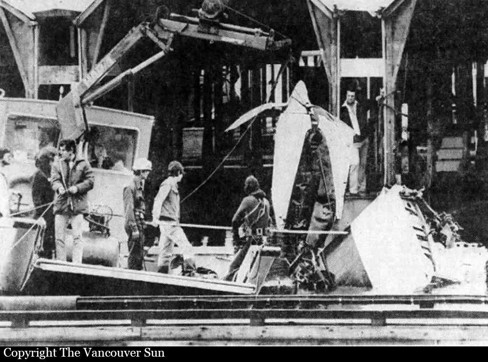
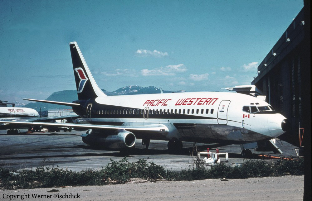
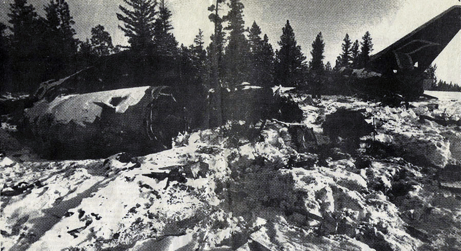
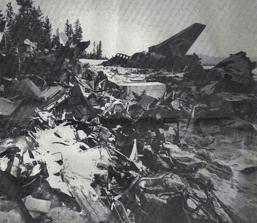
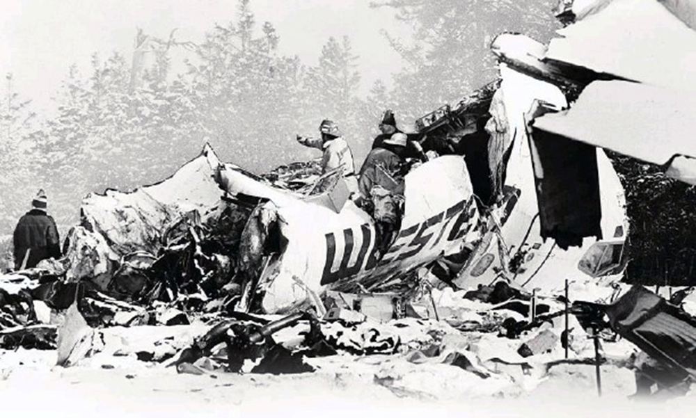
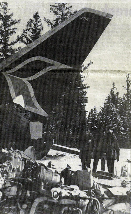
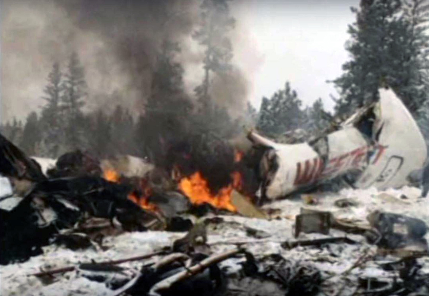
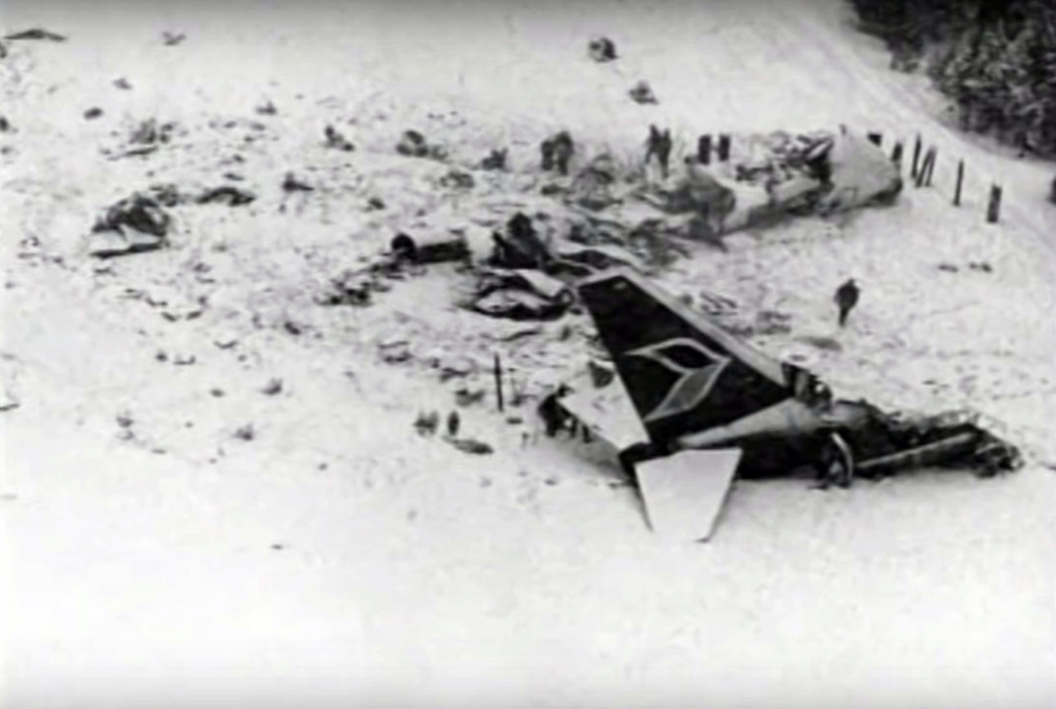
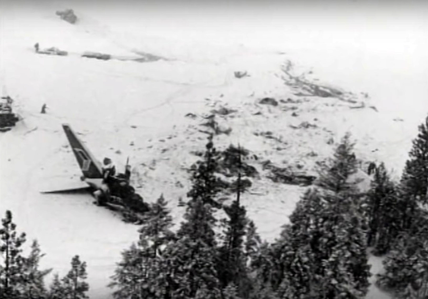
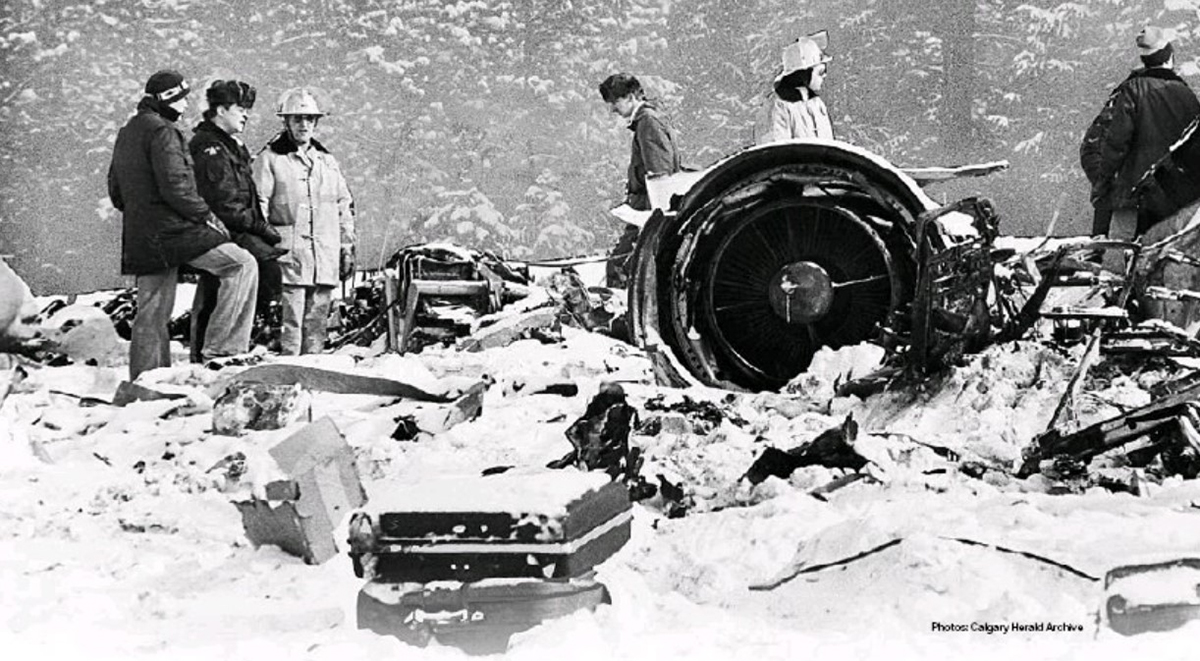
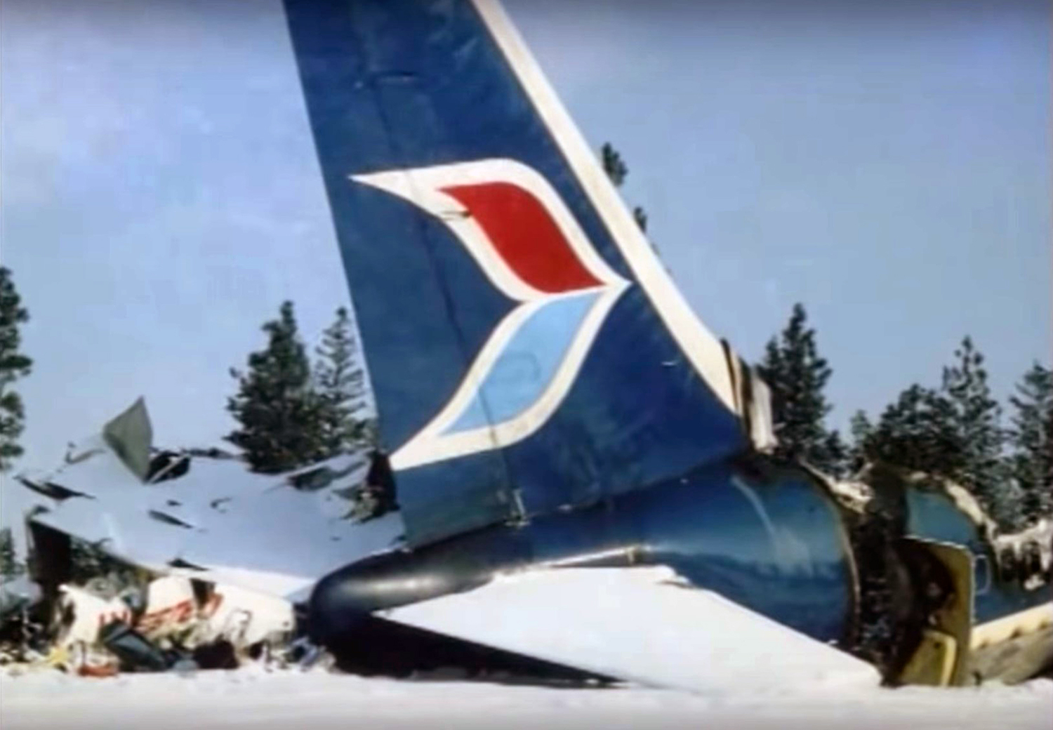
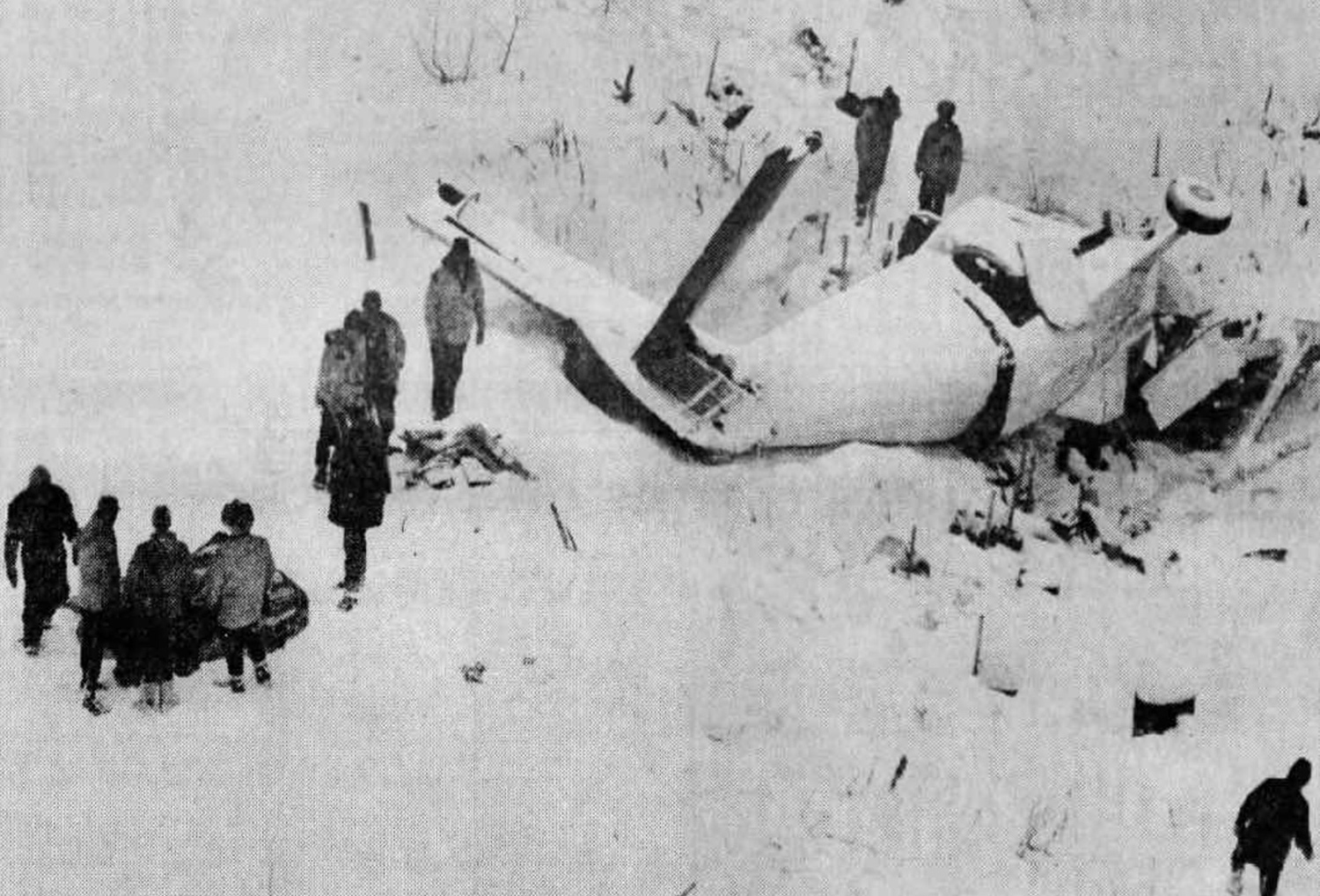
Pacific Western Airlines flight 314 was a scheduled Boeing 737 service from Fort McMurray, Aberta, to Castlegar with stops at Edmonton, Calgary and Cranbrook, B. C. The flight departed Calgary at 1932Z 11 February 1978, for Cranbrook with a Company estimated time enroute of 23 minutes. This estimate was passed to the Company Agent in Cranbrook. Flight 314 was cleared by Calgary Air Traffic Control to Cranbrook via high level airway 505, and reached the assigned altitude of 20,000 feet at 1938Z. Air Traffic Control in Calgary transmitted an ETA (estimated time of arrival) of 2005Z to Cranbrook Aeradio, via the land line. Cranbrook is an "uncontrolled" airport without a control tower, but within controlled airspace, with an "Aeradio" station providing communications, weather, and advisory service. At Cranbrook it was snowing with the visibility reported as 314 of a mile, and a radio equipped snow removal vehicle was sweeping the runway. The Aeradio operator at Cranbrook alerted the vehicle operator about the incoming aircraft at 1935Z and gave him the ETA of 2005Z; they both expected the flight would report by the "Skookum Beacon" on a straight-in approach to runway 16, thus giving the vehicle operator about seven minutes to get off the runway. At 1942Z Flight 314 called Calgary and requested and received descent clearance; it was also given clearance for the approach to Cranbrook. At 1944Z, the flight called out of 18000 feet in the descent, and Calgary ATC advised the flight to contact Aeradio. At 1945Z, Flight 314 made initial contact with Cranbrook Aeradio and at 1946Z Cranbrook passed the latest weather, altimeter and runway information. At 1947Z Cranbrook Aeradio advised the flight that snow removal was in progress and gave the latest visibility; Flight 314 acknowledged. No further transmissions were received from the flight by Aeradio or ATC. Evidence indicates the aircraft passed the Skookum beacon inbound on a straight-in instrument approach, and flew the ILS for runway 16 to touchdown.' According to witnesses and estimates partially derived from flight data recorder information, the aircraft touched down at 1955Z approximately 800 feet from the threshold and reverse thrust was selected. Reverse thrust was cancelled immediately after touchdown and a go-around was initiated. The aircraft became airborne prior to the 2000 foot mark, and flew down the runway at a height of 50 to 70 feet, flying over a snow removal vehicle which was still on the runway, 2050 feet from the threshold and 20 feet from the right edge. About this time the left engine thrust reverser doors deployed. A few seconds later, the flap was selected up from 40° to 15°. The landing gear remained down and locked. Six seconds before impact and just over 4,000 feet from the runway threshold, the flight recorder data indicates that a large amount of left rudder was momentarily applied. The aircraft climbed to 300 to 400 feet above the airfield, banked steeply to the left, lost height and side-slipped into the ground to the left of the runway. Fire broke out on impact. Four crew members and 38 passengers were killed while seven other occupants were killed.
Probable cause:
The following findings were reported:
- The estimated time of arrival of the aircraft at Cranbrook, calculated by Calgary ATC, and used by Aeradio for advisory purposes was considerably in error and resulted in a traffic conflict between the arriving aircraft and a vehicle working on the runway,
- The flight crew did not report by the Skookum beacon on final approach, as was the normal practice at Cranbrook, thereby allowing the incorrect ETA to remain undetected,
- Regulatory provisions concerning mandatory pilot position reporting during instrument approaches were inadequate,
- The interfaces between the organizations providing Air Traffic Services, Telecommunications (Aeradio) and Airports Services were not well enough developed to provide a reliable fail-safe flight information service,
- The pilots lost control of the aircraft consequent upon the left engine thrust reverser deploying in flight when the aircraft was at low speed, and in a high drag configuration,
- The FAA design standards under which the Boeing 737 was constructed did not adequately provide for the possibility of an aborted landing after touchdown and thrust reverser initiation,
- The lack of a suitable national system of incident reporting, investigation, and follow-up corrective action allowed operational problems to remain uncorrected,
- Rescue efforts at the accident scene were hampered due to lack of a fire fighting vehicle capable of negotiating deep snow and shortage of trained rescue personnel.
Final Report:

Crash of a De Havilland DHC-6 Twin Otter 100 near Narvaez Bay

Date & Time: Dec 1, 1977
Operator:
Registration:
C-GPBO
Survivors:
Yes
Site:
Schedule:
Vancouver - Saturna Island
MSN:
100
YOM:
1968
Country:
Crew on board:
2
Crew fatalities:
Pax on board:
12
Pax fatalities:
Other fatalities:
Total fatalities:
0
Circumstances:
While approaching Saturna Island, the crew encountered marginal weather and a limited visibility. Descending to a height of about 200-300 feet, the twin engine airplane struck tree tops with one of its float. Control was lost and the airplane crashed in flames in a wooded area located near Narvaez Bay. All 14 occupants were rescued while the aircraft was destroyed.
Probable cause:
Controlled flight into terrain.

Crash of a De Havilland DHC-2 Beaver off False Bay

Date & Time: Oct 30, 1977
Type of aircraft:
Operator:
Registration:
C-FODF
Survivors:
Yes
MSN:
202
YOM:
1952
Country:
Crew on board:
0
Crew fatalities:
Pax on board:
0
Pax fatalities:
Other fatalities:
Total fatalities:
0
Circumstances:
Lost a float and sank off False Bay harbor. There were no casualties.

Crash of a De Havilland DHC-6 Twin Otter 300 in Terrace: 12 killed

Date & Time: Jan 14, 1977 at 1831 LT
Operator:
Registration:
C-GNTB
Survivors:
No
Schedule:
Prince Rupert – Terrace – Smithers – Prince George
MSN:
463
YOM:
1975
Flight number:
NT405
Country:
Crew on board:
3
Crew fatalities:
Pax on board:
9
Pax fatalities:
Other fatalities:
Total fatalities:
12
Captain / Total flying hours:
15000
Captain / Total hours on type:
3000.00
Copilot / Total flying hours:
760
Copilot / Total hours on type:
286
Aircraft flight hours:
1852
Circumstances:
The aircraft took off from Prince Rupert at 1654 PST enroute to Prince George with scheduled stops at Terrace and Smithers. At 0117 the pilot contacted Terrace Aeradio, said they were about 8 minutes away from the range and requested the weather. Terrace Aeradio issued the latest weather which indicated that the ceiling and visibility were below published minima for an approach and landing. At 0118 the Flight contacted Terrace Operations and advised that they would be overhead in 5 minutes and on the ramp 11 minutes later. At 0131 the Flight reported by the range inbound at which time a final wind check was given to the Flight and acknowledged. There was no further transmission from the aircraft. The Rescue co-ordination Centre was alerted at 0146 when it was evident the aircraft had no landed. A search was initiated and at 0515 the wreckage was found scattered along the eastern slope of Little Herman Mountain. The aircraft had crashed on the final approach track to the runway, 3 miles short of the threshold at latitude 54° 25' N longitude 128° 34' W. The airplane was destroyed and all 12 occupants were killed.
Probable cause:
The following findings were identified:
- The ceiling and visibility were reported to be below published minima for landing when the approach was initiated.
- The Flight crew carried out a non-standard abbreviated approach.
- The Flight crew descended below the published minimum altitude of 1,620 feet MSL.
- The Captain was at the controls throughout the approach. The approach was continued below the authorized minimum altitude for undetermined reasons.
Final Report: