Crash of a Beechcraft C-45F Expeditor on the Mt Vorder Galmihorn: 4 killed

Date & Time: Feb 19, 1952 at 1358 LT
Type of aircraft:
Operator:
Registration:
B-7
Flight Phase:
Flight Type:
Survivors:
No
Site:
Schedule:
Geneva – Dübendorf
MSN:
7930
YOM:
1944
Country:
Region:
Crew on board:
4
Crew fatalities:
Pax on board:
0
Pax fatalities:
Other fatalities:
Total fatalities:
4
Circumstances:
The crew was on his way from Geneva to Dübendorf, near Zurich, when the twin engine aircraft hit the south side of the Mt Vorder Galmihorn (3,517 metres high) located north of the village of Grafschaft. The wreckage was found a day later and all four crew members were killed.
Crew:
1st Lt H. Schafroth, pilot,
Maj M. Brenneisen,
P. Weder, engineer,
H. Früh (Radio Suisse).

Crash of a Vickers 614 Viking 1 on Mt La Cinta: 31 killed

Date & Time: Feb 17, 1952 at 1830 LT
Type of aircraft:
Operator:
Registration:
G-AHPI
Flight Phase:
Survivors:
No
Site:
Schedule:
Bovingdon – Nice – Luqa – Nairobi
MSN:
142
YOM:
1946
Country:
Region:
Crew on board:
5
Crew fatalities:
Pax on board:
26
Pax fatalities:
Other fatalities:
Total fatalities:
31
Circumstances:
While cruising at an altitude of 1,040 meters about 65 km south of Palermo in marginal weather conditions, the twin engine aircraft hit the north slope of Mt La Cinta. The crash site was reached by the rescuers three days later and all 31 occupants have been killed. The aircraft was destroyed upon impact and an engine and a wing were found about 800 meters from the main wreckage.
Probable cause:
Imprudence on the part of the pilot, who failed to maintain a greater safety altitude during flight over Sicily, and that, particularly, in consideration of the thundery formations present over the area. A contributory factor was the pilot's ignorance of real wind conditions on the route which led to a displacement of the actual track by 3° with reference to that intended. The Commission finds that the flight safeguarding service provided by the D/F stations of Rome and Cagliari was accomplished with due care and that, without being asked to do so other D/F stations (Milan and Venice) transmitted bearing information.

Crash of a Vickers 619 Wellington X near Le Vigan: 7 killed

Date & Time: Feb 8, 1952
Type of aircraft:
Operator:
Registration:
RP383
Flight Phase:
Flight Type:
Survivors:
No
Site:
Schedule:
Northolt – Luqa
Location:
Country:
Region:
Crew on board:
7
Crew fatalities:
Pax on board:
0
Pax fatalities:
Other fatalities:
Total fatalities:
7
Circumstances:
While cruising in poor weather conditions and at an insufficient altitude, the aircraft hit the slope of a mountain shrouded in clouds. The wreckage was found near Le Vigan, about 45 km north of Montpellier. All seven crew members were killed. It was determined that the aircraft was slightly off course at the time of the accident, maybe following a navigational error on part of the crew. The poor visibility caused by low clouds was considered as a contributory factor.

Crash of a Boeing B-29-95-BW Superfortress near Yokosuka

Date & Time: Jan 29, 1952
Type of aircraft:
Operator:
Registration:
45-21822
Flight Phase:
Flight Type:
Survivors:
Yes
Site:
MSN:
13716
YOM:
1945
Location:
Country:
Region:
Crew on board:
13
Crew fatalities:
Pax on board:
0
Pax fatalities:
Other fatalities:
Total fatalities:
0
Circumstances:
En route, an engine caught fire and exploded. All 13 crew members decided to bail out and abandoned the aircraft that dove into the ground and crashed in a mountainous area located 7 km west of Yokosuka. The airplane was destroyed while all 13 crew members were found alive.
Crew:
Cpt Norman T. Abercrombie,
1st Lt Cecile C. Choato,
Sgt Bruce H. Gilbert,
2nd Lt James Guinane,
Cpt Raymond M. Lajeunesse,
Cpt Julian C. Meadows,
Sgt Jerry M. Murry,
M/Sgt Clarence C. Price,
Cpl Loyal Robinson,
Sgt Franklin E. Rynot,
Pfc Donald H. Thomas,
Col Delmore P. Wood.
Probable cause:
Engine explosion in flight.

Crash of a Grumman SA-16A Albatross in the Dolomite Canyon

Date & Time: Jan 24, 1952 at 1830 LT
Operator:
Registration:
51-001
Flight Phase:
Flight Type:
Survivors:
Yes
Site:
Schedule:
Mountain Home - San Diego
MSN:
G-74
YOM:
1951
Crew on board:
6
Crew fatalities:
Pax on board:
0
Pax fatalities:
Other fatalities:
Total fatalities:
0
Circumstances:
The crew was performing a flight from Mountain Home AFB, Idaho, to San Diego. While cruising by night at an altitude of 11,000 feet, one of the engine failed. All six crew members decided to bail out and abandoned the aircraft that crashed on the slope of the Towne Peak (7,287 feet high) located in the Dolomite canyon, in the Death Valley, about seven miles northeast of Panamint Springs. All six occupants were found unarmed while the aircraft was destroyed. It was later reported that the remaining engine was running normally at impact.
Probable cause:
Engine failure in flight.

Crash of a Boeing B-17G-105-VE Flying Fortress on Mt Buckhorn: 3 killed

Date & Time: Jan 19, 1952
Operator:
Registration:
44-85746
Flight Phase:
Survivors:
Yes
Site:
Schedule:
McChord - McChord
MSN:
8655
YOM:
1942
Crew on board:
8
Crew fatalities:
Pax on board:
0
Pax fatalities:
Other fatalities:
Total fatalities:
3
Circumstances:
The crew left McChord AFB that day on a reconnaissance mission, taking part to rescue operations after a Northwest Airlines C-54 disappeared in the region of the Queen Charlotte Island. While returning to its base by night, the airplane was too low and hit tree tops before crashing in a wooded area located on the slope of Mt Buckhorn, about 17,5 miles south of Sequim. Three crew members were killed while five others were rescued.

Crash of a Beechcraft C-45F Expeditor near Sprigno Saturnia: 2 killed

Date & Time: Jan 17, 1952 at 1300 LT
Type of aircraft:
Operator:
Registration:
MM61691
Flight Phase:
Flight Type:
Survivors:
No
Site:
Schedule:
Naples – Guidonia
MSN:
7958
YOM:
1944
Country:
Region:
Crew on board:
2
Crew fatalities:
Pax on board:
0
Pax fatalities:
Other fatalities:
Total fatalities:
2
Circumstances:
While cruising in poor weather conditions, the twin engine aircraft hit the slope of the Mt Canale dello Stretto located near Sprigno Saturnia, killing both crew members.
Crew:
Cpt Ugo Filosa, pilot,
Mot Luigi Feroci, copilot.

Crash of a Douglas C-47A-DK on Mt Crillon: 2 killed

Date & Time: Jan 12, 1952 at 1150 LT
Registration:
N41718
Flight Phase:
Flight Type:
Survivors:
No
Site:
Schedule:
Portland – Annette Island – Anchorage
MSN:
11827
YOM:
1943
Flight number:
GEA785
Crew on board:
2
Crew fatalities:
Pax on board:
0
Pax fatalities:
Other fatalities:
Total fatalities:
2
Captain / Total flying hours:
5366
Captain / Total hours on type:
3866.00
Copilot / Total flying hours:
3575
Copilot / Total hours on type:
606
Aircraft flight hours:
8546
Circumstances:
Flight 785 departed Portland, Oregon, at 0200, January 12, 1952, destined for Merrill Field, Anchorage, Alaska, with a cargo of produce consisting mainly of crated eggs. The crew consisted of Captain Burton L. McGuire, Chief Pilot of General Airways, Inc., and First Officer George A. Simpson. The flight proceeded uneventfully and landed at Annette, Alaska, at 0709, at this point having completed almost one-half of the trip. At Annette, 507 gallons of 91 octane gasoline were added, resulting in a total fuel load of 650 gallons. The fueling report of the Standard Oil station at Annette reflected that the oil supply for each engine was 24 gallons. No cargo was removed from or added to the aircraft; the cargo weight upon departure was 6,177 pounds. The weight and balance manifest indicated a takeoff gross weight of 26,894 pounds, and the load was properly distributed with respect to the center of gravity. The maximum certificated takeoff gross weight for the aircraft was 26,900 pounds. The flight delayed at Annette for two hours and twenty-two minutes, awaiting improvement of weather conditions at Anchorage. Both pilots were thoroughly briefed on weather conditions by U. S. Weather Bureau personnel, and the pilots reviewed pertinent weather information several times. The aircraft was placed in a hangar to prevent ice formation due to freezing drizzle. A solid overcast was forecast over the route from Annette to Anchorage with temperature at flight level lowering from -10 degrees C. at Annette to -12 degrees C. between Sitka and Cape Spencer, and -14 degrees C. at Yakutat. Winds at the 10,000-foot level 2 were forecast as approximately 230 degrees and 45 knots to Sitka, and 200 degrees and 65 knots north of Sitka. Stable air was predicted, with little or no turbulence except over high, rough terrain where mechanically induced turbulence was expected due to the effect of strong winds. Light icing at flight level was forecast. The freezing drizzle changed to snow at about 0905, and the pilots made preparations to continue the flight. A new flight plan was filed at Annette, and Flight 785 was authorized by Air Route Traffic Control to proceed under Instrument Flight Rules (IFR), direct from Annette to Sitka (off airway) and thence to Anchorage via Amber Airway No. 1. 3 The flight was to maintain at least 500 feet on top of the clouds while in the control area, join Amber 1 at Sitka at 9,000 feet, and maintain 9,000 feet. The alternate airport was Kenai, near Anchorage. Flight 785 departed Annette at 0931. The flight reported to Annette radio at 0940 that it estimated over Sitka at 1050. At 1111, Flight 785 advised Sitka radio that it was meeting strong head winds and estimated over Sitka in five or ten minutes. At 1116, the pilot reported by Sitka at 1113, 9,000 feet, and estimating Cape Spencer intersection 4 at 1156. Flight 785 reported by Cape Spencer intersection at 1147, 9,000 feet, estimating over Yakutat at 1245. This was the last radio contact with N 41748.
Probable cause:
The Board, upon consideration of all available evidence, determines that the probable cause of this accident was deviation from the planned route due to improper navigation of the flight. The following findings were pointed out:
- The flight was proceeding from Annette to Anchorage in accordance with an IFR flight plan,
- No malfunctions of any nature were reported by the crew after departure from Annette,
- Radio range stations in the area operated normally and the on-course signals were within allowable tolerances,
- One or more transmitters and receivers installed in N 41748 operated normally for at least two hours and sixteen minutes after the Annette departure,
- The wind at flight level in the crash area was from about 210 degrees and 80 knots, whereas the latest forecast wind on which the pilots were briefed was 65 knots from 200 degrees for the 10,000-foot level,
- The flight struck Mt. Crillon at an altitude of 9,000 feet MSL and about 30 miles northeast of its planned course.
Final Report:

Crash of a Douglas C-47B-35-DK Dakota III in Dolwyddelan: 23 killed

Date & Time: Jan 10, 1952 at 1915 LT
Operator:
Registration:
EI-AFL
Flight Phase:
Survivors:
No
Site:
Schedule:
Northolt – Dublin
MSN:
16699/33447
YOM:
1945
Region:
Crew on board:
3
Crew fatalities:
Pax on board:
20
Pax fatalities:
Other fatalities:
Total fatalities:
23
Circumstances:
At 1725LT, the aircraft christened 'Saint Kevin' took off from Northolt Airport en route for Dublin, carrying a crew of three and twenty passengers. The flight was without incident as far as Welshpool. The intended course from this point onwards until the coast was reached at a point near Harlech, lay over the Welsh mountains with heights rising to about 3,000 feet. At 1855LT the 'Saint Kevin', which throughout was flying under Instrument Flight Rules, asked and received permission from Preston Air Traffic Control to ascend from 4,500 feet which was the planned height of the flight, to 6,500 feet, being the next authorized level for westbound flights on this route. No reason was given for this request. At about 1912LT the aircraft reported its position to be over Nevin. At some time between 1912LT and 1915LT, the 'Saint Kevin', having changed to the Dublin frequency requested descent clearance. Dublin acknowledged this request and granted clearance which was not acknowledged. No further radio messages were received. At about 1915LT the aircraft crashed approximately 18 nautical miles from Nevin Beacon in a northerly direction, at a point about 4 nautical miles ESE from the summit of Snowdon. All 23 occupants lost their lives.
Probable cause:
The cause of the accident could not be determined with certainty. However, investigators concluded that the combination of several factors contributed to the accident, such as weather conditions (clouds, icing, turbulences), pilot decision, evaluation of the situation in flight, flight conditions, etc. Please refer to the final report below.
Final Report:

Crash of a Curtiss C-46F-1-CU Commando near Fairbanks: 4 killed

Date & Time: Dec 30, 1951 at 2207 LT
Type of aircraft:
Operator:
Registration:
N68963
Flight Type:
Survivors:
No
Site:
Schedule:
Point Barrow – Umiat – Fairbanks
MSN:
22485
YOM:
1945
Flight number:
TL501
Crew on board:
2
Crew fatalities:
Pax on board:
2
Pax fatalities:
Other fatalities:
Total fatalities:
4
Captain / Total flying hours:
7034
Captain / Total hours on type:
150.00
Copilot / Total flying hours:
2552
Copilot / Total hours on type:
196
Aircraft flight hours:
1937
Circumstances:
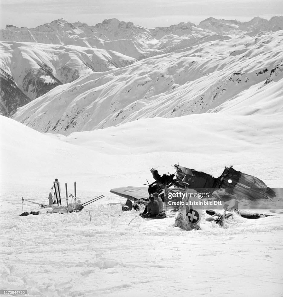
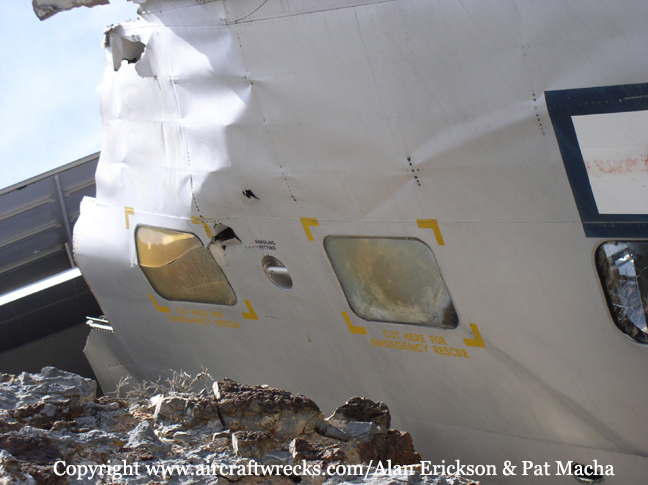
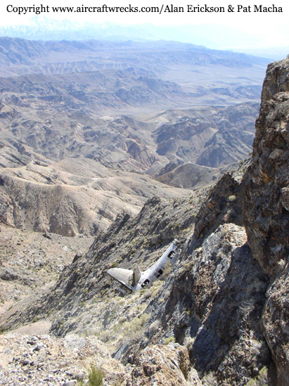
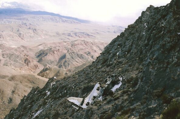
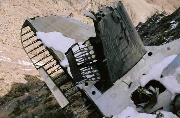
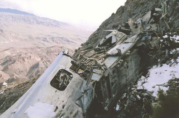
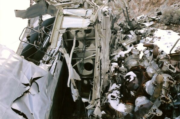
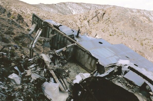
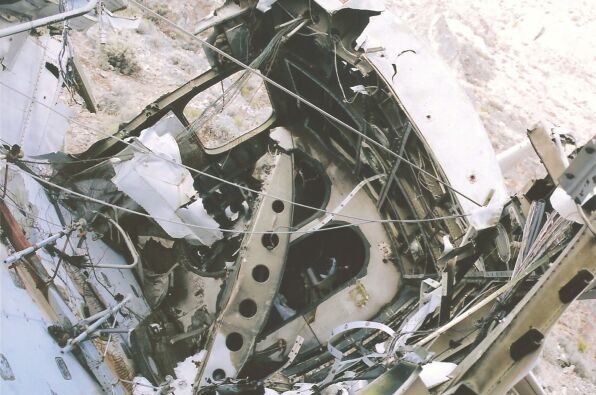
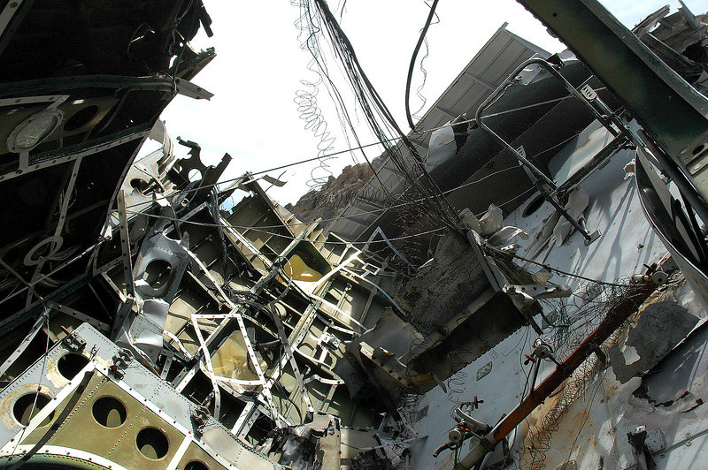
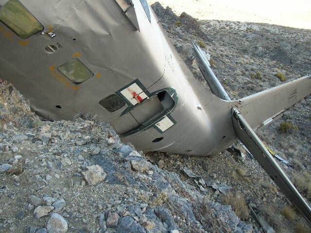
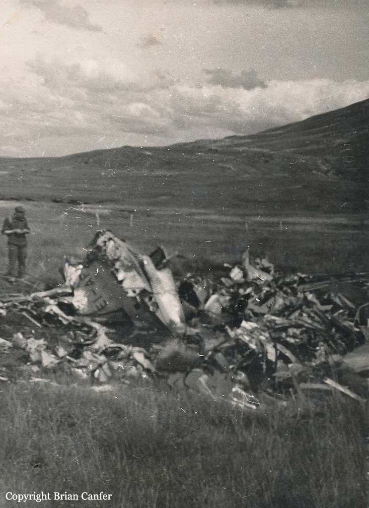
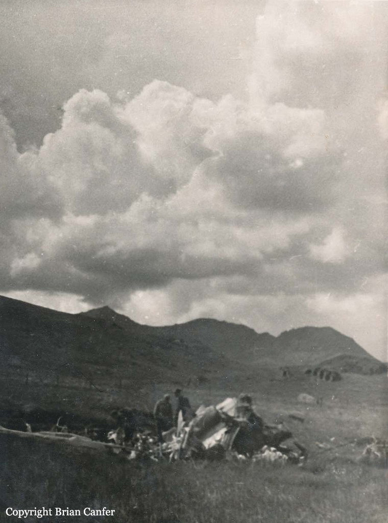
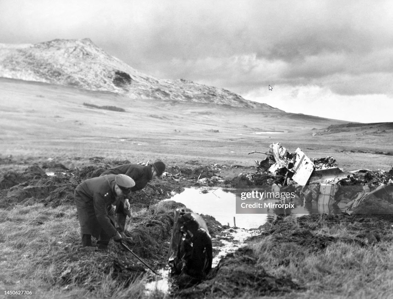
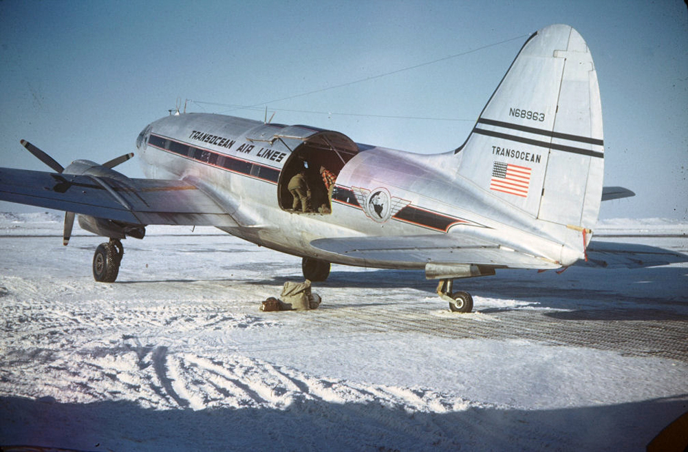
Transocean Air Lines, an irregular carrier, is currently engaged in Alaskan air transport for the United States Navy as part of its operations. Flight 501 South was made in connection with this contract. Upon departure from Point Barrow at 1655, December 30, 1951, the aircraft carried six passengers, 9,243 pounds of cargo, 275 pounds of baggage, 900 gallons of gasoline, and the two crew members, Captain R. R. Warren and First Officer R. V. Irwin. This loading resulted in a gross takeoff weight of 47,646 pounds (allowable 48,000 pounds), and the disposable load was properly distributed with relation to the center of gravity. The following IFR (Instrument Flight Rules) flight plan was filed with ARTC (Air Route Traffic Control) at Point Barrow; Point Barrow to Umiat via Amber Airway 2 at 4,000 feet mean sea level; Umiat to Bettles via Amber 2 at 10,000 feet; Bettles to Nenabank intersection 2 via Amber 2 at 8,000 feet; and Nenabank intersection to Fairbanks via Green 7 at 5,000 feet. Big Delta, 70 miles southeast of Fairbanks, was the alternate airport. Weather forecasts indicated instrument and on-top flight conditions en route; an instrument approach was anticipated at Fairbanks. The flight arrived at Umiat at 1754, remaining there for one hour and 56 minutes. The captain and first officer were advised by the CAA communications station employee of a recent repositioning of the north leg of the Bettles radio range, with a resultant change in quadrant signals. Both pilots, while in the CAA INSAC (Interstate Airways Communications) station, received the 1928 weather information. The 1810 weather, which included route and terminal forecasts and winds aloft, was also available to the crew. Winds from 240 degrees at 40-60 knots were forecast for cruising altitude to Nenabank intersection; thence to Fairbanks the forecast was 240 degrees at 30-40 knots. Upon departing Umiat at 1950, the takeoff gross weight of the aircraft was 36,373 pounds. The only passengers aboard were two employees of Wien Alaska Airlines who were carried nonrevenue through a mutual assistance agreement between the two companies. Their names were entered on the flight plan as additional crew members. The flight reported over Bettles at 2053. At 2744 it reported 25 miles northwest of Nenabank intersection, estimating there at 2150. An ARTC clearance was delivered to the flight at 2144, clearing it to the Fairbanks radio range station, to cruise and maintain 8,000 feet to the Nenabank intersection, and then maintain 5,000 feet to Fairbanks. At 2148, the flight reported over Nenabank intersection at 8,000 feet, descending to 5,000 feet IFR, and estimating Fairbanks at 2200. At 2155, it reported reaching 5,000 feet. At 2157, the flight was cleared for a standard range approach to Fairbanks, to cross Fairbanks at 4,000 feet. The flight again contacted Fairbanks at 2205 and advised as follows: "ADF OUT HAVE MISSED CONE PROCEEDING OUT WEST LEG WILL CALL WHEN OVER STATION." At 2206 Fairbanks requested confirmation that the flight was proceeding out the west leg, and at 2207 this confirmation was received from the pilot. This was the last message received and it is believed that the aircraft crashed immediately thereafter. The wreckage was found in a hilly terrain on January 3, 1952. The aircraft was destroyed upon impact and all four occupants have been killed.
Probable cause:
The Board determines that the probable cause of this accident was the failure of the pilot to follow procedures and utilize properly the radio facilities for approach and letdown at Fairbanks, with the result that the flight became lost. The following findings were pointed out:
- Weather conditions were substantially the same as forecast and would not have precluded a successful approach and landing at the terminal point,
- The flight was considerably off course when initially positioned by radar, and was shortly thereafter plotted on the west and east legs of the Fairbanks range for 12 minutes,
- All ground radio facilities functioned normally, and all radio contacts with the flight were normal,
- The flight made an authorized left turn while outbound on the east leg of the Fairbanks radio range and subsequently struck a mountain northeast of the station while on a westerly heading.
Final Report: