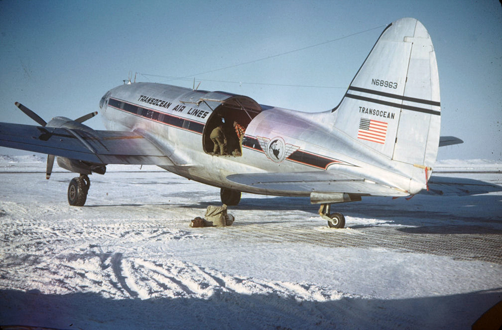
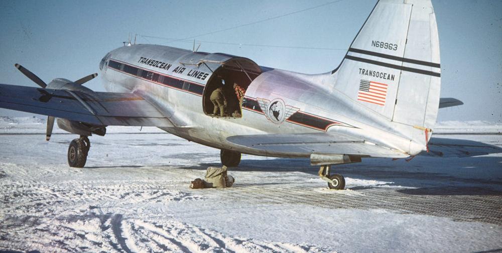
Date & Time:
Dec 30, 1951 at 2207 LT
Type of aircraft:
Curtiss C-46 Commando
Registration:
N68963
Flight Phase:
Landing (descent or approach)
Flight Type:
Cargo
Survivors:
No
Site:
Mountains
Schedule:
Point Barrow – Umiat – Fairbanks
MSN:
22485
YOM:
1945
Flight number:
TL501
Country:
United States of America
Region:
North America
Crew on board:
2
Crew fatalities:
2
Pax on board:
2
Pax fatalities:
2
Other fatalities:
0
Total fatalities:
4
Captain / Total hours on type:
150
Copilot / Total hours on type:
196
Aircraft flight hours:
1937
Circumstances:
Transocean Air Lines, an irregular carrier, is currently engaged in Alaskan air transport for the United States Navy as part of its operations. Flight 501 South was made in connection with this contract. Upon departure from Point Barrow at 1655, December 30, 1951, the aircraft carried six passengers, 9,243 pounds of cargo, 275 pounds of baggage, 900 gallons of gasoline, and the two crew members, Captain R. R. Warren and First Officer R. V. Irwin. This loading resulted in a gross takeoff weight of 47,646 pounds (allowable 48,000 pounds), and the disposable load was properly distributed with relation to the center of gravity. The following IFR (Instrument Flight Rules) flight plan was filed with ARTC (Air Route Traffic Control) at Point Barrow; Point Barrow to Umiat via Amber Airway 2 at 4,000 feet mean sea level; Umiat to Bettles via Amber 2 at 10,000 feet; Bettles to Nenabank intersection 2 via Amber 2 at 8,000 feet; and Nenabank intersection to Fairbanks via Green 7 at 5,000 feet. Big Delta, 70 miles southeast of Fairbanks, was the alternate airport. Weather forecasts indicated instrument and on-top flight conditions en route; an instrument approach was anticipated at Fairbanks. The flight arrived at Umiat at 1754, remaining there for one hour and 56 minutes. The captain and first officer were advised by the CAA communications station employee of a recent repositioning of the north leg of the Bettles radio range, with a resultant change in quadrant signals. Both pilots, while in the CAA INSAC (Interstate Airways Communications) station, received the 1928 weather information. The 1810 weather, which included route and terminal forecasts and winds aloft, was also available to the crew. Winds from 240 degrees at 40-60 knots were forecast for cruising altitude to Nenabank intersection; thence to Fairbanks the forecast was 240 degrees at 30-40 knots. Upon departing Umiat at 1950, the takeoff gross weight of the aircraft was 36,373 pounds. The only passengers aboard were two employees of Wien Alaska Airlines who were carried nonrevenue through a mutual assistance agreement between the two companies. Their names were entered on the flight plan as additional crew members. The flight reported over Bettles at 2053. At 2744 it reported 25 miles northwest of Nenabank intersection, estimating there at 2150. An ARTC clearance was delivered to the flight at 2144, clearing it to the Fairbanks radio range station, to cruise and maintain 8,000 feet to the Nenabank intersection, and then maintain 5,000 feet to Fairbanks. At 2148, the flight reported over Nenabank intersection at 8,000 feet, descending to 5,000 feet IFR, and estimating Fairbanks at 2200. At 2155, it reported reaching 5,000 feet. At 2157, the flight was cleared for a standard range approach to Fairbanks, to cross Fairbanks at 4,000 feet. The flight again contacted Fairbanks at 2205 and advised as follows: "ADF OUT HAVE MISSED CONE PROCEEDING OUT WEST LEG WILL CALL WHEN OVER STATION." At 2206 Fairbanks requested confirmation that the flight was proceeding out the west leg, and at 2207 this confirmation was received from the pilot. This was the last message received and it is believed that the aircraft crashed immediately thereafter. The wreckage was found in a hilly terrain on January 3, 1952. The aircraft was destroyed upon impact and all four occupants have been killed.
Probable cause:
The Board determines that the probable cause of this accident was the failure of the pilot to follow procedures and utilize properly the radio facilities for approach and letdown at Fairbanks, with the result that the flight became lost. The following findings were pointed out:
- Weather conditions were substantially the same as forecast and would not have precluded a successful approach and landing at the terminal point,
- The flight was considerably off course when initially positioned by radar, and was shortly thereafter plotted on the west and east legs of the Fairbanks range for 12 minutes,
- All ground radio facilities functioned normally, and all radio contacts with the flight were normal,
- The flight made an authorized left turn while outbound on the east leg of the Fairbanks radio range and subsequently struck a mountain northeast of the station while on a westerly heading.
Final Report:
N68963.pdf700.1 KB


