Crash of a Fairchild C-119G Flying Boxcar near Newburg: 4 killed

Date & Time: Oct 26, 1956 at 1518 LT
Operator:
Registration:
51-8026
Flight Phase:
Flight Type:
Survivors:
No
Site:
Schedule:
Sewart – Harrisburg
MSN:
10769
YOM:
1951
Crew on board:
4
Crew fatalities:
Pax on board:
0
Pax fatalities:
Other fatalities:
Total fatalities:
4
Circumstances:
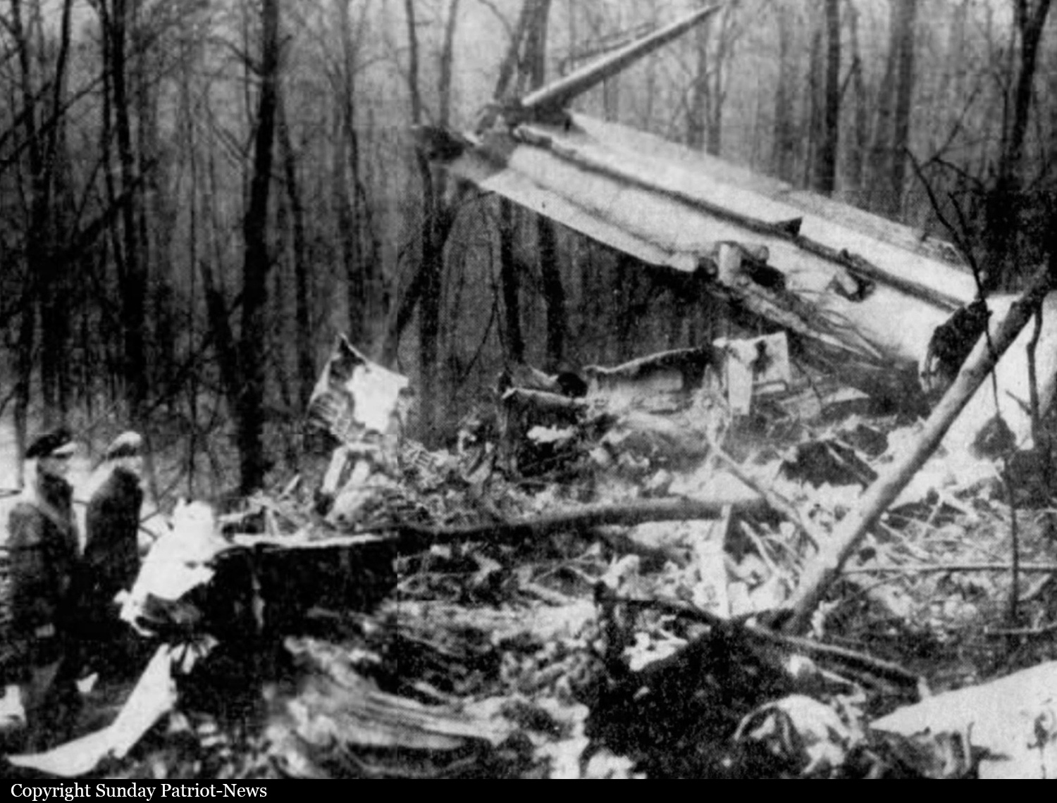
The crew was performing a flight from Sewart AFB (Smyrna, Tennessee) to Harrisburg-Intl Airport (Olmsted AFB). After passing over Newburg, the crew did not realize his altitude was too low when the airplane struck the slope of a mountain located 7 miles north of the city. The aircraft was destroyed upon impact and all four crew members have been killed.

Crash of a Casa 352 near San Nicolás del Puerto: 8 killed

Date & Time: Oct 14, 1956
Type of aircraft:
Operator:
Registration:
T.2B-99
Flight Phase:
Flight Type:
Survivors:
No
Site:
Schedule:
Jerez de la Frontera - Getafe
Country:
Region:
Crew on board:
8
Crew fatalities:
Pax on board:
0
Pax fatalities:
Other fatalities:
Total fatalities:
8
Circumstances:
The three engine aircraft departed Jerez de la Frontera Airport bound for Madrid-Getafe Airbase. En route, it crashed in a mountainous area located near San Nicolás del Puerto, Andalusia. All eight crew members were killed.

Crash of a Lockheed P2V-2 Neptune MR.1 near Campbeltown: 9 killed

Date & Time: Oct 10, 1956
Type of aircraft:
Operator:
Registration:
WX545
Flight Phase:
Flight Type:
Survivors:
No
Site:
Schedule:
Ballykelly - Ballykelly
Region:
Crew on board:
9
Crew fatalities:
Pax on board:
0
Pax fatalities:
Other fatalities:
Total fatalities:
9
Circumstances:
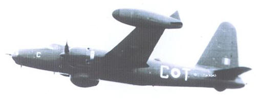
The crew was taking part to an antisubmarine exercice from RAF Ballykelly. While cruising by night and limited visibility, the airplane struck the slope of Mt Beinn na Lice located one mile northeast of the Mull of Kintyre Lighthouse. The airplane disintegrated on impact and all nine crew members have been killed.
Crew (36th Squadron):
F/Lt Geoffrey Finding, pilot,
F/O James Alexander Campbell, copilot,
F/O Gilbert Rishton, navigator,
Sgt Cyril Armstrong, flight engineer,
F/Sgt Raymond Fox, radio operator,
F/Sgt Ronald Mark Noble, air signaler,
Sgt Eric Honey, air signaler,
Sgt Bernard Edward Lynn, air signaler,
Sgt Roy Vincent Smith, air signaler.

Crash of an Avro 652A Anson V on Mt Le Grammont: 2 killed

Date & Time: Oct 5, 1956 at 1855 LT
Type of aircraft:
Operator:
Registration:
OY-DZI
Flight Phase:
Flight Type:
Survivors:
No
Site:
Schedule:
Frankfurt – Genoa
MSN:
3732
YOM:
1947
Country:
Region:
Crew on board:
2
Crew fatalities:
Pax on board:
0
Pax fatalities:
Other fatalities:
Total fatalities:
2
Circumstances:
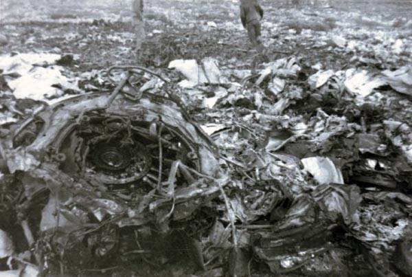
The crew was performing an ambulance flight from Frankfurt to Genoa to pick up a patient. After passing over Bern, the crew was authorized to descend to 6,000 feet and passing over the Lake of Geneva, weather conditions worsened. At an altitude of about 5,600 feet, the airplane went through clouds and the pilot made a turn to the left of 20° for unknown reasons when the airplane struck the northeast face of Mt Le Grammont (2,172 meters) located six km northwest of Vouvry. The wreckage was found less than ten meters below the summit and both crew members were killed.
Crew:
Cpt Johann-Christian Jessen, pilot,
Niels-Michael Seierde, radio operator.
Probable cause:
The exact cause of the accident could not be determined with certainty. However, weather conditions were considered as poor with icing conditions and the assumption that the accident was the result of a navigation error on part of the crew was not ruled out.

Crash of a Douglas VC-47A on Mt Yale: 12 killed

Date & Time: Sep 24, 1956
Operator:
Registration:
43-48146
Flight Phase:
Flight Type:
Survivors:
No
Site:
Schedule:
Ent - Hamilton
MSN:
13962/25407
YOM:
1944
Crew on board:
2
Crew fatalities:
Pax on board:
10
Pax fatalities:
Other fatalities:
Total fatalities:
12
Circumstances:
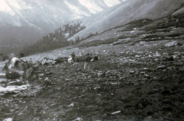
The aircraft departed Ent AFB in Colorado Springs and continued to the west. After passing over Buena Vista, the airplane hit the north face of Mt Yale (4,328 meters high) and disintegrated on impact, killing all 12 occupants.
Crew:
Col Charles Arthur Miller, pilot,
Cpt James Joseph Richardson, copilot.
Passengers:
Col Frederick W. Ledeboer,
S/Sgt William E. MacKenzie Jr.,
Oscar M. Rupert (civilian),
A1c William R. Carpenter,
Sgt Phillip Lenz,
M/Sgt Helen M. Schuyler,
Cpt David C. Jacobs,
1st Lt David W. Gill,
Sp3 William L. Simpson,
Pvt William R. Rooney.
Probable cause:
It is believed that the accident was the consequence of a controlled flight into terrain.

Crash of an Antonov AN-2 near Gizhiga: 3 killed

Date & Time: Aug 20, 1956 at 2115 LT
Type of aircraft:
Operator:
Registration:
CCCP-L3488
Flight Phase:
Flight Type:
Survivors:
Yes
Site:
Schedule:
Gizhiga - Gizhiga
MSN:
1 35 473 17
YOM:
1953
Country:
Region:
Crew on board:
4
Crew fatalities:
Pax on board:
0
Pax fatalities:
Other fatalities:
Total fatalities:
3
Captain / Total hours on type:
50.00
Aircraft flight hours:
1475
Circumstances:
The crew was returning to Gizhiga Airport following a geophysical survey flight. En route, the pilot entered a narrow valley and while the visibility was decreasing due to clouds, the pilot decided to make a 180 turn. At an altitude of 460 meters, he started a turn to the right when the airplane collided with the mountain and crashed in flames. The radio navigator was slightly injured while all three other occupants were killed. The aircraft was destroyed.
Probable cause:
The pilot was inexperienced on such geophysical survey flight and accumulated 50 flying hours on this type of aircraft prior to the accident. Also, the crew was on duty since 11 hours while the max duty time allowed for this kind of mission is six hours. If the time of the accident is confirmed at 2115LT, this means it was dark as the sunset is at 2007LT at Gizhiga on August 20.

Crash of a Douglas C-47B-1-DK near Thazi: 12 killed

Date & Time: Aug 8, 1956
Operator:
Registration:
XY-ADC
Flight Phase:
Survivors:
Yes
Site:
Schedule:
Yangon – Mandalay
MSN:
14348/25793
YOM:
1944
Country:
Region:
Crew on board:
4
Crew fatalities:
Pax on board:
18
Pax fatalities:
Other fatalities:
Total fatalities:
12
Circumstances:
Struck Mt Pindaya near Thazi while flying from Yangon to Mandalay. Ten people were rescued while twelve occupants were killed in the accident.

Crash of an Antonov AN-2 on Mt Hadaraniya: 4 killed

Date & Time: Jul 20, 1956 at 1241 LT
Type of aircraft:
Operator:
Registration:
CCCP-L5554
Flight Phase:
Survivors:
Yes
Site:
Schedule:
Batagay – Deputatsky
MSN:
1 47 473 05
YOM:
2
Country:
Region:
Crew on board:
3
Crew fatalities:
Pax on board:
3
Pax fatalities:
Other fatalities:
Total fatalities:
4
Aircraft flight hours:
1355
Circumstances:
The aircraft departed Batagay Airport at 1142LT bound for Deputatsky with a crew of three, three passengers and 543 kilos of various goods. En route, weather conditions worsened and the pilot climbed from 1,400 to 2,000 meters. As the visibility deteriorated, the aircraft deviated from the prescribed flight plan by 12 km and later, the pilot-in-command reduced his altitude to 1,300 meters when the airplane hit the slope of Mt Hadaraniya (1,468 meters high) located about 175 km northeast of Batagay. Two passengers were injured while four other occupants were killed. The aircraft was destroyed by impact forces and a post crash fire.
Probable cause:
The accident was the consequence of wrong decisions on part of the crew who decided to modify his route without prior permission while he was flying in below minima weather conditions above a mountainous area. The following findings were reported:
- poor flight organization,
- poor analysis of the flight documentation,
- meteorological forecast that did not reflect the reality.

Crash of a Douglas C-47A-25-DK near Pavín: 18 killed

Date & Time: Jul 16, 1956 at 0717 LT
Operator:
Registration:
LV-ACD
Survivors:
No
Site:
Schedule:
Buenos Aires – Río Cuarto
MSN:
13328
YOM:
1944
Location:
Country:
Crew on board:
4
Crew fatalities:
Pax on board:
14
Pax fatalities:
Other fatalities:
Total fatalities:
18
Circumstances:
The airplane departed Buenos Aires at 0515LT bound for Río Cuarto. Less than two hours into the flight, the crew contacted Río Cuarto and was informed about poor weather at destination. Despite conditions below minima, the pilot decided to start an IFR descent when the airplane struck the slope of a mountain and disintegrated on impact, killing all 18 occupants.
Probable cause:
The decision of the pilot to descend en route, without justifiable reason, below the minimum altitude prescribed for a night flight, and in weather conditions which made it his duty to follow IFR procedure a contributing cause probably being an error between control tower and aircraft in the transmission or interpretation of barometric pressure of QFE and QNH values.

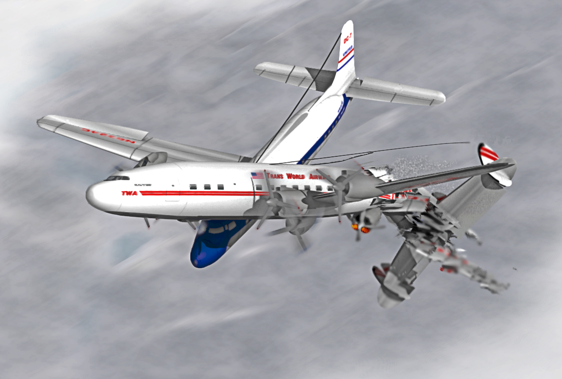
Crash of a Douglas DC-7 in the Grand Canyon: 58 killed

Date & Time: Jun 30, 1956 at 1032 LT
Type of aircraft:
Operator:
Registration:
N6324C
Flight Phase:
Survivors:
No
Site:
Schedule:
Los Angeles – Chicago – New York
MSN:
44288
YOM:
1955
Flight number:
UA718
Crew on board:
5
Crew fatalities:
Pax on board:
53
Pax fatalities:
Other fatalities:
Total fatalities:
58
Captain / Total flying hours:
16492
Captain / Total hours on type:
1238.00
Copilot / Total flying hours:
4540
Copilot / Total hours on type:
230
Aircraft flight hours:
5115
Circumstances:
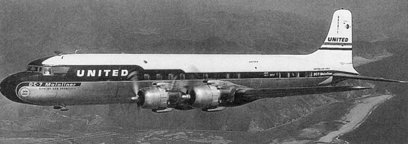
United Air Lines Flight 718 was regularly scheduled from Los Angeles to Chicago, Illinois. On June 30, 1956, it took off from runway 25L (left) of the Los Angeles International Airport at 0904 (three minutes after TWA 2). Flight 718 was on an IFR flight plan to Chicago via Green Airway 5 Palm Springs inter-section, direct Needles, direct Painted Desert, direct Durango, direct Pueblo, direct St. Joseph. Victor Airway 116 Joliet, Victor Airway 84 Chicago Midway Airport. The flight plan proposed a .JPG"> airspeed of 288 knots., a cruising altitude of 21,000 feet, and a departure time of 0845. The flight crew consisted of Captain Robert F. Shirley, First Officer Robert W. Harms, Flight Engineer Gerard Flore, and Stewardesses Nancy L. Kemnitz and Margaret A. Shoudt. Flight preparations and dispatch of United 718 were routine and the aircraft departed with 3,850 gallons of fuel. The company load manifest showed the gross weight of the aircraft at takeoff to be 105,835 pounds, which was less than the maximum allowable of 114,060 pounds; the latter weight was restricted from a maximum of 122,200 pounds for the aircraft because of a landing limitation at Chicago. The load was properly distributed with respect to the center of gravity limitations of the aircraft. After takeoff the flight contacted the Los Angeles tower radar controller, who vectored it through the overcast over the same departure course as TWA 2. United 718 reported "on top" and changed to Los Angeles Center frequency for its en route clearance. This corresponded to the flight plan as filed; however, the controller specified that the climb to assigned altitude be in VER conditions. Flight 718 made position reports to Aeronautical Radio, Inc., which serves under contract as United company radio. It reported passing over Riverside and later over Palm Springs intersection. The latter report indicated that United 718 was still climbing to 21,000 and estimated it would reach Needles at 1000 and the Painted Desert at 1034. At approximately 0958 United 718 made a position report to the CAA communications station located at Needles. This report stated that the flight was over Needles at 0958, at 21,000 feet, and estimated the Painted Desert at 1031, with Durango next. At 1031 an unidentified radio transmission was heard by Aeronautical Radio communicators at Salt Lake City and San Francisco. They were not able to understand the message when it was received but it was later determined by playing back the recorded transmission that the message was from United 718. Context was interpreted as: "Salt Lake, United 718 . . . ah . . . we're going in."
Probable cause:
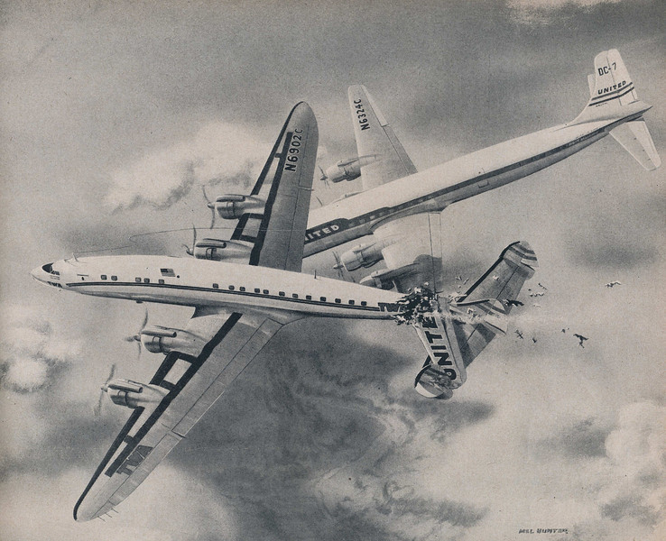
The Board determines that the probable cause of this mid-air collision was that the pilots did not see each other in time to avoid the collision. It is not possible to determine why the pilots did not see each other, but the evidence suggests that it resulted from any one or a combination of the following factors: Intervening clouds reducing time for visual separation, visual limitations due to cockpit visibility, and preoccupation with normal cockpit duties, preoccupation with matters unrelated to cockpit duties such as attempting to provide the passengers with a more scenic view of the Grand Canyon area, physiological limits to human vision reducing the time opportunity to see and avoid the other aircraft, or insufficiency of en route air traffic advisory information due to inadequacy of facilities and lack of personnel in air traffic control. The following findings were reported:
- Approaching Daggett, TWA 2 requested its company radio to obtain 21,000 feet as an assigned altitude, or 1,000 on top,
- Company radio requested 21,000 feet IFR from ARTC. This vas denied by ARTC. Request was then made for 1,000 on top. This was approved and clearance issued. The flight climbed to and proceeded at 21,000 feet,
- As an explanation for the denial of 21,000 feet, TWA 2 was furnished pertinent information on UA718,
- The last position report by each flight indicated it was at that time at 21,000, estimating the Painted Desert line of position at 1031,
- The Salt Lake controller possessed both position reports at approximately 1013, at which time both flights were in uncontrolled airspace,
- Traffic control services are not provided in the uncontrolled airspace and according to existing Air Traffic Control policies and procedures the Salt Lake controller was not required to issue traffic information; none was issued voluntarily,
- A general overcast with some breaks existed at 15,000 feet in the Grand Canyon area,
- Several cumulus buildups extending above flight level existed; one was nearly over Grand Canyon Village and others were north and northeast in the area of the collision,
- The collision occurred at approximately 1031 in visual flight rule weather conditions at about 21,000 feet,
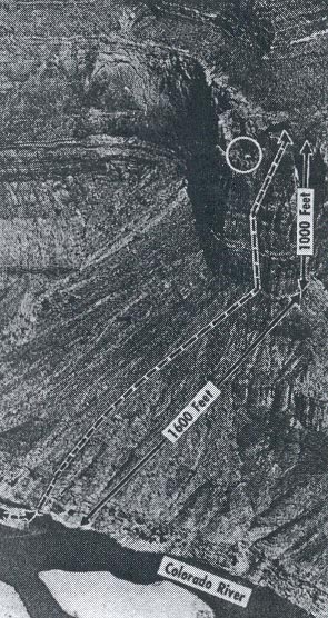
- The collision in space was above a position a short distance west of the TWA wreckage area, 17 miles west of or approximately 3-1/2 minutes' flying time from the Painted Desert line of position,
- Under visual flight rule weather conditions it is the pilot's responsibility to maintain separation from other aircraft,
- At impact the aircraft relative to each other converged at an angle of about 25 degrees with the DC-7 to the right of the L-1049. The DC-7 was rolled about 20 degrees right wing down and pitched about 10 degrees nose down relative to the L-1049,
- There was no evidence found to indicate that malfunction or failure of the aircraft or their components was a factor in the accident.
Final Report: