Zone

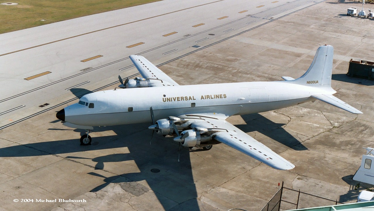
Crash of a Douglas DC-6BF in Cold Bay

Date & Time: Jun 12, 2011 at 1455 LT
Type of aircraft:
Operator:
Registration:
N600UA
Flight Type:
Survivors:
Yes
Schedule:
Togiak - Cold Bay
MSN:
44894/651
YOM:
1956
Location:
Crew on board:
4
Crew fatalities:
Pax on board:
0
Pax fatalities:
Other fatalities:
Total fatalities:
0
Captain / Total flying hours:
10000
Captain / Total hours on type:
4000.00
Aircraft flight hours:
37334
Circumstances:
According to the captain, while on approach to land, he distracted the crew by pointing out a boat dock. He said that after touchdown, he realized that the landing gear was not extended, and the airplane slid on its belly, sustaining substantial damage to the underside of the fuselage. He said that the crew did not hear the landing gear retracted warning horn, and the accident could have been prevented if he had not distracted the crew. The captain reported that there were no mechanical malfunctions with the airplane that would have precluded normal operation.
Probable cause:
The flight crew's failure to extend the landing gear, which resulted in an inadvertent wheels up landing. Contributing to the accident was the flight crew's diverted attention.
Final Report:
Crash of a Cessna 208 Caravan I in False Pass: 1 killed

Date & Time: Dec 21, 1990 at 1220 LT
Type of aircraft:
Operator:
Registration:
N9444F
Flight Type:
Survivors:
No
Schedule:
Cold Bay - False Pass
MSN:
208-0104
YOM:
1986
Crew on board:
1
Crew fatalities:
Pax on board:
0
Pax fatalities:
Other fatalities:
Total fatalities:
1
Captain / Total flying hours:
11000
Captain / Total hours on type:
323.00
Aircraft flight hours:
1787
Circumstances:
The flight departed Cold Bay for the approximately 15 minutes flight to False Pass. There are no weather reporting facilities at False Pass. Cold Bay weather was 4,500 feet overcast, light rain and fog; forecast called for frequent ceilings below 1,000 feet. Wreckage located between two mountains. False Pass weather estimated 400 feet overcast, 2-3 miles in rain and fog, winds 25-30 knots. Fishing boat captain in area estimated winds down the mountain at 60 mph or greater.
Probable cause:
The pilot's improper decision to continue flight into an area of mountainous terrain and adverse weather conditions. The terrain and weather were factors.
Final Report:

Crash of a Piper PA-31-350 Navajo Chieftain in Cold Bay: 1 killed

Date & Time: Feb 17, 1990 at 1335 LT
Operator:
Registration:
N27328
Flight Type:
Survivors:
No
Site:
Schedule:
King Cove - Cold Bay
MSN:
31-7752149
YOM:
1977
Location:
Crew on board:
1
Crew fatalities:
Pax on board:
0
Pax fatalities:
Other fatalities:
Total fatalities:
1
Captain / Total flying hours:
9487
Captain / Total hours on type:
1000.00
Aircraft flight hours:
12690
Circumstances:
The scheduled flight's departure from King Cove was delayed due to a passing snow squall. A witness at the airport stated that the weather at the airport was good when the flight departed; however, he noted dark clouds in the direction of Cold Bay, the intended destination of the flight. The airplane did not reach its destination. It was found, where it had impacted terrain near the top of a ridgeline at the 1,250 foot level, between King Cove and Cold Bay. About 8 miles west-northwest at Cold Bay, weather reports indicated there were snow showers of unknown intensity in all quadrants. The pilot, sole on board, was killed.
Probable cause:
Continued VFR flight by the pilot into instrument meteorological conditions (IMC), and his failure to maintain adequate altitude (or clearance) from mountainous terrain. The adverse weather and terrain conditions were related factors.
Final Report:

Crash of a Piper PA-31-310 Navajo in Port Heiden: 1 killed

Date & Time: Feb 14, 1985 at 1900 LT
Type of aircraft:
Operator:
Registration:
N63719
Flight Phase:
Flight Type:
Survivors:
No
Site:
Schedule:
Becharof Lake - Cold Bay
MSN:
31-7712042
YOM:
1977
Crew on board:
1
Crew fatalities:
Pax on board:
0
Pax fatalities:
Other fatalities:
Total fatalities:
1
Captain / Total flying hours:
4427
Captain / Total hours on type:
2250.00
Aircraft flight hours:
4284
Circumstances:
This flight originated near Becharof Lake and was destined for Cold Bay. Aircraft crashed into the side of a mountain at the 7,500 feet level, 23 miles left of course. Marginal weather conditions existed including a 35 knot right crosswind. Pilot had flown the same route about 1 hour prior to the accident. Company VFR flight plan was filed. Accident occurred at sunset. The pilot, sole on board, was killed.
Probable cause:
Occurrence #1: in flight collision with terrain/water
Phase of operation: cruise
Findings
1. (f) weather condition - obscuration
2. (f) weather condition - unfavorable wind
3. (f) weather condition - snow
4. (c) flight into known adverse weather - intentional - pilot in command
5. (c) vfr flight into imc - continued - pilot in command
6. (c) compensation for wind conditions - inadequate - pilot in command
7. (f) terrain condition - mountainous/hilly
8. (f) light condition - dark night
9. (f) in-flight planning/decision - poor - pilot in command
Final Report:

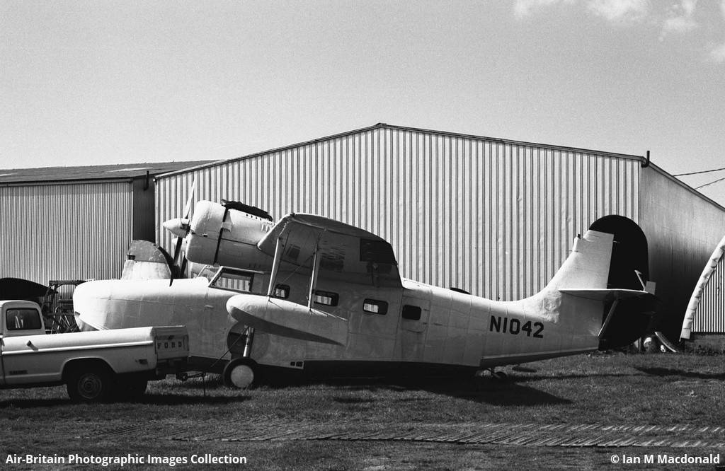
Crash of a Grumman G-21A Goose near Port Moller

Date & Time: May 12, 1978 at 1340 LT
Type of aircraft:
Operator:
Registration:
N1042
Flight Phase:
Survivors:
Yes
Schedule:
Port Moller - Cold Bay
MSN:
B043
YOM:
1943
Crew on board:
1
Crew fatalities:
Pax on board:
2
Pax fatalities:
Other fatalities:
Total fatalities:
0
Captain / Total flying hours:
2855
Captain / Total hours on type:
54.00
Circumstances:
While taking off from a lake located near Port Moller, the left wing float stayed in water, causing the seaplane to plunged into water. All three occupants escaped with minor injuries while the aircraft was written off.
Probable cause:
Dragged wingtip during takeoff run due to improper operation of brakes and/or flight controls. The following contributing factors were reported:
- Failed to abort takeoff,
- Lack of familiarity with aircraft,
- Lagoon-open water,
- 33 hours PIC in type.
Final Report:

Crash of a Volpar Turboliner II (G18S) in Dutch Harbor: 5 killed

Date & Time: Jul 22, 1976 at 0905 LT
Type of aircraft:
Registration:
N600WA
Flight Type:
Survivors:
No
Schedule:
Cold Bay - Dutch Harbor
MSN:
BA-463
YOM:
1959
Crew on board:
2
Crew fatalities:
Pax on board:
3
Pax fatalities:
Other fatalities:
Total fatalities:
5
Captain / Total flying hours:
15868
Captain / Total hours on type:
3605.00
Circumstances:
On approach to Dutch Harbor, the crew encountered poor weather conditions. On final, the twin engine airplane was too low and struck the ground few miles short of runway and crashed. The aircraft was destroyed and all five occupants were killed.
Probable cause:
Controlled flight into terrain on final approach following improper IFR operation. The following contributing factors were reported:
- Low ceiling,
- Rain,
- Fog,
- CLGS below 1,000 feet,
- Areas of visibility below 3 miles in drizzle and fog.
Final Report:

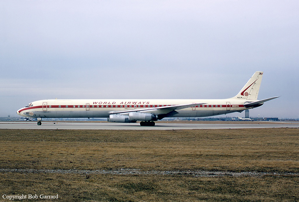
Crash of a Douglas DC-8-63CF on Mt Dutton: 6 killed

Date & Time: Sep 8, 1973 at 0542 LT
Type of aircraft:
Operator:
Registration:
N802WA
Flight Phase:
Flight Type:
Survivors:
No
Site:
Schedule:
Travis - Cold Bay - Yokota - Clark
MSN:
46146/536
YOM:
1970
Flight number:
WO802
Crew on board:
3
Crew fatalities:
Pax on board:
3
Pax fatalities:
Other fatalities:
Total fatalities:
6
Captain / Total flying hours:
22913
Captain / Total hours on type:
1969.00
Copilot / Total flying hours:
4984
Copilot / Total hours on type:
457
Aircraft flight hours:
10077
Circumstances:
On behalf of the USAF, the four engine airplane departed Travis AFB on a cargo flight to Clark AFB, Philippines, with intermediate stops in Cold Bay and Yokota AFB. While approaching Cold Bay by night at an altitude of 3,500 feet, the crew encountered marginal weather conditions when the airplane struck the slope of Mt Dutton (4,941 feet high) located 18 miles east of Cold Bay Airport. At impact, the aircraft's speed was 185 knots and it was heading 275°. The aircraft was totally destroyed and all six occupants were killed. At the time of the accident, the airplane was off course by 12°.
Probable cause:
The captain's deviation from approved instrument approach procedures. As a result of the deviation the flight descended into an area of unreliable navigation signals and obstructing terrain.
Final Report:

Crash of a Douglas C-124C Globemaster II on Mt Pavlof: 7 killed

Date & Time: Aug 26, 1970
Operator:
Registration:
52-1049
Flight Phase:
Flight Type:
Survivors:
No
Site:
Schedule:
McChord - Cold Bay
MSN:
43958
YOM:
1952
Crew on board:
7
Crew fatalities:
Pax on board:
0
Pax fatalities:
Other fatalities:
Total fatalities:
7
Circumstances:
In limited visibility, the crew started the descent to Cold Bay when the four engine aircraft struck the slope of the Pavlof Volcano located 36 miles northeast of Cold Bay. The aircraft disintegrated on impact and all seven crew members were killed. The airplane was inbound from McChord AFB, carrying seven tons of satellite observation equipment for use with the Optical Satellite Observing System. It is believed that the crew started the descent prematurely.

Crash of a Douglas DC-8-63AF off Naha: 4 killed

Date & Time: Jul 27, 1970 at 1136 LT
Type of aircraft:
Operator:
Registration:
N785FT
Flight Type:
Survivors:
No
Schedule:
Los Angeles – San Francisco – Seattle – Cold Bay – Naha – Cam Ranh Bay – Đà Nẵng
MSN:
45005/412
YOM:
1968
Flight number:
FT045
Location:
Country:
Region:
Crew on board:
4
Crew fatalities:
Pax on board:
0
Pax fatalities:
Other fatalities:
Total fatalities:
4
Captain / Total flying hours:
12488
Captain / Total hours on type:
1381.00
Copilot / Total flying hours:
12206
Copilot / Total hours on type:
1157
Aircraft flight hours:
6047
Circumstances:
The airplane departed Los Angeles for a flight to Da Nang AFB, Vietnam with intermediate stops at San Francisco, CA, Seattle, WA, Cold Bay, AK, Tokyo, Okinawa and Cam Ranh Bay. Flight 45 departed Tokyo 09:29 for the IFR flight to Okinawa. The flight proceeded without difficulty to Okinawa, and was cleared for an en route descent to an altitude of 1,000 feet msl to make a precision radar approach to runway 18 at Naha AFB. At 11:31 the flight was advised "... have reduced visibility on final ... tower just advised approach lights and strobe lights are on ....". At 11:32:46, a new altimeter setting of 25.84 inches was given to the crew and acknowledged. The landing checklist, including full flaps. setting of radio altimeters, gear down and locked, and spoilers armed, was completed at 11:33:49. At slightly less than 5 miles from touchdown, the crew was instructed to begin the descent onto glidepath and was cleared to land. The approach continued, with various heading changes and, at 11:34:53, the crew was advised that they were slightly below the glidepath 3 miles from touchdown. Additional vectors were provided and at 11:35:14, 2 miles from touchdown, the crew was again advised "...dropping slightly below glidepath ... you have a 10 knot tailwind." At 11:35:34, the controller advised the crew that they were on glidepath. The DC-8 continued to descend and broke out of heavy rain and low clouds at an estimated altitude of 75 to 100 feet. The aircraft struck the water approximately 2,200 feet short of the runway at a speed of 144 kts.
Probable cause:
An unarrested rate of descent due to inattention of the crew to instrument altitude references while the pilot was attempting to establish outside visual contact in meteorological conditions which precluded such contact during that segment of a precision radar approach inbound from the Decision Height.
Final Report:

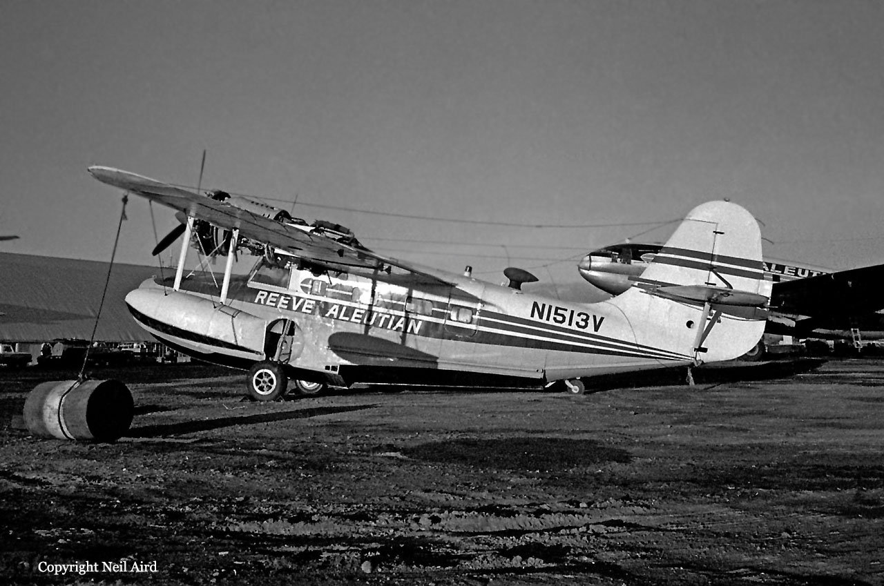
Crash of a Grumman G-21A Goose in False Pass

Date & Time: Jun 22, 1970 at 1520 LT
Type of aircraft:
Operator:
Registration:
N1513V
Survivors:
Yes
Schedule:
Cold Bay - False Pass
MSN:
B103
YOM:
1944
Crew on board:
1
Crew fatalities:
Pax on board:
3
Pax fatalities:
Other fatalities:
Total fatalities:
0
Captain / Total flying hours:
3800
Captain / Total hours on type:
800.00
Circumstances:
Upon landing on water at False Pass, the seaplane probably hit a submerged object, nosed down and came to rest in water. All four occupants were able to evacuate the cabin before the airplane sank by 110 feet deep.
Probable cause:
Aircraft came to rest in water. May have hit submerged object.
Final Report: