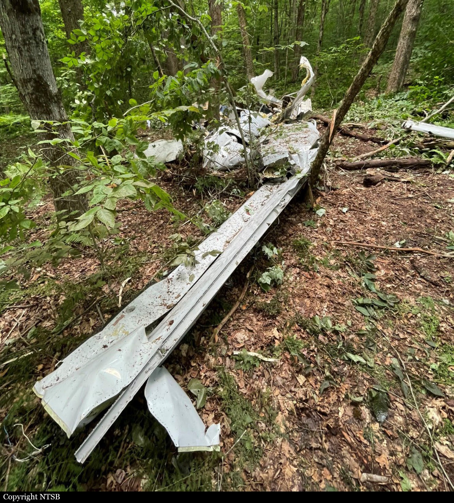
Crash of a Cessna 550 Citation II in Odessa: 2 killed

Date & Time: Aug 20, 2024 at 0700 LT
Type of aircraft:
Operator:
Registration:
N689VP
Flight Phase:
Flight Type:
Survivors:
No
Site:
Schedule:
Odessa - Ellington
MSN:
550-0689
YOM:
1991
Crew on board:
2
Crew fatalities:
Pax on board:
0
Pax fatalities:
Other fatalities:
Total fatalities:
2
Circumstances:
The crew was completing a flight from Odessa to Ellington Field, near Houston. After takeoff from runway 16, while in initial climb, the twin engine airplane collided with a poweline located about 270 metres past the runway end. The airplane descended to the right and crashed onto a garage located 150 metres further, bursting into flames. The airplane was totally destroyed and both occupants were killed.

Crash of a Beechcraft C90GTi King Air near Pousada Amazônia Fisching Lodge: 5 killed

Date & Time: Aug 15, 2024
Type of aircraft:
Registration:
PS-AAS
Flight Phase:
Flight Type:
Survivors:
No
MSN:
LJ-1987
YOM:
2010
Country:
Crew on board:
1
Crew fatalities:
Pax on board:
4
Pax fatalities:
Other fatalities:
Total fatalities:
5
Circumstances:
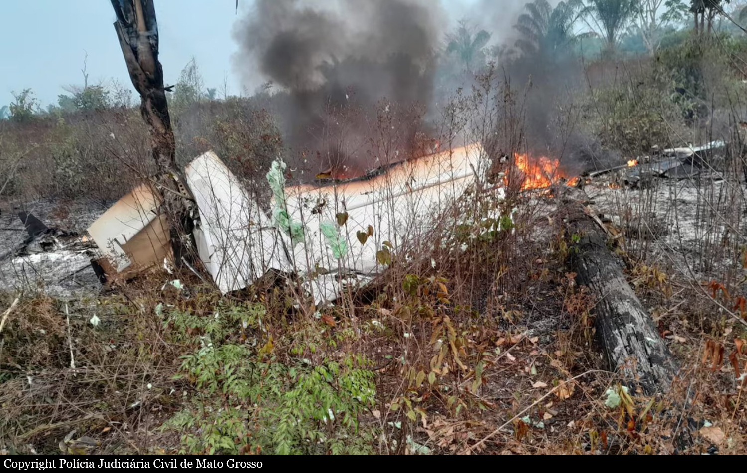
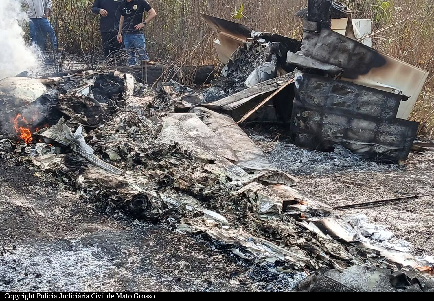
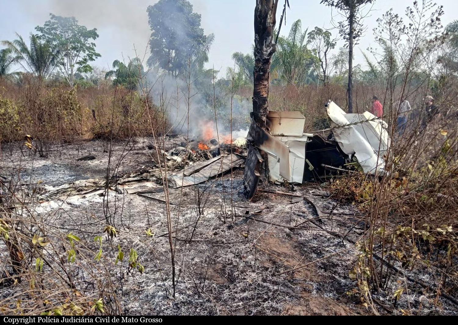
Few minutes after takeoff from the Pousada Amazônia Fisching Lodge Airstrip located at the border between Pará and Mato Grosso, while climbing, the twin engine airplane entered an uncontrolled descent and crashed in a wooded area, bursting into flames. The airplane was destroyed by impact forces and a post crash fire and all five occupants were killed.
Crew:
Hélder de Souza, pilot.
Passengers:
Arni Alberto Spiering,
Ademar de Oliveira,
Arni Alberto Spiering Benez,
João Marcos Trojan Spiering.

Crash of a Piper PA-46-310P Malibu off Qaqortoq

Date & Time: Jul 29, 2024 at 1333 LT
Operator:
Registration:
D-EOSE
Flight Phase:
Flight Type:
Survivors:
Yes
Schedule:
Goose Bay – Narsarsuaq
MSN:
46-08010
YOM:
1986
Country:
Region:
Crew on board:
1
Crew fatalities:
Pax on board:
1
Pax fatalities:
Other fatalities:
Total fatalities:
0
Captain / Total flying hours:
17802
Captain / Total hours on type:
107.00
Aircraft flight hours:
3590
Circumstances:
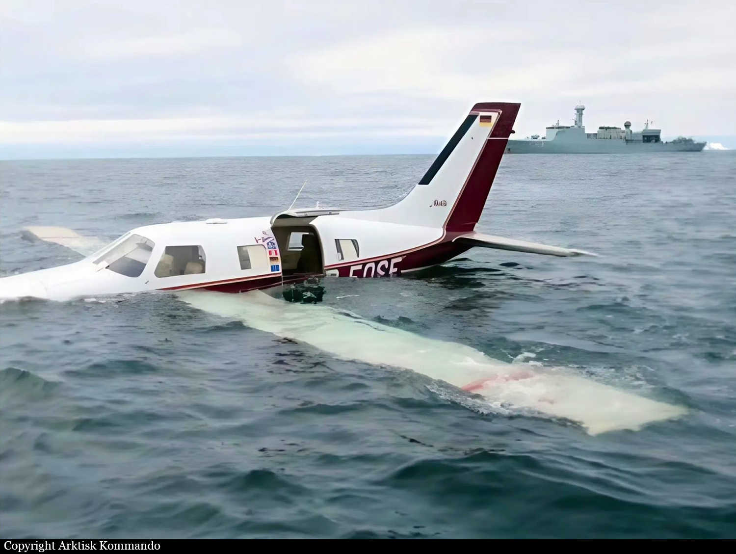
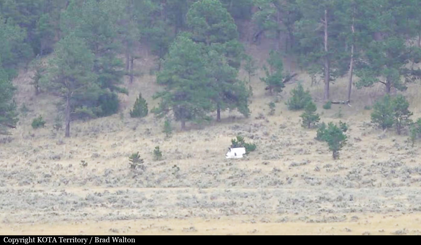
The crew was returning to Europe after taking part to the AirVenture airshow in Oshkosh. Following a fuel stop in Goose Bay, the crew continued to Narsarsuaq, Greenland. The initial cruise level was FL210, but after a short while, ATC instructed the pilot to descend to FL180. The pilot set the cruise power to 65% (26.5' Manifold Pressure (MP) and 2,400 revolutions per minute (rpm)), and the Fuel Flow (FF) leaned to 14 US gallons per hour (gph) with a Turbine Inlet Temperature (TIT) of 50° Fahrenheit (F) Lean of Peak (LOP). The weather en route was 'nice' and mostly VMC, and the Outside Air Temperature (OAT) at FL180 was approximately -10° to -15° Celsius (C). The pilot contacted Nuuk Information (ATS unit Flight Information Center (FIC) Nuuk) when the aircraft entered Nuuk Flight Information Region (FIR). At 1304LT, in preparation for landing in BGBW, the pilot reported a descent from FL180 to 11,000 feet inbound to the IFR reporting point SIMNI (located at the Greenlandic coastline, 45 nm south-west of BGBW). The pilot initiated a 500 feet per minute descent and kept the cruise power setting at 65%. While passing FL160, the pilot and the passenger briefly noticed an 'unusual, electrical, and not very strong smell'. The cabin altitude started increasing by a rate of 3,000 fpm, and the pilot realized 'something was wrong'. Shortly after, the CABIN ALTITUDE annunciator warning light illuminated, indicating a cabin altitude above 10,000 feet. As the aircraft was below an altitude of 15,000 feet and descending, the pilot considered the time of useful consciousness and opted not to don the oxygen masks. At 1316LT, the pilot declared an urgency situation to Nuuk Information: 'Pan-Pan, Pan-Pan, Pan-Pan. We have an air conditioning problem and a low oil pressure indication'. The MP dropped from 26” to 17-18” and the pilot moved the throttle lever forward without any effect. All Cylinder Head Temperatures (CHT) indicated 'normal and balanced', and the pilot moved the mixture control full forward to the rich position. The engine almost stopped, and the pilot retarded the mixture control back to the previous position. The aircraft pitch was adjusted to obtain the best glide airspeed of 90 knots. At 1317LT, while descending through 12,000 feet, the pilot declared a distress situation to Nuuk Information: 'Mayday, Mayday, Mayday. We have high rpm now and will try to make it to the shore'. The pilot activated the aircraft Emergency Locator Transmitter (ELT). A surveillance aircraft from the RDAF and an inspection ship from the RDN were on patrol in the area. The Danish Armed Forces Arctic Command allocated both to provide assistance. While descending through 7,000 feet altitude, the propeller rpm increased to 3,000 rpm, and 30 seconds later, the oil pressure indicated zero. The pilot pulled back the mixture handle to the idle/cut-off position and stopped the engine to avoid major mechanical damage. The pilot observed on his knee-mounted tablet that the predicted gliding distance of the aircraft fell short of the coastline. At 1326LT, the pilot informed Nuuk Information of the expected ditching position: 60° 30' N 46° 45' W. The pilot and the passenger prepared to ditch by checking the location of the life raft in the cabin, zipping up their survival suits (which they were already wearing up to their waists), and tightening their seat belts. At 1329LT, as the aircraft was passing 3,300 feet descending, the RDAF surveillance aircraft spotted the aircraft gliding on a north-easterly course over a low overcast. At approximately 1,700 feet, the aircraft entered the cloud layer, and exited below at approximately 700 feet. The RDAF surveillance aircraft lost sight of the aircraft as it entered the cloud layer. In order to safely descend below the cloud layer in VMC, the flight crew of the RDAF surveillance aircraft had to fly to the coastline, descend, and fly back towards the expected ditching position below the cloud layer. The visibility below the cloud layer was 'good', and the sea surface had 'only low swells'. At 1333LT, the pilot selected flap setting 2 (20°), slowed down the aircraft to minimum airspeed, and flared the aircraft straight ahead. The aircraft bounced slightly on the sea surface once, before hitting the sea surface a second time. The aircraft decelerated fairly abruptly – 'similar to a hard brake in a car' – and stopped in a wings-level position, floating on the surface. The pilot and the passenger released their seat belts, went into the aft cabin, and opened the top part of the aircraft entrance door, which was above the water level. They manoeuvred the life raft through the entrance door into the water and inflated the raft. The pilot and the passenger threw a few personal items into the raft and stepped directly from the aircraft into the raft. At 1340LT, at position 60° 34' N 46° 50' W, the RDAF surveillance crew spotted the life raft with the pilot and passenger. For the next 45 minutes, the RDAF surveillance aircraft circled overhead the life raft. At approximately 1400LT, the pilot contacted Nuuk FIC via satellite telephone. At 1423LT, a rescue crew in a rigid-hulled inflatable boat (RHIB) dispatched from the RDN inspection ship and picked up the pilot and passenger. The aircraft sank approximately 2 hours after the ditching.
Probable cause:
An engine failure during descent resulted in a ditching off the southwest coast of Greenland. The AIB could not determine the exact cause of the engine failure, but it was likely due to a seeping oil leak.
A combination of the following factors made the accident survivable:
- The pilot declared an urgency followed by an emergency to ATS, and a nearby RDAF surveillance aircraft obtained visual contact with the gliding aircraft.
- The pilot successfully landed the aircraft on calm sea.
- The pilot and the passenger wore survival suits and carried a life raft on board, which they boarded upon safely evacuating the aircraft.
- After 50 minutes, personnel from a nearby RDN inspection ship arrived and rescued the pilot and passenger.
Final Report:

Crash of a Pilatus PC-12/47E near Gillette: 7 killed

Date & Time: Jul 26, 2024 at 1305 LT
Type of aircraft:
Registration:
N357HE
Flight Phase:
Flight Type:
Survivors:
No
Schedule:
Nebraska City - Billings
MSN:
1203
YOM:
2010
Crew on board:
1
Crew fatalities:
Pax on board:
6
Pax fatalities:
Other fatalities:
Total fatalities:
7
Circumstances:
The single engine airplane departed Nebraska City Airport on a flight to Billings, carrying six passengers and one pilot. While cruising at FL260, the pilot informed ATC he was losing control of the airplane that entered a dive and crashed in a dense wooded area located about 50 km north of the Northeast Wyoming Regional Airport located near Gillette. The airplane disintegrated and all seven occupants were killed, among them three members of the Southern Gospel band 'The Nelons'

Crash of a Learjet 35 in Matupá: 2 killed

Date & Time: Jul 23, 2024 at 1315 LT
Type of aircraft:
Operator:
Registration:
PP-ERR
Flight Phase:
Flight Type:
Survivors:
No
MSN:
35-008
YOM:
1975
Country:
Crew on board:
2
Crew fatalities:
Pax on board:
0
Pax fatalities:
Other fatalities:
Total fatalities:
2
Circumstances:
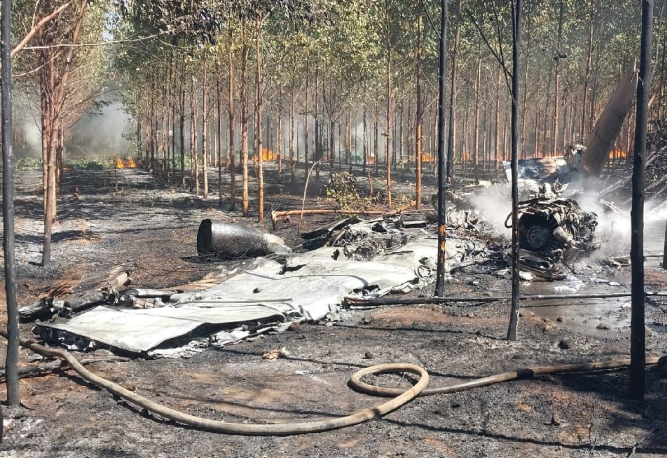
Shortly after takeoff from Matupá Airport, while climbing, the airplane went out of control and crashed in a huge explosion in an eucalyptus plantation. The airplane was totally destroyed by impact forces and a post crash fire and both occupants were killed.

Crash of a Beechcraft B60 Duke in Youngstown: 3 killed

Date & Time: Jul 19, 2024 at 1904 LT
Type of aircraft:
Operator:
Registration:
N23553
Flight Type:
Survivors:
No
Schedule:
Plattsburgh - Columbus
MSN:
P-453
YOM:
1978
Crew on board:
1
Crew fatalities:
Pax on board:
2
Pax fatalities:
Other fatalities:
Total fatalities:
3
Captain / Total flying hours:
1123
Captain / Total hours on type:
46.00
Aircraft flight hours:
4579
Circumstances:
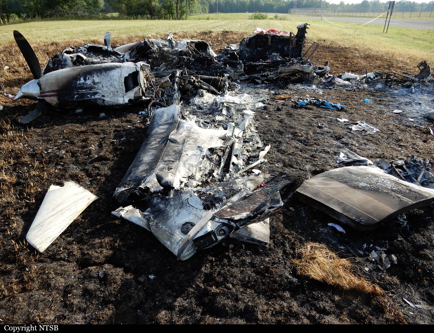
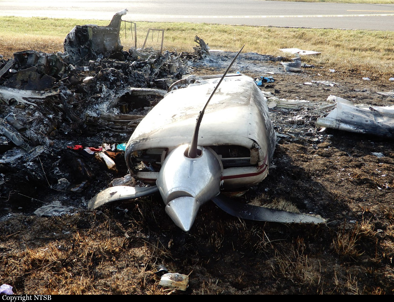
During the cruise portion of the cross-country flight, the pilot/owner informed air traffic control that the airplane’s left engine had lost power and he could not maintain altitude. The controller offered information on a nearby airport; however, the pilot requested, and then proceeded to, an airport farther away with a 9,003-ft-long runway. After twice circling the approach end of the runway to the left while descending, the pilot proceeded down the runway well above a normal glide path. A witness reported that the airplane never touched down, and track data showed that the airplane’s ground speed increased while over the runway. Airport surveillance video showed the airplane pitch up and to the left at the departure end of the runway. It continued into a left, descending turn until it impacted the ground about ¼ mile west of the departure end of the runway. Given this information, it is most likely that the pilot was unsuccessful in achieving an appropriate altitude and airspeed, which likely resulted in the pilot performing a single-engine go-around. During the subsequent climb and maneuvering, he lost control of the airplane, which resulted in an uncontrolled descent and impact with terrain. The wreckage was destroyed by impact forces and a postimpact fire. The left engine’s propeller blades were feathered and showed no indications of powered rotation at impact, while the right engine’s propeller blades showed damage signatures consistent with powered rotation at impact. A postaccident examination of the left engine revealed severe detonation damage of the No. 4 cylinder piston. Further examination of the left engine fuel servo revealed a significant amount of sand-like contamination in the servo inlet filter, which matched the properties of polyethylene terephthalate (PET), which is a thermoplastic polymer of the polyester family commonly found in fuel system components. The examination of the right engine fuel servo revealed that it was also contaminated with the same substance. The right engine’s spark plugs and one of its cylinders also displayed signatures consistent with a lean fuel to air ratio. Given this evidence, it is likely that the engines were operating with unpredictable fuel to air ratios due to the fuel system contamination, which likely contributed to the detonation in the left engine and pilot’s description that the engine lost power. The investigation was unable to determine how or when the PET was introduced into the fuel system due to the postimpact fire damage.
Probable cause:
The pilot’s loss of airplane control during a single-engine go-around. Also contributing to the accident was fuel system contamination, which resulted in detonation and a total loss of left engine power.
Final Report:

Crash of a Cessna 421C Golden Eagle III in Tofino: 2 killed

Date & Time: Jul 18, 2024 at 1243 LT
Operator:
Registration:
N264DC
Flight Phase:
Flight Type:
Survivors:
Yes
Schedule:
Tofino - Portland
MSN:
421C-1248
YOM:
1982
Country:
Crew on board:
1
Crew fatalities:
Pax on board:
2
Pax fatalities:
Other fatalities:
Total fatalities:
2
Captain / Total flying hours:
828
Captain / Total hours on type:
113.00
Aircraft flight hours:
2795
Circumstances:
The privately registered Cessna 421C aircraft was conducting a recreational instrument flight rules (IFR) flight from Tofino-Long Beach Airport (CYAZ), British Columbia (BC), to Portland International Airport (KPDX), Oregon, United States, carrying one pilot and two passengers. The aircraft departed runway 16 at approximately 1242LT. Shortly after takeoff, the aircraft occupants observed flames coming from the top of the right engine cowling. The aircraft turned east, joined the left downwind leg for runway 25, and levelled off at approximately 320 feet above ground level (AGL). The aircraft subsequently performed a descending steep turn toward the threshold of runway 25 but overshot the runway centreline to the north. During this turn, the aircraft’s rate of descent increased significantly. At 1243LT, approximately one minute after takeoff, the aircraft impacted the ground north of runway 25 in a wings-level attitude with the landing gear extended and the flaps partially extended. The initial point of impact was approximately 206 feet past the runway threshold and 157 feet north of the paved surface of runway 25. Post impact, the main landing gear separated from the aircraft while the aircraft travelled approximately 450 feet along the ground before coming to rest. When the aircraft was at approximately the mid-point of the distance travelled on the ground, it caught fire. One passenger received serious injuries but was able to exit the aircraft. The pilot and the 2nd passenger were fatally injured. The aircraft was destroyed by the post-impact fire. The Canadian Mission Control Centre did not receive an emergency locator transmitter (ELT) signal from the aircraft.
Probable cause:
An in-flight fire, located in the right engine nacelle, occurred just after takeoff. The fire characteristics were consistent with a turbocharger exhaust fire resulting from a disconnected turbocharger exhaust pipe. It is unknown if the aircraft fire warning system activated.
Final Report:

Crash of a Cessna 402B off Easton: 1 killed

Date & Time: Jul 16, 2024 at 0932 LT
Type of aircraft:
Registration:
N7875E
Flight Type:
Survivors:
No
Schedule:
Fort Meade - Easton
MSN:
402B-0432
YOM:
1973
Crew on board:
1
Crew fatalities:
Pax on board:
0
Pax fatalities:
Other fatalities:
Total fatalities:
1
Circumstances:
On approach to Easton-Newman Field Airport Runway 04, MD, the pilot lost control of the airplane that crashed into the Tred Avon River. The wreckage was found about 7 km short of runway. The airplane sank and the pilot was killed. The pilot apparently reported engine problem on final.

Crash of a Cessna 402B in Aguadilla: 1 killed

Date & Time: Jul 11, 2024 at 0923 LT
Type of aircraft:
Registration:
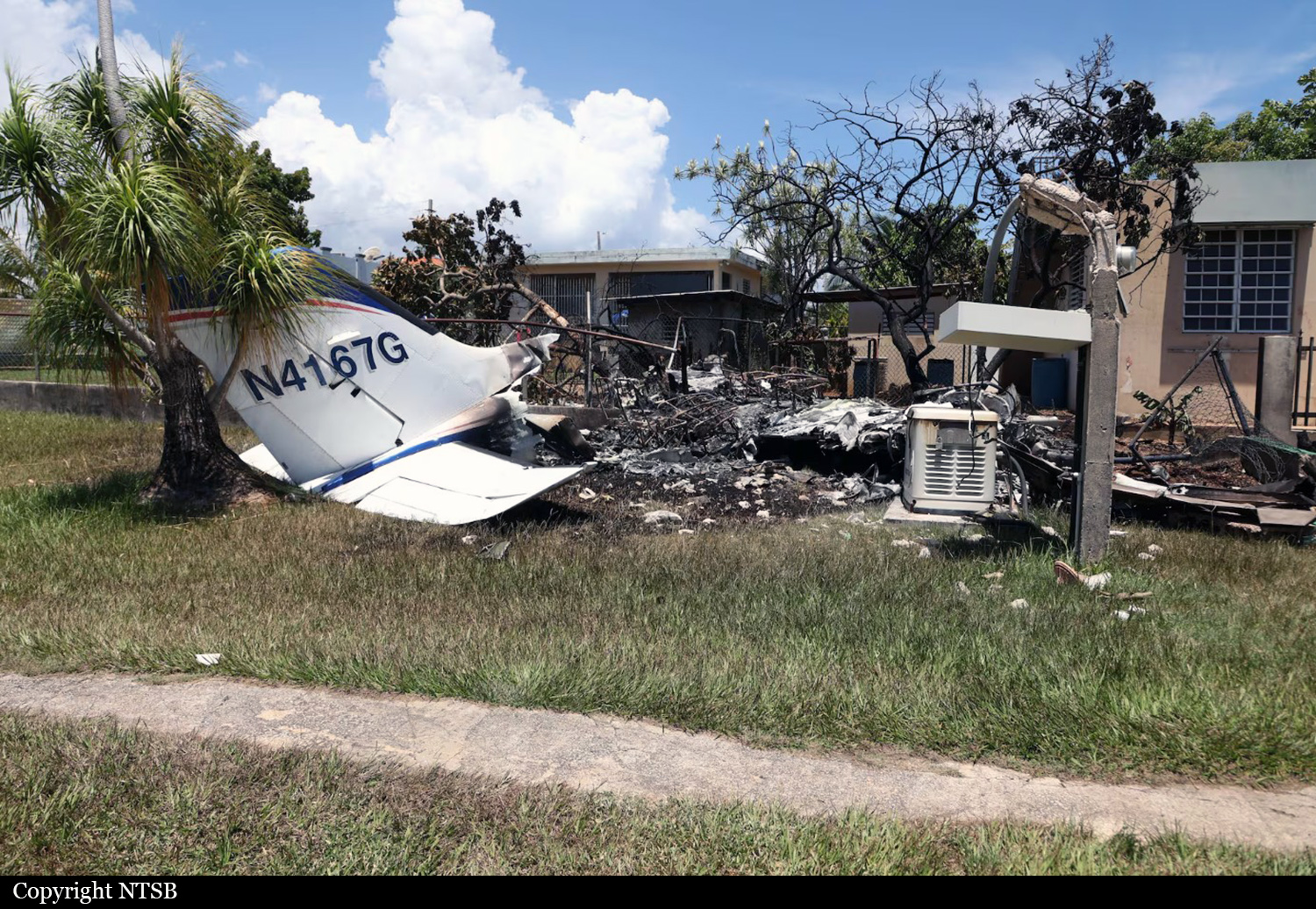
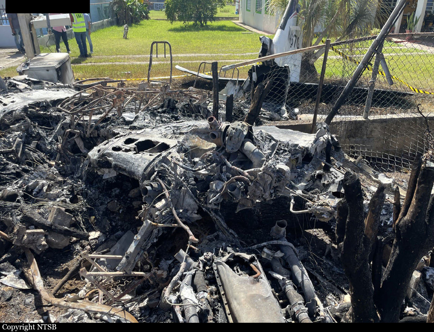
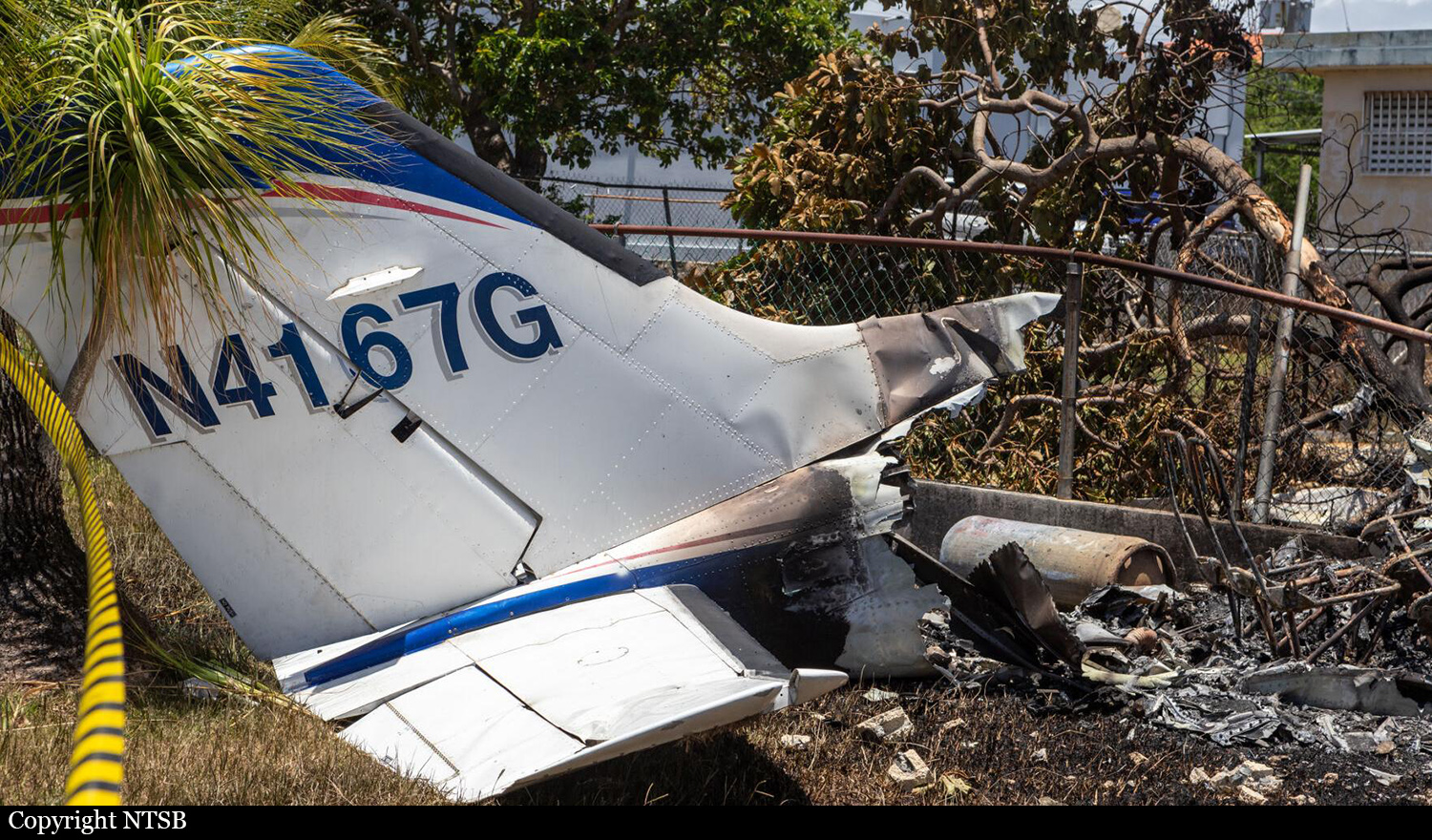
N4167G
Flight Phase:
Flight Type:
Survivors:
No
Site:
Schedule:
Aguadilla - San Juan
MSN:
402B-1214
YOM:
1976
Country:
Crew on board:
1
Crew fatalities:
Pax on board:
0
Pax fatalities:
Other fatalities:
Total fatalities:
1
Captain / Total flying hours:
1200
Aircraft flight hours:
12175
Circumstances:
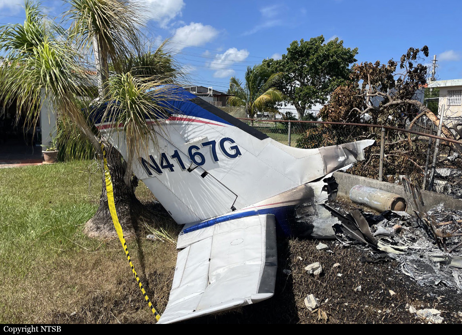
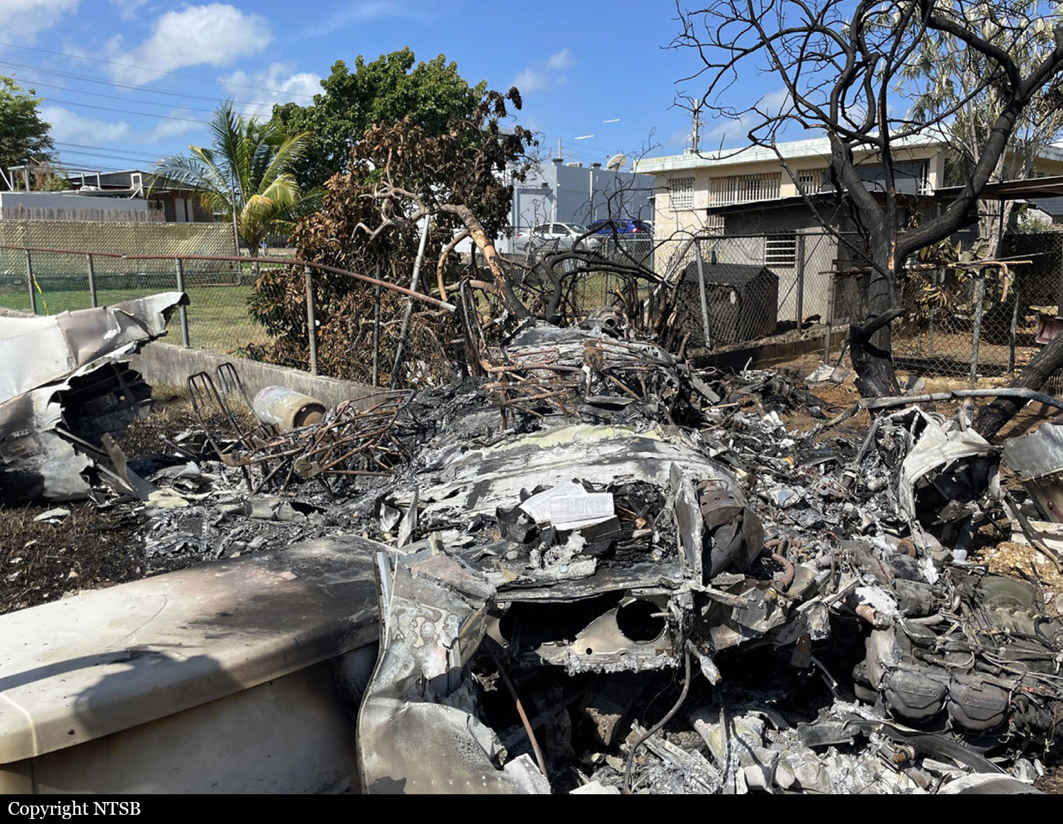
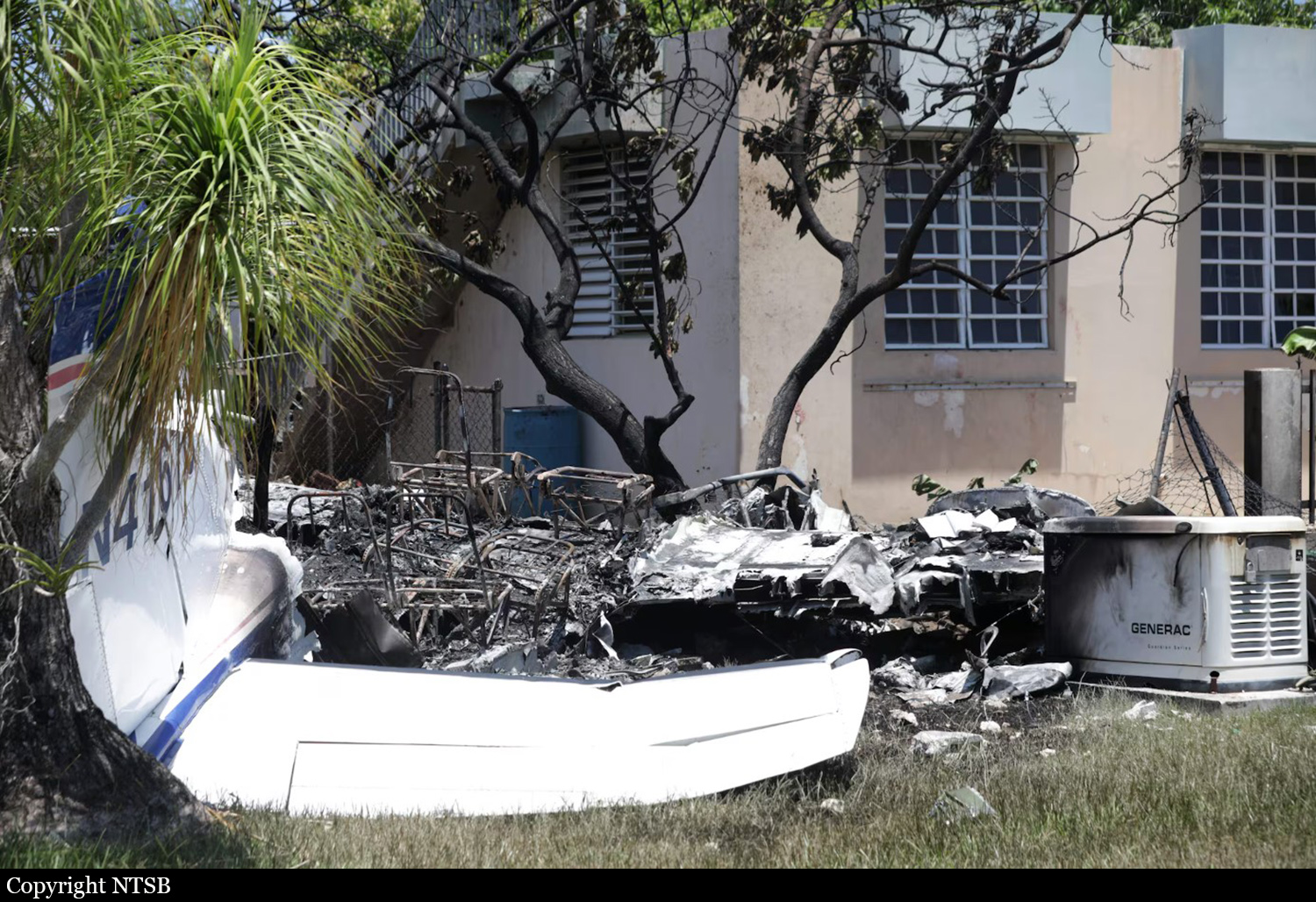
About 3 months before the accident, the twin-engine airplane underwent an annual maintenance inspection during which the mechanic identified numerous discrepancies with both engines and the airframe. The airplane was not subsequently approved for flight and the owner was provided a list of the discrepancies. The purpose of the accident flight was to relocate the airplane to another airport where the pilot planned to have the discrepancies addressed. The mechanic reported that he had advised the pilot that he needed to apply for a ferry permit from the FAA in order to complete the accident flight, but there was no evidence that the pilot had obtained one. On the day of the accident flight, air traffic control data showed that the pilot departed and climbed the airplane to about 1,500 ft mean sea level (msl). About 2 miles from the departure airport the pilot advised air traffic control of his intent to return to the departure runway due to a vibration of the right engine. The controller immediately cleared the pilot to enter the left downwind for the departure runway. The airplane then turned to the left and began a descent toward the left downwind leg of the traffic pattern. When the airplane was about a mile from the airport, the pilot reported that the airplane had an “engine failure” and that he intended to land on the departure runway, but in the opposite direction. Recorded flight track data showed that the airplane then turned directly toward the approach end of that runway and that during the final 30 seconds of track data, the airplane’s altitude and groundspeed decreased rapidly. Surveillance video captured the final few seconds of flight, and showed the airplane in a steep vertical descent and a right roll. The airplane impacted a residential area into trees, powerlines, and propane fuel tanks. After the impact, the airplane sustained significant postimpact fire damage. The airplane was destroyed and the pilot was killed. One person on the ground was slightly injured.
Probable cause:
The pilot’s decision to operate the airplane with known maintenance discrepancies, which resulted in a total loss of right engine power. Contributing to the outcome was the pilot’s failure to maintain airspeed while returning to the airport with a single operating engine, which resulted in a loss of airplane control.
Final Report:

Crash of a Piper PA-46-310P Malibu near Trout Creek: 5 killed

Date & Time: Jun 30, 2024 at 1355 LT
Operator:
Registration:
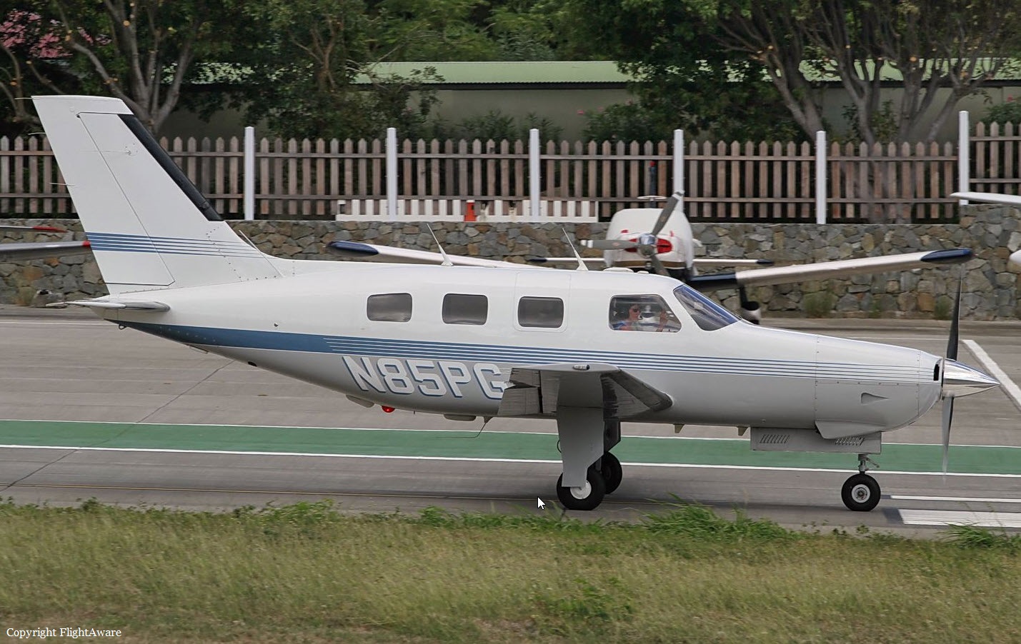
N85PG
Flight Phase:
Flight Type:
Survivors:
No
Schedule:
Oneonta - Charleston
MSN:
46-8508066
YOM:
1985
Crew on board:
1
Crew fatalities:
Pax on board:
4
Pax fatalities:
Other fatalities:
Total fatalities:
5
Captain / Total flying hours:
1460
Aircraft flight hours:
6024
Circumstances:
The pilot filed an instrument flight rules (IFR) flight plan from the departure airport with an estimated time en route of 2 hours 47 minutes and a cruising altitude of 12,000 ft mean sea level (msl). The flight planning application the pilot used to file the flight plan provided weather briefing information, which included a convective SIGMET active for the time and route of flight and pilot weather reports (PIREPs) for turbulence and moderate chop; however, it could not be determined whether the pilot reviewed this information. The flight departed about 45 minutes after the pilot’s filed departure time. Flight track data and air traffic control communications showed that, about 1 minute after departing, the pilot contacted air traffic control (ATC) to obtain an IFR clearance. The controller cleared the pilot to his destination as filed, issued a climb to 10,000 ft msl, and provided a weather advisory for moderate and heavy precipitation along the route, which the pilot acknowledged. About 4 minutes later, the controller issued the pilot a climb to 12,000 ft msl, which the pilot acknowledged. About that time, the controller began a position relief briefing with a relieving controller, which took about 2 minutes. About 2 minutes later, the new controller queried the pilot after observing that the flight had deviated left of course. The flight track data showed that, just before the query from the controller, the airplane deviated from its southwesterly ground track and began a 45-second, right 270° turn starting at an altitude of 9,800 ft msl. While in the turn, the airplane descended to an altitude of 8,700 ft msl before climbing back to an altitude of 9,800 ft msl when the airplane rolled out on an easterly ground track. About 1 minute after the query from the controller, the pilot responded, stating he had “lost” something, followed by a similar transmission 27 seconds later. This was the last transmission heard that could be attributed to the accident airplane. The airplane continued on a wavering east track for about 40 seconds, descending back down to 8,700 ft msl before climbing to 9,025 ft msl, after which the airplane entered a tight, right, descending spiral until track data was lost. The airplane crashed in a dense wooded area located in Trout Creek and was totally destroyed. All five occupants were killed.
Probable cause:
The pilot’s loss of airplane control in flight due to spatial disorientation during a climb to cruise altitude in instrument meteorological conditions and turbulence, which resulted in the in-flight breakup of the airplane. Contributing to the accident was the pilot’s continued flight into an area of known convective activity.
Final Report: