Crash of a Piper PA-46-310P Malibu near Trout Creek: 5 killed
Date & Time:
Jun 30, 2024 at 1355 LT
Registration:
N85PG
Survivors:
No
Schedule:
Oneonta - Charleston
MSN:
46-8508066
YOM:
1985
Crew on board:
1
Crew fatalities:
Pax on board:
4
Pax fatalities:
Other fatalities:
Total fatalities:
5
Aircraft flight hours:
6024
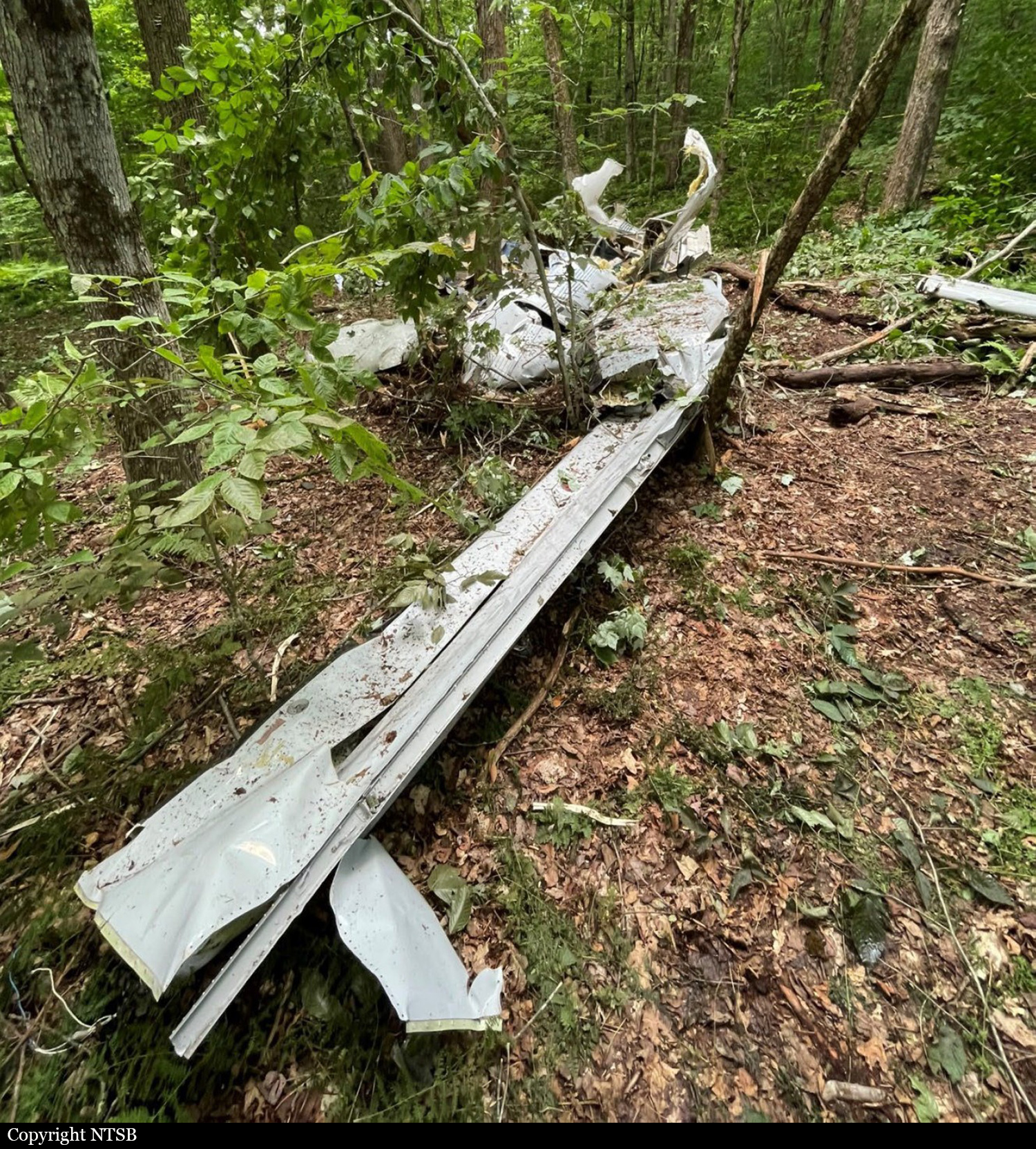
Circumstances:
The pilot filed an instrument flight rules (IFR) flight plan from the departure airport with an estimated time en route of 2 hours 47 minutes and a cruising altitude of 12,000 ft mean sea level (msl). The flight planning application the pilot used to file the flight plan provided weather briefing information, which included a convective SIGMET active for the time and route of flight and pilot weather reports (PIREPs) for turbulence and moderate chop; however, it could not be determined whether the pilot reviewed this information. The flight departed about 45 minutes after the pilot’s filed departure time. Flight track data and air traffic control communications showed that, about 1 minute after departing, the pilot contacted air traffic control (ATC) to obtain an IFR clearance. The controller cleared the pilot to his destination as filed, issued a climb to 10,000 ft msl, and provided a weather advisory for moderate and heavy precipitation along the route, which the pilot acknowledged. About 4 minutes later, the controller issued the pilot a climb to 12,000 ft msl, which the pilot acknowledged. About that time, the controller began a position relief briefing with a relieving controller, which took about 2 minutes. About 2 minutes later, the new controller queried the pilot after observing that the flight had deviated left of course. The flight track data showed that, just before the query from the controller, the airplane deviated from its southwesterly ground track and began a 45-second, right 270° turn starting at an altitude of 9,800 ft msl. While in the turn, the airplane descended to an altitude of 8,700 ft msl before climbing back to an altitude of 9,800 ft msl when the airplane rolled out on an easterly ground track. About 1 minute after the query from the controller, the pilot responded, stating he had “lost” something, followed by a similar transmission 27 seconds later. This was the last transmission heard that could be attributed to the accident airplane. The airplane continued on a wavering east track for about 40 seconds, descending back down to 8,700 ft msl before climbing to 9,025 ft msl, after which the airplane entered a tight, right, descending spiral until track data was lost. The airplane crashed in a dense wooded area located in Trout Creek and was totally destroyed. All five occupants were killed.
Probable cause:
The pilot’s loss of airplane control in flight due to spatial disorientation during a climb to cruise altitude in instrument meteorological conditions and turbulence, which resulted in the in-flight breakup of the airplane. Contributing to the accident was the pilot’s continued flight into an area of known convective activity.
Final Report: