Country
Crash of a Viking Air DHC-6 Twin Otter 400 near Kampung Mamontoga: 4 killed
Date & Time:
Sep 18, 2019 at 1100 LT
Operator:

Registration:
PK-CDC
Survivors:
No
Schedule:
Timika - Ilaga
MSN:
950
YOM:
2016
Crew on board:
3
Crew fatalities:
Pax on board:
1
Pax fatalities:
Other fatalities:
Total fatalities:
4
Circumstances:
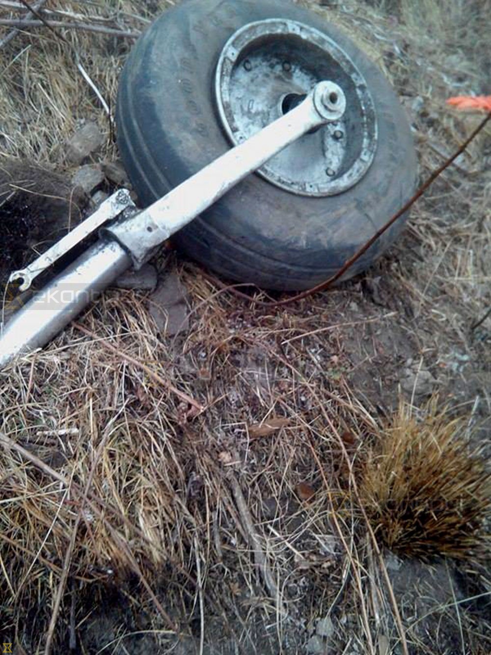
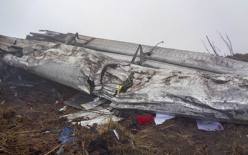
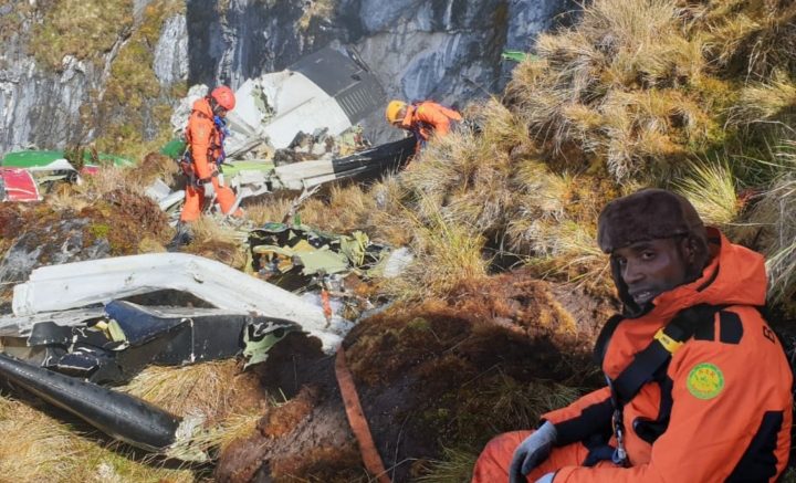
The twin engine airplane departed Timika Airport at 1036LT on a cargo flight to Ilaga, carrying one passenger, a crew of four and a load of 1,7 ton of rice. At 1054LT, the crew gave his ETA at Ilaga Airport when the contact was lost about six minutes later. As the airplane failed to arrive at destination, SAR operations were initiated. The wreckage was found four days later in a mountainous terrain, at an altitude of 4,115 meters, about 10 km from Kampung Mamontoga. The aircraft was totally destroyed and all four occupants were killed.
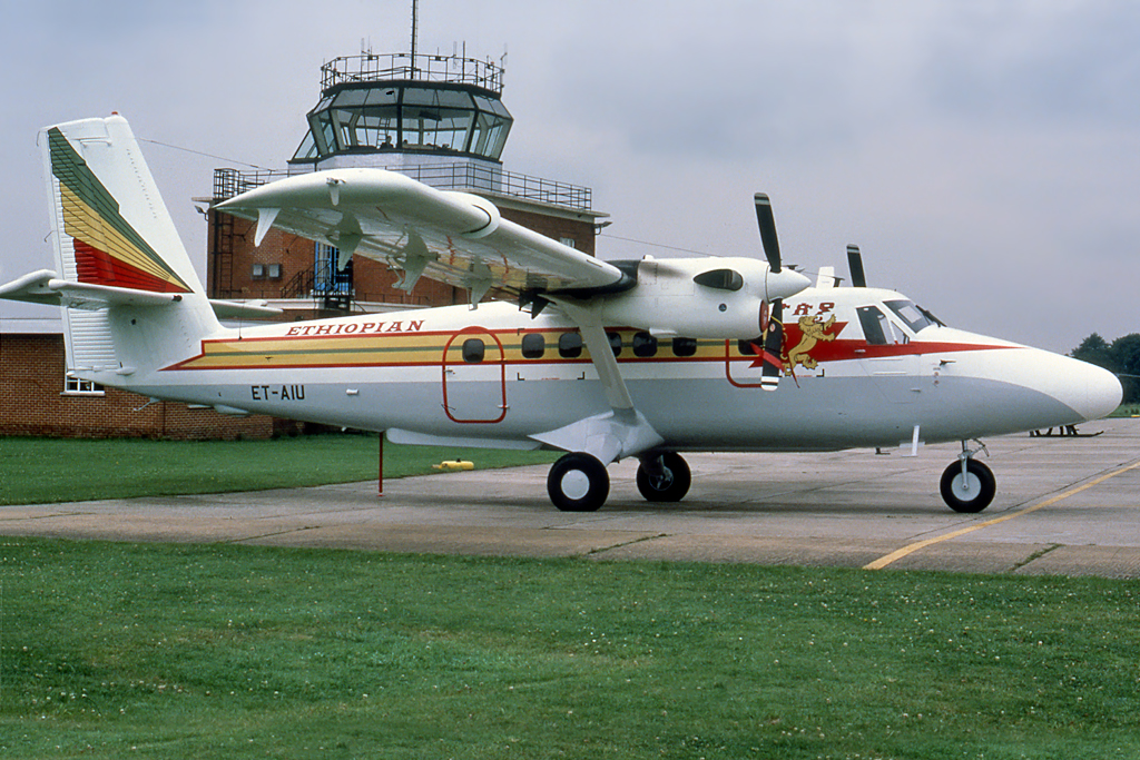
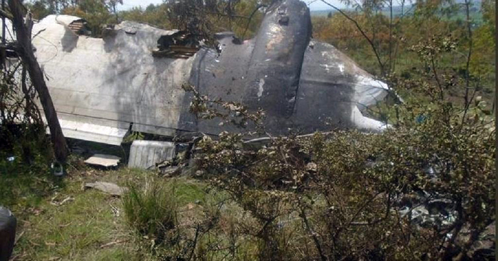
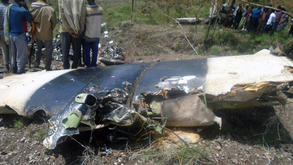
Cras of a De Havilland DHC-6 Twin Otter in Mojo: 18 killed
Date & Time:
Aug 30, 2018 at 1030 LT
Operator:

Registration:
ET-AIU
Survivors:
No
Schedule:
Dire Dawa – Debre Zeit
MSN:
822
YOM:
1985
Crew on board:
3
Crew fatalities:
Pax on board:
15
Pax fatalities:
Other fatalities:
Total fatalities:
18
Circumstances:
The twin engine airplane departed Dire Dawa in the morning on a flight to Harar Meda Airbase located in Debre Zeit, carrying 15 Army officers and three civilians on behalf of the Ethiopian Army. While descending to Harar Meda, the airplane crashed in unknown circumstances in a wooded area located in Mojo, some 17 km southeast of the airfield. The aircraft was totally destroyed and all 18 occupants were killed, among them two children. Operated on behalf of the Ethiopian Army with dual registration ET-AIU/808.

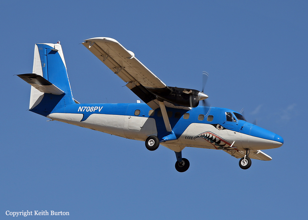
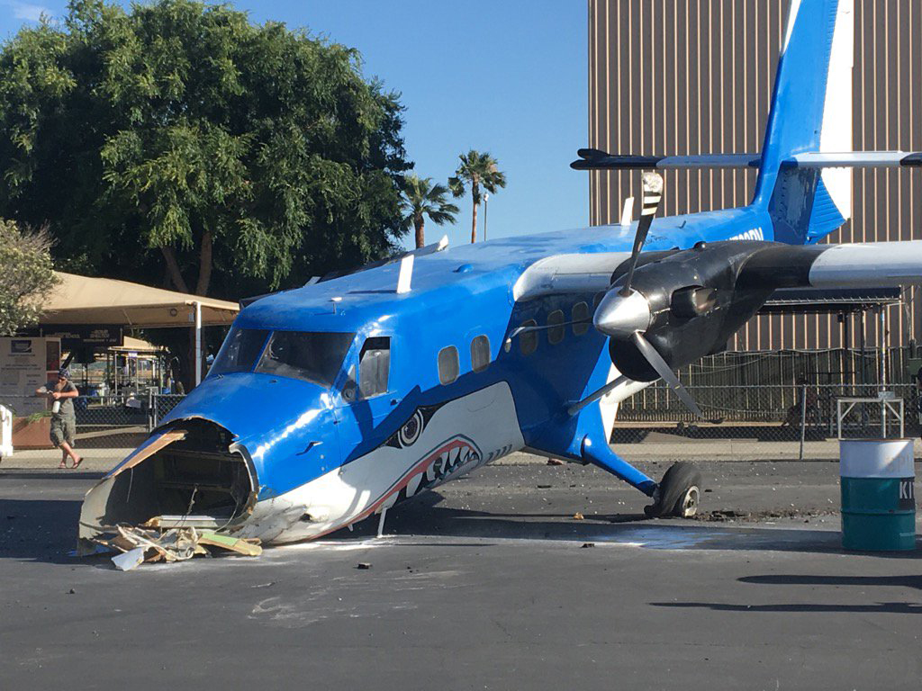
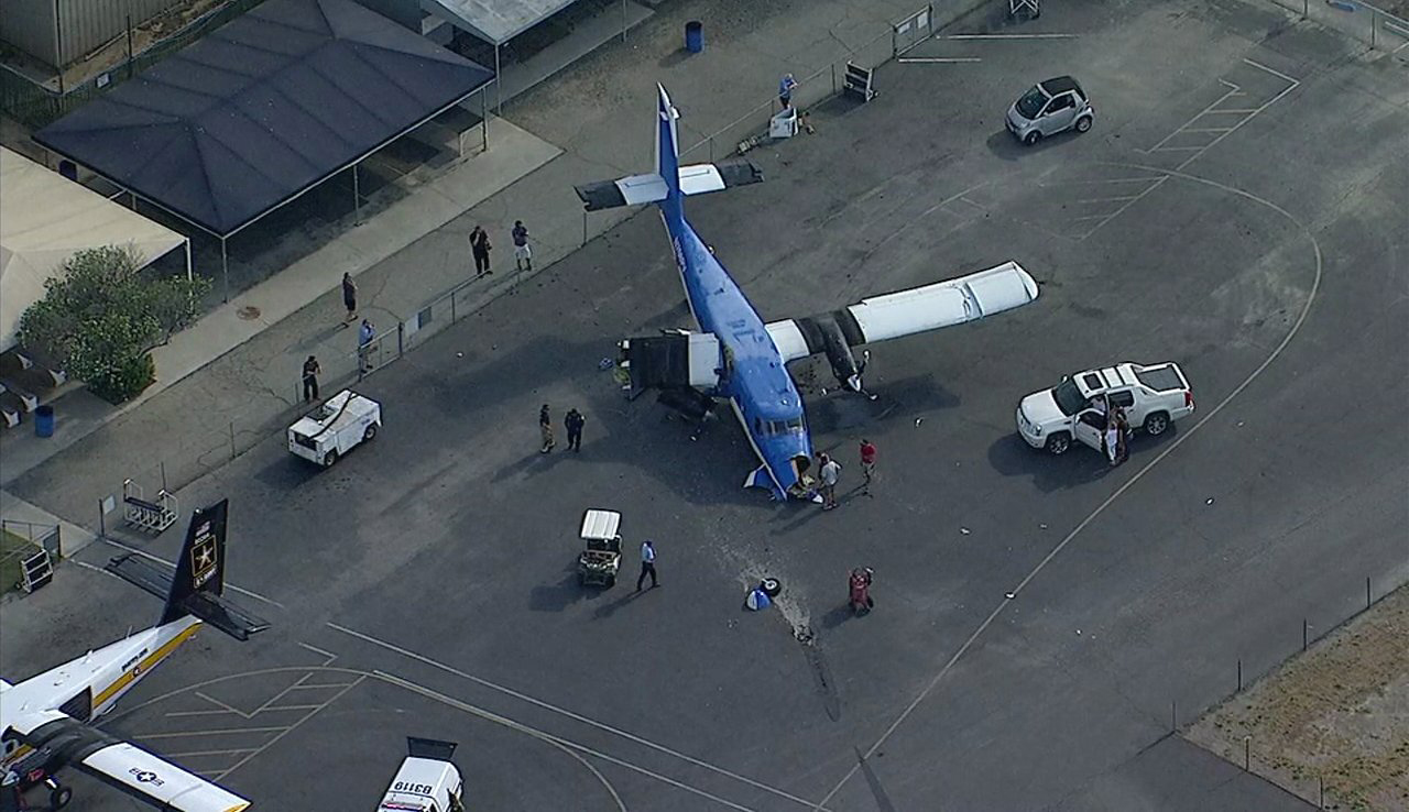
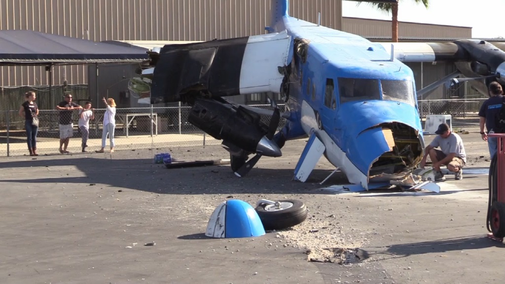
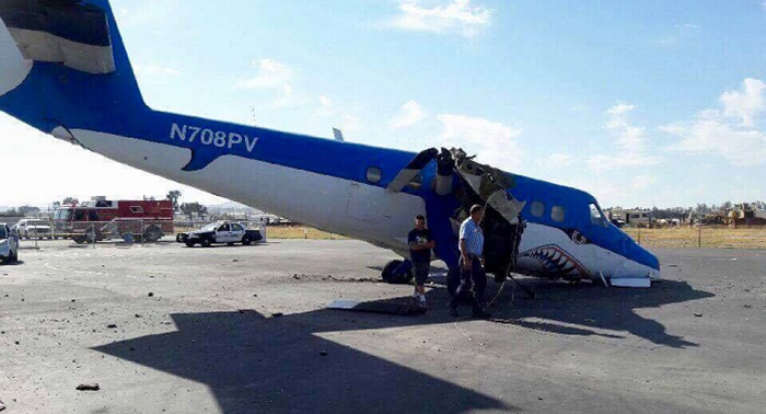
Crash of a De Havilland DHC-6 Twin Otter 300 at Perris Valley
Date & Time:
May 24, 2017 at 1515 LT
Operator:

Registration:
N708PV
Survivors:
Yes
Schedule:
Perris Valley - Perris Valley
MSN:
489
YOM:
1976
Crew on board:
2
Crew fatalities:
Pax on board:
0
Pax fatalities:
Other fatalities:
Total fatalities:
0
Captain / Total hours on type:
2131.00
Copilot / Total hours on type:
12
Aircraft flight hours:
37885
Circumstances:
The pilot of the twin-engine, turbine-powered airplane reported that, while providing flights for skydivers throughout the day, he had a potential new hire pilot flying with him in the right seat. He added that, on the eighth flight of the day, the new pilot was flying during the approach and "approximately 200 feet south from the threshold of [runway] 15 at approximately 15 feet AGL [above ground level] the bottom violently and unexpectedly dropped out. [He] believe[d] some kind of wind shear caused the aircraft [to] slam onto [the] runway and bounce into the air at a 45 to 60-degree bank angle to the right." The prospective pilot then said, "you got it." The pilot took control of the airplane and initiated a go-around by increasing power, which aggravated the "off runway heading." The right wing contacted the ground, the airplane exited the runway to the right and impacted a fuel truck, and the right wing separated from the airplane. The impact caused the pilot to unintentionally add max power, and the airplane, with only the left engine functioning, ground looped to the right, coming to rest nose down.
Probable cause:
The prospective pilot's improper landing flare and the pilot's delayed remedial action to initiate a go-around, which resulted in a runway excursion.
Final Report:
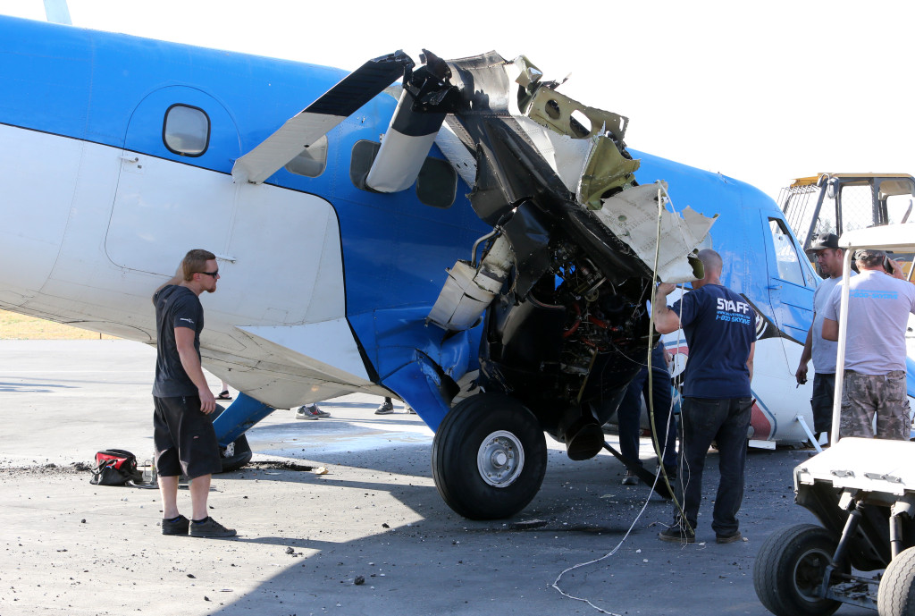
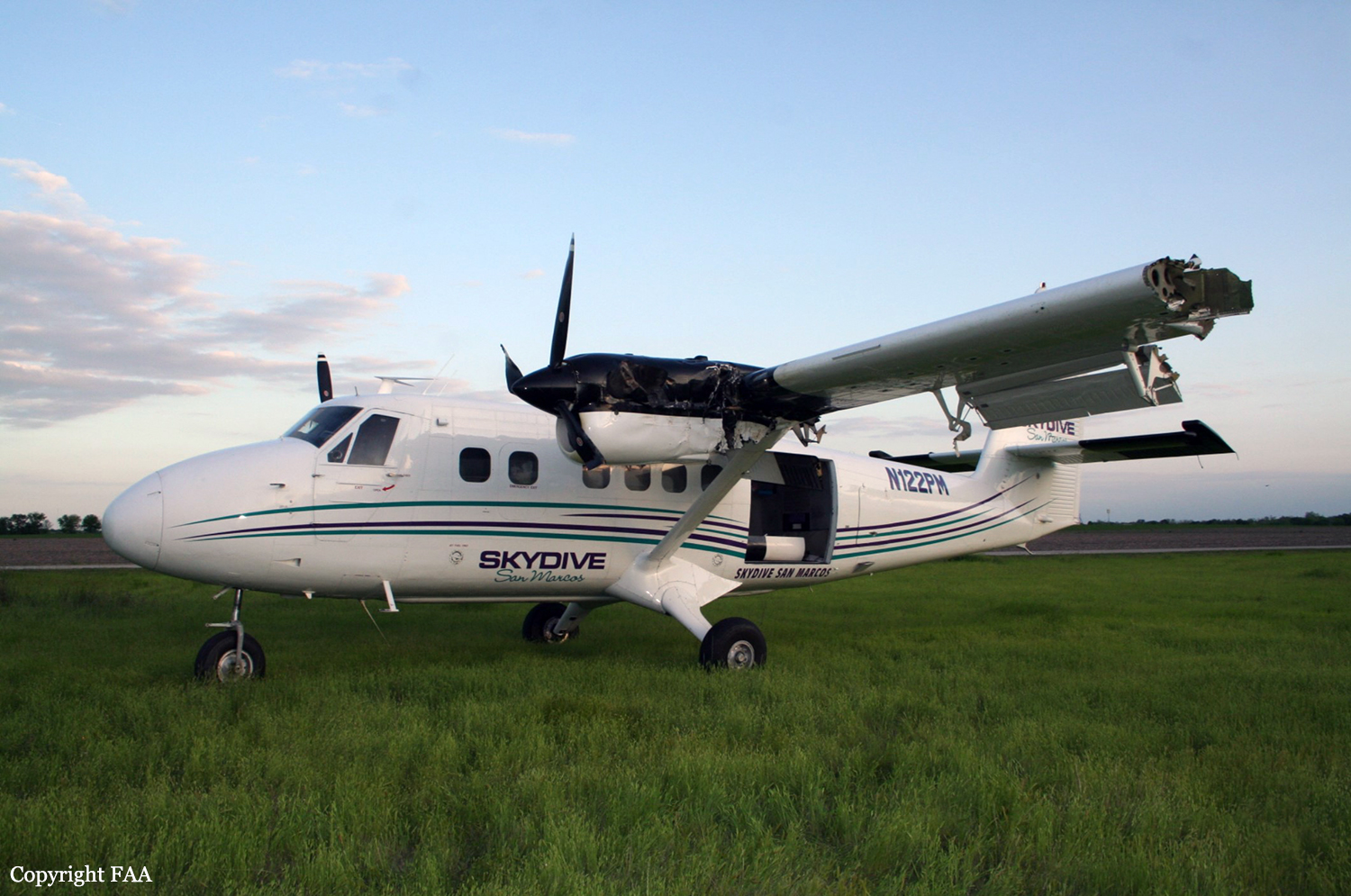
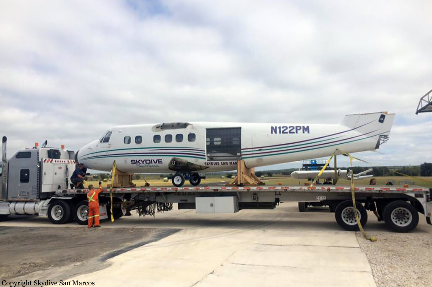
Crash of a De Havilland DHC-6 Twin Otter 100 in Fentress
Date & Time:
Apr 9, 2016 at 1700 LT
Operator:

Registration:
N122PM
Survivors:
Yes
Schedule:
Fentress - Fentress
MSN:
15
YOM:
1966
Crew on board:
2
Crew fatalities:
Pax on board:
0
Pax fatalities:
Other fatalities:
Total fatalities:
0
Captain / Total hours on type:
1000.00
Aircraft flight hours:
53624
Circumstances:
The pilot reported that he was landing in gusty crosswind conditions following a parachute jump flight, and that the gusty conditions had persisted for the previous 10 skydiving flights that day. The pilot further reported that during the landing roll, when the nose wheel touched down, the airplane became "unstable" and veered to the left. He reported that he applied right rudder and added power to abort the landing, but the airplane departed the runway to the left and the left wing impacted a tree. The airplane spun 180 degrees to the left and came to rest after the impact with the tree. The left wing was substantially damaged. The pilot did not report any mechanical malfunctions or failures with the airplane that would have precluded normal operation.
Probable cause:
The pilot's failure to maintain directional control during the aborted landing in gusty crosswind conditions, which resulted in a runway excursion and a collision with a tree.
Final Report:
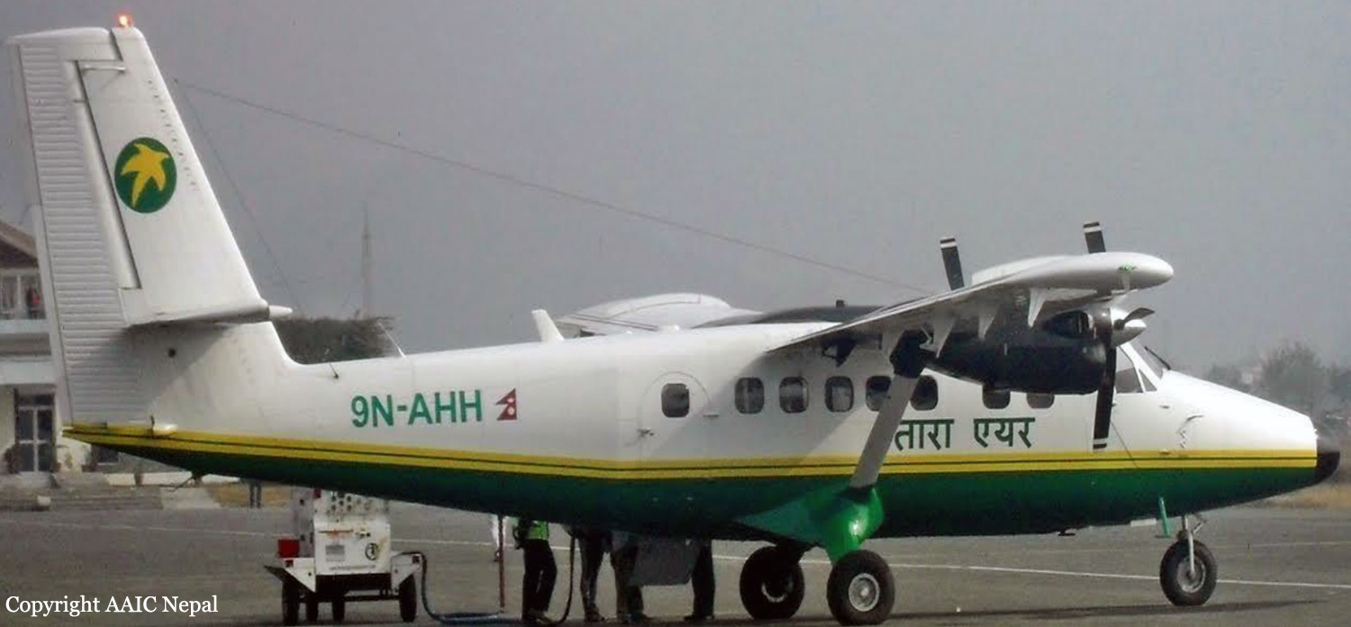
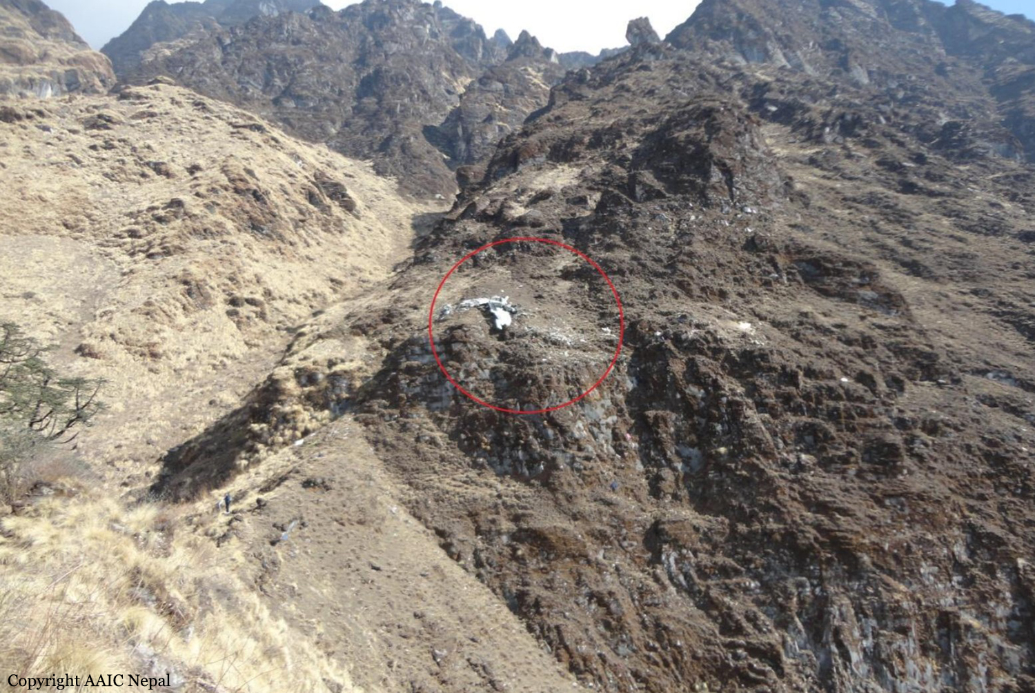
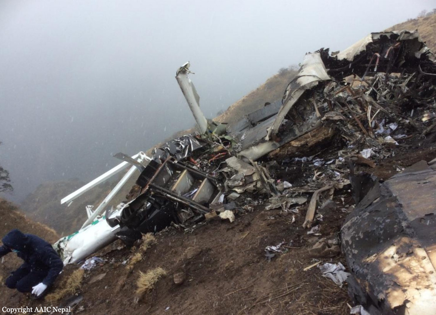
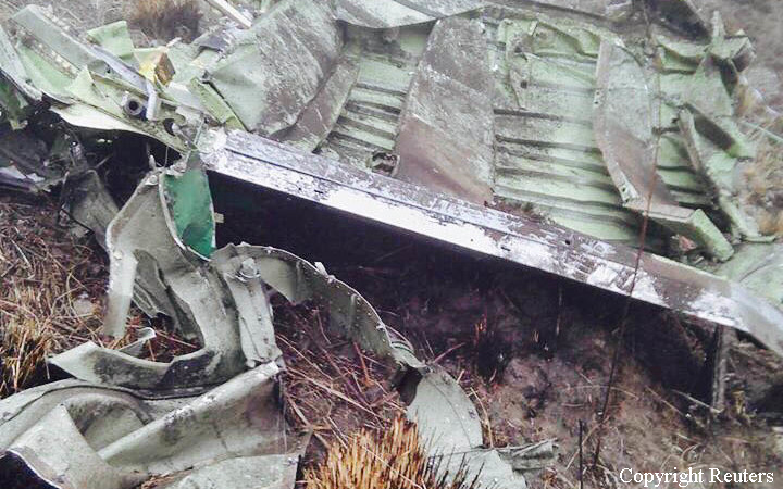
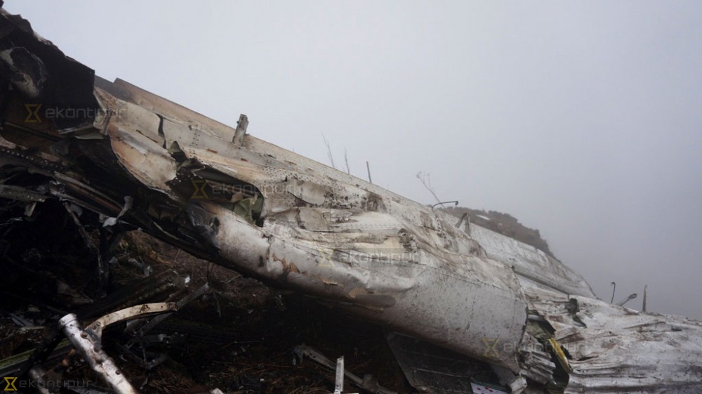
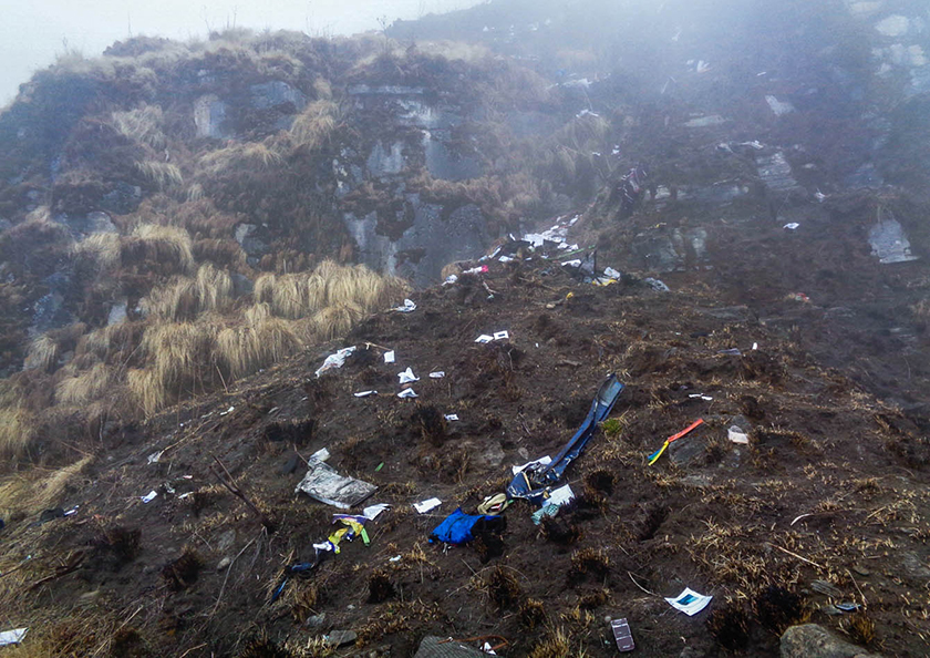
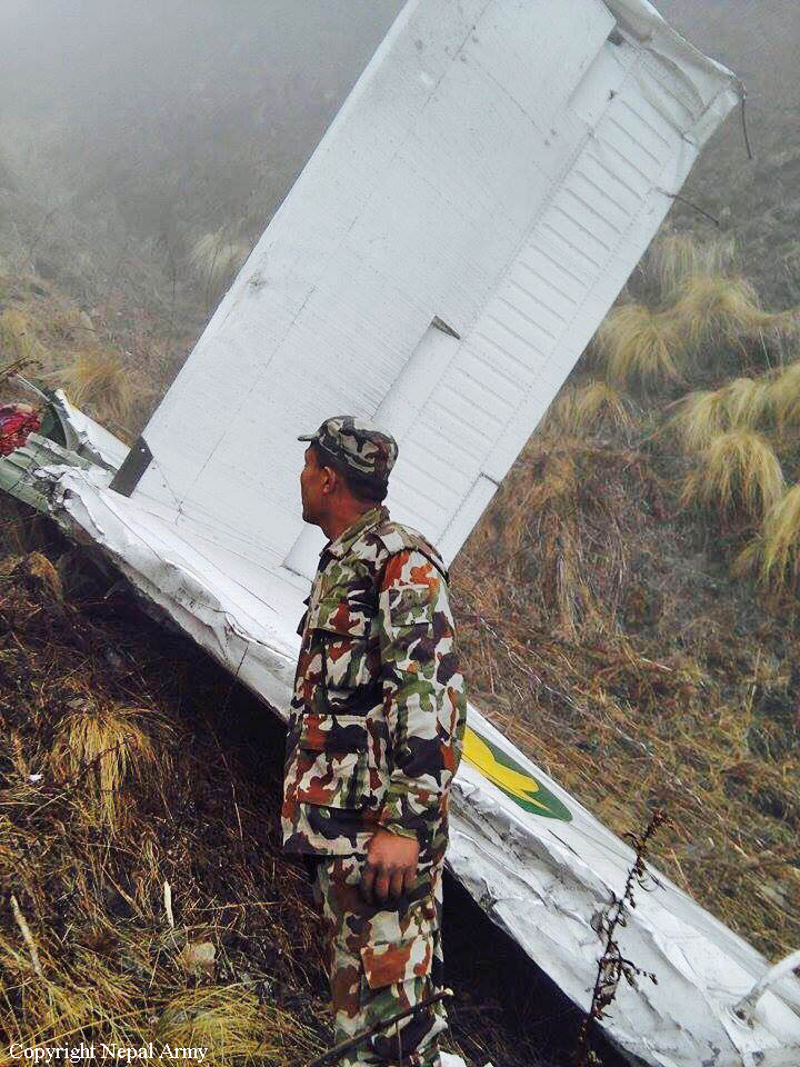
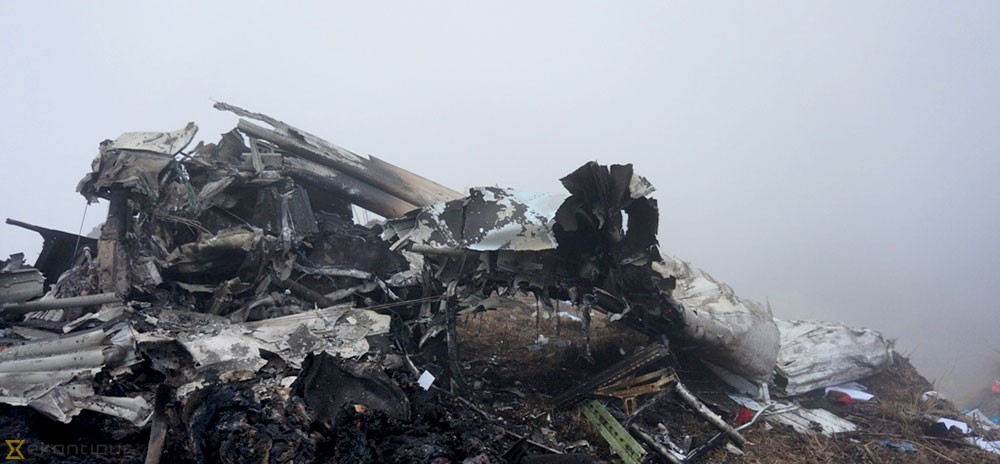
Crash of a Viking Air DHC-6 Twin Otter 400 near Dana: 23 killed
Date & Time:
Feb 24, 2016 at 0819 LT
Operator:

Registration:
9N-AHH
Survivors:
No
Schedule:
Pokhara – Jomsom
MSN:
926
YOM:
2015
Flight number:
TA193
Crew on board:
3
Crew fatalities:
Pax on board:
20
Pax fatalities:
Other fatalities:
Total fatalities:
23
Captain / Total hours on type:
18500.00
Copilot / Total hours on type:
560
Aircraft flight hours:
270
Aircraft flight cycles:
482
Circumstances:
As per the flight plan submitted on 23rd February 2016, the aircraft was scheduled for VFR flight to Jomsom (VNJS) on 24th February with estimated off-block time of 01:00, intended cruising speed of 150 knots, intended level of 10,500 ft and via direct track. The first and second alternate aerodromes were Bhairahawa (VNBW) and Pokhara (VNPK) respectively and estimated elapsed time was 20 minutes with the fuel endurance of 2 hours and 30 minute. Based on the information from the CVR, FDR and ATC records, the following description of the history of the flight was reconstructed: At 01:55, the first-officer contacted Pokhara tower requesting Jomsom and Bhairahawa weather. Upon receiving Jomsom weather which was 8 km visibility towards Lete (arrival track) and foothill partially visible; at 01:56 F/O requested start-up for Jomsom. First-officer then briefed the weather to the captain, in response to this the captain responded by saying 'Let‘s have a look, if not possible we will return' (Translated from Nepali conversation). While performing the 'before start checklist', they received weather of Bhairahawa as closed. After completing the checklist and start-up the first-officer at 02:00 requested taxi clearance. The ATC informed runway change to 22 instead of runway 04 and gave taxi clearance. At 02:03 while taxiing the captain considering bad weather condition expressed his concern over the runway change with F/O but failed to express it to the ATC. As briefed by captain earlier, the control was transferred to F/O and at 02:04 F/O made a normal take-off. At 02:08 the captain reported 5 miles at 6,200 ft to ATC. At 02:09, while passing through 7,000 ft the captain informed the actual weather, which was light haze, mountain not visible but had ground contact, to an ultra-light aircraft upon his request. As per the cockpit conversation, the crew were comparing the base of the cloud which was higher than the day before and proposed to continue climb to 12,500 ft if not on-top of the cloud at 10,500 ft. Around 5 miles before Ghorepani passing 10,100 ft, the captain told that cells were still present so advised F/O to continue climb to 12,000 ft and told that they will proceed till TATOPANI and decide to continue or divert. At 02:14 approaching GHOREPANI and passing 11,400 ft, Captain told F/O to maintain level to be in between the cloud layers and briefed F/O that if they had to divert it would be a left turn. At the same time captain asked repeatedly to F/O if his side was raining for which F/O told and confirmed not visual, after which captain told they would see and decide (regarding continuation of flight). At 02:14:50 while over Ghorepani area at 11,500 ft the EGPWS TERRAIN alert and at 02:14:52 PULL UP warning came while they were not visual and at 02:15:01 it was stated that they were visual and by 02:14:53 the warning stopped. At 02:15 while maintaining 11,500 ft the captain reported ATC that they are at Ghorepani at level 10,500 ft after which frequency changeover to Jomsom tower was given. At 02:15:27 the captain instructed F/O to maintain heading of 3300 and flight level just below the cloud, after which a shallow descent was initiated. At this time captain asked F/O if his side was visual, in response F/O replied somewhat visual. The Captain then instructed F/O to descent to 10,000 ft. Once the descent was started at 02:15:55 passing 11,000 ft an OVERSPEED warning sounded in the cockpit for 2 seconds as the speed reached 152 knots. At 02:16 while passing 10,700 ft captain advised F/O to make a left turn so that it would be easy to turn if required as he was able to see his side. Then F/O asked if left side was visual for which the captain informed that not that side (towards the track) but somewhat visual to the left of him and told that the TRACK TO GO was TO THE LEFT whereas they were actually left of the track and had descended to 10,300 ft. At 02:17:58 EGPWS TERRAIN alert sounded when the aircraft was at 10,200 ft and descending on heading of 3210 with right bank angle of around 30 . At 02:18:06 when the aircraft had descended to 10,100 ft the PULL UP WARNING sounded for which the captain said not to worry and at 02:18:12; when the aircraft was at 10,000 ft the captain took-over the control, continued descent and asked F/O if his side was visual. The F/O informed that right side was not visual at all by which the aircraft had continued shallow descent on heading 3250 with right bank angle reaching up to 130 at 2:18:19 and by 02:18:23 the aircraft once again returned back to 0° bank angle. At 02:18:23 the captain started left bank followed by right bank again while still on a shallow descent until 02:18:27.Upon reaching 9,850 ft (lowest altitude) the aircraft started very shallow climb. At 02:18:35 when aircraft was 9,920 ft the captain told F/O that they reached Landslide (a checkpoint which is on track to Jomsom on the right side of the Kali-Gandaki River). At 02:18:44 when aircraft reached 10,150 ft captain told ―what I will do is now I will turn to heading of LETTE‖ (another way point on route to Jomsom); while the PULL-UP warning was continuously sounding. At 02:18:49 when the aircraft was at 10,300 ft right bank angle increased up to 16° with pitch up attitude of 7°. At 02:18:52 the captain told that he would start climb when the aircraft had reached 10,350 ft; pitch attitude of 10° and still on right bank. The aircraft reached zero degree bank at 02:18:53 and started shallow left bank with pitch attitude of 12° nose up. By 02:18:57 the bank angle reached 200 left with pitch attitude of 11.8 and altitude of 10,550 ft and captain was still questioning F/O about the visibility towards his side but F/O informed his side not visible completely. The last data recorded in FDR was at 02:19:03 when the altitude had reached around 10,700 ft; pitch attitude of 7° nose up and left bank angle of 25° heading of 335° with EGPWS PULL-UP warning ON.
Probable cause:
The Commission concludes that the probable cause of this accident was the fact that despite of unfavourable weather conditions, the crew‘s repeated decision to enter into cloud during VFR flight and their deviation from the normal track due to loss of situational awareness aggravated by spatial disorientation leading to CFIT accident.
The contributing factors for the accident are:
1. Loss of situational awareness,
2. Deteriorating condition of weather,
3. Skill base error of the crew during critical phases of flight,
4. Failure to utilize all available resources (CRM), especially insensitivity to EGPWS cautions/warnings.
The contributing factors for the accident are:
1. Loss of situational awareness,
2. Deteriorating condition of weather,
3. Skill base error of the crew during critical phases of flight,
4. Failure to utilize all available resources (CRM), especially insensitivity to EGPWS cautions/warnings.
Final Report: