Country
code
AK
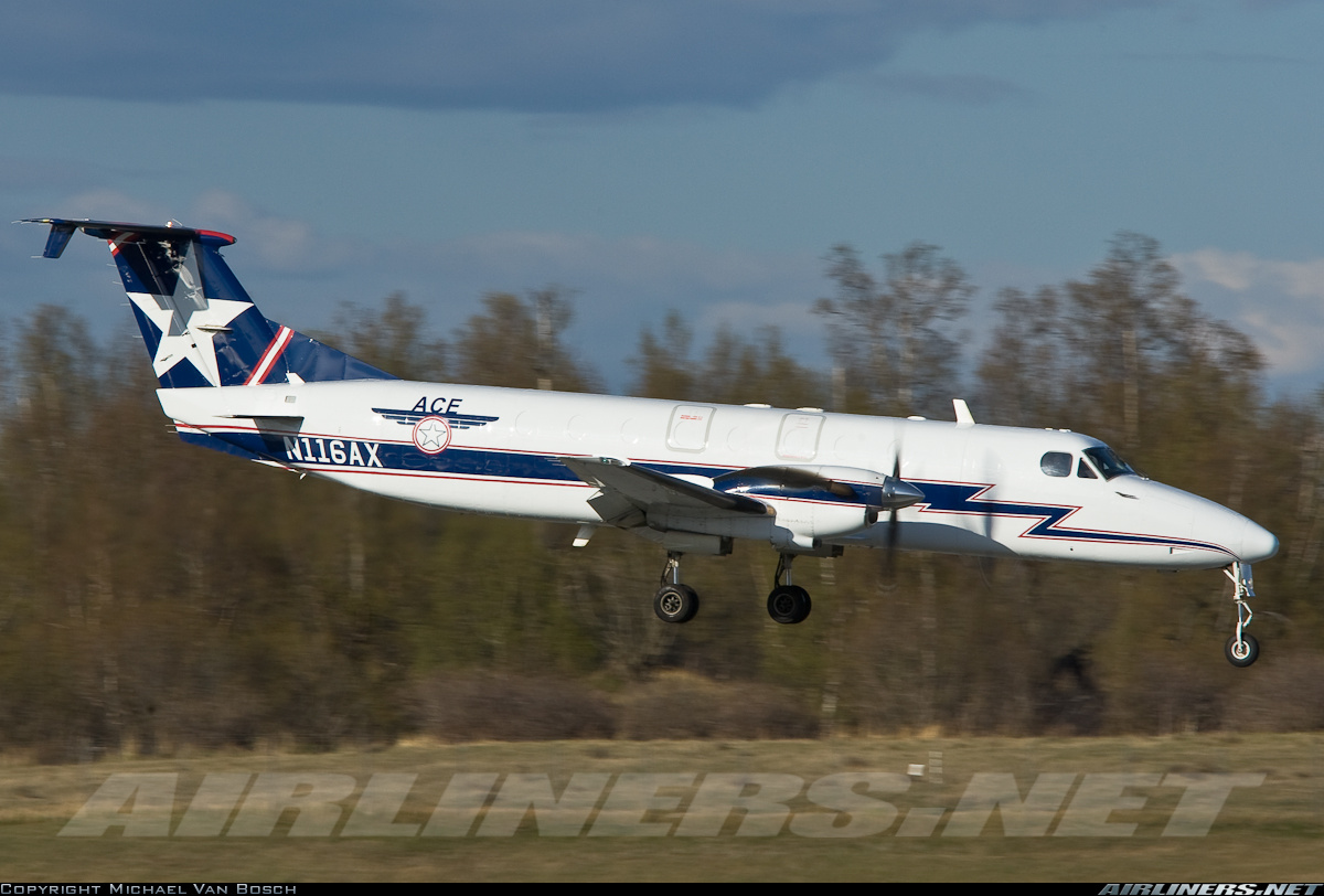
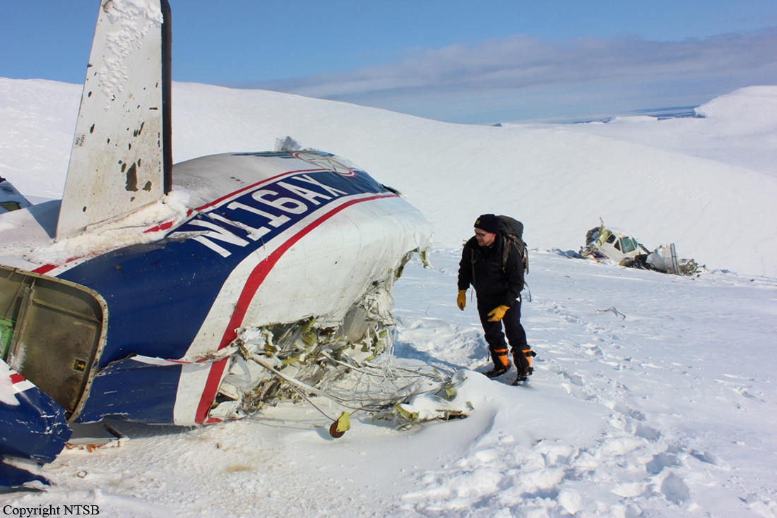
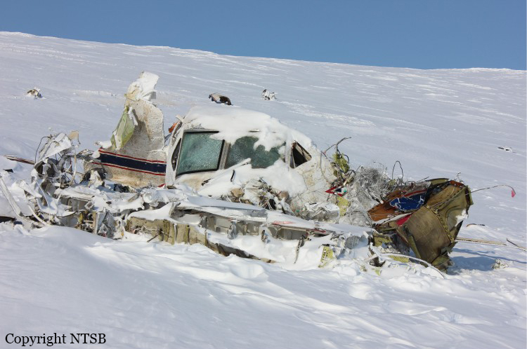
Crash of a Beechcraft 1900C-1 near Dillingham: 2 killed
Date & Time:
Mar 8, 2013 at 0815 LT
Operator:

Registration:
N116AX
Survivors:
No
Schedule:
King Salmon - Dillingham
MSN:
UC-17
YOM:
1988
Flight number:
AER51
Crew on board:
2
Crew fatalities:
Pax on board:
0
Pax fatalities:
Other fatalities:
Total fatalities:
2
Captain / Total hours on type:
5470.00
Copilot / Total hours on type:
250
Aircraft flight hours:
29827
Circumstances:
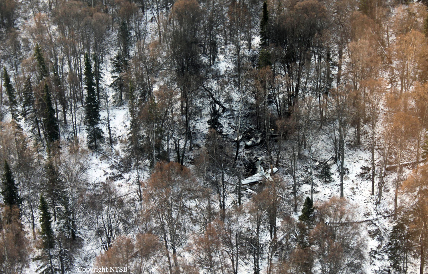
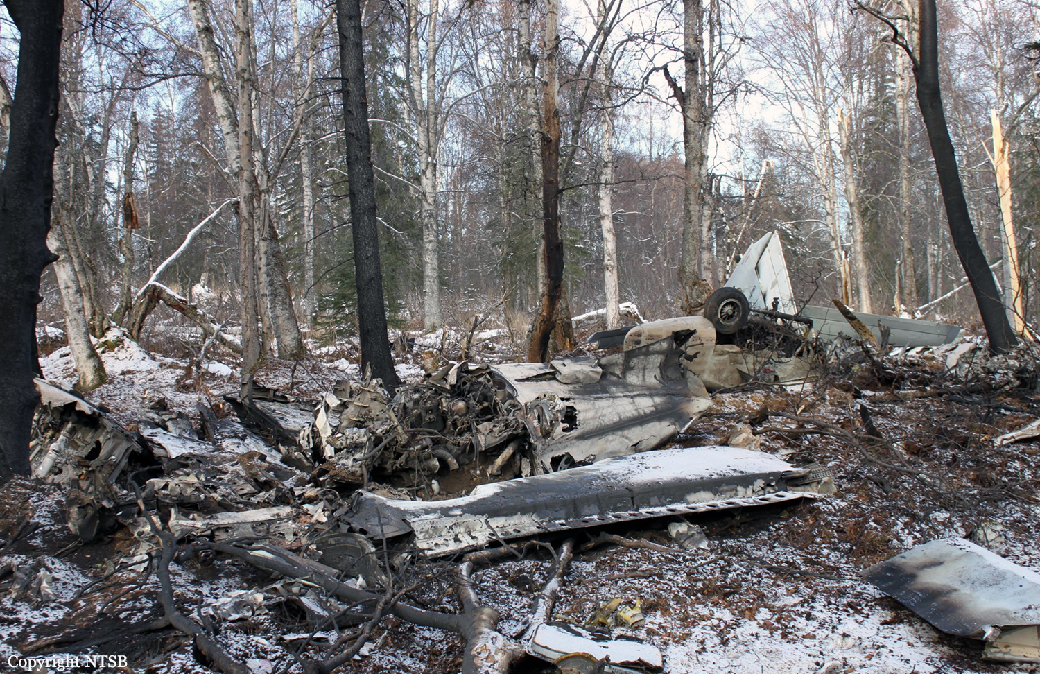
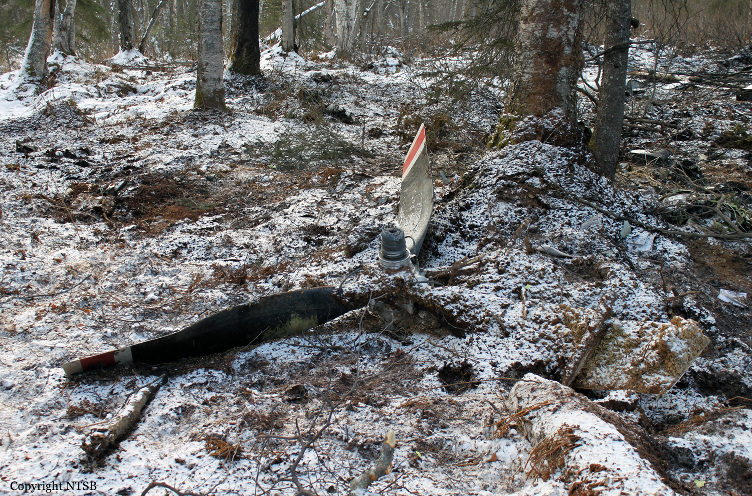
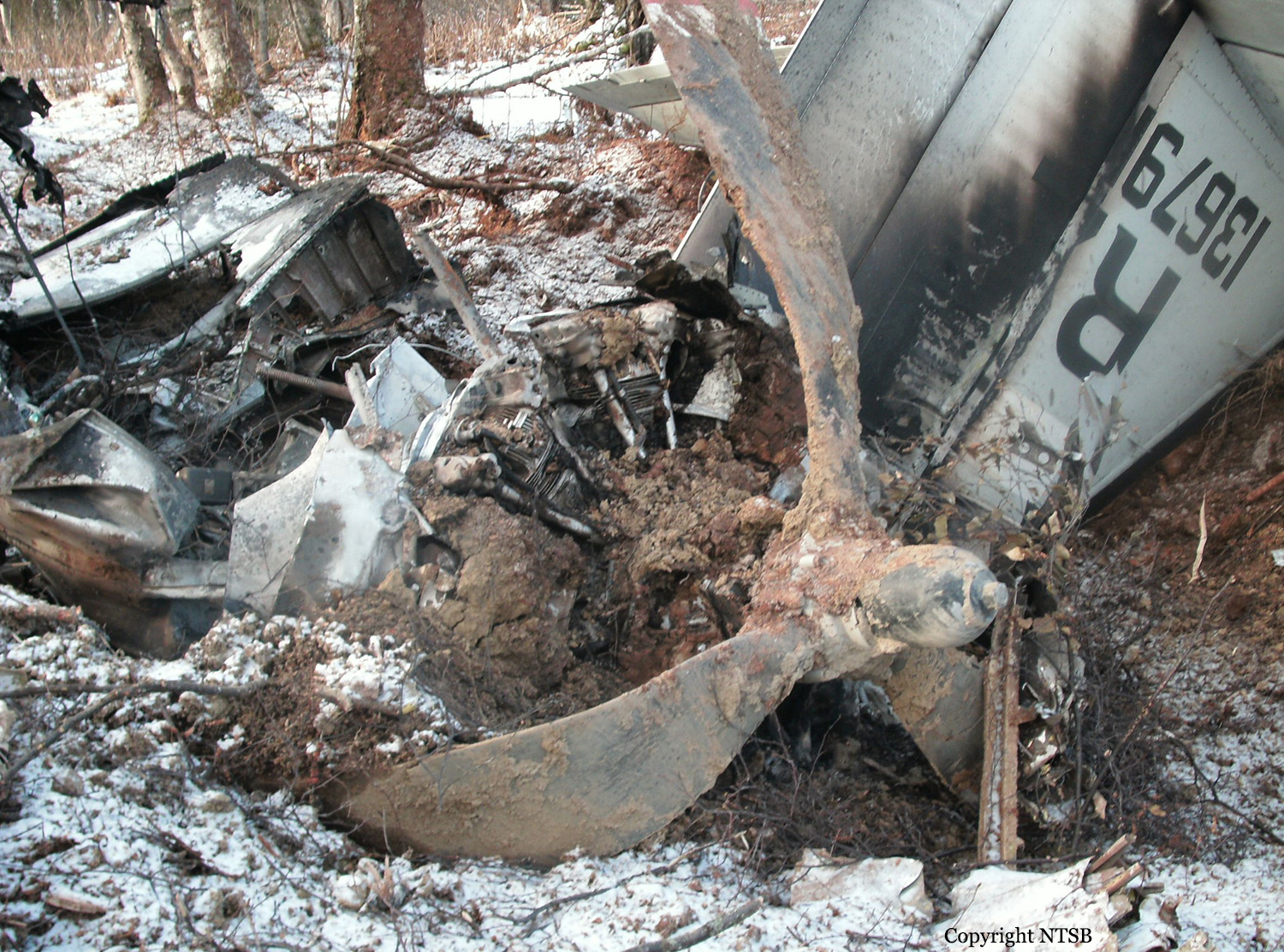
Aircraft was destroyed when it impacted rising terrain about 10 miles east of Aleknagik, Alaska. The airplane was operated as Flight 51, by Alaska Central Express, Inc., Anchorage, Alaska, as an on demand cargo flight under the provisions of 14 Code of Federal Regulations (CFR) Part 135. The airline transport certificated captain and the commercial certificated first officer sustained fatal injuries. Instrument meteorological conditions were reported in the area at the time of the accident, and the airplane was operating on an instrument flight rules (IFR) flight plan. The flight had originally departed Anchorage about 0544, and made a scheduled stop at King Salmon, Alaska, before continuing on to the next scheduled stop, Dillingham, Alaska. According to Federal Aviation Administration (FAA) personnel, as the airplane approached Dillingham, the flight crew requested the RNAV GPS 19 instrument approach to the Dillingham Airport about 0757 from controllers at the Anchorage Air Route Traffic Control Center (ARTCC). The ARTCC specialist on duty subsequently granted the request by issuing the clearance, with instructions to proceed direct to the Initial Approach Fix (IAF) to begin the approach, and to maintain an altitude of 2,000 feet or above. A short time later the flight crew requested to enter a holding pattern at the IAF so that they could contact the Flight Service Station (FSS) for a runway conditions report, and the ARTCC specialist granted that request. The ARTCC specialist then made several attempts to contact the aircraft, but was unsuccessful and subsequently lost radar track on the aircraft. When the airplane failed to arrive at the Dillingham Airport, ARTCC personnel initiated a radio search to see if the airplane had diverted to another airport. Unable to locate the airplane, the FAA issued an alert notice (ALNOT) at 0835. Search personnel from the Alaska State Troopers, Alaska Air National Guard, and the U.S. Coast Guard, along with several volunteer pilots, were dispatched to conduct an extensive search effort. Rescue personnel aboard an Air National Guard C-130 airplane tracked 406 MHz emergency locater transmitter (ELT) signal to an area of mountainous terrain about 20 miles north of Dillingham, but poor weather prohibited searchers from reaching the site until the next morning. Once the crew of a HH-60G helicopter from the Air National Guard's 210th Air Rescue Squadron, Anchorage, Alaska, reached the steep, snow and ice-covered site, they confirmed that both pilots sustained fatal injuries.
Probable cause:
The flight crew's failure to maintain terrain clearance, which resulted in controlled flight into terrain in instrument meteorological conditions. Contributing to the accident were the flight crew's failure to correctly read back and interpret clearance altitudes issued by the air traffic controller, their failure to adhere to minimum altitudes depicted on the published instrument approach chart, and their failure to adhere to company checklists. Also contributing to the accident were the air traffic controller's issuance of an ambiguous clearance to the flight crew, which resulted in the airplane's premature descent, his failure to address the pilot's incorrect read back of the assigned clearance altitudes, and his failure to monitor the flight and address the altitude violations and issue terrain-based safety alerts.
Final Report:
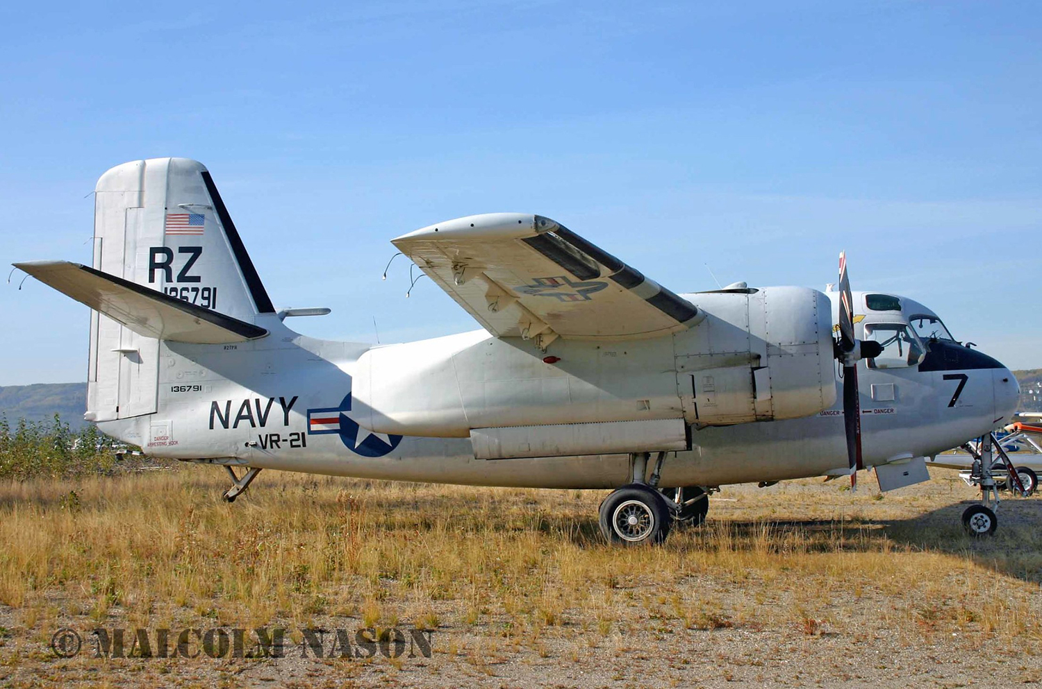
Crash of a Grumman C-1A Trader near Skwentna: 1 killed
Date & Time:
Oct 15, 2012 at 1557 LT
Registration:
N27PH
Survivors:
No
Schedule:
Wasilla – Nixon Fork Mine
MSN:
44
YOM:
1957
Crew on board:
1
Crew fatalities:
Pax on board:
0
Pax fatalities:
Other fatalities:
Total fatalities:
1
Circumstances:
The airplane was destroyed when it collided with tree-covered terrain and incurred a postcrash fire and explosion about 19 miles west of Willow, Alaska. The airline transport rated
pilot, who was the only occupant, was fatally injured. The airplane was registered to Fuel Services, LLC, Anchorage, Alaska, and was being operated as a 14 CFR Part 91 visual flight rules (VFR) cross-country fuel transport flight when the accident occurred. Marginal visual meteorological conditions were reported at the airplane's point of departure. The accident flight originated from the Wasilla Airport, Wasilla, Alaska, about 1520, en route to the Nixon Fork Mine, about 28 miles northeast of McGrath, Alaska. According to the co-owner of the airplane, the purpose of the flight was to transport approximately 900 gallons of diesel fuel to a company owned tank that supplies fuel for a mining operation. When the airplane did not arrive at its destination, the co-owner of the airplane reported it overdue to the Federal Aviation Administration (FAA) at 1757. After being notified of the overdue airplane, personnel from the 11th Air Force's Rescue Coordination Center initiated a search for the missing airplane along its supposed route of flight. On the morning of October 16, an Air National Guard C-130 Hercules was able to locate the wreckage. Rescue personnel aboard a HH-60G helicopter were able to reach the site later that morning, and confirmed the pilot was deceased. Two witnesses reported seeing the airplane fly over their locations. The first witness saw the airplane as it was flying northwest at an altitude that he estimated at 3,000 to 4,000 feet under an overcast layer. He stated that the airplane did not sound "normal," but he did not notice anything unusual, like smoke, trailing the airplane. The second witness stated that he saw the airplane fly over his cabin headed southeast at an estimated altitude of 300 to 400 feet. He stated that the airplane sounded like it was "struggling," but he could not see anything abnormal about the airplanes appearance. Primary radar data taken from the Anchorage Terminal Radar Approach Control Facility (TRACON), shows an unidentified aircraft, believed to be the accident airplane, depart the Wasilla airport about 1522. After departure, the track proceeded to the Northwest with cruising ground speeds of between 180 and 193 knots. No altitude or transponder code data was transmitted by the airplane. Around 1343 the radar track changed direction and proceeded to the southeast. Ground speeds after the track changed direction started at 143 knots, and gradually decreased to a low of 117 knots about 5 minutes before the accident. The last radar plot for the airplane was at 1556:47, approximately 5.5 nautical miles from the accident site, and showed a heading of 088 degrees, and a ground speed of 175 knots.
pilot, who was the only occupant, was fatally injured. The airplane was registered to Fuel Services, LLC, Anchorage, Alaska, and was being operated as a 14 CFR Part 91 visual flight rules (VFR) cross-country fuel transport flight when the accident occurred. Marginal visual meteorological conditions were reported at the airplane's point of departure. The accident flight originated from the Wasilla Airport, Wasilla, Alaska, about 1520, en route to the Nixon Fork Mine, about 28 miles northeast of McGrath, Alaska. According to the co-owner of the airplane, the purpose of the flight was to transport approximately 900 gallons of diesel fuel to a company owned tank that supplies fuel for a mining operation. When the airplane did not arrive at its destination, the co-owner of the airplane reported it overdue to the Federal Aviation Administration (FAA) at 1757. After being notified of the overdue airplane, personnel from the 11th Air Force's Rescue Coordination Center initiated a search for the missing airplane along its supposed route of flight. On the morning of October 16, an Air National Guard C-130 Hercules was able to locate the wreckage. Rescue personnel aboard a HH-60G helicopter were able to reach the site later that morning, and confirmed the pilot was deceased. Two witnesses reported seeing the airplane fly over their locations. The first witness saw the airplane as it was flying northwest at an altitude that he estimated at 3,000 to 4,000 feet under an overcast layer. He stated that the airplane did not sound "normal," but he did not notice anything unusual, like smoke, trailing the airplane. The second witness stated that he saw the airplane fly over his cabin headed southeast at an estimated altitude of 300 to 400 feet. He stated that the airplane sounded like it was "struggling," but he could not see anything abnormal about the airplanes appearance. Primary radar data taken from the Anchorage Terminal Radar Approach Control Facility (TRACON), shows an unidentified aircraft, believed to be the accident airplane, depart the Wasilla airport about 1522. After departure, the track proceeded to the Northwest with cruising ground speeds of between 180 and 193 knots. No altitude or transponder code data was transmitted by the airplane. Around 1343 the radar track changed direction and proceeded to the southeast. Ground speeds after the track changed direction started at 143 knots, and gradually decreased to a low of 117 knots about 5 minutes before the accident. The last radar plot for the airplane was at 1556:47, approximately 5.5 nautical miles from the accident site, and showed a heading of 088 degrees, and a ground speed of 175 knots.
Probable cause:
The pilot’s loss of control of the airplane for reasons that could not be determined because the wreckage was not recovered from the accident site.
Final Report:

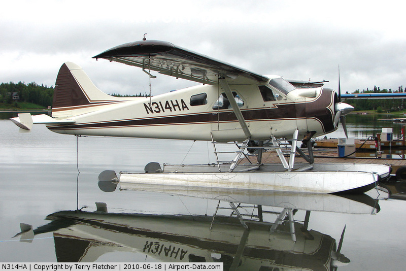
Crash of a De Havilland DHC-2 Beaver in Big River Lake
Date & Time:
Aug 25, 2012 at 0800 LT
Operator:

Registration:
N314HA
Survivors:
Yes
Schedule:
Soldotna - Big River Lake
MSN:
868
YOM:
1956
Crew on board:
1
Crew fatalities:
Pax on board:
5
Pax fatalities:
Other fatalities:
Total fatalities:
0
Captain / Total hours on type:
725.00
Aircraft flight hours:
20174
Circumstances:
The pilot of a float-equipped airplane was landing at a remote lake. The pilot stated that he was on a left base leg turning onto a short final approach when the left float struck the ground. The airplane sustained substantial damage to the wings and fuselage. The pilot indicated there were no preaccident mechanical malfunctions or anomalies that would have precluded normal operation. Accident occurred in Big River Lake, in the Kenai region.
Probable cause:
The pilot’s failure to maintain adequate ground clearance during his landing approach, which resulted in a collision with terrain.
Final Report:

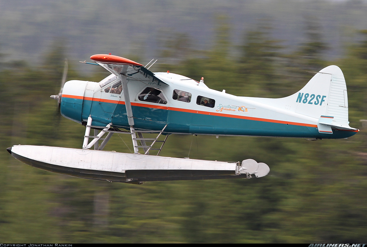
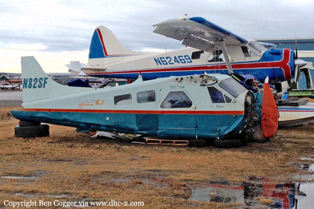
Crash of a De Havilland DHC-2 Beaver near Niblack
Date & Time:
Mar 13, 2012 at 1040 LT
Operator:

Registration:
N82SF
Survivors:
Yes
Schedule:
Niblack - Ketchikan
MSN:
839
YOM:
1955
Crew on board:
1
Crew fatalities:
Pax on board:
1
Pax fatalities:
Other fatalities:
Total fatalities:
0
Captain / Total hours on type:
12000.00
Aircraft flight hours:
17574
Circumstances:
The pilot departed from an off-airport site in marginal visual flight rules conditions. Shortly after departure, the weather worsened, and flight visibility dropped to near zero in heavy snow. He attempted to follow the shoreline at a low altitude but was unable to maintain visual contact with the ground. He stated that he saw trees immediately in front of the airplane and attempted a right turn toward what he thought was an open bay. During the turn, the right float contacted a rock outcrop, and the airplane impacted the water. The pilot did not report any mechanical anomalies that would have precluded normal operation.
Probable cause:
The pilot's decision to depart in marginal visual meteorological conditions, and his continued visual flight into instrument meteorological conditions.
Final Report:
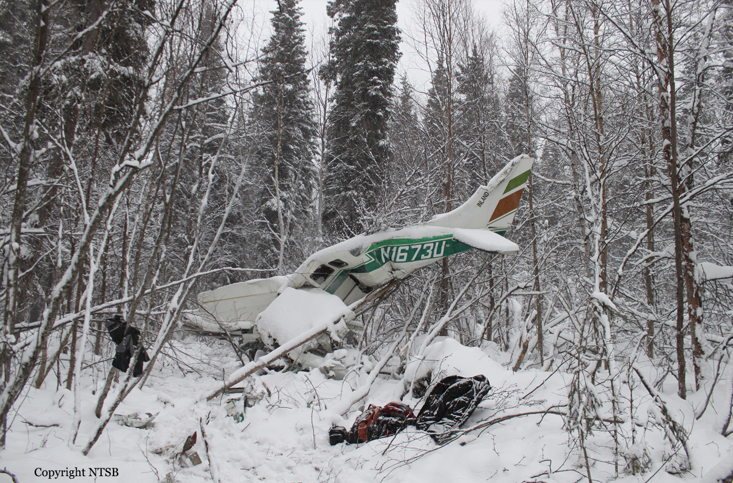
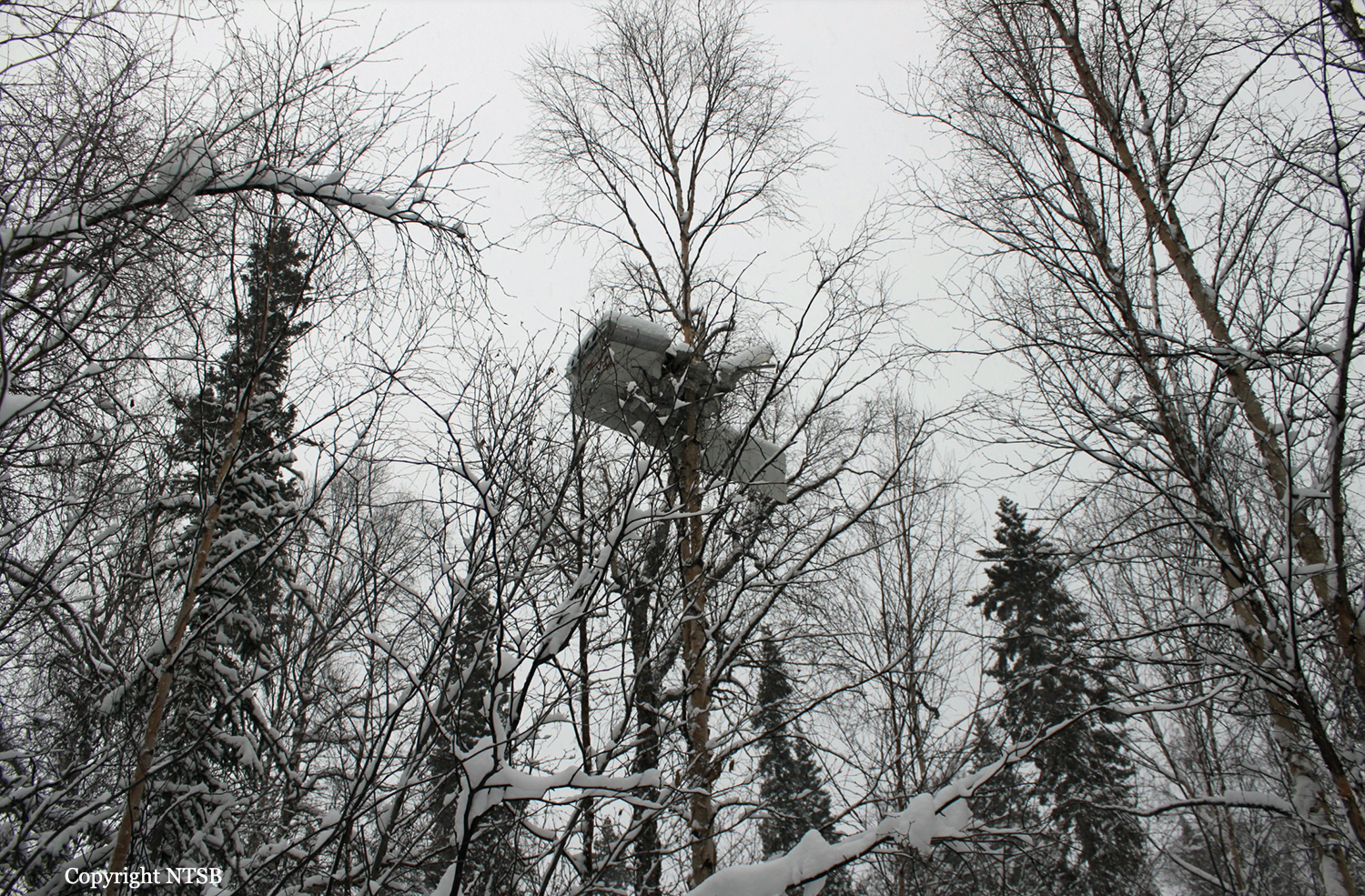
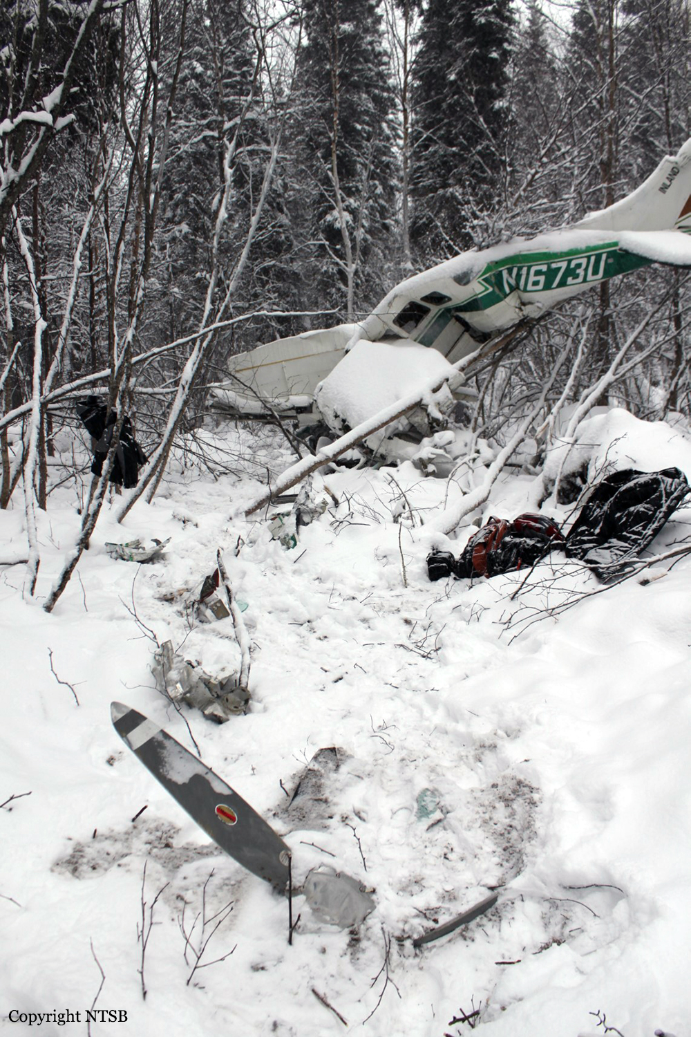
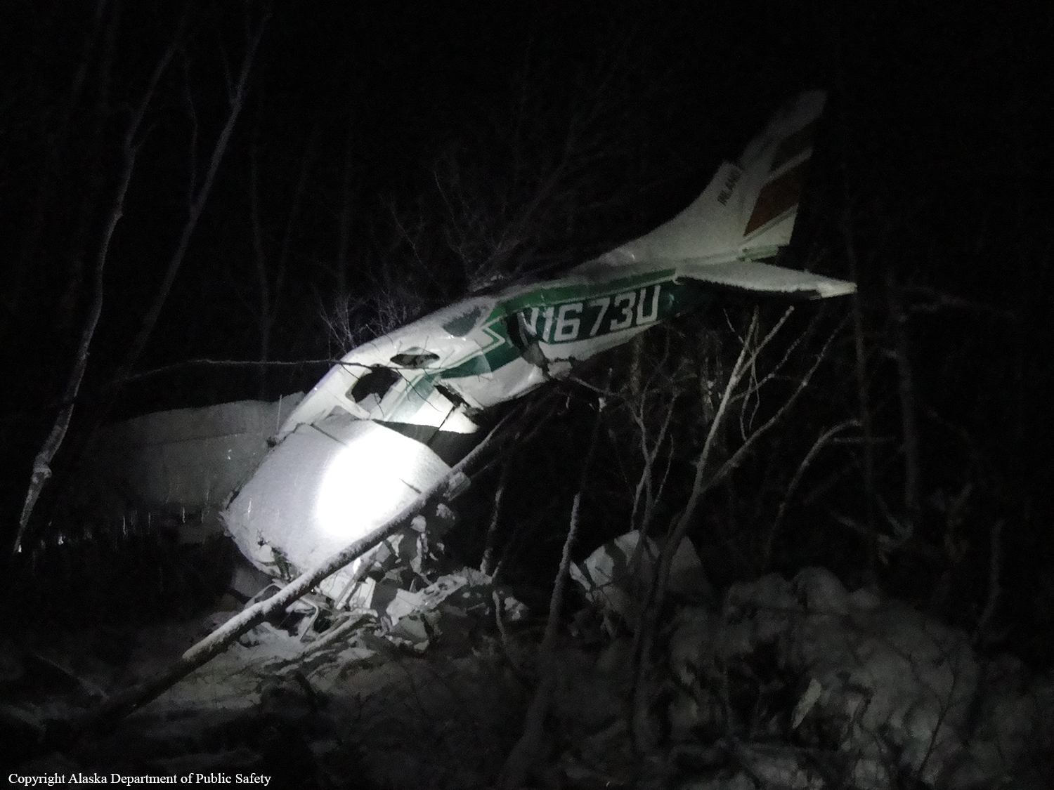
Crash of a Cessna 207 Skywagon in Chuathbaluk: 1 killed
Date & Time:
Nov 29, 2011 at 1925 LT
Operator:

Registration:
N1673U
Survivors:
No
Schedule:
Aniak - Chuathbaluk
MSN:
207-0273
YOM:
1974
Crew on board:
1
Crew fatalities:
Pax on board:
0
Pax fatalities:
Other fatalities:
Total fatalities:
1
Aircraft flight hours:
16889
Circumstances:
The pilot departed on a positioning flight during dark night, marginal visual meteorological conditions. A witness, who was waiting for the airplane at the destination airport, stated that shortly after the pilot-controlled airport lighting activated, a snow squall passed over the airport, greatly reducing the visibility. The accident airplane never arrived at its destination, and a search was initiated. The airplane’s fragmented wreckage was discovered early the next morning in a wooded area, about 2 miles from its destination. A review of archived automatic dependent surveillance-broadcast (ADS-B) data received from the accident airplane showed that the pilot departed, and the airplane climbed to about 700 feet above ground level. The airplane remained at about 700 feet for about 3 minutes, and then entered a shallow right-hand descending turn, until it impacted terrain. On-site examination of the airplane and engine revealed no preaccident mechanical anomalies that would have precluded normal operation. The cockpit area was extensively fragmented, thus the validity of any postaccident cockpit and instrument findings was unreliable. Likewise, structural damage to the airframe precluded the determination of flight control continuity. A postaccident examination of the engine and recovered components did not disclose any evidence of a mechanical malfunction. Given the witness account of worsening weather conditions at the airport just before the accident and the lack of mechanical anomalies with the airplane, it is likely that the accident pilot encountered heavy snow and instrument meteorological conditions while approaching the airport. It is also likely that the pilot became spatially disoriented during the unexpected weather encounter and subsequently collided with terrain.
Probable cause:
The pilot’s loss of situational awareness after an inadvertent encounter with instrument meteorological conditions, which resulted in an in-flight collision with tree-covered terrain.
Final Report: