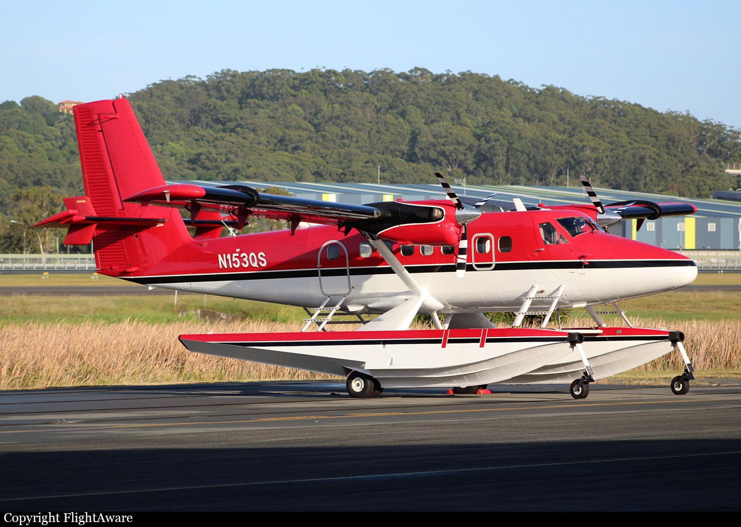
Crash of a Viking Air DHC-6 Twin Otter 400 off Half Moon Bay: 2 killed
Date & Time:
May 20, 2023 at 1400 LT
Operator:

Registration:
N153QS
Survivors:
No
Schedule:
Santa Rosa - Honolulu
MSN:
869
YOM:
2013
Crew on board:
2
Crew fatalities:
Pax on board:
0
Pax fatalities:
Other fatalities:
Total fatalities:
2
Aircraft flight hours:
1641
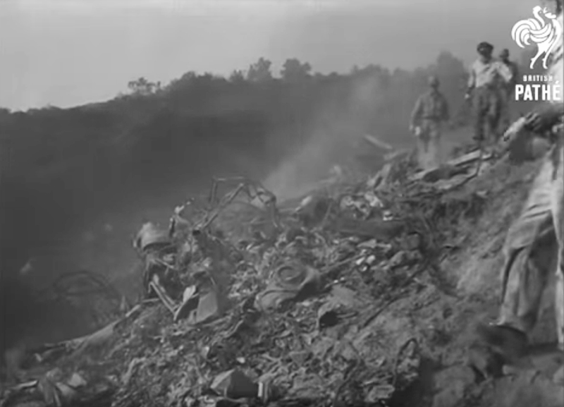
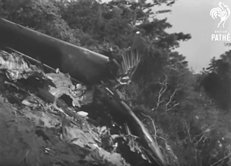
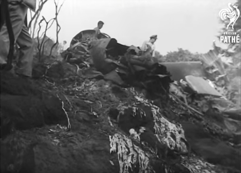
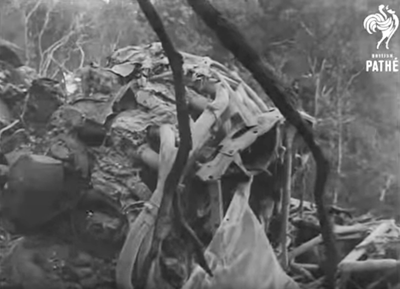
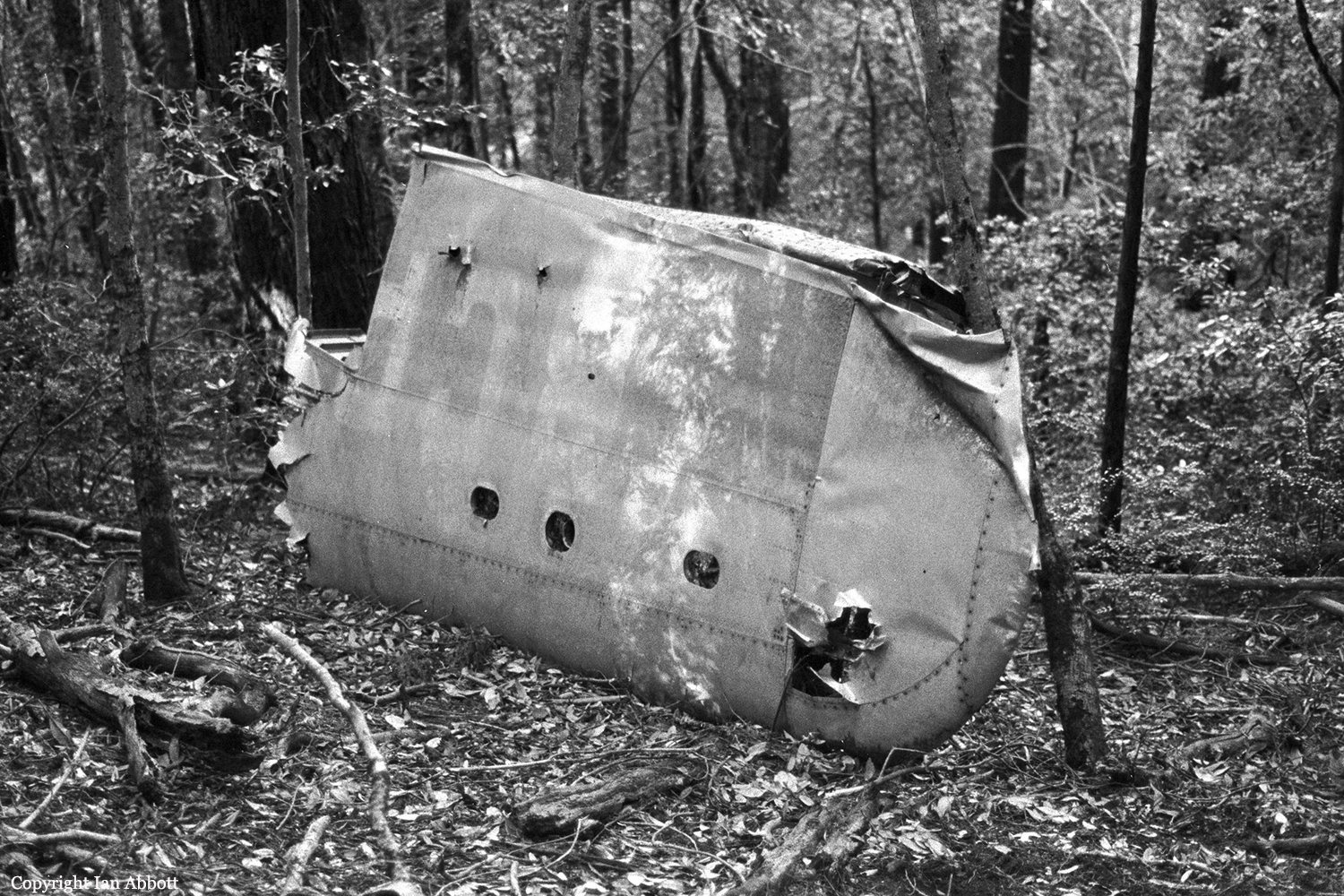
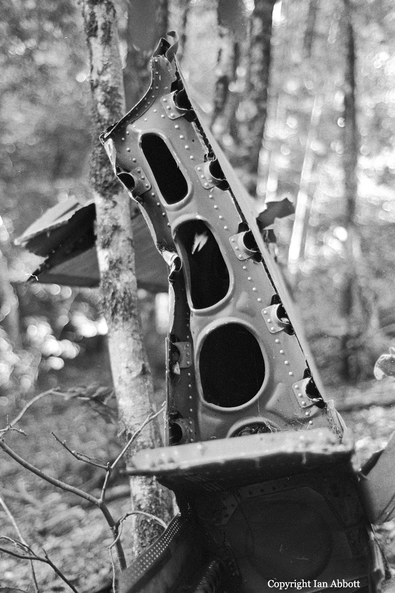
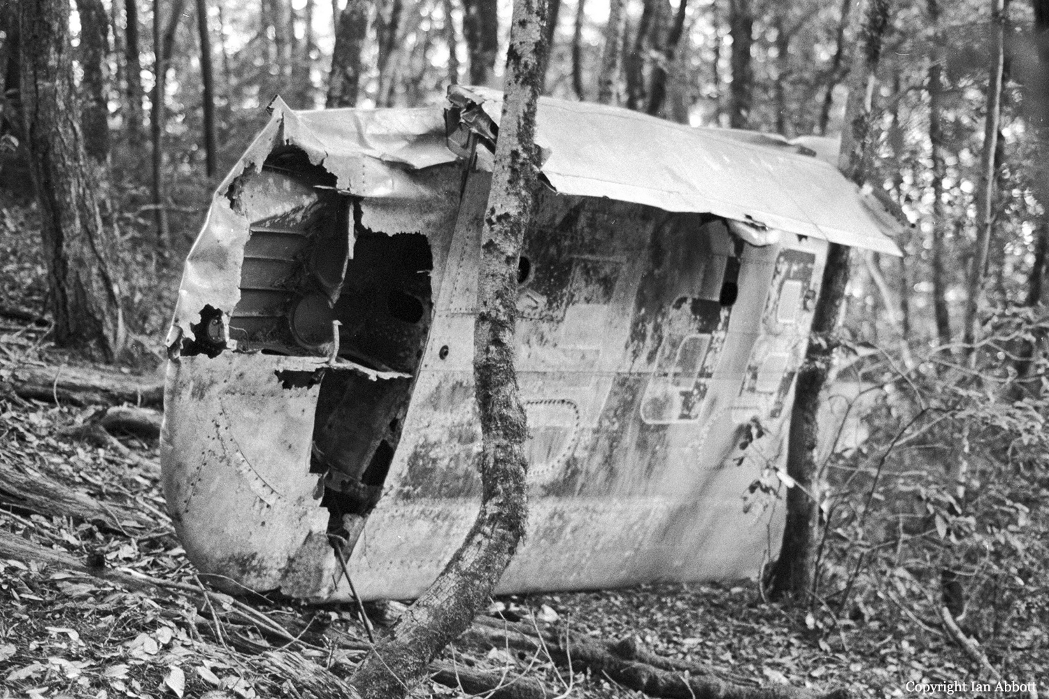
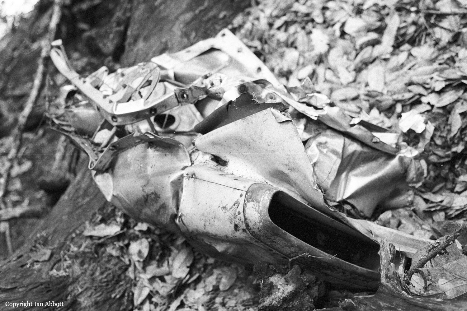
Circumstances:
The airplane was conducting a trans-Pacific flight when the accident occurred. A ferry fuel tank system was installed on the airplane and 1,189 gallons of fuel was added for the flight. About 4 hours into the flight over the Pacific Ocean, the crew contacted air traffic control (ATC) and reported that they were having a fuel transfer problem and were thinking of turning around. The crew then reported they were declaring an emergency and had 10 hours of fuel remaining but could only access about 2 hours of fuel. Satellite flight track data showed the airplane reversed course when it was about 356 miles from the California coast. About 132 miles from the coast the flight track decreases in altitude to about 4,000 ft above mean sea level (msl). The last few minutes of the data shows the altitude decrease from about 3,600 ft msl to about 240 ft msl. The last track data point was located about 33 miles off the California coast. The United States Coast Guard (USCG) responded to the accident location and reported the fuselage was inverted in the water. They reported the wings and engines were separated from the fuselage. The pilots were still strapped in their seats and unresponsive. The occupants were not recovered. Search efforts resulted in finding the nose landing gear, right wing, and right engine. A fuel bladder tank had washed ashore in southern California. Postaccident examination of the recovered components revealed no evidence of any preimpact mechanical malfunctions or failures that would have precluded normal operation. A mechanic reported that he was instructed to set up the ferry fuel tank system in the accident airplane. He installed but did not fill the system with fuel, as he did not know when the flight would take place and it would have been unsafe to have the bladders contain fuel for several days before the flight. After installing the ferry fuel tank system, he contacted the copilot (who was also a mechanic), who was then to complete the installation. The mechanic understood that the copilot would be responsible for the final installation of the ferry fuel tank system and complete the appropriate logbook entries. The mechanic was not present when the copilot completed the installation and was not sure if the copilot had signed off on it.
Probable cause:
The failure of the ferry fuel tank system to transfer fuel during a trans-Pacific flight for reasons that could not be determined, which resulted in fuel starvation and a subsequent ditching into the water.
Final Report: