Zone
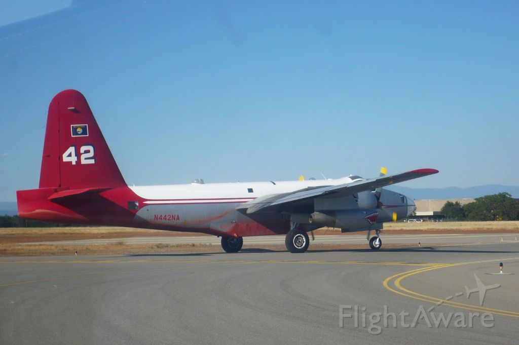
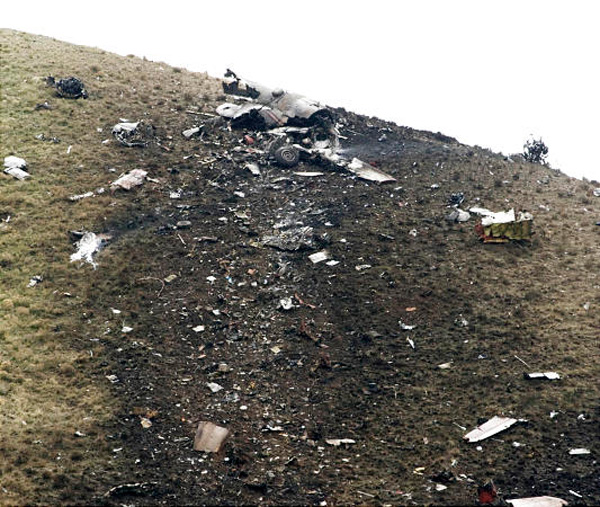
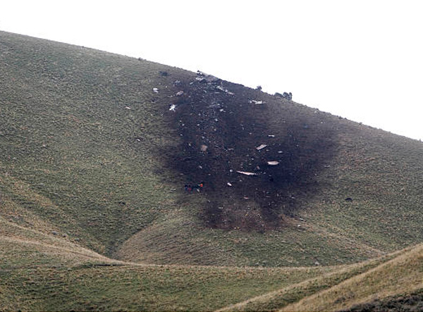
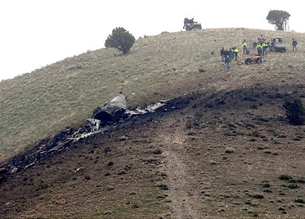
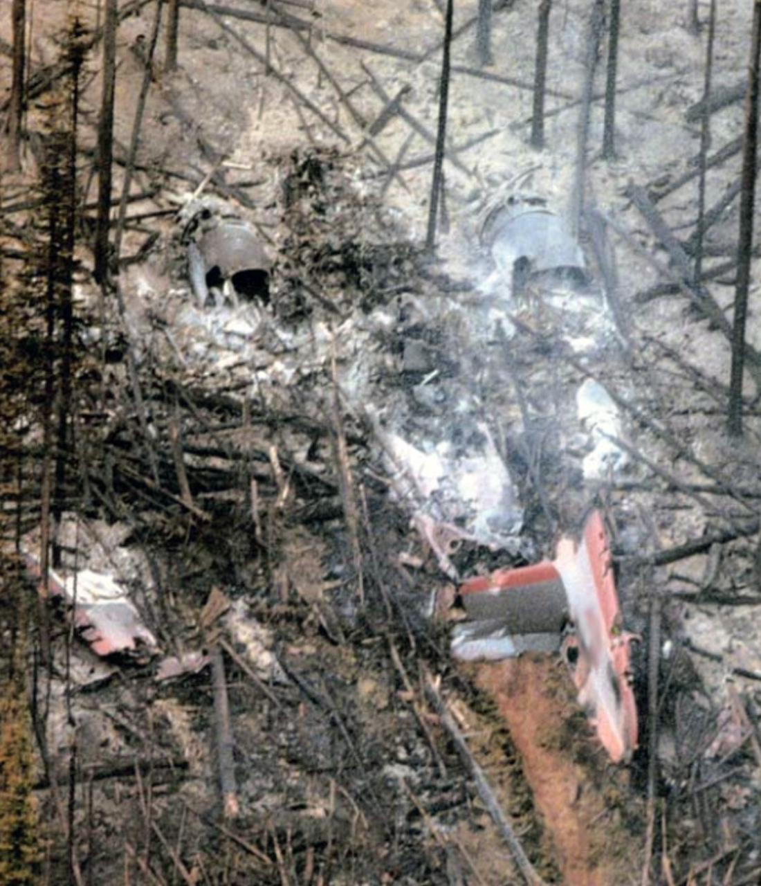
Crash of a Lockheed P2V-7 near Stockton: 3 killed
Date & Time:
Apr 25, 2009 at 1004 LT
Operator:

Registration:
N442NA
Survivors:
No
Schedule:
Missoula - Alamogordo
MSN:
726-7286
YOM:
1958
Flight number:
Tanker 42
Crew on board:
3
Crew fatalities:
Pax on board:
0
Pax fatalities:
Other fatalities:
Total fatalities:
3
Captain / Total hours on type:
916.00
Copilot / Total hours on type:
350
Aircraft flight hours:
3554
Circumstances:
The multi-engine fire bomber, which was not carrying retardant, was established at its cruise altitude while en route to a fire base where it would be used as part of the effort to fight a local fire. While en route, the flight crew encountered a forecast area of instrument meteorological conditions, whereupon they began a series of descents to lower altitudes in order to stay in visual flight rules (VFR) conditions beneath the clouds. During the last few minutes of their flight, the flight crew had descended to an altitude that was less than 1,300 feet above ground level (agl) over nearly level terrain. As they approached rapidly rising terrain at the end of the broad open valley they had been flying over, they inadvertently entered instrument meteorological conditions (IMC). Soon thereafter, while still in a nearly wings-level attitude, the airplane impacted a ridge about 240 feet below its top. The First Officer, who was flying at the time, had asked the Captain about ten minutes prior to the impact if their altitude was high enough to clear the upcoming terrain, but the Captain did not respond, and the First Officer did not challenge the Captain about the issue. Witnesses in the area reported low clouds with ceilings about 200 feet above ground level with a visibility of one-quarter mile or less, with rain and fog. One of the witnesses reported momentarily viewing the airplane flying "very low," while the others reported only being able to hear the airplane.
Probable cause:
The flight crew's failure to maintain terrain clearance during low altitude flight in low ceiling and visibility conditions. Contributing to the accident was the flight crew's failure to adequately monitor their location with respect to the rising terrain environment ahead, and, their lack of crew resource management communication as a crew.
Final Report:
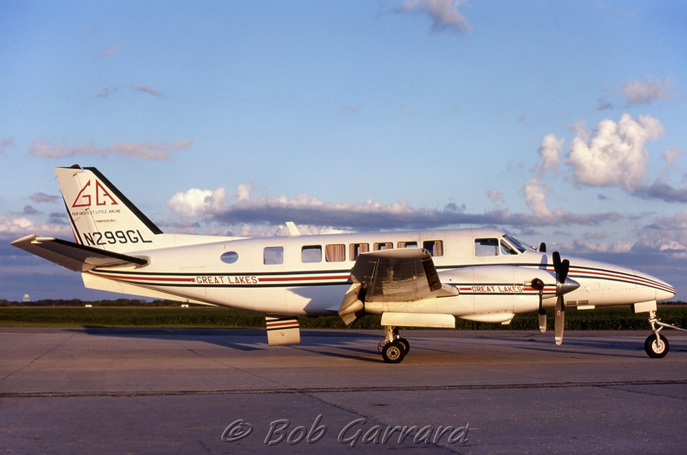
Crash of a Beechcraft 99A Airliner in Missoula
Date & Time:
Oct 17, 1998 at 0230 LT
Operator:

Registration:
N299GL
Survivors:
Yes
Schedule:
Billings - Missoula
MSN:
U-102
YOM:
1969
Flight number:
AIP5010
Crew on board:
2
Crew fatalities:
Pax on board:
0
Pax fatalities:
Other fatalities:
Total fatalities:
0
Captain / Total hours on type:
667.00
Aircraft flight hours:
39685
Circumstances:
While flying a night visual approach, the co-pilot flared too high above the runway. As the aircraft floated down the runway, the speed decreased, and the pilot-in-command took control. Because he felt the aircraft was approaching a stall, he initiated a go-around. During the attempted go-around, the pilot-in-command found it necessary to keep both hands on the control wheel due to the fact that the aircraft had been trimmed to the full nose-up position during the landing flare. Even with both hands on the control wheel, the aircraft became very difficult to control. Although the co-pilot moved the throttles to maximum power and began retraction of the flaps, the pilot-in-command's remedial action had occurred too late to successfully execute the go-around. It was later discovered that during the operator's initial training, both crew members had been taught to apply full nose-up trim after crossing the runway threshold and reducing the power to idle. This action, which the operator eliminated from the landing sequence procedure after this accident, was inconsistent with the instructions in the Beech 99 Pilots Operating Manual.
Probable cause:
The pilot-in-command's delayed remedial action in response to the co-pilot's improper landing flare, and the co-pilot's application of excessive (full nose-up) trim during the landing flare as taught in the operator's initial aircrew training program. Factors include the co-pilot's improper flare and his lack of total experience in this type of aircraft.
Final Report:

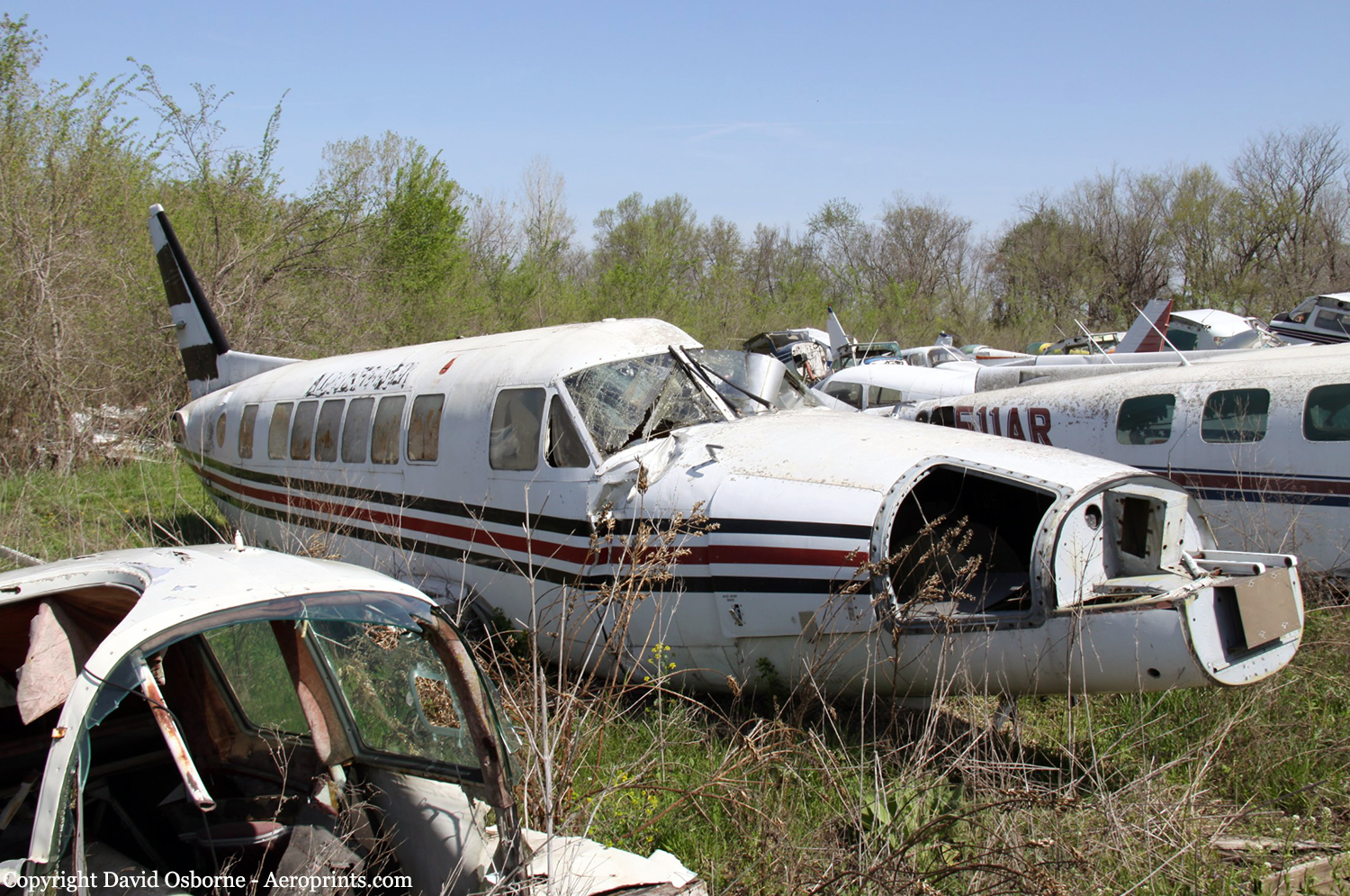
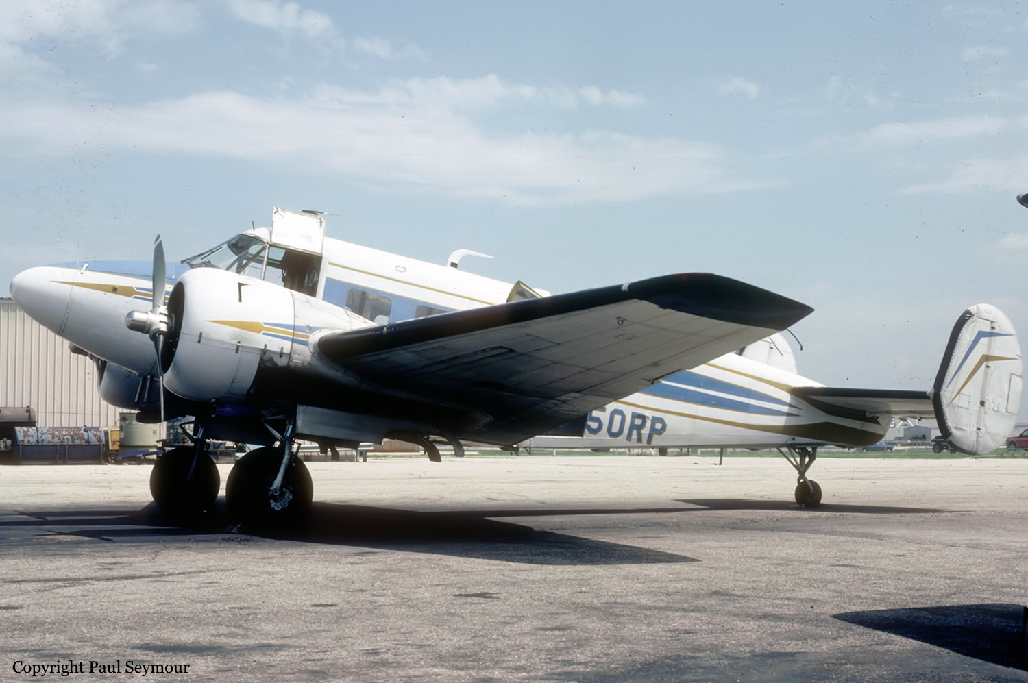
Crash of a Beechcraft E18S in Butte: 1 killed
Date & Time:
Jan 26, 1995 at 2230 LT
Operator:

Registration:
N250RP
Survivors:
No
Schedule:
Seattle - Missoula
MSN:
BA-47
YOM:
1955
Flight number:
MER035
Crew on board:
1
Crew fatalities:
Pax on board:
0
Pax fatalities:
Other fatalities:
Total fatalities:
1
Captain / Total hours on type:
2806.00
Aircraft flight hours:
15043
Circumstances:
While performing an ILS approach at night and in IMC, the airplane collided with trees in mountainous terrain prior to the IAF. The MDA prior to the IAF is 10,600 feet. The descent altitude at the outer marker is 7,713 feet. The wreckage was located under the localizer path at an elevation of 7,600 feet. Damage to tree tops along the wreckage distribution path indicates that the airplane travelled through the trees on a level plane until contact with the ground approximately 300 feet into the path. Light snow was falling at the time of the accident and visibility was deteriorating due to fog. During the post crash investigation, there was no evidence found to indicate a mechanical failure or malfunction.
Probable cause:
The pilot's failure to follow the ifr procedure by not maintaining the proper altitude prior to the initial approach fix. Factors to the accident were dark night conditions and a low ceiling.
Final Report:
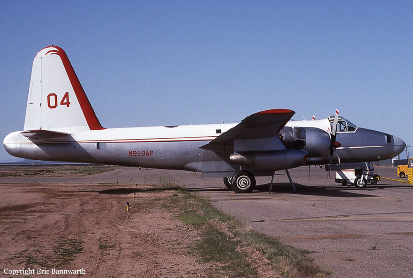
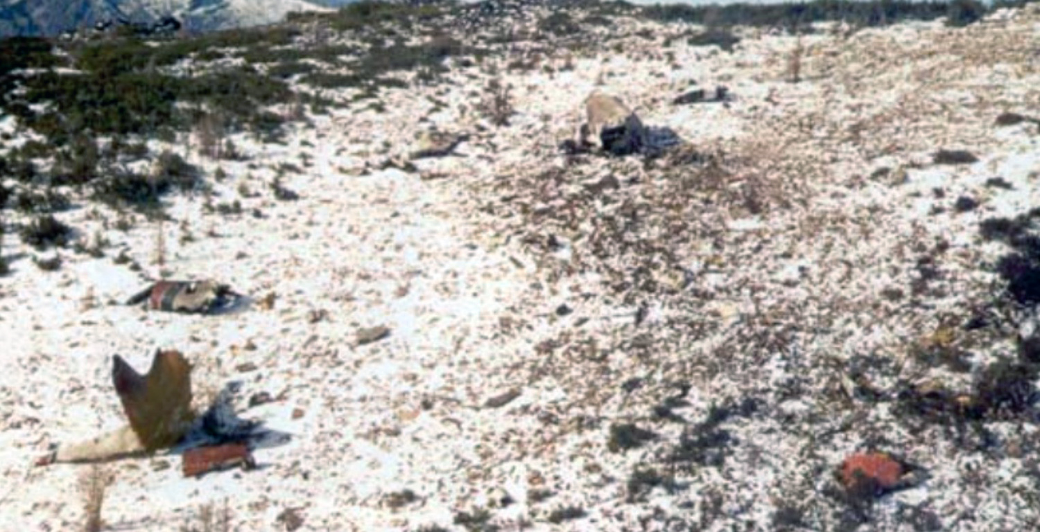
Crash of a Lockheed P-2V Neptune near Missoula: 2 killed
Date & Time:
Jul 29, 1994 at 1600 LT
Operator:
Registration:
N918AP
Survivors:
No
Schedule:
Missoula - Missoula
MSN:
726-7186
YOM:
1958
Flight number:
Tanker 04
Crew on board:
2
Crew fatalities:
Pax on board:
0
Pax fatalities:
Other fatalities:
Total fatalities:
2
Circumstances:
The aircraft departed Missoula on a fire fighting mission under callsign Tanker 04. The crew apparently became fixated on the malfunction of the retardant-release doors and did not realize the tanker was entering a narrow box canyon when it struck the slope of Mt Squaw located about 20 miles northwest of Missoula Airport. The aircraft was destroyed and both pilots were killed.
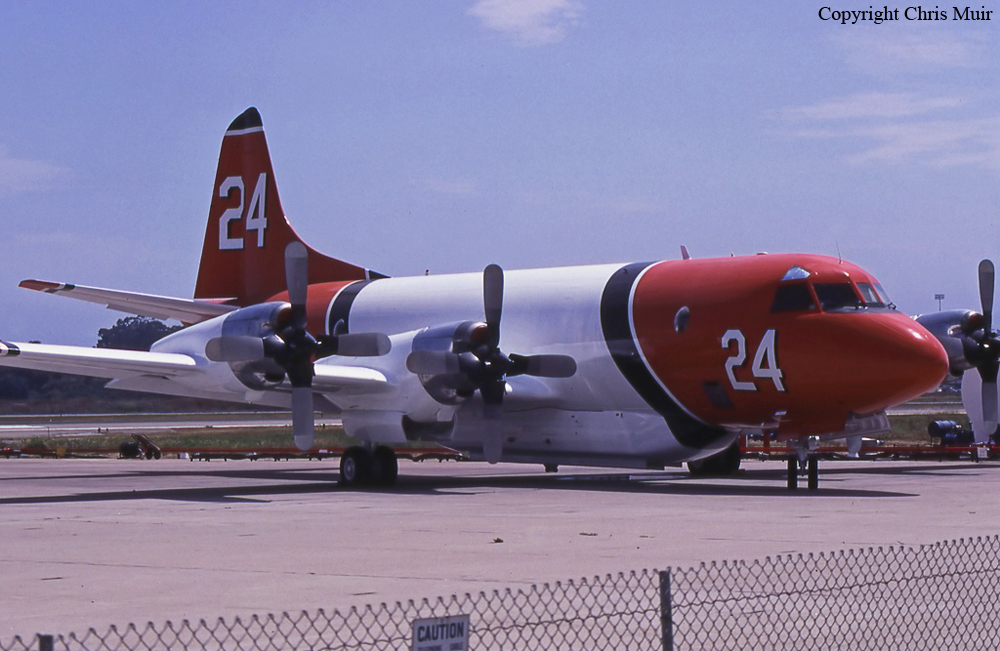
Crash of a Lockheed P-3A Orion near Florence: 2 killed
Date & Time:
Oct 16, 1991 at 1945 LT
Operator:

Registration:
N924AU
Survivors:
No
Schedule:
Santa Barbara - Missoula
MSN:
185-5072
YOM:
1964
Flight number:
Tanker 24
Crew on board:
2
Crew fatalities:
Pax on board:
0
Pax fatalities:
Other fatalities:
Total fatalities:
2
Circumstances:
Air tanker N924AU had been dispatched from its base in Santa Barbara, CA to Missoula, MT to support fire suppression efforts involving a number of large fires in the Northern Region. The flight departed in VFR conditions at 16:05 PDT. While still in the area controlled by the Oakland FAA Air Route Traffic Control Center (ARTCC), the crew requested and received an Instrument Flight Rules (IFR) clearance. They were assigned an altitude of 23,000 feet. The Orion proceeded uneventfully and was handed off to the Approach Controller at Missoula (MSO). MSO Approach did not have, at that time, terminal radar equipment that covered their entire area of responsibility. At first contact with MSO Approach, the Orion was 26 miles southeast of the Missoula International Airport and descending to 12,000 feet. In the course of several exchanges between the Orion and the MSO Approach Controller, it was disclosed and confirmed that the Orion’s flight crew did not have the approach plate (or chart) depicting the published approach procedure for the VOR-DME Bravo (B) approach, which was the approach in use for aircraft arriving from the south. Clearance was nevertheless offered and accepted and the controller provided the information as the Orion crew began to execute the VOR-DME B approach. At this time, the cloud bases at the MSO Airport were at about 7,900 feet and other aircraft making instrument approaches there were descending through 8,000 feet, cancelling their IFR flight plans and making visual approaches to the airport for landing. Since the Orion’s crew was able to monitor these radio communications/transmissions on the same frequency, they were probably counting on doing the same. At this time, there were very strong winds and moderate to severe turbulence reported at altitudes above 8,000 feet that increased with altitude in the MSO area. In addition to turbulence, the Orion crew contended with effects of flying at high altitudes, using oxygen in an unheated and un-pressurized aircraft for more than two hours. At some point in the initial phase of the approach, some confusion as to what heading to fly apparently occurred and the airtanker turned back toward the south, away from MSO. By this time the controller had authorized descent to 8,600 feet on an approximate heading of 200 degrees magnetic. MSO Approach received notification by Salt Lake City ARTCC (Center) that this airtanker was west of the course consistent with the approach procedure and subsequent notification that the airtanker had disappeared off Center’s radar screen. Repeated attempts to contact the Orion crew failed and MSO Approach notified the County Sheriff’s office, the Forest Service, and other agencies that the aircraft was missing and presumed down. Search and rescue attempts were not able to detect an Emergency Locator Transmitter (ELT) signal. The mishap site was located the following day.
Source: https://www.fs.usda.gov/managing-land/fire by Candy S. Rock Fitzpatrick.
Source: https://www.fs.usda.gov/managing-land/fire by Candy S. Rock Fitzpatrick.
Final Report:
Crash of a Cessna 421A Golden Eagle I in Helena: 3 killed
Date & Time:
Feb 3, 1988 at 2000 LT
Registration:
N517S
Survivors:
No
Schedule:
Missoula - Helena
MSN:
421A-0002
YOM:
1967
Crew on board:
2
Crew fatalities:
Pax on board:
1
Pax fatalities:
Other fatalities:
Total fatalities:
3
Captain / Total hours on type:
119.00
Aircraft flight hours:
4758
Circumstances:
This accident occurred during a night, ILS approach to runway 27 in IMC. The aircraft collided with a mountain 12 nm east-southeast of the airport while turning inbound to intercept the localizer course. Investigation revealed that one VOR receiver was set on the destination ILS frequency, the second VOR was set on an en route VOR 51 nm west of the destination airport, and the DME radio, a separate transceiver, was set on the destination DME transmitter. The frequencies of the en route VOR and the destination VOR were 117.1 and 117.7, respectively. The outbound course for the ILS approach procedure was 088° and the accident site was located on the 088 radial of the en route VOR. Investigation also revealed that the pic was occupying the right front seat and an experienced pilot who was not current in this aircraft was occupying the left seat. The second VOR receiver control head was located in the lower right portion of the instrument panel, in a location where the selected frequency was difficult to read. All three occupants were killed.
Probable cause:
Occurrence #1: in flight collision with terrain/water
Phase of operation: approach - iaf to faf/outer marker (ifr)
Findings
1. Terrain condition - mountainous/hilly
2. (f) light condition - dark night
3. (c) ifr procedure - improper - pilot in command
4. (c) navigation receiver - improper use of - pilot in command
Phase of operation: approach - iaf to faf/outer marker (ifr)
Findings
1. Terrain condition - mountainous/hilly
2. (f) light condition - dark night
3. (c) ifr procedure - improper - pilot in command
4. (c) navigation receiver - improper use of - pilot in command
Final Report: