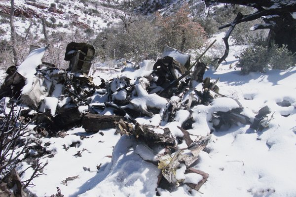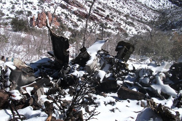
Crash of a Piper PA-31-350 Navajo Chieftain near Payson: 1 killed

Date & Time: Dec 18, 2012 at 1825 LT
Operator:

Registration:
N62959
Flight Phase:
Flight Type:
Survivors:
No
Site:
Schedule:
Holbrook - Payson - Phoenix
MSN:
31-7752008
YOM:
1977
Flight number:
AMF3853
Location:
Crew on board:
1
Crew fatalities:
Pax on board:
0
Pax fatalities:
Other fatalities:
Total fatalities:
1
Captain / Total flying hours:
1908
Captain / Total hours on type:
346.00
Aircraft flight hours:
19188
Circumstances:
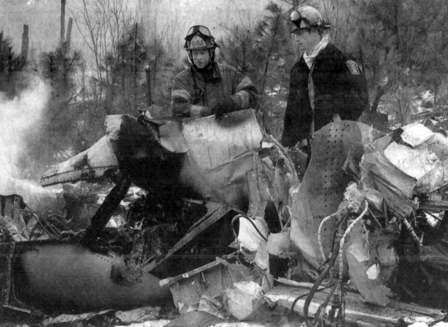
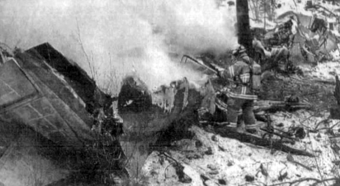
The pilot began flying the twin piston-engine airplane model for the cargo airline about 11 months before the accident. Although he had since upgraded to one of the airline’s twin turboprop airplane models, due to the airline’s logistical needs, the pilot was transferred back to the piston-engine model about 1 week before the accident. The flight originated at one of the airline’s outlying destination airports and was planned to stop at an interim destination to the southwest before continuing to the airline’s base as the final destination. The late afternoon departure meant that the flight would arrive at the interim destination about 10 minutes after sunset. That interim destination was situated in a sparsely populated geographic bowl just south of terrain that was significantly higher, and the ceilings there included multiple broken and overcast cloud layers near, or lower than, the surrounding terrain. Although not required by Federal Aviation Administration (FAA) regulations, the airline employed dedicated personnel who performed partial dispatch-like activities, such as providing relevant flight information, including weather, to the pilots. Before takeoff on the accident flight, the pilot conferred briefly with the dispatch personnel by telephone, and, with little discussion, they agreed that the flight would proceed under visual flight rules to the interim destination. Information available at the time indicated that the cloud cover almost certainly precluded access to the airport without an instrument approach; however, the airplane was not equipped to conduct the only available instrument approach procedure for that airport. Additionally, the pilot did not have in-flight access to any GPS or terrain mapping/database information to readily assist him in either locating the airport or remaining safely clear of the local terrain. Although the airplane was not being actively tracked or assisted by air traffic control (ATC) early in the flight, review of ground tracking radar data showed that the flight initially headed directly toward the interim destination but then began a series of turns, descents, and climbs. The airplane then disappeared from radar as the result of radar coverage floor limitations due to high terrain and radar antenna siting. The airplane reappeared on radar about 24 minutes after it disappeared and about 9 minutes after the FAA-defined beginning of night. Based on the flight track, it is likely that the pilot made a dedicated effort to access the airport, while concurrently remaining clear of the clouds and terrain, strictly by visual means. This task was made considerably more difficult and hazardous by attempting it in dusk conditions, and then darkness, instead of during daylight hours. About 15 minutes after the airplane reappeared on radar, when it was at an altitude of about 13,500 ft, the pilot contacted ATC and requested and was granted an instrument flight rules clearance to his final destination. About 3 minutes later, the controller cleared the flight to descend to 10,000 ft, and the airplane leveled off at that altitude about 6 minutes later. However, upon reaching 10,000 ft, the pilot requested a lower altitude to escape “heavy” upand down-drafts, but the controller was unable to comply because the ATC minimum vectoring altitude was 9,700 ft in that region. About 1 minute later, radar contact was lost. Shortly thereafter, the airplane impacted terrain in a steep nose-down attitude in a near-vertical trajectory. Although examination of the wreckage did not reveal any preimpact mechanical deficiencies that would have prevented normal operation and continued flight, the extent of the damage precluded, except on a macro scale, any determination of the preimpact integrity or functionality of any systems, subsystems, or components, including the ice protection systems, autopilot, and nose baggage door. Analysis of the radar data indicated that the airplane was above 10,000 ft for at least 41 minutes (possibly in two discontinuous periods) and above 12,000 ft (in two discontinuous periods) for at least 18 minutes. Although the airplane was reportedly equipped with supplemental oxygen, the investigation was unable to verify either its presence or its use by the pilot. Lack of supplemental oxygen at those altitudes for those periods could have contributed to a decrease in the pilot’s mental acuity and his ability to safely conduct the light. Analysis of air mass data revealed that mountain-wave activity and up- and downdrafts with vertical velocities of about 1,000 ft per minute (fpm) were present near the accident site and that the largest and most rapid transitions from up- to down-drafts occurred near the accident site, which was also supported by the airplane’s altitude data trace. The analysis also indicated that the last radar target from the airplane was located in a downdraft with a velocity of between 600 and 1,000 fpm. Other meteorological analysis indicated that the airplane encountered icing conditions, likely in the form of supercooled large droplets (SLD), several minutes before the accident. Aside from pilot reports from aircraft actually encountering SLD, no tools currently exist to detect airborne SLD. Further, the tools and processes to reliably forecast SLD do not exist. SLD is often associated with rapid ice accumulation, especially on portions of the airplane that are not served by ice protection systems. Airframe icing, whether due to accumulation rates or locations that exceed the airplane’s deicing system capabilities, mechanical failure, or the pilot’s failure to properly use the system, can impose significant adverse effects on airplane controllability and its ability to remain airborne. Because of the pilot’s recent transition from the Beechcraft BE-99, in which the pitot heat was always operating during flight, he may have forgotten that the accident airplane’s pitot heat procedures were different and that the pitot heat had to be manually activated when the airplane encountered the icing conditions. If the pitot heat is not operating in icing conditions, the airspeed information becomes unreliable and likely erroneous. Erroneous airspeed indications, particularly in night instrument meteorological conditions when the pilot has no outside references, could result in a loss of control. The investigation was unable to determine whether the pitot heat was operating during the final portion of the flight. The investigation was unable to determine whether the pilot used the autopilot during the last portion of the flight. If he was using the autopilot, it is possible that, at some point, he was forced to revert to flying the airplane manually due to the unit’s inability and to a corresponding Pilot’s Operating Handbook prohibition against using it to maintain altitude in the strong up- and downdrafts, which would increase the pilot’s workload. Another possibility is that the autopilot was unable to maintain altitude, and, instead of disconnecting it, the pilot overpowered it via the control wheel. If that occurred and the pilot overrode the autopilot for more than 3 seconds, the pitch autotrim system would have activated in the direction opposite the pilot’s input, and, when the pilot released the control wheel, the airplane could have been significantly out of trim, which could result in uncommanded pitch, altitude, and speed excursions and possible loss of control. Whether the pilot was hand-flying the airplane or was using the autopilot, the encounter with the strong up- and downdrafts and consequent altitude loss likely prompted the pilot to input corrective actions to regain the lost altitude, specifically increasing pitch and possibly power. Such corrections typically result in airspeed losses; those losses can sometimes be significant as a function of downdraft strength and the airplane’s climb capability. If that capability is compromised by the added weight, drag, and other adverse aerodynamic effects of ice, aerodynamic stall and a loss of control could result. Radar tracking data and ATC communications revealed that another, similar-model airplane flew a very similar track about 6 minutes behind the accident airplane, except that that other airplane was at 12,000 ft not 10,000 ft. The 10,000-ft ATC-mandated altitude placed the accident airplane closer to the underlying high terrain and into the clouds with the icing conditions and the strong vertical air movements. In contrast, the pilot of the second airplane reported that he was in and out of the cloud tops and did not report any weather-induced difficulties. The accident pilot did not have any efficient in-flight means for accurately determining the airborne meteorological conditions ahead, and the ATC controller did not advise him of any adverse conditions. Therefore, the pilot did not have any objective or immediate reason to refuse the ATC-assigned altitude of 10,000 ft. Ideally, based on both the AIRMET and the ambient temperatures, the pilot should have been aware of the likelihood of icing once he descended into clouds. That, particularly combined with his previously expressed lack of confidence in the airplane’s capability in icing conditions, could have prompted him to request either an interim stepdown altitude of 12,000 ft or an outright delay in a direct descent to 10,000 ft, but, for undetermined reasons, the pilot did not make any such request of ATC. Based on the available evidence, if the ATC controller had not descended the airplane to 10,000 ft when he did, either by delaying or by assigning an interim altitude of 12,000 ft, it is likely that the airplane would not have encountered the icing conditions and the strong up- and downdrafts. In addition, if the presence of SLD and/or strong up- and downdrafts had been known or explicitly forecast and then communicated to the pilot either via his weather briefing, his onboard equipment, or by ATC, it is likely that the pilot would have opted to avoid those phenomena to the maximum extent possible. The flight’s encounter with airframe icing and strong up-and downdrafts placed the pilot and airplane in an environment that either exacerbated or directly caused a situation that resulted in the loss of airplane control.
Probable cause:
The airplane’s inadvertent encounter, in night instrument meteorological conditions, with unforecast strong up- and downdrafts and possibly severe airframe icing conditions (which
likely included supercooled large droplets that the airplane was not certificated to fly in) that led to the pilot's loss of airplane control.
Final Report:

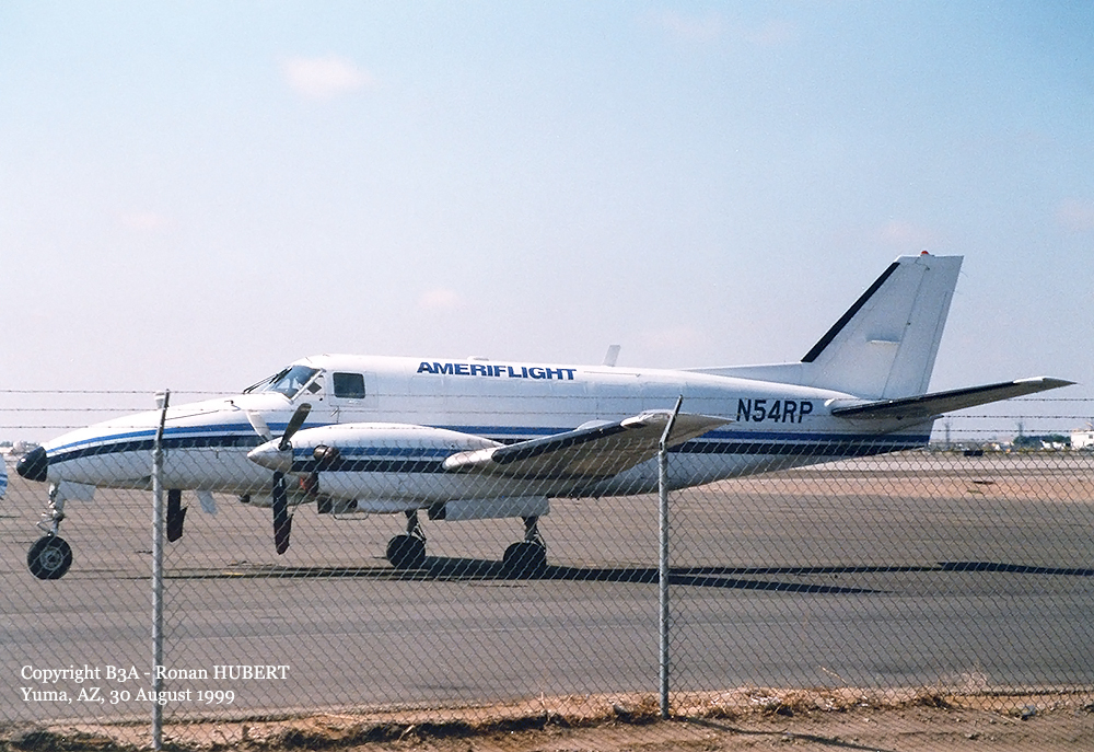
Crash of a Beechcraft C99 Airliner in Butte: 2 killed

Date & Time: Mar 18, 2006 at 1455 LT
Type of aircraft:
Operator:
Registration:
N54RP
Flight Type:
Survivors:
No
Schedule:
Helena - Butte
MSN:
U-218
YOM:
1983
Flight number:
AMF2591
Location:
Crew on board:
2
Crew fatalities:
Pax on board:
0
Pax fatalities:
Other fatalities:
Total fatalities:
2
Captain / Total flying hours:
5219
Captain / Total hours on type:
2616.00
Aircraft flight hours:
22169
Aircraft flight cycles:
35539
Circumstances:
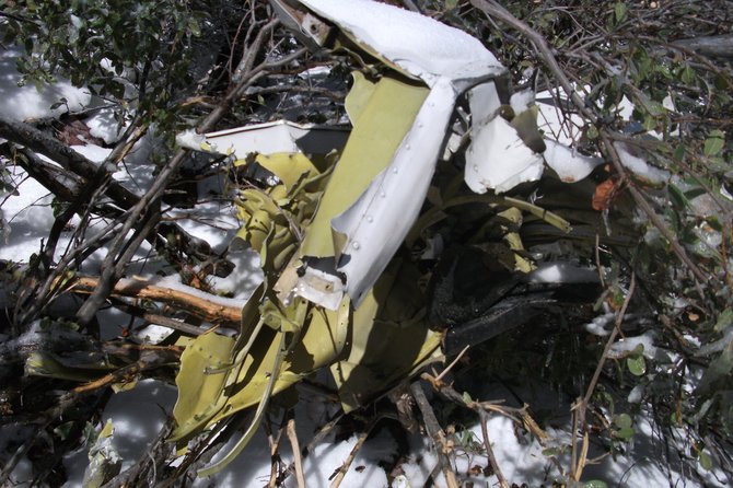
The cargo flight collided with mountainous terrain in controlled flight while executing an instrument approach procedure. Two pilots were aboard; the company's training and check captain/pilot-in-command in the right seat, and a newly hired commercial pilot in left seat, who was in training for captain The flight had been cleared for the VOR or GPS-B approach via the 7 DME arc. According to the approach plate, the transition to the approach is via a DME arc at 9,000 feet with no procedure turn. The flight is to track inbound on the 127 degree radial, descending down to, but no lower than, 7,700 feet to the initial approach fix (IAF). After crossing the IAF, the flight is to turn to 097 degrees for 10 nautical miles and descend to 6,900 feet. The remainder of the 1.5 nautical miles to the runway is to be flown under visual conditions. Documentation of the accident site indicated that the aircraft collided with trees and subsequently the mountainous terrain on a heading of approximately 127 degrees and about 6,900 feet mean sea level. The initial impact point was located approximately nine nautical miles on a magnetic bearing of 130 degrees from the IAF. Documentation of the horizontal situation indicator (HSI) on the left side instrument panel indicated that the course arrow was positioned to approximately 127 degrees, the inbound heading to the IAF. The copilot (right side) course arrow was positioned to 115 degrees. The location of the wreckage and the 127 degree heading on the HSI indicate that the pilots failed to follow the approach procedure and turn to a heading of 097 degrees after crossing the IAF. Instrument meteorological conditions were reported in the area consisting of icing conditions, heavy snow fall, with poor visibility and mountain obscuration. No pre-impact mechanical malfunctions or failures were identified.
Probable cause:
The second pilot's failure to follow the published instrument approach procedure and the captain/PIC's inadequate supervision. Snow and mountain obscuration were factors.
Final Report:

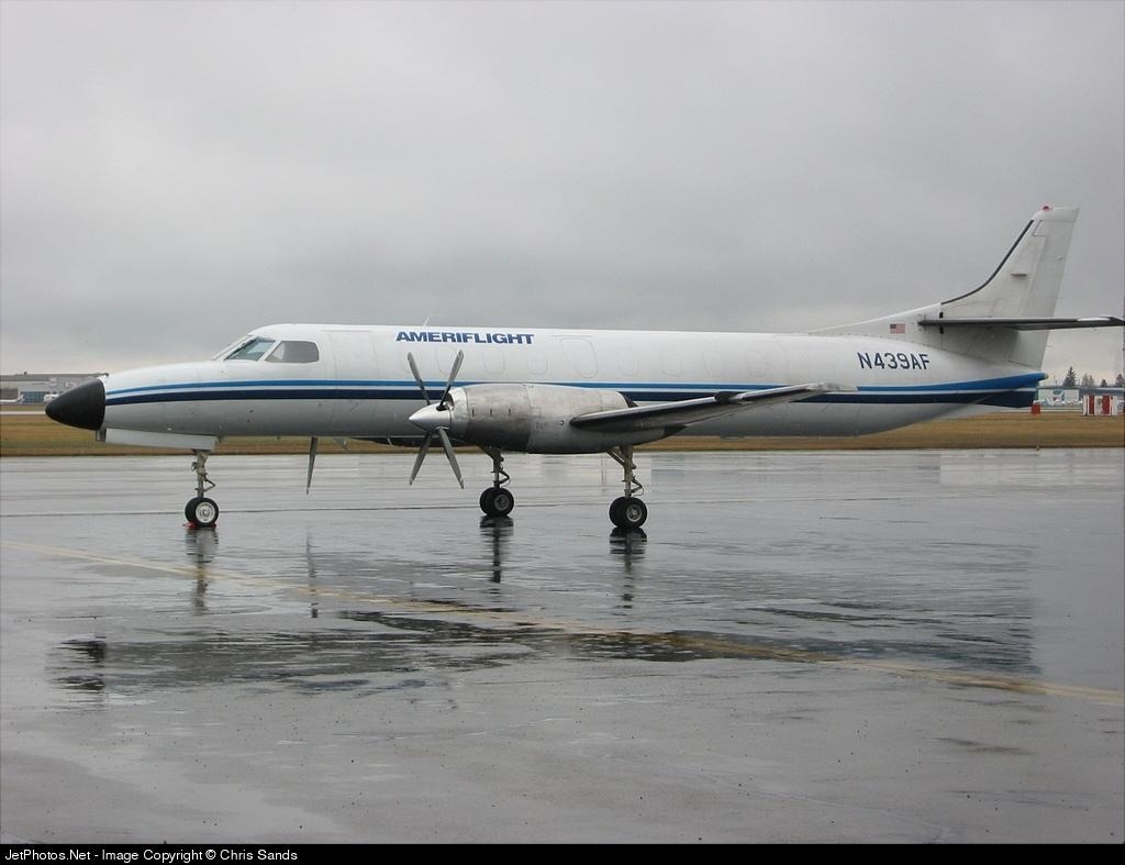
Crash of a Swearingen SA227AT Merlin IVC in Spokane: 1 killed

Date & Time: Nov 29, 2003 at 0801 LT
Operator:
Registration:
N439AF
Flight Type:
Survivors:
No
Schedule:
Seattle – Spokane
MSN:
AT-439B
YOM:
1981
Flight number:
AMF1996
Crew on board:
1
Crew fatalities:
Pax on board:
0
Pax fatalities:
Other fatalities:
Total fatalities:
1
Captain / Total flying hours:
6253
Captain / Total hours on type:
4406.00
Aircraft flight hours:
15126
Circumstances:
The pilot, who had more than 3,340 hours of pilot-in-command time in the make/model of the accident aircraft, and was very familiar with the destination airport and its ILS approach procedure, departed on a cargo flight in the SA227 turboprop aircraft. The aircraft was dispatched with the primary (NAV 1) ILS receiver having been deferred (out of service) due to unreliable performance the evening before the accident, thus leaving the aircraft with the secondary (NAV 2) ILS receiver for ILS use. The pilot arrived in the destination terminal area and was given vectors to intercept the ILS localizer, and radar data showed the aircraft intercepting and tracking the localizer accurately throughout the approach. Mode C altitude readouts showed the aircraft approaching from below the glideslope at the required intercept altitude of 4,100 feet, passing through and above the glideslope and then initiating a relatively constant descent, the angle of which exceeded the glideslope angle of -3.5 degrees. Weather at the destination airport was 400 foot overcast and the decision height for the ILS/DME runway 21R approach was 270 feet. The aircraft passed through the tops of trees in level flight about 530 feet above the airport elevation and slightly under 3 nautical miles from the runway threshold. The pilot was given a low altitude alert by the tower and acknowledged, reporting that he was descending through 2,800 feet, which was confirmed on the mode C radar readout. At that point the aircraft was well below the ILS glideslope and about 13 seconds from impacting the trees. Post crash examination of information captured from the left and right HSI units and an RMI revealed that the NAV 1 receiver was most likely set on the ILS frequency, and the NAV 2 receiver was most likely set on Spokane VORTAC, a terminal navigation facility located very slightly right of the nose of the aircraft and 14 nautical miles southwest of the destination airport.
Probable cause:
The pilot-in-command's failure to maintain proper glidepath alignment during an ILS approach in poor weather resulting in collision with trees and terrain. Contributing factors were the unreliable status of the primary (NAV 1) ILS receiver (leaving the pilot with only the secondary (NAV 2) ILS receiver), the low ceilings and trees.
Final Report:

Crash of a Piper PA-31-350 Navajo Chieftain on Gass Peak: 1 killed

Date & Time: Oct 14, 1999 at 1946 LT
Operator:
Registration:
N1024B
Flight Phase:
Flight Type:
Survivors:
No
Site:
Schedule:
North Las Vegas – Sacramento
MSN:
31-7652107
YOM:
1976
Flight number:
AMF121
Crew on board:
1
Crew fatalities:
Pax on board:
0
Pax fatalities:
Other fatalities:
Total fatalities:
1
Captain / Total flying hours:
2103
Captain / Total hours on type:
250.00
Aircraft flight hours:
14048
Circumstances:
The airplane collided with mountainous terrain during climb to cruise on a night departure. The pilot of the on-demand cargo flight was brought in off reserve to replace the scheduled pilot who was ill. The flight was behind schedule because the cargo was late. When the instrument flight release created further delay, the pilot opted to depart into the clear, dark night under visual flight rules (VFR) with the intention of picking up his instrument clearance when airborne. When clearing the flight for takeoff, the tower controller issued a suggested heading of 340 degrees, which headed the aircraft toward mountainous terrain 11 miles north of the airport. The purpose of the suggested heading was never stated to the pilot as required by FAA Order 7110.65L. After a frequency change to radar departure control, the controller asked the pilot 'are you direct [the initial (route) fix] at this time?' and the pilot replied, 'we can go ahead and we'll go direct [the initial fix].' A turn toward the initial fix would have headed the aircraft away from high terrain. The controller then diverted his attention to servicing another VFR aircraft and the accident aircraft continued to fly heading 340 degrees until impacting the mountain. ATC personnel said the 340-degree heading was routinely issued to departing aircraft to avoid them entering Class B airspace 3 miles from the airport. The approach control supervisor said this flight departs daily, often VFR, and routinely turns toward the initial fix, avoiding mountainous terrain. When the pilot said that he would go to the initial fix, the controller expected him to turn away from the terrain. Minimum Safe Altitude Warning (MSAW) was not enabled for the flight because the original, instrument flight plan did not route the aircraft through this approach control's airspace and the controller had not had time to manually enter the flight data. High terrain was not displayed on the controller's radar display and no safety alert was issued.
Probable cause:
The failure of the pilot-in-command to maintain separation from terrain while operating under visual flight rules. Contributing factors were the improper issuance of a suggested heading by air traffic control personnel, inadequate flight progress monitoring by radar departure control personnel, and failure of the radar controller to identify a hazardous condition and issue a safety alert.
Final Report:

Crash of a Beechcraft C99 Airliner near Bishop: 1 killed

Date & Time: Feb 12, 1999 at 1030 LT
Type of aircraft:
Operator:
Registration:
N205RA
Flight Phase:
Flight Type:
Survivors:
No
Site:
Schedule:
Tonopah - Bishop
MSN:
U-205
YOM:
1983
Crew on board:
1
Crew fatalities:
Pax on board:
0
Pax fatalities:
Other fatalities:
Total fatalities:
1
Captain / Total flying hours:
2958
Captain / Total hours on type:
692.00
Aircraft flight hours:
20522
Circumstances:
The airline transport pilot was repositioning the Beech C99 turboprop cargo hauler on a 73-mile trip without cargo. The pilot had been flying this route for some time and this was his last trip before upgrading to a larger aircraft and route. He told friends that he would take pictures of the scenic parts of the route on his last trip. Three witnesses reported seeing the airplane flying west at low altitude. Two of the witnesses were local ranchers who saw the airplane enter the White Mountains near Trace Plumas Canyon about 7,000 to 8,000 feet msl. White Mountain is 14,246 feet, tapering off north to 13,559 feet and south to 11,285 feet msl. The airplane was reported missing and 2 days later located on White Mountain about 9,400 feet msl. The company flight planned route is 15 miles south of the accident site through Westgard Pass, about 7,291 feet msl. Examination of the low energy impact and the subsequent recovery inspection failed to reveal any mechanical issues.
Probable cause:
The pilot's failure to follow procedures and directives and his failure to maintain clearance from mountainous terrain.
Final Report:

Crash of a Beechcraft 1900C in Seattle

Date & Time: Aug 13, 1997 at 1913 LT
Type of aircraft:
Operator:
Registration:
N3172A
Flight Type:
Survivors:
Yes
Schedule:
Portland - Seattle
MSN:
UB-47
YOM:
1985
Flight number:
AMF262
Crew on board:
1
Crew fatalities:
Pax on board:
0
Pax fatalities:
Other fatalities:
Total fatalities:
0
Captain / Total flying hours:
6370
Captain / Total hours on type:
106.00
Aircraft flight hours:
23892
Circumstances:
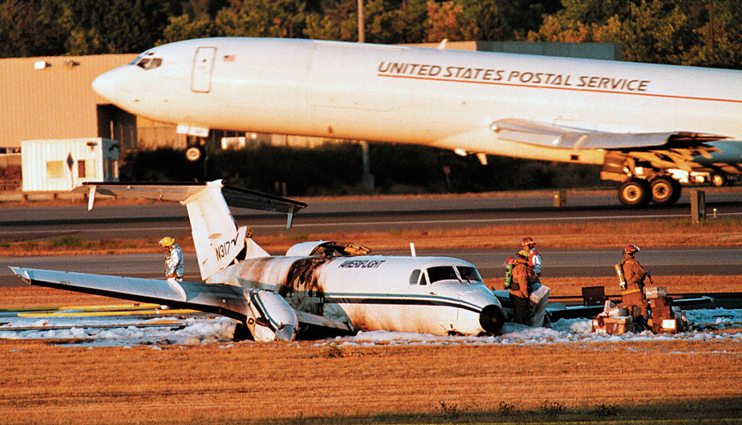
The Beech 1900C cargo aircraft was loaded with more than 4,962 pounds of cargo during an approximate 20 minute period. No scale was available at the aircraft, forcing loaders to rely on tallying either waybill weights or estimates of total cargo weight and center of gravity (CG) during the brief loading period. Additionally, a strike had shut down a major cargo competitor at the time with substantial cargo overflow to the operator. Post-crash examination determined the cargo load was 656 pounds greater than that documented on the pilot's load manifest, and the CG was between 6.8 and 11.3 inches aft of the aft limit. The airplane behaved normally, according to the pilot, until he initiated full flaps for landing approaching the threshold of runway 34L at the Seattle-Tacoma International airport. At this time, the aircraft's airspeed began to decay rapidly and a high sink rate developed as the aircraft entered into a stall/mush condition. The aircraft then landed hard, overloading the nose and left-main landing gear which collapsed. A post-impact fuel system leak during the ground slide led to a post-crash fire.
Probable cause:
A stall/mush condition resulting from an aft center of gravity which was inaccurately provided to the pilot-in-command by contractual cargo-loading personnel. Additional causes were overloading of the aircraft's landing gear and fuel leakage resulting in a post-crash fire. Factors contributing to the accident were the pilot's improper lowering of flaps in an aft CG situation and the inadequate company procedures for cargo loading.
Final Report:

Crash of a Piper PA-31-350 Navajo Chieftain in San Jose: 2 killed

Date & Time: Dec 23, 1995 at 0019 LT
Operator:
Registration:
N27954
Flight Type:
Survivors:
No
Site:
Schedule:
Oakland - San Jose
MSN:
31-7952062
YOM:
1979
Flight number:
AMF041
Crew on board:
2
Crew fatalities:
Pax on board:
0
Pax fatalities:
Other fatalities:
Total fatalities:
2
Captain / Total flying hours:
4659
Captain / Total hours on type:
914.00
Aircraft flight hours:
9840
Aircraft flight cycles:
10966
Circumstances:
The aircraft impacted mountainous terrain in controlled flight during hours of darkness and marginal VFR conditions. The flight was being vectored for an instrument approach during the pilot's 14 CFR Part 135 instrument competency check flight. The flight was instructed by approach control to maintain VFR conditions, and was assigned a heading and altitude to fly which caused the aircraft to fly into another airspace sector below the minimum vectoring altitude (MVA). FAA Order 7110.65, Section 5-6-1, requires that if a VFR aircraft is assigned both a heading and altitude simultaneously, the altitude must be at or above the MVA. The controller did not issue a safety alert, and in an interview, said he was not concerned when the flight approached an area of higher minimum vectoring altitudes (MVA's) because the flight was VFR and 'pilots fly VFR below the MVA every day.' At the time of the accident, the controller was working six arrival sectors and experienced a surge of arriving aircraft. The approach control facility supervisor was monitoring the controller and did not detect and correct the vector below the MVA.
Probable cause:
The failure of the air traffic controller to comply with instructions contained in the Air Traffic Control Handbook, FAA Order 7110.65, which resulted in the flight being vectored at an altitude below the minimum vectoring altitude (MVA) and failure to issue a safety advisory. In addition, the controller's supervisor monitoring the controller's actions failed to detect and correct the vector below the MVA. A factor in the accident was the flightcrew's failure to maintain situational awareness of nearby terrain and failure to challenge the controller's instructions.
Final Report:

Crash of a Beechcraft C99 Airlines near Avenal: 1 killed

Date & Time: Nov 16, 1994 at 0240 LT
Type of aircraft:
Operator:
Registration:
N63995
Flight Phase:
Flight Type:
Survivors:
No
Schedule:
Burbank - Oakland
MSN:
U-178
YOM:
1981
Crew on board:
1
Crew fatalities:
Pax on board:
0
Pax fatalities:
Other fatalities:
Total fatalities:
1
Captain / Total flying hours:
4880
Aircraft flight hours:
20031
Circumstances:
The pilot was on an IFR flight plan level at 10,000 feet msl in VFR conditions. The ATP rated pilot was the sole occupant, and there was no autopilot installed in the Beech C99 Airliner. About 10 minutes after a hand-off from Los Angeles center to Oakland center was acknowledged, radar contact was lost at 0239 hours. A review of the radar data revealed that over the last 4 minutes the airplane's altitude increased to 10,500 feet, then it started a left descending turn with a maximum diameter of about 2.1 nm. The last radar returns indicate the airplane continuing the left turn and descending through 5,600 feet msl, with a descent rate of about 18,000 feet per minute. There was no evidence of a mechanical malfunction of the aircraft, engines, or propellers.
Probable cause:
Loss of aircraft control at night by the pilot for unknown reasons.
Final Report:

Crash of a Piper PA-31-350 Navajo Chieftain in Frazier Park: 1 killed

Date & Time: Mar 3, 1994 at 2346 LT
Operator:
Registration:
N78DE
Flight Phase:
Flight Type:
Survivors:
No
Site:
Schedule:
Burbank - Oakland
MSN:
31-7852087
YOM:
1978
Crew on board:
1
Crew fatalities:
Pax on board:
0
Pax fatalities:
Other fatalities:
Total fatalities:
1
Captain / Total flying hours:
3600
Captain / Total hours on type:
135.00
Aircraft flight hours:
9136
Circumstances:
The pilot elected not to use the stored instrument flight plan, and he departed with a special VFR clearance. The flight was being followed by radar. After reaching visual flight conditions, the pilot proceeded toward his intended destination and climbed to 8,500 feet. Minimum safe altitude warning service was available, but not requested by the pilot. A review of radar data indicates that the airplane's track remained almost constant at 300° with a 160-knot ground speed. The last radar hit on the airplane occurred about 0.3 miles from where the airplane cruised into 8,500 foot msl terrain while still tracking along a northwesterly course. The accident occurred in dark, night time conditions.
Probable cause:
The pilot's failure to select a cruise altitude which would ensure adequate terrain clearance. Contributing factors related to the dark, nighttime condition and to the pilot's lack of attentiveness.
Final Report: