Country
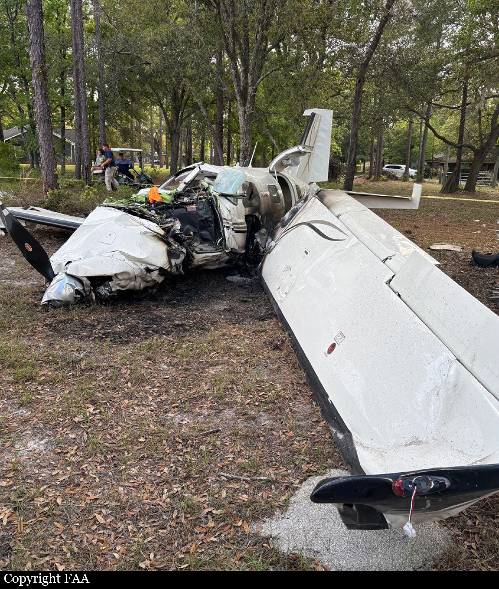
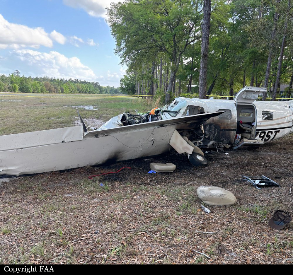
Crash of a Piper PA-46R-350T Malibu Matrix in Folkston
Date & Time:
Apr 10, 2025 at 1608 LT
Registration:
N179ST
Survivors:
Yes
Schedule:
Cornelia – Folkston
MSN:
46-92003
YOM:
2008
Crew on board:
1
Crew fatalities:
Pax on board:
5
Pax fatalities:
Other fatalities:
Total fatalities:
0
Captain / Total hours on type:
194.00
Aircraft flight hours:
1502
Circumstances:
At the conclusion of the instrument flight rules flight, the pilot approached the 2,500-ft-long by 50-ft-wide runway at the destination airport. The pilot was unable to recall any of the events that transpired after the landing flare, but the front seat passenger described that the airplane’s nose pitched up as the airplane descended below the tops of the trees that surrounded the airport. The pilot then initiated a go-around, but the airplane did not climb as expected and drifted left towards the trees. The left wing then dropped before the airplane struck the ground, resulting in a postimpact fire. The fuselage and left wing were substantially damaged during the accident sequence. The pilot reported, and a postaccident examination of the wreckage confirmed, that there were no preimpact mechanical malfunctions of the airplane that would have precluded normal operation.
Probable cause:
The pilot’s failure to maintain control of the airplane during a go-around.
Final Report:

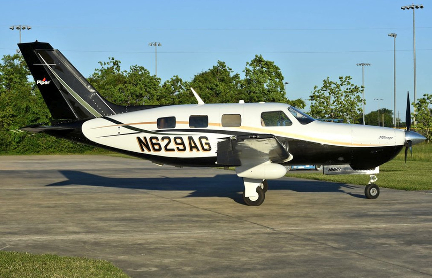
Crash of a Piper PA-46-350P Malibu Mirage in Anderson: 4 killed
Date & Time:
Sep 6, 2024 at 0952 LT
Registration:
N629AG
Survivors:
No
Schedule:
Fort Dodge - Anderson
MSN:
46-36605
YOM:
2013
Crew on board:
1
Crew fatalities:
Pax on board:
3
Pax fatalities:
Other fatalities:
Total fatalities:
4
Circumstances:
On final approach to Anderson-Darlington Field Airport, the pilot initiated a go-around procedure, probably because his altitude was too high. Control was lost and the single engine airplane crashed in an open field located three miles from the airfield, bursting into flames. All four occupants were killed.
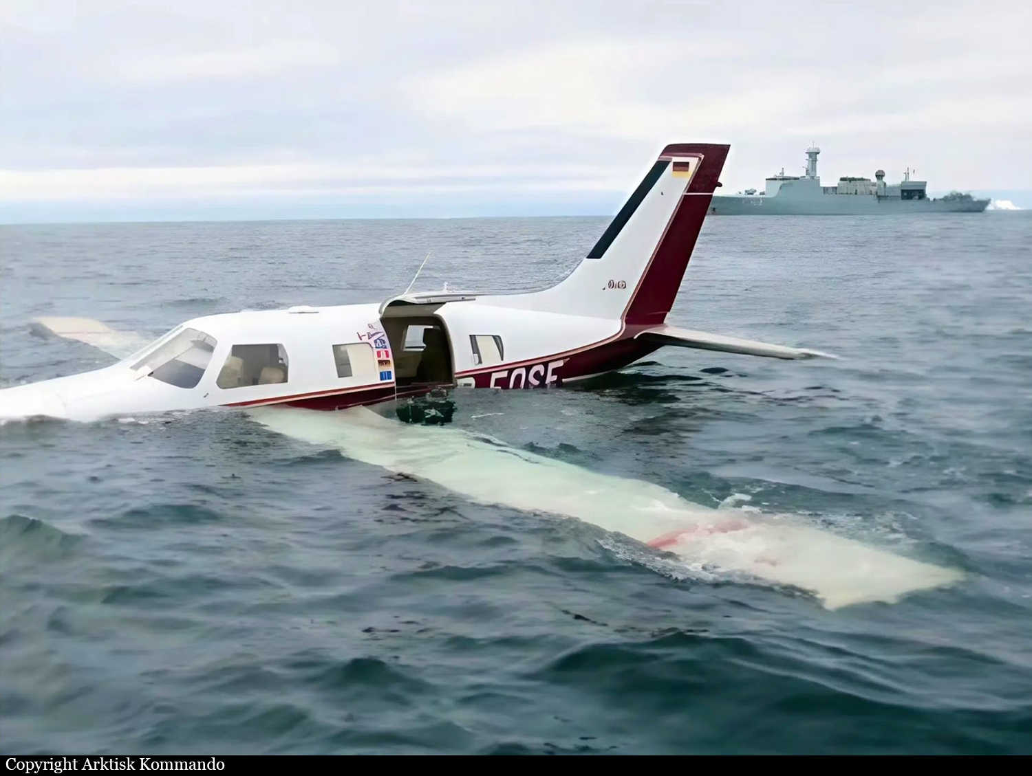
Crash of a Piper PA-46-310P Malibu off Qaqortoq
Date & Time:
Jul 29, 2024 at 1333 LT
Operator:

Registration:
D-EOSE
Survivors:
Yes
Schedule:
Goose Bay – Narsarsuaq
MSN:
46-08010
YOM:
1986
Crew on board:
1
Crew fatalities:
Pax on board:
1
Pax fatalities:
Other fatalities:
Total fatalities:
0
Captain / Total hours on type:
107.00
Aircraft flight hours:
3590
Circumstances:
The crew was returning to Europe after taking part to the AirVenture airshow in Oshkosh. Following a fuel stop in Goose Bay, the crew continued to Narsarsuaq, Greenland. The initial cruise level was FL210, but after a short while, ATC instructed the pilot to descend to FL180. The pilot set the cruise power to 65% (26.5' Manifold Pressure (MP) and 2,400 revolutions per minute (rpm)), and the Fuel Flow (FF) leaned to 14 US gallons per hour (gph) with a Turbine Inlet Temperature (TIT) of 50° Fahrenheit (F) Lean of Peak (LOP). The weather en route was 'nice' and mostly VMC, and the Outside Air Temperature (OAT) at FL180 was approximately -10° to -15° Celsius (C). The pilot contacted Nuuk Information (ATS unit Flight Information Center (FIC) Nuuk) when the aircraft entered Nuuk Flight Information Region (FIR). At 1304LT, in preparation for landing in BGBW, the pilot reported a descent from FL180 to 11,000 feet inbound to the IFR reporting point SIMNI (located at the Greenlandic coastline, 45 nm south-west of BGBW). The pilot initiated a 500 feet per minute descent and kept the cruise power setting at 65%. While passing FL160, the pilot and the passenger briefly noticed an 'unusual, electrical, and not very strong smell'. The cabin altitude started increasing by a rate of 3,000 fpm, and the pilot realized 'something was wrong'. Shortly after, the CABIN ALTITUDE annunciator warning light illuminated, indicating a cabin altitude above 10,000 feet. As the aircraft was below an altitude of 15,000 feet and descending, the pilot considered the time of useful consciousness and opted not to don the oxygen masks. At 1316LT, the pilot declared an urgency situation to Nuuk Information: 'Pan-Pan, Pan-Pan, Pan-Pan. We have an air conditioning problem and a low oil pressure indication'. The MP dropped from 26” to 17-18” and the pilot moved the throttle lever forward without any effect. All Cylinder Head Temperatures (CHT) indicated 'normal and balanced', and the pilot moved the mixture control full forward to the rich position. The engine almost stopped, and the pilot retarded the mixture control back to the previous position. The aircraft pitch was adjusted to obtain the best glide airspeed of 90 knots. At 1317LT, while descending through 12,000 feet, the pilot declared a distress situation to Nuuk Information: 'Mayday, Mayday, Mayday. We have high rpm now and will try to make it to the shore'. The pilot activated the aircraft Emergency Locator Transmitter (ELT). A surveillance aircraft from the RDAF and an inspection ship from the RDN were on patrol in the area. The Danish Armed Forces Arctic Command allocated both to provide assistance. While descending through 7,000 feet altitude, the propeller rpm increased to 3,000 rpm, and 30 seconds later, the oil pressure indicated zero. The pilot pulled back the mixture handle to the idle/cut-off position and stopped the engine to avoid major mechanical damage. The pilot observed on his knee-mounted tablet that the predicted gliding distance of the aircraft fell short of the coastline. At 1326LT, the pilot informed Nuuk Information of the expected ditching position: 60° 30' N 46° 45' W. The pilot and the passenger prepared to ditch by checking the location of the life raft in the cabin, zipping up their survival suits (which they were already wearing up to their waists), and tightening their seat belts. At 1329LT, as the aircraft was passing 3,300 feet descending, the RDAF surveillance aircraft spotted the aircraft gliding on a north-easterly course over a low overcast. At approximately 1,700 feet, the aircraft entered the cloud layer, and exited below at approximately 700 feet. The RDAF surveillance aircraft lost sight of the aircraft as it entered the cloud layer. In order to safely descend below the cloud layer in VMC, the flight crew of the RDAF surveillance aircraft had to fly to the coastline, descend, and fly back towards the expected ditching position below the cloud layer. The visibility below the cloud layer was 'good', and the sea surface had 'only low swells'. At 1333LT, the pilot selected flap setting 2 (20°), slowed down the aircraft to minimum airspeed, and flared the aircraft straight ahead. The aircraft bounced slightly on the sea surface once, before hitting the sea surface a second time. The aircraft decelerated fairly abruptly – 'similar to a hard brake in a car' – and stopped in a wings-level position, floating on the surface. The pilot and the passenger released their seat belts, went into the aft cabin, and opened the top part of the aircraft entrance door, which was above the water level. They manoeuvred the life raft through the entrance door into the water and inflated the raft. The pilot and the passenger threw a few personal items into the raft and stepped directly from the aircraft into the raft. At 1340LT, at position 60° 34' N 46° 50' W, the RDAF surveillance crew spotted the life raft with the pilot and passenger. For the next 45 minutes, the RDAF surveillance aircraft circled overhead the life raft. At approximately 1400LT, the pilot contacted Nuuk FIC via satellite telephone. At 1423LT, a rescue crew in a rigid-hulled inflatable boat (RHIB) dispatched from the RDN inspection ship and picked up the pilot and passenger. The aircraft sank approximately 2 hours after the ditching.
Probable cause:
An engine failure during descent resulted in a ditching off the southwest coast of Greenland. The AIB could not determine the exact cause of the engine failure, but it was likely due to a seeping oil leak.
A combination of the following factors made the accident survivable:
- The pilot declared an urgency followed by an emergency to ATS, and a nearby RDAF surveillance aircraft obtained visual contact with the gliding aircraft.
- The pilot successfully landed the aircraft on calm sea.
- The pilot and the passenger wore survival suits and carried a life raft on board, which they boarded upon safely evacuating the aircraft.
- After 50 minutes, personnel from a nearby RDN inspection ship arrived and rescued the pilot and passenger.
Final Report:
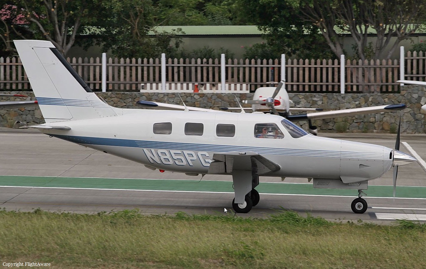
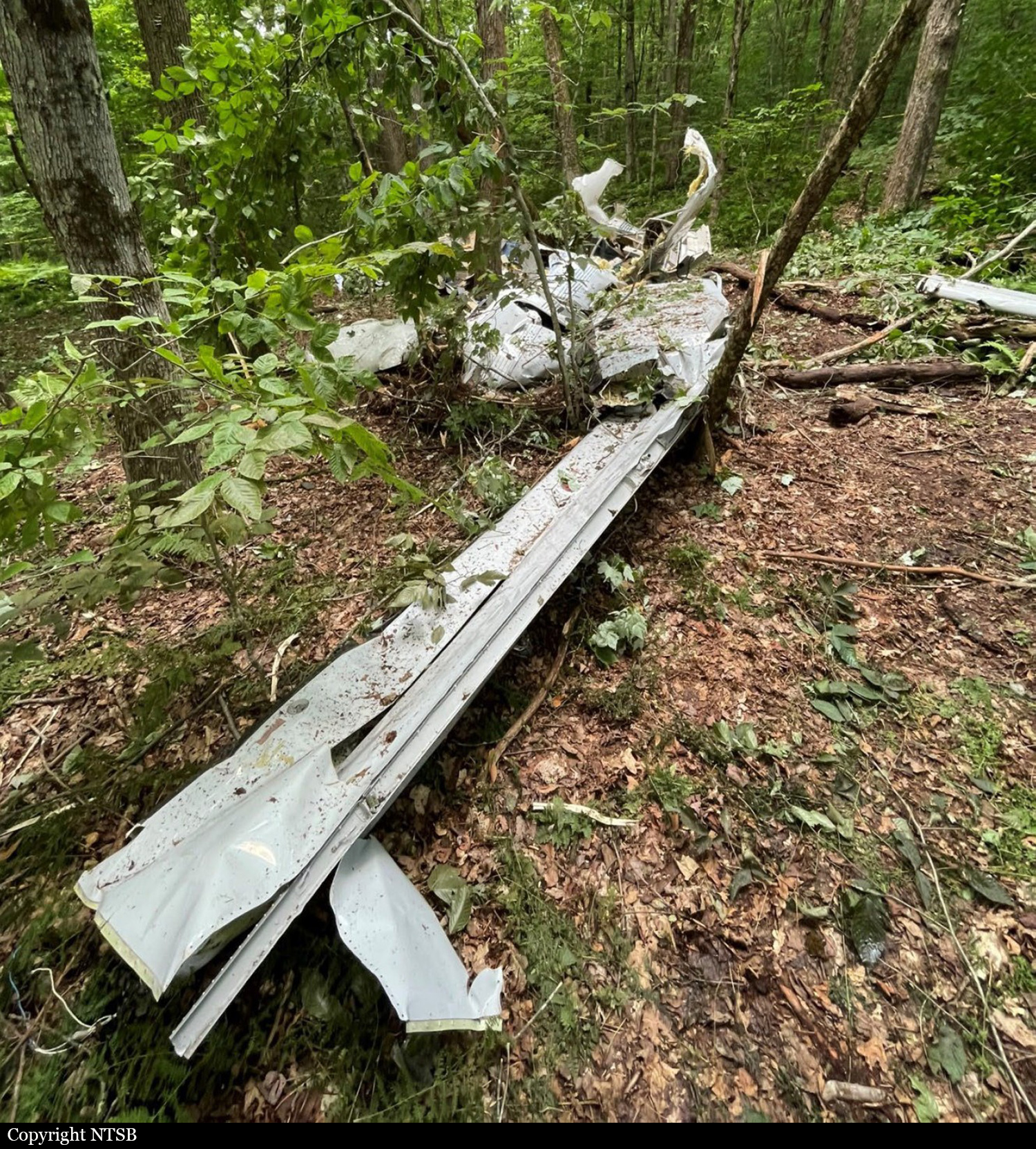
Crash of a Piper PA-46-310P Malibu near Trout Creek: 5 killed
Date & Time:
Jun 30, 2024 at 1355 LT
Registration:
N85PG
Survivors:
No
Schedule:
Oneonta - Charleston
MSN:
46-8508066
YOM:
1985
Crew on board:
1
Crew fatalities:
Pax on board:
4
Pax fatalities:
Other fatalities:
Total fatalities:
5
Aircraft flight hours:
6024
Circumstances:
The pilot filed an instrument flight rules (IFR) flight plan from the departure airport with an estimated time en route of 2 hours 47 minutes and a cruising altitude of 12,000 ft mean sea level (msl). The flight planning application the pilot used to file the flight plan provided weather briefing information, which included a convective SIGMET active for the time and route of flight and pilot weather reports (PIREPs) for turbulence and moderate chop; however, it could not be determined whether the pilot reviewed this information. The flight departed about 45 minutes after the pilot’s filed departure time. Flight track data and air traffic control communications showed that, about 1 minute after departing, the pilot contacted air traffic control (ATC) to obtain an IFR clearance. The controller cleared the pilot to his destination as filed, issued a climb to 10,000 ft msl, and provided a weather advisory for moderate and heavy precipitation along the route, which the pilot acknowledged. About 4 minutes later, the controller issued the pilot a climb to 12,000 ft msl, which the pilot acknowledged. About that time, the controller began a position relief briefing with a relieving controller, which took about 2 minutes. About 2 minutes later, the new controller queried the pilot after observing that the flight had deviated left of course. The flight track data showed that, just before the query from the controller, the airplane deviated from its southwesterly ground track and began a 45-second, right 270° turn starting at an altitude of 9,800 ft msl. While in the turn, the airplane descended to an altitude of 8,700 ft msl before climbing back to an altitude of 9,800 ft msl when the airplane rolled out on an easterly ground track. About 1 minute after the query from the controller, the pilot responded, stating he had “lost” something, followed by a similar transmission 27 seconds later. This was the last transmission heard that could be attributed to the accident airplane. The airplane continued on a wavering east track for about 40 seconds, descending back down to 8,700 ft msl before climbing to 9,025 ft msl, after which the airplane entered a tight, right, descending spiral until track data was lost. The airplane crashed in a dense wooded area located in Trout Creek and was totally destroyed. All five occupants were killed.
Probable cause:
The pilot’s loss of airplane control in flight due to spatial disorientation during a climb to cruise altitude in instrument meteorological conditions and turbulence, which resulted in the in-flight breakup of the airplane. Contributing to the accident was the pilot’s continued flight into an area of known convective activity.
Final Report:
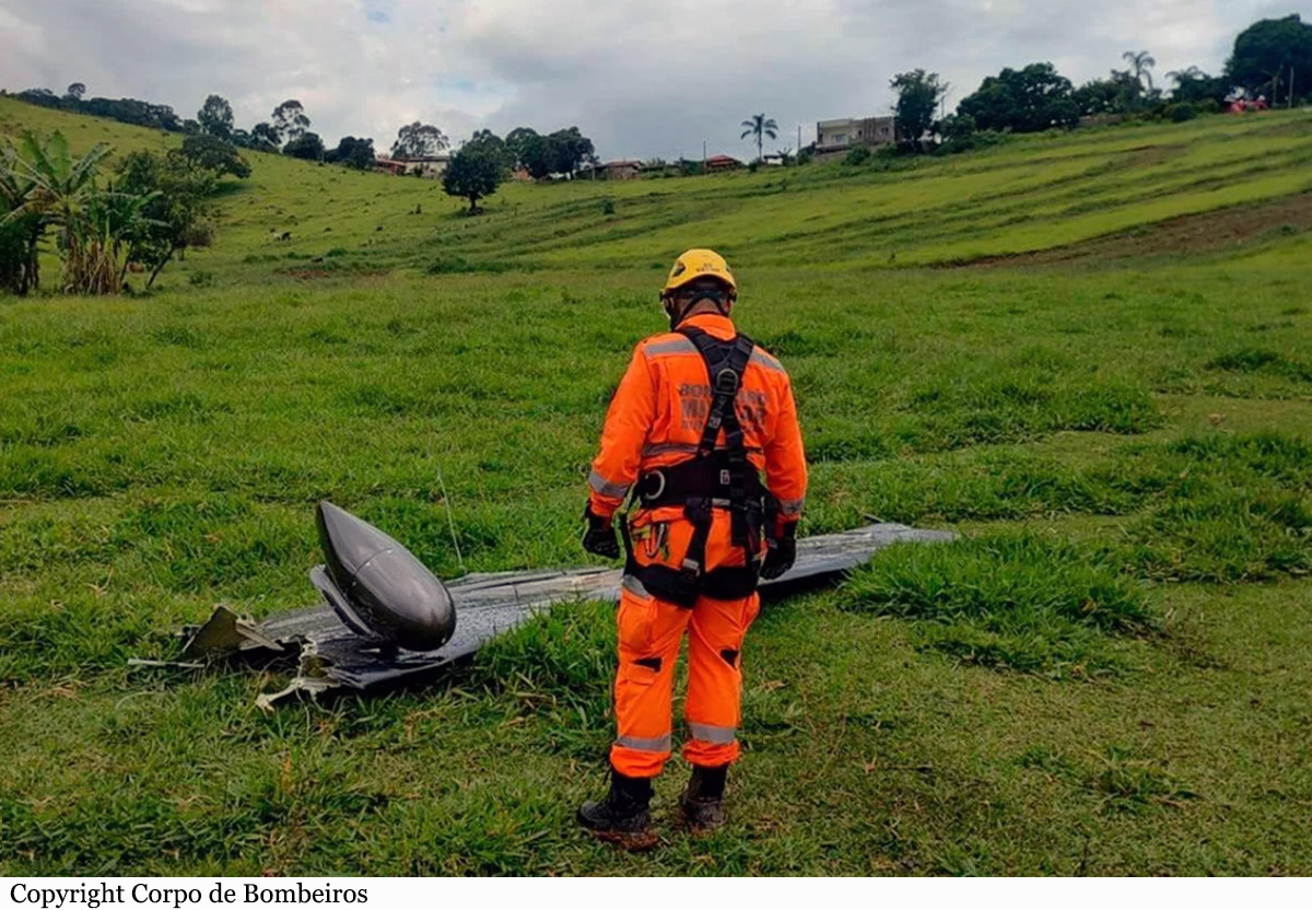
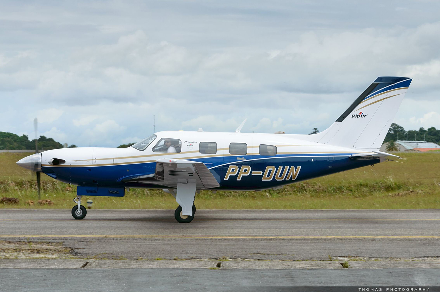
Crash of a Piper PA-46-500TP Malibu Meridian in Sorriso: 2 killed
Date & Time:
Jun 7, 2024 at 0600 LT
Registration:
PP-DUN
Survivors:
No
Schedule:
Sorriso - São José do Rio Claro
MSN:
46-97499
YOM:
2012
Crew on board:
1
Crew fatalities:
Pax on board:
1
Pax fatalities:
Other fatalities:
Total fatalities:
2
Circumstances:
After takeoff from Sorriso-Aero Agro Airfield, the pilot encountered an unexpected situation and apparently elected to return to the airport. The airplane entered an uncontrolled descent in a right turn then crashed in a dense wooded area located southeast of the city of Sorriso, bursting into flames. The airplane was totally destroyed and both occupants were killed.

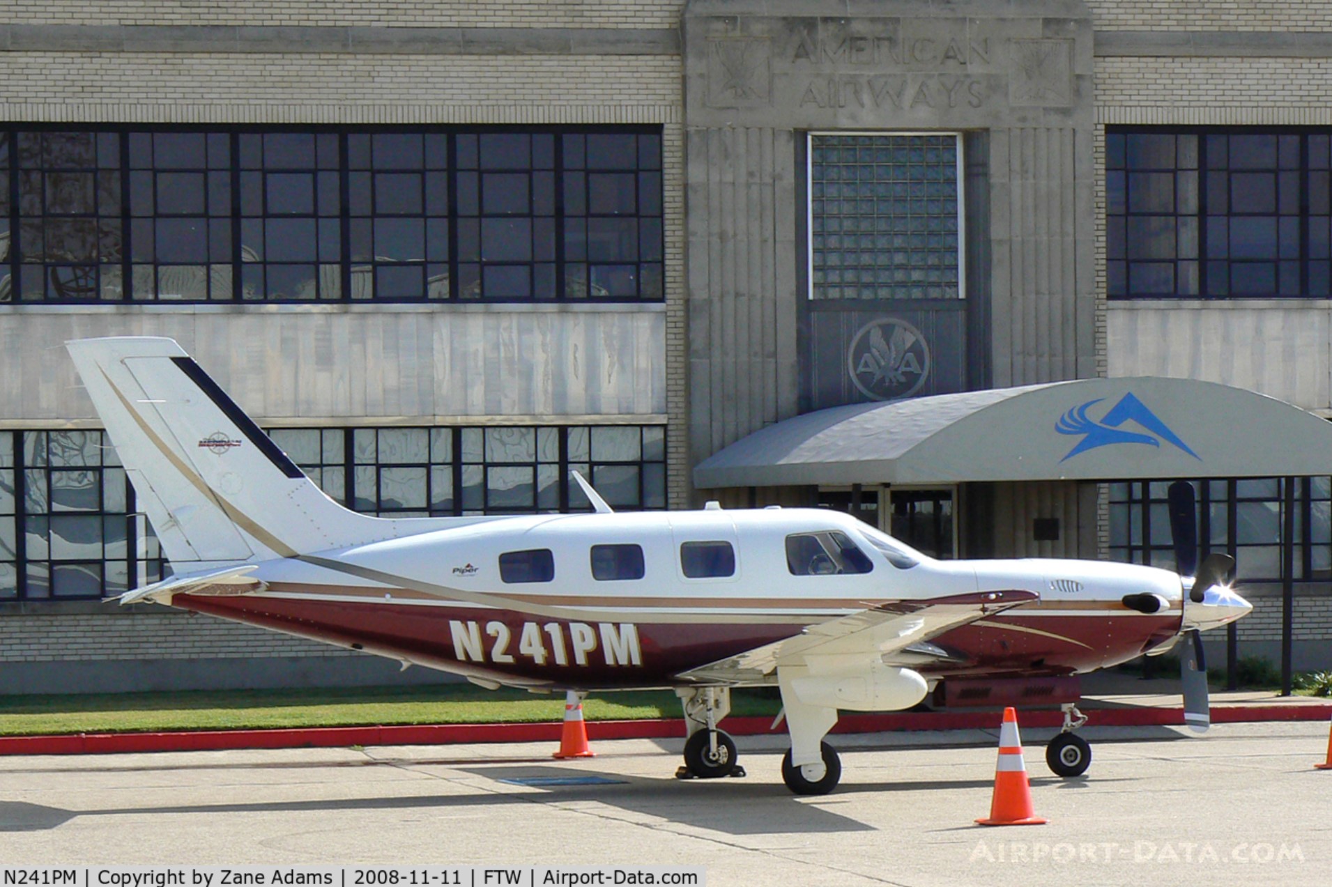
Crash of a Piper PA-46-500TP Malibu Meridian in Marianna: 2 killed
Date & Time:
May 12, 2024 at 1957 LT
Registration:
N241PM
Survivors:
No
Schedule:
Pensacola - Batesville
MSN:
46-97150
YOM:
2003
Crew on board:
1
Crew fatalities:
Pax on board:
1
Pax fatalities:
Other fatalities:
Total fatalities:
2
Circumstances:
The single engine airplane departed Pensacola Regional Airport, Florida, on a private flight to Batesville, Arkansas, with two people on board. About 1,5 hour into the flight, while cruising at an altitude of 28,000 feet, the pilot initiated a descent when control was lost. The airplane crashed in an open field located southeast of Marianna and was destroyed. Both occupants were killed.
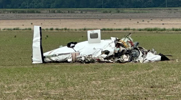
Crash of a Piper PA-46-350P Malibu Mirage near Hartsburg: 1 killed
Date & Time:
Apr 16, 2024 at 1205 LT
Registration:
N451MA
Survivors:
No
Schedule:
Madison - Siloam Springs
MSN:
46-36541
YOM:
2012
Crew on board:
1
Crew fatalities:
Pax on board:
0
Pax fatalities:
Other fatalities:
Total fatalities:
1
Captain / Total hours on type:
78.00
Aircraft flight hours:
1370
Circumstances:
The airplane was on an instrument flight rules flight and air traffic control (ATC) provided the pilot with vector guidance to avoid an active military operations area (MOA). The controller informed the pilot that he would only be able to deviate to the left of his course due to the active MOA. At that time, the airplane was in an area of developing convective weather activity and likely in instrument meteorological conditions. The pilot reported to ATC that he encountered freezing rain. ATC communications revealed that the pilot requested to deviate to the left of his course due to weather, including mention of encountering freezing rain, which ATC approved. Flight track data showed the airplane entered a descending left turn. A performance study based on the aircraft track data showed that, during the turn, the airplane’s roll angle reached 70°, the pitch angle reached -17° and then -34°, and the calibrated airspeed exceeded both the airplane's published never exceed speed (VNE), and its maximum operating maneuvering speed (VO). During the turn, the airplane’s structure broke apart, and wreckage was distributed along a 3-mile path. The flight path depicted in the flight track data was consistent with a loss of airplane control. The airplane was destroyed and the pilot was killed.
Probable cause:
The pilot’s encounter with convective weather conditions, which resulted in a loss of airplane control, the exceedance of the airplane’s never exceed speed, and the resulting overload failure of the horizontal stabilizer and subsequent failure of the airplane’s wings.
Final Report:


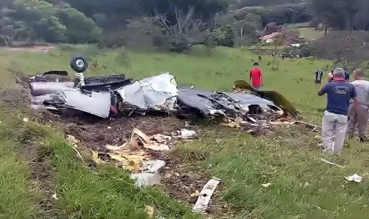
Crash of a Piper PA-46-350P Malibu Mirage near Itapeva: 7 killed
Date & Time:
Jan 28, 2024 at 1038 LT
Operator:

Registration:
PS-MTG
Survivors:
No
Schedule:
Campinas - Belo Horizonte
MSN:
46-36065
YOM:
1996
Crew on board:
1
Crew fatalities:
Pax on board:
6
Pax fatalities:
Other fatalities:
Total fatalities:
7
Circumstances:
The single engine airplane departed Campinas-Campo de Amarais-Prefeito Francisco Amaral Airport on a flight to Belo Horizonte-Pampulha-Carlos Drummond de Andrade Airport. After takeoff, the pilot continued to the east when he apparently encountered adverse weather conditions. The airplane entered an uncontrolled descent, suffered an in-flight breakup, lost a wing and eventually crashed in a prairie located less than 3 km south of Itapeva. The airplane was totally destroyed and all seven occupants were killed.