Country
Operator Image

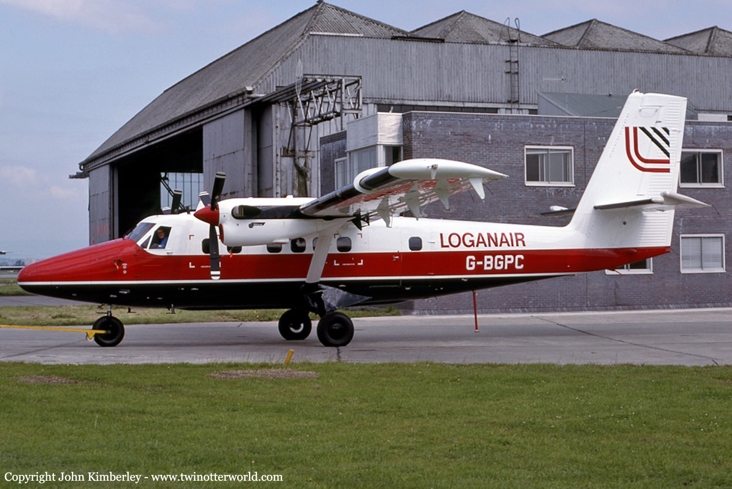
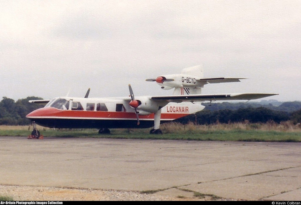
Crash of a De Havilland DHC-6 Twin Otter 300 in Port Ellen: 1 killed

Date & Time: Jun 12, 1986 at 1522 LT
Operator:
Registration:
G-BGPC
Survivors:
Yes
Schedule:
Glasgow - Port Ellen
MSN:
635
YOM:
1979
Flight number:
LC423
Region:
Crew on board:
2
Crew fatalities:
Pax on board:
14
Pax fatalities:
Other fatalities:
Total fatalities:
1
Captain / Total flying hours:
12421
Captain / Total hours on type:
867.00
Copilot / Total flying hours:
2110
Copilot / Total hours on type:
27
Aircraft flight hours:
9206
Circumstances:
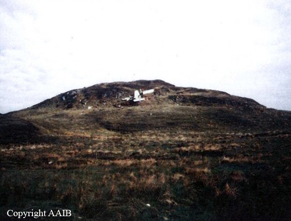
Loganair Flight LC423 was a scheduled passenger flight from Glasgow Airport (GLA) to Islay/Port Ellen (ILY). The handling pilot, who occupied the first pilot's position, had recently converted to flying the DHC-6 Twin Otter aircraft, and was completing a series of supervised route flights required by the airline before the award of full command status. A company supervisory captain, the designated commander for this flight, occupied the co-pilot's position. The Twin Otter's engines were started at 14:38, and, at 14:44, Glasgow Airport ATC approved taxy clearance to the holding point of runway 28. The aircraft was operating on a stored Instrument Flight Rules (IFR) flight plan. The requested routeing was a Standard Instrument Departure (SID), to join Airway Blue 2 for the Skipness VOR beacon, and thereafter direct to the Islay/Port Ellen NDB. The direct track is the 272° Magnetic (M) radial from Skipness. At 14:46 Glasgow ATC advised LC423 of their flight clearance. The requirement to fly the SID was cancelled and the aircraft was cleared direct to Skipness, cruising level FL55. The aircraft took off from runway 28 at 14:48. The aircraft reported a position overhead the Skipness VOR at 15:08. At this point Scottish Airways Control informed LC423 that they should clear controlled airspace, contact Port Ellen, and that there was no known traffic to affect their descent. After passing overhead the Skipness VOR the aircraft did not depart that position on the 272° radial, but instead turned 15° left, and descended on the 257° radial towards the south of the island of Islay. At 15:10, having already started to descend, LC423 contacted Islay/Port Ellen, reported an arrival time of 15:23, and requested details of the latest weather. The Islay/Port Ellen radio operator replied that the weather details were a surface wind of 220°/05 knots, visibility 2000 metres in drizzle, cloud 3 oktas at 400 feet, 5 oktas at 700 feet, and 8 oktas at 1400 feet. The sea level barometric pressure was 1018 millibars. LC423 acknowledged the information and was asked to advise when overhead the aerodrome at 3600 feet, or when in visual contact. The aircraft then continued to descend, on a track of about 260° M towards the south of the island, until it disappeared from radar cover at a height of 1400 feet and at a position 12 nautical miles (nm) from Islay/Port Ellen aerodrome on the 106° M radial. From the position that the aircraft descended below radar cover it is estimated that a direct track was flown towards the southern coast of the Isle of Islay. The flight continued at very low level parallel to the south coast. At 15:21 the Islay/Port Ellen radio operator transmitted further weather information which recorded that cloud conditions were similar to the previous report but that there was then heavy drizzle. Changes in barometric pressure settings were also reported. LC423 acknowledged this information and reported "over Port Ellen". However, the aircraft was not, at that time, over Port Ellen, but was in fact turning inland at very low level over Laphroaig. From overhead Laphroaig the aircraft settled on to a northwesterly heading and very shortly afterwards crashed into rising ground, that was obscured in hill fog, approximately 1 nm from the coast at a height of 360 feet amsl.
Probable cause:
The commander's decision to allow the handling pilot to carry out a visual approach in totally unsuitable meteorological conditions. An error in visual navigation was a contributory factor.
Final Report:

Crash of a Britten-Norman BN-2A-26 Islander in Sanday

Date & Time: Jun 1, 1984 at 0824 LT
Type of aircraft:
Operator:
Registration:
G-BDVW
Survivors:
Yes
Schedule:
Kirkwall - Stronsay - Sanday
MSN:
522
YOM:
1977
Flight number:
LC621
Location:
Region:
Crew on board:
1
Crew fatalities:
Pax on board:
7
Pax fatalities:
Other fatalities:
Total fatalities:
0
Captain / Total flying hours:
4136
Captain / Total hours on type:
67.00
Aircraft flight hours:
5015
Aircraft flight cycles:
13451
Circumstances:
Loganair flight LC 621 was scheduled to fly from Kirkwall, on Orkney Island, to the Islands of Stronsay and Sanday, departing from Kirkwall at 07:30. The weather at Kirkwall was predominantly misty with low cloud and thus unsuitable for an on-schedule departure; accordingly, the commander decided to delay the flight pending an improvement. Because there are no formal weather reporting facilities at Stronsay or Sanday, crews must rely upon the area forecast and on any informal information passed by the respective aerodrome attendants. At about 07:25 hrs, the two airfield attendants telephoned, in turn, to say that the weather at Sanday was suitable for landing and that at Stronsay the visibility was then about 1½ miles. At 07:50 the commander decided that the weather conditions at Kirkwall were now better than the published takeoff minima and that the flight could be conducted under the Visual Flight Rules (VFR). Accordingly, the BN-2 Islander took off for Stronsay with six passengers on board. The flight was uneventful and the aircraft landed at Stronsay at 07:58. There two passengers disembarked and three joined for the 6 mile flight to Sanday, which departed at 08:03. As they passed the south-west tip of Sanday Island, the visibility was 2 miles with very low patchy stratus and with a higher layer of cloud. The pilot therefore flew the route below the upper layer of cloud, at 300 feet amsl and at a reduced airspeed of 90 knots, compared with the normal cruising speed of 130 knots. When the aircraft was about 3/4 mile out from Sanday airfield the commander recognised the chequered marker boards near the end of the grass runway 03. He next saw the windsock, which showed the wind to be about 140°/15-20 knots, and slowly descended to 250 feet amsl (190 feet above the aerodrome) to position the aircraft downwind for runway 11. Whilst doing so, he lost sight of the airfield in deteriorating visibility and, as the cloudbase ahead appeared to be getting lower, he climbed away in a northwesterly direction and levelled off above the layer of cloud, at 600 feet amsl. Whilst establishing the aircraft on the track to Kirkwall, the commander noticed some areas clear of cloud about 3 miles off the northwest coast of Sanday. As, in the opinion of the commander, these provided a safe area for descent over the sea, he used them to descend to 300 feet again and approached the northwest coast at 90 knots with the intention of map-reading his way back to Sanday aerodrome. Having carried out the descent and the relevant aircraft checks the commander saw the headland, which he knew to be Whale Point, some 2-3 miles distant. By reference to his map he was aware that he could follow the road which ran in a southwesterly direction and then turn southeast to a specific point which would lead him directly onto the final approach to runway 11. However, having failed to recognise the turning point, he navigated by reference to his map around the south, east and north of the aerodrome in order to intercept the road running southwest and thus relocate the turn-in point to the runway. The commander stated that he was aware that the meteorological conditions were very conducive to the formation of carburettor icing, so he applied the normal period of carburettor heat to each engine just before the final approach. He then turned the aircraft onto the final approach and, not yet seeing the airfield, used the school - which he could see and knew to be almost directly beneath the final approach path - to align the aircraft with the runway. As the aircraft passed abeam of the school the commander was able to identify the runway markers of runway 11. By this time the aircraft speed had reduced from the 65 knots at which the approach had been flown, but the speed actually achieved is not known. The left wing of the aircraft then dropped and the aircraft established a rate of sink. The stall warning system activated and the application of full throttle could not arrest the descent before ground contact. During this final descent, the aircraft turned through 55° to the left and struck the ground in a manner quoted by some passengers as not very different from a normal landing, although at a point some 450 feet (137 metres) short of the runway threshold. Thinking that the aircraft had merely bounced on the ground, the commander left the power applied and attempted to climb away. With full throttle still applied, the aircraft continued through two barbed wire fences, across a small quarry and a shallow ditch. It finally came to rest, after passing through another barbed wire fence, some 1,065 feet (325 metres) from the initial impact point. The commander then closed the throttles and shut down the engines.
Probable cause:
The accident was caused by the commander's decision to continue a low level VFR flight in meteorological conditions which were inappropriate. His low experience of the task was a contributory factor.
Final Report:

Crash of a Britten-Norman BN-2A Trislander III-1 in Aberdeen

Date & Time: May 15, 1979
Type of aircraft:
Operator:
Registration:
G-BCYC
Survivors:
Yes
MSN:
1011
YOM:
1975
Region:
Crew on board:
0
Crew fatalities:
Pax on board:
0
Pax fatalities:
Other fatalities:
Total fatalities:
0
Circumstances:
Upon touchdown, the tree engine aircraft went out of control and came to halt. There were no casualties but the aircraft was written off.