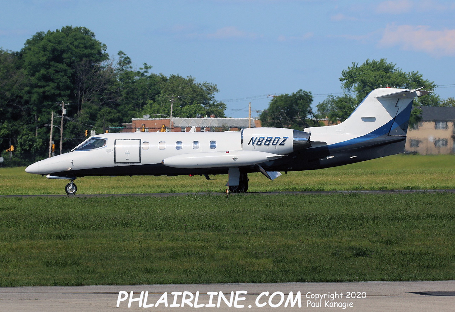
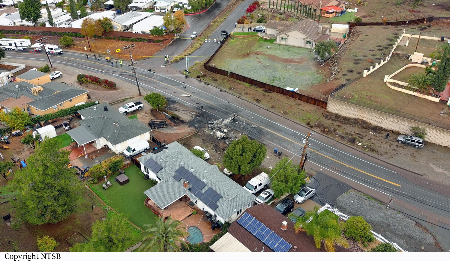
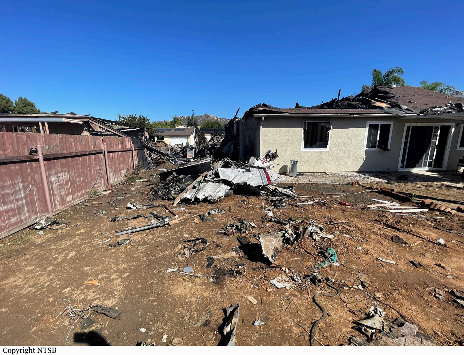
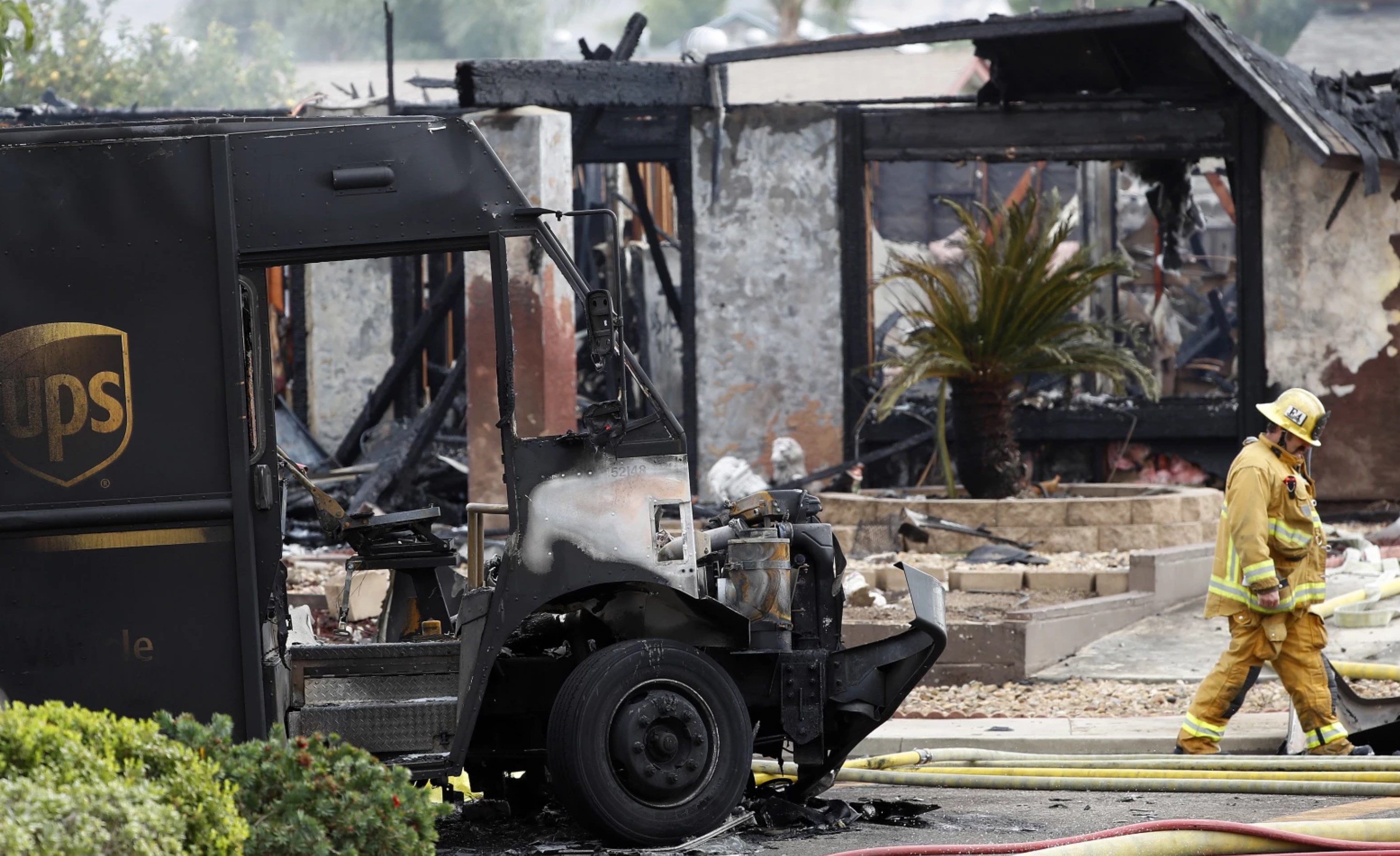
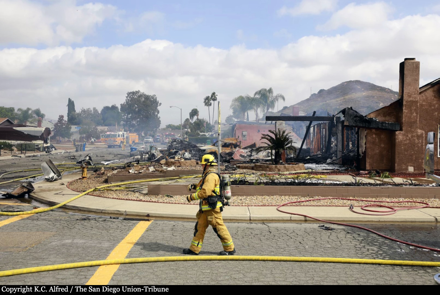
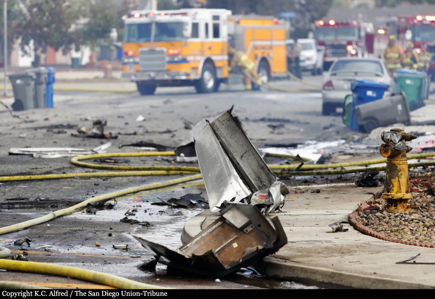
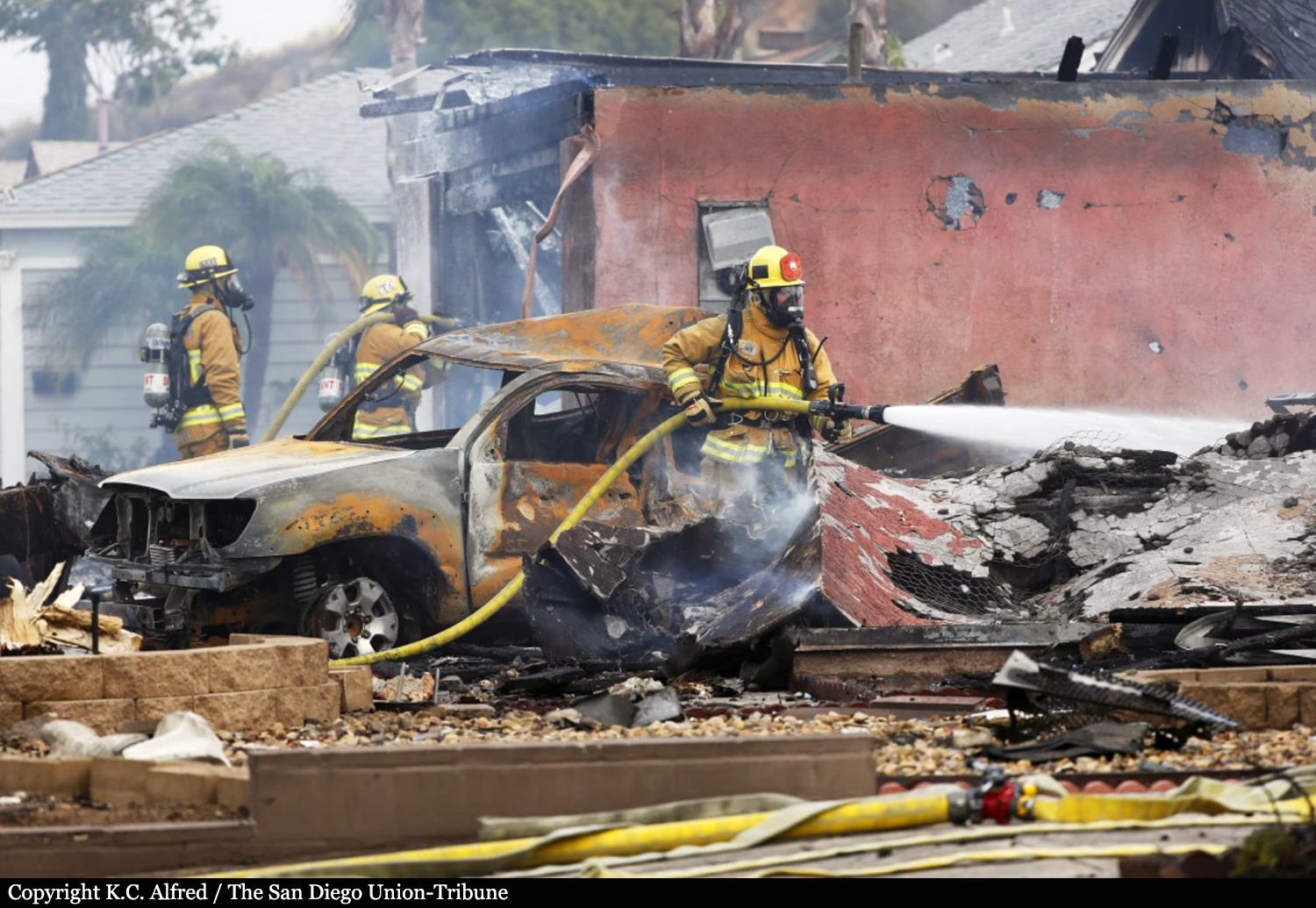
Crash of a Learjet 35A in Santee: 4 killed
Date & Time:
Dec 27, 2021 at 1914 LT
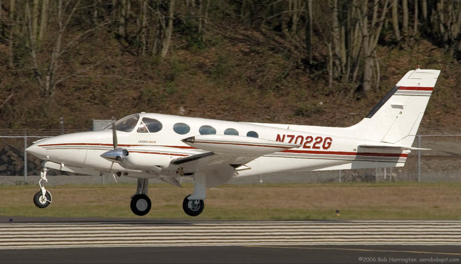
Operator:

Registration:
N880Z
Survivors:
No
Schedule:
Santa Ana - Santee
MSN:
35A-591
YOM:
1985
Crew on board:
2
Crew fatalities:
Pax on board:
2
Pax fatalities:
Other fatalities:
Total fatalities:
4
Aircraft flight hours:
13582
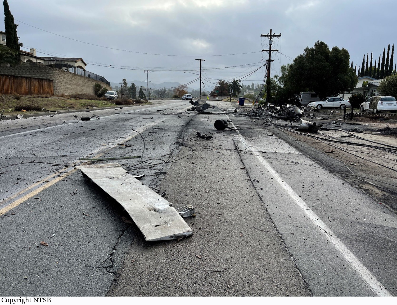
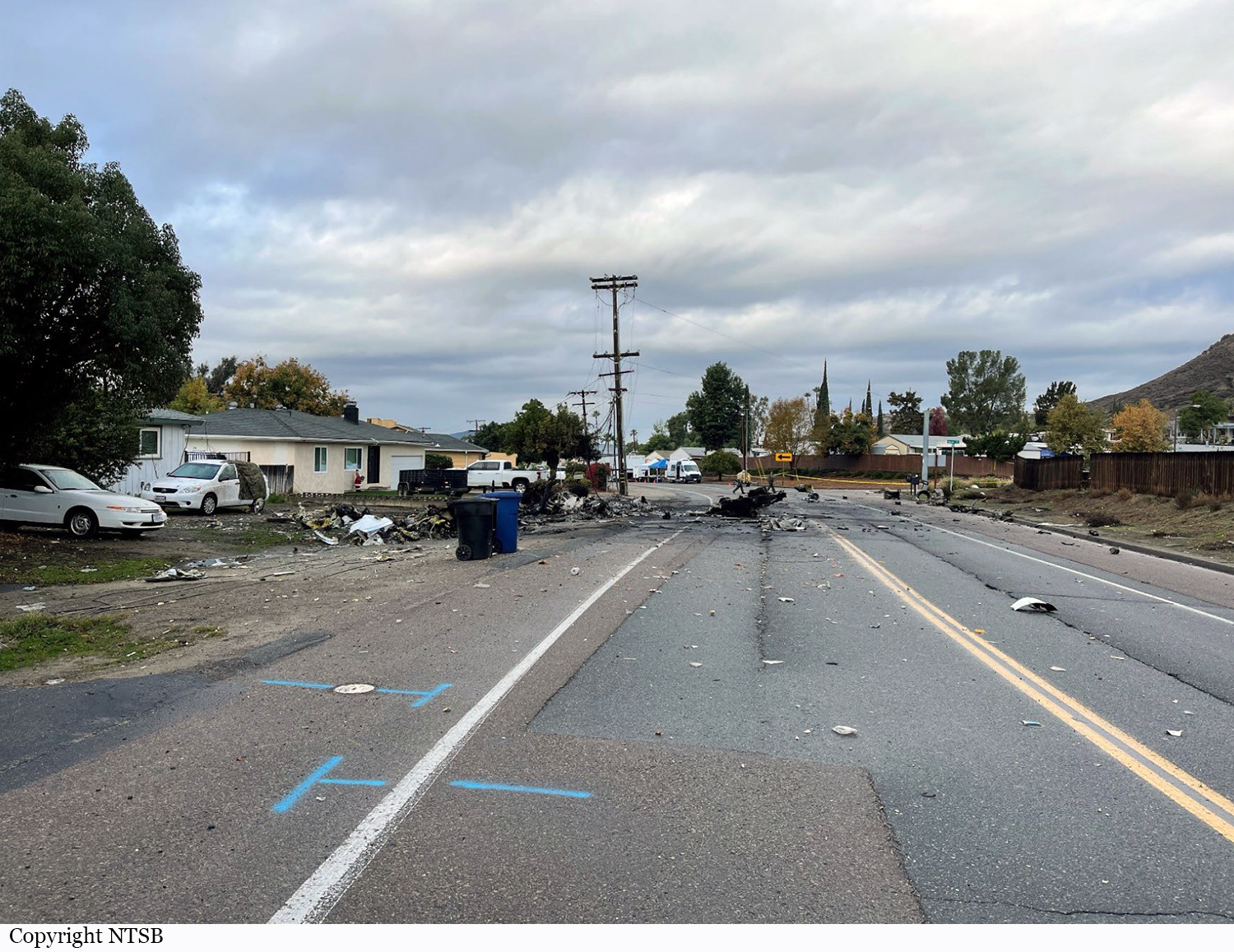
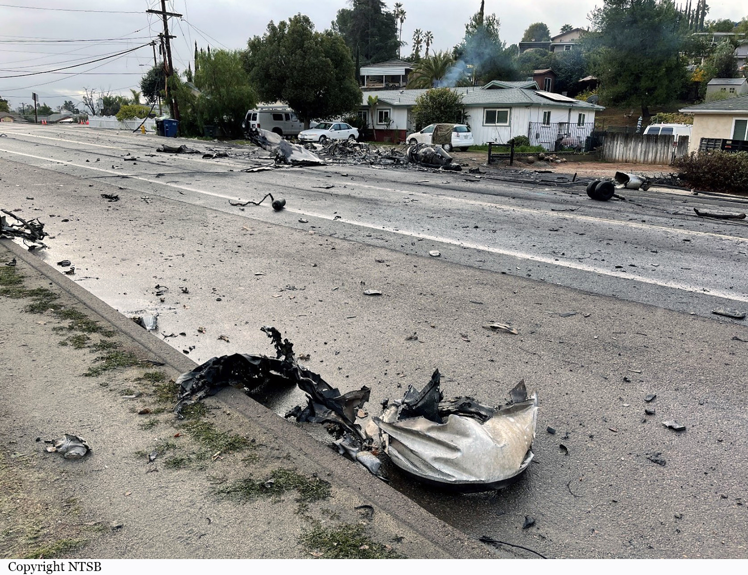
Circumstances:
Earlier on the day of the accident, the flight crew had conducted a patient transfer from a remote airport to another nearby airport. Following the patient transfer, the flight crew departed under night conditions to return to their home base. Review of air traffic control (ATC) communication, as well as cockpit voice recorder (CVR) recordings, showed that the flight crew initially was cleared on the RNAV (GPS) runway 17 instrument approach. The approach plate for the instrument approach stated that circling to runway 27R and 35 was not authorized at night. Following the approach clearance, the flight crew discussed their intent to cancel the approach and circle to land on runway 27R. Additionally, the flight crew discussed with each other if they could see the runway. Once the flight crew established visual contact with the runway, they requested to squawk VFR, then the controller cleared them to land on runway 17. The flight crew then requested to land on runway 27. The controller asked the pilot if they wanted to cancel their instrument flight rules (IFR) flight plan, to which the pilot replied, “yes sir.” The controller acknowledged that the IFR cancellation was received and instructed the pilot to overfly the field and enter left traffic for runway 27R and cleared them to land. Shortly after, the flight crew asked the controller if the runway lights for runway 27R could be increased; however, the controller informed them that the lights were already at 100 percent. Just before the controller’s response, the copilot, who was the pilot flying, then asked the captain “where is the runway.” As the flight crew maneuvered to a downwind leg, the captain told the copilot not to go any lower; the copilot requested that the captain tell him when to turn left. The captain told him to turn left about 10 seconds later. The copilot stated, “I see that little mountain, okay” followed by both the captain and co-pilot saying, “woah woah woah, speed, speed” 3 seconds later. During the following 5 seconds, the captain and copilot both stated, “go around the mountain” followed by the captain saying, “this is dicey” and the co-pilot responding, “yeah it’s very dicey.” Shortly after, the captain told the copilot “here let me take it on this turn” followed by the co-pilot saying, “yes, you fly.” The captain asked the copilot to watch his speed, and the copilot agreed. About 1 second later, the copilot stated, “speed speed speed, more more, more more, faster, faster… .” Soon after, the CVR indicated that the airplane impacted the terrain. Automatic dependent surveillance – broadcast (ADS-B) data showed that at the time the flight crew reported the runway in sight, they were about 360 ft below the instrument approach minimum descent altitude (MDA), and upon crossing the published missed approach point they were 660 ft below the MDA. The data showed that the flight overflew the destination airport at an altitude of about 775 ft mean sea level (msl), or 407 ft above ground level (agl), and entered a left downwind for runway 27R. While on the downwind leg, the airplane descended to an altitude of 700 ft msl, then ascended to an altitude of 950 ft msl while on the base leg. The last recorded ADS-B target was at an altitude of 875 ft msl, or about 295 ft agl.
Probable cause:
The flight crew’s decision to descend below the published MDA, cancel their IFR clearance to conduct an unauthorized circle-to-land approach to another runway while the airport was in nighttime IFR conditions, and the exceedance of the airplane’s critical angle of attack, and subsequently entering an aerodynamic stall at a low altitude. Contributing to the accident was the tower crew’s failure to monitor and augment the airport weather conditions as required, due in part to, the placement of the AWOS display in the tower cab and the lack of audible AWOS alerting.
Final Report: