Country
Crash of a Cessna 500 Citation I off Caracas: 5 killed
Date & Time:
Jun 3, 2025 at 1957 LT
Operator:

Registration:
YV3217
Survivors:
No
Schedule:
Caracas - Porlamar
MSN:
500-0187
YOM:
1974
Crew on board:
2
Crew fatalities:
Pax on board:
3
Pax fatalities:
Other fatalities:
Total fatalities:
5
Circumstances:
Few minutes after takeoff from Caracas-Maiquetía-Simón Bolívar Airport, while climbing to an altitude of 7,000 feet, the airplane entered an uncontrolled descent and crashed into the sea off Caracas. In the afternoon of the next day, debris were found floating on water approximately 11 km north of the airport, at coordinates 10° 42' 14" N 66° 59' 00" W. On June 5, other debris were recovered at coordinates 10° 37' 00" N 66° 59' 15" W. The airplane was totally destroyed and all five occupants were killed.

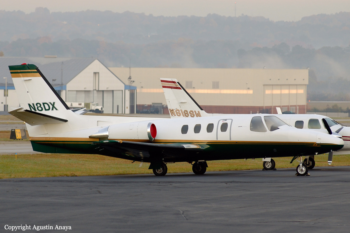
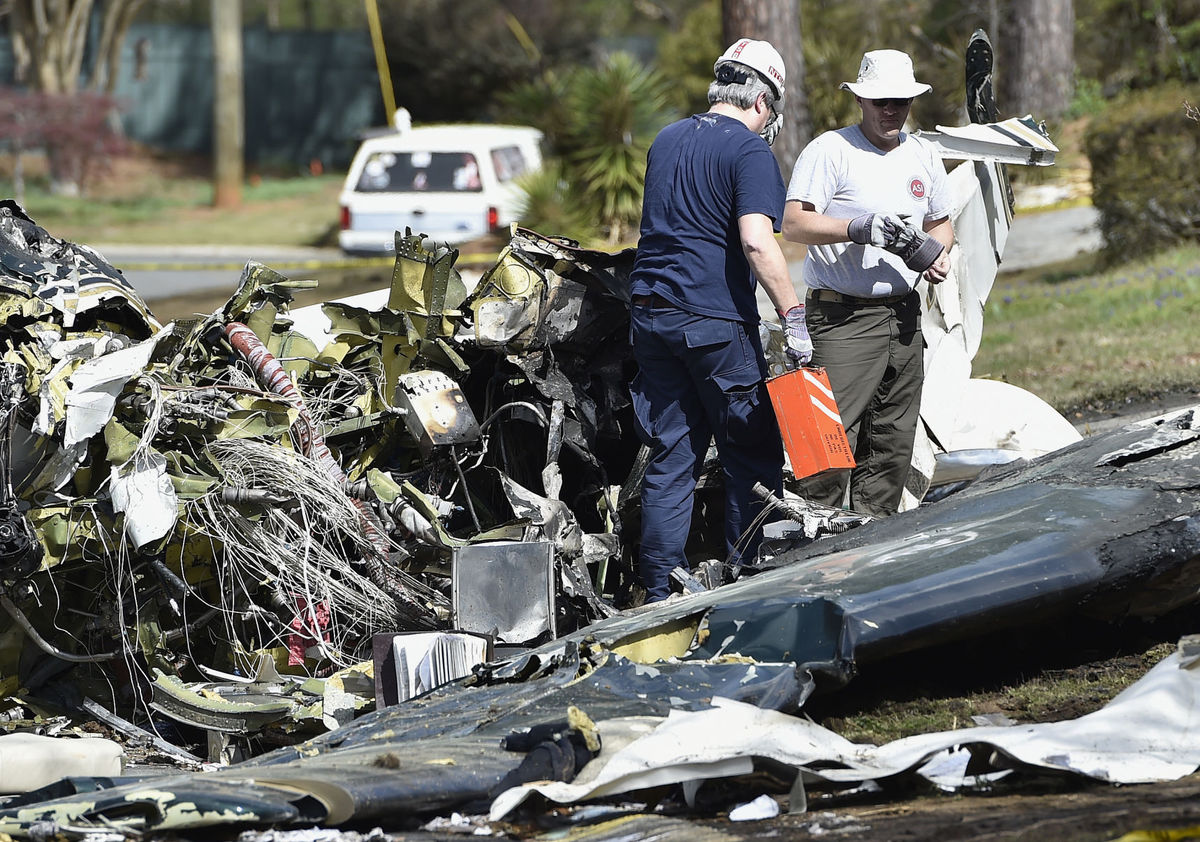
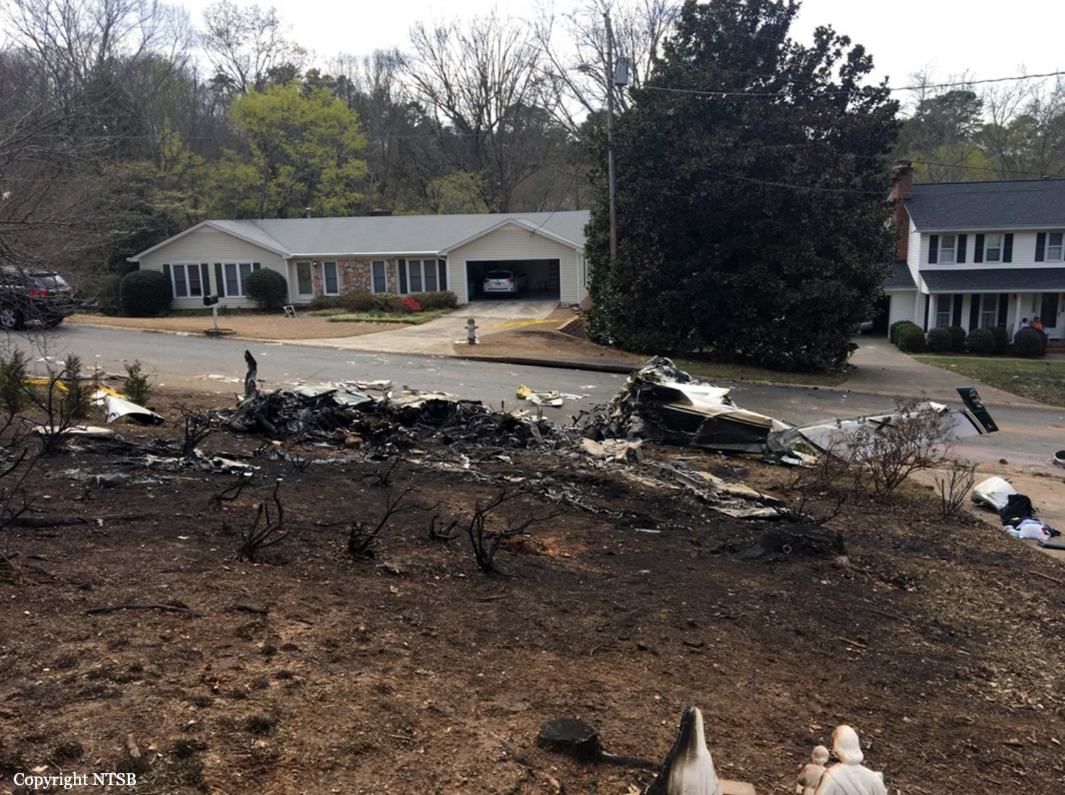
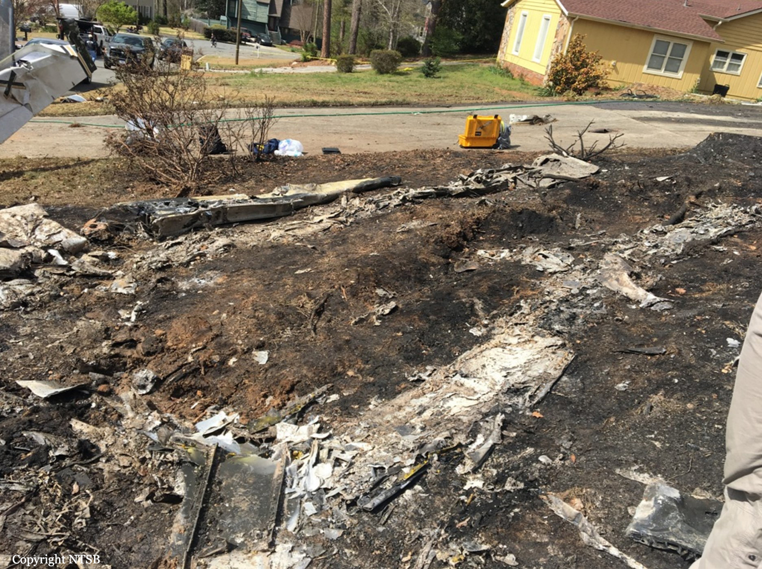
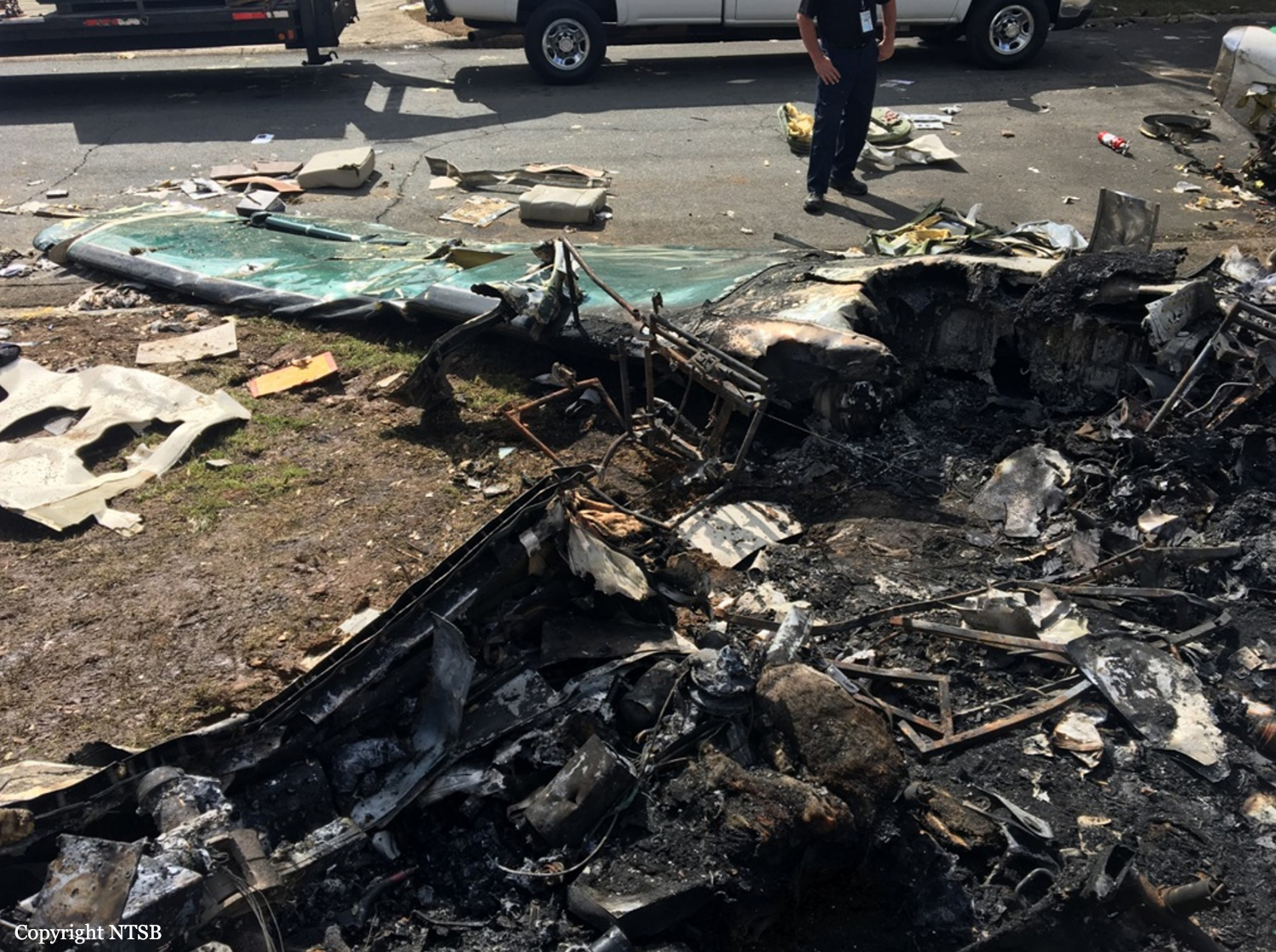
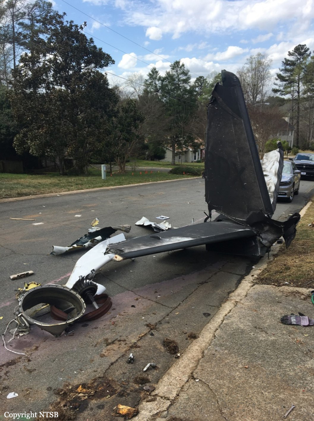
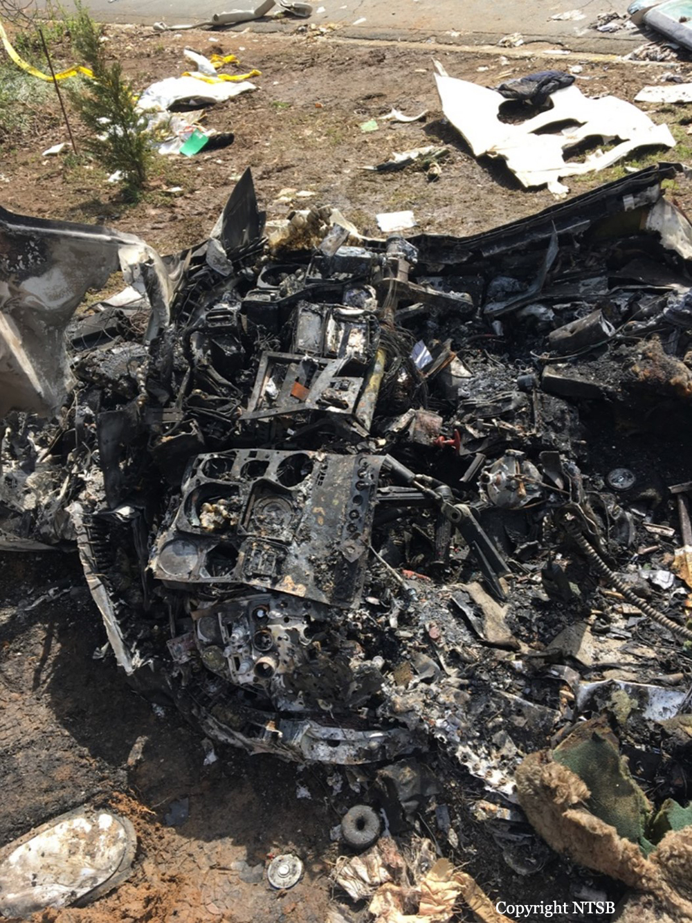
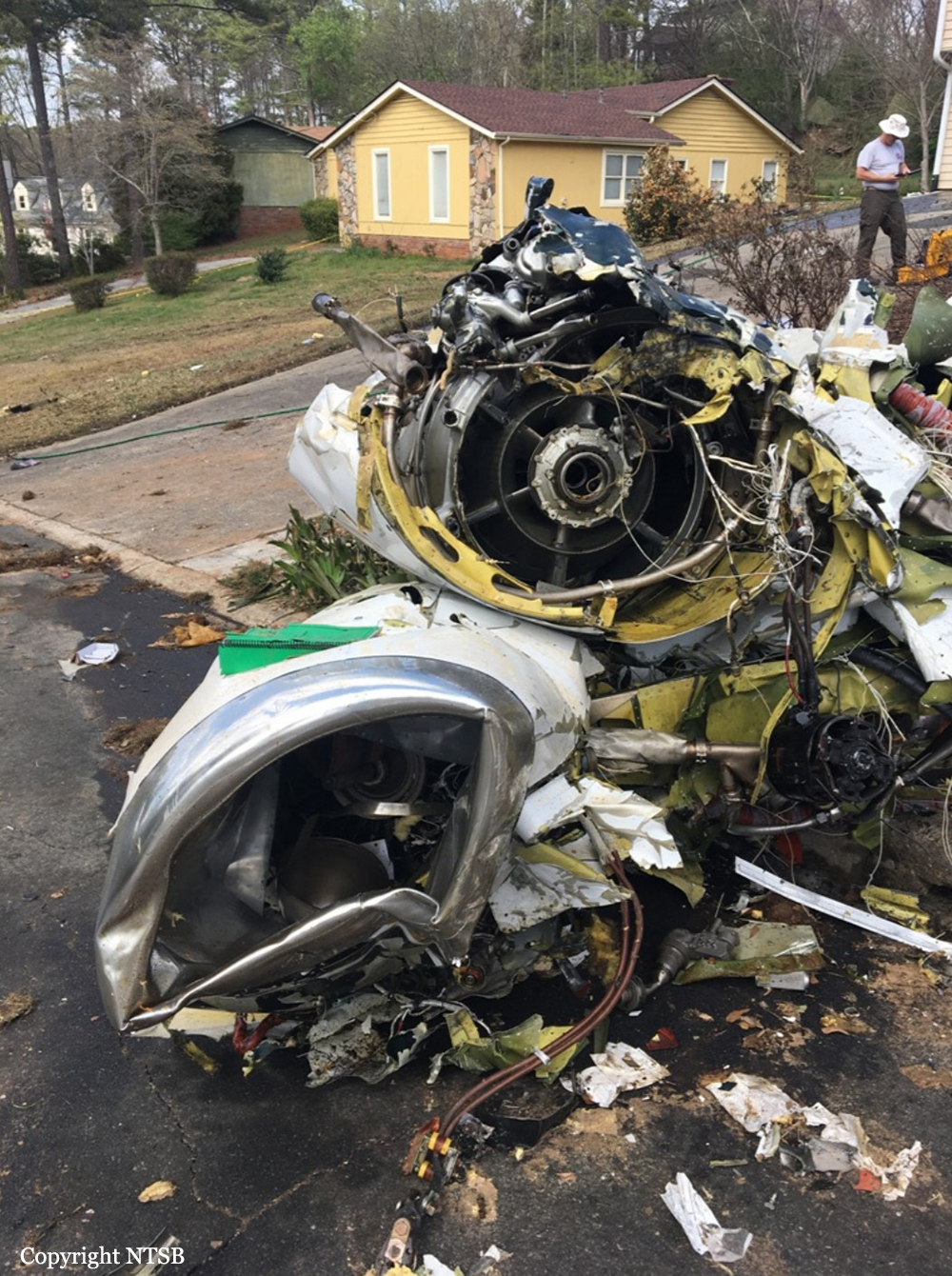
Crash of a Cessna 500 Citation I in Marietta: 1 killed
Date & Time:
Mar 24, 2017 at 1924 LT
Registration:
N8DX
Survivors:
No
Schedule:
Cincinnati – Atlanta
MSN:
500-0303
YOM:
1976
Crew on board:
1
Crew fatalities:
Pax on board:
0
Pax fatalities:
Other fatalities:
Total fatalities:
1
Aircraft flight hours:
9299
Circumstances:
The private pilot departed on an instrument flight rules flight plan in his twin-engine turbojet airplane. The flight was uneventful until the air traffic controller amended the flight plan, which required the pilot to manually enter the new routing information into the GPS. A few minutes later, the pilot told the controller that he was having problems with the GPS and asked for a direct route to his destination. The controller authorized the direct route and instructed the pilot to descend from 22,000 ft to 6,000 ft, during which time the sound of the autopilot disconnect was heard on the cockpit voice recorder (CVR). During the descent, the pilot told the controller that the airplane had a steering problem and was in the clouds. The pilot was instructed to descend the airplane to 4,100 ft, which was the minimum vectoring altitude. The airplane continued to descend, entered visual meteorological conditions, and then descended below the assigned altitude. The controller queried the pilot about the airplane's low altitude and instructed the pilot to maintain 4,100 ft. The pilot responded that he was unsure if he would be able to climb the airplane back to that altitude due to steering issues. The controller issued a low altitude warning and again advised the pilot to climb back to 4,100 ft. The pilot responded that the autopilot was working again and that he was able to climb the airplane to the assigned altitude. The controller then instructed the pilot to change to another radio frequency, but the pilot responded that he was still having a problem with the GPS. The pilot asked the controller to give him direct routing to the airport. A few minutes later, the pilot told the controller that he was barely able to keep the airplane straight and its wings level. The controller asked the pilot if he had the airport in sight, which he did not. The pilot then declared an emergency and expressed concerns related to identifying the landing runway. Afterward, radio contact between the controller and the pilot was lost. Shortly before the airplane impacted the ground, a witness saw the airplane make a complete 360° roll to the left, enter a steep 90° bank to the left, roll inverted, and enter a vertical nose-down dive. Another witness saw the airplane spiral to the ground. The airplane impacted the front lawn of a private residence, and a postcrash fire ensued.The pilot held a type rating for the airplane, but the pilot's personal logbooks were not available for review. As a result, his overall currency and total flight experience in the accident airplane could not be determined. The airplane was originally certified for operations with a pilot and copilot. To obtain an exemption to operate the airplane as a single pilot, a pilot must successfully complete an approved single-pilot exemption training course annually. The accident airplane was modified, and the previous owner was issued a single-pilot conformity certificate by the company that performed the modifications. However, there was no record indicating that the accident pilot received training under this exemption. Several facilities that have single-pilot exemption training for the accident airplane series also had no record of the pilot receiving training for single-pilot operations in the accident airplane. Therefore, unlikely that the pilot was properly certificated to act as a single-pilot. The GPS was installed in the airplane about 3.5 years before the accident. A friend of the pilot trained him on how to use the GPS. The friend said that the pilot generally was confused about how the unit operated and struggled with pulling up pages and correlating data. The friend of the pilot had flown with him several times and indicated that, if an air traffic controller amended a preprogrammed flight plan while en route, the pilot would be confused with the procedure for amending the flight plan. The friend also said the pilot depended heavily on the autopilot, which was integrated with the GPS, and that he would activate the autopilot immediately after takeoff and deactivate it on short final approach to a runway. The pilot would not trim the airplane before turning on the autopilot because he assumed that the autopilot would automatically trim the airplane, which led to the autopilot working against the mis-trimmed airplane. The friend added that the pilot was "constantly complaining" that the airplane was "uncontrollable." A postaccident examination of the airplane and the autopilot system revealed no evidence of any preimpact deficiencies that would have precluded normal operation. This information suggests that pilot historically had difficulty flying the airplane without the aid of the autopilot. When coupled with his performance flying the airplane during the accident flight without the aid of the autopilot, it further suggests that the pilot was consistently unable to manually fly the airplane. Additionally, given the pilot's previous experience with the GPS installed on the airplane, it is likely that during the accident flight the pilot became confused about how to operate the GPS and ultimately was unable to properly control of the airplane without the autopilot engaged. Based on witness information, it is likely that during the final moments of the flight the pilot lost control of the airplane and it entered an aerodynamic stall. The pilot was then unable to regain control of the airplane as it spun 4,000 ft to the ground.
Probable cause:
The pilot's failure to maintain adequate airspeed while manually flying the airplane, which resulted in the airplane exceeding its critical angle of attack and experiencing an aerodynamic stall. Contributing to the accident was the pilot's inability control the airplane without the aid of the autopilot.
Final Report:


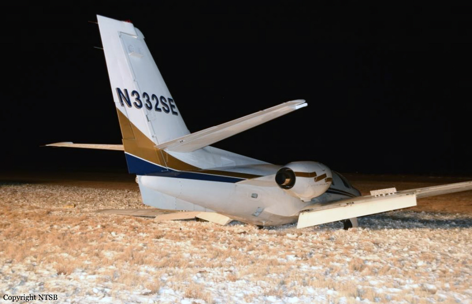
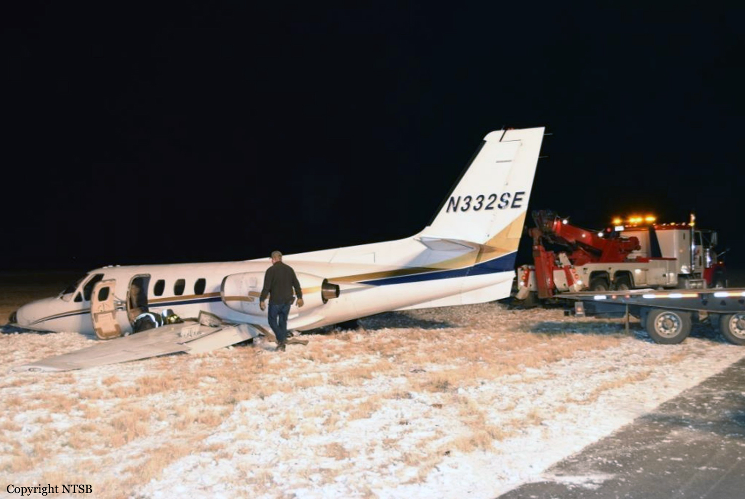
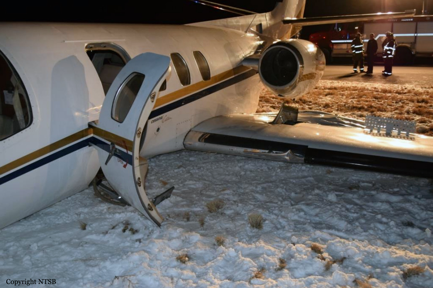
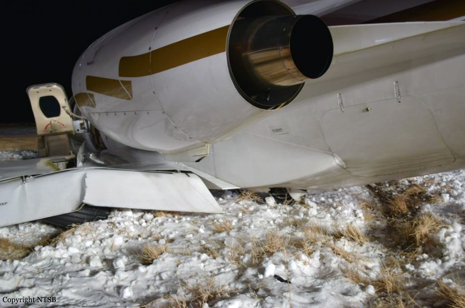
Crash of a Cessna 500 Citation I in Gunnison
Date & Time:
Dec 4, 2016 at 1853 LT
Registration:
N332SE
Survivors:
Yes
Schedule:
San Jose – Pueblo
MSN:
500-0332
YOM:
1975
Crew on board:
1
Crew fatalities:
Pax on board:
0
Pax fatalities:
Other fatalities:
Total fatalities:
0
Captain / Total hours on type:
142.00
Aircraft flight hours:
5218
Circumstances:
The commercial pilot of the jet reported that he initially requested that 100 lbs of fuel be added to both fuel tanks. During the subsequent preflight inspection, the pilot decided that more fuel was needed, so he requested that the airplane's fuel tanks be topped off with fuel. However, he did not confirm the fuel levels or check the fuel gauges before takeoff. He departed on the flight and did not check the fuel gauges until about 1 hour after takeoff. He stated that, at that time, the fuel gauges were showing about 900-1,000 lbs of fuel per side, and he realized that the fuel tanks had not been topped off as requested. He reduced engine power to conserve fuel and to increase the airplane's flight endurance while he continued to his destination. When the fuel gauges showed about 400-500 lbs of fuel per side, the low fuel lights for both wing fuel tanks illuminated. The pilot reported to air traffic control that the airplane was low on fuel and diverted the flight to the nearest airport. The pilot reported that the airplane was high and fast on the visual approach for landing. He misjudged the height above the ground and later stated that the airplane "landed very hard." The airplane's left main landing gear and nose gear collapsed and the airplane veered off the runway, resulting in substantial damage to the left wing. The pilot reported no preaccident mechanical malfunctions or failures with the airplane that would have precluded normal operation.
Probable cause:
The pilot's failure to fly a stabilized approach and his inadequate landing flare, which resulted in a hard landing. Contributing to the accident was the pilot's failure to ensure that the airplane was properly serviced with fuel before departing on the flight.
Final Report:
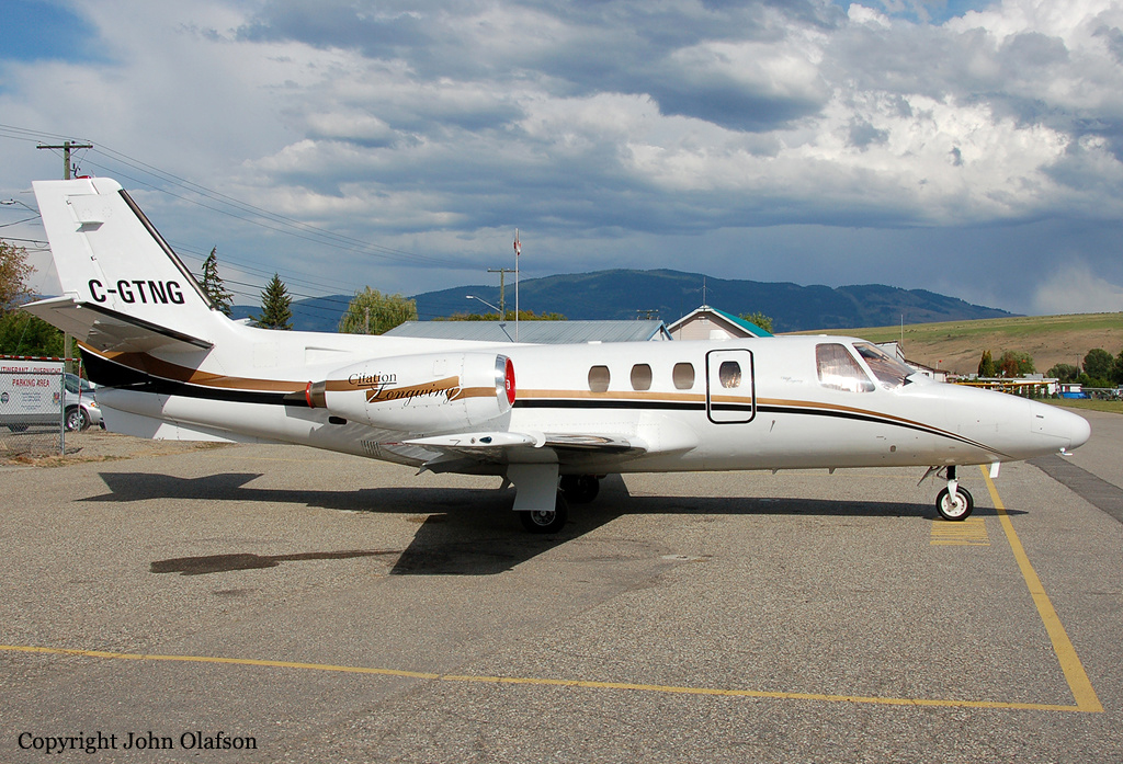
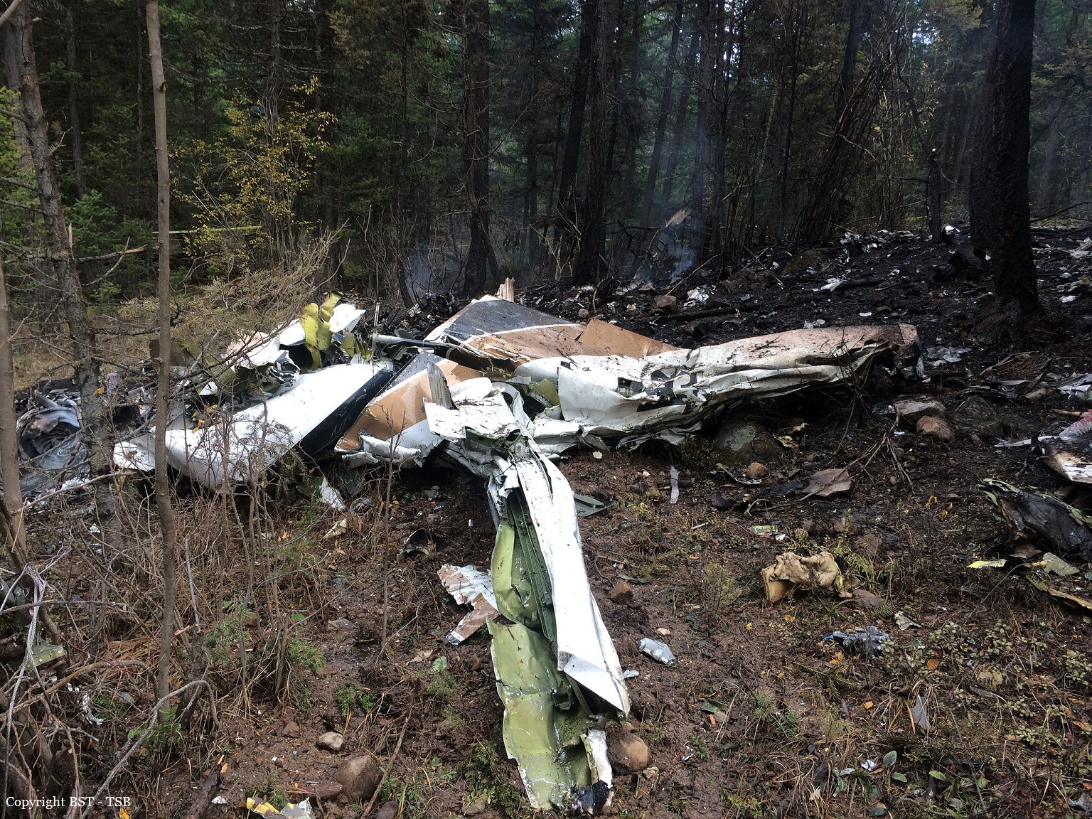
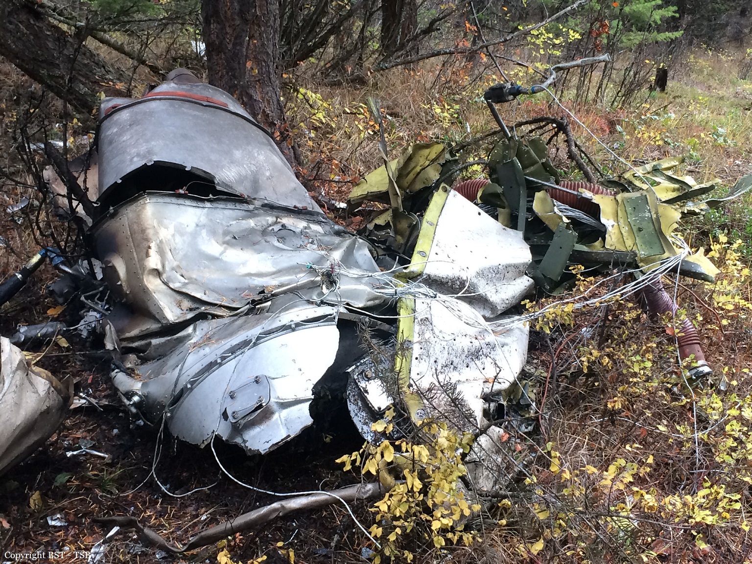
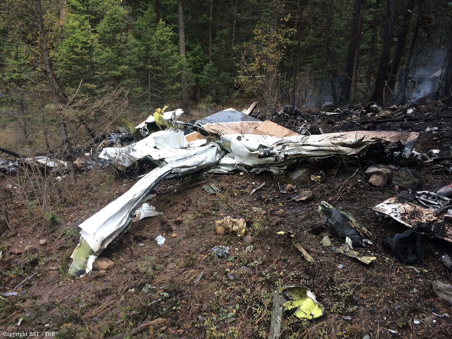
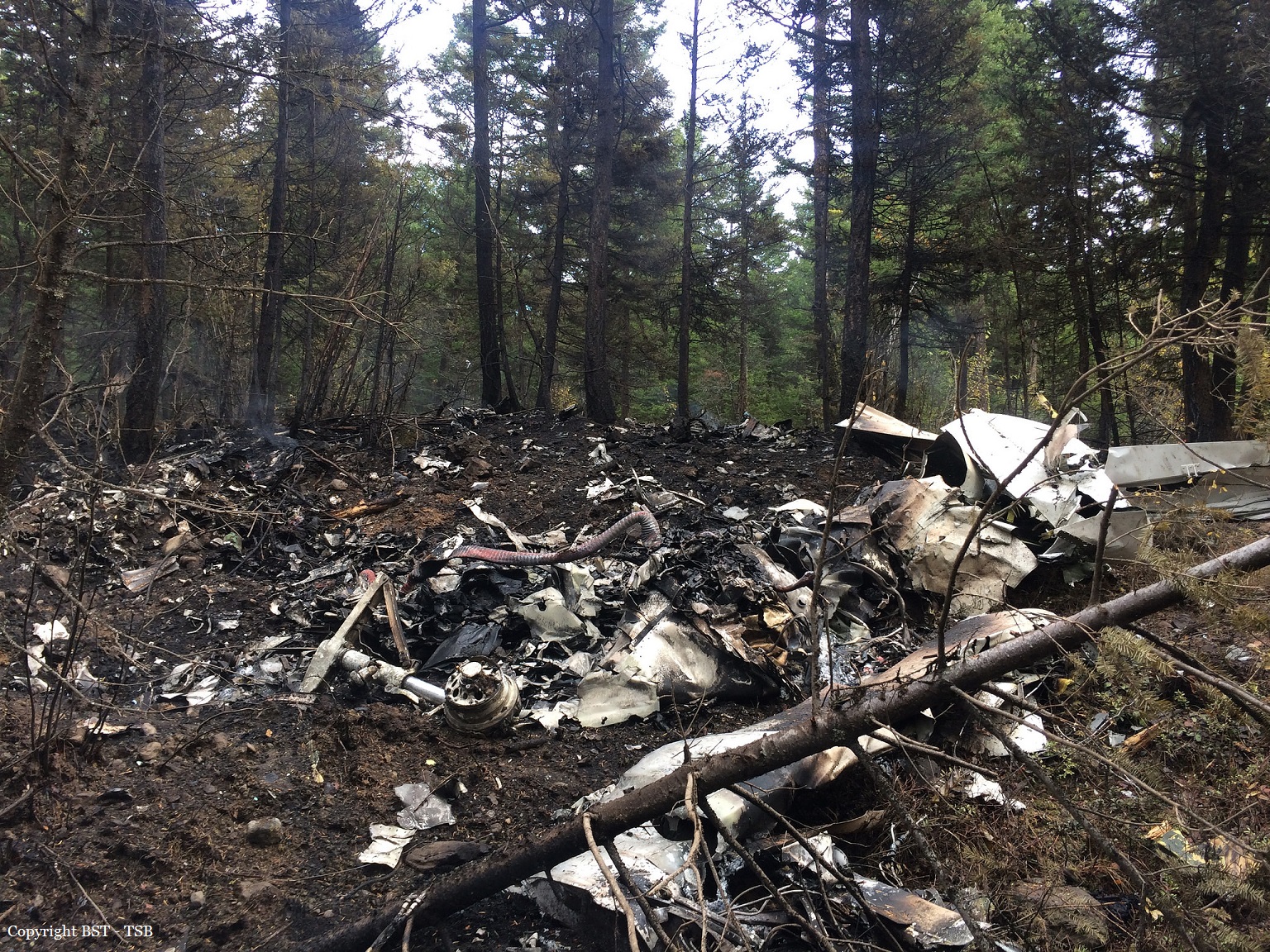
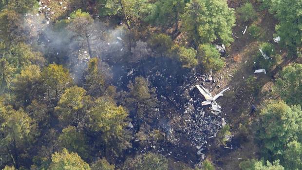
Crash of a Cessna 500 Citation I in Winfield: 4 killed
Date & Time:
Oct 13, 2016 at 2136 LT
Registration:
C-GTNG
Survivors:
No
Schedule:
Kelowna – Calgary
MSN:
500-0169
YOM:
1974
Crew on board:
1
Crew fatalities:
Pax on board:
3
Pax fatalities:
Other fatalities:
Total fatalities:
4
Captain / Total hours on type:
525.00
Aircraft flight hours:
8649
Circumstances:
The pilot and 3 passengers boarded the aircraft. At 2126, the pilot obtained an IFR clearance from the CYLW ground controller for the KELOWNA SEVEN DEP standard instrument departure (SID) procedure for Runway 34. The instructions for the runway 34 KELOWNA SEVEN DEP SID were to climb to 9000 feet ASL, or to an altitude assigned by air traffic control (ATC), and to contact the Vancouver Area Control Centre (ACC) after passing through 4000 feet ASL. The aircraft was then to climb and track 330° magnetic (M) inbound to the Kelowna non-directional beacon (LW). From LW, the aircraft was to climb and track 330°M outbound for vectors to the filed or assigned route. At 2127, C-GTNG began to taxi toward Runway 34. At 2131, the CYLW tower controller cleared the aircraft to take off from the intersection of Runway 34 and Taxiway D. The pilot acknowledged the clearance and began the take-off roll on Runway 34 about 1 minute later. Radar data showed that, at 2133:41, the aircraft was 0.5 nautical miles (nm) beyond the departure end of the runway and was climbing at more than 4000 feet per minute (fpm) through 2800 feet ASL, at a climb angle of approximately 16°. In that time, it had deviated laterally by about 3° to the right of the 330°M track associated with the SID. At 2134:01, when the aircraft was 1.2 nm beyond the runway, it had climbed through 3800 feet ASL and deviated further to the right of the intended routing. The aircraft’s rate of climb decreased to about 1600 fpm, and its ground speed was 150 knots. A short time later, the aircraft’s rate of climb decreased to 600 fpm, its climb angle decreased to 2°, and its ground speed had increased to 160 knots. At 2134:22, the aircraft was 2.1 nm beyond the departure end of the runway, and it was climbing through approximately 4800 feet ASL. The aircraft had deviated about 13° to the right of the intended track, and its rate of climb reached its maximum value of approximately 000 fpm, 3 with a climb angle of about 22°. The ground speed was roughly 145 knots. At 2134:39, the aircraft was 2.7 nm beyond the departure end of the runway, passing through 5800 feet ASL, and had deviated about 20° to the right of the intended routing. The rate of climb was approximately 2000 fpm, with a climb angle of about 7°. According to the SID, the pilot was to make initial contact with the ACC after the aircraft had passed through 4000 feet ASL.Initial contact was made when the aircraft was passing through 6000 feet ASL, at 2134:42. At 2134:46, the ACC acknowledged the communication and indicated that the aircraft had been identified on radar. The aircraft was then cleared for a right turn direct to the MENBO waypoint once it was at a safe altitude, or once it was climbing through 8000 feet ASL. The aircraft was also cleared to follow the flight-planned route and climb to 10 000 feet ASL. At 2134:55, the pilot read back the clearance as the aircraft climbed through 6400 feet ASL, with a rate of climb of approximately 2400 fpm. The aircraft was tracking about 348°M at a ground speed of about 170 knots. At 2135:34, the aircraft began a turn to the right, which was consistent with the instruction from the ACC. Flying directly to the MENBO waypoint required the aircraft to be on a heading of 066°M, requiring a right turn of about 50°. At this point, the aircraft was still climbing and was passing through 8300 feet ASL. The rate of climb was about 3000 fpm. The aircraft continued the right turn and was tracking through 085°M. After reaching a peak altitude of approximately 8600 feet ASL, the aircraft entered a steep descending turn to the right, consistent with the characteristics of a spiral dive. At 2135:47, the ACC controller cleared C-GTNG to climb to FL 250. The lack of radar returns and radio communications from the aircraft prompted the controller to initiate search activities. At 2151, NAV CANADA notified first responders, who located the accident site in forested terrain at about midnight. The aircraft had been destroyed, and all of the occupants had been fatally injured.
Probable cause:
The aircraft departed controlled flight, for reasons that could not be determined, and collided with terrain.
Final Report: