Country
Operator Image

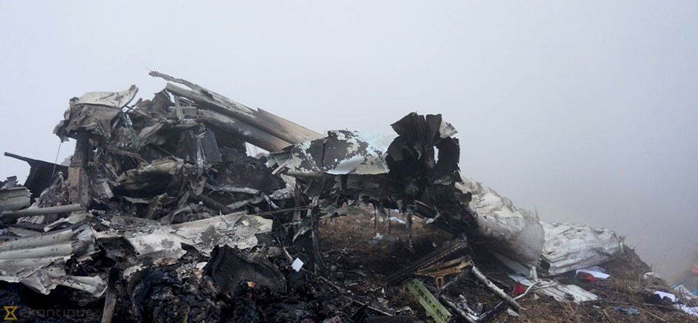
Crash of a De Havilland DHC-6 Twin Otter 300 near Sanosware: 22 killed

Date & Time: May 29, 2022 at 1010 LT
Operator:
Registration:
9N-AET
Flight Phase:
Survivors:
No
Site:
Schedule:
Pokhara – Jomsom
MSN:
619
YOM:
1979
Flight number:
TRA197
Country:
Region:
Crew on board:
3
Crew fatalities:
Pax on board:
19
Pax fatalities:
Other fatalities:
Total fatalities:
22
Captain / Total flying hours:
17500
Captain / Total hours on type:
13500.00
Copilot / Total flying hours:
520
Copilot / Total hours on type:
315
Aircraft flight hours:
41336
Aircraft flight cycles:
71338
Circumstances:
On 29 May 2022, Tara Air’s 9N-AET, Twin Otter (DHC-6/300) aircraft was scheduled for three flights on Pokhara-Jomsom-Pokhara sector. Tara Air had also filed flight plans for two additional Charter flights on the same sector. Among those five flights, four flights were to be conducted by a set of crews already positioned at Pokhara while the last flight was scheduled to be commanded by the PIC who had reached Pokhara from Kathmandu that very morning. Since Jomsom Airport was closed for operations due to bad weather, the PIC went to Tara Air crew camp and waited for the updates of weather improvement of Jomsom. After Jomsom Airport was open for operations at 0321 UTC, Tara Air operation decided to operate the first scheduled flight. However suspecting the next flight operation to Jomsom could not be operated, the original PIC assigned to the flight seated on board as a passenger to Jomsom for his scheduled business trip and the PIC assigned for the last flight took command. The Flight Plan was amended accordingly. At 0342 UTC, Summit Air’s 9N-AKZ, LET-410 took-off from Pokhara to Jomsom. At 0405 UTC, it reported an altitude of 12,500 ft and patches of cloud over Tatopani. At 0409 UTC, Summit Air’s second aircraft 9N-AMG, LET-410, took-off for Jomsom and subsequently, at 0410 UTC, 9N-AET of Tara Air (TRA197) took-off with 19 passengers and three crews on board. The Copilot had initially reported 3 crew and 18 passengers onboard to Pokhara Tower but later, revised the passenger figure was 19 prior to takeoff. 9N-AET was supposed to take-off before SMT 601 but the PIC seemed hesitant to commence the flight due to weather PIREP from 9N-AKZ that, the en-route weather was not favorable for VFR flights and critical around LETE and TATOPANI. All the crew members of TRA 197 and SMT 601 were in their respective cockpits and communicating with the preceding flight 9N-AKZ as well as with Pokhara tower for the updated information of en-route and destination weather. No flights had been conducted since morning and most of the passengers of Tara air and Summit Air were already at airport. In this situation it can be assumed that there was pressure to conduct flight from each angle. While listening to the CVR of TRA 197, it was observed that someone, either ground staff or some intimate passenger to the crew, advising strongly to the PIC to conduct the flight. Following the PIREP from 9NAKZ, both TRA197 and SMT 601 subsequently started their engines to commence the flights. The PIC of TRA 197 was still hesitant to conduct the flight for Jomsom even after the engine start and delayed the taxi as he was not yet convinced about the weather report received from preceding 9N-AKZ aircraft. In the meantime, SMT 601 lined up for departure to Jomsom. That was one of the most important pressure points to the PIC of TRA 197 to initiate departure. TRA 197 finally lined up and took off from Pokhara at 0410 UTC following the SMT 601 based on the en-route weather information (VMC) from 9N-AKZ, through Pokhara Tower. The en-route weather provided by Summit Air’s 9N-AKZ to Pokhara Tower and the crewmembers of TRA 197 and SMT 601 was not the same. Aircraft took off from Pokhara from runway 04 heading North. Tower instructed “report 5 DME northwest RW 04”. Then after departure at 90 climb power aircraft turned left to maintain a heading of 345 and planned to join heading 305 degree towards Ghodepani. After four minutes, TRA 197 reported, “Now on course…. 6000 climbing and ETA Jomsom 32” (0432 UTC). At 04:21 TRA 197 reported to Pokhara Tower as position approaching Ghodepani 12000 climbing for 12500. After 6 Seconds ATC Pokhara asked TRA 197, “confirm would like to change level and TRA 197 replied, “No Ma'am we have crossed Ghodepani and like to be on”. Pokhara Tower instructed, “Tara 197 contact Jomsom Tower 122.5” CVR recordings show that after TRA 197 crossed Ghodepani, the PIC was not comfortable with the en-route weather. However, the flight was continued following the advice of SMT 601. At 0426 UTC, TRA 197made the first contact with Jomsom AFS and reported its position to which Jomsom Tower conveyed the prevailing weather as “Wind South Westerly up to 30 kts, QNH 1019, Temp 18º”. The PIC of TRA 197 reconfirmed twice if the wind was maximum, up to 30 Kts and currently South Westerly-25kts. The crew was discussing about the bad weather being encountered and the PIC himself voiced his dissatisfaction about the behavior of other pilots who conduct VFR flights in such unfavorable weather. The CVR recordings reveal that the aircraft was encountering clouds and the PIC was trying his best to remain clear of the clouds. During the course of flight, TRA 197 hadn’t reported any abnormalities encountered and neither any technical defect on aircraft either to Jomsom tower or Pokhara Tower. As per CVR, PIC was searching for light and brighter areas and adamantly heading towards it. As per CVR and V2 tracker data, the aircraft was maintaining 12000 ft and was in a climbing attitude. During the continuous attempts of crew to avoid the clouds with Terrain Avoidance and Warning System [TAWS] inhibited, the aircraft met with an unfortunate CFIT accident into the rocky terrain at an altitude of 4050 meter AMSL at Sanusare Mountain, Thasang Rural Municipality, Mustang. As per V2 tracker, last position of 9N-AET was 7.7 nm SW of Jomsom Airport. The aircraft was completely destroyed by the impact and there were no survivors.
Probable cause:
The probable cause of this accident was the flight crew's failure to monitor and maintain the proper course while inadvertently flying in IMC conditions with the aircraft Terrain Avoidance and Warning System (TAWS) inhibited which resulted into a Controlled Flight Into Terrain (CFIT) accident.
The following contributing factors were identified:
1. The flight crew's failure to follow the SOP of company.
2. The aircraft flight operation with TAWS inhibited during deteriorating en-route weather condition.
3. Loss of situational awareness of crew.
4. Deteriorating en route weather.
5. Less experienced copilot for that sector and high crew gradient.
6. Poor CRM during the flight.
7. The whole cockpit duties [both PF and PM] were undertaken by the PlC, which likely impaired his performance.
8. Underutilization of the available Navigation instruments.
Final Report:

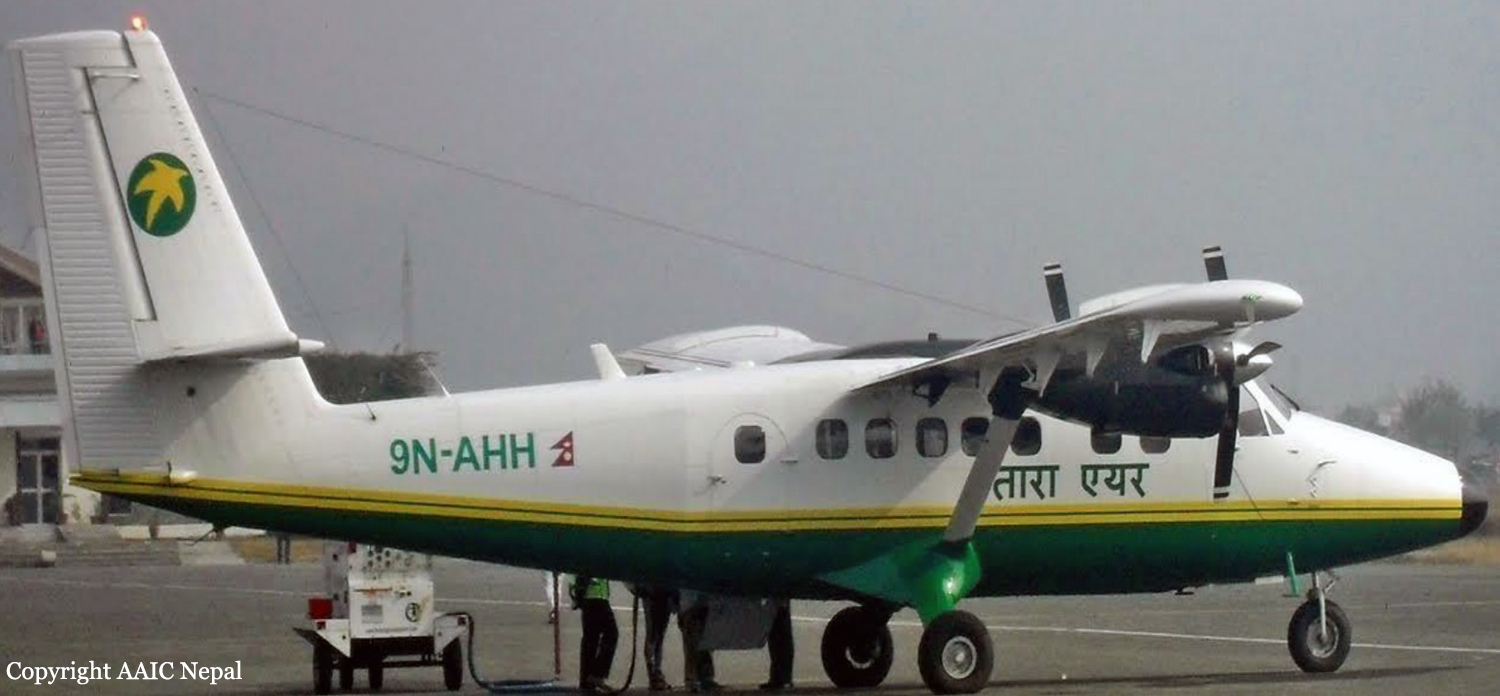
Crash of a Viking Air DHC-6 Twin Otter 400 near Dana: 23 killed

Date & Time: Feb 24, 2016 at 0819 LT
Operator:
Registration:
9N-AHH
Flight Phase:
Survivors:
No
Site:
Schedule:
Pokhara – Jomsom
MSN:
926
YOM:
2015
Flight number:
TA193
Country:
Region:
Crew on board:
3
Crew fatalities:
Pax on board:
20
Pax fatalities:
Other fatalities:
Total fatalities:
23
Captain / Total flying hours:
20108
Captain / Total hours on type:
18500.00
Copilot / Total flying hours:
760
Copilot / Total hours on type:
560
Aircraft flight hours:
270
Aircraft flight cycles:
482
Circumstances:
As per the flight plan submitted on 23rd February 2016, the aircraft was scheduled for VFR flight to Jomsom (VNJS) on 24th February with estimated off-block time of 01:00, intended cruising speed of 150 knots, intended level of 10,500 ft and via direct track. The first and second alternate aerodromes were Bhairahawa (VNBW) and Pokhara (VNPK) respectively and estimated elapsed time was 20 minutes with the fuel endurance of 2 hours and 30 minute. Based on the information from the CVR, FDR and ATC records, the following description of the history of the flight was reconstructed: At 01:55, the first-officer contacted Pokhara tower requesting Jomsom and Bhairahawa weather. Upon receiving Jomsom weather which was 8 km visibility towards Lete (arrival track) and foothill partially visible; at 01:56 F/O requested start-up for Jomsom. First-officer then briefed the weather to the captain, in response to this the captain responded by saying 'Let‘s have a look, if not possible we will return' (Translated from Nepali conversation). While performing the 'before start checklist', they received weather of Bhairahawa as closed. After completing the checklist and start-up the first-officer at 02:00 requested taxi clearance. The ATC informed runway change to 22 instead of runway 04 and gave taxi clearance. At 02:03 while taxiing the captain considering bad weather condition expressed his concern over the runway change with F/O but failed to express it to the ATC. As briefed by captain earlier, the control was transferred to F/O and at 02:04 F/O made a normal take-off. At 02:08 the captain reported 5 miles at 6,200 ft to ATC. At 02:09, while passing through 7,000 ft the captain informed the actual weather, which was light haze, mountain not visible but had ground contact, to an ultra-light aircraft upon his request. As per the cockpit conversation, the crew were comparing the base of the cloud which was higher than the day before and proposed to continue climb to 12,500 ft if not on-top of the cloud at 10,500 ft. Around 5 miles before Ghorepani passing 10,100 ft, the captain told that cells were still present so advised F/O to continue climb to 12,000 ft and told that they will proceed till TATOPANI and decide to continue or divert. At 02:14 approaching GHOREPANI and passing 11,400 ft, Captain told F/O to maintain level to be in between the cloud layers and briefed F/O that if they had to divert it would be a left turn. At the same time captain asked repeatedly to F/O if his side was raining for which F/O told and confirmed not visual, after which captain told they would see and decide (regarding continuation of flight). At 02:14:50 while over Ghorepani area at 11,500 ft the EGPWS TERRAIN alert and at 02:14:52 PULL UP warning came while they were not visual and at 02:15:01 it was stated that they were visual and by 02:14:53 the warning stopped. At 02:15 while maintaining 11,500 ft the captain reported ATC that they are at Ghorepani at level 10,500 ft after which frequency changeover to Jomsom tower was given. At 02:15:27 the captain instructed F/O to maintain heading of 3300 and flight level just below the cloud, after which a shallow descent was initiated. At this time captain asked F/O if his side was visual, in response F/O replied somewhat visual. The Captain then instructed F/O to descent to 10,000 ft. Once the descent was started at 02:15:55 passing 11,000 ft an OVERSPEED warning sounded in the cockpit for 2 seconds as the speed reached 152 knots. At 02:16 while passing 10,700 ft captain advised F/O to make a left turn so that it would be easy to turn if required as he was able to see his side. Then F/O asked if left side was visual for which the captain informed that not that side (towards the track) but somewhat visual to the left of him and told that the TRACK TO GO was TO THE LEFT whereas they were actually left of the track and had descended to 10,300 ft. At 02:17:58 EGPWS TERRAIN alert sounded when the aircraft was at 10,200 ft and descending on heading of 3210 with right bank angle of around 30 . At 02:18:06 when the aircraft had descended to 10,100 ft the PULL UP WARNING sounded for which the captain said not to worry and at 02:18:12; when the aircraft was at 10,000 ft the captain took-over the control, continued descent and asked F/O if his side was visual. The F/O informed that right side was not visual at all by which the aircraft had continued shallow descent on heading 3250 with right bank angle reaching up to 130 at 2:18:19 and by 02:18:23 the aircraft once again returned back to 0° bank angle. At 02:18:23 the captain started left bank followed by right bank again while still on a shallow descent until 02:18:27.Upon reaching 9,850 ft (lowest altitude) the aircraft started very shallow climb. At 02:18:35 when aircraft was 9,920 ft the captain told F/O that they reached Landslide (a checkpoint which is on track to Jomsom on the right side of the Kali-Gandaki River). At 02:18:44 when aircraft reached 10,150 ft captain told ―what I will do is now I will turn to heading of LETTE‖ (another way point on route to Jomsom); while the PULL-UP warning was continuously sounding. At 02:18:49 when the aircraft was at 10,300 ft right bank angle increased up to 16° with pitch up attitude of 7°. At 02:18:52 the captain told that he would start climb when the aircraft had reached 10,350 ft; pitch attitude of 10° and still on right bank. The aircraft reached zero degree bank at 02:18:53 and started shallow left bank with pitch attitude of 12° nose up. By 02:18:57 the bank angle reached 200 left with pitch attitude of 11.8 and altitude of 10,550 ft and captain was still questioning F/O about the visibility towards his side but F/O informed his side not visible completely. The last data recorded in FDR was at 02:19:03 when the altitude had reached around 10,700 ft; pitch attitude of 7° nose up and left bank angle of 25° heading of 335° with EGPWS PULL-UP warning ON.
Probable cause:
The Commission concludes that the probable cause of this accident was the fact that despite of unfavourable weather conditions, the crew‘s repeated decision to enter into cloud during VFR flight and their deviation from the normal track due to loss of situational awareness aggravated by spatial disorientation leading to CFIT accident.
The contributing factors for the accident are:
1. Loss of situational awareness,
2. Deteriorating condition of weather,
3. Skill base error of the crew during critical phases of flight,
4. Failure to utilize all available resources (CRM), especially insensitivity to EGPWS cautions/warnings.
Final Report:

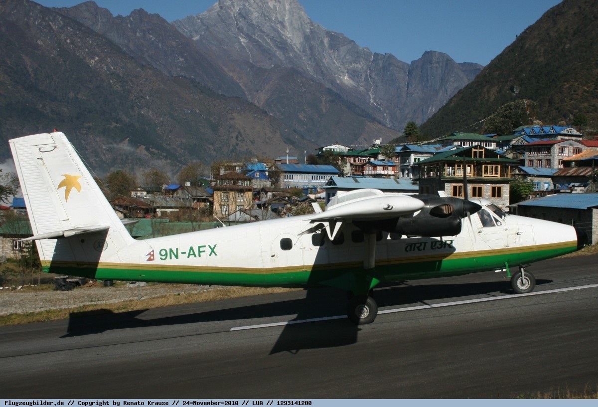
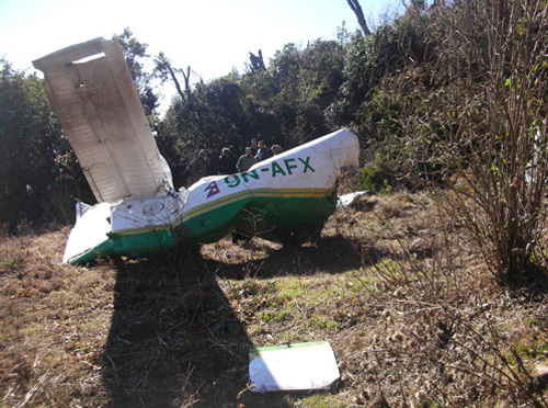
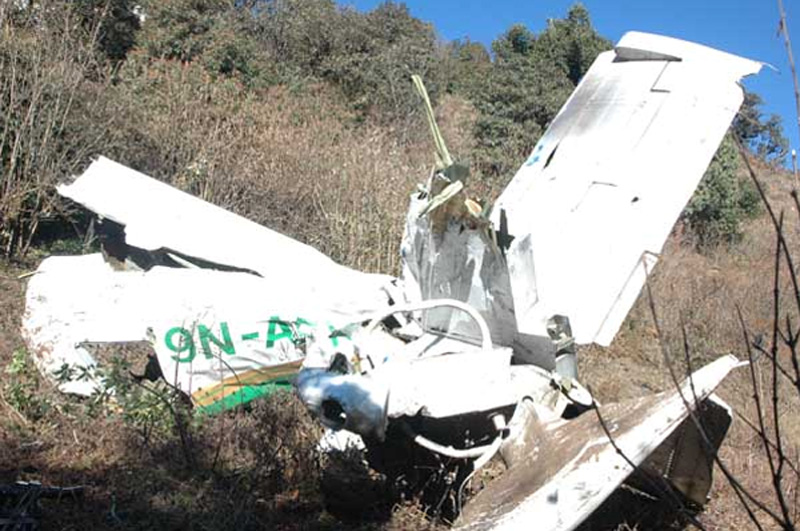
Crash of a De Havilland DHC-6 Twin Otter 300 near Okhaldhunga: 22 killed

Date & Time: Dec 15, 2010 at 1530 LT
Operator:
Registration:
9N-AFX
Flight Phase:
Survivors:
No
Site:
Schedule:
Lamidanda - Kathmandou
MSN:
806
YOM:
1984
Country:
Region:
Crew on board:
3
Crew fatalities:
Pax on board:
19
Pax fatalities:
Other fatalities:
Total fatalities:
22
Captain / Total flying hours:
6700
Captain / Total hours on type:
5000.00
Copilot / Total flying hours:
1100
Copilot / Total hours on type:
341
Circumstances:
The twin engine aircraft departed Lamidanda Airport at 1508LT on a flight to Kathmandu. Shortly after departure, the crew was cleared to climb to 10,500 feet but ATC ask them to maintain 8,500 feet due to traffic. The captain disagreed with this ATC instruction and continued to climb. The copilot asked the captain to accept the ATC proposal so finally, the captain cleared the copilot (who was the pilot in command) to descend to 8,500 feet despite the fact it was risky due to the mountainous terrain. Few minutes later, the aircraft entered clouds when the right wing impacted ground. The aircraft crashed in a rocky area located on the Palunge Hill, near Okhaldhunga. The wreckage was found the following morning. The aircraft was destroyed by impact forces and all 22 occupants were killed. IMC conditions prevailed at the time of the accident due to low visibility (cloudy conditions).
Probable cause:
The cause of the accident was the unwise decision taken by the crew to descend without taking the harsh mountain terrain into consideration. Controlled flight into terrain.