Country

Crash of a Beechcraft 200 Super King Air in Iqaluit

Date & Time: Jul 17, 2016 at 1217 LT
Operator:
Registration:
C-FCGW
Flight Type:
Survivors:
Yes
Schedule:
Iqaluit - Iqaluit
MSN:
BB-207
YOM:
1977
Flight number:
BFF200
Location:
Country:
Crew on board:
2
Crew fatalities:
Pax on board:
0
Pax fatalities:
Other fatalities:
Total fatalities:
0
Circumstances:
A Beech 200 Super King Air aircraft operated by Air Nunavut as flight 200, was on a training flight at Iqaluit, NU (CYFB) to upgrade a candidate to captain status. A VFR circuit was executed to simulate a flapless landing. While in the circuit, the crew experienced an actual communication failure on COM 1 while two other aircraft were inbound to Iqaluit. At the end of the downwind leg, a flap failure was simulated and the crew carried out the appropriate checklist. However, the landing checklist was not completed and the aircraft landed with the landing gear in the up position on runway 16. The aircraft skidded on the belly and came to a stop on the runway between taxiway A and G. The crew declared an emergency and evacuated the airplane with no injuries. The aircraft sustained damage to the belly pod and both propellers.

Crash of a Cessna 208B Grand Caravan in the Hudson Bay: 1 killed

Date & Time: Sep 25, 2013 at 1400 LT
Type of aircraft:
Operator:
Registration:
C-FEXV
Flight Phase:
Flight Type:
Survivors:
No
Schedule:
Sault Sainte Marie - Sault Sainte Marie
MSN:
208B-0482
YOM:
1995
Flight number:
MAL8988
Country:
Crew on board:
1
Crew fatalities:
Pax on board:
0
Pax fatalities:
Other fatalities:
Total fatalities:
1
Circumstances:
On behalf of Morningstar Air Express, the pilot departed Sault Sainte Marie Airport, south Ontario, in the morning, for a local training flight. For unknown reasons, the pilot did not maintain any radio contact with his base or ATC and continued to the north for about 1,200 km when the aircraft crashed in unknown circumstances in the Hudson Bay, some 500 km east of Churchill, Manitoba. The aircraft was destroyed and the pilot was killed.
Probable cause:
The exact cause of the accident remains unknown.

Crash of a Swearingen SA227AC Metro III in Sanikiluaq: 1 killed

Date & Time: Dec 22, 2012 at 1806 LT
Type of aircraft:
Operator:
Registration:
C-GFWX
Survivors:
Yes
Schedule:
Winnipeg - Sanikiluaq
MSN:
AC-650B
YOM:
1986
Flight number:
PAG993
Country:
Crew on board:
2
Crew fatalities:
Pax on board:
7
Pax fatalities:
Other fatalities:
Total fatalities:
1
Captain / Total flying hours:
5700
Captain / Total hours on type:
2330.00
Copilot / Total flying hours:
1250
Copilot / Total hours on type:
950
Aircraft flight hours:
32982
Circumstances:
On 22 December 2012, the Perimeter Aviation LP, Fairchild SA227-AC Metro III (registration C-GFWX, serial number AC650B), operating as Perimeter flight PAG993, departed Winnipeg/James Armstrong Richardson International Airport, Manitoba, at 1939 Coordinated Universal Time (1339 Central Standard Time) as a charter flight to Sanikiluaq, Nunavut. Following an attempted visual approach to Runway 09, a non precision non-directional beacon (NDB) Runway 27 approach was conducted. Visual contact with the runway environment was made and a circling for Runway 09 initiated. Visual contact with the Runway 09 environment was lost and a return to the Sanikiluaq NDB was executed. A second NDB Runway 27 approach was conducted with the intent to land on Runway 27. Visual contact with the runway environment was made after passing the missed approach point. Following a steep descent, a rejected landing was initiated at 20 to 50 feet above the runway; the aircraft struck the ground approximately 525 feet beyond the departure end of Runway 27. The 406 MHz emergency locator transmitter activated on impact. The 2 flight crew and 1 passenger sustained serious injuries, 5 passengers sustained minor injuries, and 1 infant was fatally injured. Occupants exited the aircraft via the forward right overwing exit and were immediately transported to the local health centre. The aircraft was destroyed. The occurrence took place during the hours of darkness at 2306 Coordinated Universal Time (1806 Eastern Standard Time).
Probable cause:
Findings as to causes and contributing factors:
1. The lack of required flight documents, such as instrument approach charts, compromised thoroughness and placed pressure on the captain to find a workaround solution during flight planning. It also negatively affected the crew’s situational awareness during the approaches at CYSK (Sanikiluaq).
2. Weather conditions below published landing minima for the approach at the alternate airport CYGW (Kuujjuarapik) and insufficient fuel to make CYGL (La Grande Rivière) eliminated any favourable diversion options. The possibility of a successful landing at CYGW was considered unlikely and put pressure on the crew to land at CYSK (Sanikiluaq).
3. Frustration, fatigue, and an increase in workload and stress during the instrument approaches resulted in crew attentional narrowing and a shift away from welllearned, highly practised procedures.
4. Due to the lack of an instrument approach for the into-wind runway and the unsuccessful attempts at circling, the crew chose the option of landing with a tailwind, resulting in a steep, unstable approach.
5. The final descent was initiated beyond the missed approach point and, combined with the 14-knot tailwind, resulted in the aircraft remaining above the desired 3- degree descent path.
6. Neither pilot heard the ground proximity warning system warnings; both were focused on landing the aircraft to the exclusion of other indicators that warranted alternative action.
7. During the final approach, the aircraft was unstable in several parameters. This instability contributed to the aircraft being half-way down the runway with excessive speed and altitude.
8. The aircraft was not in a position to land and stop within the confines of the runway, and a go-around was initiated from a low-energy landing regime.
9. The captain possibly eased off on the control column in the climb due to the low airspeed. This, in combination with the configuration change at a critical phase of flight, as called for in the company procedures, may have contributed to the aircraft’s poor climb performance.
10. A rate of climb sufficient to ensure clearance from obstacles was not established, and the aircraft collided with terrain.
11. The infant passenger was not restrained in a child restraint system, nor was one required by regulations. The infant was ejected from the mother’s arms during the impact sequence, and contact with the interior surfaces of the aircraft contributed to the fatal injuries.
Findings as to risk:
1. If instrument approaches are conducted without reference to an approach chart, there is a risk of weakened situational awareness and of error in following required procedures, possibly resulting in the loss of obstacle clearance and an accident.
2. If additional contingency fuel is not accounted for in the aircraft weight, there is a risk that the aircraft may not be operated in accordance with its certificate of airworthiness or may not meet the certified performance criteria.
3. If Transport Canada crew resource management (CRM) training requirements do not reflect advances in CRM training, such as threat and error management and assertiveness training, there is an increased risk that crews will not effectively employ CRM to assess conditions and make appropriate decisions in critical situations.
4. If a person assisting another is seated next to an emergency exit, there is an increased risk that the use of the exit will be hindered during an evacuation.
5. If a person holding an infant is seated in a row with no seatback in front of them, there is an increased risk of injury to the infant as no recommended brace position is available.
6. If young children are not adequately restrained, there is a risk that injuries sustained will be more severe.
7. If a lap-held infant is ejected from its guardian’s arms, there is an increased risk the infant may be injured, or cause injury or death to other occupants.
8. If more complete data on the number of infants and children travelling by air are not available, there is a risk that their exposure to injury or death in the event of turbulence or a survivable accident will not be adequately assessed and mitigated.
9. If temperature corrections are not applied to all altitudes on the approach chart, there is an increased risk of controlled flight into terrain due to a reduction of obstacle clearance.
10. If the missed approach point on non-precision instrument approaches is located beyond the 3-degree descent path, there is an increased risk that a landing attempt will result in a steep, unstable descent, and possible approach-and-landing accident.
11. If there is not sufficient guidance in the standard operating procedures, there is a risk that crews will not react and perform the required actions in the event that ground proximity warning system warnings are generated.
12. If standard operating procedures, the Airplane Flight Manual and training are not aligned with respect to low-energy go-arounds, there is a risk that crews may perform inappropriate actions at a critical phase of flight.
13. If non-compliant practices are not identified, reported, and dealt with by a company’s safety management system, there is a risk that they will not be addressed in a timely manner.
14. If Transport Canada’s oversight is dependent on the effectiveness of a company’s safety management system’s reporting of safety issues, there is a risk that important issues will be missed.
Other findings:
1. The quick response of the people on the ground reduced the exposure of passengers and crew to the elements.
Final Report:

Crash of a Boeing 737-210C in Resolute Bay: 12 killed

Date & Time: Aug 20, 2011 at 1142 LT
Type of aircraft:
Operator:
Registration:
C-GNWN
Survivors:
Yes
Schedule:
Yellowknife - Resolute Bay - Grise Fiord
MSN:
21067/414
YOM:
1975
Flight number:
FAB6550
Country:
Crew on board:
4
Crew fatalities:
Pax on board:
11
Pax fatalities:
Other fatalities:
Total fatalities:
12
Captain / Total flying hours:
12910
Captain / Total hours on type:
5200.00
Copilot / Total flying hours:
4848
Copilot / Total hours on type:
103
Aircraft flight hours:
86190
Circumstances:
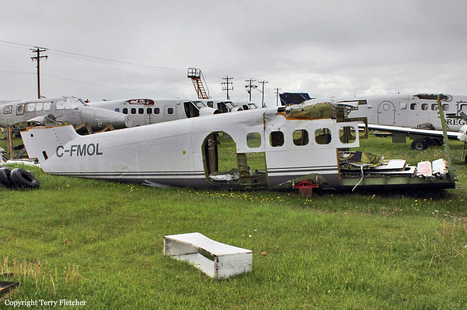
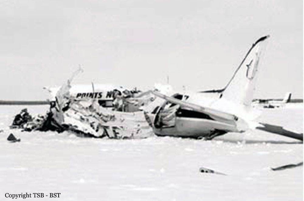
The First Air Boeing 737-210C combi aircraft departed Yellowknife (CYZF), Northwest Territories, at 1440 as First Air flight 6560 (FAB6560) on a charter flight to Resolute Bay (CYRB), Nunavut, with 11 passengers, 4 crew members, and freight on board. The instrument flight rules (IFR) flight from CYZF was flight-planned to take 2 hours and 05 minutes at 426 knots true airspeed and a cruise altitude of flight level (FL) 310. Air traffic control (ATC) cleared FAB6560 to destination via the flight-planned route: CYZF direct to the BOTER intersection, then direct to the Cambridge Bay (CB) non-directional beacon (NDB), then direct to 72° N, 100°45' W, and then direct to CYRB (Figure 1). The planned alternate airport was Hall Beach (CYUX), Nunavut. The estimated time of arrival (ETA) at CYRB was 1645. The captain occupied the left seat and was designated as the pilot flying (PF). The first officer (FO) occupied the right seat and was designated as the pilot not flying (PNF). Before departure, First Air dispatch provided the crew with an operational flight plan (OFP) that included forecast and observed weather information for CYZF, CYRB, and CYUX, as well as NOTAM (notice to airmen) information. Radar data show that FAB6560 entered the Northern Domestic Airspace (NDA) 50 nautical miles (nm) northeast of CYZF, approximately at RIBUN waypoint (63°11.4' N, 113°32.9' W) at 1450. During the climb and after leveling at FL310, the crew received CYRB weather updates from a company dispatcher (Appendix A). The crew and dispatcher discussed deteriorating weather conditions at CYRB and whether the flight should return to CYZF, proceed to the alternate CYUX, or continue to CYRB. The crew and dispatcher jointly agreed that the flight would continue to CYRB. At 1616, the crew programmed the global positioning systems (GPS) to proceed from their current en-route position direct to the MUSAT intermediate waypoint on the RNAV (GNSS) Runway (RWY) 35 TRUE approach at CYRB (Appendix B), which had previously been loaded into the GPS units by the crew. The crew were planning to transition to an ILS/DME RWY 35 TRUE approach (Appendix C) via the MUSAT waypoint. A temporary military terminal control area (MTCA) had been planned, in order to support an increase in air traffic at CYRB resulting from a military exercise, Operation NANOOK. A military terminal control unit at CYRB was to handle airspace from 700 feet above ground level (agl) up to FL200 within 80 nm of CYRB. Commencing at 1622:16, the FO made 3 transmissions before establishing contact with the NAV CANADA Edmonton Area Control Centre (ACC) controller. At 1623:29, the NAV CANADA Edmonton ACC controller cleared FAB6560 to descend out of controlled airspace and to advise when leaving FL270. The crew were also advised to anticipate calling the CYRB terminal control unit after leaving FL270, and that there would be a layer of uncontrolled airspace between FL270 and FL200. The FO acknowledged the information. FAB6560 commenced descent from FL310 at 1623:40 at 101 nm from CYRB. The crew initiated the pre-descent checklist at 1624 and completed it at 1625. At 1626, the crew advised the NAV CANADA Edmonton ACC controller that they were leaving FL260. At 1627:09, the FO subsequently called the CYRB terminal controller and provided an ETA of 1643 and communicated intentions to conduct a Runway 35 approach. Radio readability between FAB6560 and the CYRB terminal controller was poor, and the CYRB terminal controller advised the crew to try again when a few miles closer. At 1629, the crew contacted the First Air agent at CYRB on the company frequency. The crew advised the agent of their estimated arrival time and fuel request. The crew then contacted the CYRB terminal controller again, and were advised that communications were now better. The CYRB terminal controller advised that the MTCA was not yet operational, and provided the altimeter setting and traffic information for another inbound flight. The CYRB terminal controller then instructed the crew to contact the CYRB tower controller at their discretion. The FO acknowledged the traffic and the instruction to contact CYRB tower. At 1631, the crew contacted the CYRB tower controller, who advised them of the altimeter setting (29.81 inches of mercury [in. Hg]) and winds (estimated 160° true [T] at 10 knots), and instructed them to report 10 nm final for Runway 35T. The crew asked the tower controller for a runway condition report, and was advised that the runway was a little wet and that no aircraft had used it during the morning. The FO acknowledged this information. The crew initiated the in-range checklist at 1632 and completed it at 1637. At 1637, they began configuring the aircraft for approach and landing, and initiated the landing checklist. At 1638:21, FAB6560 commenced a left turn just before reaching MUSAT waypoint. At the time of the turn, the aircraft was about 600 feet above the ILS glideslope at 184 knots indicated airspeed (KIAS). The track from MUSAT waypoint to the threshold of Runway 35T is 347°T, which coincides with the localizer track for the ILS/DME RWY 35 TRUE approach. After rolling out of the left turn, FAB6560 proceeded on a track of approximately 350°T. At 1638:32, the crew reported 10 nm final for Runway 35T. The captain called for the gear to be lowered at 1638:38 and for flaps 15 at 1638:42. Airspeed at the time of both of these calls was 177 KIAS. At 1638:39, the CYRB tower controller acknowledged the crew’s report and instructed them to report 3 nm final. At 1638:46, the FO requested that the tower repeat the last transmission. At 1638:49, the tower repeated the request to call 3 nm final; the FO acknowledged the call. At this point in the approach, the crew had a lengthy discussion about aircraft navigation. At 1640:36, FAB6560 descended through 1000 feet above field elevation. Between 1640:41 and 1641:11, the captain issued instructions to complete the configuration for landing, and the FO made several statements regarding aircraft navigation and corrective action. At 1641:30, the crew reported 3 nm final for Runway 35T. The CYRB tower controller advised that the wind was now estimated to be 150°T at 7 knots, cleared FAB6560 to land Runway 35T, and added the term “check gear down” as required by the NAV CANADA Air Traffic Control Manual of Operations (ATC MANOPS) Canadian Forces Supplement (CF ATC Sup) Article 344.3. FAB6560’s response to the tower (1641:39) was cut off, and the tower requested the crew to say again. There was no further communication with the flight. The tower controller did not have visual contact with FAB6560 at any time. At 1641:51.8, as the crew were initiating a go-around, FAB6560 collided with terrain about 1 nm east of the midpoint of the CYRB runway. The accident occurred during daylight hours and was located at 74°42'57.3" N, 94°55'4.0" W, at 396 feet above mean sea level. The 4 crew members and 8 passengers were fatally injured. Three passengers survived the accident and were rescued from the site by Canadian military personnel, who were in CYRB participating in Operation NANOOK. The survivors were subsequently evacuated from CYRB on a Canadian Forces CC-177 aircraft.
Probable cause:
Findings as to causes and contributing factors:
1. The late initiation and subsequent management of the descent resulted in the aircraft turning onto final approach 600 feet above the glideslope, increasing the crew’s workload and reducing their capacity to assess and resolve the navigational issues during the remainder of the approach.
2. When the heading reference from the compass systems was set during initial descent, there was an error of −8°. For undetermined reasons, further compass drift during the arrival and approach resulted in compass errors of at least −17° on final approach.
3. As the aircraft rolled out of the turn onto final approach to the right of the localizer, the captain likely made a control wheel roll input that caused the autopilot to revert from VOR/LOC capture to MAN and HDG HOLD mode. The mode change was not detected by the crew.
4. On rolling out of the turn, the captain’s horizontal situation indicator displayed a heading of 330°, providing a perceived initial intercept angle of 17° to the inbound localizer track of 347°. However, due to the compass error, the aircraft’s true heading was 346°. With 3° of wind drift to the right, the aircraft diverged further right of the localizer.
5. The crew’s workload increased as they attempted to understand and resolve the ambiguity of the track divergence, which was incongruent with the perceived intercept angle and expected results.
6. Undetected by the pilots, the flight directors likely reverted to AUTO APP intercept mode as the aircraft passed through 2.5° right of the localizer, providing roll guidance to the selected heading (wings-level command) rather than to the localizer (left-turn command).
7. A divergence in mental models degraded the crew’s ability to resolve the navigational issues. The wings-level command on the flight director likely assured the captain that the intercept angle was sufficient to return the aircraft to the selected course; however, the first officer likely put more weight on the positional information of the track bar and GPS.
8. The crew’s attention was devoted to solving the navigational problem, which delayed the configuration of the aircraft for landing. This problem solving was an additional task, not normally associated with this critical phase of flight, which escalated the workload.
9. The first officer indicated to the captain that they had full localizer deflection. In the absence of standard phraseology applicable to his current situation, he had to improvise the go-around suggestion. Although full deflection is an undesired aircraft state requiring a go-around, the captain continued the approach.
10. The crew did not maintain a shared situational awareness. As the approach continued, the pilots did not effectively communicate their respective perception, understanding, and future projection of the aircraft state.
11. Although the company had a policy that required an immediate go-around in the event that an approach was unstable below 1000 feet above field elevation, no go-around was initiated. This policy had not been operationalized with any procedural guidance in the standard operating procedures.
12. The captain did not interpret the first officer’s statement of “3 mile and not configured” as guidance to initiate a go-around. The captain continued the approach and called for additional steps to configure the aircraft.
13. The first officer was task-saturated, and he thus had less time and cognitive capacity to develop and execute a communication strategy that would result in the captain changing his course of action.
14. Due to attentional narrowing and task saturation, the captain likely did not have a high- level overview of the situation. This lack of overview compromised his ability to identify and manage risk.
15. The crew initiated a go-around after the ground proximity warning system “sink rate” alert occurred, but there was insufficient altitude and time to execute the manoeuvre and avoid collision with terrain.
16. The first officer made many attempts to communicate his concerns and suggest a go-around. Outside of the two-communication rule, there was no guidance provided to address a situation in which the pilot flying is responsive but is not changing an unsafe course of action. In the absence of clear policies or procedures allowing a first officer to escalate from an advisory role to taking control, this first officer likely felt inhibited from doing so.
17. The crew’s crew resource management was ineffective. First Air’s initial and recurrent crew resource management training did not provide the crew with sufficient practical strategies to assist with decision making and problem solving, communication, and workload management.
18. Standard operating procedure adaptations on FAB6560 resulted in ineffective crew communication, escalated workload leading to task saturation, and breakdown in shared situational awareness. First Air’s supervisory activities did not detect the standard operating procedure adaptations within the Yellowknife B737 crew base.

Findings as to risk:
1. If standard operating procedures do not include specific guidance regarding where and how the transition from en route to final approach navigation occurs, pilots will adopt non-standard practices, which may introduce a hazard to safe completion of the approach.
2. Adaptations of standard operating procedures can impair shared situational awareness and crew resource management effectiveness.
3. Without policies and procedures clearly authorizing escalation of intervention to the point of taking aircraft control, some first officers may feel inhibited from doing so.
4. If hazardous situations are not reported, they are unlikely to be identified or investigated by a company’s safety management system; consequently, corrective action may not be taken.
5. Current Transport Canada crew resource management training standards and guidance material have not been updated to reflect advances in crew resource management training, and there is no requirement for accreditation of crew resource management facilitators/instructors in Canada. This situation increases the risk that flight crews will not receive effective crew resource management training.
6. If initial crew resource management training does not develop effective crew resource management skills, and if there is inadequate reinforcement of these skills during recurrent training, flight crews may not adequately manage risk on the flight deck.
7. If operators do not take steps to ensure that flight crews routinely apply effective crew resource management practices during flight operations, risk to aviation safety will persist.
8. Transport Canada’s flight data recorder maintenance guidance (CAR Standard 625, Appendix C) does not refer to the current flight recorder maintenance specification, and therefore provides insufficient guidance to ensure the serviceability of flight data recorders. This insufficiency increases the risk that information needed to identify and communicate safety deficiencies will not be available.
9. If aircraft are not equipped with newer-generation terrain awareness and warning systems, there is a risk that a warning will not alert crews in time to avoid terrain.
10. If air carriers do not monitor flight data to identify and correct problems, there is a risk that adaptations of standard operating procedures will not be detected.
11. Unless further action is taken to reduce the incidence of unstable approaches that continue to a landing, the risk of controlled flight into terrain and of approach and landing accidents will persist.

Other findings:
1. It is likely that both pilots switched from GPS to VHF NAV during the final portion of the in-range check before the turn at MUSAT.
2. The flight crew of FAB6560 were not navigating using the YRB VOR or intentionally tracking toward the VOR.
3. There was no interference with the normal functionality of the instrument landing system for Runway 35T at CYRB.
4. Neither the military tower nor the military terminal controller at CYRB had sufficient valid information available to cause them to issue a position advisory to FAB6560.
5. The temporary Class D control zone established by the military at CYRB was operating without any capability to provide instrument flight rules separation.
6. The delay in notification of the joint rescue coordination centre did not delay the emergency response to the crash site.
7. The NOTAMs issued concerning the establishment of the military terminal control area did not succeed in communicating the information needed by the airspace users.
8. The ceiling at the airport at the time of the accident could not be determined. The visibility at the airport at the time of the accident likely did not decrease below approach minimums at any time during the arrival of FAB6560. The cloud layer at the crash site was surface-based less than 200 feet above the airport elevation.
Final Report:

Crash of a Rockwell Shrike Commander 500S in Rankin Inlet

Date & Time: Jul 18, 2010 at 1330 LT
Operator:
Registration:
N5800H
Flight Phase:
Flight Type:
Survivors:
Yes
Schedule:
Portland - Rankin Inlet - Iqaluit - Bern
MSN:
500-3082
YOM:
1970
Country:
Crew on board:
3
Crew fatalities:
Pax on board:
0
Pax fatalities:
Other fatalities:
Total fatalities:
0
Captain / Total flying hours:
23100
Captain / Total hours on type:
40.00
Copilot / Total flying hours:
5400
Copilot / Total hours on type:
13
Circumstances:
The Aero Commander 500S had recently been purchased. The new owner of the aircraft retained the services of 2 experienced pilots to deliver the aircraft from Portland, Oregon, United States, to Bern, Switzerland. After having flown several positioning legs, the aircraft arrived at Rankin Inlet for refuelling. The aircraft was refuelled from two 45-gallon drums and was to continue on to Iqaluit, Nunavut. The pilot-in-command occupied the right seat and the pilot flying the aircraft occupied the left seat. The aircraft was at its maximum takeoff weight of 7000 pounds. Prior to take off, the crew conducted a run-up and all indications seemed normal. During the takeoff roll, the engines did not produce full power and the crew elected to reject the takeoff. After returning to the ramp, a second run-up was completed and once again all indications seemed normal. Shortly after second rotation, cylinder head temperatures increased and both Lycoming TIO-540-E1B5 engines began to lose power. The pilots attempted to return to the airport, but were unable to maintain altitude. The landing gear was extended and a forced landing was made on a flat section of land, approximately 1500 feet to the southwest of the runway 13 threshold. There were no injuries and the aircraft sustained substantial damage.
Probable cause:
Findings as to Causes and Contributing Factors:
1. At the fuel compound, the 45-gallon drum containing slops was located near the stock of sealed 45-gallon drums of 100LL AVGAS, contributing to the fuel handler selecting the drum of slops in error.
2. The 45-gallon drum of slops had similar markings to the stock of sealed 45-gallon drums of 100LL AVGAS, preventing ready identification of the contaminated drum.
3. The fuel handler did not notice that the large bung plug was not sealed on the second 45-gallon drum and, as a result, delivered the drum of slops to the aircraft.
4. The pilots did not notice that the large bung plug was not sealed on the second 45-gallon drum and, as a result, fuelled the aircraft with contaminated fuel.
5. The pilots were inexperienced with refuelling from 45-gallon drums and did not take steps to ascertain the proper fuel grade in the second 45-gallon drum. As a result, slops, rather than 100LL AVGAS, was pumped into the aircraft’s fuel system.
6. The fuel system design was such that the fuel from both wing fuel cells combined in the centre fuel cell and, as a result, contaminated fuel was fed to both engines.
7. The contaminated fuel resulted in engine power loss in both engines and the aircraft was unable to maintain altitude after takeoff.
Finding as to Risk:
1. The impact force angles were substantially different from that of the ELT’s G-switch orientation. As a result, the ELT did not activate during the impact. This could have delayed search and rescue (SAR) notification.
Final Report:

Crash of a De Havilland DHC-6 Twin Otter 300 near Alert

Date & Time: May 10, 2010 at 1719 LT
Operator:
Registration:
C-FSJB
Survivors:
Yes
MSN:
377
YOM:
1973
Country:
Crew on board:
2
Crew fatalities:
Pax on board:
3
Pax fatalities:
Other fatalities:
Total fatalities:
0
Circumstances:
The crew was performing a supply mission in the Nunavut with three scientists on board. Equipped with ski, the aircraft landed on the snow covered terrain some 168 km north of Alert Air Base. After landing, the aircraft came to a halt when the right ski punctured the ice and the aircraft partially sunk while both engines were still running. All five occupants escaped uninjured and were evacuated two hours later by the crew of a Bell 407 to Resolute Bay. Damaged beyond repair, the aircraft was abandoned on site and later cancelled from registry in November 2011.
Probable cause:
Landing gear went through the ice after landing on ice/snow terrain.

Crash of a Dornier DO228-202 in Cambridge Bay

Date & Time: Dec 13, 2008 at 0143 LT
Type of aircraft:
Operator:
Registration:
C-FYEV
Survivors:
Yes
Schedule:
Resolute Bay - Cambridge Bay
MSN:
8133
YOM:
1987
Country:
Crew on board:
2
Crew fatalities:
Pax on board:
12
Pax fatalities:
Other fatalities:
Total fatalities:
0
Captain / Total flying hours:
13400
Captain / Total hours on type:
802.00
Copilot / Total flying hours:
850
Copilot / Total hours on type:
470
Circumstances:
The Summit Air Charters Dornier 228-202 was on a charter flight from Resolute Bay to Cambridge Bay, Nunavut, under instrument flight rules. While on final approach to Runway 31 True, the aircraft collided with the ground approximately 1.5 nautical miles from the threshold at 0143 mountain standard time. Of the 2 pilots and 12 passengers on board, 2 persons received serious injuries. The aircraft was substantially damaged. The emergency locator transmitter activated, and the crew notified the Cambridge Bay Airport radio operator of the accident via the aircraft radio. Local ground search efforts found the aircraft within 30 minutes, and all occupants were removed from the site within two hours.
Probable cause:
Findings as to Causes and Contributing Factors:
1. An abbreviated visual approach was conducted at night in instrument meteorological conditions, which resulted in the flight crew’s inability to obtain sufficient visual reference to judge their height above the ground.
2. The flight crew did not monitor pressure altimeter readings or reference the minimum altitude requirements in relation to aircraft position on the approach, resulting in controlled flight into terrain.
3. The pilots had not received training and performance checks for the installed global positioning system (GPS) equipment, and were not fully competent in its use. The attempts at adjusting the settings likely distracted the pilots from maintaining the required track and ground clearance during the final approach.
Findings as to Risk:
1. The precision approach path indicator systems (PAPI) at Cambridge Bay had not been inspected in accordance with the Airport Safety Program Manual. Although calibration of the equipment did not have a bearing on this occurrence, there was an increased risk of aircraft misalignment from the proper glide path, especially during night and reduced visibility conditions.
2. The flight crew’s cross-check of barometric altimeter performance was not sufficient to detect which instrument was inaccurate. As a result, reference was made to a defective altimeter, which increased the risk of controlled flight into terrain.
3. Operators’ maintenance organizations normally do not have access to the troubleshooting information contained in Component Maintenance Instruction Manuals for the Intercontinental Dynamics Corporation altimeters. Therefore, aircraft could be dispatched with damaged instruments with the potential for developing a loss of calibration during flight.
4. The flight was conducted during a period in which the crew’s circadian rhythm cycle could result in cognitive and physical performance degradation unless recognized and managed.
Final Report:

Crash of a De Havilland DHC-6 Twin Otter 300 in Mile 222 (Canol Road)

Date & Time: Jul 4, 2004 at 1730 LT
Operator:
Registration:
C-FMOL
Flight Phase:
Flight Type:
Survivors:
Yes
Schedule:
Mile 222 - Mile 170
MSN:
303
YOM:
1971
Country:
Crew on board:
2
Crew fatalities:
Pax on board:
0
Pax fatalities:
Other fatalities:
Total fatalities:
0
Circumstances:
The North-Wright Airways Ltd. DHC-6 Twin Otter, registration C-FMOL, was departing from an approximately 1,500 foot long gravel strip at Mile 222 of the Canol Road (near the Tsichu River), Canada. The takeoff was initiated to the north and into wind. Immediately after becoming airborne, the aircraft encountered a strong right cross-wind and settled back onto the strip. The left wheel contacted willows that had overgrown the edge of the strip. The aircraft veered left into the willows at about 60 knots, and began to decelerate. Prior to flying speed being regained, the aircraft rolled off the end of the strip and come to rest in a shallow creek. The right wing partially separated from the fuselage at impact and the forward fuselage, nose gear and right main gear sustained substantial damage. The pilot and first officer were uninjured. The purpose of the trip was to move hunting gear and outfitter supplies back to an airstrip at Mile 170 of the Canol Road (Godlin Lake). The aircraft was at or near gross weight at the time of the occurrence.

Crash of a Douglas C-47A-5-DK in Ennadai Lake: 2 killed

Date & Time: Mar 17, 2000 at 1230 LT
Operator:
Registration:
C-FNTF
Flight Type:
Survivors:
No
Schedule:
Points North Landing - Ennadai Lake
MSN:
12344
YOM:
1944
Country:
Crew on board:
2
Crew fatalities:
Pax on board:
0
Pax fatalities:
Other fatalities:
Total fatalities:
2
Captain / Total flying hours:
8200
Captain / Total hours on type:
840.00
Copilot / Total flying hours:
4300
Copilot / Total hours on type:
85
Circumstances:
The Douglas DC-3 departed Points North Landing, Saskatchewan, about 1125 central standard time on a visual flight rules flight to Ennadai Lake, Nunavut, with two pilots and 6600 pounds of cargo on board. The flight was one of a series of flights to position building materials for the construction of a lodge. The pilots had completed a similar flight earlier in the day. The runway at Ennadai, oriented northeast/southwest, was an ice strip about 2700 feet long by 150 feet wide marked with small evergreens. The ice strip was constructed on the lake, and the approaches were flat, without obstacles. The snow was cleared so there were no snow ridges on the runway ends. The arrival at Ennadai Lake, toward the southwest, appeared to be similar to previous arrivals. The aircraft was observed to touch down nearly halfway along the ice strip, the tail of the aircraft remained in the air, and the aircraft took off almost immediately. The main landing gear was seen to retract. The aircraft reached the end of the runway then abruptly entered a steep, nose-up attitude, banked sharply to the left, turned left, and descended into the ice. The left wing made first contact with the ice. The aircraft rotated around the left wing and struck the ice in a steep, nose-down attitude about 400 feet from the end of the ice strip. There was no fire. The crew were killed instantly. Canadian Forces rescue specialists were air-dropped to the site on the day of the accident.
Probable cause:
Findings as to Causes and Contributing Factors:
1. The pilot lost control of the aircraft while conducting a go-around from a balked landing on an ice strip.
2. The aircraft's centre of gravity (C of G) on the accident flight was beyond the aft C of G limit.
3. The actual C of G of the aircraft at basic operating weight was 16.7 inches aft of the C of G provided in the weight and balance report.
4. The load sheet index number used by the crew was inaccurate.
5. The stack of 2x4 lumber was inadequately secured and may have shifted rearward during the go-around.
6. The crew did not recalculate the aircraft's weight and balance for the second flight.
7. Leaks in the heater shroud allowed carbon monoxide gas to contaminate cockpit and cabin air.
8. The captain's carboxyhaemoglobin level was 17.9%, which may have adversely affected his performance, especially his decision making and his visual acuity.
Other Findings:
1. The carbon monoxide detector had no active warning system. The user directions for the detector, which are printed on the back of the detector, are obscured when the detector is installed.
2. The company maintenance facility overhauled the heater as required by the Transport Canada-approved inspection program.
3. Although the manufacturer's maintenance instruction manual for the S200 heater, part number 27C56, lists inspection and overhaul procedures, it does not specify their intervals.
4. No maintenance instructions are available for the heater, part number 27C56. The company maintenance facility did not conduct inspections, overhauls, or pressure decay tests as specified for later manufactured heaters.
Final Report:

Crash of an Avro 748-335-2A in Iqaluit

Date & Time: Dec 3, 1998 at 1536 LT
Type of aircraft:
Operator:
Registration:
C-FBNW
Flight Phase:
Survivors:
Yes
Schedule:
Iqaluit - Igloolik
MSN:
1759
YOM:
1978
Flight number:
FAB802
Location:
Country:
Crew on board:
4
Crew fatalities:
Pax on board:
3
Pax fatalities:
Other fatalities:
Total fatalities:
0
Captain / Total flying hours:
8000
Captain / Total hours on type:
800.00
Copilot / Total flying hours:
2143
Copilot / Total hours on type:
117
Circumstances:
At approximately 1536 eastern standard time, First Air flight 802, a Hawker Siddeley HS-748-2A, serial number 1759, was on a scheduled flight from Iqaluit to Igloolik, Nunavut. On board were two flight crew, one flight attendant, one loadmaster, and three passengers. During the take-off run on runway 36, at the rotation speed (VR), the captain rotated the aircraft; however, the aircraft did not get airborne. Approximately seven seconds after VR, the captain called for and initiated a rejected take-off. The aircraft could not be stopped on the runway, and the nose-wheel gear collapsed as the aircraft rolled through the soft ground beyond the end of the runway. The aircraft hit the localizer antenna and continued skidding approximately 700 feet. It came to rest in a ravine in a nose-down attitude, approximately 800 feet off the declared end of the runway. The flight attendant initiated an evacuation through the left, main, rear cabin door. The two pilots evacuated the aircraft through the cockpit windows and joined the passengers and the flight attendant at the rear of the aircraft. The flight attendant was slightly injured during the sudden deceleration of the aircraft. The aircraft was substantially damaged.
Probable cause:
Findings as to Causes and Contributing Factors:
1. The captain rejected the take-off at a speed well above the engine-failure recognition speed (V1) with insufficient runway remaining to stop before the end of the runway.
2. The far-forward position of the centre of gravity contributed to the pilot not rotating the aircraft to the normal take-off attitude.
3. The aircraft never achieved the required pitch for take-off. The captain=s inability to accurately assess the pitch attitude was probably influenced by the heavier than normal elevator control forces and the limited nighttime visual references.
4. The loadmaster did not follow the company- and Transport Canada-approved procedures to evaluate the excess baggage added to the aircraft, which led to a discrepancy of 450 pounds and a C of G position further forward than expected.
5. The performance analysis suggested that the aircraft was under-rotated as a result of a forward C of G loading and the generated lift never exceeded the aircraft=s weight during the take-off attempt.
Findings as to Risk:
1. The aircraft was approximately 200 pounds over maximum gross take-off weight.
2. The aircraft accelerated more slowly than normal, probably because of the snow on the runway.
3. Although atmospheric conditions were conducive to contamination and the aircraft was not de-iced, it could not be determined if contamination was present or if it degraded the aircraft performance during the attempted take-off.
4. Water methanol was not used for the occurrence take-off. Use of water methanol may have reduced the consequences of the rejected take-off.
5. The captain did not call for the overrun drill, and none of the items on the checklist were covered by the crew.
6. The co-pilot did not follow the emergency checklist and call air traffic control to advise of the rejected take-off or call over the public address system to advise the passengers to brace.
7. The aircraft lost all its electrical systems during the impact with the large rocks, rendering the radios unserviceable.
8. No HS-748 simulator exists that could be used to train pilots on the various take-off and rejected take-off scenarios.
9. There was confusion regarding the aircraft=s location. The flight service station, fire trucks, and intervening teams were not using an available grid map for orientation.
10. There is a risk associated with not de-icing aircraft before take-off in weather conditions such as those on the day of the accident.
11. There is a risk associated with not calculating the WAT limit and performance of an aircraft during an engine-out procedure in an environment with obstacles.
Other Findings
1. The aircraft=s brakes, anti-skid system, and tires functioned properly throughout the rejected take-off.
Final Report: