Country
Operator Image

Crash of an IAI-1124A Westwind II off Norfolk Island

Date & Time: Nov 18, 2009 at 2156 LT
Type of aircraft:
Operator:
Registration:
VH-NGA
Flight Type:
Survivors:
Yes
Schedule:
Apia - Norfolk Island - Melbourne
MSN:
387
YOM:
1983
Country:
Region:
Crew on board:
2
Crew fatalities:
Pax on board:
4
Pax fatalities:
Other fatalities:
Total fatalities:
0
Captain / Total flying hours:
3596
Captain / Total hours on type:
923.00
Copilot / Total flying hours:
1954
Copilot / Total hours on type:
649
Aircraft flight hours:
21528
Aircraft flight cycles:
11867
Circumstances:
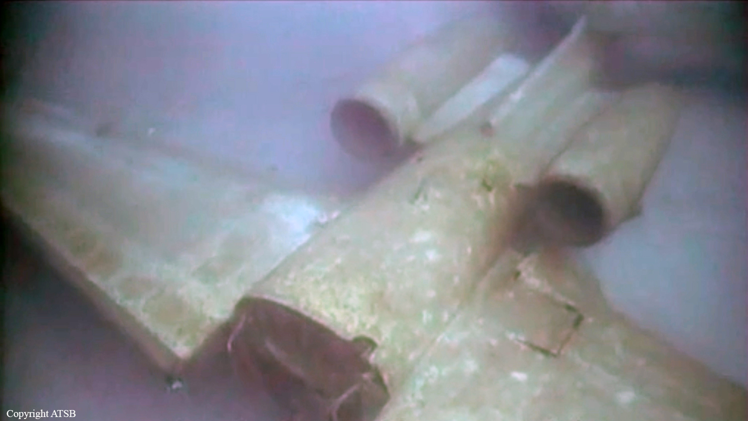
On 18 November 2009, the flight crew of an Israel Aircraft Industries Westwind 1124A aircraft, registered VH-NGA, was attempting a night approach and landing at Norfolk Island on an aeromedical flight from Apia, Samoa. On board were the pilot in command and copilot, and a doctor, nurse, patient and one passenger. On arrival, weather conditions prevented the crew from seeing the runway or its visual aids and therefore from landing. The pilot in command elected to ditch the aircraft in the sea before the aircraft’s fuel was exhausted. The aircraft broke in two after ditching. All the occupants escaped from the aircraft and were rescued by boat.
Probable cause:
The pilot in command did not plan the flight in accordance with the existing regulatory and operator requirements, precluding a full understanding and management of the potential hazards affecting the flight. The flight crew did not source the most recent Norfolk Island Airport forecast, or seek and apply other relevant weather and other information at the most relevant stage of the flight to fully inform their decision of whether to continue the flight to the island, or to divert to another destination. The flight crew’s delayed awareness of the deteriorating weather at Norfolk Island combined with incomplete flight planning to influence the decision to continue to the island, rather than divert to a suitable alternate.
Final Report:

Crash of an IAI-1124 Westwind in Alice Springs: 3 killed

Date & Time: Apr 27, 1995 at 1957 LT
Type of aircraft:
Operator:
Registration:
VH-AJS
Flight Type:
Survivors:
No
Schedule:
Darwin – Katherine – Alice Springs – Adélaïde – Sydney
MSN:
221
YOM:
1978
Country:
Region:
Crew on board:
2
Crew fatalities:
Pax on board:
1
Pax fatalities:
Other fatalities:
Total fatalities:
3
Captain / Total flying hours:
10108
Captain / Total hours on type:
2530.00
Copilot / Total flying hours:
3747
Copilot / Total hours on type:
85
Aircraft flight hours:
11508
Circumstances:
The aircraft was on a scheduled freight service from Darwin via Tindal, Alice Springs, and Adelaide to Sydney under the IFR. The flight from Darwin to Tindal was apparently normal, and the aircraft departed Tindal slightly ahead of schedule at 1834 CST. The pilot in command occupied the left cockpit seat. At 1925, the aircraft reported at position DOLPI (200 miles north of Alice Springs) Flight Level 330, to Melbourne Control. Another Westwind aircraft was en route Darwin–Alice Springs and was more than 40 miles ahead of VH-AJS. Information from the aircraft cockpit voice recording confirmed that the pilot in command was flying the aircraft. At about 1929, he began issuing instructions to the co-pilot to program the aircraft navigation system in preparation for a locator/NDB approach to Alice Springs. The pilot in command asked the co-pilot to enter an offset position into the area navigation (RNAV) system for an 11-mile final for runway 12. The co-pilot entered the bearing as 292 degrees Alice Springs. (This was the outbound bearing from Alice Springs NDB to Simpson’s Gap locator indicated on the locator/NDB approach chart.) The pilot in command stated that he had wanted the bearing with respect to the runway, 296 degrees, entered but said that the setting could be left as 292 degrees. He then instructed the co-pilot to set Alice Springs NDB frequency on ADF 1, Simpson’s Gap locator on ADF 2, and to preset the Temple Bar locator frequency on ADF 2 so that it could be selected as soon as the aircraft passed overhead Simpson’s Gap. He indicated his intention to descend to 4,300 feet until overhead Simpson’s Gap, and said that the co-pilot should then set 3,450 feet on the altitude alert selector. On passing Temple Bar, the co-pilot was to set 2,780 feet on the altitude alert selector which the pilot in command said would be used as the minimum for the approach. At 1940, the co-pilot contacted Adelaide Flight Service (FIS) and was given the Alice Springs weather, including the local QNH. At 1945, he advised Adelaide FIS that the aircraft was leaving Flight Level 330 on descent. At about 30 miles from Alice Springs, the pilot in command turned the aircraft right to track for the offset RNAV position 292 degrees/11 miles Alice Springs. The crew set local QNH passing 16,000 feet and then completed the remaining transition altitude checks. These included selecting landing and taxi lights on. At 1949, the co-pilot advised Adelaide FIS that the aircraft was transferring frequency to the Alice Springs MTAF. At 1953, the aircraft passed Simpson’s Gap at about 4,300 feet and the copilot set 3,500 feet in the altitude alert selector. About 15 seconds later, the pilot in command told the co-pilot that, after the aircraft passed overhead the next locator, he was to set the ‘minima’ in the altitude alert selector. At 1954 , the pilot in command called that the aircraft was at 3,500 feet. A few seconds later, the co-pilot indicated that the aircraft was over the Temple Bar locator and that they could descend to 2,300 feet. The pilot in command repeated the 2,300 feet called by the co-pilot and asked him to select the landing gear down. The crew then completed the pre-landing checks. Eleven seconds later, the co-pilot reported that the aircraft was 300 feet above the minimum descent altitude. This was confirmed by the pilot in command. About 10 seconds later, there were two calls by the co-pilot to pull up. Immediately after the second call, the aircraft struck the top of the Ilparpa Range (approximately 9 kilometres north-west of Alice Springs Airport), while heading about 105 degrees at an altitude of about 2,250 feet in a very shallow climb. At approximately 1950, witnesses in a housing estate on the north-western side of the Ilparpa Range observed aircraft lights approaching from the north-west. They described the lights as appearing significantly lower than those of other aircraft they had observed approaching Alice Springs from the same direction. The lights illuminated buildings as the aircraft passed overhead and then they illuminated the northern escarpment of the range. This was followed almost immediately by fire/explosion at the top of the range.
Probable cause:
The following factors were considered significant in the accident sequence:
1. There were difficulties in the cockpit relationship between the pilot in command and the co-pilot.
2. The level of crew resource management demonstrated by both crew members during the flight was low.
3. The Alice Springs locator/NDB approach was unique.
4. The briefing for the approach conducted by the pilot in command was not adequate.
5. When asked for the ‘minima’ by the pilot in command, the co-pilot called, and the pilot in command accepted, an incorrect minimum altitude for the aircraft category and for the segment of the approach.
6. The technique employed by the pilot in command in flying the approach involved a high cockpit workload.
7. The crew did not use the radio altimeter during the approach.
Final Report:

Crash of an IAI 1124 Westwind off Sydney: 2 killed

Date & Time: Oct 10, 1985 at 0059 LT
Type of aircraft:
Operator:
Registration:
VH-IWJ
Flight Phase:
Flight Type:
Survivors:
No
Schedule:
Sydney – Brisbane – Cairns
MSN:
371
YOM:
1982
Flight number:
QH474
Country:
Region:
Crew on board:
2
Crew fatalities:
Pax on board:
0
Pax fatalities:
Other fatalities:
Total fatalities:
2
Captain / Total flying hours:
9881
Captain / Total hours on type:
3101.00
Copilot / Total flying hours:
8091
Copilot / Total hours on type:
500
Aircraft flight hours:
3105
Circumstances:
IAI 1124 Westwind aircraft, registered VH-IWJ, was operating under a current Certificate of Registration, the holder of which was Pel-Air Aviation Pty Ltd (Pe1-Air). The aircraft was operated by Pel-Air and, at the time of the accident, it was engaged on a regularly scheduled cargo service. This service was operated under the terms of a current Charter and Aerial Work Licence, and was flown on behalf of Ansett Air Freight, a subsidiary of Ansett Transport Industries Pty Ltd. The particular flight, designated Flight 474, was operated on 4 nights each week from Sydney to Brisbane and Cairns, Queensland. The aircraft had departed Cairns earlier in the evening and had flown via Brisbane to Sydney, arriving at 2336 hours. The arriving crew reported that the aircraft was performing normally. A total of 1,350 litres of fuel was added to the aircraft tanks and loading of general cargo was carried out by Ansett Air Freight personnel. The flight plan submitted to Air Traffic Control (ATC) indicated that the flight would follow the normal Instrument Flight Rules (IFR) procedures. The estimated time interval to Brisbane was 70 minutes at planned Flight Level 370 (approximate altitude of 37,000 feet). The aircraft carried sufficient fuel for 164 minutes of flight, and refuelling was planned to take place at Brisbane prior to departure for Cairns. Pel-Air intended to use the flight to assess the performance of the rostered co-pilot, who was being considered for upgrading to command status. He was to occupy the left hand control seat, while the right hand seat occupant was the Chief Pilot of the company. At 0033 hours the crew established radio contact on the Sydney ATC Clearance Delivery frequency, and were given a "16 West Maitland One" Standard Instrument Departure (SID). The flight pattern associated with this clearance requires the aircraft to maintain heading after take-off on Runway 16 until reaching a height of 500 feet, when a left turn is made to intercept the 126 radial of the Sydney VOR (Very High Frequency Omnidirectional Range). At a position of 6 nautical miles by Distance Measuring Equipment (DME) from the aerodrome, a left turn onto 357 degrees is made in order to continue tracking with reference to the West Haiti and VOR. A copy of the applicable SID chart is shown at Appendix A. Shortly before 0049 hours the crew contacted Sydney Control Tower, and the aircraft was directed to taxi for a departure from Runway 16. At the time the wind was light and variable. After receiving the appropriate clearance, an evidently normal take-off was made, and at 0056 hours contact was established with Sydney Departures Control. The pilot in command advised that the aircraft was on climb to Flight Level 370 , and requested the direct track to Brisbane. This was a standard request, to allow the aircraft to proceed directly to the destination rather than follow the various radio navigation aids along the route. Such a request was normally granted by ATC if the general traffic situation permitted use of the direct track, and provided the aircraft was equipped with a suitable navigation system. VH-IWJ was fitted with a VLF/Omega navigation system which was capable of direct tracking. After ascertaining this, the Departures controller advised the aircraft that the direct track to Brisbane would probably be available. The acknowledgment of this comment was the last recorded transmission from the aircraft. Shortly before 0059 hours the Departures controller broadcast the clearance for the aircraft to track direct to Brisbane at the planned cruising level. No response was received from the aircraft, although the controller noted that radar returns were still visible on his screen. Shortly afterwards, these returns faded, and the Distress Phase of Search and Rescue procedures was Instituted at 0100 hours. At about this time, a number of persons observed what appeared to be the lights of an aircraft descending rapidly towards the sea. The lights maintained their position relative to each other, indicating that the aircraft was not rotating as it descended. The aircraft had faded from the radar screen at a point about 11 kilometres south-east of Sydney Airport. A search of the area was commenced using helicopters and boats. Wreckage Identified as being from the aircraft was sighted by a helicopter at 0245 hours. Recovery of pieces of the aircraft structure, freight and human remains was effected by Police and Department of Aviation launches. The degree of destruction indicated that the aircraft had struck the water while travelling at high speed. The bulk of the wreckage was presumed to be lying in about 85 metres of water about 5 kilometres out to sea from Botany Bay. An Intensive search was carried out by vessels from the Royal Australian Navy, later assisted by a vessel from the NSW Department of Fisheries and Agriculture. Use was made of various underwater detection devices. Search efforts were hampered by persistent unfavourable sea conditions and no trace was found of the wreckage. Operations were finally suspended towards the end of November 1985. An Internationally recognised underwater location and salvage expert was then employed, and the wreckage was ultimately located and identified in 92 metres of water on 20 January 1986. Recovery of the Flight Data and Cockpit Voice Recorders, the major portions of both engines, and sundry other pieces of the aircraft structure, was effected the following month.
Probable cause:
The following findings were reported:
1.There was a known malfunction of the rate of turn indicator.
2. The pilot in command possibly simulated simultaneous failures of all three flight attitude indicators.
3. There were no external references by which the crew could assess the attitude of the aircraft.
4. A loss of control of the aircraft occurred at a height of about 5000 feet.
5. The crew did not recover control of the aircraft prior to impact with the sea.
Final Report: