Crash of a Cessna 421C Golden Eagle III in Monterey: 1 killed
Date & Time:
Jul 13, 2021 at 1042 LT
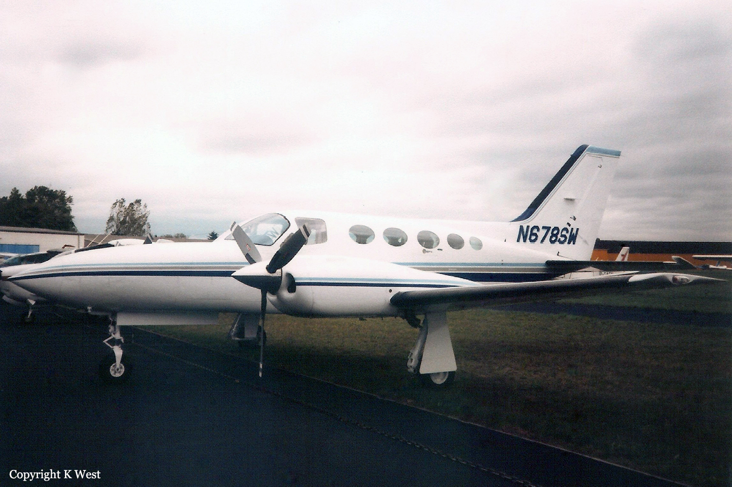
Registration:
N678SW
Survivors:
No
Schedule:
Monterey – Salinas
MSN:
421C-1023
YOM:
1981
Crew on board:
1
Crew fatalities:
Pax on board:
0
Pax fatalities:
Other fatalities:
Total fatalities:
1
Aircraft flight hours:
5818
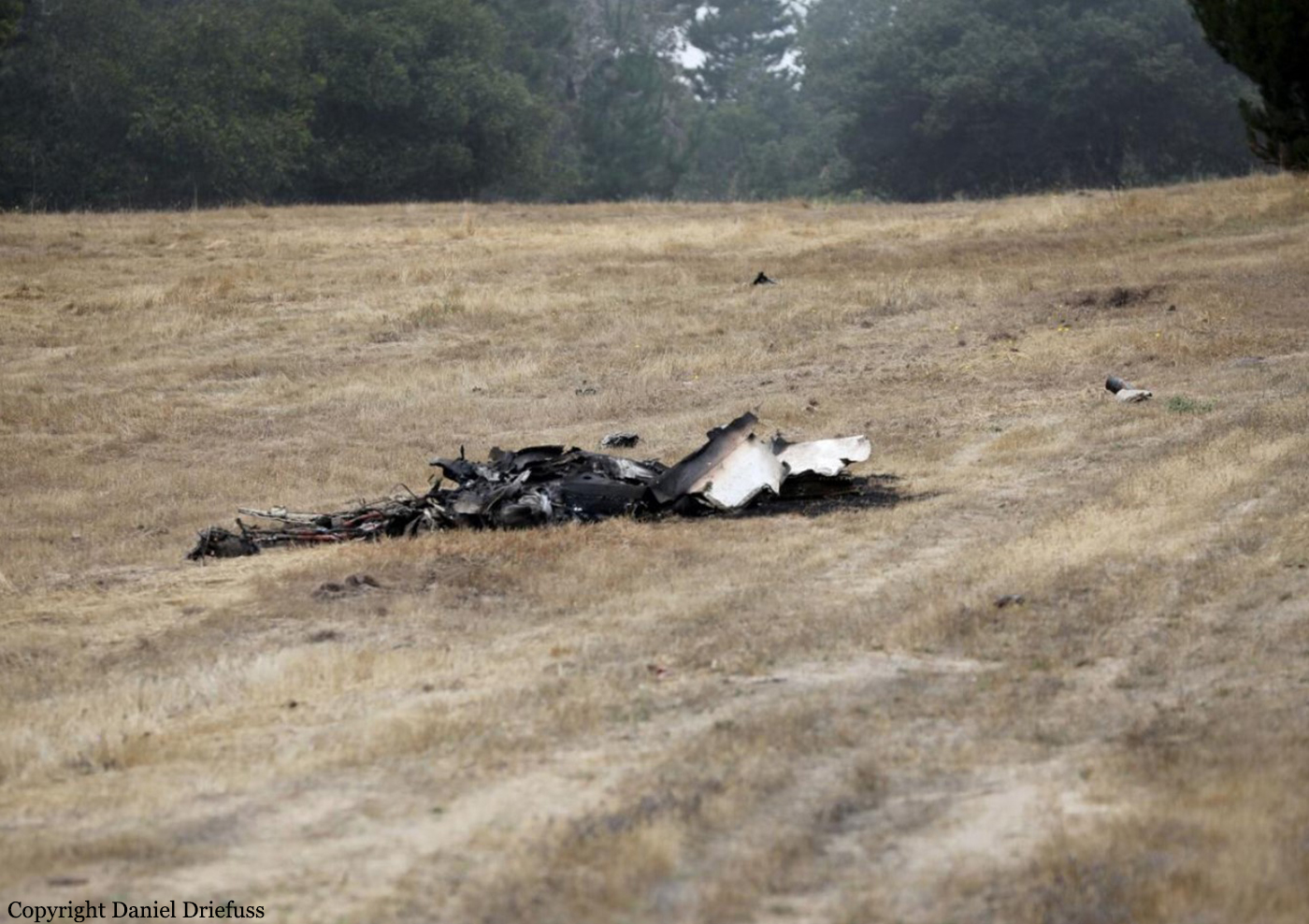
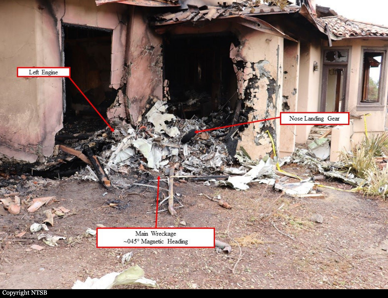
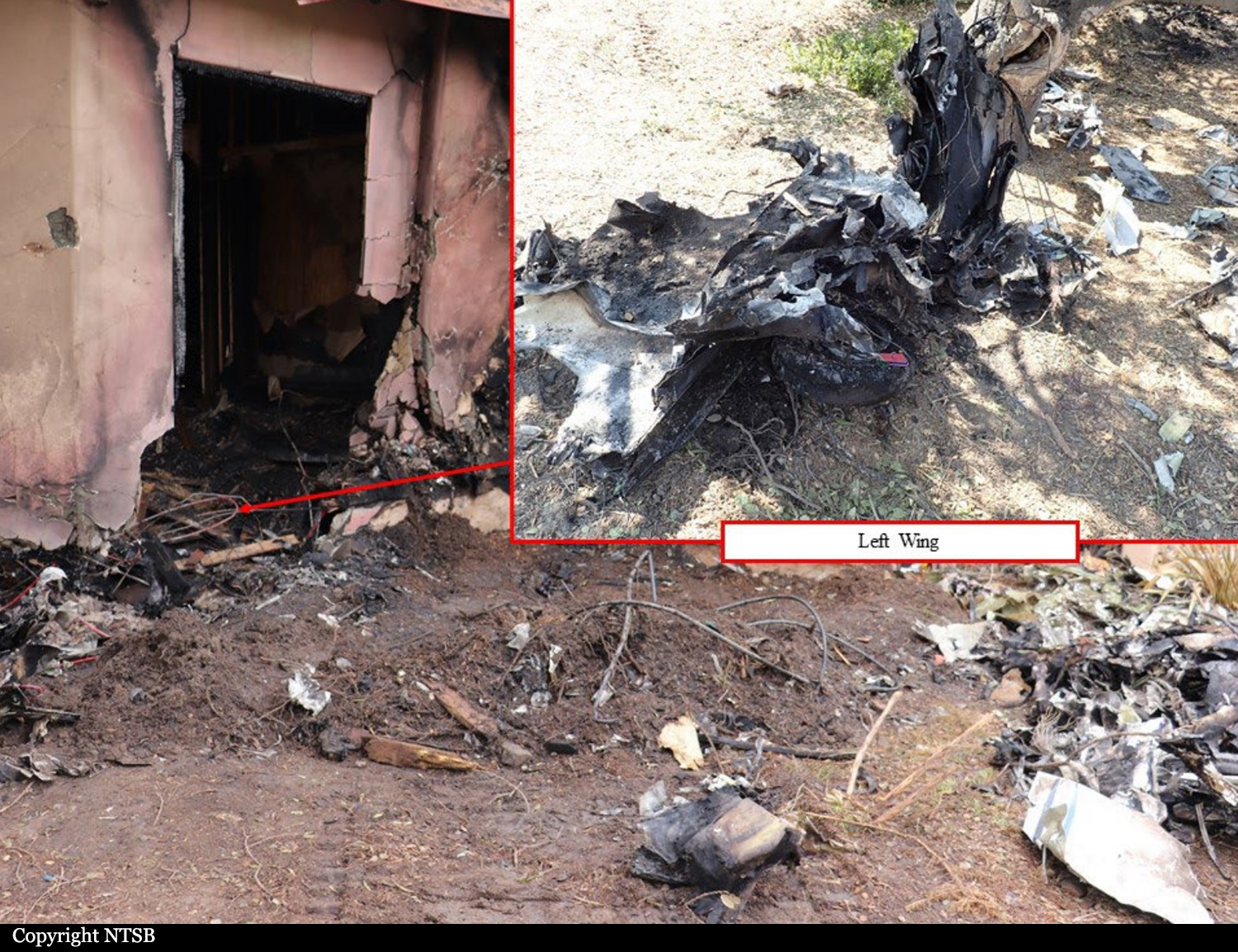
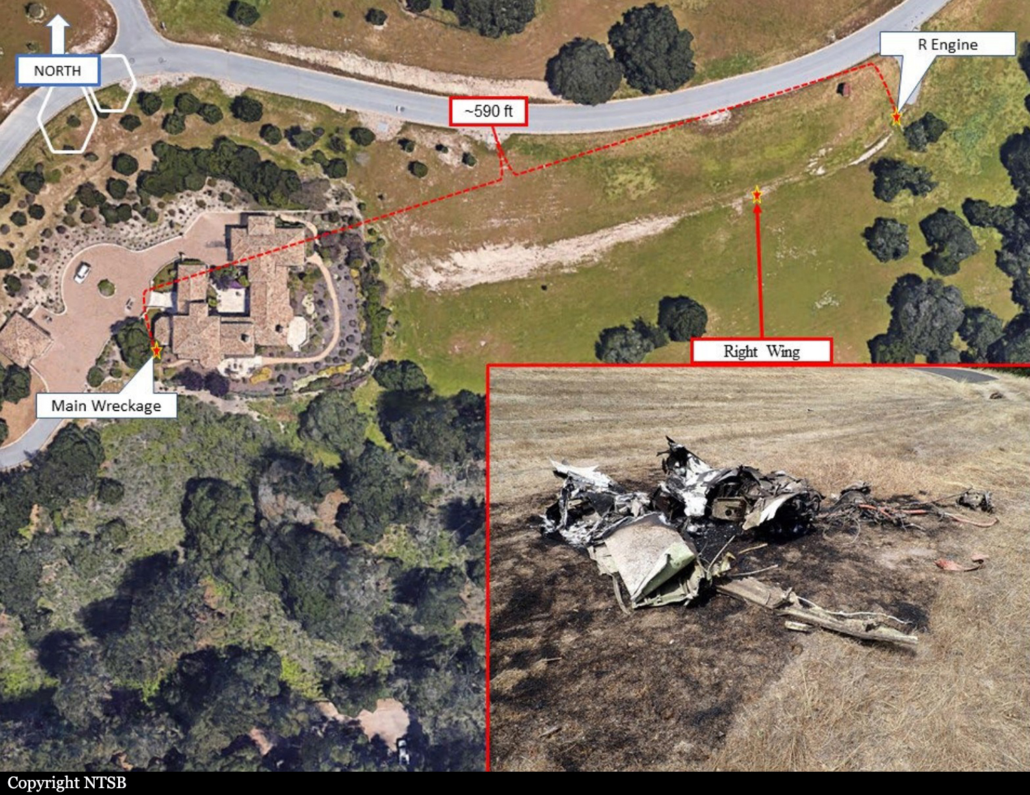
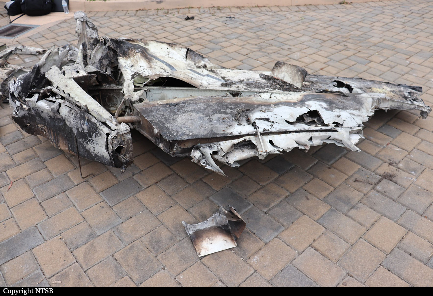
Circumstances:
Before taking off, the pilot canceled an instrument flight rules (IFR) flight plan that she had filed and requested a visual flight rules (VFR) on-top clearance, which the controller issued via the Monterey Five departure procedure. The departure procedure included a left turn after takeoff. The pilot took off and climbed to about 818 ft then entered a right turn. The air traffic controller noticed that the airplane was in a right-hand turn rather than a left-hand turn and issued a heading correction to continue a right-hand turn to 030o , which the pilot acknowledged. The airplane continued the climbing turn for another 925 ft then entered a descent. The controller issued two low altitude alerts with no response from the pilot. No further radio communication with the pilot was received. The airplane continued the descent until it contacted trees, terrain, and a residence about 1 mile from the departure airport. Review of weather information indicated prevailing instrument meteorological conditions (IMC) in the area due to a low ceiling, with ceilings near 800 ft above ground level and tops near 2,000 ft msl. Examination of the airframe and engines did not reveal any anomalies that would have precluded normal operation. The airplane’s climbing right turn occurred shortly after the airplane entered IMC while the pilot was acknowledging a frequency change, contacting the next controller, and acknowledging the heading instruction. Track data show that as the right-hand turn continued, the airplane began descending, which was not consistent with its clearance. Review of the pilot’s logbook showed that the pilot had not met the instrument currency requirements and was likely not proficient at controlling the airplane on instruments. The pilot’s lack of recent experience operating in IMC combined with a momentary diversion of attention to manage the radio may have contributed to the development of spatial disorientation, resulting in a loss of airplane control.
Probable cause:
The pilot’s failure to maintain airplane control due to spatial disorientation during an instrument departure procedure in instrument meteorological conditions which resulted in a collision with terrain. Contributing to the accident was the pilot’s lack of recent instrument flying experience.
Final Report: