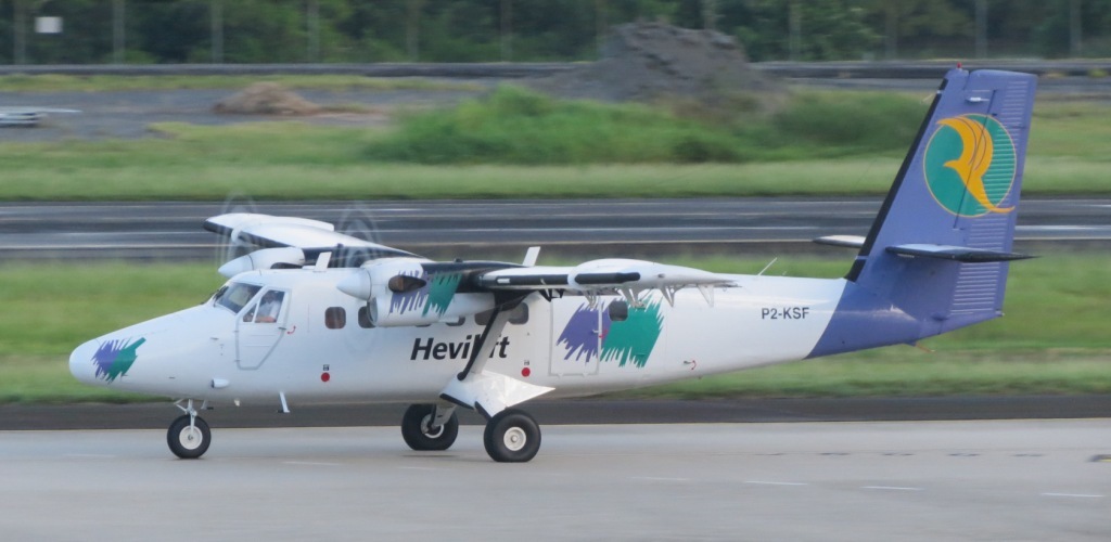
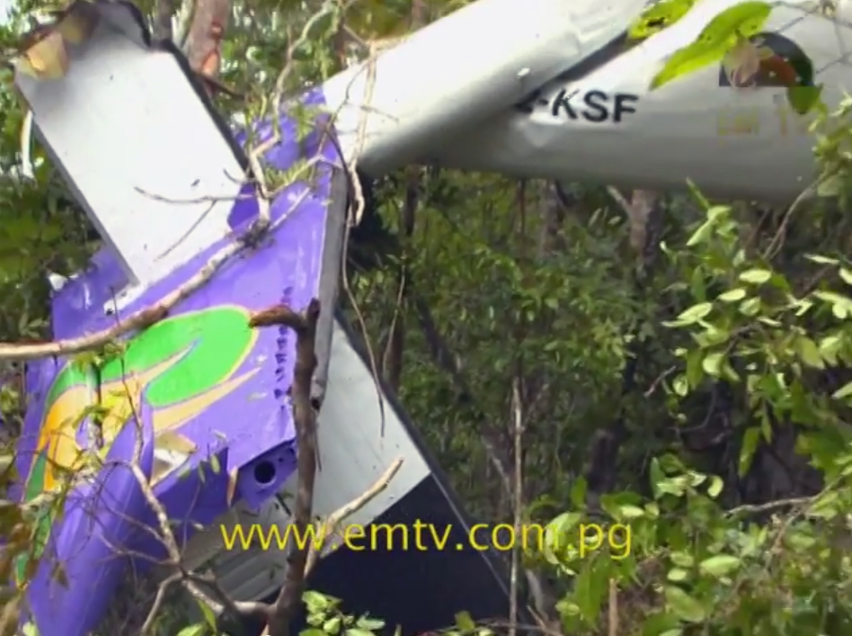
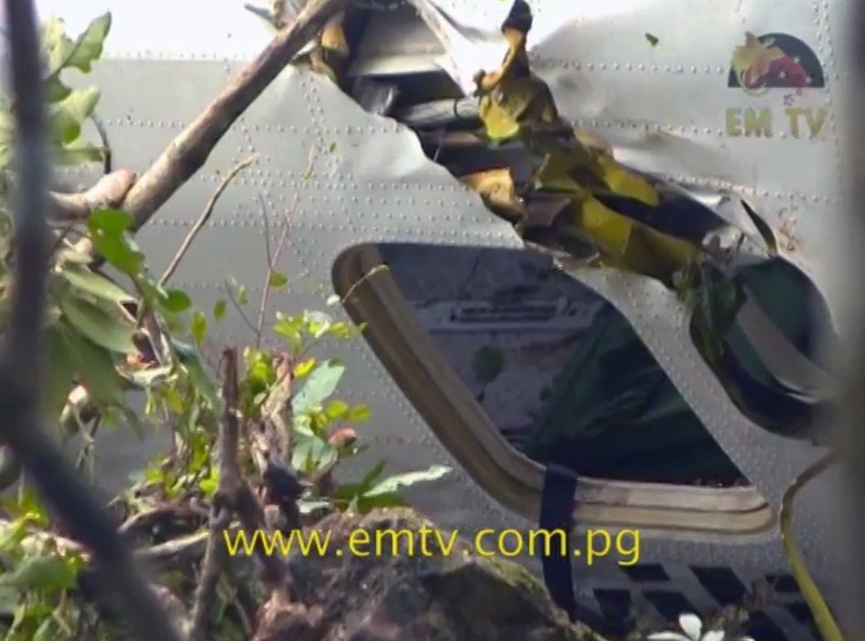
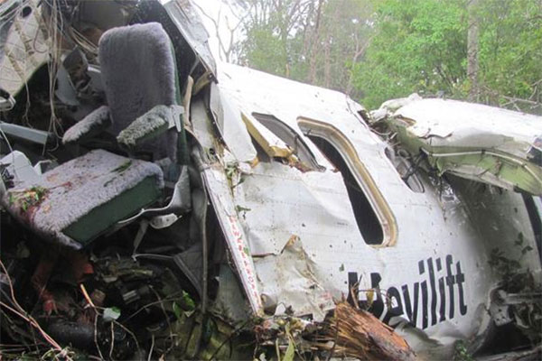
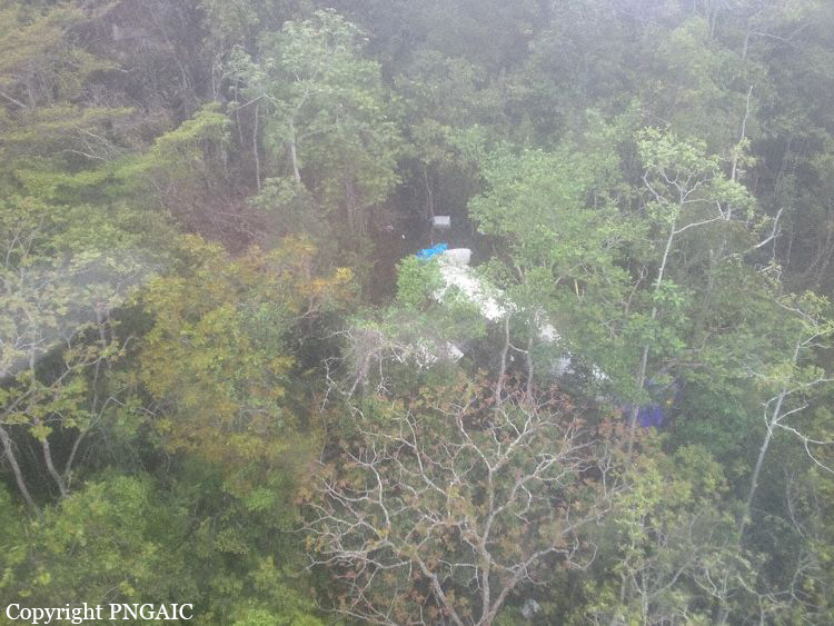
Crash of a De Havilland DHC-6 Twin Otter 300 near Port Moresby: 4 killed

Date & Time: Sep 20, 2014 at 0935 LT
Operator:
Registration:
P2-KSF
Survivors:
Yes
Site:
Schedule:
Woitape - Port Moresby
MSN:
528
YOM:
1977
Region:
Crew on board:
2
Crew fatalities:
Pax on board:
7
Pax fatalities:
Other fatalities:
Total fatalities:
4
Captain / Total flying hours:
19290
Captain / Total hours on type:
5980.00
Copilot / Total flying hours:
432
Copilot / Total hours on type:
172
Aircraft flight hours:
34327
Aircraft flight cycles:
46302
Circumstances:
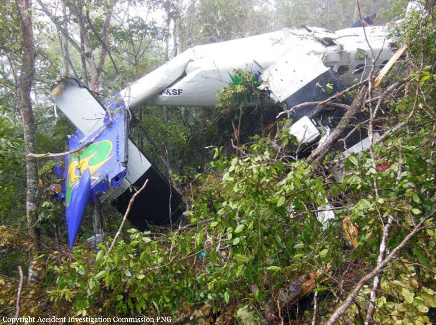
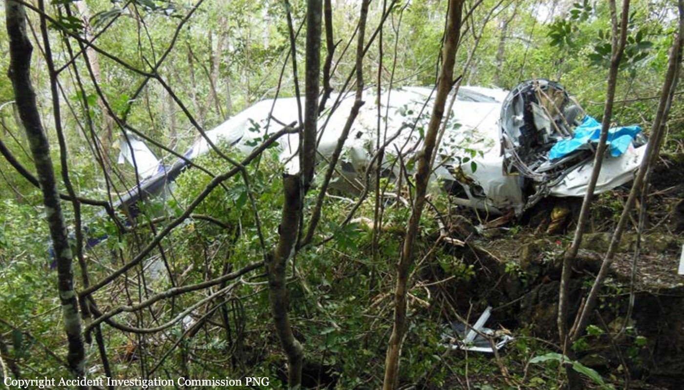
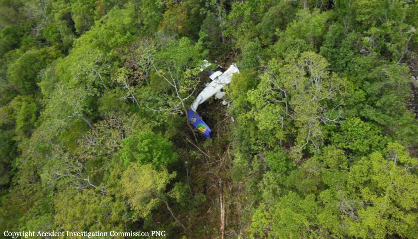
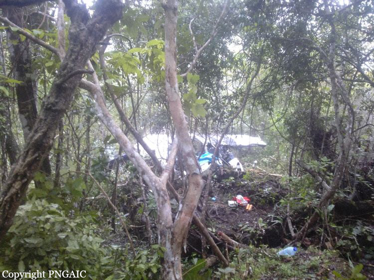
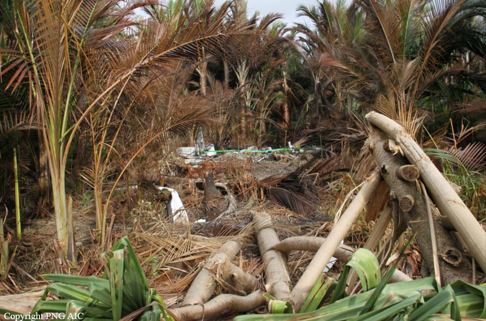
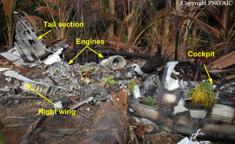
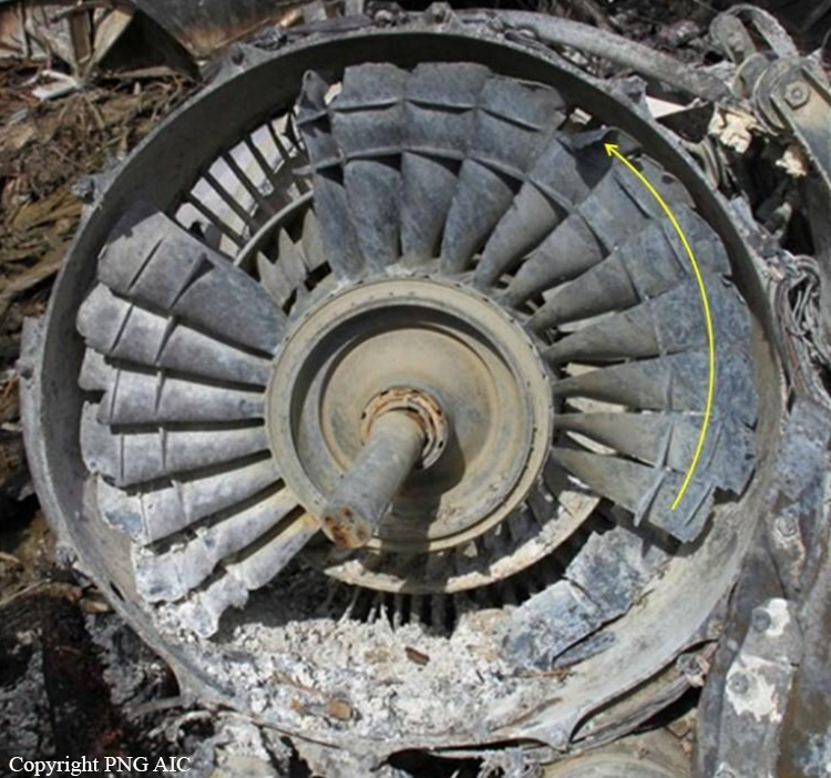
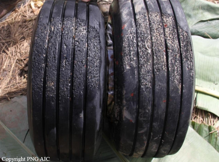
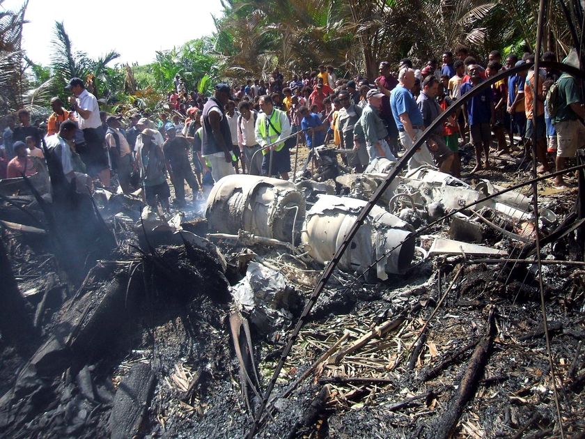
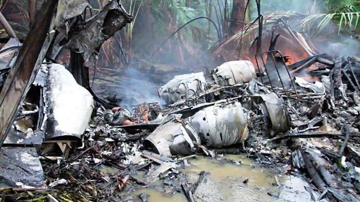
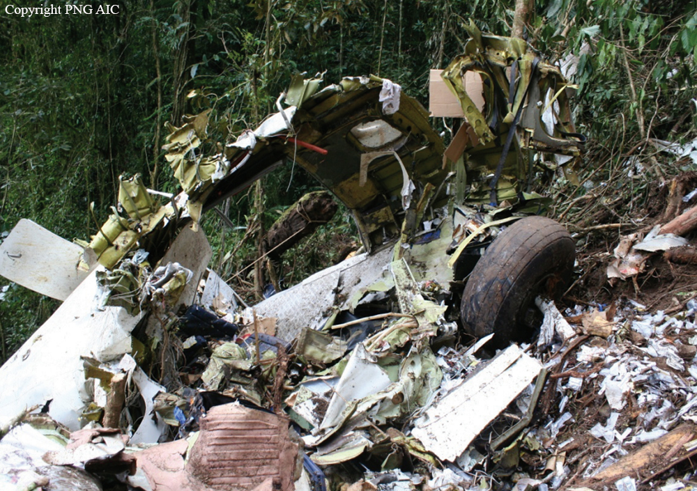
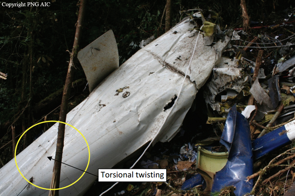
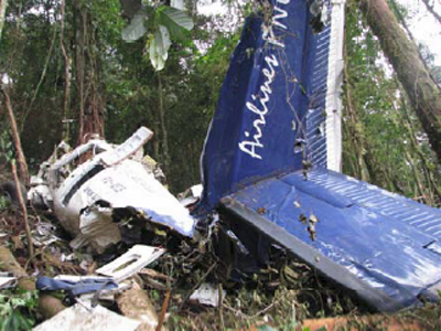
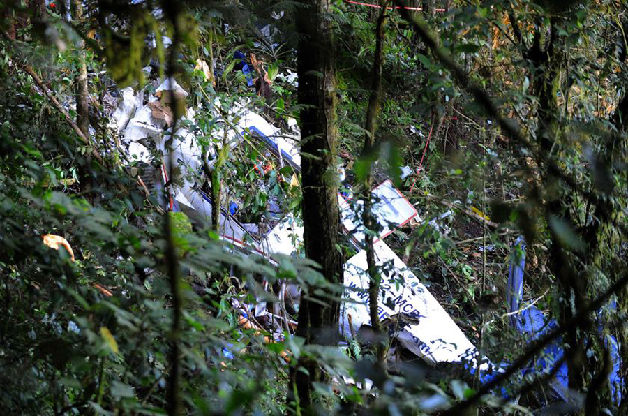
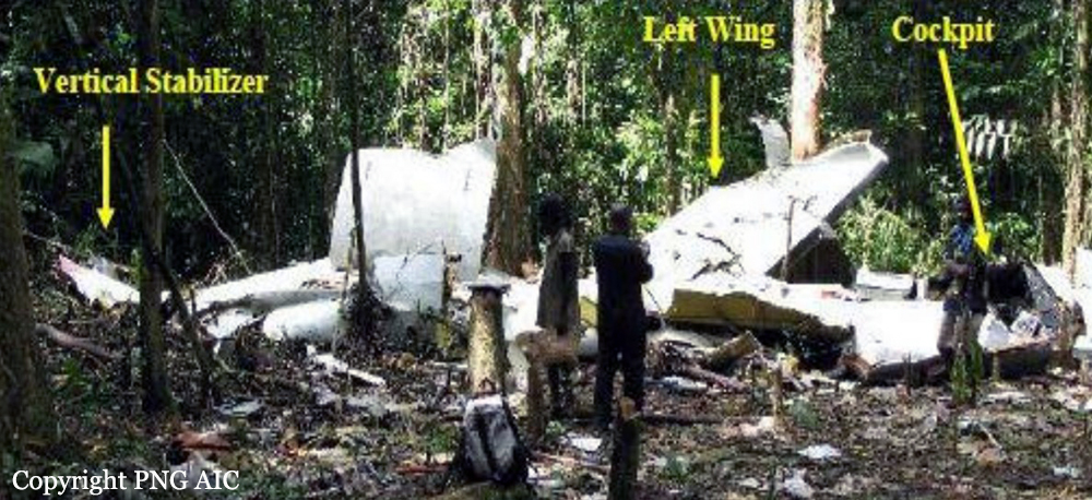
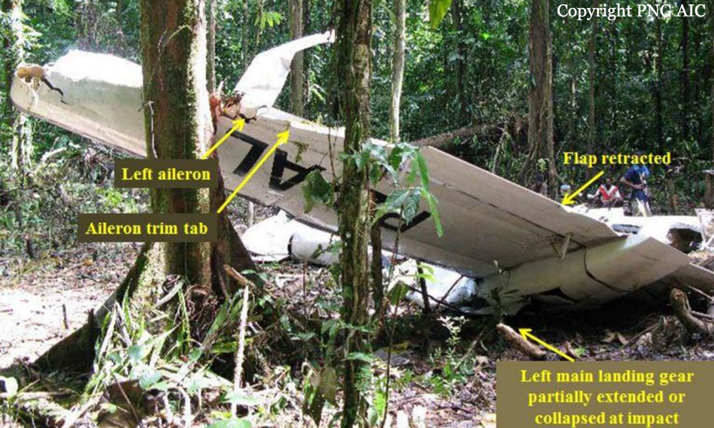
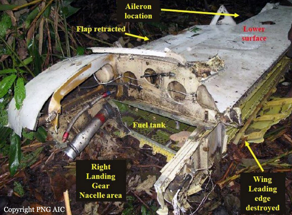
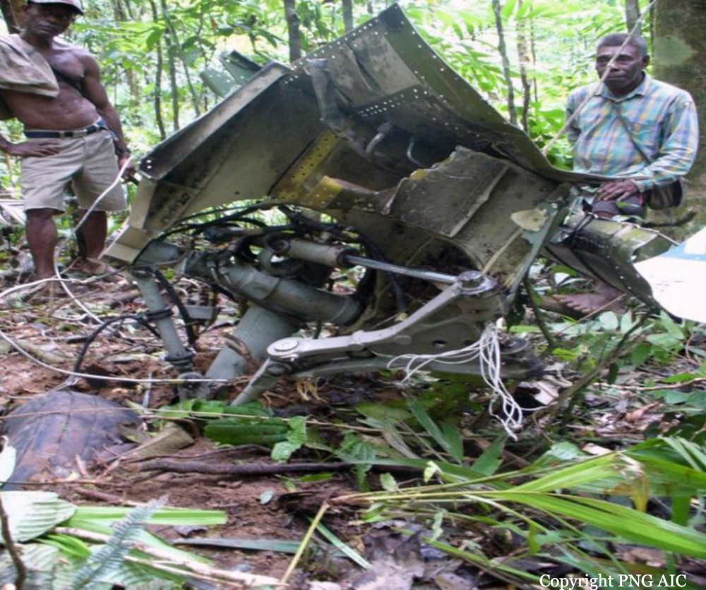
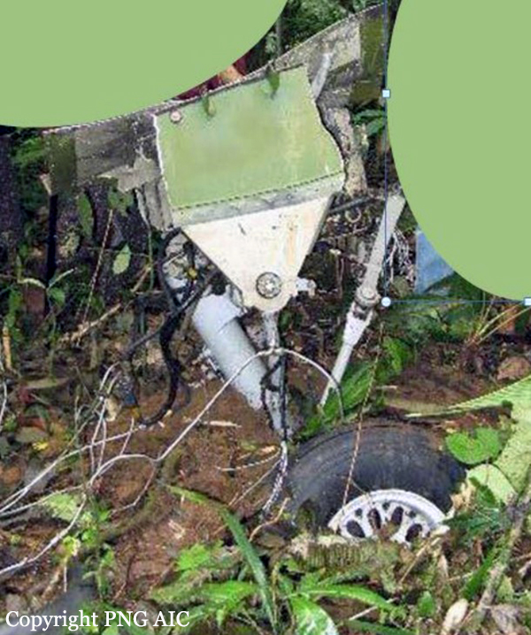
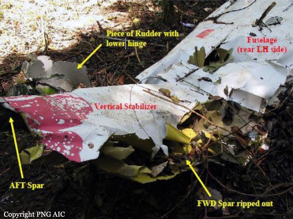
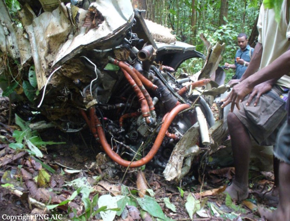
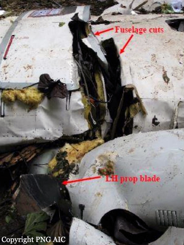
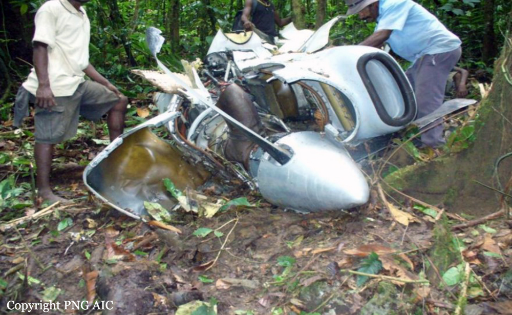
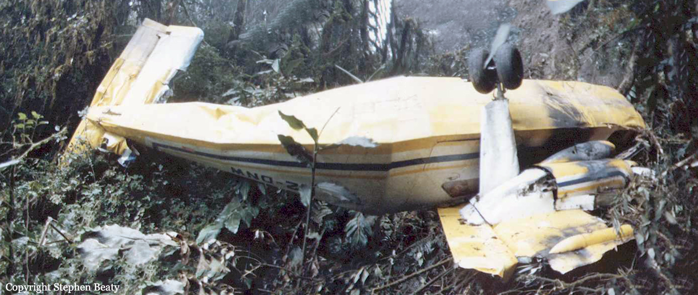
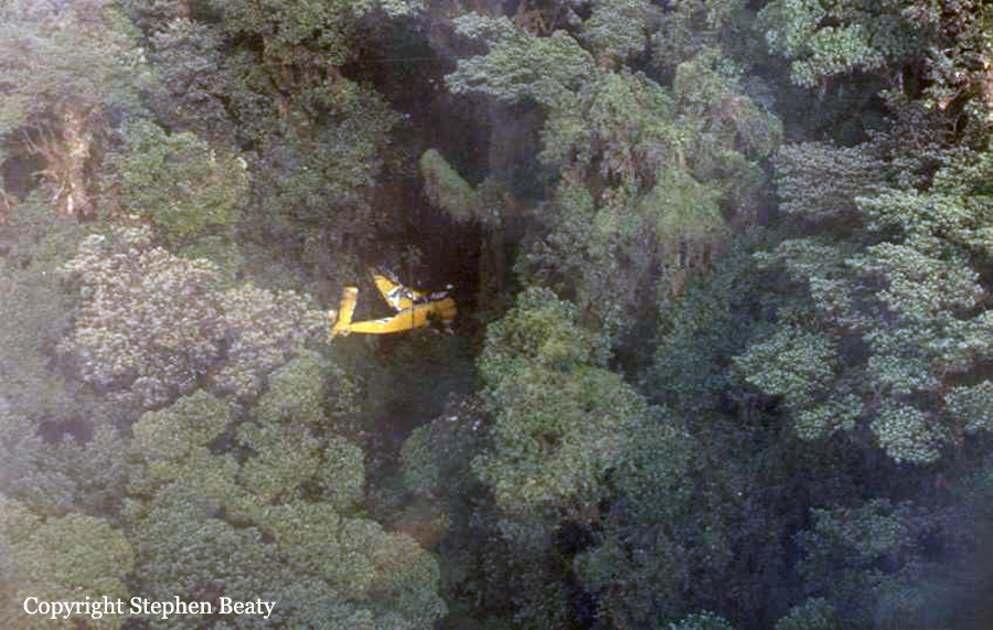
A DHC-6 Twin Otter aircraft was returning from Woitape, Central Province, to Jacksons Airport, Port Moresby on the morning of 20 September 2014 on a charter flight under the instrument flight rules (IFR). The weather at Woitape was reported to have been clear, but at Port Moresby the reported weather was low cloud and rain. Witnesses reported that the summit of Mt Lawes (1,700 ft above mean sea level (AMSL)) was in cloud all morning on the day of the accident. When the aircraft was 36 nm (67 km) from Port Moresby, air traffic control gave the flight crew a clearance to descend maintaining visual separation from terrain and to track to a left base position for runway 14 right (14R) at Jacksons Airport, Port Moresby. The clearance was accepted by the crew. When the aircraft was within 9.5 nm (17.5 km) of the airport, the pilot in command (PIC) contacted the control tower and said that they were “running into a bit of cloud” and that they “might as well pick up the ILS [instrument landing system] if it’s OK”. The flight crew could not have conducted an ILS approach from that position. They could have discontinued their visual approach and requested radar vectoring for an ILS approach. However, they did not do so. The Port Moresby Aerodrome Terminal Information Service (ATIS), current while the aircraft was approaching Port Moresby had been received by the flight crew. It required aircraft arriving at Port Moresby to conduct an ILS approach. The PIC’s last ILS proficiency check was almost 11 months before the accident flight. A 3-monthly currency on a particular instrument approach is required under PNG Civil Aviation Rule 61.807. It is likely the reason the PIC did not request a clearance to intercept the ILS from 30 nm (55.5 km) was that he did not meet the currency requirements and therefore was not authorized to fly an ILS approach. During the descent, although the PIC said to the copilot ‘we know where we are, keep it coming down’, it was evident from the recorded information that his assessment of their position was incorrect and that the descent should not have been continued. The PIC and copilot appeared to have lost situational awareness. The aircraft impacted terrain near the summit of Mt Lawes and was substantially damaged by impact forces. Both pilots and one passenger were fatally injured in the impact, and one passenger died on the day after the accident from injuries sustained during the accident. Of the five passengers who survived the accident, three were seriously injured and two received minor injuries. One of the fatally injured passengers was not wearing a seat belt.
Probable cause:
The following contributing factors were identified:
- The flight crew continued the descent in instrument meteorological conditions without confirming their position.
- The flight crew’s assessment of their position was incorrect and they had lost situational awareness
- The flight crew deprived themselves of the “Caution” and “Warning” alerts that would have sounded about 20 sec and about 10 sec respectively before the collision, by not deactivating the EGPWS Terrain Inhibit prior to departure from Woitape.
Final Report:

Crash of a Cessna 550 Citation II in Bwagaoia: 4 killed

Date & Time: Aug 31, 2010 at 1615 LT
Type of aircraft:
Registration:
P2-TAA
Survivors:
Yes
Schedule:
Port Moresby – Bwagaoia
MSN:
550-0145
YOM:
1980
Region:
Crew on board:
2
Crew fatalities:
Pax on board:
3
Pax fatalities:
Other fatalities:
Total fatalities:
4
Captain / Total flying hours:
14591
Copilot / Total flying hours:
872
Aircraft flight hours:
14268
Circumstances:
The aircraft was conducting a charter flight from Jackson’s International Airport, Port Moresby, National Capital District, Papua New Guinea (PNG), to Bwagaoia Aerodrome, Misima Island, Milne Bay Province, PNG (Misima). There were two pilots and three passengers on board for the flight. The approach and landing was undertaken during a heavy rain storm over Bwagaoia Aerodrome at the time, which resulted in standing water on the runway. This water, combined with the aircraft’s speed caused the aircraft to aquaplane. There was also a tailwind, which contributed the aircraft to landing further along the runway than normal. The pilot in command (PIC) initiated a baulked landing procedure. The aircraft was not able to gain flying speed by the end of the runway and did not climb. The aircraft descended into terrain 100 m beyond the end of the runway. The aircraft impacted terrain at the end of runway 26 at 1615:30 PNG local time and the aircraft was destroyed by a post-impact, fuel-fed fire. The copilot was the only survivor. Other persons who came to assist were unable to rescue the remaining occupants because of fire and explosions in the aircraft. The on-site evidence and reports from the surviving copilot indicated that the aircraft was serviceable and producing significant power at the time of impact. Further investigation found that the same aircraft and PIC were involved in a previous landing overrun at Misima Island in February 2009.
Probable cause:
Contributing safety factors:
• The operator’s processes for determining the aircraft’s required landing distance did not appropriately consider all of the relevant performance factors.
• The operator’s processes for learning and implementing change from the previous runway overrun incident were ineffective.
• The flight crew did not use effective crew resource management techniques to manage the approach and landing.
• The crew landed long on a runway that was too short, affected by a tailwind, had a degraded surface and was water contaminated.
• The crew did not carry out a go-around during the approach when the visibility was less than the minimum requirements for a visual approach.
• The baulked landing that was initiated too late to assure a safe takeoff.
Other safety factors:
• The aircraft aquaplaned during the landing roll, limiting its deceleration.
• The runway surface was described as gravel, but had degraded over time.
• The weather station anemometer was giving an incorrect wind indication.
Final Report:

Crash of a De Havilland DHC-6 Twin Otter 300 in Kokoda: 13 killed

Date & Time: Aug 11, 2009 at 1114 LT
Operator:
Registration:
P2-MCB
Survivors:
No
Site:
Schedule:
Port Moresby - Kokoda
MSN:
441
YOM:
1975
Flight number:
CG4684
Location:
Region:
Crew on board:
2
Crew fatalities:
Pax on board:
11
Pax fatalities:
Other fatalities:
Total fatalities:
13
Captain / Total flying hours:
2270
Captain / Total hours on type:
1970.00
Copilot / Total flying hours:
2150
Copilot / Total hours on type:
1940
Aircraft flight hours:
46700
Circumstances:
On 11 August 2009, a de Havilland Canada DHC-6 Twin Otter aircraft, registered P2-MCB, with two pilots and 11 passengers, was being operated on a scheduled regular public transport service from Port Moresby to Kokoda Airstrip, Papua New Guinea (PNG). At about 1113, the aircraft impacted terrain on the eastern slope of the Kokoda Gap at about 5,780 ft above mean sea level in heavily-timbered jungle about 11 km south-east of Kokoda Airstrip. The aircraft was destroyed by impact forces. There were no survivors. Prior to the accident the crew were manoeuvring the aircraft within the Kokoda Gap, probably in an attempt to maintain visual flight in reported cloudy conditions. The investigation concluded that the accident was probably the result of controlled flight into terrain: that is, an otherwise airworthy aircraft was unintentionally flown into terrain, with little or no awareness by the crew of the impending collision.
Probable cause:
From the evidence available, the following findings are made with respect to the collision with terrain, 11 km south-east of Kokoda Airstrip, Papua New Guinea, involving a de Havilland Canada DHC-6-300 Twin Otter aircraft, registered P2-MCB, and should not be read as apportioning blame or liability to any particular organisation or individual.
Contributing safety factors:
• Visual flight in the Kokoda Gap was made difficult by the extensive cloud coverage in the area.
• The crew attempted to continue the descent visually within the Kokoda Gap despite the weather conditions not being conducive to visual flight.
• It was probable that while manoeuvring at low level near the junction of the Kokoda Gap and Kokoda Valley, the aircraft entered instrument meteorological conditions.
• The aircraft collided with terrain in controlled flight.
Other safety factors:
• The copilot was assessed during normal proficiency checks for instrument approach procedures but was not qualified for flight in instrument meteorological conditions.
• The operator did not have a published emergency recovery procedure for application in the case of inadvertent flight into instrument meteorological conditions.
• The Civil Aviation Safety Authority Papua New Guinea surveillance of the operator did not identify the operations by the operator in contravention of Rule 91.112.
• The lack of a reliable mandatory occurrence reporting arrangement minimized the likelihood of an informed response to Papua New Guinea-specific safety risks.
• There was no qualified Director (or similar) of Aviation Medicine in Papua New Guinea (PNG).
• The lack of both flight data and cockpit voice recorders adversely affected a full understanding of the accident by the investigation.
Other key findings:
• The investigation was unable to discount the possible incapacitation of the copilot as a factor in the accident.
• Although not required by the aviation rules at the time of the accident, the adoption of threat and error management training for flight crews, and of the methodology by operators would provide a tool to identify and mitigate operational risk as follows:
– by flight crews, when flight planning and during flight; and
– by operators, when developing their operational procedures.
Final Report:

Crash of an Embraer EMB-110P1 Bandeirante near Kandrian: 2 killed

Date & Time: Mar 30, 2007 at 0523 LT
Operator:
Registration:
P2-ALU
Flight Phase:
Flight Type:
Survivors:
No
Schedule:
Port Moresby – Hoskins – Rabaul
MSN:
110-232
YOM:
1979
Flight number:
ND304
Region:
Crew on board:
2
Crew fatalities:
Pax on board:
0
Pax fatalities:
Other fatalities:
Total fatalities:
2
Captain / Total flying hours:
4653
Captain / Total hours on type:
1253.00
Copilot / Total flying hours:
4235
Copilot / Total hours on type:
610
Aircraft flight hours:
36962
Aircraft flight cycles:
43756
Circumstances:
The aircraft was refueled with 640 litres (L) of Jet-A1 (AVTUR) in preparation for an early morning departure to Hoskins, New Britain, on 30 March. On 30 March, the crew lodged a flight plan, which stated that the total fuel on board was 2,100 pounds (lbs) (1,208 L). The first sector of the planned route was from Port Moresby to Hoskins. The pilot-in-command (PIC) obtained an area forecast for the flight, which indicated that there were areas of rain and scattered cloud from 1500-5000 feet (ft), with deteriorating conditions forecast for the period between 0400-0800 hours (hrs); for their arrival at Hoskins. The forecast required 30 minutes holding fuel in addition to the flight and statutory fuel requirements. These conditions were normal for their destination at this time of the year.The aircraft departed Port Moresby at 0402, as flight number ND304 for Hoskins. It initially climbed to the planned Flight Level (FL) 140 (14,000 ft), which was 300 ft above the lowest safe altitude (LSA) on the initial RNC track between Port Moresby and Girua, an Instrument Flight Rules (IFR) reporting point on the north coast of the PNG mainland. The LSA for the sector between Girua and the en-route reporting point Maran was 3,300 ft, and the PIC had planned to cruise at 9,000 ft. The sector between Maran and Hoskins was planned at 9,000 ft, with a LSA of 8,300 ft. The purpose of the flight was to transport newspapers and general freight to Hoskins and Rabaul. Flight Information Area (FIA) communications with Nadzab Flight Service used High Frequency (HF) radio, and a Very High Frequency (127.1 MHz) repeater transceiver located near the township of Popondetta. This service was usually monitored by Nadzab Flight Service during their normal hours of operation, for aircraft operating on the Girua to Hoskins track. One of the functions of the Nadzab Flight Service Unit was to record all transmissions received via the Girua repeater site. The crew made a position report, intercepted by Port Moresby Flight Service, advising that they were overhead Maran at 0506, cruising at FL 110 (11,000 ft), and gave an estimated time of arrival (ETA) Hoskins at 0540. That was 2,000 ft higher than the planned level. The position report was received by Port Moresby Flight Service, because Nadzab Flight Service had not commenced operations. It subsequently commenced operations for the day at 0540. Because Nadzab was responsible for the airspace in which ALU was operating, Port Moresby Flight Service advised Nadzab of ALU’s position report, once Nadzab opened. The Maran position report was the last recorded radio contact with the aircraft. No transmission declaring the intention to descend below FL110 was heard from the crew of ALU. No MAYDAY transmission was reported by ATS or other aircrew. When the crew of ALU failed to report their arrival at Hoskins, a search was commenced of the Hoskins aerodrome. At 0650 a DISTRESFA Search and Rescue Phase (SAR) was declared indicating the degree of apprehension held for the safety of the aircraft and its occupants. Later that morning verbal reports were received from a coastal logging company in an area east of Kandrian, that an aircraft had crashed. The wreckage of ALU was found 27 km east of Kandrian, at an elevation of 780 ft above sea level. Both crew members had not survived the impact. The wreckage was located at position 06° 11′ 39.8′′ S, 149° 52′ 58.9′′ E, and was dispersed along a 500 m wreckage trail after colliding with numerous trees and impacting the terrain. The investigation estimated the time of the accident to be about 0523.
Probable cause:
The reason the crew were unable to maintain level flight above the en-route lowest safe altitude with one engine inoperative, and subsequently impacted terrain, could not be determined.
Final Report:

Crash of a De Havilland DHC-6 Twin Otter 300 near Ononge: 2 killed

Date & Time: Jul 29, 2004 at 1030 LT
Operator:
Registration:
P2-MBA
Flight Phase:
Flight Type:
Survivors:
Yes
Site:
Schedule:
Port Moresby - Ononge
MSN:
353
YOM:
1973
Location:
Region:
Crew on board:
2
Crew fatalities:
Pax on board:
1
Pax fatalities:
Other fatalities:
Total fatalities:
2
Circumstances:
While descending to Ononge, the crew encountered poor weather conditions and decided to divert to the Yongai Airfield located about 27 km northeast of Ononge. Few minutes later, while cruising at an altitude of 2,286 metres in clouds, the twin engine aircraft struck the slope of a mountain. Rescuers arrived on scene a day later. The loadmaster was seriously injured while both pilots were killed.
Probable cause:
Controlled flight into terrain.

Crash of a De Havilland DHC-4A Caribou in Kiunga: 2 killed

Date & Time: Jul 1, 1995
Type of aircraft:
Registration:
P2-VTC
Flight Type:
Survivors:
Yes
Schedule:
Port Moresby – Tabubil
MSN:
13
YOM:
1960
Region:
Crew on board:
2
Crew fatalities:
Pax on board:
1
Pax fatalities:
Other fatalities:
Total fatalities:
2
Circumstances:
While descending to Tabubil Airport on a cargo flight from Port Moresby, the crew encountered poor weather conditions and decided to divert to Kiunga. While approaching Kiunga, the right engine failed, followed shortly later by the left engine. The aircraft lost height, struck trees and crashed 5 km from the airport. One pilot survived while both other occupants were killed. The aircraft was leased to the Vanimo Trading Company.
Probable cause:
Double engine failure for unknown reasons. The assumption of a fuel starvation seems excluded.

Crash of a Britten-Norman BN-2A-21 Islander near Port Moresby: 8 killed

Date & Time: Jul 5, 1990
Type of aircraft:
Operator:
Registration:
P2-DNJ
Flight Phase:
Survivors:
Yes
Site:
Schedule:
Port Moresby - Woitape
MSN:
857
YOM:
1977
Region:
Crew on board:
1
Crew fatalities:
Pax on board:
11
Pax fatalities:
Other fatalities:
Total fatalities:
8
Circumstances:
After takeoff from Port Moresby Airport, the pilot encountered poor weather conditions. While flying at an insufficient altitude, the twin engine aircraft struck the slope of a mountain and crashed 35 km north of Port Moresby. SAR operations were initiated but the wreckage was found in an isolated area five days later only. Four passengers seriously wounded were rescued while eight other occupants were killed. At the time of the accident, the visibility was poor.

Crash of a Britten-Norman BN-2A Islander near Kokoda: 3 killed

Date & Time: Aug 30, 1985 at 0830 LT
Type of aircraft:
Operator:
Registration:
P2-DNW
Flight Phase:
Survivors:
Yes
Site:
Schedule:
Port Moresby – Kokoda
MSN:
67
YOM:
1969
Flight number:
WW701
Location:
Region:
Crew on board:
1
Crew fatalities:
Pax on board:
5
Pax fatalities:
Other fatalities:
Total fatalities:
3
Circumstances:
While cruising under VFR mode in marginal weather conditions, the pilot failed to realize his altitude was insufficient when the airplane struck a wooded mountain. The wreckage was found 17 km south of Kokoda. The pilot and two female passengers were killed. Two other passengers, including the photos author, were evacuated to local hospital. One was seriously injured while the photo author was uninjured.

Crash of an Embraer EMB-110P2 Bandeirante in Port Moresby

Date & Time: Nov 4, 1982 at 0510 LT
Operator:
Registration:
P2-RDL
Flight Phase:
Flight Type:
Survivors:
Yes
Schedule:
Port Moresby - Lae
MSN:
110-300
YOM:
1980
Region:
Crew on board:
1
Crew fatalities:
Pax on board:
0
Pax fatalities:
Other fatalities:
Total fatalities:
0
Circumstances:
Just after liftoff, the left engine failed. The pilot decided to land back but the aircraft was unable to stop within the remaining distance. It overran, went through two perimeter fence and came to rest 60 meters further, bursting into flames. The pilot, sole on board, was uninjured.
Probable cause:
Failure of the left engine during initial climb for unknown reasons.

Crash of a GAF Nomad N22B in Manari: 16 killed

Date & Time: Dec 23, 1979
Type of aircraft:
Operator:
Registration:
P2-DNL
Survivors:
No
Schedule:
Port Moresby - Manari
MSN:
39
YOM:
1977
Location:
Region:
Crew on board:
2
Crew fatalities:
Pax on board:
14
Pax fatalities:
Other fatalities:
Total fatalities:
16
Captain / Total flying hours:
5000
Circumstances:
Upon arrival at Manari Airstrip, the crew decided to initiate a go-around for unknown reasons. While climbing, the airplane banked left then nosed down and crashed near the airfield. The aircraft was destroyed upon impact and all 16 occupants were killed.