Zone

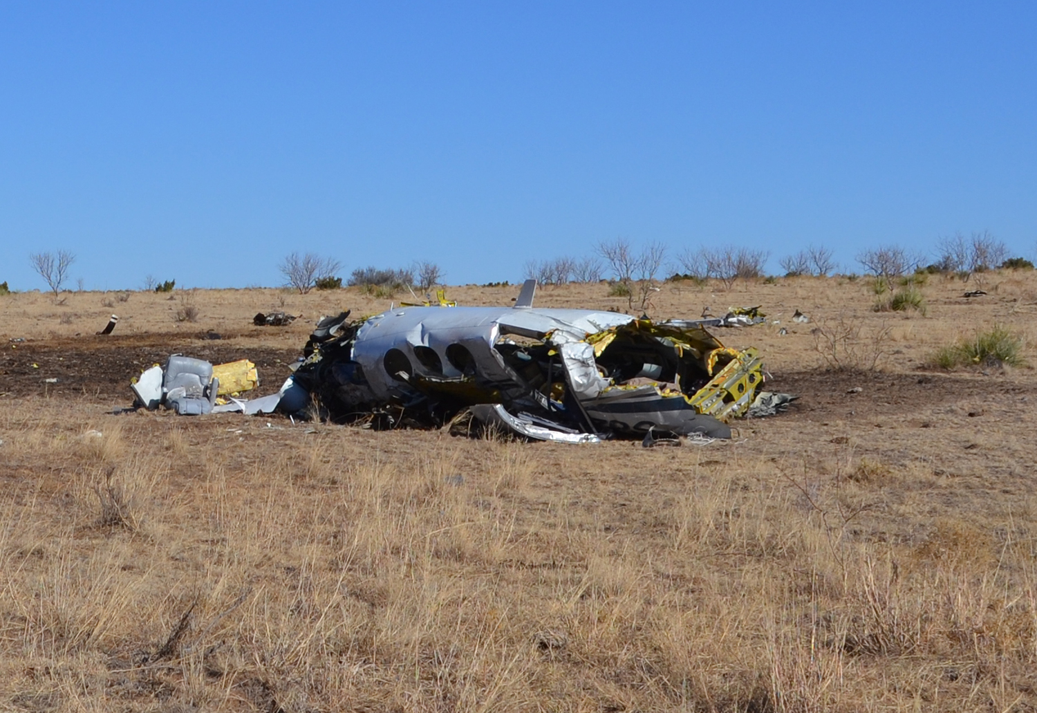
Crash of a Cessna 421C Golden Eagle III near Canadian: 2 killed

Date & Time: Feb 15, 2019 at 1000 LT
Registration:
N421NS
Flight Phase:
Flight Type:
Survivors:
No
Schedule:
Amarillo – Canadian
MSN:
421C-0874
YOM:
1980
Location:
Crew on board:
1
Crew fatalities:
Pax on board:
1
Pax fatalities:
Other fatalities:
Total fatalities:
2
Captain / Total flying hours:
5000
Aircraft flight hours:
6227
Circumstances:
The pilot was conducting a personal cross-country flight with one passenger in his twin-engine airplane. There was no record that the pilot received a weather briefing before the accident flight. While en route to the destination, the pilot was in contact with air traffic control and received visual flight rules flightfollowing services. About 18 miles from the destination airport, the radar service was terminated, as is typical in this geographic region due to insufficient radio and radar coverage below 7,000 ft. The airplane was heading northeast at 4,900 ft mean sea level (msl) (about 2,200 ft above ground level [agl]). About 4 minutes later, radar coverage resumed, and the airplane was 6 miles west of the airport at 4,100 ft msl (1,400 ft agl) and climbing to the north. The airplane climbed through 6,000 ft msl (3,300 ft agl), then began a shallow left turn and climbed to 6,600 ft msl (3,800 ft agl), then began to descend while continuing the shallow left turn ; the last radar data point showed the airplane was about 20 nm northwest of the airport, 5,100 ft msl (2,350 ft agl) on a southwest heading. The final recorded data was about 13 miles northwest of the accident site. A witness near the destination airport heard the pilot on the radio. He reported that the pilot asked about the cloud height and the witness responded that the clouds were 800 to 1,000 ft agl. In his final radio call, the pilot told the witness, "Ok, see you in a little bit." The witness did not see the airplane in the air. The airplane impacted terrain in a slightly nose-low and wings-level attitude with no evidence of forward movement, and a postimpact fire destroyed a majority of the wreckage. The damage to the airplane was consistent with a relatively flat spin to the left at the time of impact. A postaccident examination did not reveal any preimpact mechanical malfunctions or anomalies that would have precluded normal operation. A detailed examination of the cockpit instruments and other portions of the wreckage was not possible due to the fire damage. A cold front had advanced from the northeast and instrument meteorological conditions prevailed across the region surrounding the accident site and the destination airport; the cloud ceilings were 400 ft to 900 ft above ground level. The airplane likely experienced wind shear below 3,000 ft, and there was likely icing in the clouds. While moderate icing conditions were forecast for the accident site, about the time of the accident, investigators were unable to determine the amount and severity of icing the flight may have experienced. The weather conditions had deteriorated over the previous 1 to 2 hours. The conditions at the destination airport had been clear about 2 hours before accident, and visual flight rules conditions about 1 hour before accident, when the pilot departed. Based on the available evidence it is likely that the pilot was unable to maintain control of the airplane, which resulted in an aerodynamic stall and spin into terrain.
Probable cause:
The pilot's failure to maintain control of the airplane while in instrument meteorological conditions with icing conditions present, which resulted in an aerodynamic stall and spin into terrain.
Final Report:

Crash of a Pilatus PC-12 in Amarillo: 3 killed

Date & Time: Apr 28, 2017 at 2348 LT
Type of aircraft:
Operator:
Registration:
N933DC
Flight Phase:
Flight Type:
Survivors:
No
Schedule:
Amarillo – Clovis
MSN:
105
YOM:
1994
Crew on board:
1
Crew fatalities:
Pax on board:
2
Pax fatalities:
Other fatalities:
Total fatalities:
3
Captain / Total flying hours:
5866
Captain / Total hours on type:
73.00
Aircraft flight hours:
4407
Circumstances:
The pilot and two medical crew members departed on an air ambulance flight in night instrument meteorological conditions to pick up a patient. After departure, the local air traffic controller observed the airplane's primary radar target with an incorrect transponder code in a right turn and climbing through 4,400 ft mean sea level (msl), which was 800 ft above ground level (agl). The controller instructed the pilot to reset the transponder to the correct code, and the airplane leveled off between 4,400 ft and 4,600 ft msl for about 30 seconds. The controller then confirmed that the airplane was being tracked on radar with the correct transponder code; the airplane resumed its climb at a rate of about 6,000 ft per minute (fpm) to 6,000 ft msl. The pilot changed frequencies as instructed, then contacted departure control and reported "with you at 6,000 [ft msl]" and the departure controller radar-identified the airplane. About 1 minute later, the departure controller advised the pilot that he was no longer receiving the airplane's transponder; the pilot did not respond, and there were no further recorded transmissions from the pilot. Radar data showed the airplane descending rapidly at a rate that reached 17,000 fpm. Surveillance video from a nearby truck stop recorded lights from the airplane descending at an angle of about 45° followed by an explosion. The airplane impacted a pasture about 1.5 nautical miles south of the airport, and a post impact fire ensued. All major components of the airplane were located within the debris field. Ground scars at the accident site and damage to the airplane indicated that the airplane was in a steep, nose-low and wings-level attitude at the time of impact. The airplane's steep descent and its impact attitude are consistent with a loss of control. An airplane performance study based on radar data and simulations determined that, during the climb to 6,000 ft and about 37 seconds before impact, the airplane achieved a peak pitch angle of about 23°, after which the pitch angle decreased steadily to an estimated -42° at impact. As the pitch angle decreased, the roll angle increased steadily to the left, reaching an estimated -76° at impact. The performance study revealed that the airplane could fly the accident flight trajectory without experiencing an aerodynamic stall. The apparent pitch and roll angles, which represent the attitude a pilot would "feel" the airplane to be in based on his vestibular and kinesthetic perception of the components of the load factor vector in his own body coordinate system, were calculated. The apparent pitch angle ranged from 0° to 15° as the real pitch angle steadily decreased to -42°, and the apparent roll angle ranged from 0° to -4° as the real roll angle increased to -78°. This suggests that even when the airplane was in a steeply banked descent, conditions were present that could have produced a somatogravic illusion of level flight and resulted in spatial disorientation of the pilot. Analysis of the performance study and the airplane's flight track revealed that the pilot executed several non-standard actions during the departure to include: excessive pitch and roll angles, rapid climb, unexpected level-offs, and non-standard ATC communications. In addition to the non-standard actions, the pilot's limited recent flight experience in night IFR conditions, and moderate turbulence would have been conducive to the onset of spatial disorientation. The pilot's failure to set the correct transponder code before departure, his non-standard departure maneuvering, and his apparent confusion regarding his altitude indicate a mental state not at peak acuity, further increasing the chances of spatial disorientation. A post accident examination of the flight control system did not reveal evidence of any preimpact anomalies that would have prevented normal operation. The engine exhibited rotational signatures indicative of engine operation during impact, and an examination did not reveal any preimpact anomalies that would have precluded normal engine operation. The damage to the propeller hub and blades indicated that the propeller was operating under high power in the normal range of operation at time of impact. Review of recorded data recovered from airplane's attitude and heading reference unit did not reveal any faults with the airplane's attitude and heading reference system (AHRS) during the accident flight, and there were no maintenance logbook entries indicating any previous electronic attitude director indicator (EADI) or AHRS malfunctions. Therefore, it is unlikely that erroneous attitude information was displayed on the EADI that could have misled the pilot concerning the actual attitude of the airplane. A light bulb filament analysis of the airplane's central advisory display unit (CADU) revealed that the "autopilot disengage" caution indicator was likely illuminated at impact, and the "autopilot trim" warning indicator was likely not illuminated. A filament analysis of the autopilot mode controller revealed that the "autopilot," "yaw damper," and "altitude hold" indicators were likely not illuminated at impact. The status of the "trim" warning indicator on the autopilot mode controller could not be determined because the filaments of the indicator's bulbs were missing. However, since the CADU's "autopilot trim" warning indicator was likely not illuminated, the mode controller's "trim" warning indicator was also likely not illuminated at impact. Exemplar airplane testing revealed that the "autopilot disengage" caution indicator would only illuminate if the autopilot had been engaged and then disconnected. It would not illuminate if the autopilot was off without being previously engaged nor would it illuminate if the pilot attempted and failed to engage the autopilot by pressing the "autopilot" push button on the mode controller. Since the "autopilot disengage" caution indicator would remain illuminated for 30 seconds after the autopilot was disengaged and was likely illuminated at impact, it is likely that the autopilot had been engaged at some point during the flight and disengaged within 30 seconds of the impact; the pilot was reporting to ATC at 6,000 ft about 30 seconds before impact and then the rapid descent began. The airplane was not equipped with a recording device that would have recorded the operational status of the autopilot, and the investigation could not determine the precise times at which autopilot engagement and disengagement occurred. However, these times can be estimated as follows:
- The pilot likely engaged the autopilot after the airplane climbed through 1,000 ft agl about 46 seconds after takeoff, because this was the recommended minimum autopilot engagement altitude that he was taught.
- According to the airplane performance study, the airplane's acceleration exceeded the autopilot's limit load factor of +1.6 g about 9 seconds before impact. If it was engaged at this time, the autopilot would have automatically disengaged.
- The roll angle data from the performance study were consistent with engagement of the autopilot between two points:
1) about 31 seconds before impact, during climb, when the bank angle, which had stabilized for a few seconds, started to increase again and
2) about 9 seconds before impact, during descent, at which time the autopilot would have automatically disengaged. Since the autopilot would have reduced the bank angle as soon as it was engaged and there is no evidence of the bank angle reducing significantly between these two points, it is likely that the autopilot was engaged closer to the latter point than the former. Engagement of the autopilot shortly before the latter point would have left little time for the autopilot to reduce the bank angle before it would have disengaged automatically due to exceedance of the normal load factor limit. Therefore, it is likely that the pilot engaged the autopilot a few seconds before it automatically disconnected about 9 seconds before impact. The operator reported that the airplane had experienced repeated, unexpected, in-flight autopilot disconnects, and, two days before the accident, the chief pilot recorded a video of the autopilot disconnecting during a flight. Exemplar airplane testing and maintenance information revealed that, during the flight in which the video was recorded, the autopilot's pitch trim adapter likely experienced a momentary loss of power for undetermined reasons, which resulted in the sequence of events observed in the video. It is possible that the autopilot disconnected during the accident flight due to the pitch trim adapter experiencing a loss of power, which would have to have occurred between 30 and 9 seconds before impact. A post accident weather analysis revealed that the airplane was operating in an environment requiring instruments to navigate, but it could not be determined if the airplane was in cloud when the loss of control occurred. The sustained surface wind was from the north at 21 knots with gusts up to 28 knots, and moderate turbulence existed. The presence of the moderate turbulence could have contributed to the controllability of the airplane and the pilot's inability to recognize the airplane's attitude and the autopilot's operational status.
Probable cause:
The pilot's loss of airplane control due to spatial disorientation during the initial climb after takeoff in night instrument meteorological conditions and moderate turbulence.
Final Report:

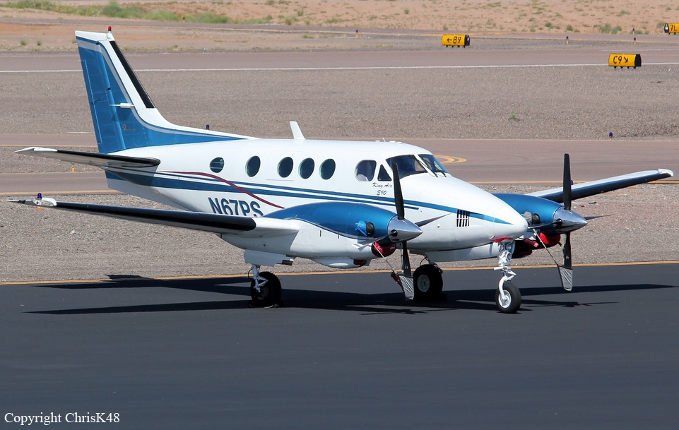
Crash of a Beechcraft E90 King Air near Amarillo: 2 killed

Date & Time: Dec 14, 2012 at 1805 LT
Type of aircraft:
Operator:
Registration:
N67PS
Flight Phase:
Flight Type:
Survivors:
No
Schedule:
Amarillo - Fort Worth
MSN:
LW-112
YOM:
1974
Location:
Crew on board:
1
Crew fatalities:
Pax on board:
1
Pax fatalities:
Other fatalities:
Total fatalities:
2
Captain / Total flying hours:
1650
Aircraft flight hours:
8607
Circumstances:
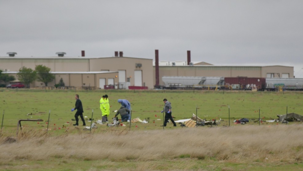
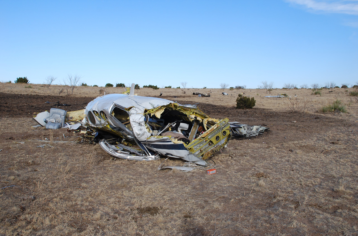
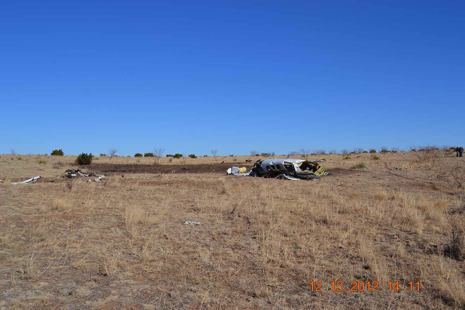
During the cross-country instrument flight rules flight, the pilot was in contact with air traffic control personnel. The controller cleared the airplane to flight level 210 and gave the pilot permission to deviate east of the airplane's route to avoid weather and traffic. A review of radar data showed the airplane heading southward away from the departure airport and climbing to an altitude of about 14,800 feet mean sea level (msl). Shortly thereafter, the airplane turned north, and the controller queried the pilot about the turn; however, he did not respond. The airplane wreckage was located on ranch land with sections of the airplane's outer wing, engines, elevators, and vertical and horizontal stabilizers separated from the fuselage and scattered in several directions, which is consistent with an in-flight breakup before impact with terrain. A review of the weather information for the airplane's route of flight showed widely scattered thunderstorms and a southerly surface wind of 30 knots with gusts to 40 knots. An AIRMET active at the time advised of moderate turbulence below flight level 180. Three pilot reports made within 50 miles of the accident site indicated moderate turbulence and mountain wave activity. An assessment of the humidity and freezing level noted the potential for clear, light-mixed, or rime icing between 10,700 and 17,300 feet msl. Postaccident airplane examination did not reveal any mechanical malfunctions or anomalies with the airframe and engines that would have precluded normal operation. It's likely the airplane encountered heavy to extreme turbulence and icing conditions during the flight, which led to the pilot’s loss of control of the airplane and its subsequent in-flight breakup.
Probable cause:
The pilot’s loss of control of the airplane after encountering icing conditions and heavy to extreme turbulence and the subsequent exceedance of the airplane’s design limit, which led to an in-flight breakup.
Final Report:

Crash of a Hawker-Siddeley HS.125-1A-522 on Mt Otay: 10 killed

Date & Time: Mar 16, 1991 at 0143 LT
Type of aircraft:
Registration:
N831LC
Flight Phase:
Survivors:
No
Site:
Schedule:
San Diego – Amarillo – Evansville
MSN:
25095
YOM:
1966
Crew on board:
2
Crew fatalities:
Pax on board:
8
Pax fatalities:
Other fatalities:
Total fatalities:
10
Captain / Total flying hours:
15000
Captain / Total hours on type:
150.00
Circumstances:
After flying personnel of entertainment group to Lindbergh Field, aircraft was positioned to nearby Brown Field, since late departure was planned after noise curfew was in effect at Lindbergh. Pilot talked with FSS specialist (splst) 3 times before takeoff. He reported he did not have instruction departure procedures from airport. Splst read departure procedures on phone. On last call to FSS, pilot said he planned to depart VFR toward northeast and obtain IFR clearance after airborne (this route was toward mountains.) During call, pilot expressed concern about remaining cleared of TCA and inquired about staying below 3,000 feet. Splst agreed with pilots concerns, but after accident, splst said he thought pilot was referring to 3,000 feet agl, rather than 3,000 feet msl. Pilot had filed to takeoff at midnight, but didn't get airborne until 0141 pst. Since flight was over 1.5 hours late, IFR flight plan had 'clocked out.' As controller was reentering flight plan in computer, aircraft hit rising terrain near top of mountain, about 8 miles northeast of airport at elevation of about 3,300 feet. No deficiencies were found with aircraft or its engines. Copilot had no type rating for this aircraft, tho he reportedly had made 3 takeoffs and landings in Hawker-Siddeley HS.125. All 10 occupants were killed, among them all members of the country music 'Reba McEntire Band'.
Passengers:
Chris Austin,
Kirk Cappello,
Joey Cigainero,
Paul Kaye Evans,
Jim Hammond,
Terry Jackson,
Anthony Saputo,
Michael Thomas.
Probable cause:
Improper planning/decision by the pilot, the pilot's failure to maintain proper altitude and clearance over mountainous terrain, and the copilot's failure to adequately monitor the progress of the flight. Factors related to the accident were: insufficient terrain information provided by the flight service specialist during the preflight briefing after the pilot inquired about a low altitude departure, darkness, mountainous terrain, both pilot's lack of familiarity with the geographical area, and the copilot's lack of familiarity with the aircraft.
Final Report:

Crash of a Cessna 340 in Amarillo: 1 killed

Date & Time: Feb 16, 1978 at 1349 LT
Type of aircraft:
Operator:
Registration:
N39L
Survivors:
Yes
Schedule:
Enid - Amarillo
MSN:
340-0210
YOM:
1973
Crew on board:
1
Crew fatalities:
Pax on board:
5
Pax fatalities:
Other fatalities:
Total fatalities:
1
Captain / Total flying hours:
1599
Captain / Total hours on type:
258.00
Circumstances:
On approach to Amarillo Airport in marginal weather conditions, the pilot failed to realize his altitude was insufficient when the airplane struck wires and crashed in flames in a field. A passenger was killed while five other occupants were injured.
Probable cause:
Collision with wires during traffic pattern-circling after the pilot diverted attention from operation of aircraft. The following contributing factors were reported:
- Misjudged altitude,
- Snow covered,
- Low ceiling,
- Snow,
- Visibility 3 miles or less.
Final Report:

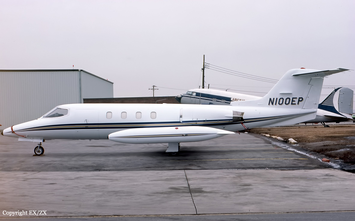
Crash of a Learjet 25B in Amarillo

Date & Time: Oct 5, 1977 at 1943 LT
Type of aircraft:
Operator:
Registration:
N100EP
Flight Phase:
Survivors:
Yes
Schedule:
Amarillo - Houston
MSN:
25-138
YOM:
1974
Crew on board:
2
Crew fatalities:
Pax on board:
1
Pax fatalities:
Other fatalities:
Total fatalities:
0
Captain / Total flying hours:
3250
Captain / Total hours on type:
920.00
Circumstances:
During the takeoff roll, just prior to liftoff, control was lost. The airplane veered off runway and crashed in flames. All three occupants escaped with minor injuries while the aircraft was destroyed.
Probable cause:
Collision with ground during takeoff due to inadequate supervision of flight. The following contributing factors were reported:
- Simulated conditions,
- Pilot-in-command non CFI,
- Pulled engine at Vr,
- Copilot with no Learjet dual instruction made takeoff.
Final Report: