Crash of a Piper PA-31T Cheyenne II in Tepic: 4 killed

Date & Time: Jan 23, 2024 at 1055 LT
Type of aircraft:
Operator:
Registration:
XB-OQA
Flight Type:
Survivors:
No
Schedule:
Atizapán de Zaragoza – Tepic
MSN:
31-7620049
YOM:
1976
Country:
Crew on board:
1
Crew fatalities:
Pax on board:
3
Pax fatalities:
Other fatalities:
Total fatalities:
4
Aircraft flight hours:
3600
Circumstances:
On final approach to Tepic-Amado Nervo Airport, the twin engine airplane went out of control and crashed in a field located west of the airport, bursting into flames. The airplane was destroyed and all four occupants were killed.

Crash of a Piper PA-31T Cheyenne near Eatonton: 5 killed

Date & Time: Jun 5, 2020 at 1520 LT
Type of aircraft:
Registration:
N135VE
Flight Phase:
Flight Type:
Survivors:
No
Schedule:
Williston – New Castle
MSN:
31-7520024
YOM:
1975
Crew on board:
2
Crew fatalities:
Pax on board:
3
Pax fatalities:
Other fatalities:
Total fatalities:
5
Captain / Total flying hours:
2000
Copilot / Total flying hours:
15
Aircraft flight hours:
7749
Circumstances:
Before the personal instrument flight rules flight began, the pilot obtained a preflight weather briefing that indicated that instrument meteorological conditions, convective activity, and moderate-to-severe icing conditions would be occurring along the route of flight. According to track data, while the pilot was navigating to avoid weather, the pilot was using the autopilot for maneuvering. After the pilot reported to air traffic control that the airplane would be turning direct to its destination, the performance analysis of track data showed that the airplane began a slight left turn with a bank angle of about 10°, which was consistent with the intended route of flight. However, the turn then reversed, and the airplane began banking to the right, reaching about 120° right wing down during the next 70 seconds and showing a slow oscillation in pitch attitude. Satellite imagery showed that the airplane was likely in instrument meteorological conditions when it began a rapid descent, and the airplane’s descent rate was about 7,000 feet per minute. Postaccident examination of the airplane and right engine (the left engine was not recovered) revealed no evidence of any preimpact mechanical malfunctions or failures that would have precluded normal operation. The dynamics of the airplane’s movements after the right turn began indicated that the airplane likely was not being actively controlled when it diverted from the intended flightpath. The circumstances of this accident were thus consistent with the pilot’s lack of timely recognition that the autopilot was disengaged. The available evidence for this accident precluded a determination of where the pilot’s attention was directed while navigating direct to the destination. However, the turbulence would have increased the pilot’s workload, and the restricted visibility conditions would have prevented the pilot’s use of outside cues to detect deviations in the airplane’s attitude. Also, the initial roll rates might not have been sufficient to provide reliable cues to the pilot of the developing bank, and the convective conditions would likely have made it difficult for the pilot to detect and recover from the fully developed unusual attitude.
Probable cause:
The pilot’s failure to maintain control of the airplane while maneuvering in instrument meteorological conditions, which placed the airplane in an unusual attitude from which the pilot could not recover. Contributing to the accident was the convective and turbulent weather.
Final Report:

Crash of a Piper PA-31T Cheyenne I in Billings: 1 killed

Date & Time: Apr 20, 2020 at 0950 LT
Type of aircraft:
Operator:
Registration:
N926K
Flight Phase:
Flight Type:
Survivors:
No
Schedule:
Billings - Billings
MSN:
31-8004046
YOM:
1980
Crew on board:
1
Crew fatalities:
Pax on board:
0
Pax fatalities:
Other fatalities:
Total fatalities:
1
Captain / Total flying hours:
12955
Aircraft flight hours:
4696
Circumstances:
Air traffic control communications revealed that the pilot requested to take off from the departure runway so that he could perform traffic pattern work and return for a landing on the left adjacent runway. Shortly after takeoff and while departing to the west, the pilot was instructed twice to enter the left traffic pattern, with no response. Radar data showed the airplane departing the runway and remaining on runway centerline heading for the length of the flight. The airplane climbed to about 100 ft above ground level and the airplane’s groundspeed increased to 81 knots soon after departure then decreased to 70 knots before dropping off radar. Witnesses reported seeing the airplane depart the airport at a low climb rate and slow airspeed. Shortly after, the airplane flew out of view and a column of smoke was seen on the horizon. Accident site documentation identified symmetrical propeller strikes on the ground consistent with the airplane impacting the ground in a shallow, nose-up, wings level attitude. Examination of the airframe and both engines did not reveal any evidence of a preaccident mechanical failure or malfunction that would have precluded normal performance to allow for sufficient airspeed and climb rate after takeoff. Both the engines exhibited damage signatures consistent with the engines producing symmetrical power at impact. The pilot’s most recent flight in the accident airplane was 2 months before the accident. The pilot was reported to have problems with understanding the accident airplane’s avionics system; however, it is unknown if he was having these problems during the accident flight. Review of the pilot’s medical history revealed no significant medical concerns or conditions that could pose a hazard to flight.
Probable cause:
The degraded airplane performance after takeoff for reasons that could not be determined from available evidence.
Final Report:

Crash of a Piper PA-31T Cheyenne II in Lafayette: 5 killed

Date & Time: Dec 28, 2019 at 0921 LT
Type of aircraft:
Registration:
N42CV
Flight Phase:
Survivors:
Yes
Site:
Schedule:
Lafayette - Atlanta
MSN:
31T-8020067
YOM:
1980
Crew on board:
1
Crew fatalities:
Pax on board:
5
Pax fatalities:
Other fatalities:
Total fatalities:
5
Captain / Total flying hours:
1531
Captain / Total hours on type:
730.00
Aircraft flight hours:
5954
Circumstances:
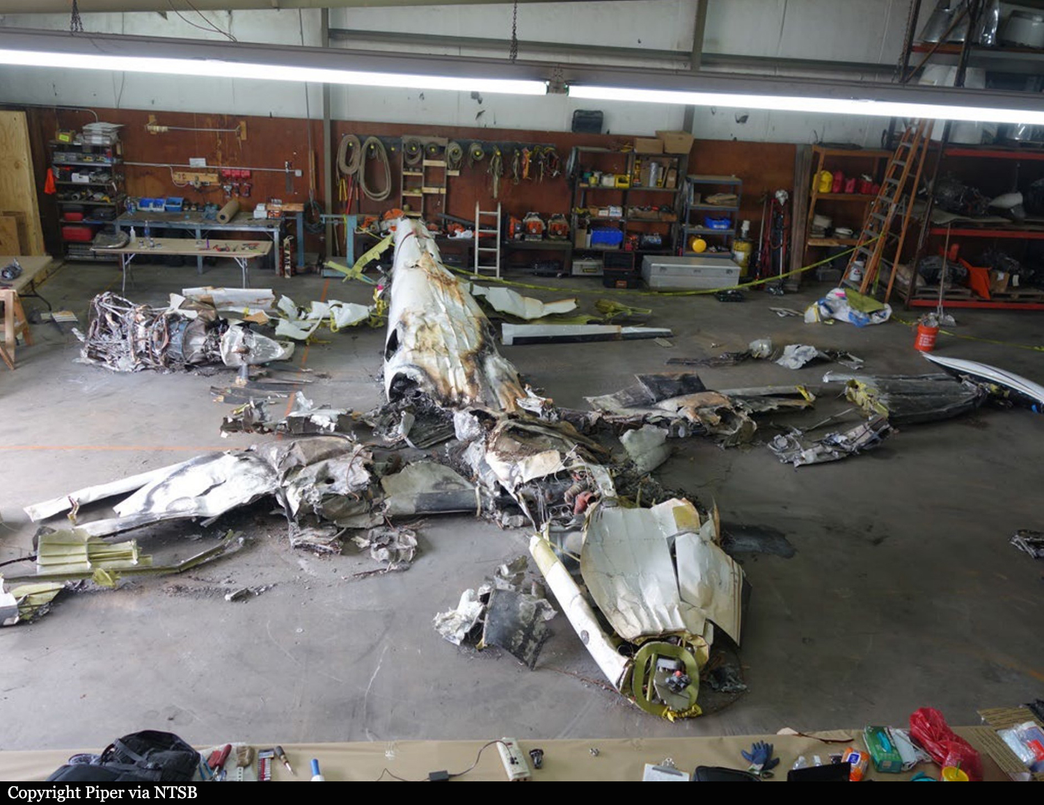
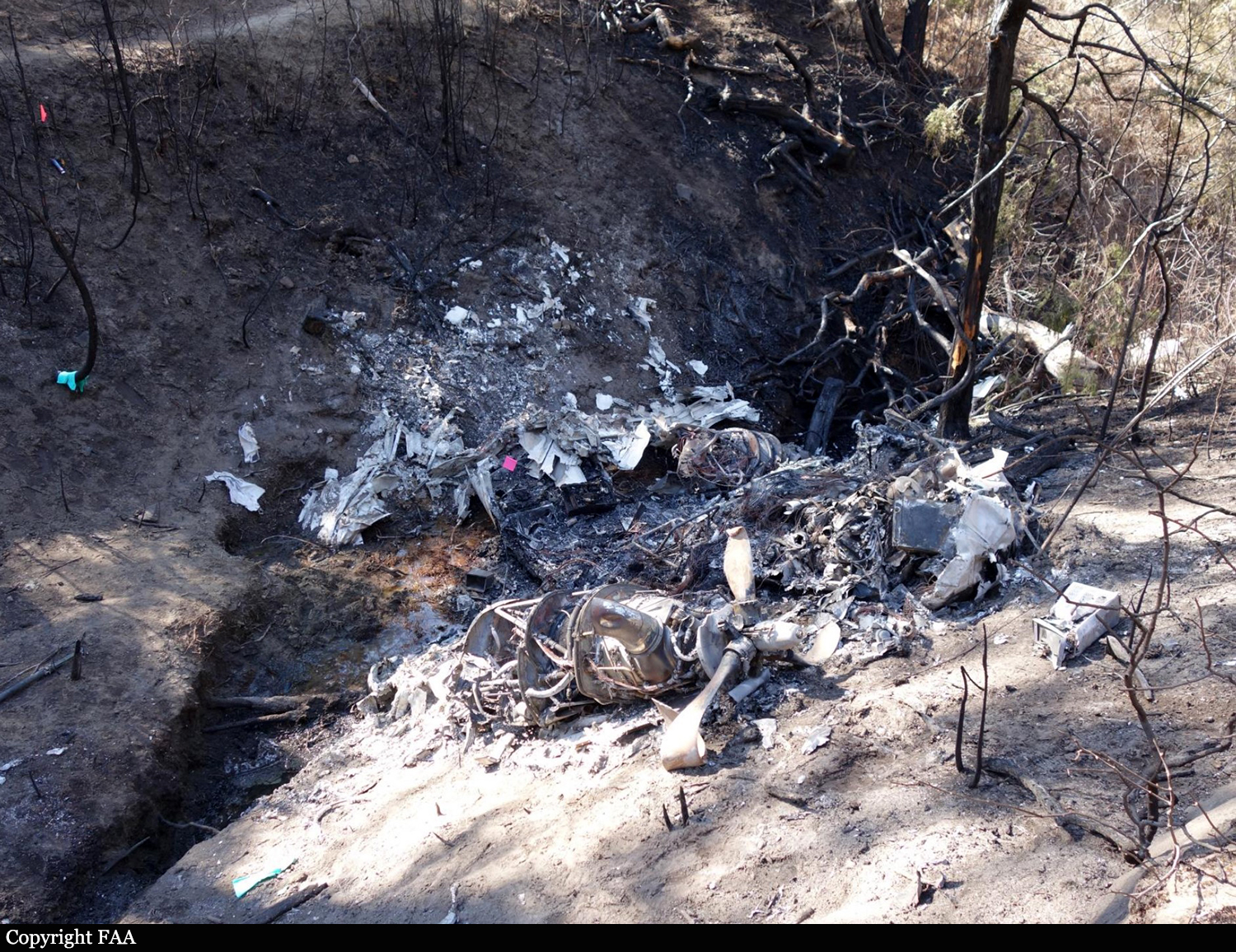
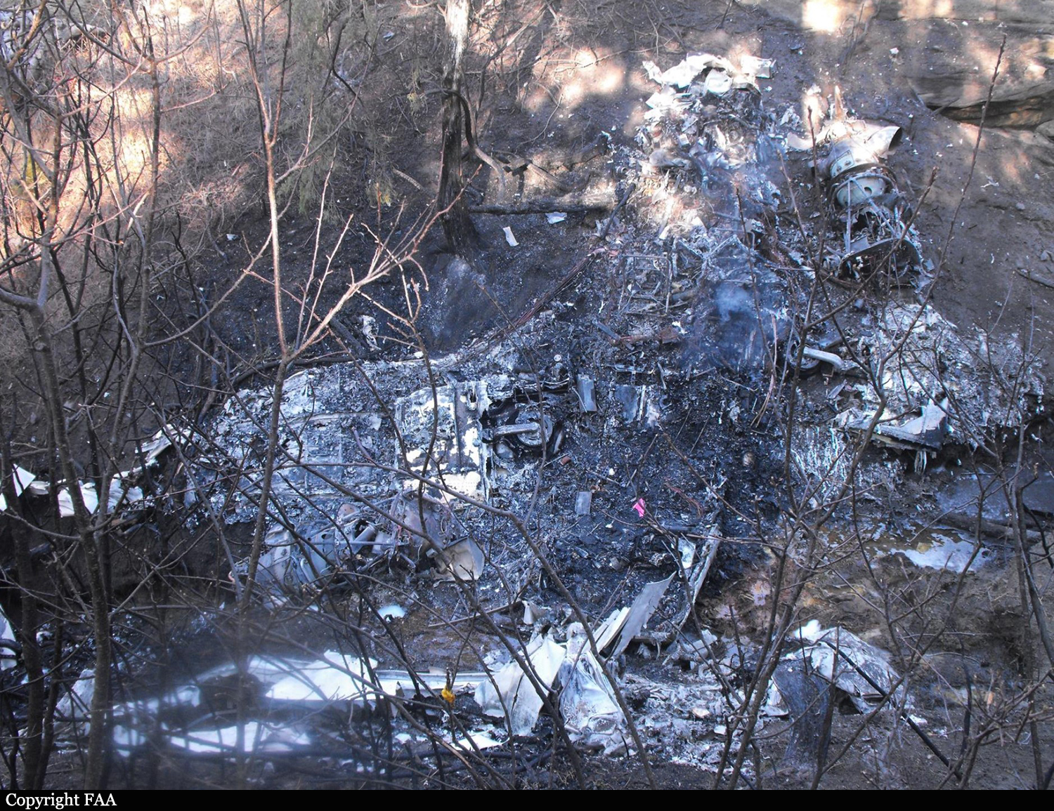
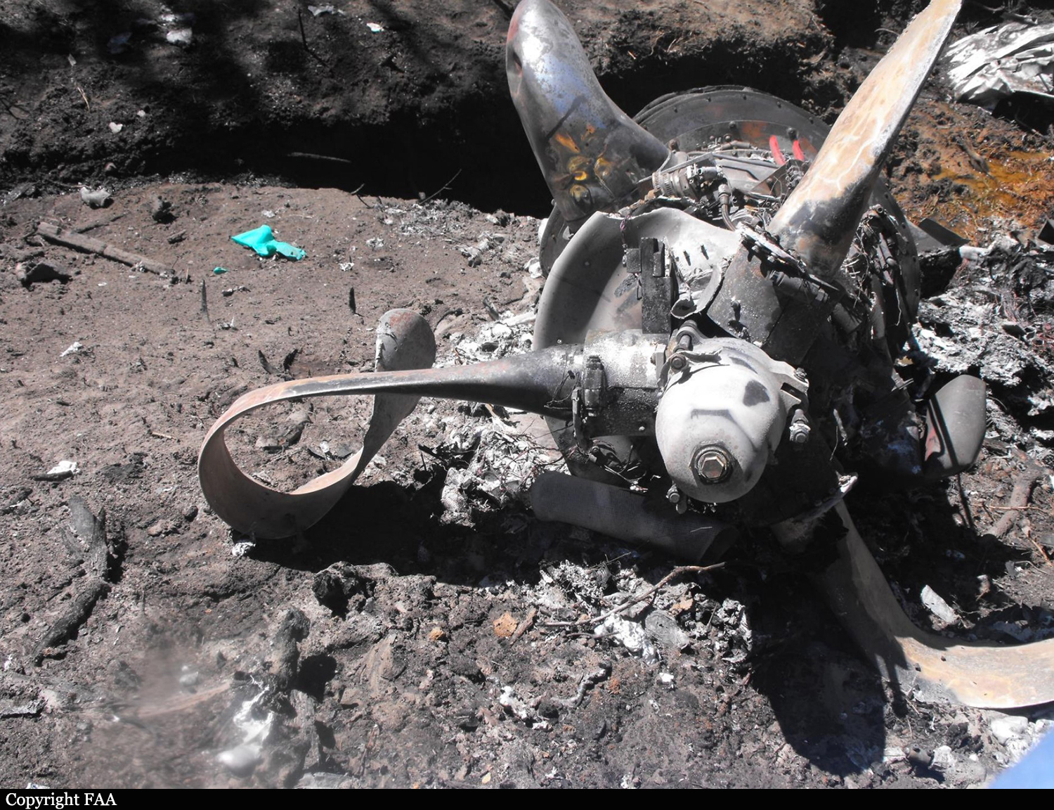
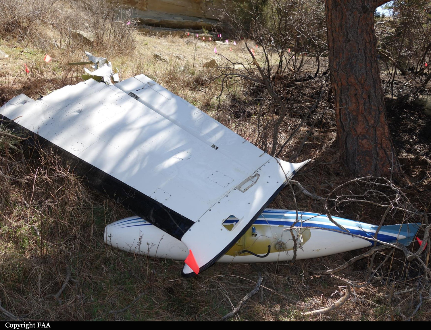
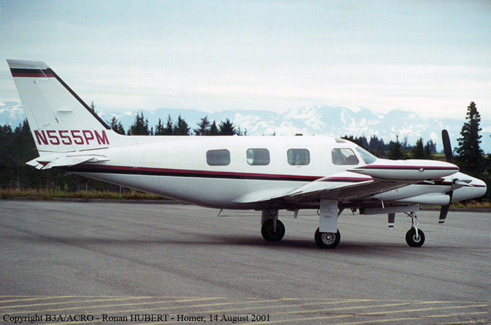
The personal flight departed from Lafayette Regional Airport/Paul Fournet Field (LFT), Lafayette, Louisiana, and entered the clouds when the airplane was at an altitude of about 200 ft above ground level. Before takeoff, the controller issued an instrument flight rules clearance to the pilot, instructing him to turn right onto a heading of 240° and climb to and maintain an altitude of 2,000 ft mean sea level (msl) after takeoff. Automatic dependent surveillance-broadcast (ADS-B) data for the accident flight started at 0920:05, and aircraft performance calculations showed that the airplane was climbing through an altitude of 150 ft msl at that time. The calculations also showed that the airplane then turned slightly to the right toward the assigned heading of 240° and climbed at a rate that varied between 1,000 and 2,400 ft per minute and an airspeed that increased from about 151 to 165 knots. At 0920:13, the airplane started rolling back toward wings level and, 7 seconds later, rolled through wings level and toward the left. At that time, the airplane was tracking 232° at an altitude of 474 ft and an airspeed of 165 knots. The airplane’s airspeed remained at 165 knots for about 10 seconds before it started increasing again, and the airplane continued to roll steadily to the left at an average roll rate of about 2° per second. The aircraft performance calculations further showed that, at 0920:40, the airplane reached a peak altitude of 925 ft msl. At that time, the airplane was tracking 200°, its bank angle was about 35° to the left, and its airspeed was about 169 knots. The airplane then started to descend while the left roll continued. At 0920:55, the airplane reached a peak airspeed of about 197 knots, which then started decreasing. At 0920:57, the airplane descended through 320 ft at a rate of descent of about 2,500 ft per minute and reached a bank angle of 75° to the left. At 0920:58, the controller issued a low altitude alert, stating that the pilot should “check [the airplane’s] altitude immediately” because the airplane appeared to be at an altitude of 300 ft msl. The pilot did not respond, and no mayday or emergency transmission was received from the airplane. The last ADS-B data point was recorded at 0920:59; aircraft performance calculations showed that, at that time, the airplane was descending through an altitude of 230 ft msl at a flightpath angle of about -7°, an airspeed of 176 knots, and a rate of descent of about 2,300 ft per minute. (The flightpath angle is in the vertical plane—that is, relative to the ground. The ground track, as discussed previously, is in the horizontal plane—that is, relative to north.) The airplane struck trees and power lines before striking the ground, traveled across a parking lot, and struck a car. The car rolled several times and came to rest inverted at the edge of the parking lot, and a postcrash fire ensued. The airplane continued to travel, shedding parts before coming to rest at the far end of an adjacent field. At the accident site, the surviving passenger told a local police officer that “the plane went straight up and then straight down.”
Probable cause:
The pilot’s loss of airplane control due to spatial disorientation during the initial climb in instrument meteorological conditions.
Final Report:

Crash of a Piper PA-31T Cheyenne in the Atlantic Ocean: 5 killed

Date & Time: Oct 25, 2018 at 1119 LT
Type of aircraft:
Registration:
N555PM
Flight Phase:
Flight Type:
Survivors:
No
Schedule:
Andrews - Governor's Harbour
MSN:
31T-7620028
YOM:
1976
Country:
Region:
Crew on board:
2
Crew fatalities:
Pax on board:
3
Pax fatalities:
Other fatalities:
Total fatalities:
5
Captain / Total flying hours:
2778
Copilot / Total flying hours:
12000
Aircraft flight hours:
7718
Circumstances:
The two pilots and three passengers were conducting a cross-country flight over the ocean from South Carolina to the Bahamas. About 30 minutes into the flight, while climbing through 24,300 ft to 25,000 ft about 95 miles beyond the coast, the pilot made a garbled radio transmission indicating an emergency and intent to return. At the time of the transmission the airplane had drifted slightly right of course. The airplane then began a descent and returned on course. After the controller requested several times for the pilot to repeat the radio transmission, the pilot replied, "we're descending." About 15 seconds later, at an altitude of about 23,500 ft, the airplane turned sharply toward the left, and the descent rate increased to greater than 4,000 ft per minute, consistent with a loss of control. Attempts by the air traffic controller to clarify the nature of the emergency and the pilot's intentions were unsuccessful. About 1 minute after the sharp left turn and increased descent, the pilot again declared an emergency. No further communications were received. Search efforts coordinated by the U.S. Coast Guard observed an oil slick and some debris on the water in the vicinity of where the airplane was last observed via radar, however the debris was not identified or recovered. According to recorded weather information, a shallow layer favorable for light rime icing was present at 23,000 ft. However, because the airplane was not recovered, the investigation could not determine whether airframe icing or any other more-specific issues contributed to the loss of control. One air traffic control communication audio recording intermittently captured the sound of an emergency locator transmitter (ELT) "homing" signal for about 45 minutes, beginning near the time of takeoff, and ending about 5 minutes after radar contact was lost. Due to the intermittent nature of the signal, and the duration of the recording, it could not be determined if the ELT signal had begun transmitting before or ceased transmitting after these times. Because ELT homing signals sound the same for all airplanes, the source could not be determined. However, the ELT sound was recorded by only the second of two geographic areas that the airplane flew through and began before the airplane arrived near either of those areas. Had the accident airplane's ELT been activated near the start of the flight, it is unlikely that it would be detected in the second area and not the first. Additionally, the intermittent nature of the ELT signal is more consistent with an ELT located on the ground, rather than an airborne activation. An airborne ELT is more likely to have a direct line-of-sight to one or more of the ground based receiving antennas, particularly at higher altitudes, resulting in more consistent reception. The pilot's initial emergency and subsequent radio transmissions contained notably louder background noise compared to the previous transmissions. The source or reason for the for the increase in noise could not be determined.
Probable cause:
An in-flight loss of control, which resulted in an impact with water, for reasons that could not be determined because the airplane was not recovered.
Final Report: