Country
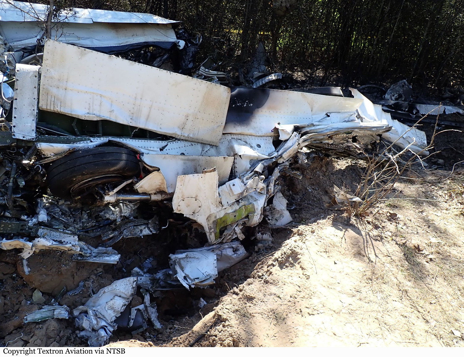
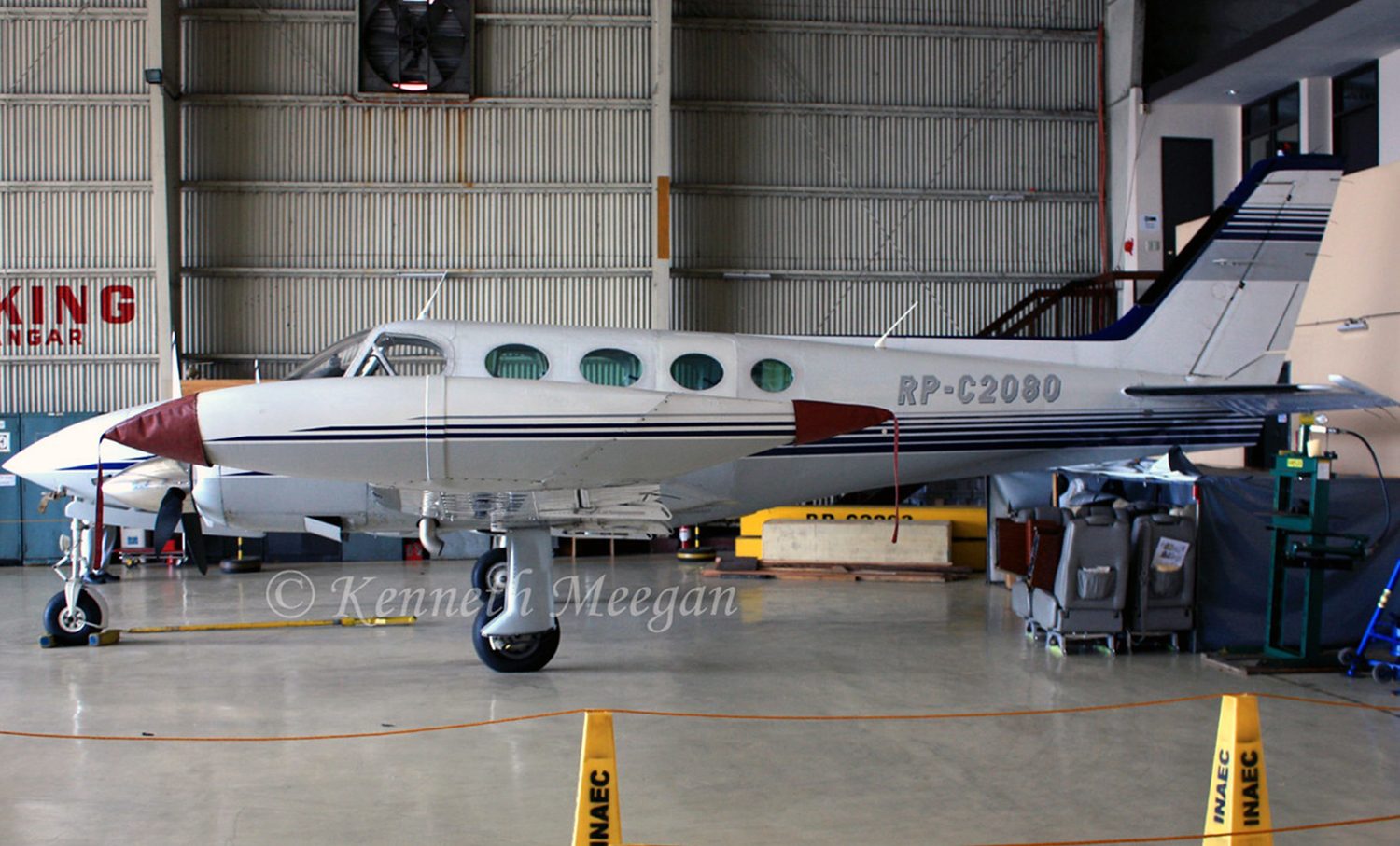
Crash of a Cessna 340A on Mt Mayon: 4 killed
Date & Time:
Feb 18, 2023 at 0646 LT
Operator:

Registration:
RP-C2080
Survivors:
No
Schedule:
Legazpi - Manila
MSN:
340A-0917
YOM:
1979
Crew on board:
2
Crew fatalities:
Pax on board:
2
Pax fatalities:
Other fatalities:
Total fatalities:
4
Circumstances:
The twin engine airplane departed Legazpi-Bicol Airport in the early morning on an executive flight to the capital City. Few minutes after takeoff, while climbing to an altitude of 6,000 feet, it impacted the rocky slope of Mt Mayon located about 16 km north of Legazpi Airport. The wreckage was found the next day near the crater of the volcano. The airplane disintegrated on impact and all four occupants were killed.

Crash of a Cessna 340A off Cockburn Town
Date & Time:
Jan 3, 2023 at 1117 LT
Registration:
N824BC
Survivors:
Yes
Schedule:
Basseterre – Providenciales
MSN:
340A-0306
YOM:
1977
Crew on board:
1
Crew fatalities:
Pax on board:
3
Pax fatalities:
Other fatalities:
Total fatalities:
0
Circumstances:
The twin engine airplane departed Basseterre-Robert L. Bradshaw Airport in St Kitts & Nevis on a flight to Providenciales, Turks & Caicos Islands (distance 1,116 km). Approaching Cockburn Town (Grand Turk Island), the pilot informed ATC he was shot of fuel and later ditched the airplane offshore. All four occupants were rescued by a fisherman around 15h30. The aircraft sank.
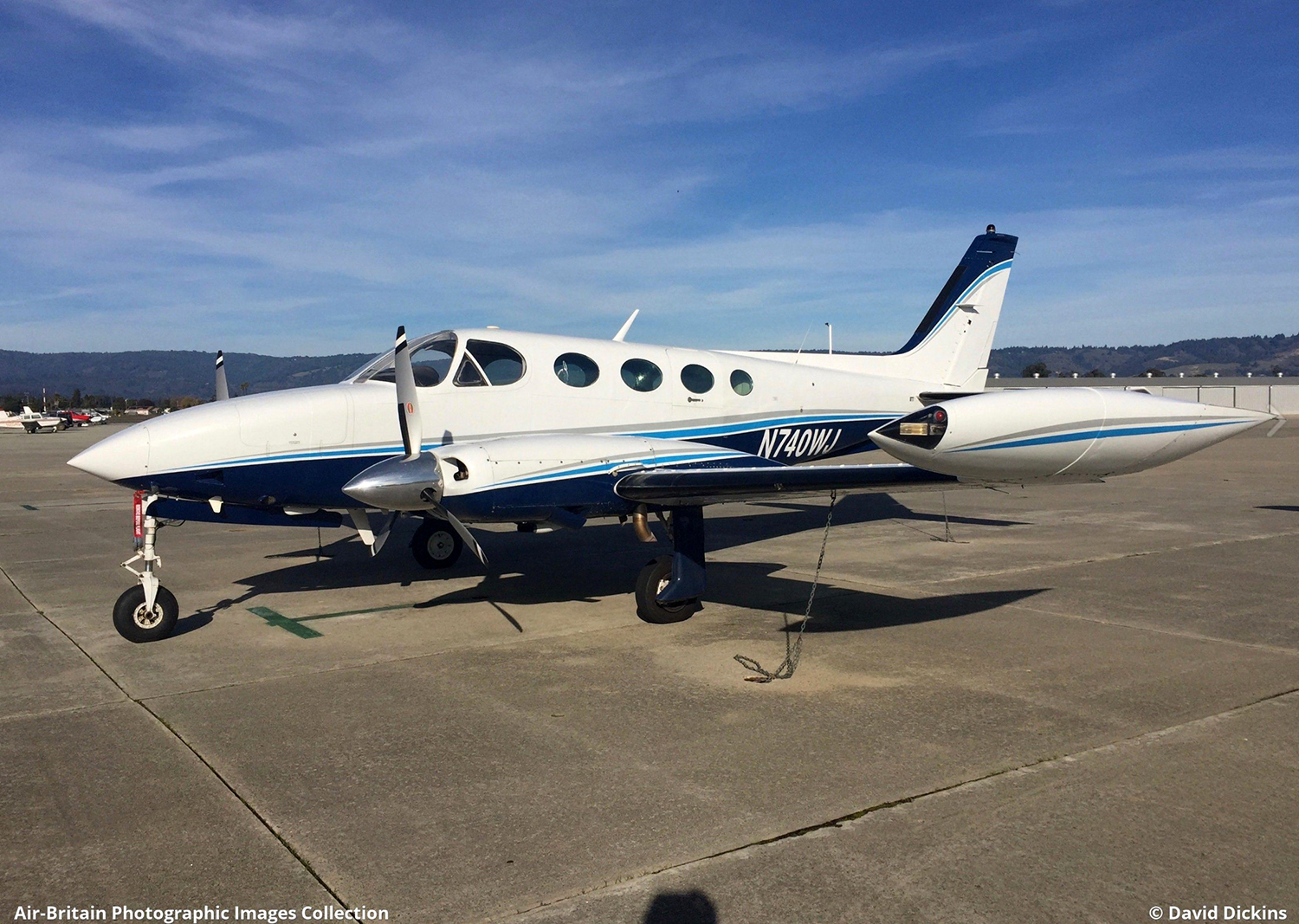
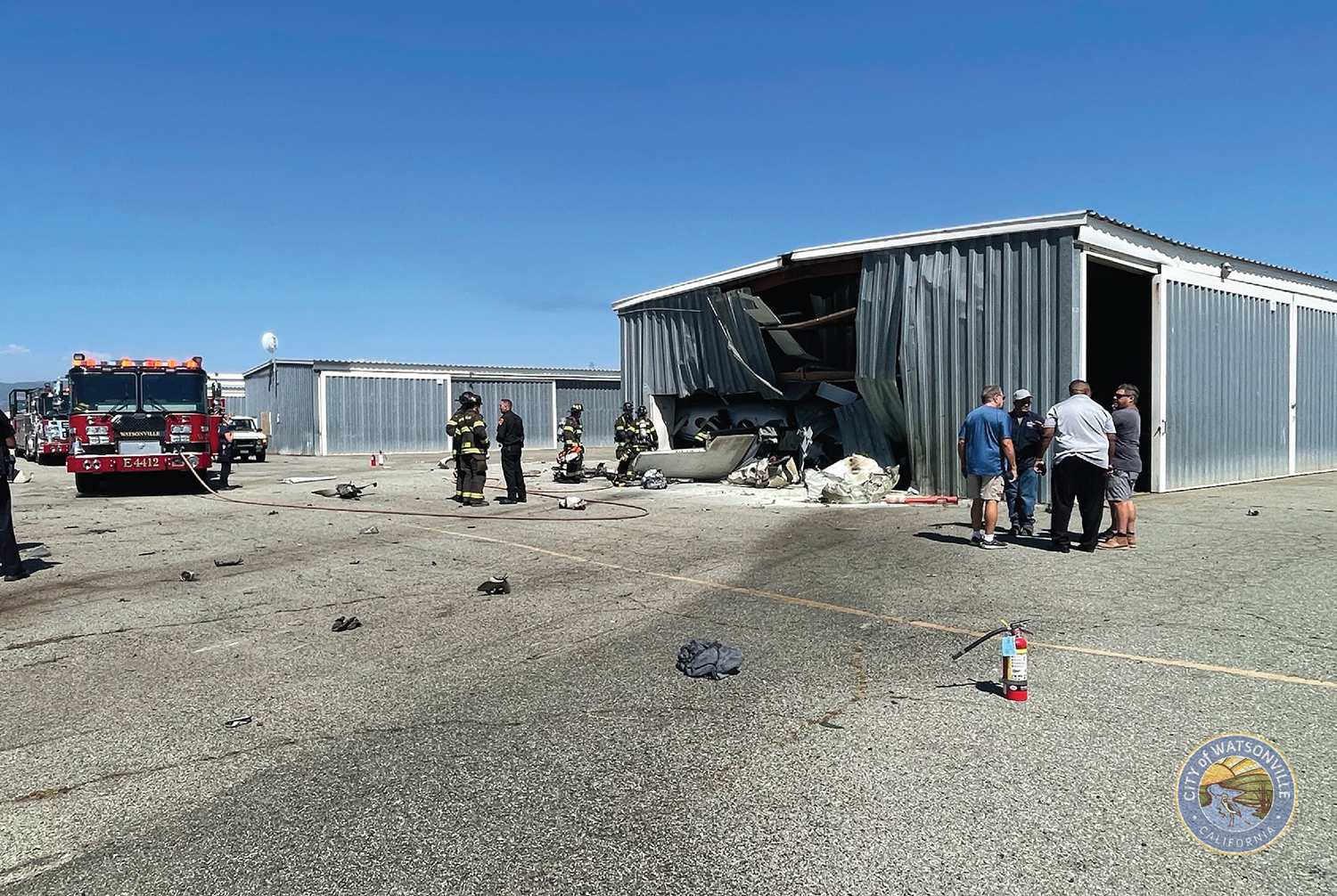
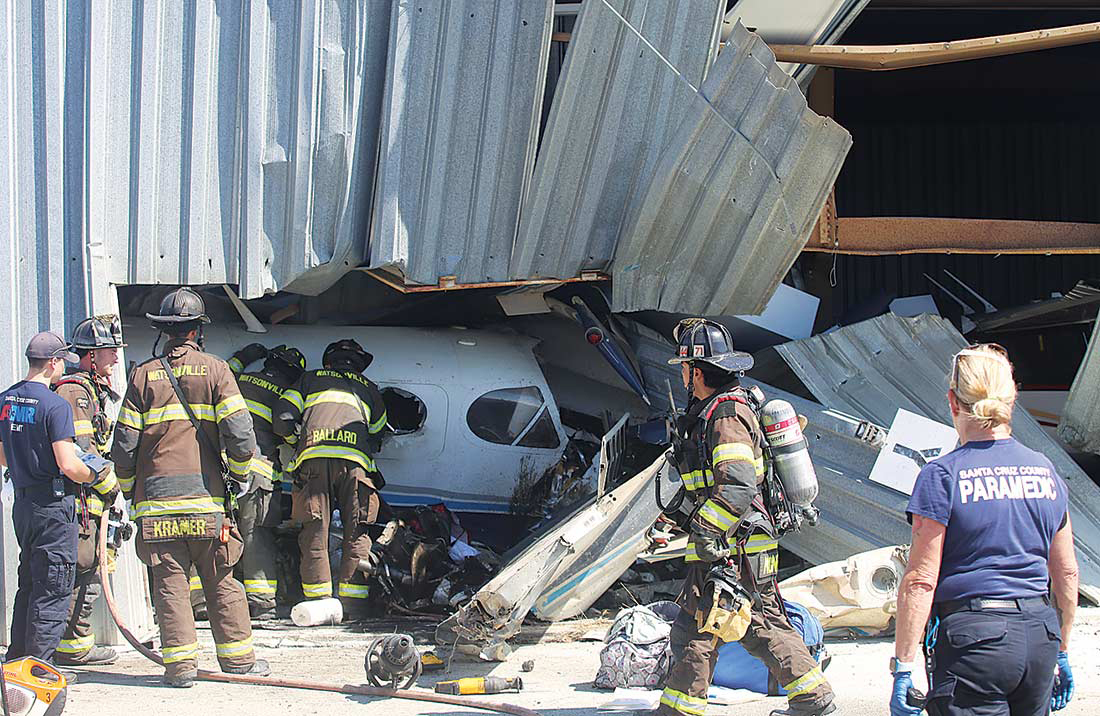
Crash of a Cessna 340A in Watsonville: 2 killed
Date & Time:
Aug 18, 2022 at 1456 LT
Registration:
N740WJ
Survivors:
No
Schedule:
Turlock – Watsonville
MSN:
340A-0740
YOM:
1979
Crew on board:
1
Crew fatalities:
Pax on board:
1
Pax fatalities:
Other fatalities:
Total fatalities:
2
Circumstances:
On final approach to Watsonville Airport, at a height of 200 feet, the twin engine airplane collided with a private Cessna 152 registered N49931 and carrying one pilot. Following the collision, the Cessna 152 crashed in a grassy area near the runway, bursting into flames. The Cessna 340 crashed on the runway, veered off and came to rest into a hangar. All three occupants in both aircraft were killed.
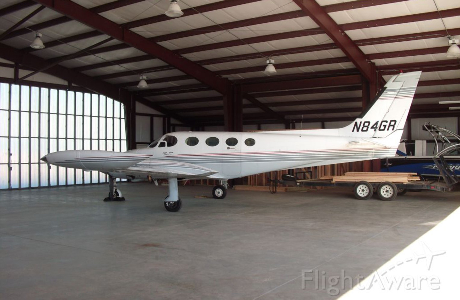
Crash of a Cessna 340 in Covington: 2 killed
Date & Time:
Apr 21, 2022 at 1905 LT
Operator:

Registration:
N84GR
Survivors:
No
MSN:
340-0178
YOM:
1973
Crew on board:
1
Crew fatalities:
Pax on board:
1
Pax fatalities:
Other fatalities:
Total fatalities:
2
Circumstances:
Shortly after takeoff from Covington Airport Runway 10, while in initial climb, the twin engine airplane went out of control and crashed on the General Mills Plant located about 1,5 km southeast of the airfield, bursting into flames. The aircraft was destroyed and both occupants were killed. There were no casualties on the ground.
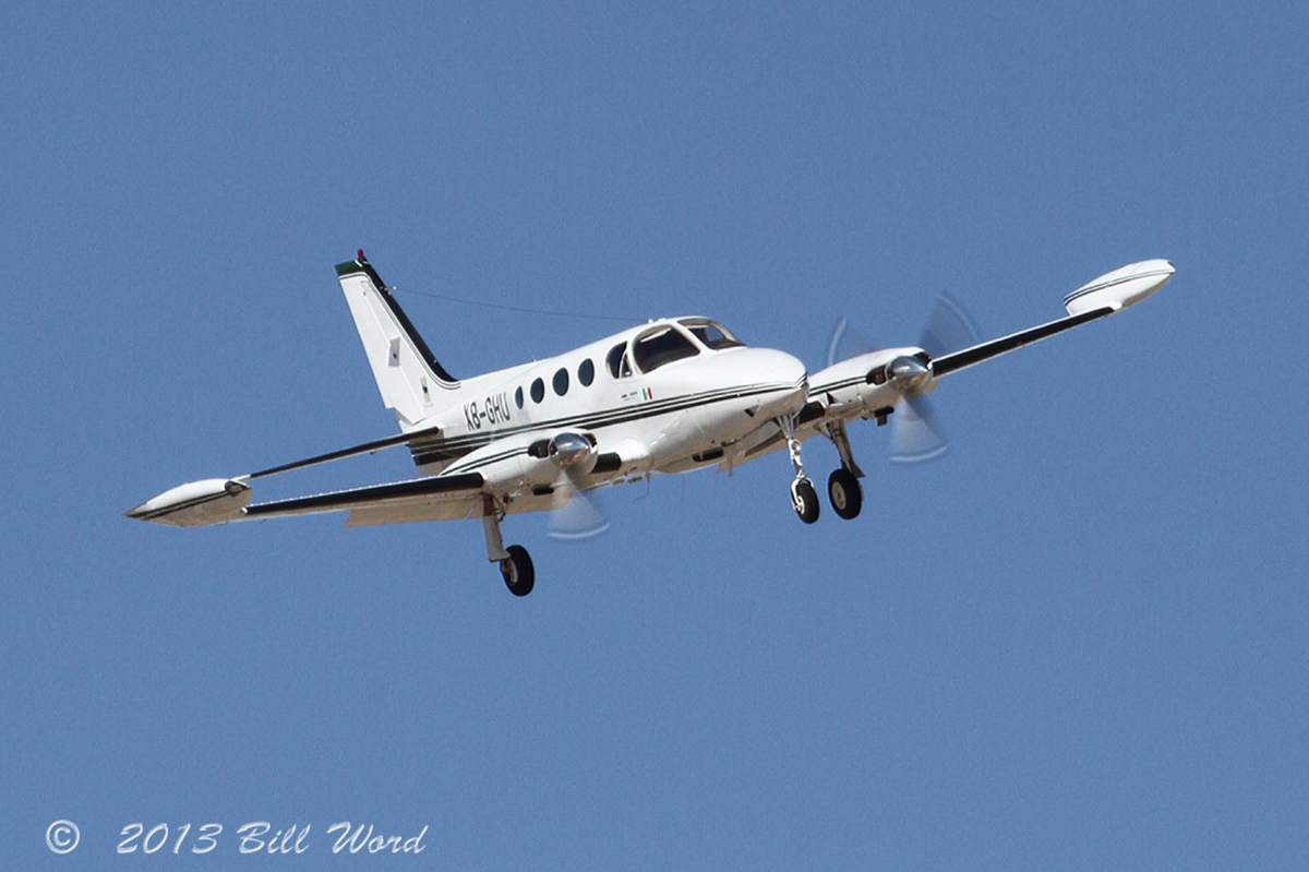
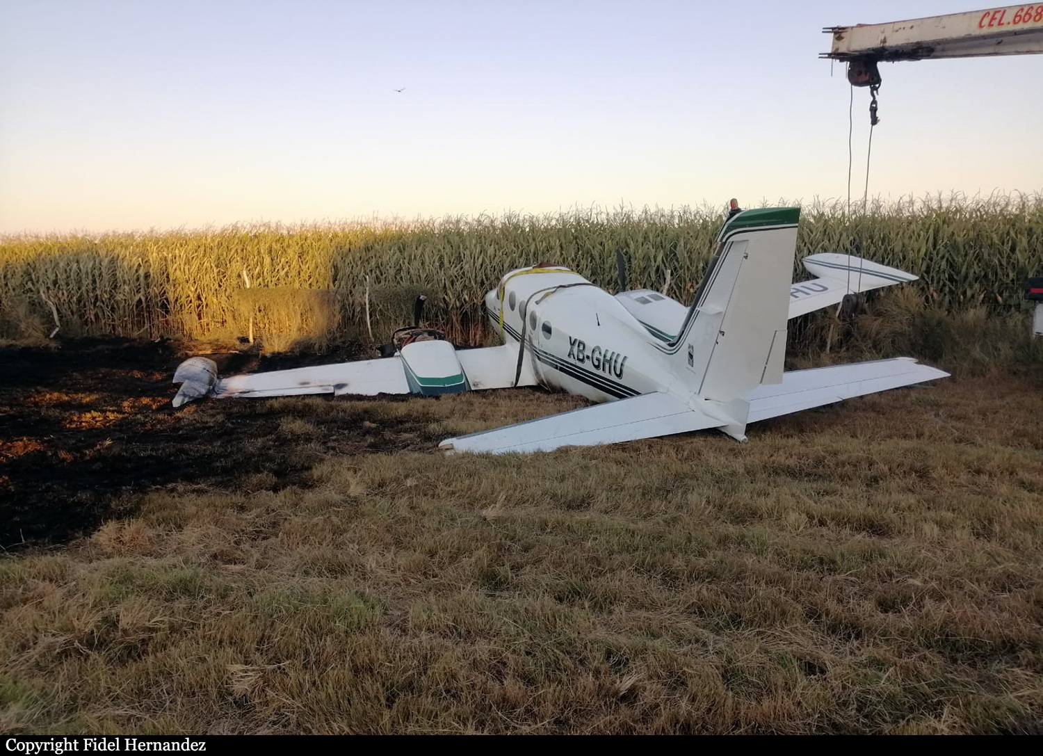
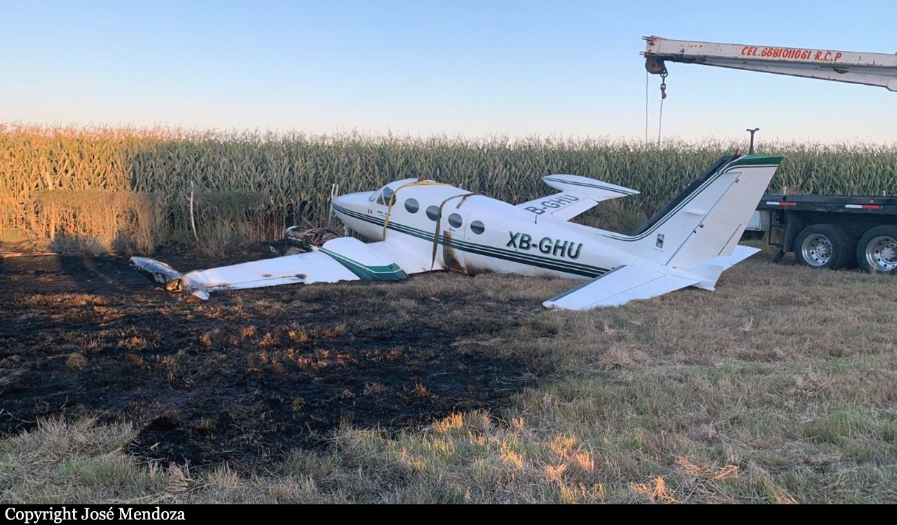
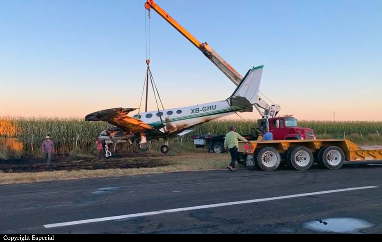
Crash of a Cessna 340A in Los Mochis
Date & Time:
Apr 6, 2022 at 1748 LT
Operator:

Registration:
XB-GHU
Survivors:
Yes
Schedule:
Los Mochis - Club Aéreo Nuevo Santa Rosa
MSN:
340A-0506
YOM:
1978
Crew on board:
1
Crew fatalities:
Pax on board:
0
Pax fatalities:
Other fatalities:
Total fatalities:
0
Circumstances:
The pilot, sole on board, departed Los Mochis International Airport on a flight to the Club Aéreo Nuevo Santa Rosa located east-northeast of the city. After landing on a road, the airplane suffered an apparent undercarriage failure, veered to the right and came to rest in a grassy area, bursting into flames. The pilot evacuated safely while the aircraft suffered serious damages due to fire.
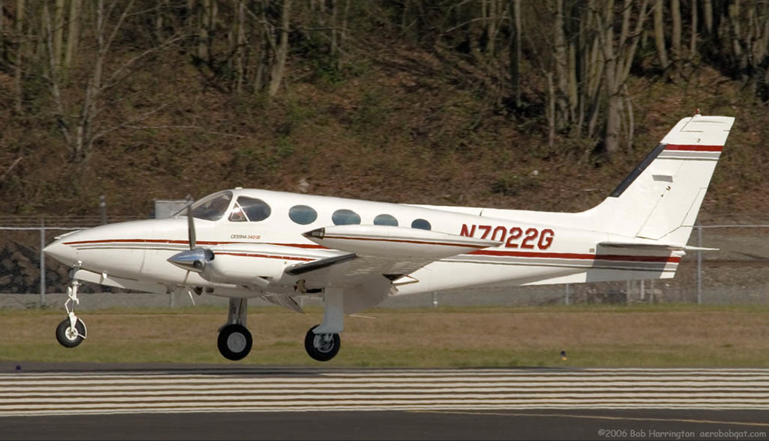
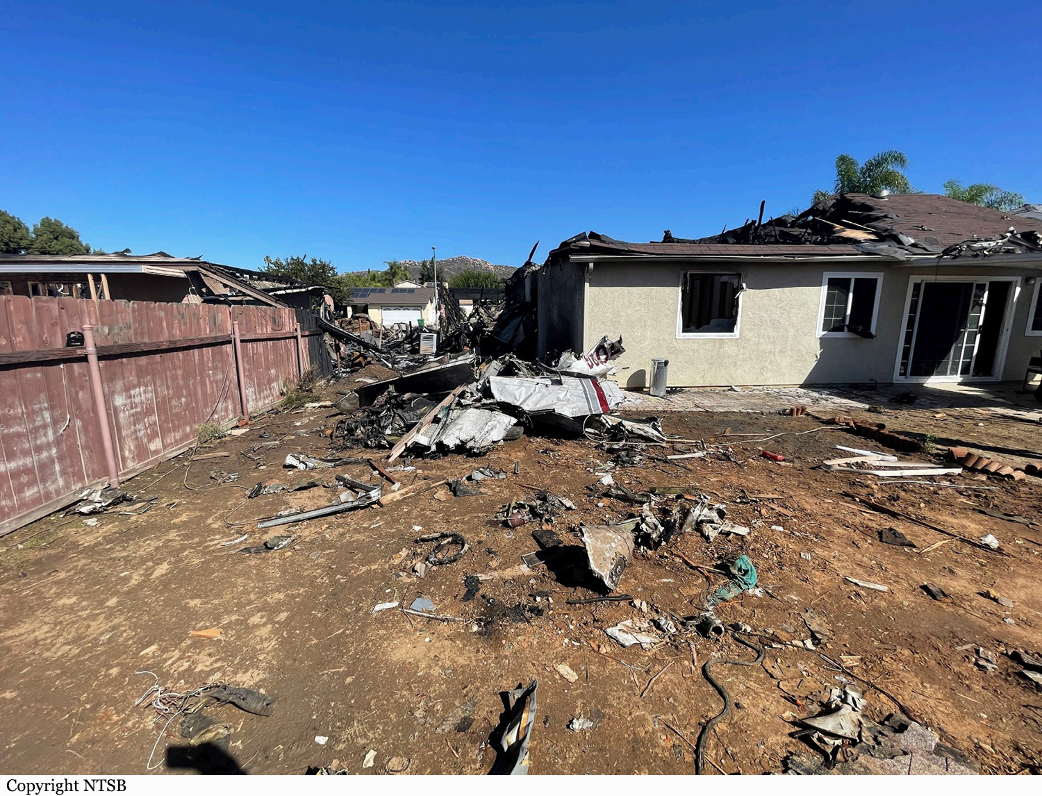
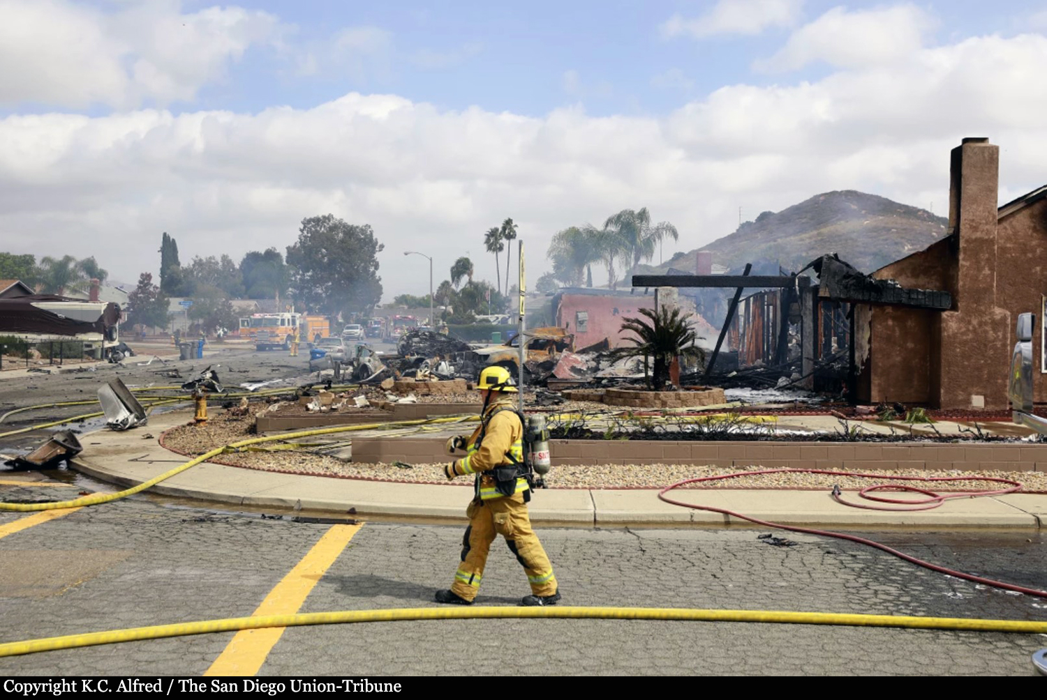
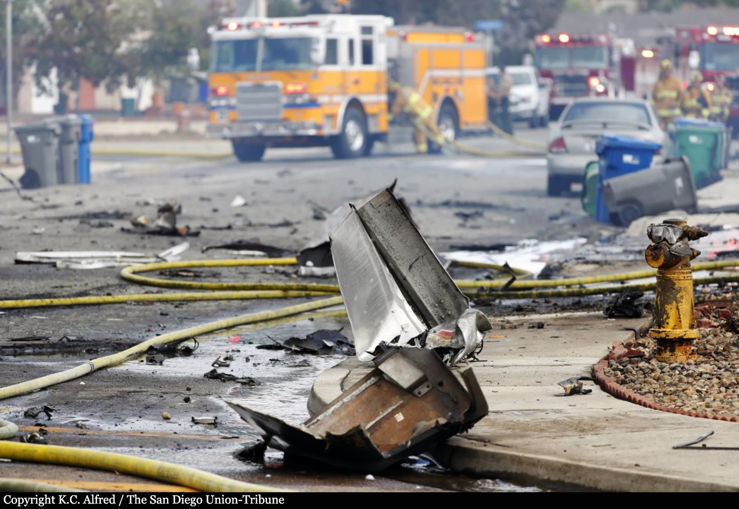
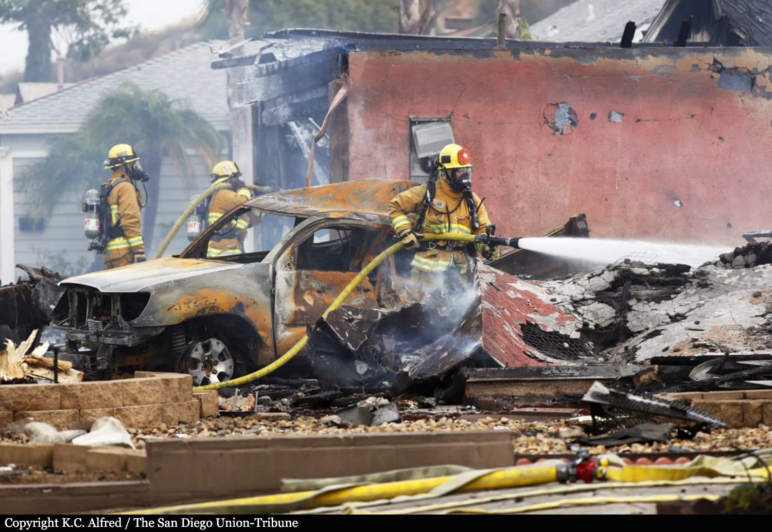
Crash of a Cessna 340A in Santee: 2 killed
Date & Time:
Oct 11, 2021 at 1214 LT
Registration:
N7022G
Survivors:
No
Schedule:
Yuma – San Diego
MSN:
340A-0695
YOM:
1979
Crew on board:
1
Crew fatalities:
Pax on board:
0
Pax fatalities:
Other fatalities:
Total fatalities:
2
Circumstances:
The pilot was on a cross-country flight, receiving vectors for an instrument approach while in instrument meteorological conditions (IMC). The approach controller instructed the pilot to descend to 2,800 ft mean sea level (msl) until established on the localizer, and subsequently cleared the flight for the instrument landing system (ILS) approach to runway 28R, then circle to land on runway 23. About 1 minute later, the controller told the pilot that it looked like the airplane was drifting right of course and asked him if he was correcting back on course. The pilot responded “correcting, 22G.” About 9 seconds later, the pilot transmitted “SoCal, is 22G, VFR runway 23” to which the controller told the pilot that the airplane was not tracking on the localizer and subsequently canceled the approach clearance and instructed the pilot to climb and maintain 3,000 ft. As the pilot acknowledged the altitude assignment, the controller issued a low altitude alert, and provided the minimum vectoring altitude in the area. The pilot acknowledged the controller’s instructions shortly after. At this time, recorded advanced dependent surveillance-broadcast (ADS-B) data showed the airplane on a northwesterly heading at an altitude of 2,400 ft msl. Over the course of the following 2 minutes, the controller issued multiple instructions for the pilot to climb to 4,000 ft, which the pilot acknowledged; however, ADS-B data showed that the airplane remained between 2,500 ft and 3,500 ft. The controller queried the pilot about his altitude and the pilot responded, “2,500 ft, 22G.” The controller subsequently issued a low altitude alert and advised the pilot to expedite the climb to 5,000 ft. No further communication was received from the pilot despite multiple queries from the controller. ADS-B data showed that the airplane had begun to climb and reached a maximum altitude of 3,500 ft before it began a descending right turn. The airplane remained in the right descending turn at a descent rate of about 5,000 ft per minute until the last recorded target at 900 ft msl, located about 1,333 ft northwest of the accident site. The airplane and two houses were destroyed. The pilot and the driver of a UPS truck were killed. Two other people on the ground were injured.
Probable cause:
Loss of control due to spatial disorientation.
Final Report:

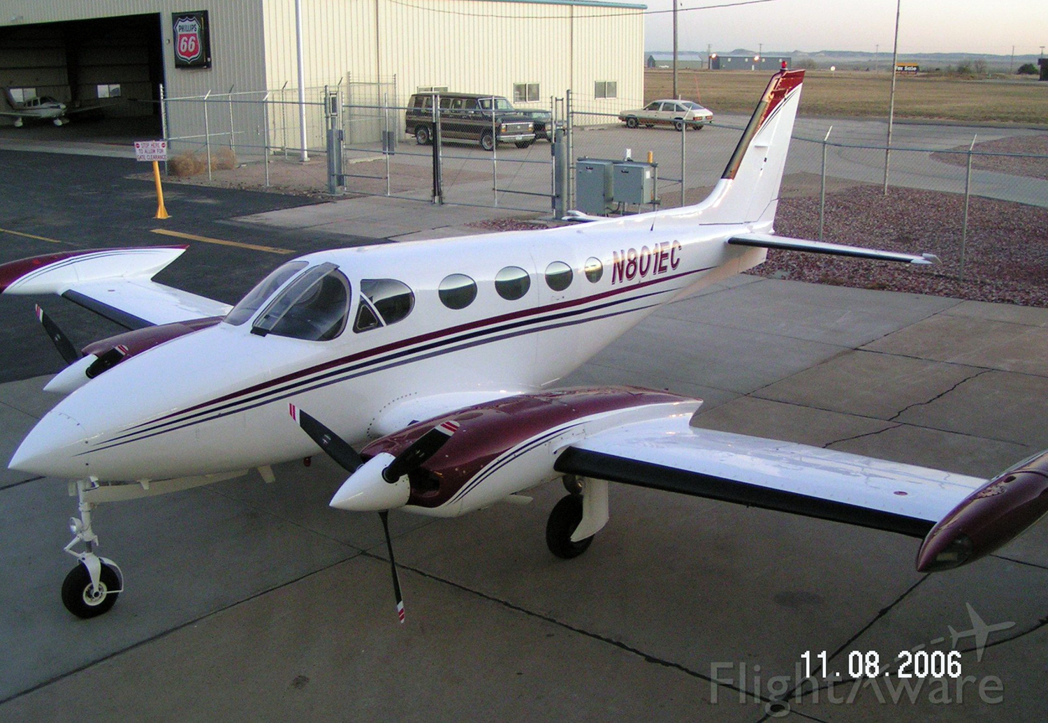
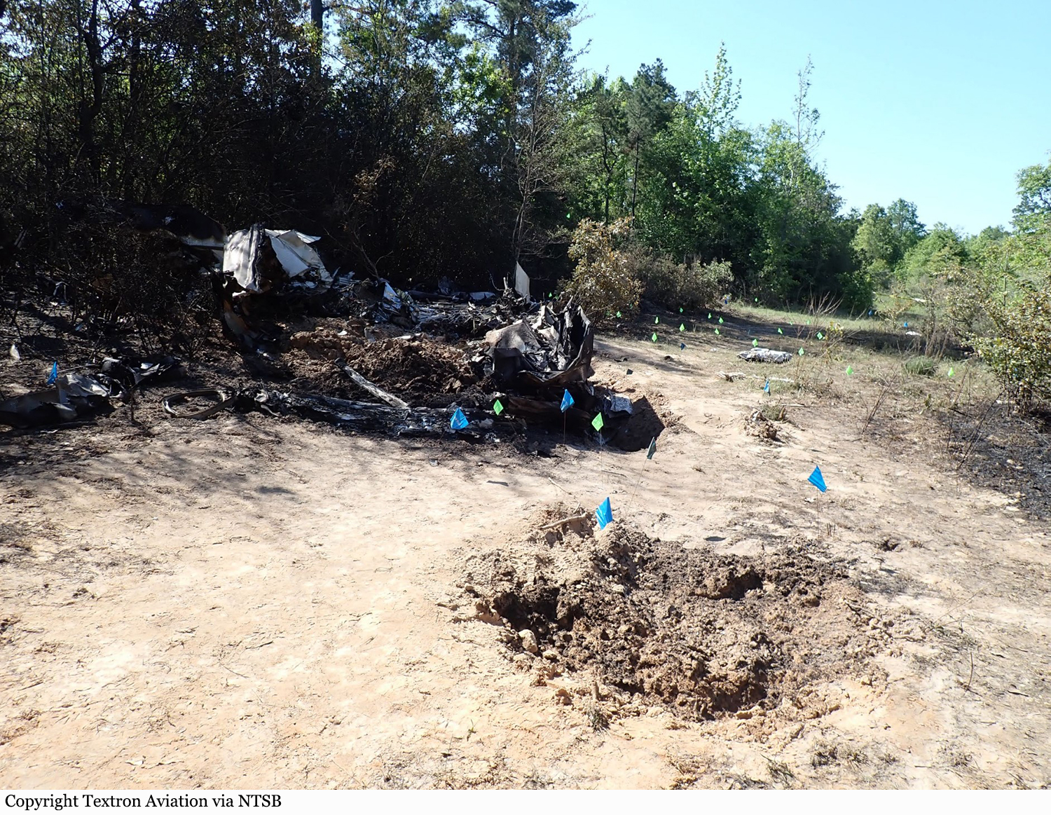
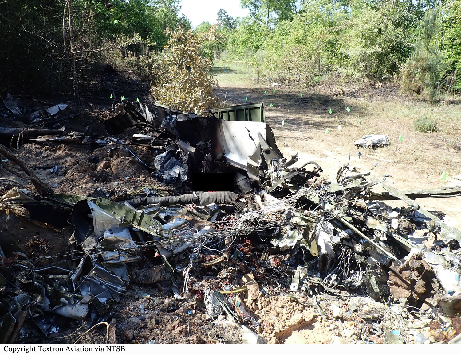
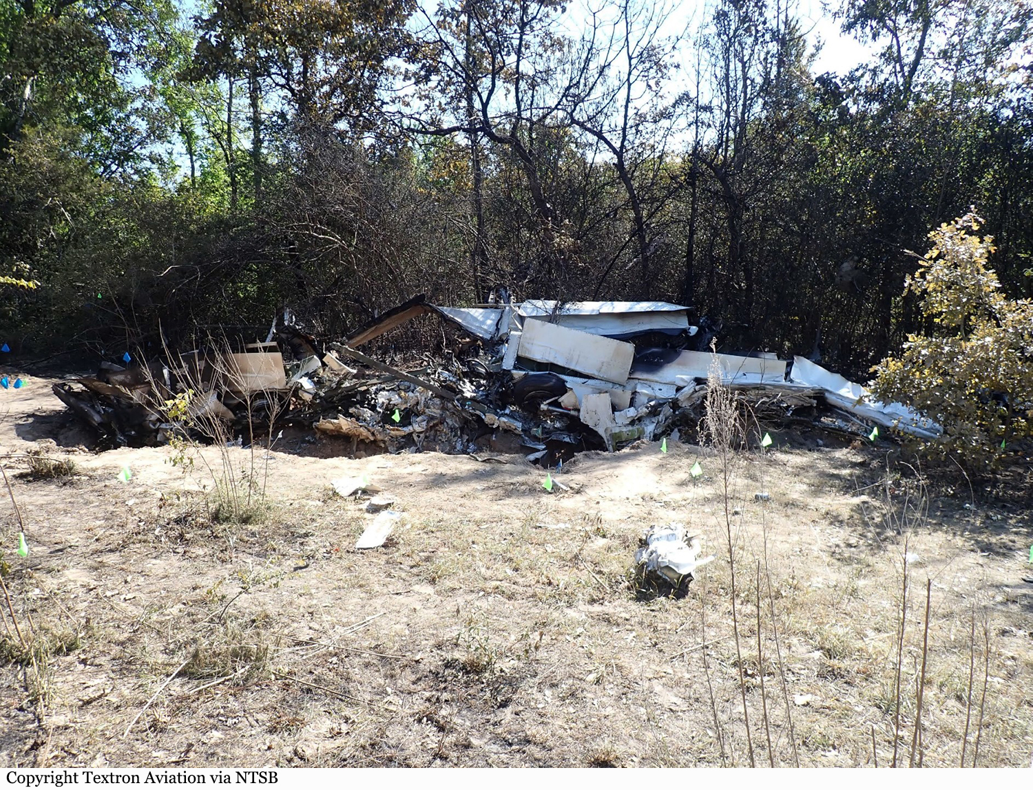
Crash of a Cessna 340A in Tatum: 1 killed
Date & Time:
Apr 19, 2021 at 1346 LT
Registration:
N801EC
Survivors:
No
Schedule:
Longview - Tatum
MSN:
340A-0312
YOM:
1977
Crew on board:
1
Crew fatalities:
Pax on board:
0
Pax fatalities:
Other fatalities:
Total fatalities:
1
Captain / Total hours on type:
120.00
Aircraft flight hours:
6500
Circumstances:
The pilot was planning to perform a functional test of the airplane’s newly upgraded autopilot system. Automatic dependent surveillance-broadcast data showed that, after takeoff, the airplane turned east and climbed to 2,750 ft. Air traffic control information indicated that the controller cleared the pilot to operate under visual flight rules to the east of the airport. Communications between ground control, tower control, and the pilot were normal during the ground taxi, takeoff, and climb. Radio and radar communications were lost 6 minutes after takeoff, and no radio distress calls were received from the pilot. The airplane impacted wooded terrain about 3/4 mile to the east of the last recorded radar data point. Groundspeeds and headings were consistent throughout the flight with no abrupt deviations. The airplane impacted the wooded terrain in a nose-down, near-vertical flight attitude. Most of the airplane, including the fuselage, wings, and empennage, were consumed by a postimpact fire. Both engines and propellers separated from the airplane at impact with the ground. Examination of the engines revealed no preaccident failures or malfunctions that would have precluded normal operations. Both propellers showed signs of normal operation. Flight control continuity was confirmed. The elevator trim cables stop blocks were secured to the cables and undamaged. They were found against the forward stop meaning the trim tab was at full down travel (elevator leading edge full down) which indicated that the airplane was trimmed full nose up at impact. The airplane’s cabin sustained fragmentation from impact and was consumed by fire; as a result, the autopilot system could not be examined. The investigation was unable to determine why the pilot lost control of the airplane.
Probable cause:
The pilot’s loss of airplane control for undetermined reasons.
Final Report: